(Scroll to the bottom for a links listing of all my daily blogs)
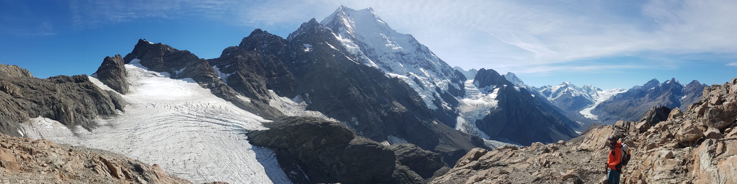
The Pacific Coast Bigfoot Crest Rim Trail (PCBCRT) is my made-up name for a roughly 1200 mile hike, stringing together parts or all of 4 distinct long distance trails: the Oregon Coast Trail (OCT), Bigfoot Trail (BFT), Pacific Crest Trail (PCT), and Tahoe Rim Trail (TRT). While I’d already hiked the PCT in its entirety in 2018, this was a nice means to connect footsteps to 3 shorter trails I’d been wanting to hike for awhile…read on for a description of each.
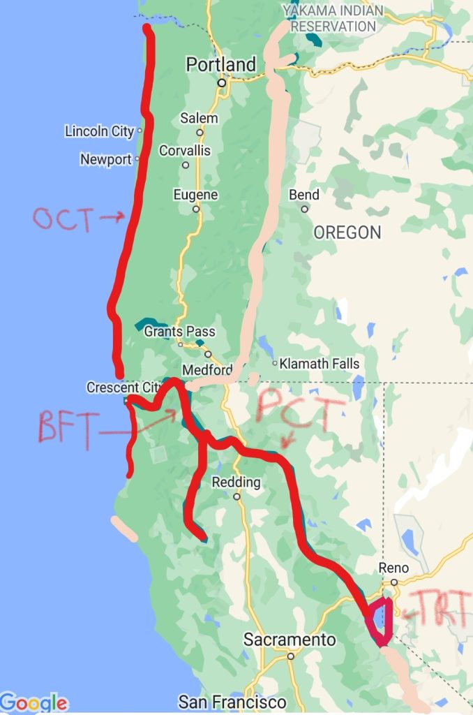
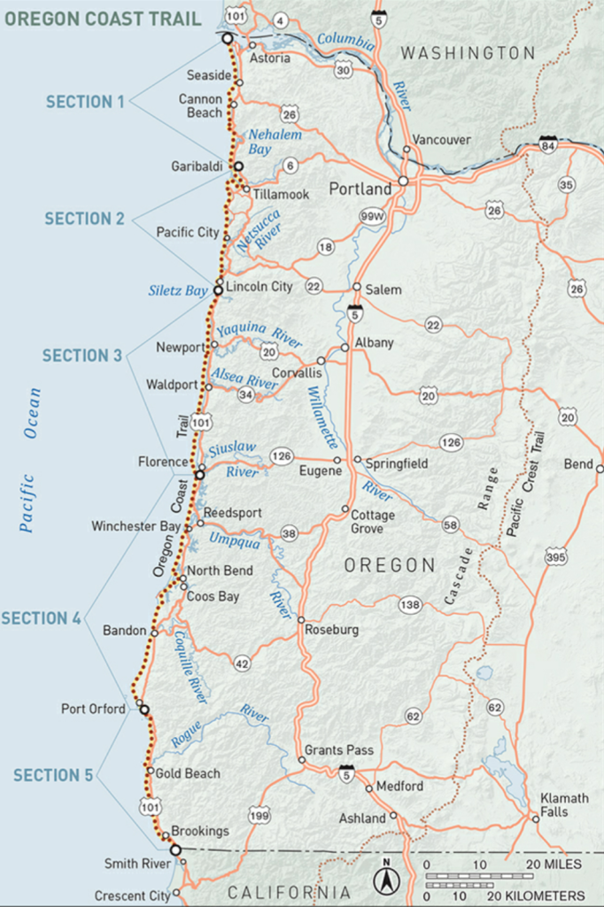
The Oregon Coast Trail is a roughly 400-mile walking route that capitalizes on Oregon’s 262 miles of publicly owned and accessible sandy beaches. While about half the route is on the beach, another quarter follows footpaths through state parks, national forests and over lush headlands. The remaining quarter (or less) follows quiet side roads and, where unavoidable, the shoulder of US 101. The OCT is still a work in progress, with new trail sections yet to open, plus many logistical details regarding boat ferries, camping options and other services… see Hiking the Oregon Coast Trail, by Bonnie Henderson.
The route is marked much of the way but still involves making use of a variety of resources, including various maps sets, an excellent guidebook, and several GPS files and apps…in other words, there is no simple FarOut guide (yet!). Tides, prevailing winds, river / bay crossings, and muddy and steep trails all come into focus along this route. Most of the road walking is the result of inlets and bays, but can be significantly alleviated by making use of small boat ferries/shuttles…or just hitching a ride on a boat or along the roads. Towns are frequent, mitigating the need to carry much food or water. Finding legal camping can be the biggest problem…this is not much of a wilderness experience, given the proximity to cities and highways.
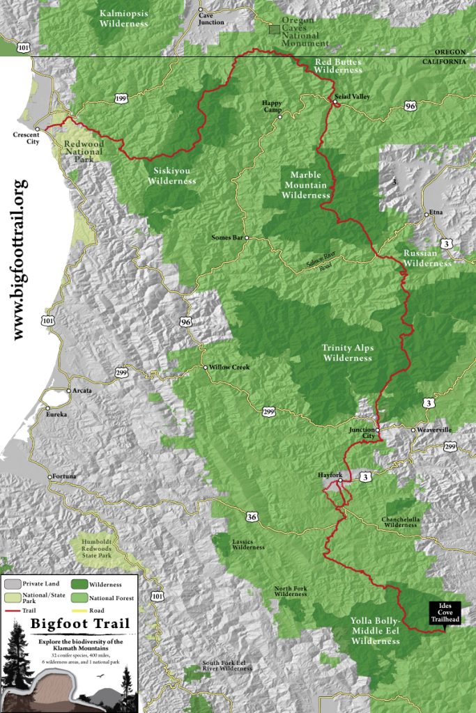
The BigFoot Trail is a roughly 360 mile hiking trail in northern California. The southern terminus begins in the Yolla Bolly wilderness, west of Redding CA, while the northern terminus begins at the Pacific Ocean, in Redwood National Park near Crescent City CA. The trail travels through the Klamath Mountains, briefly crossing into Oregon. It passes through 5 National Forests, 6 Wilderness areas (Yolla Bolly, Trinity Alps, Russian, Marble Mountain, Red Buttes, Siskiyou), 1 National Park (Redwood), and traverses 3 Wild and Scenic rivers. The Bigfoot Trail was conceived in 2009, utilizing existing trails (including 40 miles of the Pacific Crest Trail), dirt and paved roads. Most of the BFT is below 7,000′ elevation, with the highest point at 7,822ft/2384m. A major focus is the diversity of conifer trees, with 32 species to be found along the route. This region is a celebration of biodiversity, so the BFT aims to bring about awareness and conservation to this important area.
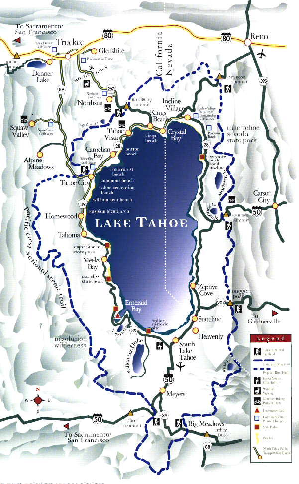
The Tahoe Rim Trail is a 175 mile long-distance hiking trail that forms a loop around the Lake Tahoe Basin in the Sierra Nevada and ranges of Nevada and California. The trail varies in elevation from 6,223 feet at the outlet of Lake Tahoe to 10,338 feet at Relay Peak in Nevada. About 50 miles of trail above the lake’s west shore are also part of the Pacific Crest Trail.
Here is the list of all my posts relating to this hike:
The Pacific Coast Bigfoot Crest Rim Trail Introduction
PCBCRT Day 0: Reconnecting to the Pacific Coast
PCBCRT Day 1: Off After a Bang
PCBCRT Day 2: Variety is the spice of life
PCBCRT Day 3: A Huge Bite of Trail-Beach-Trail Sandwich
PCBCRT Day 4: The Tourist Trail
PCBCRT Days 5 & 6: More Touristing & a Reunion
PCBCRT Day 7: A Date with the Tide & Camels
PCBCRT Day 8: Passing by Quickly
PCBCRT Day 9: A Very Social Day
PCBCRT Day 10: A Quiet Day
PCBCRT Days 11 & 12: Blowing Down the Coast
PCBCRT Day 13: Dunes
PCBCRT Day 14: Tsunami Dreams
PCBCRT Day 15: The not so Gem of the Oregon Coast
PCBCRT Day 16: Cape Arago and Bandon
PCBCRT Day 17: Stopped by the Sixes
PCBCRT Day 18: Agate Hunting
PCBCRT Day 19: Gold Beach
PCBCRT Day 20: Cape Sebastian
PCBCRT Day 21: Samuel Boardman Corridor
PCBCRT Day 22: Into California and Kayaking on the Smith River
PCBCRT Day 23: Crescent City Magic
PCBCRT Day 24: Redwoods National and State Parks
PCBCRT Day 25: Redwoods Redemption Day
PCBCRT Day 26 & 27: Redwoods Wrap-up & Return to Crescent City
PCBCRT Day 28: Bigfoot Trail…Into the Shadow of the Titans
PCBCRT Day 29: Into the Mountains and the Heat
PCBCRT Day 30: Bigfoot on my Back
PCBCRT Day 31: Clear Creek Redemption
PCBCRT Day 32: Along the Border
PCBCRT Day 33: Bigfoot Meets the PCT
PCBCRT Day 34 & 35: Seiad Valley Vortex
PCBCRT Day 36: Running up that Hill
PCBCRT Day 37: Marble Mountains & Unplanned Town Stop
PCBCRT Day 38: The Russian Wilderness
PCBCRT Day 39: Packers Peak Bigfoot Trail Highpoint
PCBCRT Day 40: Trinity Alps
PCBCRT Day 41: Off Script & Much In Motion
PCBCRT Day 42: On Cruise Control
PCBCRT Day 43: When Fires Start to Burn
PCBCRT Halftime Report
PCBCRT Day 44: Out of the Heat
PCBCRT Day 45: Grizzly Peak Bagging
PCBCRT Day 46: Burney Falls
PCBCRT Day 47: The Rim
PCBCRT Days 48 & 49: Lassen and Chester
PCBCRT Day 50: Into the Burn
PCBCRT Day 51: Thru Belden
PCBCRT Day 52: Super Blue Moon
PCBCRT Day 53: Always a Hard Day
PCBCRT Day 54: September Storms
PCBCRT Day 55: The Delicate Dance Between Wet and Dry
PCBCRT Day 56: Hut to Ski Lodge to Hut
PCBCRT Day 57: Starting the TRT
PCBCRT Day 58: Tahoe City
PCBCRT Day 59: The 2nd Start of the TRT
PCBCRT Day 60: Mount Rose
PCBCRT Day 61: Crushing on Crushed Granite
PCBCRT Day 62: South Lake Tahoe in and out
PCBCRT Day 63: Around Freel
PCBCRT Day 64: Half Day
PCBCRT Day 65: Dicks Peak
PCBCRT Day 66: The Homestretch
PCBCRT Day 67: I Just Can’t Get Enough
PCBCRT Day 68: Wolves or Huskies?
PCBCRT Day 69: Sonora Peak
PCBCRT Bonus Hike: The Pinecrest Loop Trail
PCBCRT Summary and Stats