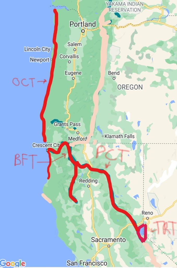
This is a rough sketch of the Pacific Coast Bigfoot Crest Rim Trail…PCBCRT. (I know, my scribbling looks a little like blood dripping…sorry about that. It ended up being a good proxy for how my legs looked after some bushwacking along the route.) I ‘invented’ this roughly 1200 mile route as a conglomeration of 4 distinct long distance trails, stringing together parts or all of the Oregon Coast Trail (OCT), Bigfoot Trail (BFT), Pacific Crest Trail (PCT), and Tahoe Rim Trail (TRT). I made-up the name to include a portion of each trail’s official name, paying homage to a common misconception, emphasized by the “Pacific Coast” part. That’s because about half the public mistakenly calls the Pacific Crest Trail the Pacific Coast Trail…I’ve encountered this error so many times that I don’t even bother to correct people anymore. In reality, the Pacific Crest Trail doesn’t even travel within sight of the Pacific Coast. Rather, it stays high along the mountains of CA, OR and WA, which form a prominent part of the Pacific Ring of Fire, the result of plate tectonics and uplift.
The fun part of combining these 4 trails was that my route incorporated both the Coast AND the Crest, connecting all the dots when it came to the interesting geography and geology of the region. Now when people asked if I’d ever hiked the Pacific COAST Trail, I could truthfully answer: Yes! At least through Oregon, plus some of the CA and WA parts, too.
This plan was also a sort of a ‘picking-up-where-I-left-off’ from my 2022 mountains-to-ocean Pacific Northwest Trail, only with that theme done in reverse. I first dreamed of walking along the Oregon Coast back in 2016, when I visited Newport for a work conference…the best I could manage at the time was a couple mile run on Nye Beach. Then while hiking the beach portion of the PNT at the end of summer 2022, I again felt a yearning for this kind of adventure. I actually planned to follow the PNT with the OCT that summer, but I just ran out of time. Finally it was happening summer 2023!
In making the effort to travel all the way from Miami to Portland, I figured I should also do as much West Coast hiking as the summer would allow. Conveniently, the Bigfoot Trail picked up almost right where the Oregon Coast Trail left off. I planned to hike the entirety of the 400 mile Oregon Coast Trail, plus another bonus 100 miles along the CA coast through Redwoods National Park. I would then retrace my steps to Crescent City, where the 350 mile Bigfoot Trail headed east, across the Klamath mountains. There it met the PCT, which it shared for over 40 miles. While I’d already hiked the PCT in its entirety, it served as a fun and convenient means to connect footsteps from the BFT to the TRT. Depending on time, weather and fires, I would either finish the rest of the Bigfoot Trail through the Trinity Alps or begin hiking SOBO towards Lake Tahoe. The NoCal section of the PCT was roughly 400 miles, about 50 miles of which was shared by the the Tahoe Rim Trail. I planned to hike all of the 175 mile loop around the lake. So altogether, this hike was about 1000 to 1200 miles.
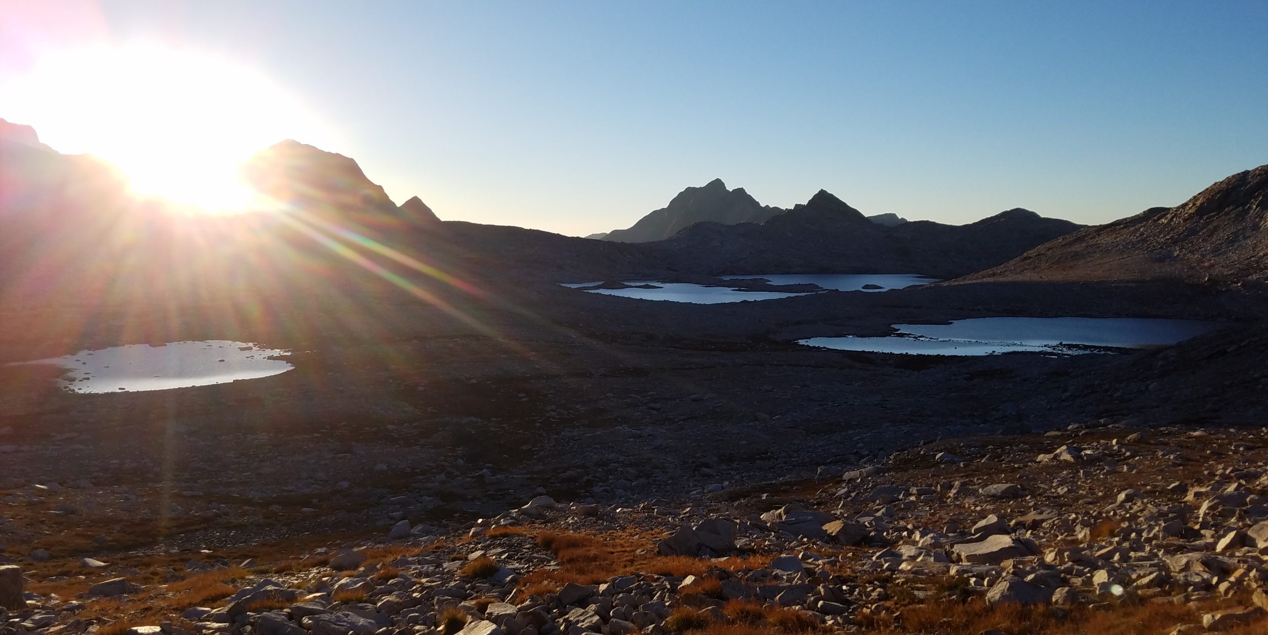
I’d heard some pretty mixed reviews on these shorter trails, particularly the OCT. A lot of thru-hikers disliked it because of the amount of road walking (assuming one didn’t make much of an effort to take boat shuttles/hitches). It’s also not much of a true wilderness experience. Legit campsites were hard to find and motels expensive. But I was very much aware of these limitations…after all, I dealt with them on Te Araroa and the Pacific Northwest Trail. Both of those trails had tons of road walking and similar logistical problems when it came to tides and river crossings. But I loved the beach sections on the PNT and TA, so I didn’t see why the OCT would be any different. I planned to go southbound, starting at the mouth of the Columbia river early July. This direction made the most sense for several reasons: 1. the prevailing wind direction along the coast, 2. linking to the other trails, 3. if I were starting in CA on the TRT going northbound, I would have dealt with a ton of snow in July.
After this grand adventure, my plan was to return to the North Rim of the Grand Canyon to finish the Hayduke.
See below for more detailed descriptions of these 3 new trails on my list:
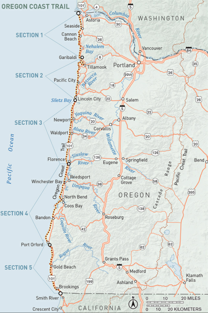
The Oregon Coast Trail is a roughly 400-mile walking route that capitalizes on Oregon’s 262 miles of publicly owned and accessible sandy beaches. While about half the route is on the beach, another quarter follows footpaths through state parks, national forests and over lush headlands. The remaining quarter (or less) follows quiet side roads and, where unavoidable, the shoulder of US 101. The OCT is still a work in progress, with new trail sections yet to open, plus many logistical details regarding boat ferries, camping options and other services… see Hiking the Oregon Coast Trail, by Bonnie Henderson.
The route is marked much of the way but still involves making use of a variety of resources, including various maps sets, an excellent guidebook, and several GPS files and apps…in other words, there is no simple FarOut guide (yet!). Tides, prevailing winds, river / bay crossings, and muddy and steep trails all come into focus along this route. Most of the road walking is the result of inlets and bays, but can be significantly alleviated by making use of small boat ferries/shuttles…or just hitching a ride on a boat or along the roads. Towns are frequent, mitigating the need to carry much food or water. Finding legal camping can be the biggest problem…this is not much of a wilderness experience, given the proximity to cities and highways.
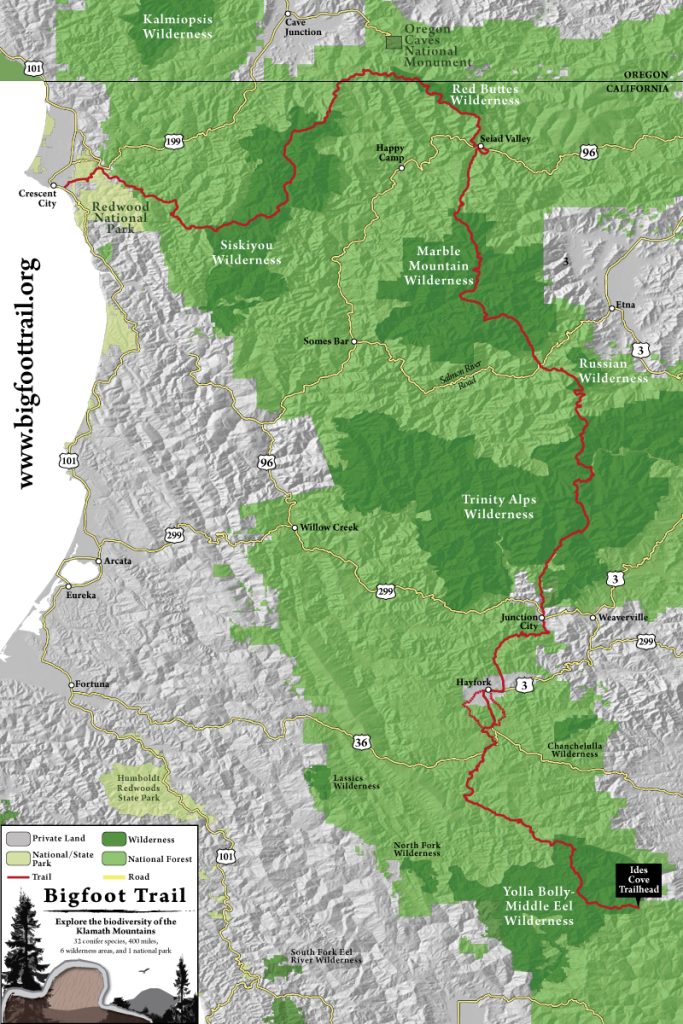
The BigFoot Trail is a roughly 360 mile hiking trail in northern California. The southern terminus begins in the Yolla Bolly wilderness, west of Redding CA, while the northern terminus begins at the Pacific Ocean, in Redwood National Park near Crescent City CA. The trail travels through the Klamath Mountains, briefly crossing into Oregon. It passes through 5 National Forests, 6 Wilderness areas (Yolla Bolly, Trinity Alps, Russian, Marble Mountain, Red Buttes, Siskiyou), 1 National Park (Redwood), and traverses 3 Wild and Scenic rivers. The Bigfoot Trail was conceived in 2009, utilizing existing trails (including 40 miles of the Pacific Crest Trail), dirt and paved roads. Most of the BFT is below 7,000′ elevation, with the highest point at 7,822ft/2384m. A major focus is the diversity of conifer trees, with 32 species to be found along the route. This region is a celebration of biodiversity, so the BFT aims to bring about awareness and conservation to this important area. While my training as a marine biologist is a bit far removed from tree identification, I hope to find as many of the conifers as I can.
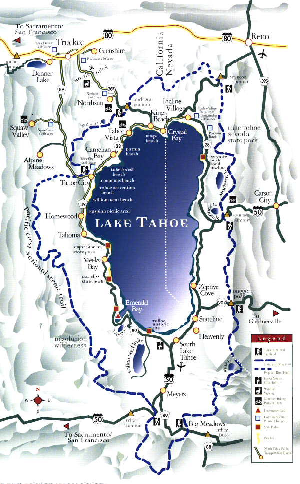
The Tahoe Rim Trail is a 175 mile long-distance hiking trail that forms a loop around the Lake Tahoe Basin in the Sierra Nevada and ranges of Nevada and California. The trail varies in elevation from 6,223 feet at the outlet of Lake Tahoe to 10,338 feet at Relay Peak in Nevada. About 50 miles of trail above the lake’s west shore are also part of the Pacific Crest Trail.