Memorial Day weekend, May 26th- 27th, 2023
Music Pass and Sand Lakes, Sangre De Cristo,
10 miles, elevation 11,500
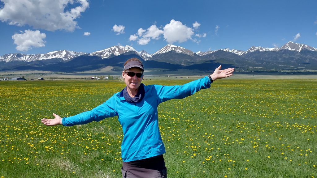
I didn’t finish the last 150 miles or so of the Hayduke (yet), and I also bypassed the route’s highpoint in the Henry mountains, due to heaps of snow. While I planned to return to the Grand Canyon to finish the western half of the route in the fall, I doubted I would get back to the Henry Mountains for just one peak bagging foray. Finding myself in Colorado with a bit of extra time after my Aunt’s memorial service, I figured I could at least gain back some style points by matching the Hayduke Highpoint: the south summit of Mt Ellen at 11,500′. So I called my good friend Jolly that I met nearly 6 years ago on the Colorado Trail, asking if he’d like to join me. He lived near Westcliffe, not far from where I grew up. I’d been visiting his cool earthship home since 2020 and we’d done several trips in the Sangres…one to the top of 14er Mt. Humbolt and another to Lake of the Clouds. The Sangres are my all-time favorite mountains, my hometown 14ers and 13ers. They collectively form the most impressive skyline for over 100 miles. Someday, when my climbing\scrambling skills were better, I hoped to traverse the range. But for now, I was content to just attain the magic elevation, a.l.a. the Hayduke Highpoint.
Finding such an elevation in the Sangres was an easy task… almost all of the dozens of trails lead that high in no time. While the Henry mountains did look pretty impressive from afar, their highest peaks only constituted a minor ridge in the Sangres… Colorado just can’t be beaten when it comes to surplus elevation. The Sangres themselves are an especially well endowed range…they contain 9 of the 50 some 14ers in the state (6 of which I’ve climbed), plus more then a dozen 13ers. Translated from Spanish, the mountains are the Blood of Christ, named so by early explorers. I’d like to think the meaning has been somewhat modified over the years. Probably the explorers were really exclaiming “Bloody Christ! How will we get over those???”
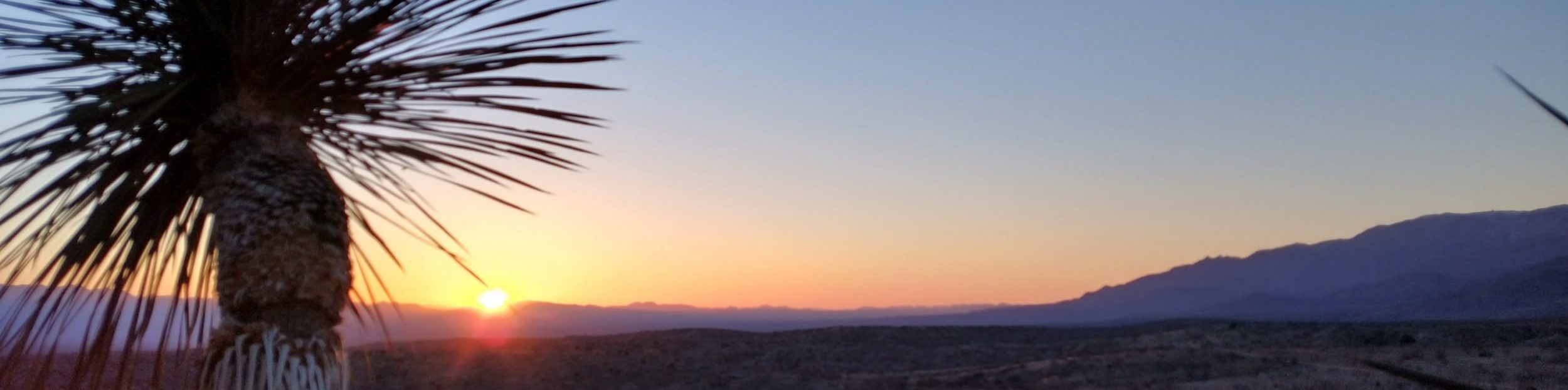
I loved climbing them, even in May with a lingering snowpack and early threatening monsoons. We put these potential hazards out of mind and just set off to have a good time. It was quite a contrast to go from the blazing hot desert of the Grand Canyon to alpine bliss, soundly rooted in spring versus the 100 degree summer. Jolly suggested Music Pass and the Sand Lakes, which he’d visited years prior. I might have traveled over this pass when I was a child, riding on the back of my dad’s motorcycle. It was either Music, Mosca, or Medano pass, I couldn’t quite recall. Probably one of the latter since Music pass trail prohibits motor travel. I know it was one of these because we made it all the way to the Great Sand Dunes. I remember my dad dumping the motorcycle numerous times in the sand and me trying to walk up one of the dunes, which scalded my feet.
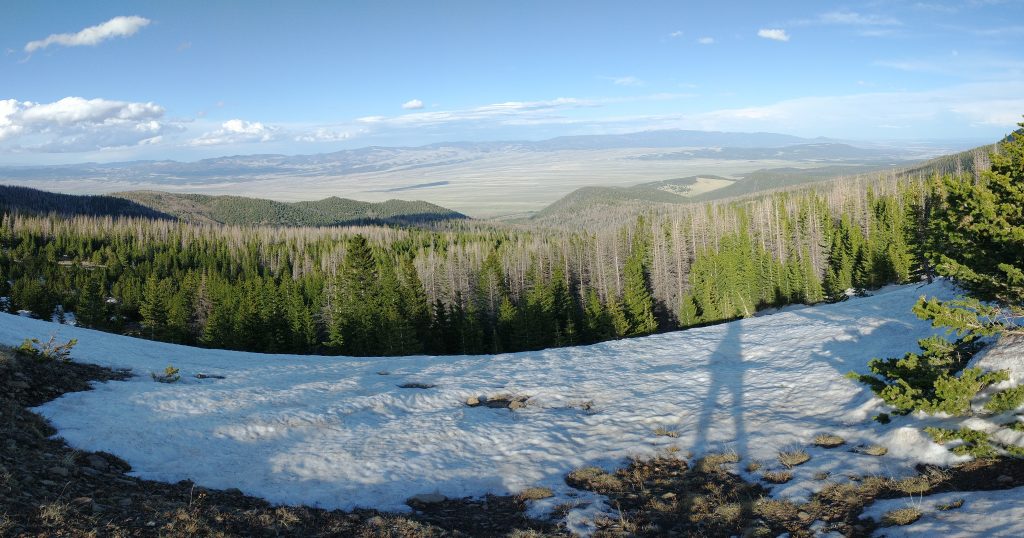
I had no desire to go as far as the sand dunes on this adventure, rather just to see if we could make it to one of the Sand Lakes, a distance of only about 5 miles one way. We departed from the trailhead at noon, noting only 2 other cars in the parking lot. This being the start of Memorial Day weekend, we were surprised by the solitude. Then again, the Sanges were still one of the quietest mountain ranges in all of Colorado…which had a lot to do with why I loved them so much. We walked a jeep road for the first few miles, gaining altitude pretty quickly as it was a steep grade. We stopped for a few breaks to catch our breath. Jolly confided that he hadn’t backpacked since the AZT and when we last we’d visited the Lakes of the Clouds in 2020, as he’d been focusing on bike packing for the past 2 years. It’s hard to keep pace with someone just coming off a long distance hike no matter what, but at least we weren’t in a hurry. There were thunderstorms all around us, so either we’d get hit or we’d get lucky, nothing we could do about it. The chance of rain was 40%, which is a pretty good chance one is seeing hail\snow\rain in the high country. We watched Pike Peaks become enveloped by a huge thunder cloud, grateful we weren’t attempting a 14er this day.
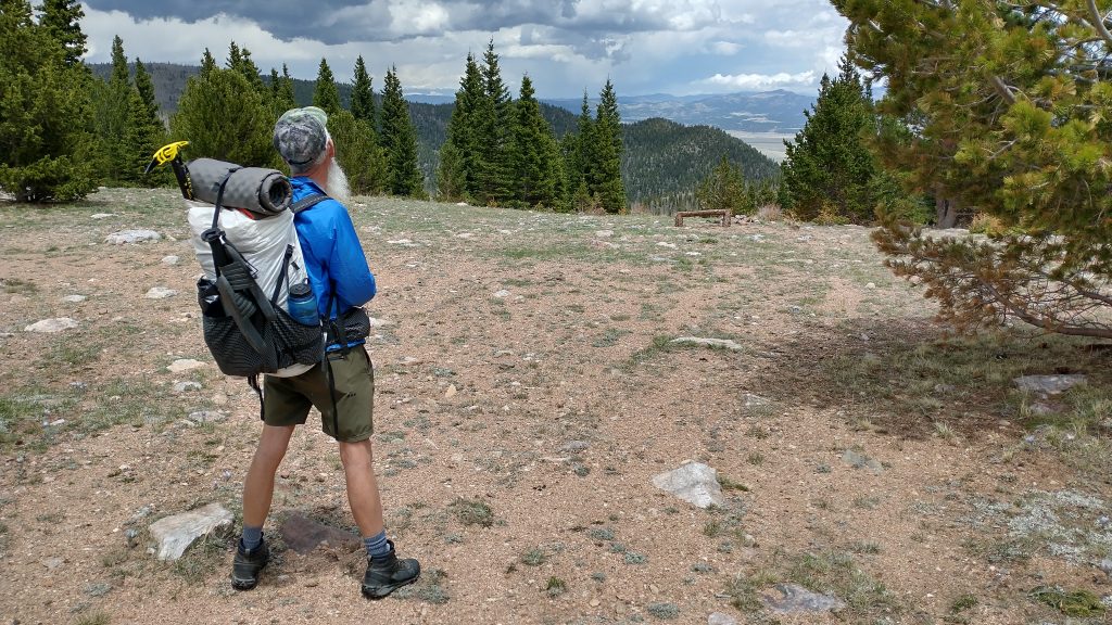
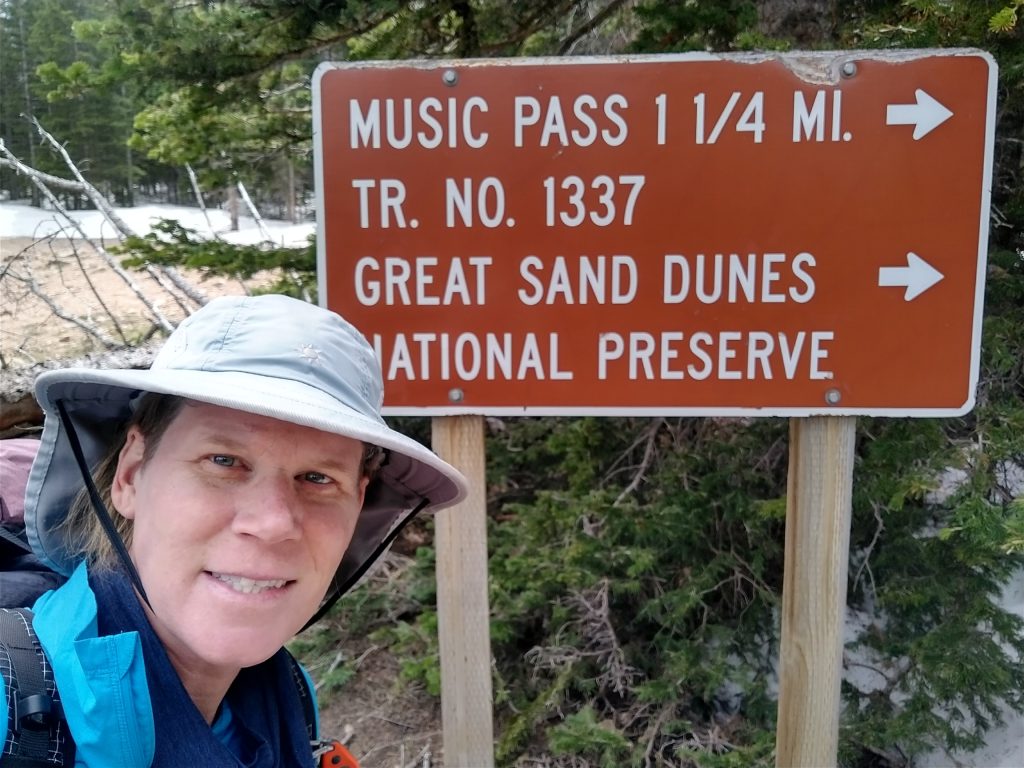
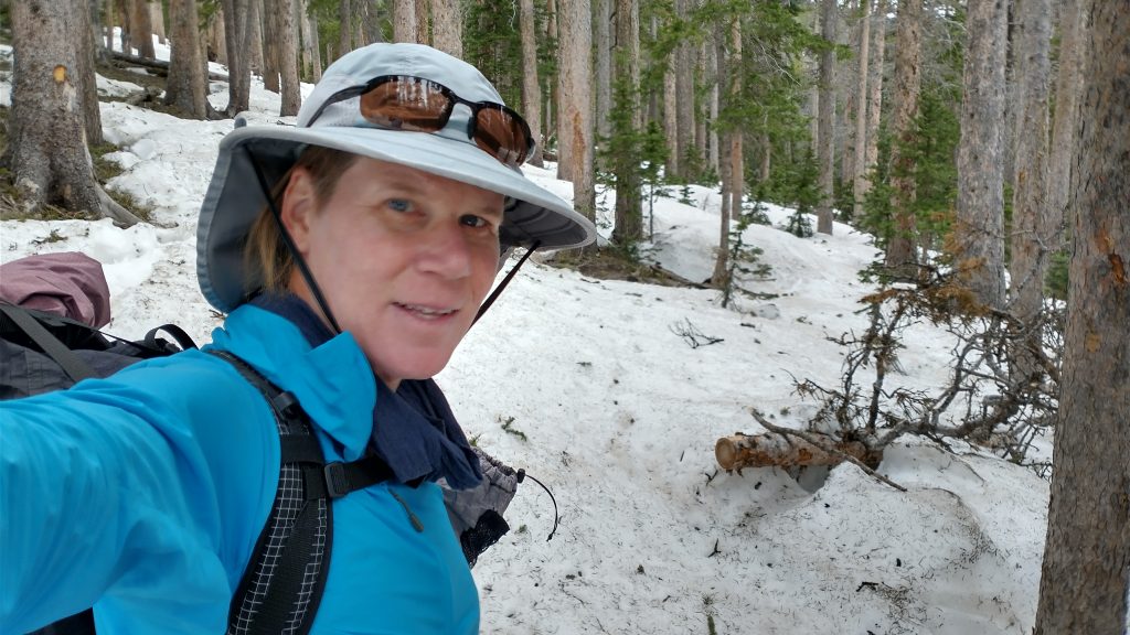

Upon reaching the transition from the 4wd road to single-track trail, we also hit the snow line. The trail traversed along a north-facing slope, deep in the trees, so I knew we’d be wading through about a mile of it all the way to the pass. It seemed only fitting, since a trip to the top of Mt Ellen would have involved lots of snow, as well. I happen to be one of the few that enjoys such a challenge, at least for a few hours, and not days on end. The snow was still almost firm enough to avoid postholing and there were footsteps to follow. With my light and quick feet, I pulled ahead. I met 2 day hikers just shy of the pass, on their way back down. It was their footsteps I’d been following. We stopped to chat just as a passing shower of snow flurries hit. I laughed that it was still sunny and the weather didn’t seem threatening. I had such a lighthearted feeling about the day, somehow I just knew nothing was going to go wrong…even when the day hikers warned me that Sand creek was running high and looked impassable. A crossing was required to get to lower Sand Lake, plus there was lots of snow on the other side and no discernible trail.
No bother, I cared not if we made it all the way to the lakes. Coming off the heels of a disappointingly incomplete thru-hike, at least there was no longer any pressure to keep pressing ahead, keep up, make tough decisions, or feel bad about stopping short. I had nothing to prove anymore. In my solo hiking, I was able to make risk assessments and decisions that I knew were my own. Thankfully Jolly was in sync with my plans for this short trip. Actually, he was struggling a bit to keep pace in the snow but turns out he had a good excuse, as he was carrying almost 4 liters of water plus a beer! Eight extra pounds can sure make a difference when it comes to postholing frequency. The beer that he’d sneaked out was actually for me, since he didn’t even drink alcohol. I wrested it away from him when I spied it hiding in his pack, alleviating him of some of the weight.
We made it to the pass, which was the perfect spot for a break to take in the views. Miraculously, the thunderstorms had parted directly overhead and the valley before us was cast in sunlight. It was nothing but blue skies to the west, while a line of darkness rolled over the plains to the east. The weather goddesses took pity on us this day. About 5 feet of snow was still nearly encompassing the pass kiosk, making for a fun photo opportunity.

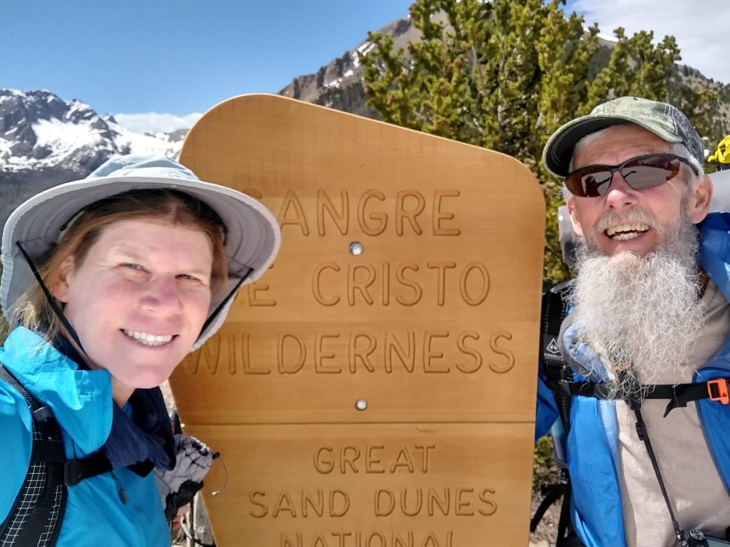
We entered the Sangre De Cristo Wilderness area and found lovely snow-free trail heading into the valley. Beautiful alpine meadows beckoned us. Before long, we were gliding through them, marveling at the serenity of our surroundings. There were many established campsites and we had our pick of the lot. I blew right past the turn-off to the lake, engrossed in my easy pace through the meadow. Thankfully Jolly broke me from my trance and we doubled back to the junction.
Reaching the creek, I realized just how over-extended my water crossing comfort levels had become on the Hayduke, and Te Araroa before that. What was described as impassable by the day hikers looked like nothing to me. I quickly spied a location that I could have crossed. And yet, looking at all the snow on the other side, it was just as easy of a decision to say no. Jolly suggested that we make camp in the meadow and maybe shoot for the lakes the next morning, sans packs. This seemed like a great idea. We found a perfect spot with a view of Tijeras Peak and the meadow below. The lake sites, being about 400′ higher, were likely covered by snow anyway. It was all the more I could have asked for: views, solitude, and the comfort of these mountains I’d so long sought refuge in. Bliss.
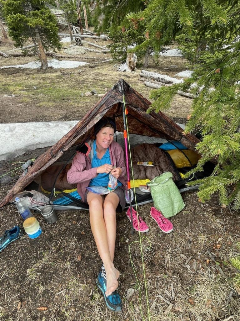


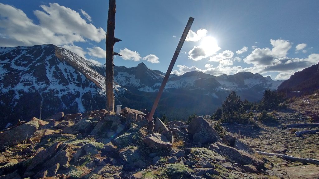
We had our tents up and camp prepared by 4 pm! Had we even hiked 5 miles, I wasn’t sure? Sometimes it’s really nice to just be a “normal” backpacker. But I couldn’t help feeling a bit restless. So I went exploring with the remaining daylight and fair weather. I struck out down the meadow to find many more nice, empty campsites and even a cache of buckets belonging to the NPS. I suspected they were full of trail maintenance items. Having exhausted my meadow-picking, I decided to go back up to the pass to enjoy the late afternoon lighting. I also figured I would hit the exact elevation I’d been seeking to match, since the Music Pass kiosk had come in just under 11,400′. I gained the pass again and turned north, heading for the peak. I was thankful for my explorations, because I found 2 different USGS survey markers along with a nice stack of rocks, marking the 11,500′ point perfectly.


Highpoint Mission Accomplished!
While I can’t say for certain, since I never made it there, I suspect the view from this location was somewhat superior to the view from Mt. Ellen. I guess I just preferred looking up at the collection of 13ers that surrounded me rather then down at the flat and scorched desert below… I’d gotten the gist of such a view from Penellen Pass, anyway. For contrast, I could still look to the east to see the Wet Mountain valley and range below. I was inspired to look into developing my own route and perhaps become the first to complete a “thru-hike” of the Wet mountains someday. They had been the mountains I’d grown up with after all, seeing from my window every day I looked out for over 10 years. Why not?
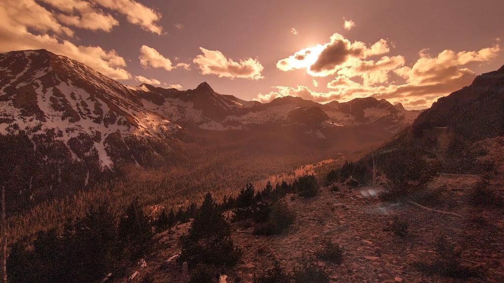
Having taken in all the beauty for one day, I returned to camp and cooked dinner. I had the pleasure of a cold beer waiting for me, properly chilled by a nearby ‘snow cooler’. Jolly was already fast asleep, feeling pretty tired from the elevation I guess. He woke up long enough to make dinner and enjoy the Alpenglow. It was a perfect, relaxed day for both of us.
It rained a little overnight and I heard some distant thunder…a far cry from the hellish storms that can sometimes torment a camper in the wee hours. The next morning, we woke to temps in the low 30s and enjoyed a leisurely breakfast. Contentedness won out, as we decided to abandon our lake pursuits and just hike back the way we’d come. We passed a few trail runners and 1 backpacker. He had a fishing pole strapped to his pack, so maybe he’d be the first to make it to the lakes this year. All I know for sure is that I was fine with not seeing them…just gives me an excuse to come back another time. Thanks to Jolly for another great outing in the Sangres!
Rather off topic, I also wanted to mention a funny story that happened in Las Vegas while I was waiting for a flight to Denver. No, the story doesn’t involve tigers, hookers, or blow. I didn’t go to a single casino or even catch a show. I found the whole place rather deplorable, in fact. The consumerism, commercialism, and excessive acts of debauchery were definitely not my style. The amazing thing that happened is that I actually ran into 2 authentic Hayduke hikers in this sea of fake landscapes. They were also catching a flight the same day and happened to be walking by my hotel in the morning. They’d stayed in the hotel next to mine, near the airport…of course we all think alike. I recognized them from their sun-baked, feral-looking appearance, but with nice ultralight backpacks. At first I assumed they must be AZT hikers who had just finished, but no. They told me they had just hiked some obscure route called the Hayduke, “had I heard of it?” I couldn’t believe the coincidence, as I’d barely seen a clue about these 2 being in front of me. In looking at some of my photos of trail registers later, I did see their names: Mimi and MountainDog.
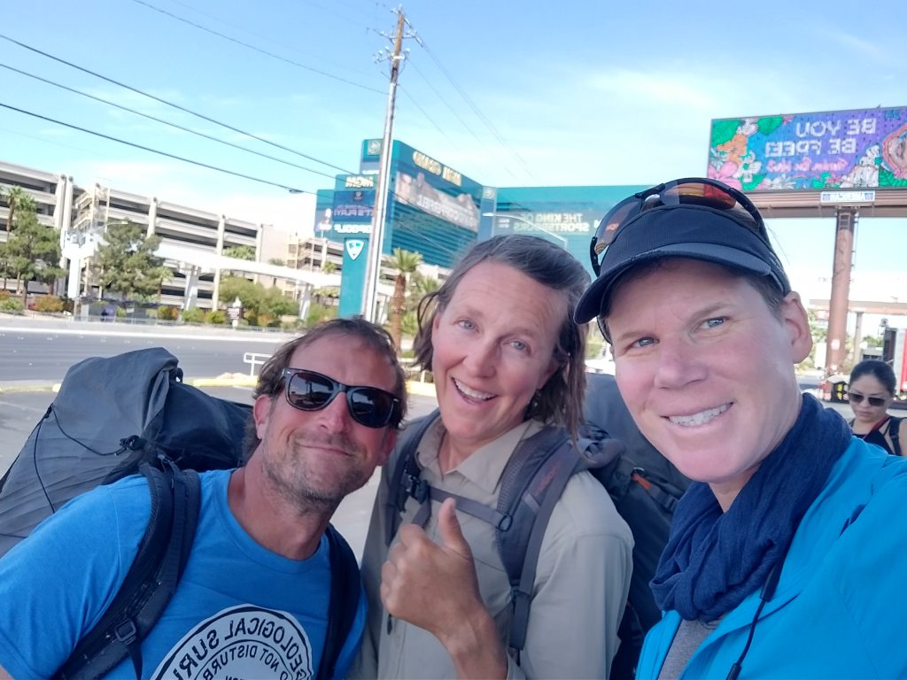
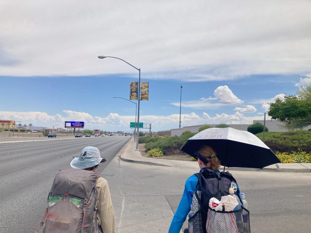
We went to Dennys to waste time before our flights and swapped stories about the trail. I was surprised to learn that they had started the route at the beginning of March, being some of the earliest hikers in 2023 and enduring a lot of cold and snow. Afterwards, in true hikertrash fashion, we walked to the airport. I didn’t even think this was possible, given that it was such a large international airport, but LAS was indeed walk-able! So I’ll give Las Vegas some credit for that at least, plus my negative feelings about it were slightly improved by my chance encounter with my fellow thru-hikers. We had to part ways at the 2 different terminals, as my flight was at the other, but I was glad to make some more friends on this last day.
Unfortunately Las Vegas still had one more evil card to play when my flight had a mechanical and we sat for 6 hours on the boiling hot tarmac. To try to fix the problem, they even turned off all the power to the plane (reboot!), so we were without air for a bit. Truly torturous. The evil Frontier gate agents also tried to charge me $100 for my cherished umbrella, stating that because it didn’t fit in the bag checker, it counted as a separate baggage item. Luckily a lady standing in line behind me, without any luggage, agreed that this was ridiculous and offered to carry it on for me. I smiled a big FU grin at the agents, as they had to just shut their stupid pie holes. I wasn’t going to pay $100 for a used umbrella anyway…it only cost $40 new. For future hikes and flights, I devised a method of hiding it inside my pants as I boarded the plane…if they can’t see it, they can’t give me a hard time about it. This gives new meaning to the phrase ‘is that a banana in your pocket?’…no, just an umbrella, which I can’t live without.
I posted my Hayduke summary and stats in June 2023, following this post, but I since moved it to follow at the end of my UPDATED Hayduke hike, after I came back in the fall to resume from the North Rim. In the interim, I hiked the Oregon Coast Trail to the Bigfoot Trail to the PCT to the Tahoe Rim Trail, then the PCT again all the way to Sonora Pass in the Sierra. I called this trail the Pacific Coast Bigfoot Crest Rim Trail, or PCBCRT, which follows next. Or you can jump to my next Hayduke post here. Thank you for following!
More rich content and impressive images. Glad you made the alt highpoint. Can’t wait to hear more about “…developing my own route and perhaps become the first to complete a “thru-hike” of the Wet mountains someday.” Thanks for sharing.