Saturday, July 15th, 2023, 0520-1740
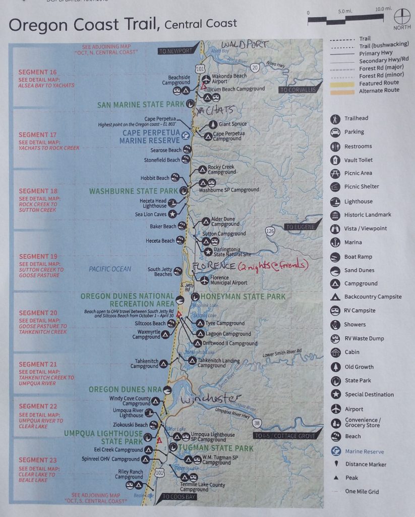
Beachside State Rec to North Jetty Park, Florence
30 miles, Gain 1600′, Loss 1600′, elevation 60
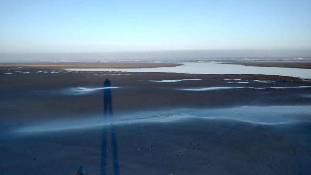
I got a very early start, hoping to reach a certain area while there was still a mid-tide. It didn’t work out, but at least I was immediately reminded of why I like to be on trail so early. For starters, the highway had very little traffic. The foreground of the beach was all private property where I rejoined the highway and I didn’t feel like backtracking to the campground, so I just road walked for a mile to the next campground. I was able to use the bathroom there, then I was on the the beach, enjoying the first rays of sunlight as they hit me…it felt magical. Like so many times, I had the whole beach to myself.
It was low tide in the early morning, so I got to take advantage of wide, flat terrain. There were many small puddles and ponds mixed throughout the sand, so I spent some energy jumping over these obstacles. Perhaps the most important skill I learned in high school was how to long jump…I made it to the state track meet in the event and also set my school record in the triple jump. The Coast Guard Academy’s physical exam cadre even recruited me to teach the standing long jump to other cadets who were struggling. It was kind of a dumb event to be a part of the physical fitness exam, but I was good at it. These days, I practiced it all the time to span small creeks without getting my feet wet.
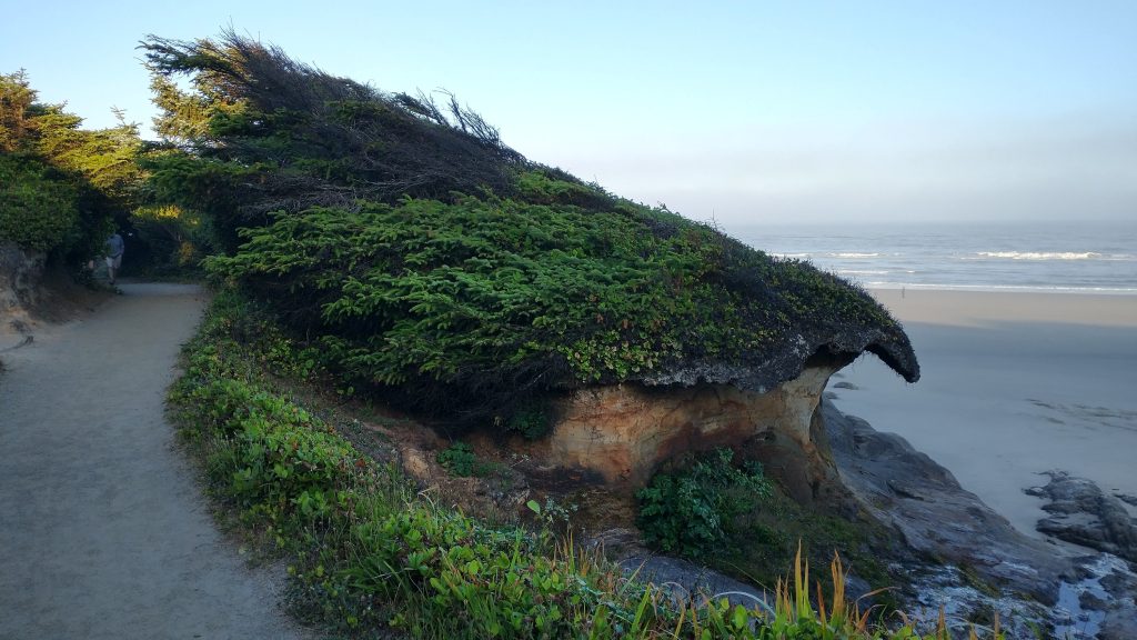
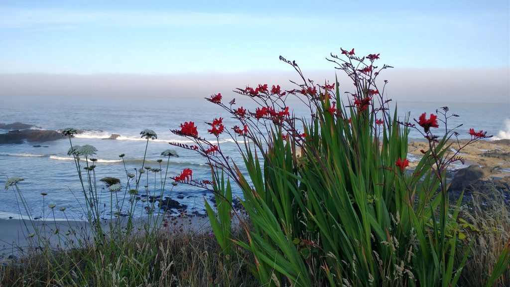
I was shortly strolling past all the fancy houses in Yachats and then onto a trail, as I picked up the 804 coastal path. I read a sign explaining that it was the old road leading to Yachats and had been preserved as a trail to benefit the community, despite battles with land owners, who tried to close it. It was a beautiful path, skirting the edges of the coves, rocky points, and tide pools along the beachfront. Everywhere I could see bright orange sea stars clinging to the rocks. The tide was so low that I could have stayed on the beach a little longer, but the path was a nice change in pace. It was also pretty popular with runners and walkers, all out enjoying the glorious morning. I got a really nice vibe from Yachats, even though I didn’t stay there, or even stop for a bite to eat. I saw a sign that read “Yachats is the gem of the Oregon coast.” It seemed that way. I’d have to come back someday and give it some more time.
Just outside of town, I picked up another trail leading to Cape Perpetua. There, I took a somber moment to visit the Amanda Memorial and trail, a tribute to the atrocities endured by coastal native Americans, and specifically a blind Coos woman named Amanda. She was forcibly marched from Coos Bay north to here, as a white general tried to consolidate several reservations, breaking former treaties in the process. She was marched until her feet bled…we only know this because the general made a note of it in his journal. It was hard to reconcile my walking, which can sometimes lead to bleeding feet, but is done so by choice and for enjoyment. Her experience along this coast was completely involuntary and nothing short of misery.
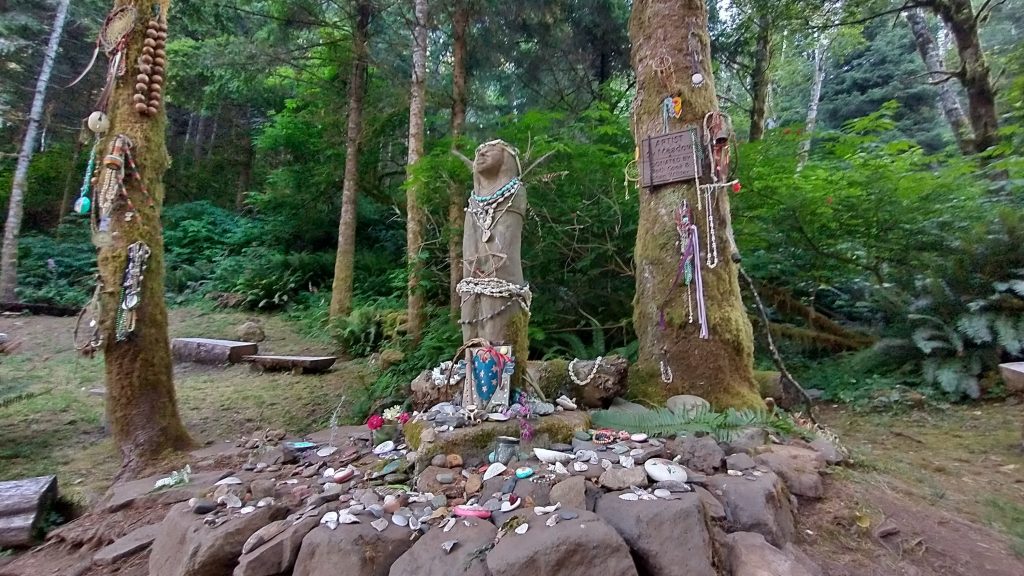
All around the memorial were offerings: dream catchers, jewelry, rocks, and other mementos. I hadn’t thought to bring something, then I remembered a piece of smoothed beach glass I’d found the day before. It looked like an emerald, so I’d held onto it. It was the perfect fit for this array, so I placed it at her feet and wished for peace. What a sad chapter and reminder of the stolen land I walked along.
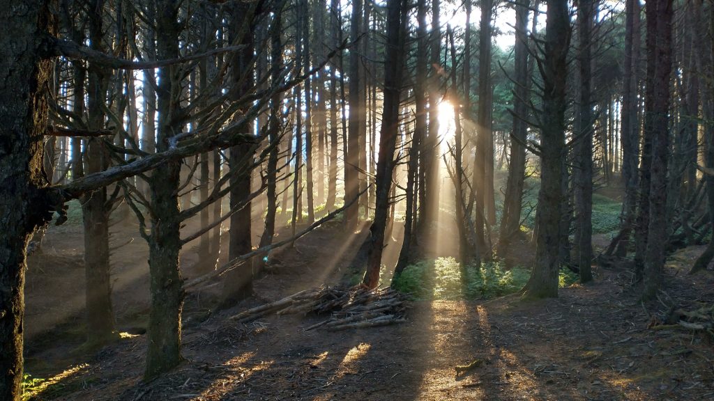
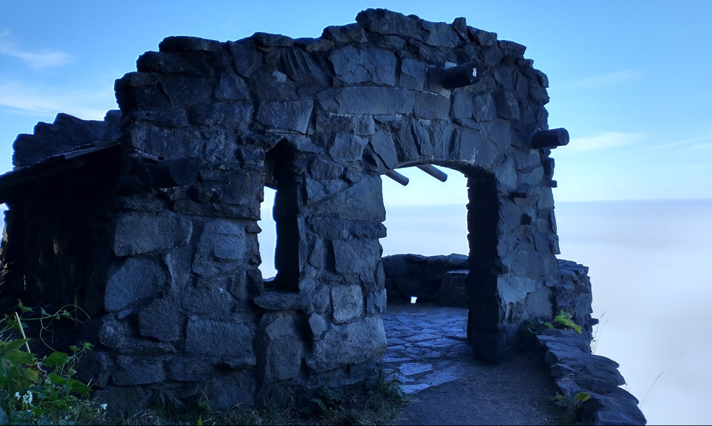
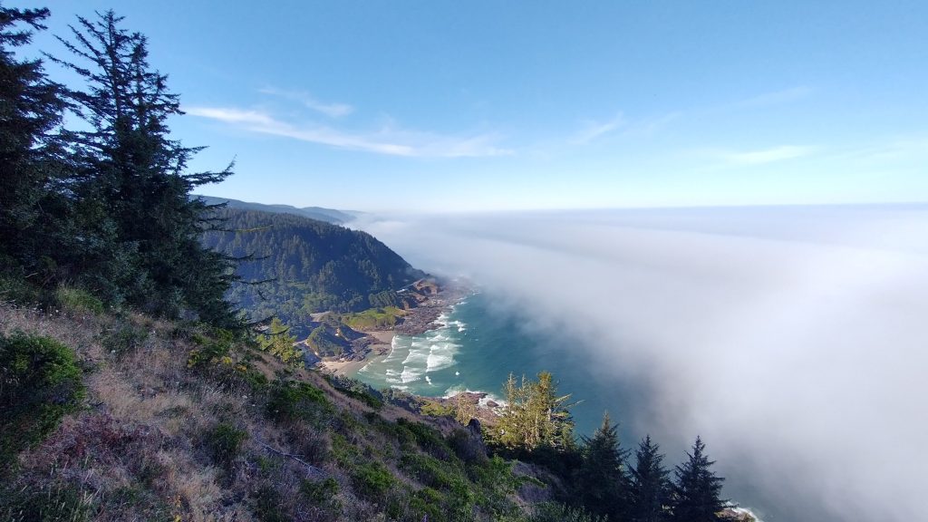
The trail climbed high through a valley and topped off at 1066′. It was a gorgeous trail and I actually saw a few runners and day hikers. It swung around on a ridge, coming to a lookout point and rock shelter that appeared to be perched on the edge of nothingness. A marine layer fog had formed since I left the coast, and now the ocean was a white cloud. It made for a really cool effect as the shelter background and for amazing views of the coast, looking south. The shelter had been built by the CCC and there were several memorials to the CCC camp that had been located in the park.
I descend 17 switchbacks (yes I counted them), passed through the campground and past the visitors center, then walked the last few miles of trail before a long road stretch. There were many more trails in this park waiting to be explored for another time. It was a really nice state park except for one thing: several of the signs depicted hiking maps, which listed the Oregon Coast Trail as being a 2.5 mile round trip. I guess this was the case for the portion that runs along 101 in the park, but way to sell my epic journey along the coast so short! Couldn’t they at least include a blurb about the whole Oregon Coast Trail, all 400 miles of it?
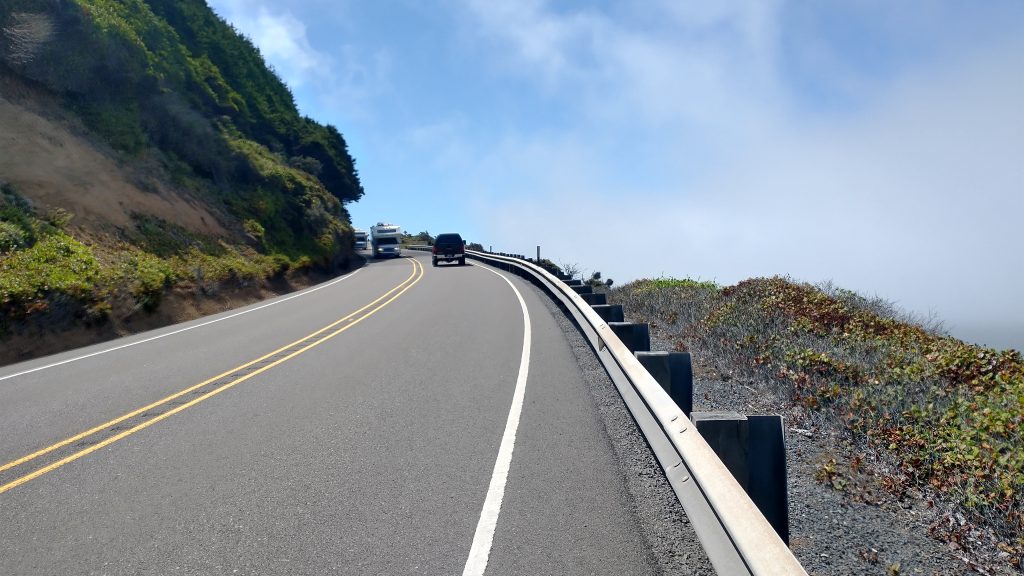
At last, I reached a 6 mile road walk I’d been dreading, as coastal highway 101 was very tight here, winding around blind curves with little to no shoulder. It was incredibly scenic, but hard to focus on this when I had to instead focus on bus-sized RVs coming round the turns. Taking a cue from Trailcrew’s notes, I bushwhacked down to the beach just after Bray point. This was the part I was hoping to hit at a mid tide but I’m afraid I missed my window, as waves were already creeping up the rocks. I gave it a valiant effort, at least. The first points were easy to walk the rocks around but I came to one that required some pretty sketchy scrambling on the slippery cliffs. I also considered wading through the surf but thought better of it. At one moment, I was staring right down into the churning ocean, with barely a few sparse handholds between me and it. This wasn’t worth it. I had to choose between the chance of being dashed on the rocks by the waves or hit by an RV. Having made it to another cove, I could only see more sketchy points ahead, so I decided to bail. Either Trailcrew had a much lower tide or was just much more brave when it came to rock scrambling with a pack on…probably both.
The problem with getting stuck in a tiny cove with a rising tide was that there wasn’t public beach access. Lucky for me, there were several sets of wooden stairs leading to the bluffs above. I of course knew all of them were private, but the last scramble had been scary enough that I didn’t want to go back and repeat it. So I made the call to take the stairs…better to beg for forgiveness than die on the rocks. Reaching the top, I peaked around, looking for signs of anyone being home. I had the luck of popping up at what looked like a rental place, with no one home. I quickly ducked around the fence and rejoined the highway, no harm no foul. My beach crawl managed to knock off about a mile and a half of scary road walking, so I guess it was worth it. Now I only had about 2 miles left of the original 6 miles of road walking, so it was manageable. Plus, there were some surprisingly good gaps in the traffic, especially for a Saturday. Looking down at the rugged coast from the road above, I could see I’d made the right decision to bail. Some of the points looked absolutely treacherous, with giant wind-stirred waves crashing at the base. No thank you!
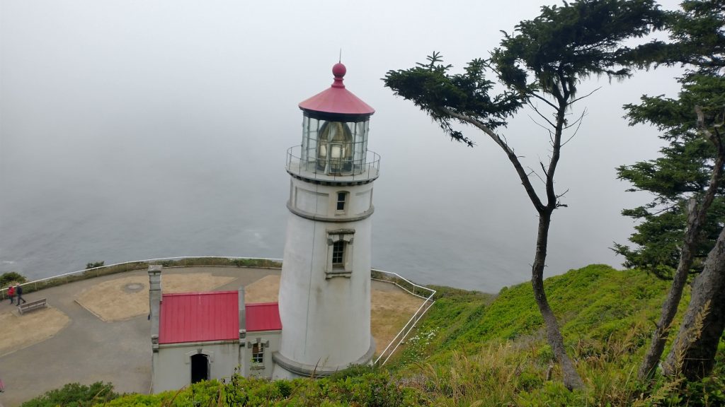
At Rock Creek (really original name), I was able to return to the beach again. By this time, the fog had gotten really thick and the wind was gusting fiercely. I walked to the end of Hobbit beach and took the hobbit trail a few miles up to Heceta Head Lighthouse. On the way, it started to rain from all the fog collecting on the trees. Every time a gust of wind would come through, the condensation would fall on my head. I actually got a little wet, which was funny considering how the day had started so clear and bright. This was my 5th of 9 Oregon Coast lighthouses. Unlike the Cape Meares lighthouse, which I’d had to myself on a sleepy Sunday morning, this one was crawling with visitors. There were also several friendly volunteers stationed, happy to answer questions, but unfortunately the lighthouse top was not open to visitors. That’s because it’s still a working lighthouse and was beaming its light as I looked at it. With the fog, I wondered how far it could be seen…not very, I’d guess.
I took a late lunch break here, trying to decide what to do next. I was cold and tired…I’d already walked 25 miles and wasn’t sure where I was going to end up for the day. I wondered down to the parking lot and was relieved to at least find some water from a faucet behind the vault toilets. The water didn’t taste very well (another hiker later reported that it might have made him sick), but I was glad to have it to wash off my shoes and face, plus collect water for the night. Part of the reason I was so cold was that my feet had been wet all day, since I hadn’t bothered to take my shoes off at a few stream crossings. I considered getting a ride into Florence to stay at a hostel there, but didn’t figure there would be any room left on a Saturday.
I also didn’t want to walk through the HWY 101 Heceta tunnel, which was a couple hundred yards long and had no shoulder on either side. From where I rested down below, I could hear cars blaring their horns in the tunnel. I imagined they were irate at some poor cyclist trying to ride through and holding up traffic. There was a button at either end of the tunnel that cyclists could push, which caused lights to flash and alert drivers to slow to 25 MPH. I thought this was still way too fast for the safety of the cyclists. I could just imagine how pissed off drivers would be if I tried to walk through at 3 MPH, especially given all the weekend traffic. So I posted up at the Heceta Head intersection/pull out and rather aggressively advocated for a ride from the first car to come by…the driver was hesitant but kindly obliged. Then, since I was already getting a ride, I asked if I could go 3 more miles down the highway to where the first beach access was. No problem. I guess this was technically the first time I hitched a ride from a car this trip. I’d previously taken a bus and been offered a ride when I wasn’t seeking one. I’d also begged a few rides from boats. It all came pretty easy for me, but sometimes it paid to be a little pushy, even if I didn’t like putting people on the spot like I did in this case.
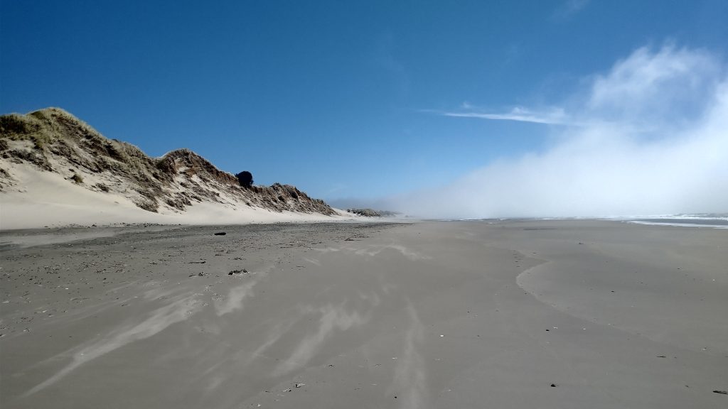
My unofficial GPS route guided me to a location that was past the actual trail to the beach, so I overshot by a quarter mile. Walking back up the highway, a squished squirrel reminded me why I decided to skip the last 3 miles. Back on the beach for the final time this long day, I wondered that I shouldn’t have stayed inland on the highway. The wind was ridiculous! It was at first clear, with the fog creating a cool effect. But then it socked in and I couldn’t see more than 100 yards for the rest of the day. And man was it cold! I wanted nothing more than to stop to camp for the night but there was no sheltered place to be found. I’d entered the first section of the Oregon Dunes, a geologic feature that stretched for 60 some miles to the south. I had 5 miles of beach walking to reach the jetty of the Siuslaw river entrance, which turned into the most tedious walking yet. Tired, cold, and wet didn’t make for a good combination. But the wind was blowing too hard to do anything about these factors, so I just blew along, feeling like a tumbleweed. I had to finally stop to put on my rain jacket and I could barely get my arms through the holes, the wind was whipping it around like one of those wind-sock characters in front of a used car lot.
I was so relieved to finally arrive at the jetty and make my way inland on a quiet road. I dove off into the woods at the first chance I saw and found a beautifully protected spot, well out of sight from the road. Was I ever grateful for my stealth spotting abilities this night! The site was so peaceful, kind of down inside the bottom of a dune, yet I could hear the wind howling in the trees above and the surf crashing on the shore. I pitched my the tent very quickly and was shortly warming up inside my quilt, relishing my dry clothes. Whew, what a day! It was my longest and definitely most taxing yet. But the earlier part was really fantastic and I covered a whole lot a varied ground again. I couldn’t believe how many different things I did and saw each and every day on this ‘trail’!
Sunday, July 16th, 2023, 0610-0740
North Jetty Park to Florence
5 miles, Gain 100′, Loss 100′, elevation 40
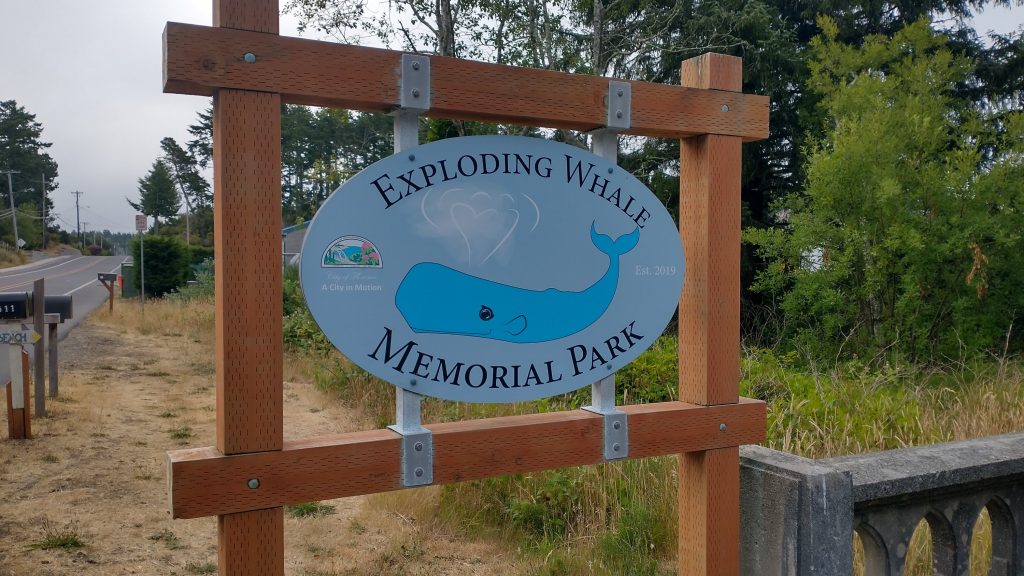
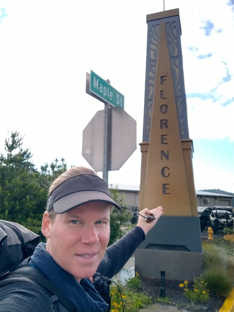
I combined these 2 posts, since not a lot happened this day. I decided to take a little break in Florence to catch up on chores and avoid hitting the next section of dunes on a Sunday, since the area was so popular with ATVs. Also, Florence CO was my hometown growing up, so Florence OR deserved some of my attention. Plus, after such a long day previously, I’d earned a NERO. Florence was considered the halfway point of the OCT and sure enough, my miles hiked came to about 200. My overnight stealth spot was clutch and the 5 mile road walk from the beach was nice and quiet on a sleepy Sunday morning. I stopped to walk around the Exploding Whale Memorial Park…sadly there was no sign describing the funny event from the 1970’s. The authorities decided the best way to dispose of a dead beached whale was to blow it up…and it didn’t go so well. There’s a video of it here. I had to love this town for its sense of humor!
Once I made it to 101, I found a great cafe, The Little Brown Hen. I ate a big breakfast, complete with a biscuit smothered in their signature marionberry sauce. Yum! After sucking down several coffee refills, the place got super busy, so I gave up my table to sit outside on a curb, sucking wifi. I found out they discouraged loitering by being too kind…my waitress came outside to offer me water and another patron offered to give me a ride somewhere. I felt bad about being such a disruption, so I moved on.
I dropped in on the Florence 101 hostel, run by the sweetest lady, Marianne. She was just on her way to church but checked her schedule to see if she could fit me in for the night. Her 3 or 4 rooms were booked but she offered to let me stay in her shed/cabin outside for next to nothing. I actually preferred this accommodation over the rooms. The place had everything: Wifi, laundry, couches, a kitchen, and free breakfast. The Post Office was across the street, the library next door, and the Safeway a block away…this was pretty much a perfect trail town in my book! I was so excited for a day to relax and get stuff done, which is what I did. Later, OCT hiker Mike, who I’d last seen north of Newport, checked in for the night. So I chatted about the trail with him and also learned that he’s an arborist in Portland, which sounded like such a cool job to me. It was a nice, chill day and fun to enjoy the pretty little town. I loved Florence! I’d even like to maybe go back there to live someday.
Hi Twig,
I see that you’re south of Waldport. In World War II, there was a Conscientious Objector camp there. Quite a number of literary folks from the Bay Area spent time in that facility. After their release, they returned to the SF region and continued to publish. Early beat generation…In a former life, I did some research and teaching at the local university on such topics. So are you going to divulge how far you triple jumped? Ha.
Perhaps that blurb came to you twice…