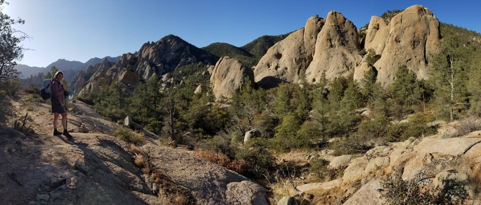
Saturday, July 22nd, 2023, 0600-2000
Sixes River to Humbug State Park Dry Run Creek
17 miles, Gain 1500′, Loss 1500′, elevation 170′
This was one of my favorite campsites, so I was not excited about leaving just to ford a cold river right off the batt. It was still foggy and the wind blowing, though not as bad. I could see quite a difference in the river level but I was still about 3 hours before the low, so I think the water level was about +3′. The current was ripping at the outflow onto the beach, the swiftest I’d seen of any water crossing on the coast yet. I went for it anyway and the water only came up to my knees. Thank goodness, since I really didn’t want to get my clothes wet. It was 51 degrees plus the wind chill, so I had a hard time getting my shoes back on with my frozen hands and feet. I was so happy to finally be done with that river and just be walking to warm up.
I only had about a mile or so of beach before the trail leading up to Cape Blanco. I couldn’t see hardly anything because of the fog. I was worried that I missed the trail because my rudimentary OCT trackline showed that I had overshot, so I backtracked a ways and still couldn’t find any trail up the bluff. My trackline was wrong (as it often was). The trail was further south and eventually I located it. I hated fog… it was very disorienting.
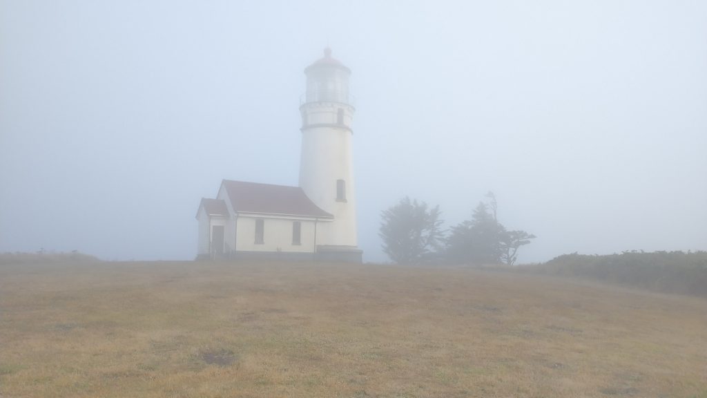
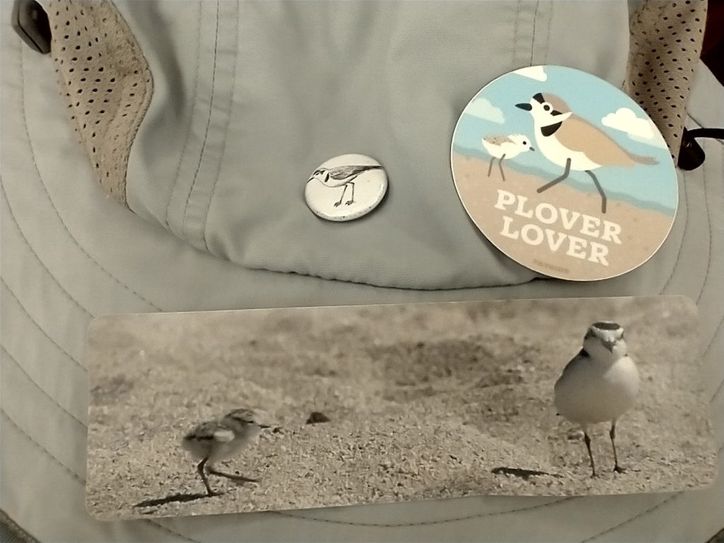
Cape Blanco was the westernmost point in Oregon, and apparently was always windy, maybe foggy too. Even though conditions were pretty yuck, I ventured a half mile off track to see the lighthouse. I had to get very close to see it through the fog. It was only 7 am, so I was the only one out there. The place officially opened at 10 am, but I wasn’t about to stick around that long, freezing and getting wet from the fog.
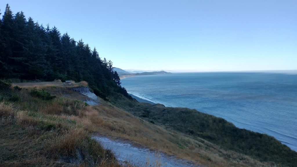
I continued into the forest, passing by the campground. There were several lookout points along the way, but I figured there would be nothing to see. To my surprise, the coast was clear! It had been less than 15 minutes since I left the cape, covered in thick fog. Looking back several times throughout the day, I could see that it was still covered in fog. There must have been something about the way it jutted out into the ocean that collected the fog. It sure had come and gone a bunch of times over the past 24 hours.
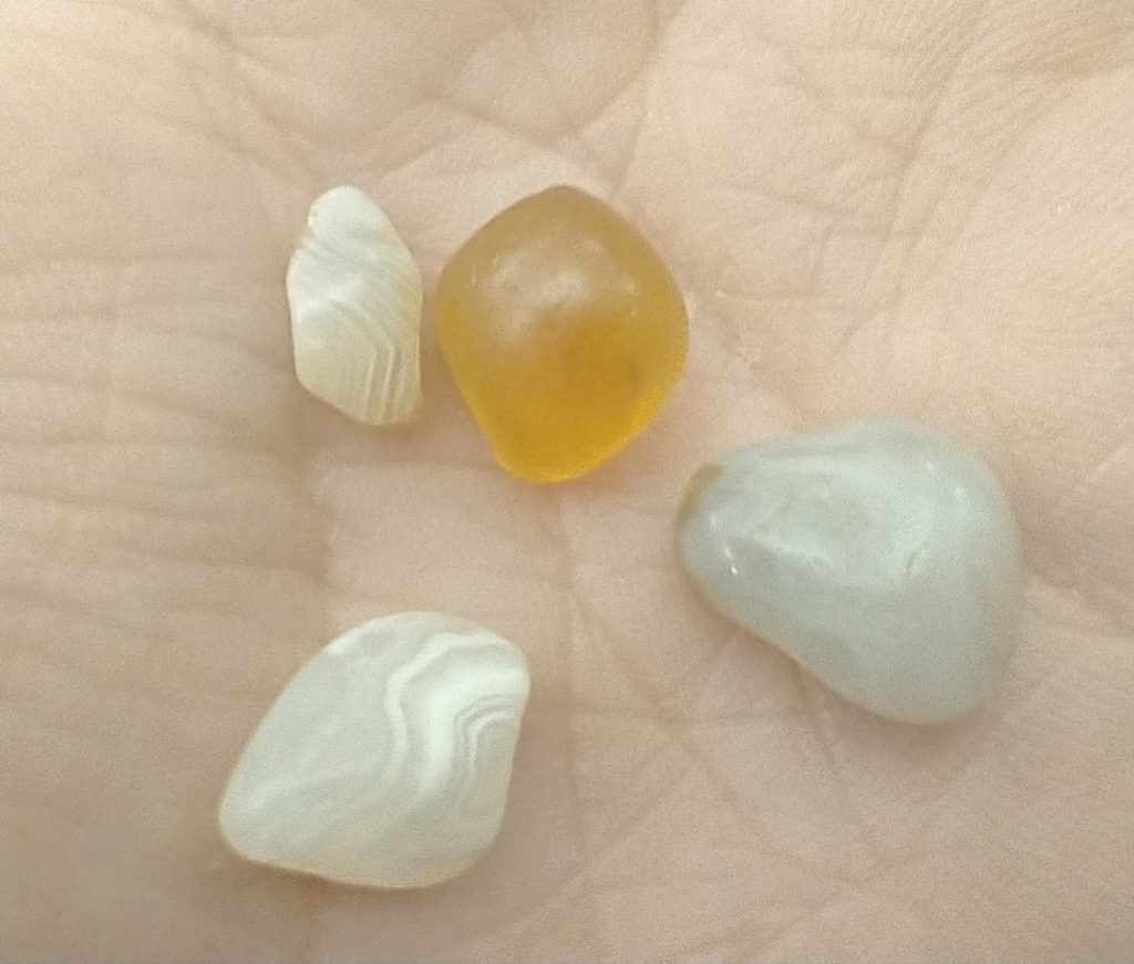
I dropped down to another beach, which was a delight in the sunny weather and almost no wind. I immediately saw Altra Lone Peak shoe prints, the same I’d been seeing the day before. I figured they were from a female hiker that a NOBO said he camped with recently. I crossed the Elk river, which was more like a stream at only ankle deep. At that point, I could see the hiker ahead, so I picked up my pace to catch up. Then I met several groups driving jeeps who had come in search of agates. Just as I saw them get out with their search sticks (they had a claw \ scoop at one end so that users didn’t have to bend over), I remembered that Mike had told me about these beaches being good places to find agates. I looked down just then and there was a polished yellow\orange clear stone sitting right there. I talked to the other people and they showed me some things to look for. I had a hard time distinguishing agates from all the quartz, but it was fun to look for them as I walked.
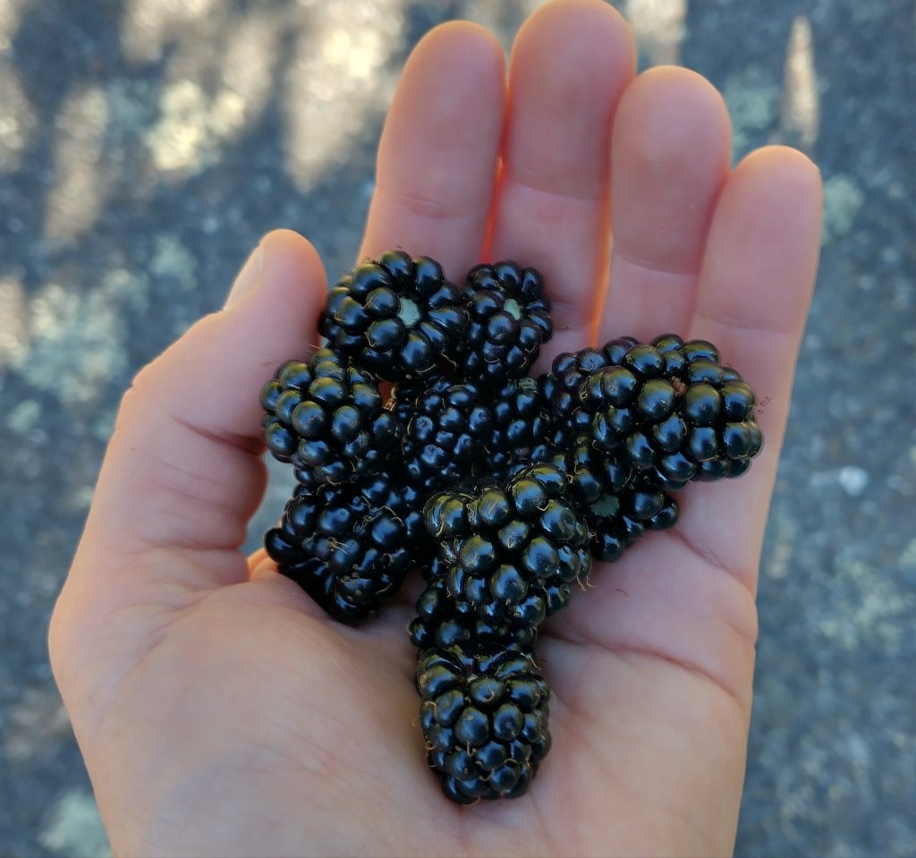
I caught up to the other hiker just as we got to the end of beach. Her name was Nancy and she was from Washington. I walked with her briefly to the center of Port Orford, where we split ways, as she was staying with friends. I visited a farmers market and spent way too much on fresh baked pastries, kombucha, and street tacos. But it was nice to support the locals. A vendor was selling rather small tubs of boysenberries for $5, which were similar to blackberries. He stated that boysenberries ripen well before blackberries, but I happened to know that the blackberries were just starting to ripen, too. I’d been walking past them for weeks, watching them progress, and I’d just found a few ripe ones days before. I couldn’t bear to buy a tub when I knew I’d be gorging on them soon. Sure enough, I found heaps of them in Humbug State Park later that day.
I did the usual small town stuff: grocery store, Dollar store, and library loitering. The Port Orford library was my favorite yet, mainly because it had a big fluffy live-in cat. I got some computer AND cat time in. The librarian was also exceptionally nice, continuously crediting me more computer time without me even having to ask. I debated a dinner of fish and chips before I moved on, but settled on a wrap to-go instead.
From town, I walked the beach to Rocky Point headland, where I once again couldn’t find the trail leading off the beach… I didn’t go far enough for the second time this day. So I took a deer path up to the highway, which was not great in that I did some steep bushwhacking through blackberries. I walked highway 101 for a mile or so, then turned onto a section of the old coast road, which had been repurposed as a hiking and biking route. It was nice to be on this quiet road \ path and it inspired me find a quiet camp just off it. I followed a creek into a lush forest and slept in the crook of a giant hemlock. Another great site in the forest!
A side note, I meant to keep better track of the amount of road walking I did on this hike but didn’t keep a good tally to this point. So much of it was no big deal to me and I also got really lucky with low tides and boat rides, which kept me on the beach and off roads a lot. It’s one of those things that will just vary quite a bit from person to person, depending on the tides they get.