Friday, July 21st, 2023, 0600-1700
Bandon to Sixes River
21 miles, Gain 1000′, Loss 1000′, elevation 210′
I slept mostly undisturbed in my somewhat questionable campsite. I was finally woken by an animal, quite abruptly in the middle of the night. It made a sound like the combination of a scream and cough, repeated multiple times. Thanks to my thru-hike on Catalina Island, I knew that it was probably a fox…I’d been barked at by the miniature foxes there. This time, I wasn’t sure if the barking was directed at me or something else. Normally I would dismiss foxes as rather harmless, but I’d read an account from another backpacker whose tent was attacked by a rabid fox in Arizona. Thankfully the barking became fainter and fainter as it moved away. It did come back later, barking once again as it passed. Clearly it was upset that I was camping in its territory. It was ironic that I should have such an interaction with wildlife in town and not while camping in the wilderness. But actually, camping on the outskirts of a town or at a busy campground was the riskiest in terms of encounters with animals. In such areas were the animals that had been drawn to human activities, mostly having to do with food, and were therefore the ones most habituated and least afraid. Problem bears became that way from raiding trash cans and picnic tables, not from finding the random thru-hiker stealth camping in the middle of nowhere. Certain species, like deer, almost seem to do better living around humans, who provide ample food in the form of lawns and gardens.
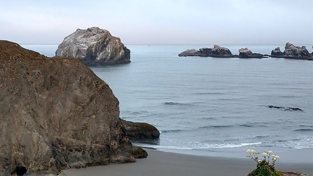
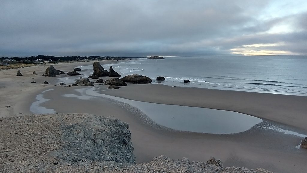
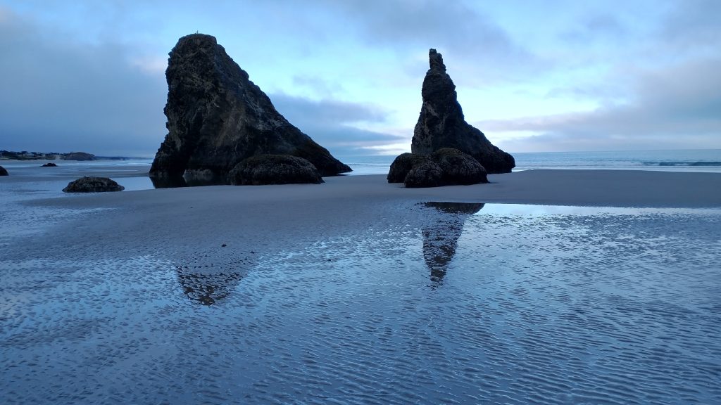
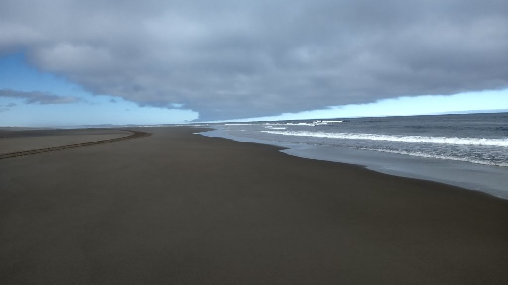
I woke very early in the dark and considered packing up then, but I didn’t want my headlamp to draw attention. So I waited until dawn and moved out. Good thing because a car had already arrived at the church parking lot at 6 am! Early praises. Hopefully I went unnoticed. I returned to the beach at Face Rock and the scene was gorgeous. I could easily make out the face in the rock and spent some time exploring the sea caves and stacks. It was low tide again, which revealed so many wonders.
Bandon would be my first choice of towns to return to spend some vacation time. There was just so much to see around all the cool rock formations on the beach. I would probably pick a more legitimate accommodations next time, though. The beach resort just over the hill from where I camped was $260 a night, so hopefully there are some vacation rental deals. Another option would be to camp at the Bullard’s State Park area and visit the town from there.
I enjoyed 5 easy miles of low tide walking to the New River, which was an easy ankle deep ford. The river was known to have multiple breaches through the dunes, as it ran alongside them north for quite a ways. I think I crossed an earlier channel, but it was so small I didn’t realize it. I took my shoes off for the crossing and then decided to walk barefoot for about a mile. Past the river, the beach narrowed and steepened and was said to be some of the most difficult walking on the OCT. The low tide helped, as I was able to walk just in the waves on the exposed tidal flats. But the sand became very course and soft. Pretty soon, I decided that the webbed-feet effect provided by my shoes was better than skinny feet, in terms of sinking. I also didn’t want to sunburn the tops of my feet.
Shoes on and both trekking poles out, I did my best 4wd impression to plod away. There was 8 miles of this slanted soft sand walking, which really began to wear on me. My uphill knee started to hurt from the unusual twisting, so I had to walk on the high flat berm periodically to give it relief. Much of the beach was marked for snowy plovers, so I did my best to stay low near the ocean. I came to a designated campsite in the dunes, sanctioned by the BLM to concentrate campers in one spot and away from snowy plovers. It was only the second official backcountry campsite on the OCT…and I didn’t stay there. I did visit to check out the registry, curious if there were any hikers ahead. No one had signed in for awhile, even though I saw fresh footprints leading away down the beach. I was glad I visited because I got some snowy plover bling from the box with the registry…a couple stickers and a pin!
Later, I met a volunteer, Mary, who was with an organization helping to protect the birds. She did outreach and observations based out of Flores Lake. It was nice to talk to her for a bit. I didn’t imagine they find many people so receptive to their cause. I briefly viewed the lake, which was very popular with kite surfers. I hadn’t seen any since my first day along the Ft Stevens beach. As usual, there was wind and then the fog started to form, obscuring my view of the lake and the point ahead. Earlier in the day, I could see the Cape Blanco lighthouse flashing every 20 seconds in the distance. It was my goal for the end of the day.
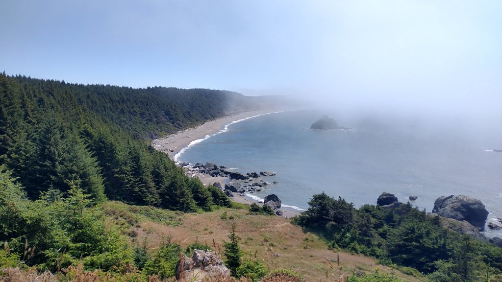
I left the beach at the end of the lake, entering a series of trails through the forest. I stopped to have lunch, glad to be out of the soft sand, wind and fog. I’d contemplated pressing on another 4 miles to the Sixes River, hoping I could get there before the high tide. But I was too hungry and tired from the beach slogging. It was wishful thinking to cross the New River and Sixes all in one tide period. I also wasted a bunch of time taking a wrong trail, reconnecting to the right one, then dropping my pack for what I thought was a spur trail to Blacklock point when actually it was the official trail. I had to backtrack about a quarter mile just to go pick up my pack and resume the way I’d just been…dumb! I must have been in a post-lunch fog. It sure felt that way when I hit another beach, which was more slow-going given how high the tide was. I was literally in a fog on the beach, which reduced visibility to only about 100 yards. It became really cold and windy at that point. The Oregon Coast sure was moody!
All my screwing around ensured that I got to the river exactly at the 4pm high tide. I’d already gone 20 miles, but had hoped to make it to near the lighthouse, just 2 miles more. Looking at the deep river channel, I knew there was no way I was crossing it. The best spot was at the outflow into the ocean, but the waves were pounding and the wind and fog made it even more unappealing. It wouldn’t be a good idea to get wet in these conditions. I was already cold so I took refuge behind some driftwood. I decided to go upriver a ways and maybe find a place to cross that was at least out of the wind. But after a quarter mile, I encountered a house and decided it was best not to trespass.
Checking my tide chart, I realized it wouldn’t be low enough to cross until after 7 p.m. I’d done enough miles for the day so even if it was early, it was time to camp. The beach was out of the question because of the wind and fog and the river side was not protected much at all, so I headed inland. Luckily there was a road heading up the bluff, and roads always lead to flat spots…or are flat spots in a pinch. No doubt it lead onto private property but I didn’t see any houses. The road seemed freshly cut, so maybe the plan was to build a house somewhere? I followed it up to a pasture and there was evidence of cows around… I’d seen some across the river too. Oddly, there was a derelict boat sitting in the field… I could have used that boat down by the river, just saying.
A spur road led to a dead end and look out across the river, which was a perfect flat and protected site. It was amazing…or would have been if not for the fog obscuring the view. How did I even find these places, I wondered? I have a gift…the art of stealth camping. I settled in for a lovely evening, quite happy I was stopped short.