06:00-15:00, Saturday, 8-08-20
CO 14ers: 18 & 19 of 53
Distance RT: 18 miles
Elevation gain/loss: 6,800′
Starting Elevation: 8,000′
Summits: 14,345′ & 14,042′
Rank: 4 & 43 of 53
Location: Southern Sangre De Cristos Range, east of Alamosa
Route: Lake Como 4WD road to the Northwest Ridge of Blanca, then South Face of Ellingwood, difficult Class 2

After driving a few hours to basically get from the eastern side of the Blanca/Lindsey massif to the western side, with a stop for an early dinner in between, we were staged for a repeat performance. We would hike 5.5 miles up a 4WD road, then conquer the peaks the next morning. The standard routes for the three 14ers in the Blanca massif all depart from Lake Como. It would’ve been very convenient to climb these peaks from the Lily Lake valley where we started the day, but alas, I didn’t know of any non-technical routes from this side.
The road leading to Lake Como is described as one of the most treacherous 4WD experiences in all the west. Many 4WD’s can make it about 3 miles up the road, but only the most specialized can make it past the several ‘jaws’ features near the end. We were witness to these massive speed bumps, in the form of jagged rocks, as well as several abandoned vehicles that didn’t make it. It was a given that we would be parking at the first lot we came to and walking the road. We arrived just as some were getting back to their cars. They had started very early the same day to do the 18 mile RT.
We were glad to be eliminating some of the miles on this day but mind you, we’d already hiked 7 miles up and down a 14er in the morning. I might have felt a little tired setting out, especially with the hot afternoon sun blazing down on my shoulders…I actually put up my umbrella for a bit. The first few miles were in the open sagebrush plains, dry and windy. The area is near the Great Sand Dunes National Park, so the substrate is also very sandy at the beginning. The road seemed to collect mostly loose football-sized rocks, which made for a very unpleasant experience. Combine that with the occasional vehicle driving by, I opted to just bushwhack alongside the road for about a mile. This wasn’t an option once the switchbacks began, so I endured the crappy road. In fact, the Lake Como road is one of the worst I’ve ever walked and at the same time, I was still glad not to be driving. Here’s a look at one of the ‘jaws’, which was easy for us to walk past but likes to eat the undercarriage of vehicles.
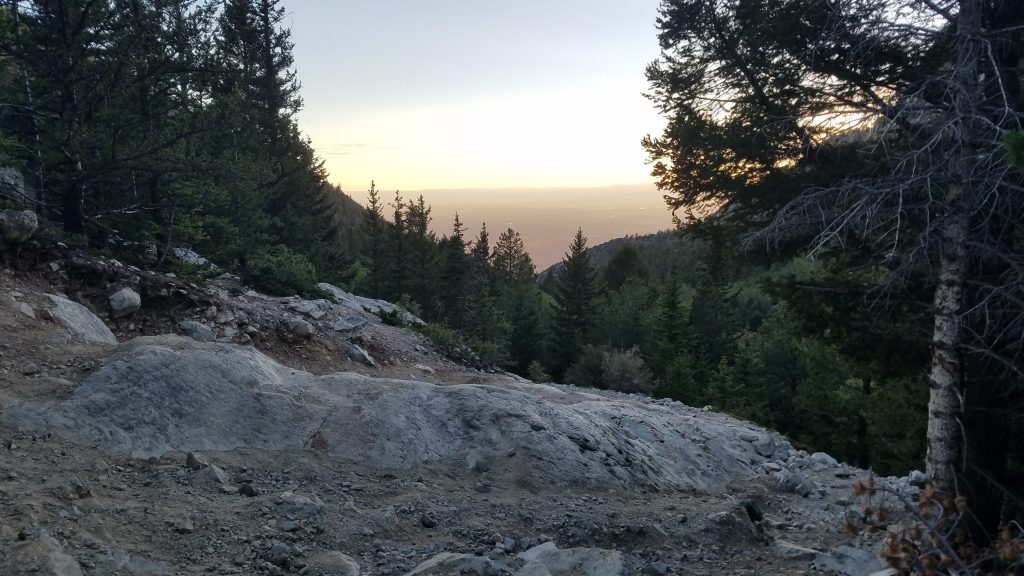
The road was also pretty steep, with an unrelenting progression upwards. This makes sense since we started at only 8,000′. Next to Pikes Peak, this was the most elevation gain I had to do for a 14er…well actually 2 14ers, so it was worth it! For some of the road walk, I was kept entertained by catching up to people that had earlier passed us in their 4WDs. First I caught up to a truck, not having made it all that much further than ours. Then next a couple backpackers from the truck, heavily laden with big packs. And finally a mountain biker they gave a ride, struggling to move his bike up the nasty road. He ended up having to push it and so I easily glided past him. The road became so bad that I doubt even a vehicle could have kept pace with me on foot.
We had hoped to make it all the way to Lake Como but ran out of daylight, just about a mile shy. We found a decent campsite behind some rocks and far enough off the road to avoid getting run over in the dark. Unfortunately it wasn’t far enough to escape the headlamp beams of those walking up and down the road throughout the night. We saw and heard several on their bid for an early start. No matter, we got some rest and continued our approach the next morning.
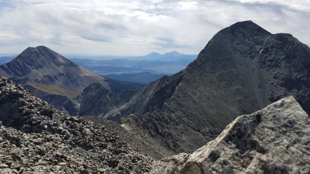
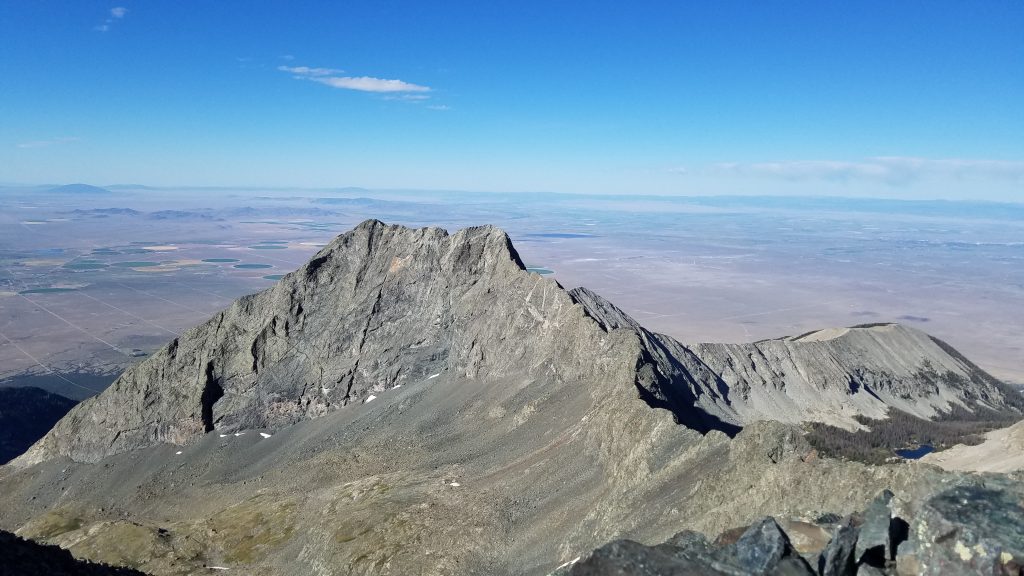
We passed a series of alpine lakes and benches in the first few miles, which brought us to 13,000′. Blanca is the 4th tallest mountain in Colorado (and all the Rockies), so we still had a long ways to go. We navigated a path through some ledges and up to the saddle in the ridge. Here we took a short break to take in the views to the east. The remainder of the ridge up to the peak looked massive from this vantage. The picture below, taken later from Ellingwood Point, shows just how much a climb it really is (Lindsey and the Spanish Peaks sit in the background to the left).
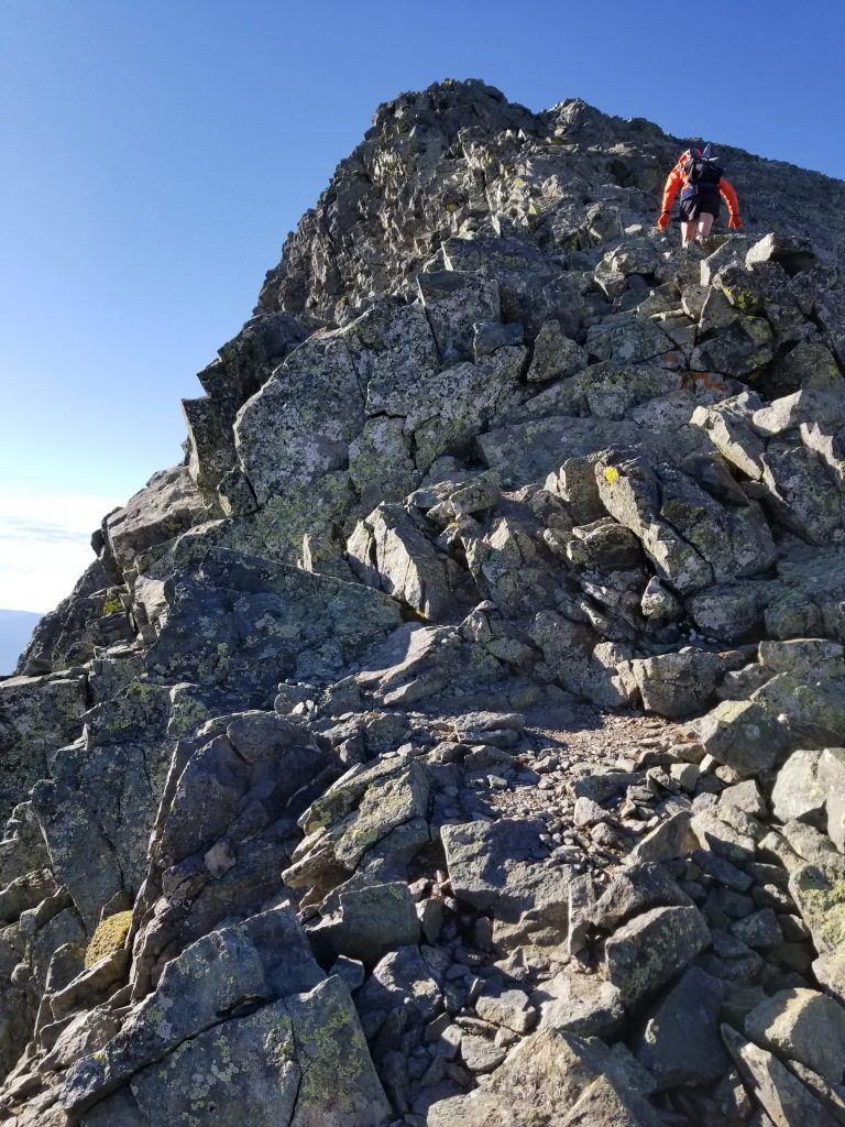
We began steadily climbing the ridge, which involved a lot of hand-over-hand and some narrow ledge scrambling. It was not easy by any means, even tricky in some places.
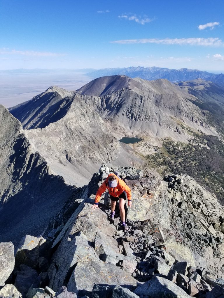
After what seemed like forever, I wobbled up the final rocks. The summit definitely had that top of the world feeling. The surrounding 14ers (Ellingwood Point, Little Bear Peak, & Mt Lindsey) all looked small in comparison.
Here’s a southwest look at Little Bear Peak, the only 14er of the 4 in this area that I didn’t climb, since it involved a Class 4 route and notorious rock-fall gully…not without helmets.
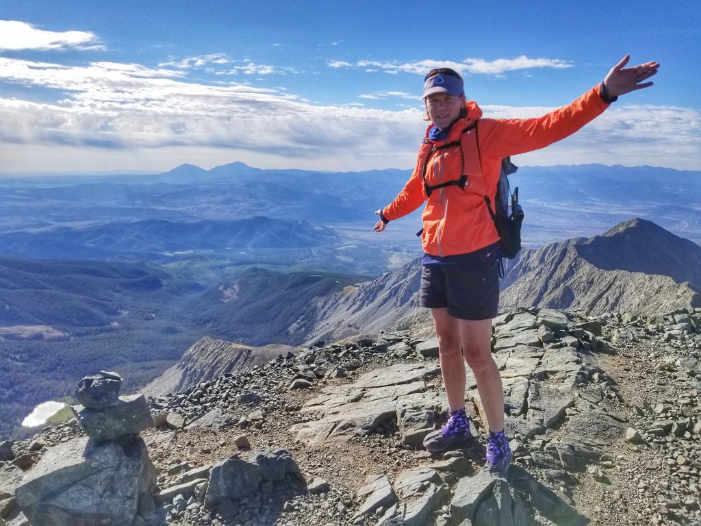
Blanca’s a very inspiring mountain, held sacred by the Navajo people. I’ve been enamored with it since I was a little girl, viewing it from the window of my dad’s small plane as we flew over La Veta Pass. Despite being so high in the air, the peak still towered over us. Perhaps that’s why it felt so overwhelming on this day. I was also feeling down about the memories of my dad. He’d been gone from this world for one month and reaching the top of Blanca brought a flood of emotions.
My weird mood and low-energy persisted as we retraced our steps down the ridge. When we came to the saddle where we could have continued on towards Ellingwood Point without loosing elevation, I chickened out on the route. It involved some Class 3 moves that I just wasn’t feeling up for. Instead, I went 300′ down in elevation to the junction of the 2nd standard route. I watched some other hikers attempting this ridge, getting off course, and coming to a really dangerous cliff. Luckily they were able to turn around and find safe passage, but this made me not regret my choice of routes as much.
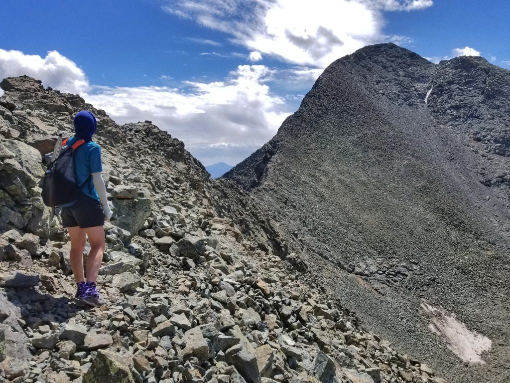
Looking back towards the behemoth that is Blanca and the Class 3 ridge that connects the 2 peaks.
The last couple hundred feet up Ellingwood absolutely destroyed me. I didn’t remember struggling as much since my marathon hike up Pikes Peak. I was having an off day, no doubt about it, but that’s to be expected sometimes. I laid down on some rocks at the top to catch my breath and clear my head. Some nausea passed while I just enjoyed the views…I’d earned a break.
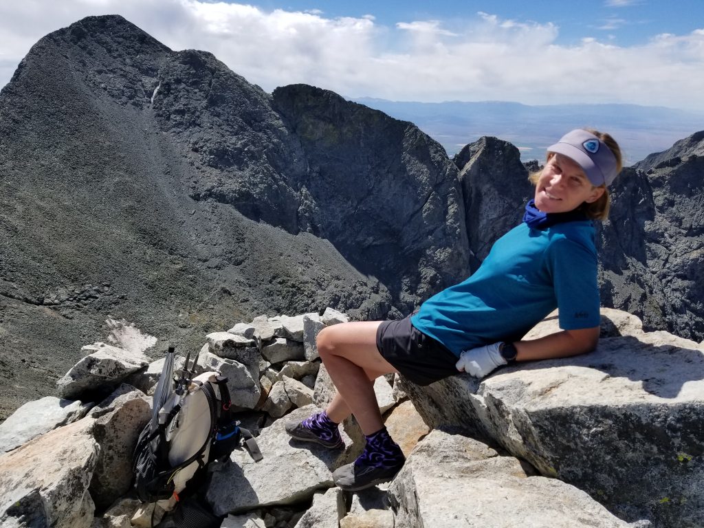
Ellingwood Point is named for Albert R. Ellingwood, a pioneering member of the Colorado Mountain Club. He’s the first person on record to have climbed all the state’s 14ers…a worthy accomplishment for getting one named after you, I agree.
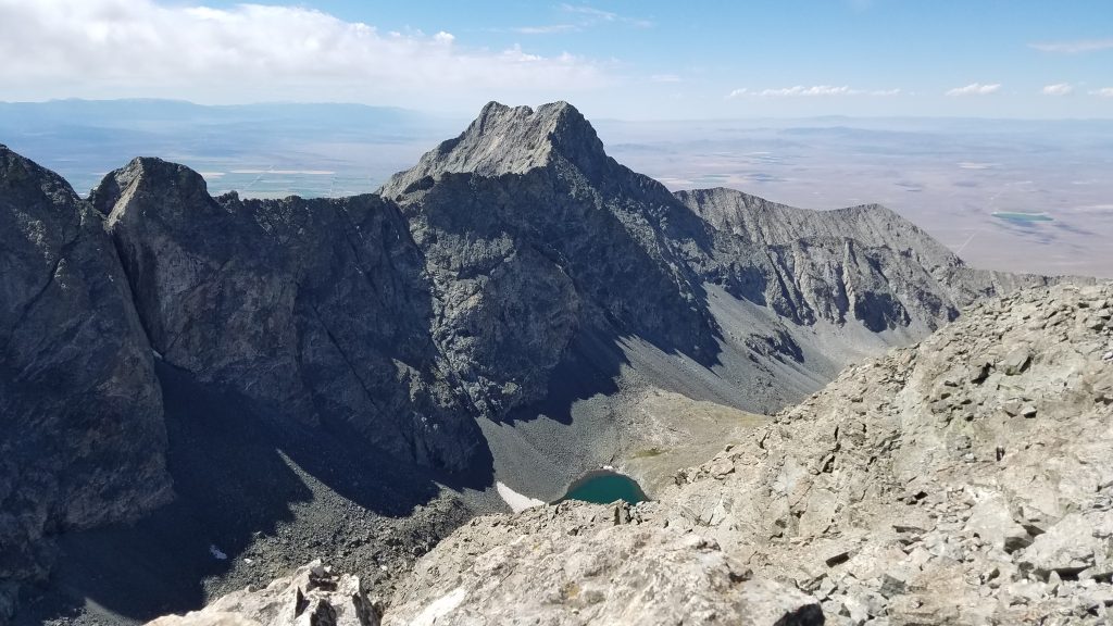
Here’s a view of Little Bear Peak again…looks pretty gnarly. These steep valleys were no doubt carved by glaciers, giving them their rugged good looks.
We started heading down just before noon, not looking forward to the long, rugged road walk. It was a chore to be sure. I wondered if I’d ever accomplish what Ellingwood and so many others have…is Little Bear worth another hike up this road and some scary climbing? I guess time will tell.
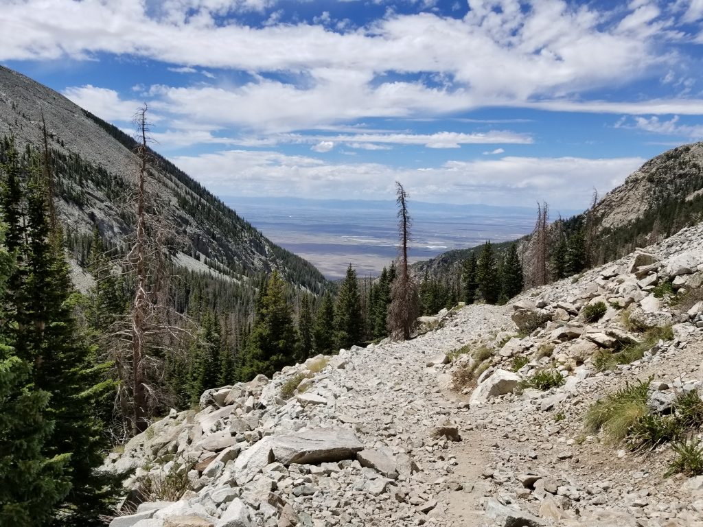
This gives you a good idea of what the road is like for most of its 6 miles…yuck indeed. I highly recommend breaking up the trip with an overnight at Lake Como. Better yet, find some friends with a specialized 4WD and good driving skills…and strap in for a bumpy ride!