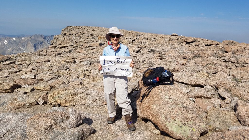
05:00-15:00, Wednesday, 8-19-20
CO 14ers: 25 of 53
Distance RT: 15 miles
Elevation gain/loss: 5,100′
Starting Elevation: 9,400′
Summit: 14,255′
Rank: 15 of 53
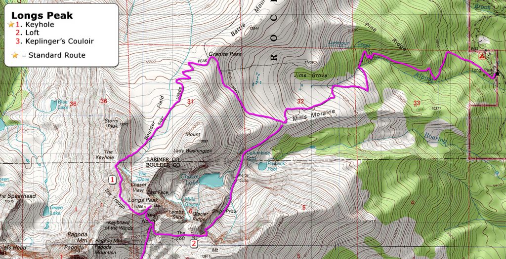
Location: Front Range, NW of Boulder
Route: Keyhole, Class 3
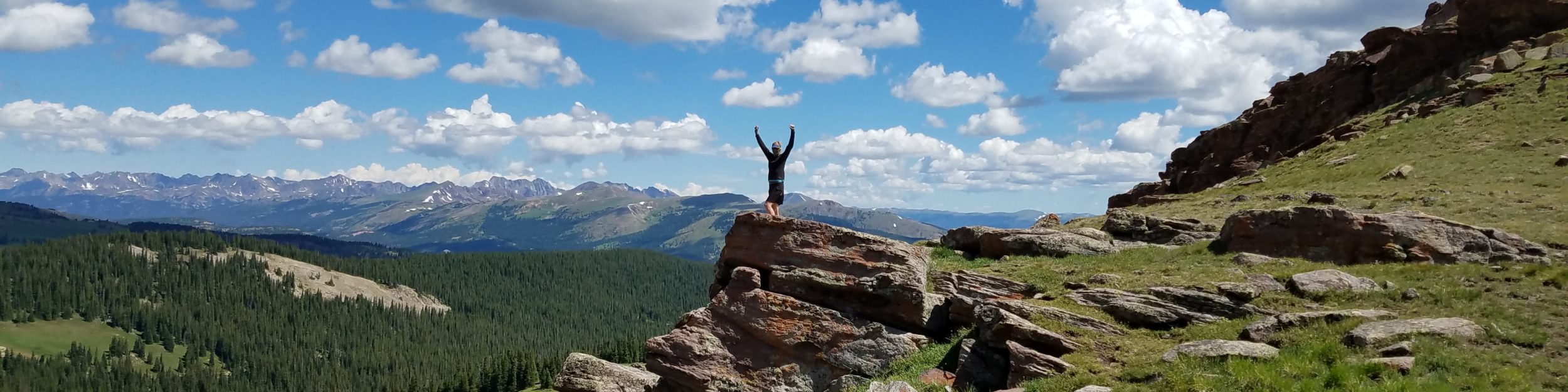
My final 14er of 2020 was a fitting one. I started the season with one of the biggest challenges, in terms of distance and elevation gain: Pikes Peak. I finished on an equally challenging peak, which was also probably my favorite hike the whole season…that’s saying a lot. Interestingly, Longs and Pikes Peak share a connection in that they both sit on the front range, rising over 9,000 feet above the Great Plains. It’s this similarity that resulted in the naming of Longs Peak. In 1820, Major Stephen Long, an Army officer and explorer, led an expedition west into the new territories. His party sighted a high peak from far away and headed for it, thinking it was previously ‘discovered’ Pikes Peak. They ended up about 100 miles north of where they thought they were (Longs Peak is the northernmost 14er in the Rockies), but hey, close enough for those days, right? For this distinction (error!), they named the peak after Long. (I’ve previously expressed how I feel about guys with bad geography skills.)
I’d planned to end my 14er season on Quandary Peak the day before, since I had an upcoming appointment in Denver on the 20th. But the stars were in alignment for Longs Peak: my fitness was as good as it gets and I finally had the confidence to attempt it. I’d long (pun intended) been intimidated by this mountain. I’d read many stories about the difficulties of the route and had studied the scary pictures on 14ers.com….there are some hairy sections to be sure. But I’d completed several Class 3 routes by this point, so certainly had it in me. I’d round off my annual count with a clean 20 and still make it to Denver in time, barring no major shortcomings.
I drove to within a few miles of the trailhead, staying overnight at the Meeker Park campground. The trailhead parking lot sits inside Rocky Mountain National Park, so covert car camping is a big no-no. Besides, the campground provided a quiet, undisturbed place to rest before a big day. It’s common practice to begin a round trip day hike to Longs Peak in the wee hours of the morning…say 2-3 am. That’s because the Park Service estimates it takes 10-15 hours to complete. I felt 5 am was more reasonable, given my usual fast pace.
My alarm went off way too early but I held to my schedule. Arriving the parking lot, I wasn’t too surprised to find it nearly full. Yet only a few people were moving about. I guessed everyone else had either left well before me or were camping overnight somewhere. I started up the trail in the dark, finding it very broad, well-groomed, and easy to navigate. In fact, the majority of the route is a standard Class 1-2 marked trail, about 5.5 miles in length. It’s only the last 2 miles that are challenging.
Despite the difficulty that the distance and technical aspect present, Longs is an immensely popular 14er, given its notoriety and proximity to the front range. According to the Park Service, tens of thousands attempt it every year but fewer than 50% are successful in reaching the summit. Unfortunately, more than 60 people have died on Longs Peak, with an average of 2 deaths per year. Mind you, these are probably more from weather-related factors such as lightening strikes and hypothermia. Falls are still a possibility though, especially if there’s ice or snow on the route. For my bid, I enjoyed perfect conditions, aside from a little wildfire smoke. In fact, I ended this whirl-wind high elevation season without being threatened by a thunderstorm once, which is a real feat and/or stroke of luck!
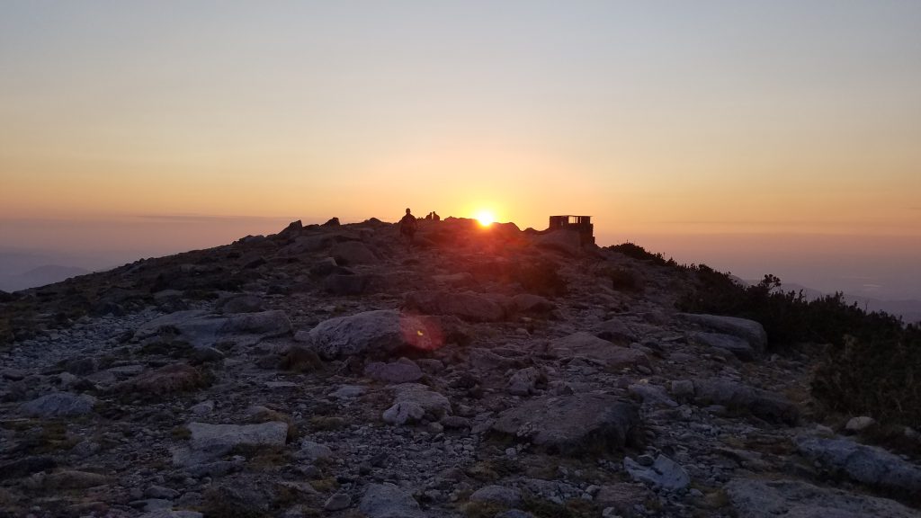
As I reached timberline, it became light enough to see without my headlamp. By the time I was in view of Chasm Lake, the sun was just breaching Mt Meeker and Mills Moraine. I stopped briefly to take some sunrise pictures and chat with the first hikers I came across since leaving the trailhead.
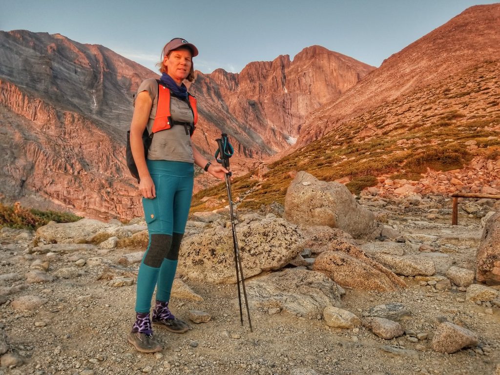
This is one of the most photographed parts of the hike, with the striking eastern prominence of the peak lit by the rising sun. Real rock climbers go up this sheer face, called the Diamond Route.
A trail led down to the lake, but I turned northwest to head for Granite Pass, a saddle between Mt Lady Washington and Battle Mountain. Along some extensive switchbacks, I caught up to a few more hikers. One guy commented on the difficulty of the trail as I passed, looking for words of support or sympathy. I didn’t say anything, since I was still in the first 4 miles of the Class 1 section. He then asked how much further I thought the summit was. I answered him honestly, trying not to sound discouraging or judgemental. I could tell he was out of his element and probably shouldn’t go much further. But hey, this is how we all start to calibrate our ‘hardness’ scale. This would’ve been very hard if it were my first 14er, like it was for him and others this day. I was simply on a different rung of the ladder, about 26 up with a different view of things. I got there by climbing and climbing, always climbing.
I moved on up to the Boulder Field, where there’s a backcountry campsite with pit toilets. I had to give the facilities a try, finding them very industrial, built with diamond plate steel to withstand the harsh elements at 12,400′. Rock and wood walls lined the campsites to minimize the wind. A few tents were still set up as I passed.
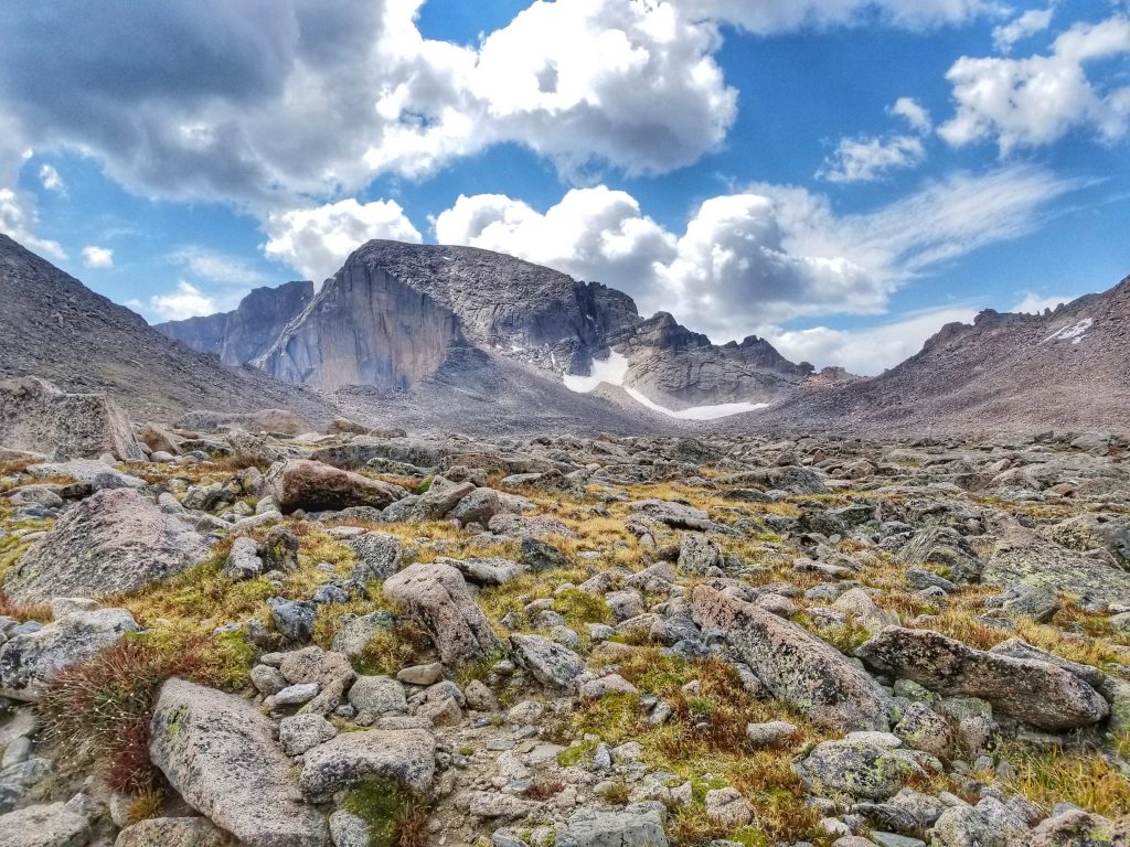
The above are pictures of Boulder Field basin. The ‘Keyhole’ sits in the the saddle along the ridge to the right.
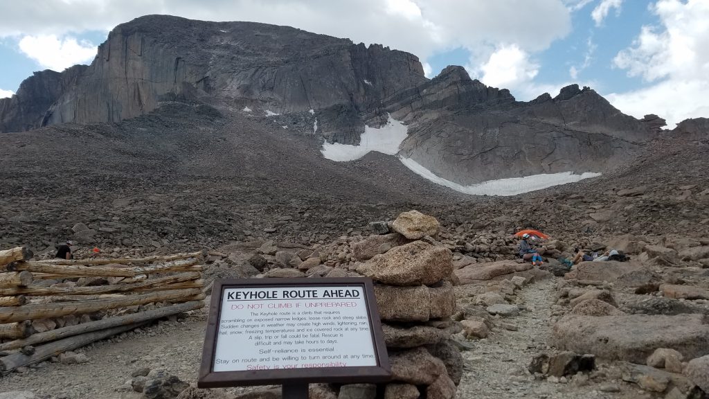
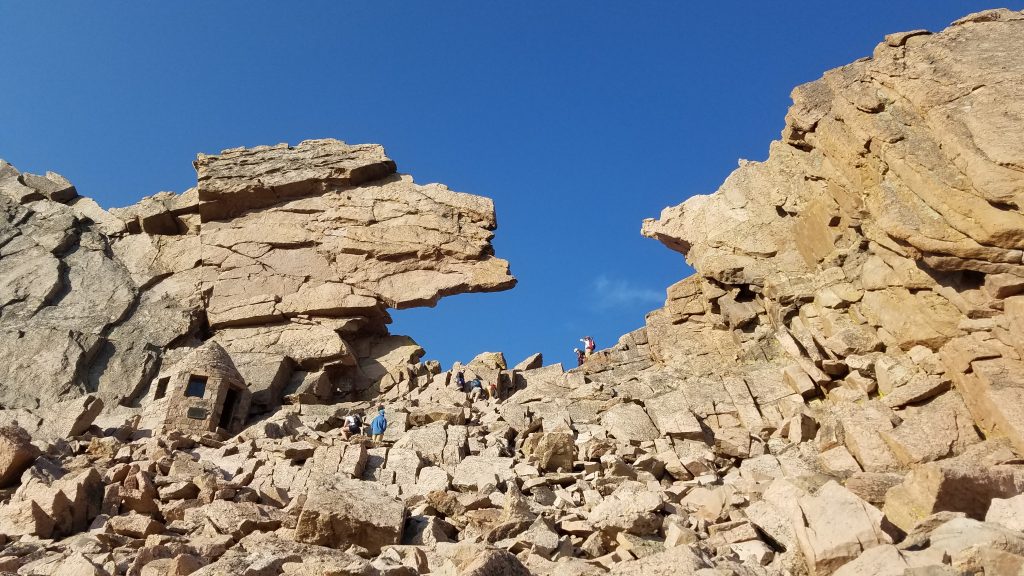
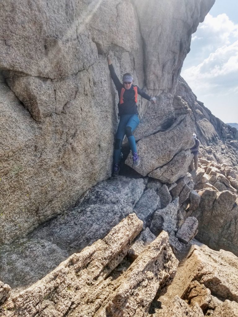
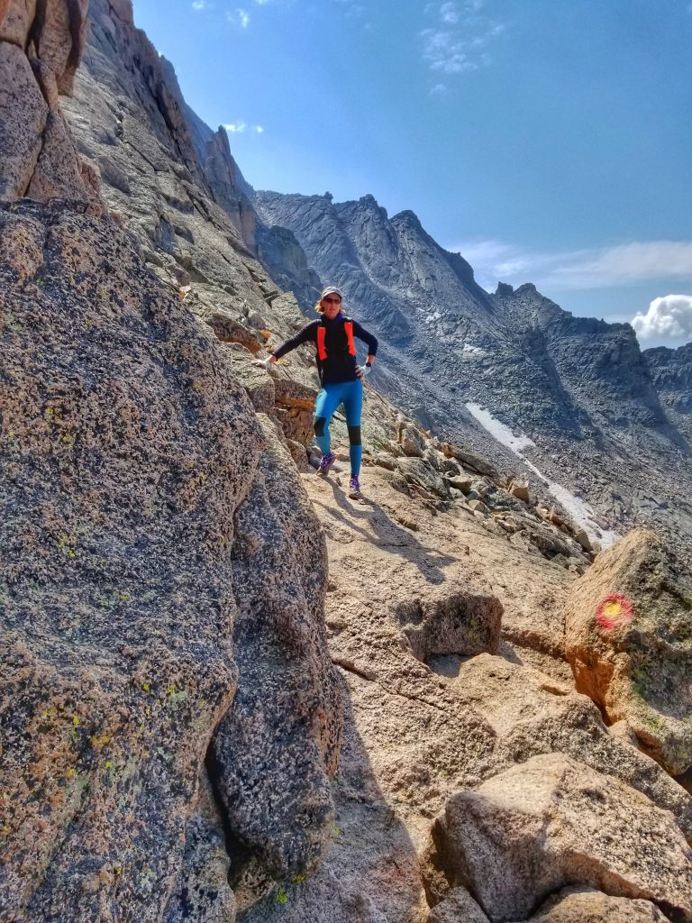
The trail quickly petered out as I headed for the Keyhole, the notorious demarcation of the route. The slope steepened steadily, making for a fun scramble among huge boulders. I could see quite a few people making their way towards the opening. A stone hut stood just below the gateway, a silent sentry judging those who pass. It reminded me of the Muir Hut on Muir Pass in the Sierra. It blended in so well with the rocks that I could barely see it. Yet the Keyhole is unmistakable. This is as far as many people make it, since the going gets a lot tougher from here on out.
An article I’d read recommended that hikers should be at the Keyhole by 6 am. I clocked in at 8 am, but I still felt like I was doing well on time. It was less than 1.5 miles to the summit, albeit the most difficult and slowest stretch. Coming over the ridge to the other side, I suddenly saw a long line of people. With my ‘late’ start, I’d consigned myself to a game of catch-up and this was apparently where most of the 3 am pace-group had made it to. At least it was easy to see where the route went. The Park Service painted red and yellow ‘bulls eyes’ on the rocks as markers, but they were hardly necessary due to the line of people.
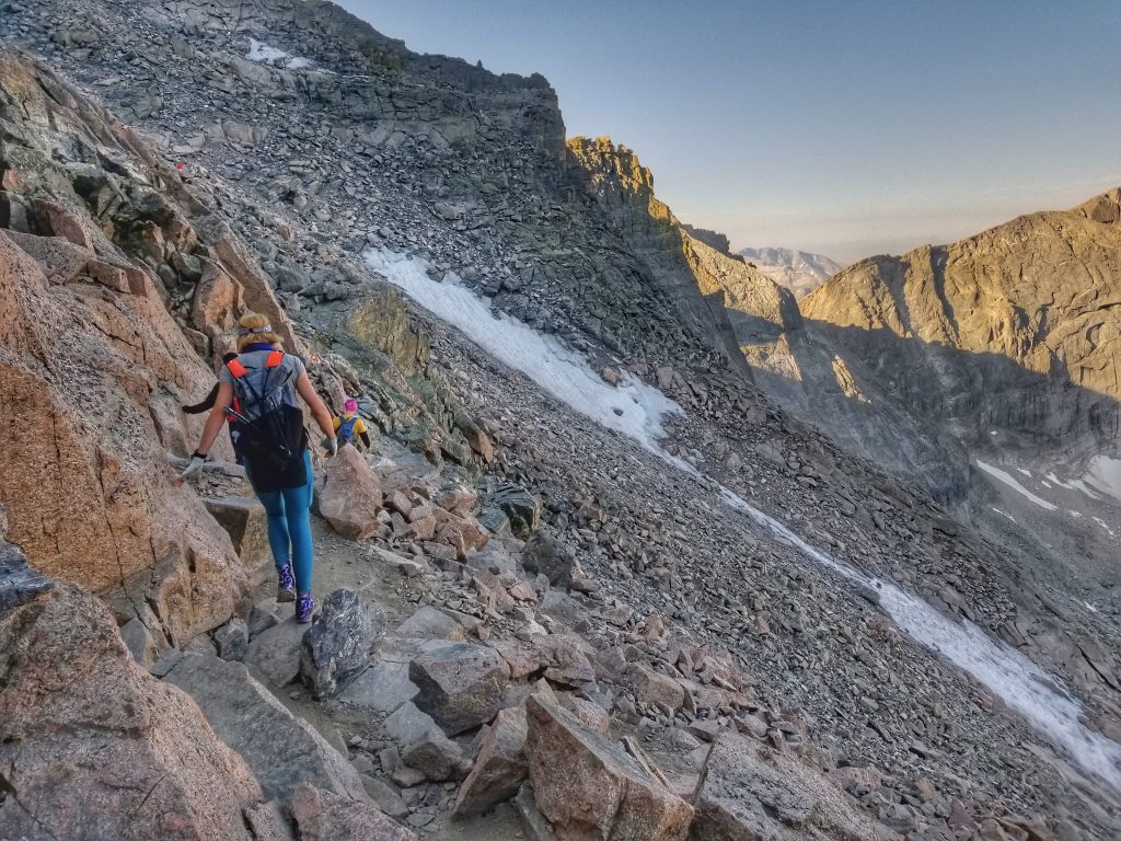
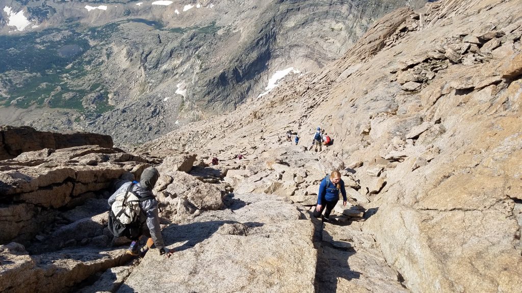
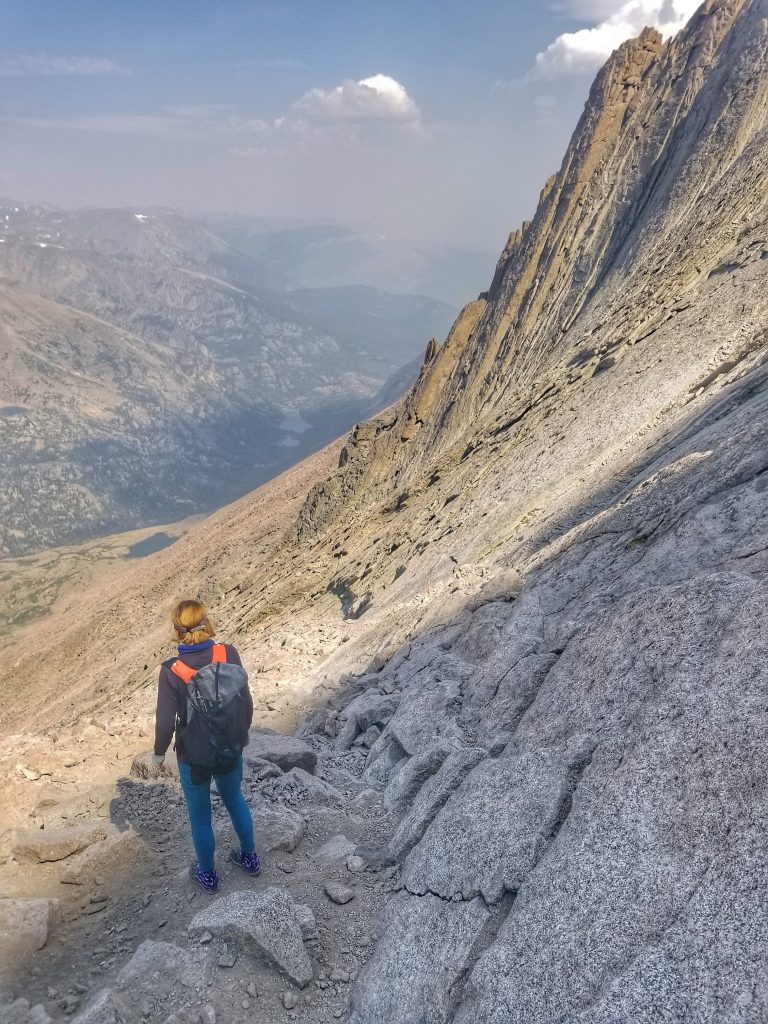
I began picking my way along, finding it not as hard as it looked. There was enough room to pass here and there and everyone was courteous in letting me go by. Even I was surprised by my fast pace! I made short work of the ledges section and then the Trough, a 600′ tall gully. It was pretty easy at first, similar to other gullies I’d climbed, but became more steep and narrow as I went up. Mostly I was worried about rockfall from other hikers, given the funneling effect. A large boulder face at the very top proved to be one of the most challenging problems all day. Some consider this to be the crux of the route and I’d probably agree with that assessment.
Next was the ‘Narrows”, an exposed ledge section that is just as trippy as it sounds. I don’t like traverses along exposure, so I made a point not to look down much. Wherever possible, I went inside of rockfalls instead of to the outside, sometimes making it harder on myself by doing so. As is often the case, it all looked worse than it actually was.
Finally I came to the ‘Homestretch’, a 300′ pitch of some pretty slick granite. It gets slicker with every person that climbs it, so I wouldn’t want to do it if it was wet. Fortunately there were some good cracks and it was slanted enough that I didn’t need a 4-point connection the entire way. Here’s a view from the bottom and also the top. As you might be able to see, this can be a real choke-point, especially mid-day when there are climbers both coming and going.


I’m almost at the top!
The view heading down…a lot of people are more freaked out from down-climbing than going up…which is a good way to get stuck. Such steep slopes don’t bother me as much. Perhaps staring down so many ski runs as a kid helped in this regard. I didn’t even have to turn towards the rock. Crab-walking down a crack worked fine. The biggest risk was rockfall.
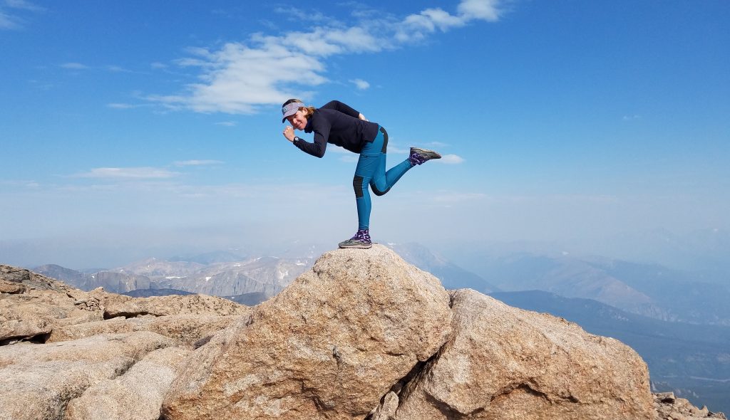
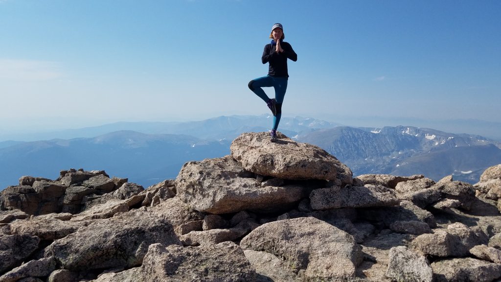
The summit was a joyous place: flat, spacious and full of exuberant people. It was weird to spend so much time navigating the steep slopes, only to find a football field-sized area at the very top. It’s as if someone took an iron to it. I arrived just after 9 am (only 4 hours after I’d started), with plenty of time to relax and enjoy. It felt like I’d flown past the hard section, so I was especially relieved and proud. Nothing to do now but take silly summit pictures!
This lady hiked to the summit for her 70th birthday!!! A repeat offender, she’d hiked the mountain too many times for me to remember the number! So inspiring to meet her.
I hung out for over an hour and a half, walking most of the length of the summit along the rim. The views were pretty epic, despite the wildfire smoke. I was mostly above it but it was really starting to fill the valleys. I thought back to almost exactly a year before, when I was hiking the CDT. I stood on top Parkview Peak to the west on August 21st 2019, admiring the play of clouds around Longs Peak, wondering if I’d ever have the guts to climb it. The answer was YES!
At last I began retracing my steps through the challenging terrain. The only part I found tricky was the rock face at the top of the Trough. It required one or two blind footholds as I lowered myself down, facing the rock. It was here that I ran into the guy I passed around mile 4. He was still heading up, refusing to give in. His friends had wisely turned back long ago, so he was alone and seeking advice from other hikers on how to get around the rock. I was worried for him but figured that’s why there are Park Rangers patrolling the slopes, helping those that get in over their heads. The Park webpage warns of ‘summit fever’ and that reaching the top is only half the battle. I’ve never questioned if I could make it back down a mountain, but I’d read plenty of stories about climbers that had such a problem. My watch read 11 am at this point, so it’s likely the guy was facing a long walk back in the dark…at best.
Surveying what’s left of the Ledges section. Notice the smoke rolling in and a few cumulus clouds starting to gather. Time to go down.
Here’s a shot showing one of the ‘bulls-eye’ markers and my pose saying “I got this!”
The line of climbers disappeared just before the Keyhole, to the point where I actually had to start looking for the bulls-eyes. I got off route a little, staying too high and having to do some more fun down-climbing. Once through the gate, I played around the hut, taking a break to soak in the surroundings. There was no rush anymore…in fact, I took longer getting down than going up.
The rest of the journey was easy walking, reveling in all my successful adventures over the summer. I took another break at the junction to the lake, laughing at the antics of an overly-friendly chipmunk. For once, I was the one being passed by other hikers. I reached the parking lot just before 3 pm, almost exactly 10 hours since I’d started and just as soon as it began to rain and thunder. Perfect timing. I could sense that I’d been dragging my feet a bit, reluctant that this was my last 14er for the season. I was heading back to much flatter lands in the days to come. But what a way to go out with a bang! Hopefully there would more 14ers, although I remained uncommitted to hiking all of them. I’d just have to see how much the summit fever got to me.
Stay tuned for more posts about the Long Trail of Vermont, coming up next.