Scott and Sailor, the hosts of the Sonora Pass PCT Hiker Cabin, were keen to share a 78 mile loop hike that they created. I met them at PCT Trail Days, which is where they told me about their cabin and the Pinecrest Loop Trail, or PLT. You can read more about this trail here. The idea behind it is for PCT hikers to be able to connect to Pinecrest on foot, if so desired, but to also provide the local community with a route encompassing nearby trails that connect all the way to the PCT and Yosemite National Park.
I had some extra time at the end of my thru-hike from the Columbia River to the Tahoe Rim Trail (PCBCRT), so I hiked a few extra days on the PCT to Sonora Pass. I took a zero at Scott and Sailors cabin, then set out on this little journey, soaking up as much time in the incredible Sierra as I could.

Monday, Sep 18th, 2023, 1040-1900
Pinecrest to Upper Relief Valley
19 miles, elevation 8810′
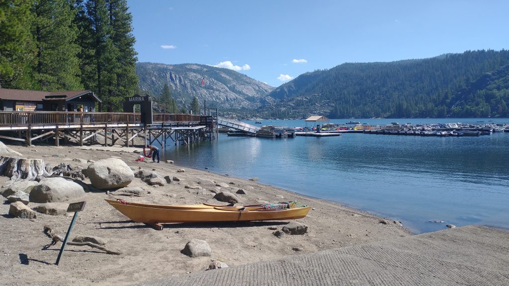
Scott gave me and some other hikers a quick ride to the general store in town, so I started the loop (clockwise) from there. I walked along Pinecrest lake for less than a mile, then turned northeast to ascend a series of marked trails away from the lake. I climbed steadily, coming across several junctions. Navigation was pretty easy since I had a GPX file with waypoint descriptions. The trails seemed to be mostly used by mountain bikes, but I didn’t see any. There were some nice view down into the Pinecrest Valley from where an old lookout tower once stood, just west of Pinecrest Peak. I navigated through a trail to road exchange and passed one truck. The guy appeared to be a hunter. The route mostly followed some older roads, which clearly not too many vehicles used. I passed a parked FS truck and the driver was off in the woods somewhere, probably taking inventory or conducting a survey. A sign warned of rough conditions ahead but of course travel was easy for me.

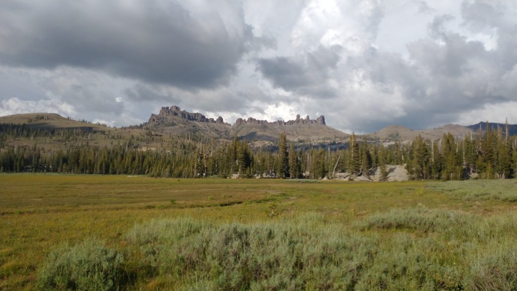
I reached a trailhead, where I found the GPX line to be slightly off going through nearby Coyote meadow. I bypassed Coyote meadow slightly to the north, to avoid a very boggy situation, then was back on the line. I know that when Scott and Sailor hiked the route in the Fall of 2022, it had been very dry. 2023 had record snow, so both water and even snow were still incredibly abundant along the route. I entered the Emigrant Wilderness Area, enjoying nice trail and a variety of ecosystems. There were some nice views of a few volcanic tuft peaks (Cooper Peak, Castle Rock and the Three Chimneys), which I’d spied days earlier from the top of Sonora Peak. After another mile or so, I ran into 2 hunters that were packing out a deer. I respected that they had gone a few miles into the backcountry to bag one, without the use of even a pack animal. Hard core.
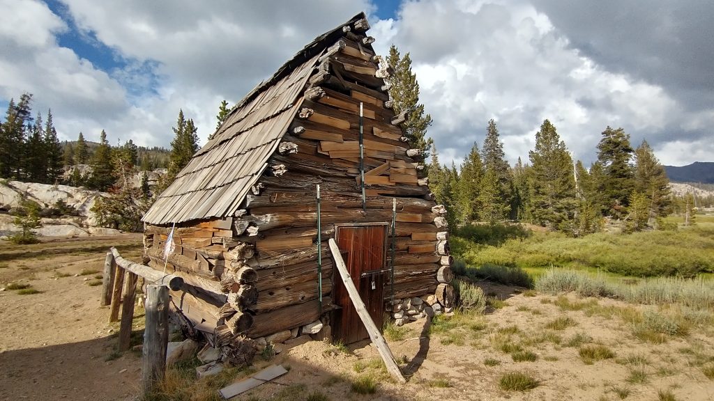
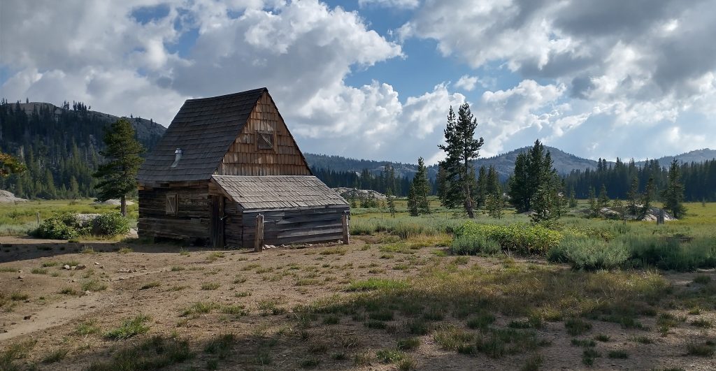
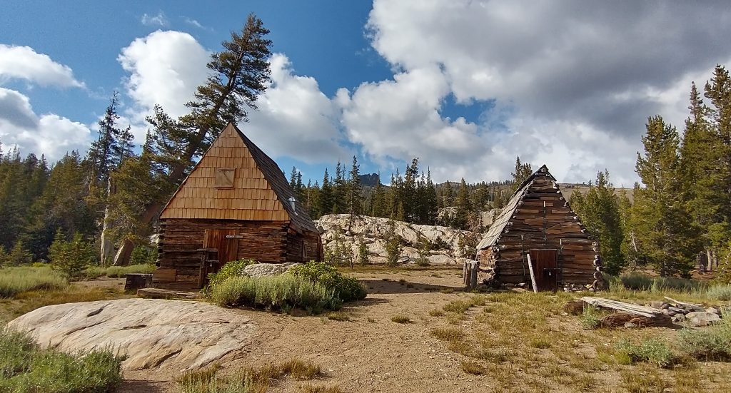
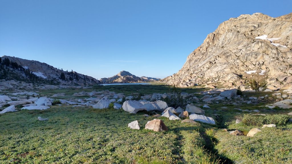
Travel was easy through through this wide flat valley, where I passed by multiple lakes and ponds that didn’t even show in the notes or on the map. I stopped paying much attention to listed water sources at this point…it was simply everywhere. I took a side trip to a set of historic cabins that were pretty cool. They sure occupied a beautiful setting.
I crossed Hay meadow, and continued across a series of small ridges and meadows. Wildflowers were everywhere. Occasionally I came across junction posts with the trail names. I followed arrows towards Upper Relief Valley and passed a group of backpackers at the western edge of the valley, camped next to a stream. They were the only ones I saw all day. I continued on a ways, finding a nice camp site near a series of lakes. The mosquitoes were rather bad for late September, but not the worst. There shouldn’t have been any this time of year, but with the water still being everywhere, I guess it was inevitable. It was a very nice day overall.
Tuesday, Sep 19th, 2023, 0630-1840
Upper Relief Valley to south of Grizzly Peak
27.5 miles (11.5 miles of the PCT), elevation 9540′
In the early morning, I continued down the valley through a gorge, dropping quickly while following Relief Creek. This led to a bigger valley, which held Relief Reservoir. I crossed the creek one last time and the trail climbed high to traverse above the reservoir on the western side, leading north. There was a junction just past the creek crossing, which led south. This trail could be taken as a short-cut, reducing the loop to 56 miles. This section was where I first started encountering mule trains. I just missed one going south along the short-cut. I counted 50 mules and horses that were a part of that train, led by about 5 cowboys. Within half an hour, I met another train of about 30 animals. The trail was absolutely pounded and I couldn’t imagine how such large groups could be permitted in a Wilderness area. They were all coming from Kennedy Meadows North and catering to the influx of deer hunters. I guess they went out ahead of time to set up big camps and then took clients in and out via mules. They needed a lot of mules to also pack out the deer carcasses. It seemed like they planned to bag A LOT of deer.
After passing the reservoir, I turned right to follow Kennedy Creek up into another large valley. I could have continued north 2.2 miles to reach Kennedy meadows for a resupply, but on such a short trip, I had no need to. I still have never been there, only driven past. It’s a popular stop for PCT hikers. Heading into the valley, I passed another small group of outfitters/horse packers who were camped along the creek. I smelled their fire first, wondering if any fire bans were in effect. Long ago, I’d come to expect all of California as being in a perpetual fire ban situation, thus I found it odd to smell a campfire. Since I never bothered to make fires myself, I had no idea what the current regulations were. All I knew was that I did have my CA Fire Permit, which was needed even by hikers to use a small canister stove. I’d easily obtained one online at the beginning of the summer.
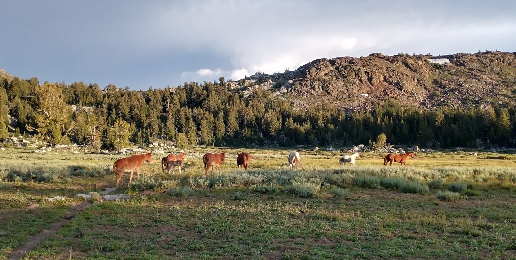
The valley opened into a huge meadow and I enjoyed views of the surrounding peaks. I passed by a cabin and also a lot of cows. The meadow became very boggy, likely because of the impact from all the cows, and I inevitably got my feet wet. I even took a high bypass to traverse past Kennedy Lake, but it didn’t matter, the trail was wet and mucky everywhere from all the side-streams and cow hoofs. I had a hard time reconciling how cattle grazing could be allowed in such a beautiful valley. This area was not part of the Emigrant Wilderness, which I’d excited above the reservoir. It was sad to see it so polluted by cow shit.


Past the lake, I began a steep climb to an upper basin and pass. The trail became pretty scant, but it wasn’t anything I hadn’t dealt with before. The minor route-finding was one of my favorite parts about this trip! I cut cross country to go over the pass and was surprised to see 2 hunters just ahead of me. I yelled out just before I overtook them, since I certainly didn’t want to get too close before alerting them. They were of course surprised to see me come from nowhere. I didn’t stop to chat, wondering if they had come from Kennedy Meadows or hiked down from the PCT. I bet they were perplexed to see a single female backpacker go blazing by, where there wasn’t even a trail.
From the saddle, I could just make out some of the switchbacks of the PCT. I took the most direct line down the valley to intercept my favorite hiking superhighway and was shortly enjoying cruisy trail for the next 11.5 miles. I was glad I pushed hard to get over the pass because some afternoon thunderstorms really started to threaten the area. I passed 5 or 6 hikers heading northbound, all of whom asked me if I’d encountered rain and/or lightning between my location and Sonora Pass. Of course I actually hadn’t come directly from Sonora Pass this day, but I could just tell by looking over my shoulder that it was a bad idea to keep heading north. I could hear rumbling behind me all afternoon and the sky was very dark. Luckily the storms all went north and east as I traveled south and west. I climbed for several miles to reach the boundary of Yosemite National Park, then passed beautiful Dorothy Lake. I would have liked to camp near the lake, but as I didn’t have a bear canister (or permit), this was a no-go.
I was only in the park boundary for a few miles, so it wasn’t hard to avoid a stay in the area. I turned right off the PCT (officially where I finally said goodby to it for the summer) and proceeded NW over Bond Pass, back into the Emigrant Wilderness. As I walked through the next meadow, I encountered a herd of horses and mules, turned loose to graze. They were on their way to a creek, but seemed to make a beeline for me as well. I think they were looking for a treat, but I didn’t have anything to offer them. They surrounded me but luckily I grew up around these large animals and wasn’t afraid…I can certainly see how someone else might be! For me, it was a great opportunity for a petting, so I stroked a few heads. Some were wearing bells, which I guess is how the cowboys found them again. They wondered off and I continued on. Shortly I passed the dude camp but I don’t think anyone saw me. I’d been thinking about making my camp in the meadow, but didn’t want to be disturbed by the herd or nearby camp overnight. So I walked another mile or so to a creek, finding some hidden flat spots among the boulders. I went for a dip in the creek, then ran back naked to my tent. Suddenly I was freezing and the mosquitoes were starting to swarm. I dove inside my tent and nestled into my quilt. Safe!
Wednesday, Sep 20th, 2023, 0630-1900
South of Grizzly Peak to Pinecrest
31.5 miles, elevation 5680′
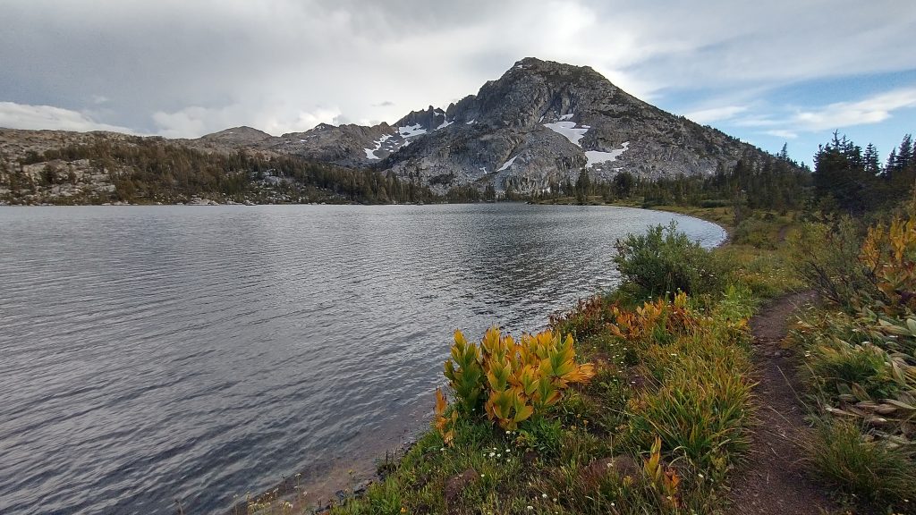
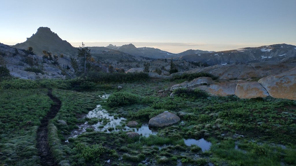
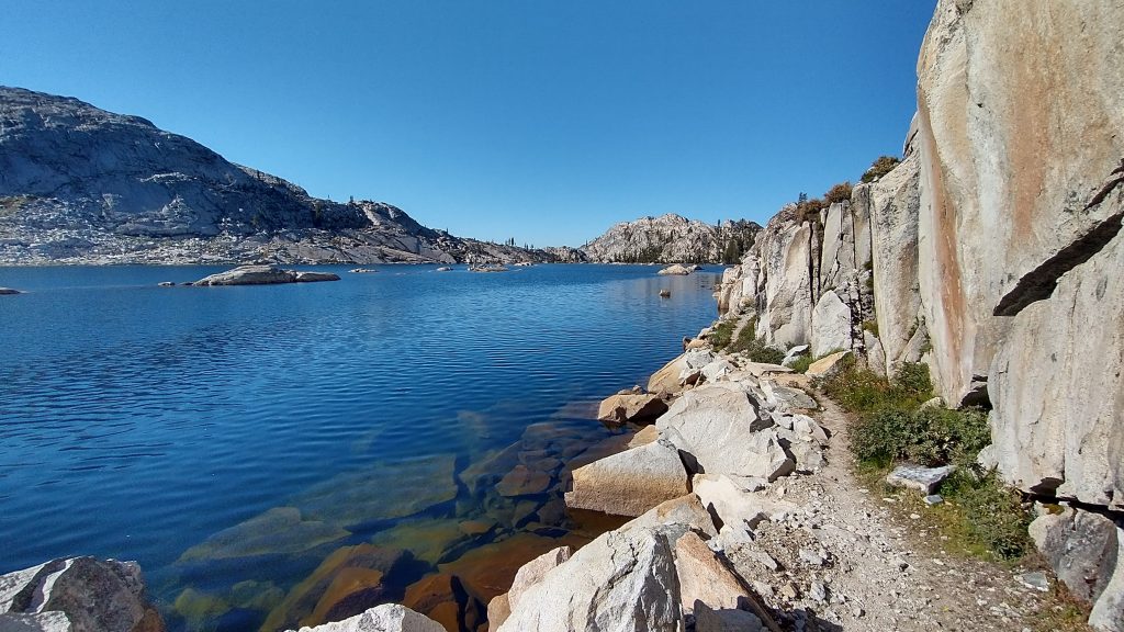
I hit the trail with the first light, traveling over a small pass where I walked through a bit of snow. Water was gushing everywhere in the area, so I succumbed to wet feet once again. The pack trains had also been through, so the trail was a bit mucked up. Fortunately the mud was almost frozen, so it was easy to walk over without sinking. I was surprised just how cold it was in the meadows, since my campsite in the trees had been relatively warm…trees make all the difference! There was frost on all the vegetation and ice over some of the puddles. I arrived at Emigrant Meadow Lake and made a sharp left off the well-trodden trail onto a barely visible trail. The pack trains from Kennedy Meadows apparently did not use this route. I paused for a bit to take a bunch of pictures of the glorious lake. It was such a beautiful morning!
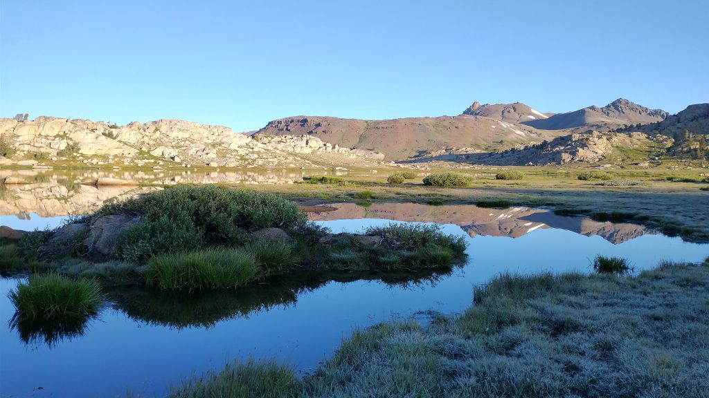
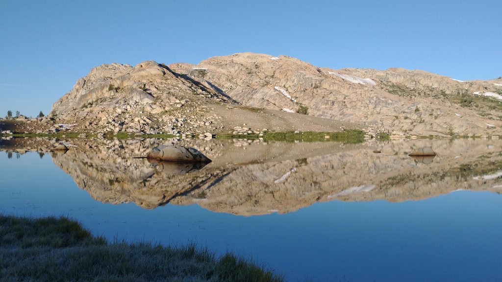
The notes mentioned about 3 miles of route-finding, but I found travel from one lake to the next pretty easy. The next was Middle Emigrant Lake, followed by Blackbird lake and Emigrant Lake. The terrain was so open, I could see where I needed to go. I found trail here and there, along with some cairns. It became a well-trodden train once again at Blackbird lake. This route-finding part was my favorite section of the whole loop and I didn’t see a single person. It was great to feel so isolated, in an area that probably sees a fair amount of traffic in general.
I spent much of the day walking past so many spectacular lakes and giant granite domes. The area looked just like the features I passed in Yosemite on the PCT. Emigrant Lake was huge, reminding me of Lake Aloha in the Desolation Wilderness. The trail was very close to the shore in places, providing for some spectacular scenery. I also saw some huge fish swimming around casually. There were many choice campsites in this stretch, and I even spied a few tents. I ran into a ranger just past the lake, who of course asked me for my permit, which I didn’t have. I thought one was needed just for camping the vicinity of the lakes, but I guess the permit covered the entire Emigrant Wilderness area. My mistake, I should have visited the FS office in Pinecrest before setting out. I mentioned that I was hiking down from the PCT, which was true, and he didn’t say anything more, probably assuming I had a PCT permit. Future hikers of the PLT should read the information here for obtaining a permit. I think they are free, with no quotas or reservations, but must be obtained in person at a FS office. I regret I didn’t do my due diligence in planning ahead of time for this hike. I’d covered so much territory over the summer, most of which didn’t require permits, I’d gotten a little care-free.
In my defense, traveling solo, not building fires, and stealth camping well off-trail in small, obscure, and non-developed spots with my camo tent had the tiniest fraction of impact as compared to the mule trains of 50 animals that I saw the day prior. I mean, if a Wilderness Area can allow for that kind of heavy use, my use was basically inconsequential. I wondered why the rangers weren’t monitoring/questioning the large dude camps instead, especially the ones I saw having campfires (since I’m pretty sure there was a fire ban in effect). I later read that they were only allowed up to 25 stock animals, so here again, they seemed to be flagrantly violating the Wilderness rules…and for profit. Anyway, in my case, no harm, no foul.
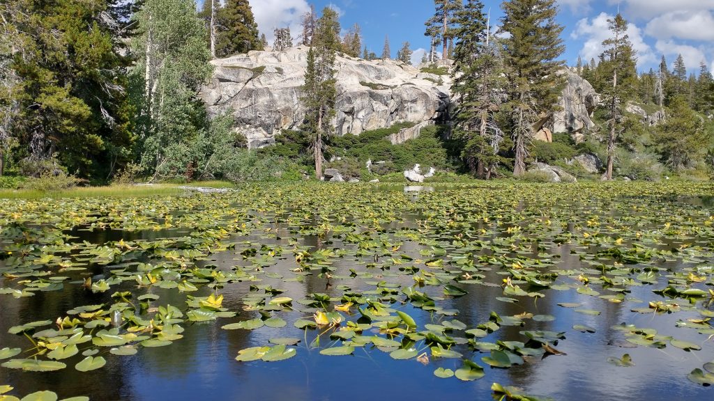
The trail was nice the rest of the day, but less exciting the further I descended. The high alpine scenery was replaced by lower forests and boggier-looking lakes. I took a lunch break at Deer lake, enjoying the serenity for about 5 minutes until a group of about 8 backpackers came along, one with a baby. Of course they took a break at the near end of the lake and the baby started crying. Me being an old curmudgeon, too used to my solitude, I was quickly encouraged to keep moving. Having cut my lunch break short, I started contemplating a long day to make it all the way back to the cabin. I had enough food and time for another night out in the woods, but the idea of a hot meal at the cabin really sank in. I decided to push. And so passed Jewelry, Gem, Piute, Lily, and Camp lakes. All had wooden posts and notes on the map about no-camping restrictions (especially Camp Lake???), which was fine by me. There were some nice ridges in between, with views of more granite valleys…I would have preferred to camp in those areas rather than the lakes. I passed a few more backpackers and day hikers, so clearly this was a well-used area.
I made it all the way down to Crabtree Trailhead by the late afternoon, then navigated a series of dirt roads and horse trails, leading towards and past the ski area. A couple mile stretch on a paved road started to wear on me, but I finished strong on a bike trail leading through a logging area and down a ridge into town. This was a local trail that Scott and Sailor had both been volunteering their time to develop and do maintenance on, so it was an honor to walk it at the end. I popped out into a neighborhood, just in time to run into Sailor driving their Prius. She was actually just setting out to look for me, hoping she might intercept me somewhere after Crabtree TH. I’d sent her a text earlier notifying her of my arrival. I was relieved that she didn’t make it far before finding me. I yellow-blazed the last 1/10 of a mile back to the cabin with her and collapsed into a bed after a long day. And so ended my loop hike of the PLT. Whew! What a fun and nice couple of days…I’d do it again!
I spent one more day at Scott and Sailor’s Trail Magic cabin, communing with my fellow PCT hikers for the last time this summer. A few of us helped Scott break down and store all their beach toys (Sunfish sailboat, kayak, and canoe). They were winding down their Trail Magic operations in the next few weeks. Most of the cabins were on a long-term lease with the FS that didn’t allow for year-round occupation, so they would be bailing to warmer climates for the summer…perhaps even Florida, stay tuned! Again, a huge thanks to Scott and Sailor for developing the PLT and for sharing their awesome hiker cabin. It was the perfect ending to my PCBCRT hike!
My friend Jon picked me up the next day and I was off to Arizona to finish the Hayduke..from the Sierra to the Grand Canyon…what a transition!
