Saturday, Aug 5th, 2023, 0620-2000
Poker Flats to Azalea Lake, BFT mm 103
30 miles, Gain 5690′, Loss 5325′, elevation 5400′
Those dang deer really gave me the business overnight. I kept waking with a start whenever they passed by close. One even knocked my full water bottle off the picnic table. I should have brought everything inside my tent so I didn’t worry about things. I hung my second trekking pole in a tree and even then I was concerned they might pull it down. They will chew the grips and run off with any clothing items, including socks. I was even worried about my shoes, but unfortunately I have a strict rule about not putting those in my tent because they are such a biohazard. Still, it would really suck to lose one, so I guess I should carry a spare plastic bag from now on. It’s funny that the rest of the world thinks bears are the problem.
I visited the privy on my way out, happy to have one. It was one of those so infrequently used that I could have slept inside…there was even a hanging air freshener and three rolls of toilet paper, all untouched! It’s the little things that brightened my day. A 6 mile gravel road walk greeted me, which was fine by me. Especially since as soon as I left the meadow, I entered into another burn area. This one was so extensive, stretching as far as I could see. The smoke from the Oregon fire had once again settled into the valleys, making the scene look even more apocalyptic. I later learned this was from the 2020 Slater fire, which burned 157,229 acres and claimed 2 firefighters lives. It’s hard to describe just how depressing it was to walk through this. It was a somber morning.
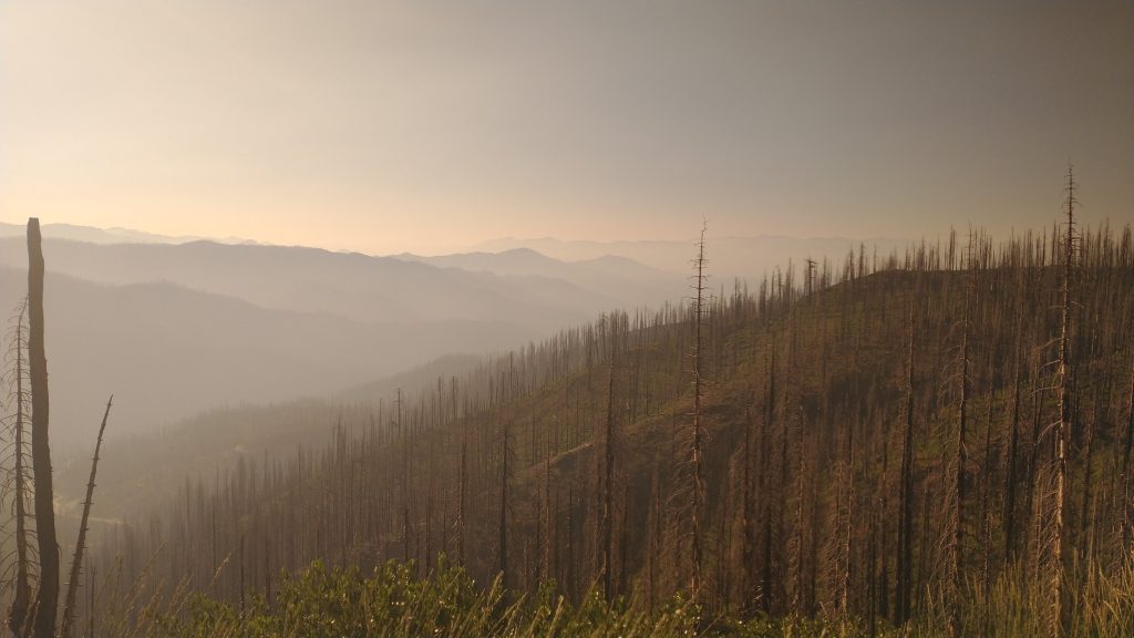
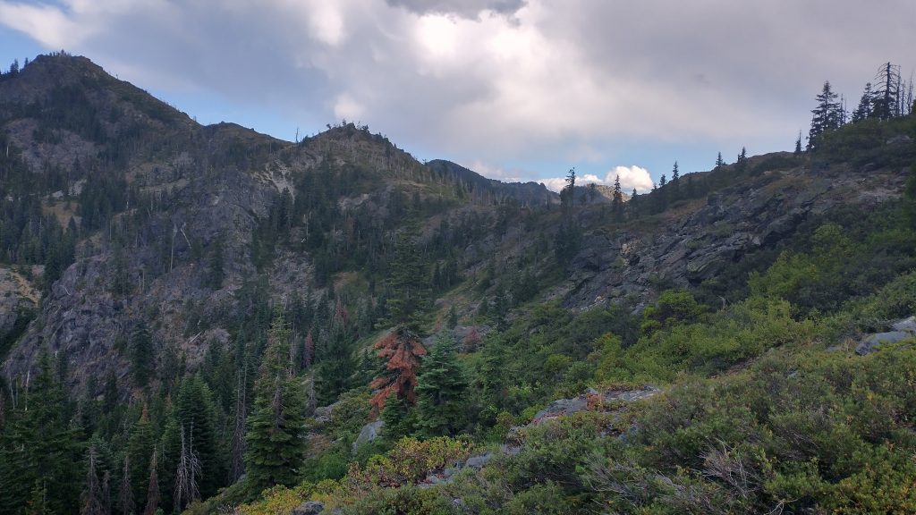
I followed the dirt road to a lesser logging road, which abruptly ended. I knew I needed to connect to paved Greyback rd., which was just over the ridge. Many years ago, attempts were made to cut and flag a trail, but the fire had obliterated any evidence of those efforts. On the plus side, the lack of any live trees made it easy to see the saddle I needed to shoot for. I was well accustomed to cross country travel, even in burn areas, but the slope was pretty steep. In a forested area, it’s possible to travel on such an angle because the soft, loamy soils will effectively yield to each foot placement, providing grip. In a burn, the soil is charred and crumbly, terrible to walk on.
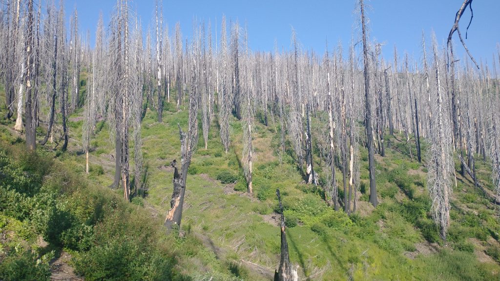
I could barely cling to the hillside as I tried to contour along. The soil would slide or completely collapse beneath my feet. Then there were the endless branches and sticks to navigate through. These super-heated fires made them very stiff and sharp, like so many thousands of skewer sticks, all waiting to poke me. The only good thing was that the fire was so recent, the tree skeletons hadn’t yet fallen. Someday soon, I guessed that the area would become utterly impassable. The double whammy would come from the bushy first stage growth of brambles. I counted my blessings that these factors were still reasonably manageable.
I made progress, surprised I was able to go through the mess at all. Seeing the highway from afar was tantalizing…it gave me a target but reminded me how slow I was going. Thankfully the section was only about 2\3 of a mile. Once I gained the road, I regretted not picking up water from the creek when I crossed it just minutes earlier. Access from the road was through a horrid mess of brambles, so I settled on collecting from a trickle along the roadside. Probably not a safe bet but it was the lesser of 2 evils. I wanted to tank up before another long and hot road walk through the burn.
I also tried to exact my revenge on the blackberry, raspberry, and thimbleberry growing in abundance along the open hill sides. They had some yummy fruit in exchange for scrapes on my legs. A fair trade I’d say. The fire seemed to have been a boon for such types of plants, and at least there was something green growing in the area. I wisely got out the umbrella and turned to. It was easy travel but also very unappealing. A few cars passed, everyone very nice and respectful. One slowed down to ask if I was ok, I gave him the thumbs up, and another truck stopped outright, asking if they could help me. I figured I might as well offload my trash, which of course they agreed to and were surprised that it was so little. The lady then offered me a turkey sandwich, which she swore was leftover, so I gladly accepted. She threw in a cold ice tea as well. I was suddenly so overjoyed. I love road walking! This happened several times on the CDT and PNT…spontaneous trail magic, thank you kind drivers!
I ate as I walked and was actually quite comfortable under my umbrella, with my trekking poles stowed for the road, hands free for my sandwich and drink. The road walk suddenly went from sucking to enjoyable … that’s thru-hiking for you. The road started to swing east and I entered Oregon again. The route did a big dog-leg north, taking advantage of the ridges along the border. I’d be heading east for a solid day, then finally south. I was humming along, in a great mood when I passed another truck parked in a pull out. I caught a glimpse of two people decked out in camo and ammo vests. Just as I was about 50 yards up the road, I nearly jumped out of my skin from a close-range, high-powered rifle shot. Back to sucking again. Hadn’t they seen me just go by? Or maybe they didn’t care? Was it hunting season already? I started singing my chant “please don’t shoot me” and quickened my pace. Moments later, the truck drove by, eying me closely. I averted my eyes, not trying to interact, but I saw it was a man and woman, which eased my fears just a bit. They turned around and drove up a second time, so I figured it was time to chat. They were actually quite friendly, just curious why I was walking the road and if I did these kind of crazy things often.
Being armed, they of course needed to warn me about bears. I just smiled and said thanks for the heads up, when I really wanted to exclaim, “I’m way more afraid of people with guns than bears!” I also know that you don’t provoke people with guns…duh. I didn’t bother to ask what they were shooting… it’s Muricah, does it even matter? Probably just getting ready for hunting season, sighting their riffle or something. My dad was a big time gun collector, so I know some basics. I’ve gone the opposite direction as him and am happy with my choices. If I won’t even carry a second pair of underwear, do you think I’m going to lug a gun around?
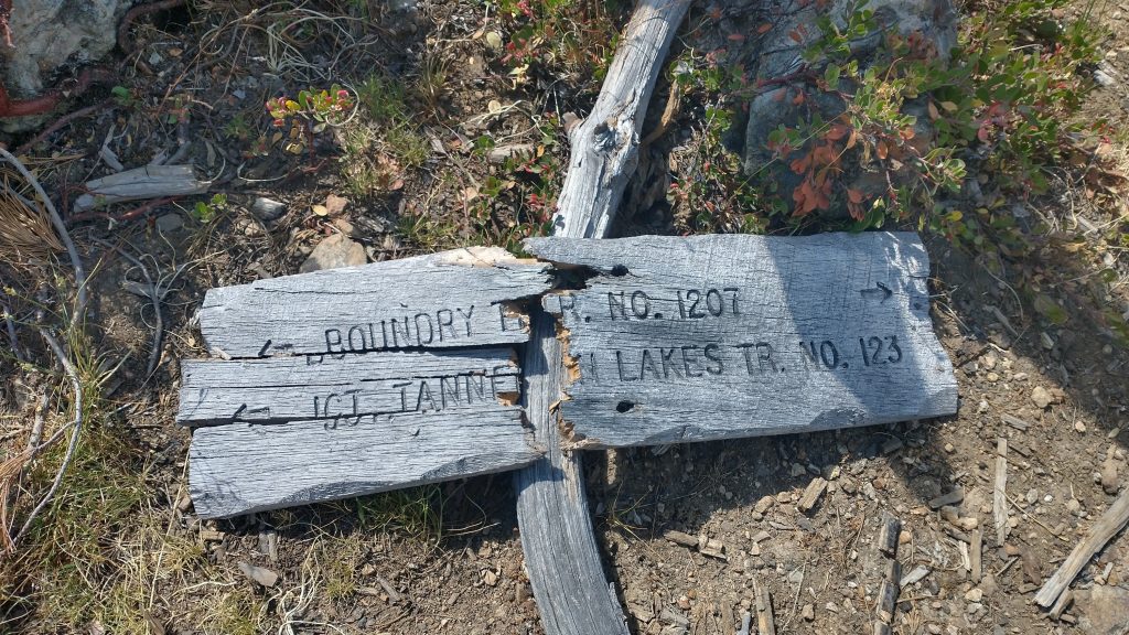
They wished me well and were off, probably with a good story to tell their friends. “There was this crazy woman walking the ridge through the burn, wearing a dress and umbrella. We had no idea why she was out there or where she came from!” I finally came to the trailhead to the Tanner lakes, passing up the first (much better one) to grab water and go for a dip in the East lake. The only access was through a campsite with 2 tents. I sat my pack down next to their rifle, propped against a tree. I figured I better announce my presence, calling a hullo several times. I got a muted reply from across the lake. I waved to the fisherman and they waved back, obviously quite surprised by my arrival. I mean, it was a Saturday with road access less than a mile away, so it shouldn’t have been too surprising. Had I wanted a gun, I now had very easy access to one… probably loaded too. I laughed at how quickly the tables can turn. Maybe hide your gun in your tent when you leave to go fishing? Bigfoot might sneak up at any moment, after all.
The fishermen probably watched with intrigue as I fairy-stepped to the end of a giant log jutting into the lake, scooped some water, slid like a salamander into and out of the lake in my dress, then disappeared into the woods again. The log scramble was key, because the lake was very mucky at the edges. Navigating endless blowdowns had at least made me very adept at walking on top logs, even slippery wet ones. The water was pretty warm but still refreshing. It gave me the energy to keep going for several hours more without stopping. By then, I’d set my sights on Azalea lake as an endpoint. I didn’t figure I had a chance of doing 30 miles when I started in the morning, but thanks to the easy road walking, it now seemed possible. Only 9 more miles to go. Of course, I knew all too well that now that I was back on trail, those miles might take me a whole day.
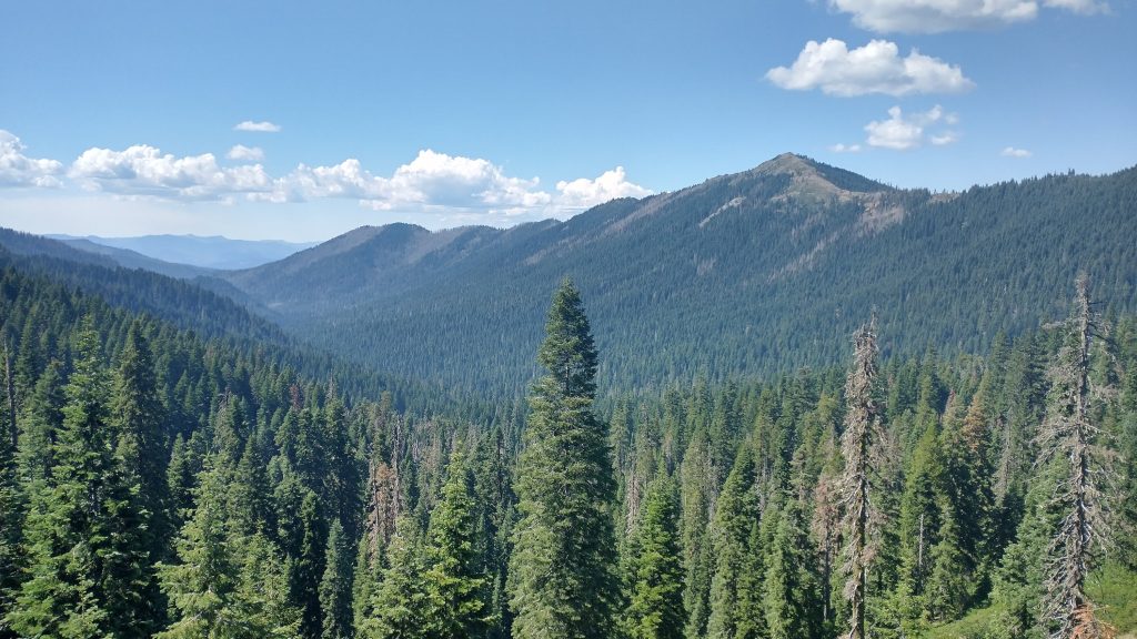
Thankfully I’d finally left the worst of the burn and actually entered some beautiful in-tact forest. The boundary trail was such a joy to walk as it bounced along the ridges, it almost became mindless. It started out pretty rough, overgrown and ephemeral near the lakes, but really improved through the forest. There were some usual blowdowns… probably, I can’t even remember. Stepping over them just became second nature. I was noticing all the different trees, still not sure of every species, here and there confirming that there were cones of a Douglas fir, incense cedars and Jeffrey pines…I think? I’m trying!
I made it to a four-way junction at a saddle and had to break for about 30 minutes. Only 6 miles to go…but a lot of uphill. Ugh. This day was way too many miles, my own fault, but I didn’t really like the locations short of the lake. Actually, Sucker Creek Gap would have been an awesome dry campsite, had I planned to carry water up. Oh well. It would have also left a lot of miles to get done on my last day into town. I easily had enough food for another night, I was also just kind of anxious to see other thru hikers again. The PCT called to me. I went down into a valley and suffered through a 1000′ climb back to the high point of the Red Buttes Wilderness at 5971′, the highest I’d been yet. At least some clouds had rolled in, cutting down on the heat. For once the views were really awesome! A cool breeze had come in, clearing away the smoke. I spent some time peak-finding, locating the points I traversed just days before. Plus I could see Mt Shasta, that elusive volcano from 2018. I freaking loved volcanoes! Hmmm, I thought, I should climb it. The sky’s the limit.
It was getting pretty late by the time I wound down to the lake. It was perfect, great for swimming, warm, and with fantastic campsites. I was glad I pushed to it, I only wished I had more time there. Unfortunately I couldn’t have gone much further than Poker Flats the night before, without having to camp in the bad burn area. Two others liked Azalea lake, as well. I hadn’t camped with other backpackers in a true backcountry site since Tillamook head, my second night on the OCT, I think. I chatted briefly with the guy closest to me, feeling bad about showing up so late and setting up so near to him. I didn’t have time to search around for the most choice site…I had a date with the lake. The water felt just perfect, not too hot or cold. But the air was chilly with a stiff breeze, so I even put on my puffy afterwards. It was the perfect set of conditions to snuggle into my quilt after such a long day.