Friday, Aug 4th, 2023, 0640-1930
West Clear Creek to Poker Flats, BFT mm 73
20 miles, Gain 5590′, Loss 3440′, elevation 5040′
I woke feeling pretty bruised and battered, not looking forward to more of the same abuse. I had a mile and a half to the junction with Clear Creek, where I hoped the trail might improve. But first I had to backtrack 200 yards to find the trail again. Good thing I stopped when I did the previous day because there was about a mile more of bad blowdowns, which would have been the nail in my coffin. I could barely have taken another step, I was so tired. Being in such a state leads to bad outcomes, as evidence of my banged up legs.
With patience, some restored energy, and a clear head, I found the trail, leading up to traverse the hillside. My map indicated that it did so, but you never can be too certain the trackline is correct. When a trail goes high like that, it’s for the reason of avoiding something in the creek bed: a waterfall, cliffs, slips, boulders, a whole list of things. As such, I knew better than to try to just bushwhack down the creek from where I camped. It’s always worth it to find the trail when there is one, no matter how scant.
Once I got moving again, I actually felt pretty good. The trail improved in the last half mile to the junction and I followed it across the creek. It was suddenly very good trail, enough so that I glaced at my app and realized I was on the wrong trail. I backtracked a short ways, took the correct turn, and encountered blowdowns in less than a minute. Now that’s more like it. At one point, I even tried counting blowdowns just for an hour, to get an idea of how many there actually were. I stopped counting after 15 minutes and around 60 blowdowns. Most were easy to step over and only about 5 of these slowed my pace significantly.
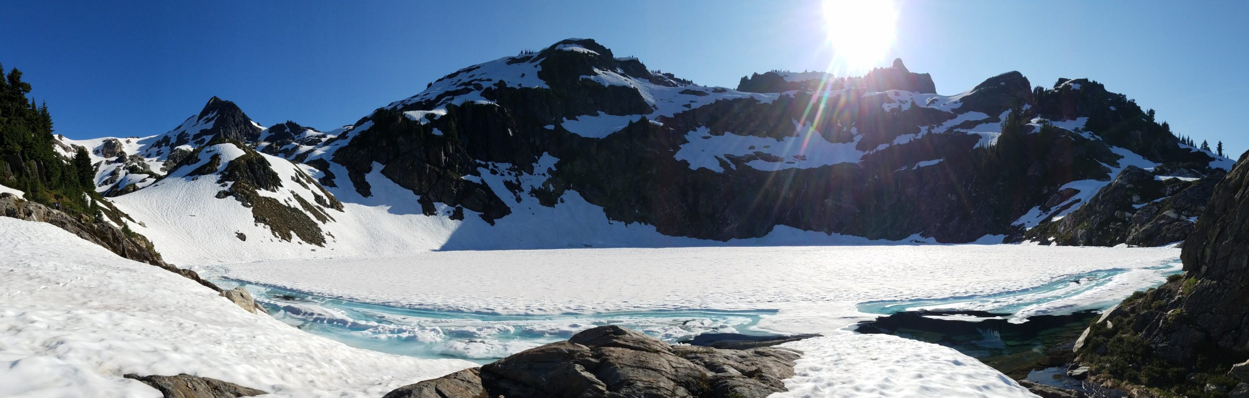
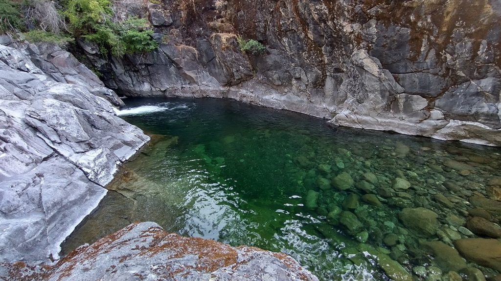
About 11 miles of winding up the Clear Creek watershed were in order for the morning. It was slow going for the first 3 miles, dealing with the blowdowns through more burn areas, but nowhere near as bad as the day before. At least it was easy to see the trail. I thought I was doing a pretty good pace, but the miles still came slowly. It made me suspect that the mileage count was off, too. By 9 am, I came to Wilderness Waterfall (real original name). The map notes said to take a swim, so I did. The air already felt hot enough and the giant swim hole was so irresistible. I refrained from jumping from the highest ledge, concerned that if it wasn’t as deep as it looked, I’d be in trouble. No sense in breaking a leg alone in the middle of nowhere, just for a cheap thrill. I settled for a jump off a low ledge, which was just as refreshing.
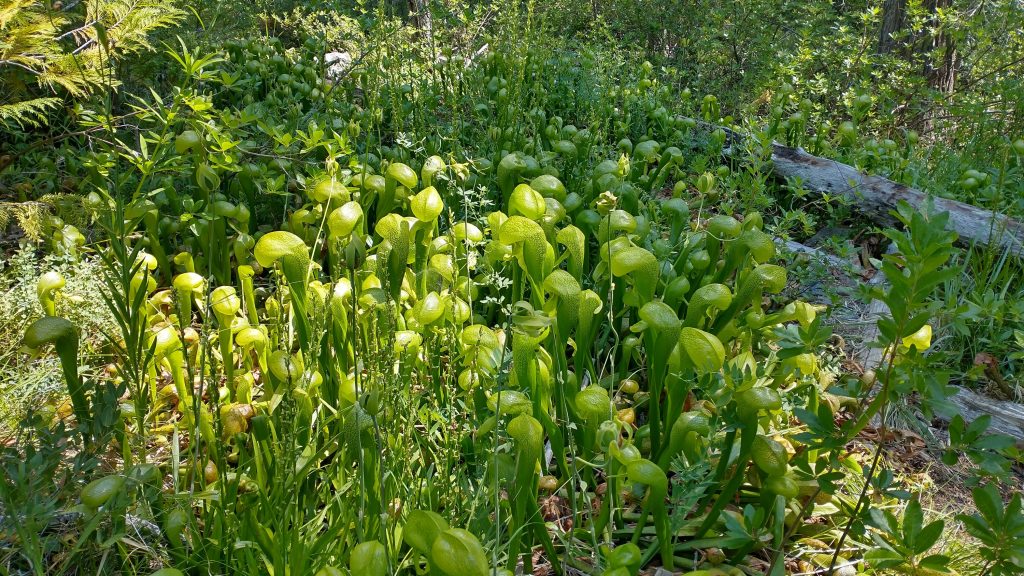
My mood significantly improved after this, as did the trail. Clearly a trip to the falls from the north made it into a somewhat popular trail. I even saw a few footprints and the blowdowns were miraculously almost gone. I could just walk down the trail… it felt heavenly. It also helped that the forest through here was intact, healthy and beautiful. This always makes for great trail. I even found more of the amazing pitcher plants.
When I came to the junction with Doe creek, I finally saw 2 backpackers! I hadn’t seen anyone the day before and these would be the only 2 I saw this day. I explained my route and they were quite impressed. Being from the Bay area, they were somewhat familiar with the area. In trying to explain the difficulty of the day before, I said that I’d only been able to go 15 miles. This came across exactly the opposite as I intended, because to them that sounded like a huge day. It also made me realize that I should be very satisfied with such an effort. The lady shared some of her Trader Joes dried mango, which I unwittingly yogi-ed off her by saying, “oh, that’s my favorite!”. Well, it is but that line invariably forces someone to make an offering. It’s a known thru-hiker tactic, reader be warned. I really didn’t intend it, but it was a welcomed and appreciated treat, nonetheless.
I continued on good trail for several more miles, wondering why Constantine and Horsepower had both described the trail as rough and “shwacky”. Then I came to another burn area where the trail disappeared. I did some bushwhacking through low blackberries but some were ripe, so it was an even score. I love the wild type blackberries…they are small but oh so sweet. I took my late lunch break near the headwaters of the creek, climbed some more, and finally gained a ridge with views. I tried some tree identification from the trail notes. I really should have purchased Michael Kauffmann’s tree ID guide when I found it at the visitor center at Prairie Creek, but I didn’t want to add more weight to my already overloaded pack. The whole theme of this hike was to appreciate the conifer diversity in this region, the most anywhere on earth. Michael coupled together this route to be able to find 32 different species, based off his travels and research in the area.
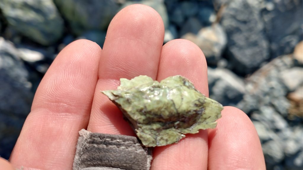
I’d admittedly been lax in sharpening my naturalist knowledge during my thru-hikes, especially when it came to plants. I learned the edible berry-bearing ones pretty fast, but neglected the trees. I knew ponderosas, but had a long ways to go with the rest. I had some ID panels for some of the trees, but they were stored on my phone, which I was afraid to use in excess lest I needed all my juice for navigation purposes. But I had at least been noticing all the different trees and learning some along the way. Because of my map notes, I also identified an outcropping of serpentine, a cool rock formation with a shiny green marbled appearance. Some of the shards were a lot like dragonglass \ obsidian. See, I was stopping to smell the rocks, trees, and darlingtonia!
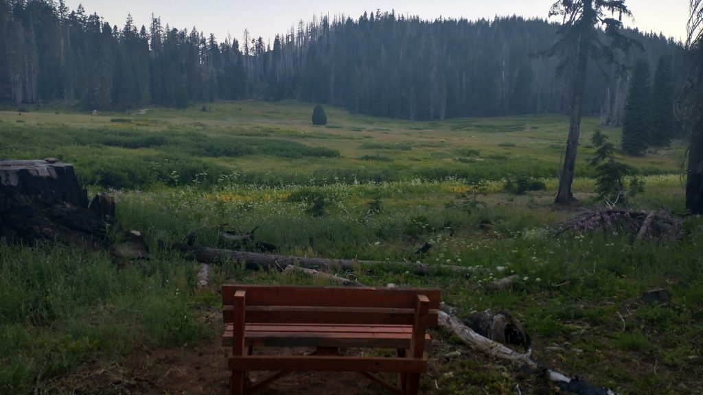
Alas, I had to push on without noting all the trees in the notes. It was a long stretch and I only had so many days of food. With my low miles the day before, I was worried there might be more to come, putting me shy of my estimate for food. I had been rather conservative in my planning, but had at least expected 20 mile days. It was all I could do to make that target this day. I continued to traverse along some ridges, with views of the Lieutenants and Preston peak, now to my south. The trail came and went in all its various states, in and out of several valleys. There were more burn areas and meadows, making the trail quite ephemeral. Even still, it was a very pleasant day of walking. Tough but rewarding. The last bit was mercifully on an old road, easy to follow and with a nice grade up the final hill for the day. I dropped down through another burn, losing the trail but finding easy cross-country to come to Poker Flats, a huge meadow with a trailhead and privy. A small campsite at the end of the road offered a picnic table and breeze to keep the mossies away, so I could actually enjoy the table.
Being a Friday night, I was worried about 2 legged visitors. Instead, I got unwanted 4 legged visitors. NoCal is notorious for pee-habituated blacktail deer and I made a critical error in providing an offering near my campsite. Big mistake. Right at dusk they started encircling me. The first was kind of cute, until I realized I would be stuck with her and probably her offspring all night. I tried to rush her off but she kept coming back. Oh well, as long as there were deer around, didn’t that mean the absence of predators?