Thursday, Aug 3rd, 2023, 0615-1930
Harrington Creek to West Fork Clear Creek, BFT mm 53.2
15 miles, Gain 6510′, Loss 4950′, elevation 2907′
There was no Bigfoot again, or any other large animals overnight. I heard nothing but the river…the next best white noise after surf. As remote as this place was, it seemed like a good spot to find a Bigfoot. Apparently they are quite stealthy, having never left one shred of DNA evidence. But I crept up on a bear, so maybe I could be as stealthy as Bigfoot.
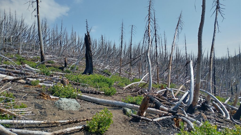
As for my day, it was one of those I’d rather not talk about. Extensive burn areas, endless blowdowns, bushwhacking, and constant trail finding. I expected to do battle with rough trail and boy did I. The numbers speak for themselves…13 hours to go 15 miles. By 1 pm, I’d only gone 7.5 miles. I ended the day sopping up blood off my legs, hiding in my tent so the hordes of mosquitoes didn’t get more. It was a blood-letting kind of day.
It started off ok, enough to have me thinking, gee, this isn’t so bad. Others had described it as one of the worst sections of the Bigfoot Trail and the notes from the creator listed the climb from the Smith River to Harrington Saddle as a very difficult section: “it should only be hiked if you are a good navigator.” I would concur with that statement and having made it through, I guess that makes me a good navigator. I can definitely say having GPS was very helpful. I knew generally where I had to go based on my paper maps. Up on the ridges, with a clear open view, I could walk cross-country much of the time. But as I learned on many routes like the Hayduke, GPS was the tool for finding exact locations…like where a trail starts to switchback on a steep slope. If you’re not exactly on the remnants of a trail in such locations, things can go badly. The maps provided by the Bigfoot Trail association were too small scale to show such fine detail, but I’m not sure an even larger scale map would have helped.
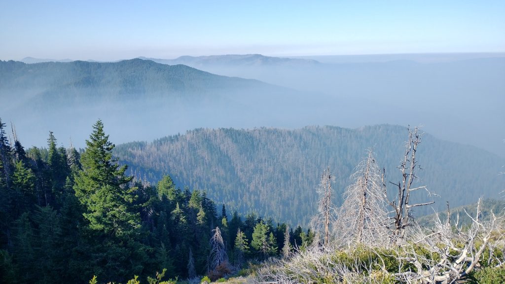
I made it about a mile through easy trail, climbing steadily, until I entered a burn area. Then the blowdowns started popping up pretty frequently. Two spots were troublesome enough that I had to take my pack off. On top of that, the air was thick with smoke from an Oregon fire near the Rogue river. I could smell and taste it. I really hated burn areas, but breathing smoke at the same time was a distasteful double whammy. My previous travels through northern California on the PCT were nothing but smoke for weeks. I couldn’t see anything…I only caught a glimpse of Mt Shasta once! I was really hoping for a different experience this time around, but so far was out of luck.
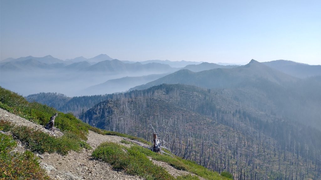
I made it up higher where the smoke wasn’t so thick and there were actually some views. I took a very short break to catch my breath, with only 1200 more feet of climbing. In total, it was about 4500′ of gain over 5 miles to 5775′. This took me 3 hours…I think I actually might have climbed Katahdin faster. I thought trail conditions might improve after Baldy Peak but they actually got a lot worse. Up to that point, I could see the trail pretty easily. As I descended the ridge, it would completely disappear, obliterated in heavy burn areas. I also hadn’t experienced severely brushy spots (as were reported by others), that is until I got to the meadows around Harrington lake. There I was pushing through some chest high vegetation, but at least it wasn’t thorny. Earlier I encountered some plant, probably related to blackberry, that grabbed at me like crazy, thorns everywhere. It actually ripped my trekking pole from my hand. But the meadows had some kind of seed bur, like a goathead but not as rigid, that stuck to me everywhere. I kept having to stop to pick them off, as they were irritating my skin. Thank goodness I was high enough not to be running into poison oak.
I took a long break at the headwaters of Harrington creek. I needed to hydrate and rest, I was so tired from the climb. Going up was one thing, but constantly having to contort my body and do acrobatics around, over and under blowdowns really exerted a lot of energy. This made my effort level hard to gauge by just the miles done. Going up to the Harrington saddle was another exercise in endurance, steep with scant trail to follow and lots of bushwhacking. I took another break because I had service and was able to download my peak finding data for the area. I had to at least become acquainted with the local mountains… plus I was tired.
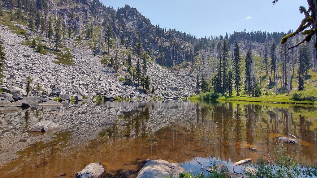
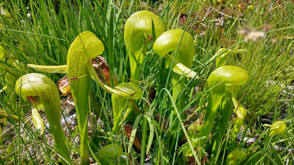
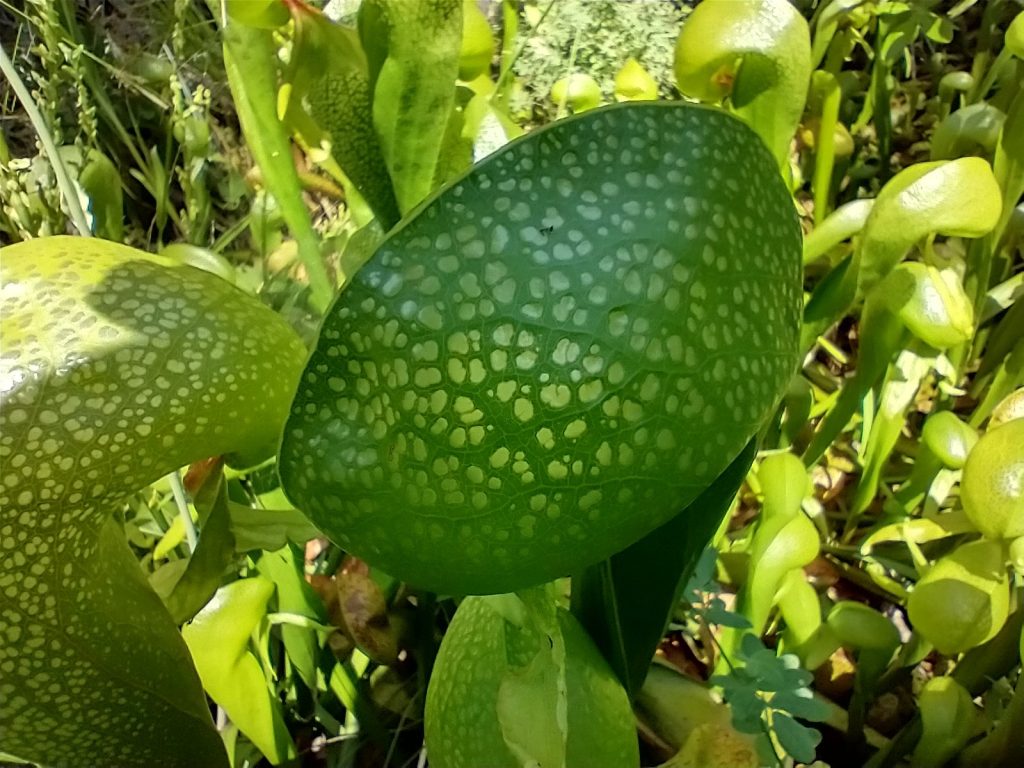
I stayed high along some more ridges with ok trail, where I at least found a beautiful grove of living forest for a spell. Then up through another severe burn, which was hard to navigate through the maze of twisted tree skeletons. Quite surprisingly, while skirting a stand of blowdowns, I came upon a bog area with hundreds of darlingtonia, a rare type of carnivorous pitcher plant that only grow in NoCal and OR in serpentine soils. They were so intricate and beautiful, I was in awe to find them, especially among the stark devastation of the burn area. Nature was so confounding and resilient sometimes.
Buoyed by my find and at last due for a big descent into the West Clear Creek drainage, I thought the last part of my day might be easier. Wrong again. I immediately lost the switchbacks going down the steep hillside and ended up following a game trail on a slippery tilt-a-whirl slope…not fun. I could swear I read that there was ok trail heading into the drainage but there was almost no trail at all. Just blowdowns and tricky steep topography. Old log cuts were about the only signs I had to go by to stay close to the trail remnants. Acrobat for 10 yards over obstacles, scan for a log cut, repeat. I thought I could easily make it to the end of the map section at the junction with the main Clear Creek, but it took me hours just to go 4 miles. When a runner starts to fade at the end of a race, they say ‘a bear has jumped on their back.’ I think Bigfoot jumped on my back here at the end.
Up to this point, I’d done an amazing job to avoid injury. In the last half mile, I raked my trailing left shin over a log and almost immediately jabbed my right ankle into an unseen branch. Blood was suddenly running down both legs and I knew it was time to call it. I was getting sloppy…that and my luck going over thousands of blowdowns was running out. After losing the trail for the umpteenth time along the creek, it was also starting to get dark. Luckily I found a flat spot among the tangled mess of trees with access to the creek. I quickly rinsed the blood off in the creek and collected some water.
The mossies were immediately upon me, hangry for the first hiker to come by in their lifetime, probably. They were small and fast, and while still not as bad as the ones on the PNT, they added a final blow to a rough day. Haha, screw you mossies, I didn’t graduate from the PNT for nothing. I beat an experienced quick retreat into my tent, leaving the masses frustrated outside. One small win for the day. In thru-hiking, there are the good, bad and ugly days…at that moment in my tent I wanted to say this was an ugly one but looking back, I see there were plenty of good moments. I saw some fantastic things that few get to see. Unsurprising, I went a whole day without seeing any people. I made it through some tough country on my own, relatively unscathed, and was proud of that.
Your writing takes me on a journey that I will never experience on my own and I gain more and more respect for you each day. I think of you often so maybe you will realize that you’re not always alone.
That’s such a sweet thing to say. It gave me warm fuzzies to read this.