Saturday, Aug 26th, 2023, 0610-1800
Lassen NP Boundary to Hwy 36
30 miles, Gain 4000′, Loss 5000′, elevation 5050′
Despite such an early start and many miles the day before, I didn’t sleep very well. First I was uncomfortable because of the lumpy ground, then cold. I thought I must be a wimp to be so cold, until I looked at my thermometer. It reached 33 degrees, almost freezing! In fact, there was frost on my tent and the plants surrounding me. No wonder I felt a chill in my 30 degree quilt. Yikes, my gear was not ready for this cold, neither was I. To make matters worse, I had a ton of condensation in my tent.
I hated camping in burn areas. There were no trees to soak up the moisture and regulate the temperature. As a result, there were huge temperature swings from night to day…from a cold sink to blazing hot. This sucked for hikers, but was more pertinent to the poor animals and plants trying to regain a foothold in such inhospitable areas. It’s an excruciatingly slow process for a forest to come back…if it ever does.
I set off for the day wearing all my layers, including my rain gloves. Shortly my mind was off the cold and focused on finding the trail. The valley was very open and wide, with such an easy grade that travel was enjoyable, even with scant trail. The FarOut notes described it as a bushwhack, but clearly the commenter hadn’t hiked the PNT. The route followed logically along the east bank of Hat Creek, so really I didn’t even have to navigate, just follow the creek. At the creek crossing, I found a freshly made log bridge, shaved flat on top for easy passing. Thanks Park Service! It was sure nice not to have to get my feet wet on such a cold morning. There was also a trail sign, but the writing was burned off…or maybe I just didn’t bother to look at it, confident in my navigation.
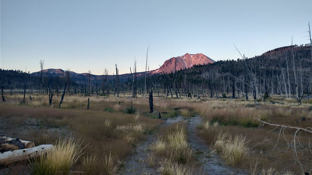
A 2 track jeep trail began at that point, making things even easier. The valley wound straight towards the gaping maw of Mt Lassen, which was lit with alpenglow. Very Nice! I was so glad I took the alternate to have such views of the volcano. Last time I’d barely seen it from afar, like it wasn’t even there on the main route of the PCT.
I also saw lots of wildflowers and even a few patches of live trees here and there. For a change, I was actually really enjoying this burn area. It was older, so some new trees had made a comeback. The views of Lassen continued to enchant. The 2 track was so easy and nice, I could afford to look up and around without tripping. Walking bliss while blue blazing.
I reached the paved park road, which was very quiet at 7 am. It was an easy 2 mile stroll, walking in the lane opposite of traffic. All the vehicles were going south, so I pretty much had the lane to myself. Only 3 cars passed going north. As far as road walks go, it was a cinch. I reached a campground and trailhead just in time to use the privy and take off some layers. I started going through patches of a more recent burn from the devastating Dixie fire of 2021. It had burned nearly 1 MILLION acres, including large chunks of Lassen. I didn’t know it at the time, but this burn area would envelope several more days of hiking, all the way past Belden.
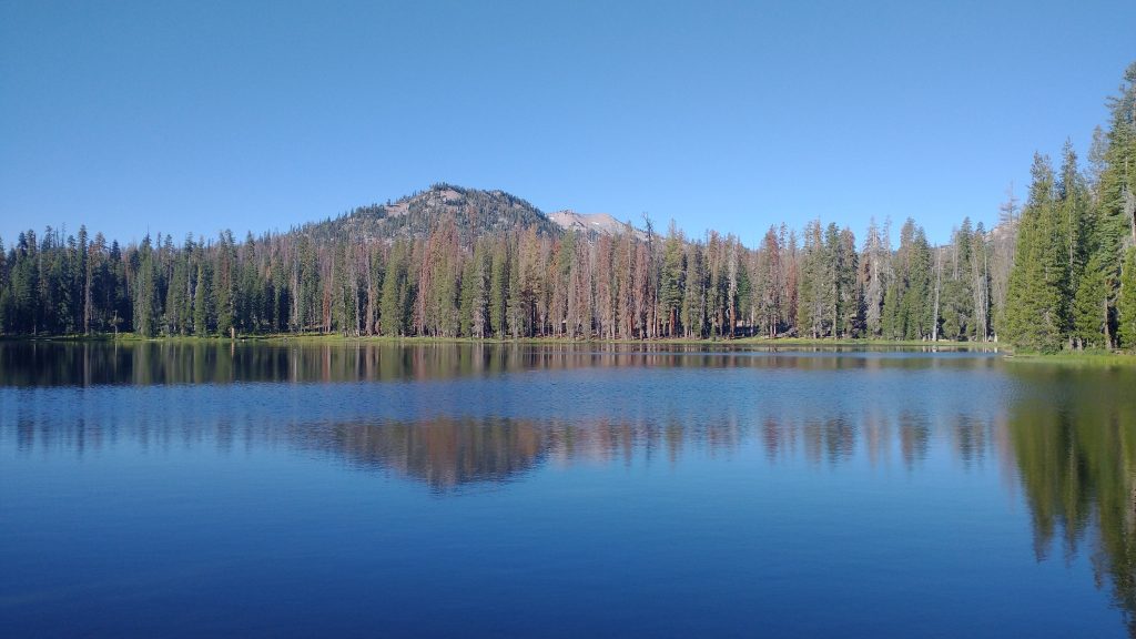
I followed another trail down from Summit lake along Kings Creek for 2.5 miles. I rejoined the PCT and continued through the burn down to a valley where Drakesbad resort used to be. Sadly, over half the buildings had burned in the fire. The resort was still closed but in the process of rebuilding. The nearby campground had also partially burned and was closed. I clearly recalled the forest through this area. It was the most significant change I noticed of the PCT sections I’d walked thus far. The fire had burned really hot, leaving almost nothing but skeletal trees. After only 2 years, only some white thorn and other low shrubs had grown back. It was really depressing to see.
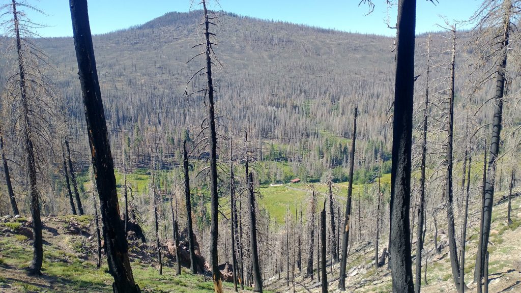
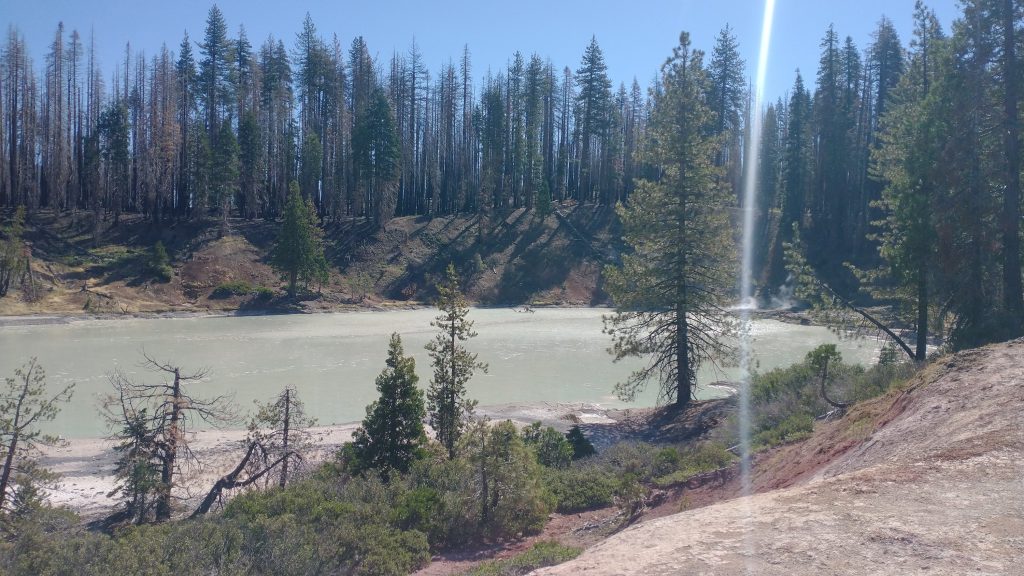
I took the alternate past boiling lake, another volcanic feature. It seemed even more alien and apocalyptic surrounded by burned trees. Then there were many more forgettable miles through the burn. The trail was in surprisingly good shape but I wondered what the future held. There would be erosion problems from the poor and unstable soil. Also the skeletal trees would begin to fall in a few years, creating a nightmare of pick-up-sticks on top the trail, not to mention a severe risk of crushing hikers. This was the case I’d found going through a 10 year old burn in the Mogollon mountains in New Mexico.
I reached the border of the park, stopping to collect water and have lunch at a creek. There I saw the first 2 thru-hikers I’d seen all day. One was going north and the other, Keys, was going south. I continued down into another valley, mercifully entering a stretch of unburned forest for a few miles. It was so nice to walk among living trees, especially since it had gotten hot again. I took a dip in the North Fork Feather River and tackled the last climb of the day. I met a trail crew and then enjoyed the nice work they had done in the area. I stopped at the top of the hill to do some texting and absentmindedly left my trekking poles up against a tree. I walked an extra half mile to go back to get them…silly.
The burn resumed and I found some dirt roads to walk down instead. They were faster and I wasn’t missing out on any nice scenery. The last few miles to highway 36 were the worst. There were logging operations to try to recover some of the dead trees, which I was obviously not opposed to, but the landscape just looked so devastated. I was glad to reach the HWY and get a quick ride into Chester. The town had only just been saved from the fire…it was completely surrounded by the burn. All the residents had choice words for the power company PG&E. Similar to the fire that destroyed the town of Paradise in 2018, the Dixie fire was started when a tree fell on one of their power lines. They were responsible for maintaining a clear corridor wherever their power lines went, but obviously had neglected such an important obligation. This preventable incident led to the largest single source fire in California’s history, also taking the lives of many and destroying hundreds of structures. No doubt, the execs at the company were still getting their bonuses. It’s shameful and criminal if you ask me.
My ride was kind enough to drive me to the outskirts of town at the Pfauhaus hostel. Apparently Pfau is German for Peacock and that was the couple, Michael and Annika’s last name. They greeted me on their porch, where we sat for hours chatting. They offered me all sorts of party favors, including whisky, when I told them it was my birthday. They also gifted me with their spare burrito. They had just ordered out and decided to share one burrito and keep the other for lunch the next day. I tried to eat only half but was so hungry, I easily devoured the whole thing. It was almost a mile back into town and late, so I was very thankful to be able to just hang out there. I found out that they had both been interpreters for the armed services, so they had some interesting stories. I had such a fun time talking to them and regret that I didn’t get any pictures together. After a late night, I retired to their spare loft, which had a bathroom and kitchen. This was where they let hikers crash, with a suggested donation. I was they only one staying there this night.
Sunday, Aug 27th, 2023, zero day in Chester
Technically the day before was my birthday, but hiking 30 miles through a burn wasn’t much of a birthday present, so I treated myself to a day off….which includes writing many details for this blog. I’ll note that I had a jumbo peach milkshake from the Pine Shack, which was definitely a treat. I didn’t go into Chester on my previous PCT hike, so it was nice to finally have my Halfway Celebration milkshake. The rest of the day was spent doing laundry and hanging out. Keys joined me in the loft for the night and it was nice to share in his company.