Friday, Aug 25th, 2023, 0350-1910
Hat Creek to Hat Creek Lassen NP Boundary
33.5 miles, Gain 4690′, Loss 4820′, elevation 6200′
My early morning start went well and according to plan. I had my coffee and breakfast, broke camp, and headed into the dark. I was rather used to walking in the early mornings by the light of my headlamp, from previous late-season hikes. The best part was that it wasn’t cold, which always makes an early start more palatable. It was really pleasant and easy going up some some switchbacks out of the valley. Then I hit a flattish lava field that was open to the sky, which was really quite amazing. I felt like I was walking on the surface of an alien planet, encompassed by an inverted soup bowl of stars. I was trying to use my red light, so as not to ruin my night vision, but many lava stones in the path made this tricky. Still, I took brief pauses to stargaze and wonder about the meaning of it all.
Presently, a light to the east began to grow. The predictability of our own planet’s rhythms grounded me to my place and time. The shapes along the rim took form. It was still a rather alien landscape but at least one I had walked before. Time spent in Hawaii, Arizona and New Mexico also reminded me of my present surroundings. Lava rocks and parched landscape…these were actually somewhat common themes that my many long walks had incorporated. I felt somewhat at home in such places.
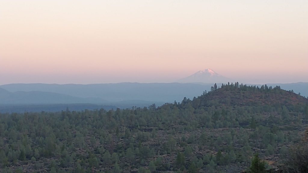
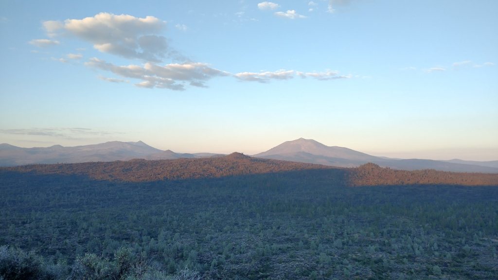
Watching the sun light up the many cones and significant volcanoes of the region was mesmerizing. Mt Shasta was still very prominent, as was Lassen. What views I finally got to enjoy, now when there wasn’t smoke! Repeating the PCT through NoCal had been so worth it, even if it meant suffering through some intense heat. This morning was refreshingly cool, in the 50s, but it began to warm quickly. I caught up to Out Here just as I was able to turn my headlamp off and he was breaking camp. It was amusing how we’d been hop scotching each other for days. I’d marked him as someone that was moving at a much faster pace than myself, but we ended up having a pretty similar schedule.
I kept going, certain he’d catch up and pass me later. I was set to take a short break at Cache 22, a longstanding water tank maintained by a guy, Jim Beatty, also known as Cache 22. I met him earlier in the year in Moab. He was doing a section of the Hayduke. I left a note for him in the logbook, thanking him for his contribution to hikers. I caught up to another lady in a Jolly Gear dress. Her name was Slingshot. I also passed 3 NOBOs still plugging away at it. They were about 70 miles north of the halfway point and it was the end of August…the math was a harsh reality for them. But they also had multiple fire closures to look forward to, which would speed them along towards their goal.
I used the water cache to meet my single stop requirement for the morning and afternoon, pressing on through the day towards Old Station. It was exactly 30 miles to the gas station and restaurant. With my early start, I could be there by 2 pm, just in time for a late lunch. I checked my map for blue blazing opportunities and found a nice road walk that cut off a corner. Ironically, the road led me past several stock ponds and lakes that were far better than most I’d seen in the southwest. On the PCT, there was an off trail spring that could only be accessed from a steep side trail that involved many hundreds of feet of elevation loss then gain. I wondered that the spring wasn’t just coming from these stock ponds (which incidentally had cows standing and pooping in them). It was a good reminder that the information on Far Out wasn’t the only option in terms of water. These stock ponds were much easier to get to than the spring, had I needed water. I just had to consult my maps. I was free of sticking to the red line and the limited options it represented.
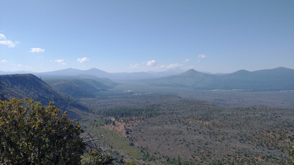
I rejoined the trail just as it arrived at the last viewpoint from the rim. There was a parking lot and developed viewing platform, complete with binoculars that were worse than regular vision. Old Station still looked far away but was only 2 more miles. I descended the switchbacks from the rim and fretted over the heat. I put my umbrella up but was still feeling cooked. I’d been pondering skipping Old Station to go for a new single day record of 46 miles, but doing so would put me inside of Lassen National Park, where a bear can was required. I didn’t have one and wanted to play by the rules. So I decided just to go for a break in town after all, then see what I felt like afterwards.
I felt absolutely wrecked rolling up to JJs cafe. In 2018, Flowers and I had hurried to make it there before their closing at 4 pm, and we’d just managed. It was exactly 2 pm, so I thought I easily had it made. Well, turns out they were closed for the whole weekend due to illness. What a bummer. I got some microwavable stuff from the gas station instead and considered my options. No other hikers were around to go explore the submarine lava tubes with, so I scratched that idea. There was also no reason to hang around the gas station any longer. If I pushed some more miles this day and a big day the following, I could make it to Chester for my birthday.
I decided to first see what was down the road near the post office. A resort supposedly served milkshakes and burgers and I figured I’d see if Out Here had made it there. He was rushing to get to the PO before it closed for the weekend. I planned to walk the 4 road miles but figured I should stick out a thumb anyway. As is often the case, the 3rd truck to come by stopped. The driver Chris was from Oregon, trying to escape the smoke. We got to chatting and blew right by the rest of “town”. I never even noticed any buildings.
I felt so bad, I didn’t want to ask him to go all the way back. So I found a dirt road that would intersect the trail and we only had to backtrack a little. In this way, I missed about 7 miles of official trail but I was ok with that. This little skip made it feasible to get to Chester by the next day. Chris was so nice, he gave me a cucumber and tomato from his garden as a parting gift. I ate them next to Hat Creek, then took a long overdue dip. I continued down the trail another 5 miles or so, right up to the national park border. I saw a bear butt along the way…funny that it was not on the other side of the border, since that’s where I needed the bear can. I settled into a crappy spot in a burn area, just near where I planned to break from the PCT to take an alternate through Lassen NP the next morning. I recalled the previous route being somewhat boring, with limited views of Lassen volcano. This route went closer to the mountain, plus was also about 4 miles shorter.
I didn’t have a lot of good photos over the past few days, probably since I’ve seen everything before, I’m not as inclined to take pictures of the same stuff. The rim did have really grand, sweeping vistas, which don’t come through as well in photos.