Friday, July 7th, 2023, 0645-2100
Tillamook Head Backpacker Camp to Manzanita
26 miles, Gain 3500′, Loss 4300′, elevation 30
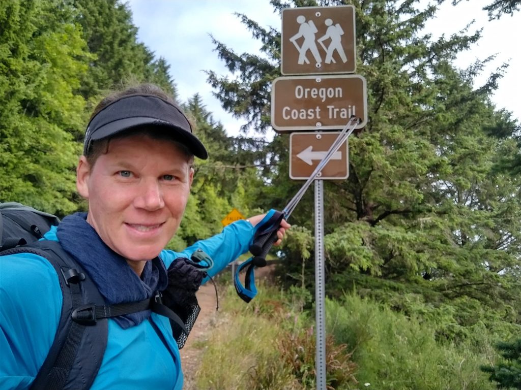
The reason for such a short day yesterday and a long one this day had everything to do with tides and where to sleep. I needed to hit a low tide for the upcoming stretch of beach, which was in the morning. Because of the waning full moon, the tides were also rather extreme, meaning one of the lows each day was at a negative level, 1-2 feet below the average low. This was significant, since it meant I might be able to walk the beach farther than the official route. It’s mentioned in the guidebook and also was reported by a hiker named Trailcrew. I met him on the Hayduke and had been following his excellent trail reports for many years and trails…the PNT for example. I’d recently become friends with him on the socials, so he’d been showering me with lots of helpful advice on the OCT and BFT.
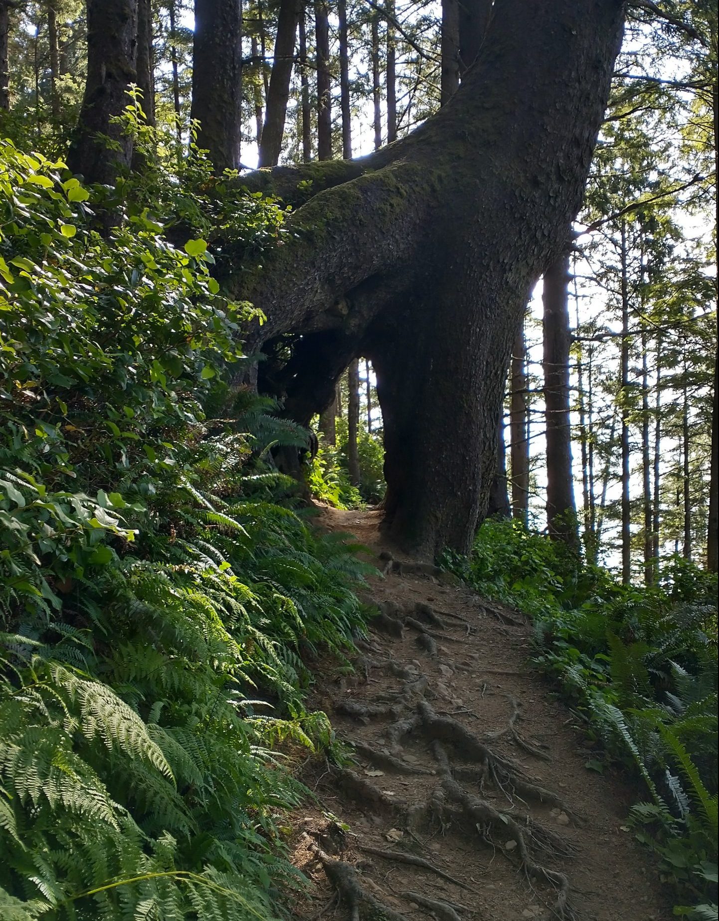
There was a -1.5′ tide at 10:15. Trailcrew said he was able to slide by the numerous headlands 2 hours before the low, so I set off early to arrive at Indian beach by 7:20 am. The trail down the south side of Tillamook head was very well groomed and I enjoyed easy walking. An interpretive sign gave information about the local history and listed all the movies that had been filmed in the area: Goonies, Kindergarten Cop, Point Break, and of course, Twilight. I’d been reading all the signs along the way, relishing in the touristy nature of the coast. I was here to discover as much as I could as I walked, not to make big miles…although one can sometimes do both.
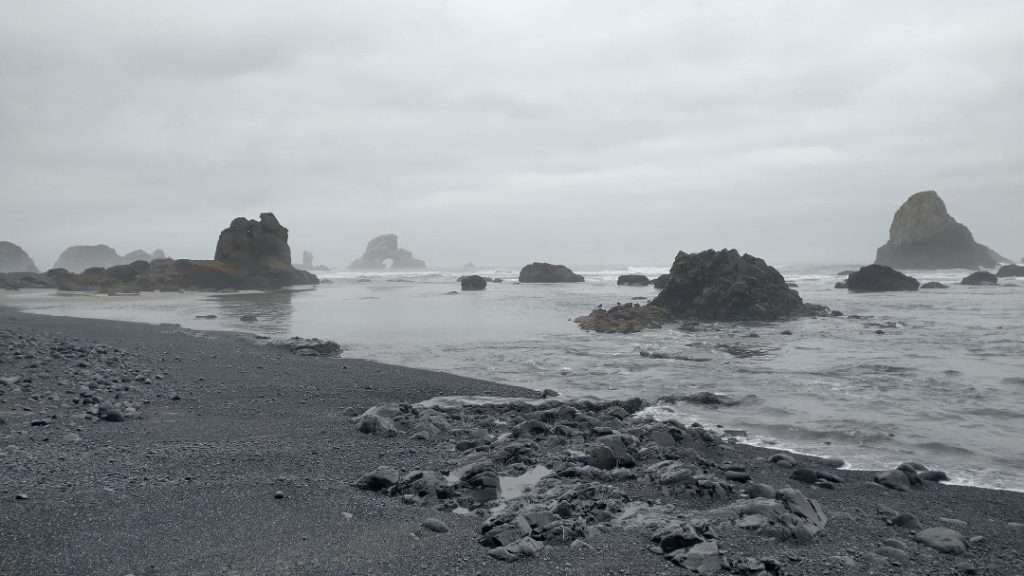
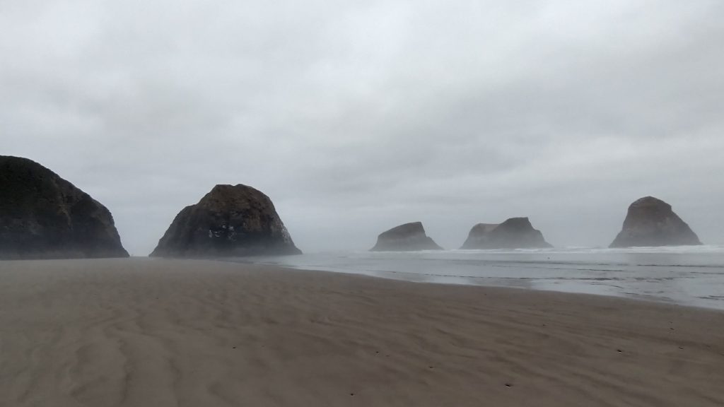
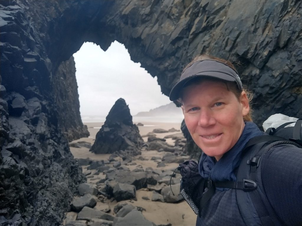
The beach was gorgeous, with perfectly sculpted waves breaking on a white crescent wedged between 2 rugged headlands. Usually this is bad news for thru-hiking but I had to at least try to see if I could get around the point. There were a handful of early risers enjoying the lovely break and I was envious from my surfing days. But my hiking fulfilled my present passions and I was eager for the challenges ahead. Bald point had me scrambling over some pretty interesting and tilted surfaces. At first there was a little use trail but it cliffed-out at a washout on the other side. I turned to descend straight down to the beach through some big, wet and slimy boulders. I was afraid of each slippery foot placement and thoughts of knocking myself out and being consumed by the tide crossed my mind. I ended up placing my sit pad on a boulder and butt-scooting \ sliding down with my pad as a sort of sled. I landed upright on the beach but it was rough enough to dislodge my water bottle. I hadn’t even considered what I would do if I had to backtrack. All this when I could have just stuck to good trail all the way to Ecola or Chapman points. I guess the OCT had been too easy and I needed some Hayduke-style excitement. Knowing that others had gotten through spurred me on, plus the coastline was gorgeous, full of offshore sea stacks and sea arches. Seabirds of every kind were fluttering about: cormorants, pelicans, murres, guillemots, oyster catchers, eagles, ospreys and gulls. I’d done a lot of similar shoreline-picking in Hawaii and Washington, so the risks felt familiar and fun.
Next I needed to get around another unnamed point where the sea still hadn’t retreated. Climbing over the point was out of the question with sheer cliffs. Waves were still breaking on the point but rolled in low and slow, suggesting a sandy shoal at the edge. I decided to try to wade past, so I changed into my camp shoes and emptied my pockets, storing my phone in my pack. I couldn’t see around the rock, so I didn’t know how far I’d have to wade or how deep it might get. Good thing I took some precautions because the waves immediately soaked me up to my hips. I was pretty concerned about taking a swim for a few seconds but I kept my pace and emerged on the other side, only half wet. More then I bargained for but by my own designs. I could have just waited for the tide to go out more, but I was too impatient, wanting to take full advantage of the extreme low tide window. I was rewarded with some of the best beach walking ever. The rock formations were so scenic and dramatic, I was in awe. And I had the whole place to myself! These remote beaches saw very few human visitors it seemed, obviously due to the challenges of getting there.
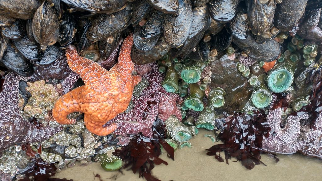
Taking a break from the obstacles, I had some time to check out the prolific intertidal sea life clinging to the rocks. I found the most amazing compilation of giant muscles, anemones, and sea stars. I saw similar tidepools and rocks in Olympic National Park, but this area impressed me so much. I could have spent hours picking around there but alas, the tide waits for no one. There were many more low tide points that I needed to clear miles down the beach. As I rounded Ecola Point between 2 giant buttresses, I finally saw a man with 3 corgis. I figured my troubles getting around points were over, otherwise, how did the corgis make it?
Also, what was with all the corgis I saw on the beaches all day? Turns out there’s an annual Corgi Beach Day the last week of June, so I guess there were just a lot of remnant corgis hanging out. Or perhaps people that live on the coast really like these dogs. The weird things you see and learn about thru-hiking. Unfortunately the corgis did not mean I was in the clear, because they’d apparently come down a side trail. I came to another pool of water at Chapman Point, this time just a residual tidal lake, no waves. I jumped in without giving it much thought and surprise surprise, it was deep, coming up over my belly button. Plus there was somehow a current pulling at my feet. I took a few nervous steps and finally found high ground. Again, more than I bargained for but doable.
The rest of the way into Cannon Beach was just ok. The beach became very crowded and all the excitement was gone, replaced with just the cold uncomfortable feeling of being halfway soaked. I wanted to find a beach showerhead to wash off the saltwater, then warm up in a café. A public restroom sufficed, where I’m sure my transient bedraggled look and sink shower scared off a few beach patrons. I stood in front of the hand dryer for awhile, trying to stop my shivering. Some onlookers might have felt sorry for me, yet I’d just had an amazing morning and couldn’t be happier. The line out the café steered me in the direction of a convenience store, where I heated a cheap breakfast burrito in a microwave. Good enough!
I was back on the beach, ready to slay some more low tide points. I walked past Haystack Rock, the famous behemoth that makes Cannon Beach noteworthy. I didn’t even both to investigate, as I’d already seen the best tide pools earlier, free of the crowds. I was amused by all the signs and ropes the volunteers had put up around the pools and rock cliffs, trying to keep people from trampling the delicate marine life. In Oregon, all the offshore islands are marine preserves, generally off limits to humans and their pets. But at such a low tide, people can walk out to Haystack rock by the masses. The signs and ropes had to be set up and taken down with each passing tide. I didn’t need to contribute to the problem and glided by.
I passed several more points, all free and clear of the tide, nothing but flat sand for miles. The northern Oregon beaches were strikingly wide, flat and hard-packed, perfect for walking. One of the last points was Hug point, where a road had been blasted from the rock long ago. It was fun to walk along this rough promenade. Just after, there were a series of sea caves that required some exploring. One went pretty far back. At last I came to where the official route broke off the beach, some 9 miles later. I neglected to get water before this, so I collected water from Arch Cape creek. Hikers were discouraged from drinking from coastal sources, but I hoped that the run off was coming from the nearby state park and not too tainted. I filtered it, of course, and it tasted fine.
I was still anxious to get past Arch Cape, the last tidal point. I’m not sure why the official OCT didn’t continue all the way to Cove Beach because I got to walk through a really cool sea arch. I guess the tide didn’t permit this often? Or maybe it was one of those private property gray-areas. I followed Trailcrew’s advice on this little deviation, and it was nice. Luckily, all the points had been really easy since Cannon Beach, allowing my full 11 mile trek through this stretch. I sat down at noon to have lunch, enjoying an almost deserted beach and not having to worry about any more tide restrictions for awhile. The afternoon would be entirely forest trail through Oswald West State Park.
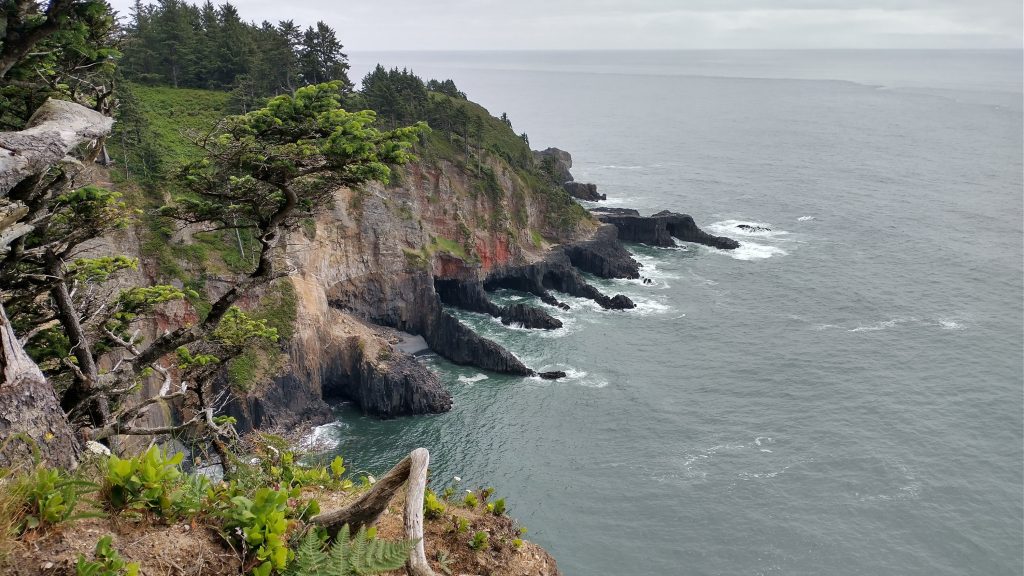
I walked up Falcon Cove Road to rejoin the OCT trail, paralleling 101. Eventually the trail broke to the west and led to the tip of Cape Falcon. A side trail led to a sheer cliff and view down to a small cove. I studied the shoreline from high above…there was definitely no clambering around these points, even at the lowest of tides. Deep sea caves were carved into some of the rocks. I loved gazing at the rugged topography, imagining myself exploring such coves with my kayak. The trail wrapped around to the other side, passing through some very dense and overgrown vegetation. I stopped at nearly every lookout, eating up a lot of time.
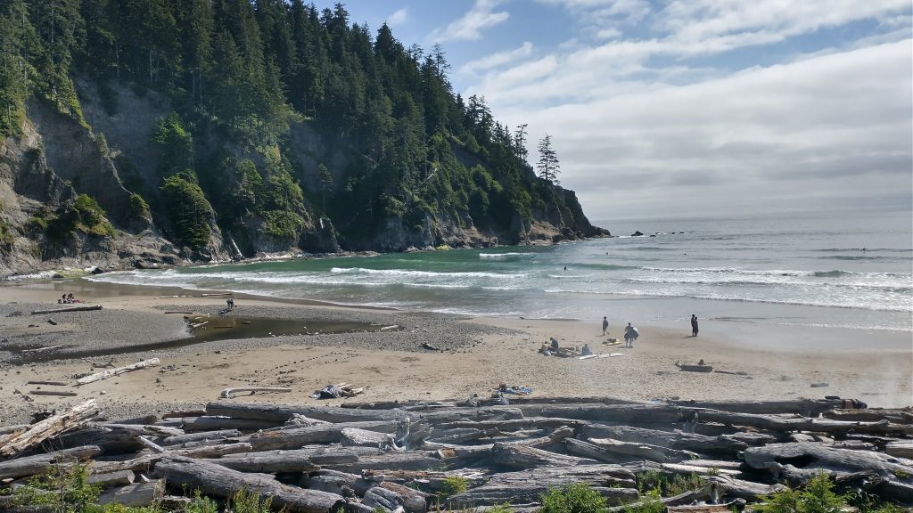
I had a very rough plan for the rest of the afternoon. I could stop short of Neahkahnie mountain, stealth camping somewhere around Sand Beach. But I preferred to go the distance and perhaps find a stealth camp near the top of Neahkahnie. Continuing all the way to Manzanita would entail a huge day, but it was still a possibility. I kept moving and started to encounter a few day hikers. Thus far, many of the beaches had been quite busy but the trails had been deserted. There was a lot of activity around Sand Beach, so I didn’t linger. There used to be a campground but it was closed when a tree nearly fell on some campers. It was a very pretty beach, one I’d like to come back to someday.
Coming to Necarney Creek, I found that the bridge had been taken out by a giant tree. I spent 2 minutes trying to decide what to do, then spotted a tree laying across the creek. Bingo. I had to claw my way off the tree, grasping at roots to lower myself safely. Obstacle # 10? for the day. I lost count. I passed through an elk flat and a side trail to the Devils Cauldron, which I of course had to take. Around 5 pm I came to a crossing of 101 and the start of the climb to Neahkahnie, the highpoint of the OCT. The smart move would have been to hitch into Manzanita and continue the trail in the morning. I’m not that smart, so I pushed on. I was already very tired and it was getting late. At least 6 miles and 1600′ of climbing remained. It was such a tiring climb, steep in a few places so I stopped briefly to pick salmon berries here and there. I’d dawdled too much for such a big day but was kind of committed once I started up. There weren’t many stealth camping options, plus just as I neared the top, the fog rolled in. My main reason for heading up the mountain in the afternoon was because it had finally started to clear and I wanted to take advantage of the views. Oh well.
I blew past the viewpoint at the top, as there was nothing to see. At least it was all downhill from that point. I crossed a dirt road, which probably might have worked for a stealth site. But by now, I was starting to look forward to the ease of staying in town. I had an offer to stay at the beach house another night and this seemed like the perfect circumstances to take the offer. I was so utterly exhausted, I wanted only a hot shower and meal, then to crash into a bed. Every trail has its few extremely hard days and I hoped this would be the worst for this trail. I’ll note again, this was all of my own doing. The last few miles were on an extension trail, paralleling the highway. The trail builders had done a good job to run it all the way into town, not just a benefit to thru-hikers but also the community. I met a local couple walking their dog, so it was nice to see the extension being used.
At the edge of town, the grocery store and a Thai place were a sight for sore eyes. I put in my restaurant order and shopped for some supplies. I was so spent but I still had more than a mile to go to the house. I considered trying to hitch but it seemed like more trouble than it was worth. I stumbled through the door well after 9 pm and it was all I could do to finish off the chores of eating and washing. My goodness, what a tough day…and so much fun.