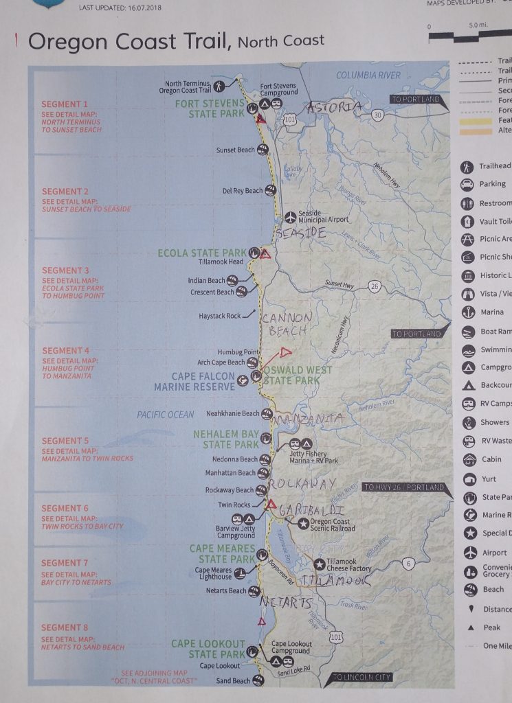
Thursday, July 6th, 2023, 0715-1900
Sunset beach to Tillamook Head Backpacker Camp.
16 miles, Gain 1365′, Loss 600′, elevation 780
I slept like a total rock, it was so amazing. I was finally on trail, so my mind was at peace. The distant hum of the surf drowned out all else. I heard nothing until the lovely birdsong in the morning. I noted some thick fog right away, but it didn’t feel very moist or clammy. In fact, I thought I was completely dry until I felt my tent walls. Yep, it was condensation nation, but mostly just on the outside. This was not surprising to me, given my location on this notoriously moist coast. But I was hoping for a miracle under the pines. Instead, they were collecting the fog and dripping on me. Still, I was so grateful for my beautiful little spot, completely protected from view, at least. I felt comfortable sleeping in a bit and lingering to calmly sip my coffee. I was in no rush this day, as I only needed to go 16 miles (to account for camping and tide restrictions).
Once I left the pines, I realized how much shelter they had provided from the fog. I immediately felt tiny water droplets gathering on my body and had to put on my rain jacket. It was like a very slight drizzle. The beach was very low visibility but even still, vehicles were whizzing by so early in the day. I entered the highway, with no lanes or markers, a free-for-all for drivers. Since I had no control over their trajectory or speed, I decided not to worry about them. It’s like when I’m kayaking around motorboats, they go so fast and have more maneuverability, I have no choice to trust that they will not run into me. So the vehicles streamed past and I ignored them. I imagined that some drivers might be irate that I dared to walk their beach…what nerve! But mostly everyone was courteous and gave me a wide berth. Most were also appropriately driving slow in the fog. I guess they had to worry about getting hit by other vehicles too.
The last bit of beach leading to Gearhart was off limits to vehicles, but I still saw one truck driving past. It had some state seal, so was probably an official beach patrol making sure other cars stayed out and/or monitoring something. I also saw a stuck SUV at the last road over the dunes. Vehicles needed a running start in order to maintain momentum through the soft sand, otherwise ooops! I smiled to myself at the vehicle’s predicament, a small victory for footsteps over mechanized wheels. Is that petty? Maybe so but satisfying nonetheless.
I had to leave the beach to get past a small estuary and outlet, the first of many yet to come. It was a very pleasant walk through the quaint beach town. On the guidebook’s advice, I took a short path leading behind some houses. It was like walking through the backyards of cutesy cottages in England. Most structures on the Oregon Coast had wood shingle siding, giving them a very rustic and charming appearance. Such material had its downsides, as my hosts found out the hard way at their beach house in Manzanita. A neighbor had just hung a crystal in a window and the concentrated beam of sunlight caused a reflection burn through their wood shingles. They were lucky it didn’t set the house on fire! Who knew such a thing could happen???
I reached my first hwy 101 road walk, but only had to go half a mile before turning onto a side street in Seaside. The guidebook did a good job of routing hikers onto quieter side streets as much as possible, to avoid 101 at all costs. It’s the major thoroughfare along the entire coast, connecting most of the small towns and harbors. It’s also known to motorists as a scenic drive. Thus it’s one of the busiest highways, especially in the summer, often congested with RVs, motorcycles, rental cars, trucks towing boats, and logging trucks. Unfortunately, it’s sometimes the only way for an OCT hiker to get from one beach to the next when a large headland or inlet stands in the way. But at least the northern half of the OCT had relatively little 101 walking.
From there I headed to the library, wasting several hours on the internet. It was nice being in no hurry…I could get used to this type of hiking. After, I went to Safeway to get some items for dinner (packed out a tray of sushi because why not?) and then had a huge burrito at a taco shop for $8. I’d heard that things were very pricey on the coast, but so far I’d found food to be pretty reasonable. I knew I’d be spending a lot more on food this trip, given all the convenient restaurants and cafes along the way. So my strategy was to compensate by spending less on hotels. I could take hot showers at the hiker biker camps for much cheaper. Lodging’s by far the most expensive spending category on a hike, and without a partner to split the costs, it can take a huge cut from a budget. I rationalized that I could have 5 to 10 yummy meals for the cost of one hotel bed… priorities!
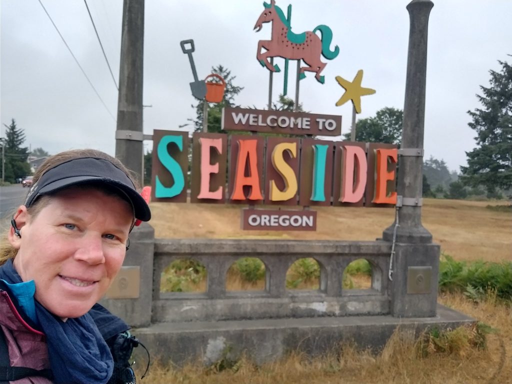
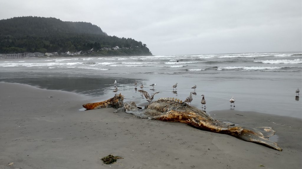
In town, I saw a funny hand-painted sign that read: “No soliciting. We are broke, We love Jesus. We know who we are voting for. Unless you are giving away beer, GO AWAY.” I also admired all the kitschy beach shops, swan-shaped paddle boats for rent, and the Lewis and Clark “End of Trail” monument. Some white dudes made it all the way to this point many years ago…but only because a smart Native American woman showed them the way. Naturally, Sacajawea wasn’t pictured in the monument…go figure. I continued on down the beach, finding a small gray whale carcass. Earlier I’d seen a dead male sea lion washed ashore. Despite the smell, the marine biologist in me required a closer inspection of each. I’m also an expert beach scavenger. It’s one of my favorite pastimes…and now I turned it into a long distance hike!
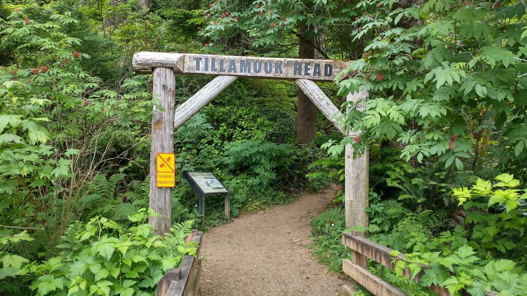
In the distance, I set my sights on my destination for the day, Tillamook Head. It’s the first prominent headland that a hiker comes to on the OCT going south. The only option was to go up and over. Headlands at least made for a nice change in pace and scenery from the sometimes monotony of beach walking. This was where things truly became a trail, moving through lush coastal forests of Sitka spruce and western hemlock. Most of these headlands were protected from logging and had old growth forests, so I was walking among some giants of the tree world. Many of the spruce were 6-10 feet wide! The trail was soft and loamy but got pretty boggy at the top. My new shoes quickly became covered in mud…oh well.


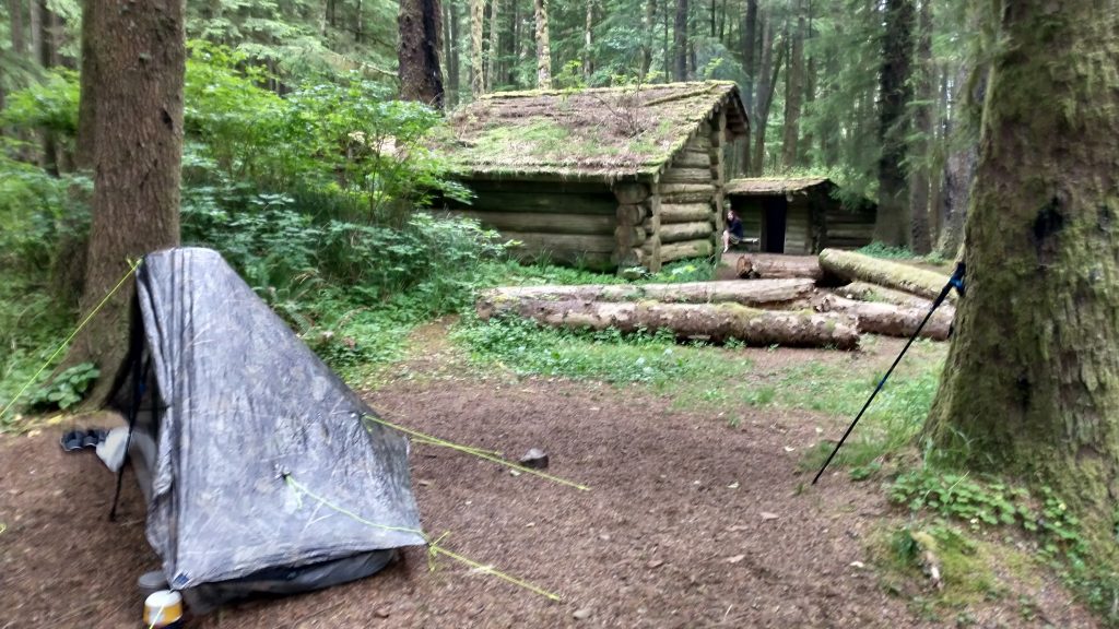
I climbed over 1,200’…just because I was hiking along the coast didn’t mean it was flat. The trail was also quite overgrown in places. It wasn’t anything I hadn’t easily dealt with before, but I could see how those new to hiking might find it difficult. In several places, social trails led off the wrong way. My GPS kept me on track, because there certainly weren’t blazes or markers regularly. At last I reached the designated backpacker camp, one of only a few on this trail. It was complete with 3 AT-style shelters, a fire pit, toilet, and covered picnic tables. I considered a shelter for about half a second, then pitched my tent in a perfect flat spot nearby. I needed to dry it anyway and the shelters were reported to be ridden with mice. There were 4 youthful and exuberant campers sitting around the fire: Veoko, Olivia, Tim, and Erin.
Olivia was German and had been hiking the PCT for a spell. Her visa was about up and she wanted to see the coast before she had to go home. She walked with me to check out the high bluff overlooking Tillamook Rock Lighthouse, which sat 1.2 miles offshore. From the guidebook: “Also known as “Terrible Tilly,” this deactivated lighthouse was officially lit in 1881 after 525 days of harrowing construction, making it the most expensive lighthouse to construct and maintain on the West Coast. It earned its nickname due to the variable weather conditions and treacherous commute, not to mention the isolation the keepers were forced to endure. Due to the cost of maintaining it, the light was deactivated in 1957, and it is now a refuge to more than 12,000 nesting birds. Near the viewpoint you will also find a World War II bunker that is being reclaimed by the forest.”
Once again, it had been a full day of ‘touristing‘ and I was famished. But I still stayed up late to hang with my fellow hikers. They had all come up from the south side, a mere 1.5 miles from a parking lot. I wouldn’t be seeing them again but it was fun to be in the company of hikers that weren’t all thru-hikers like myself, much like many of my shelter experiences had been on the AT. I retired to my tent in the forest, surrounded by the huge trees.