Wednesday, July 12th, 2023, 0540-1700
Pacific City to Fogarty Creek
21 miles, Gain 1400′, Loss 1400′, elevation 200
I forgot to acknowledge that Pacific City marked the roughly 100 mile mark on the OCT…hence my expensive celebratory dinner the night before. At least I’d been saving money by mostly stealth camping. My first campground stay ended up being pretty good, especially because of the camels and bunnies. There must have been about 50 bunnies, all various colors and sizes. I was a little worried about them chewing on my stuff, which is why I didn’t set up until late, then packed at first light. I tried to catch a few but as you might imagine, a lot of kids had the same devious thoughts, so the buns were consequently quite wary and just fast enough to avoid my grasp. But I did get to stroke one as it bounded away, so that sort of counts as a petting, maybe? (If you’re familiar with my other hikes, you’ll know that accumulating a list of animals I’ve petted along the way is a theme of mine…this year was off to a record start with first-time pettings of a giant tortoise, camel and bunnies!)
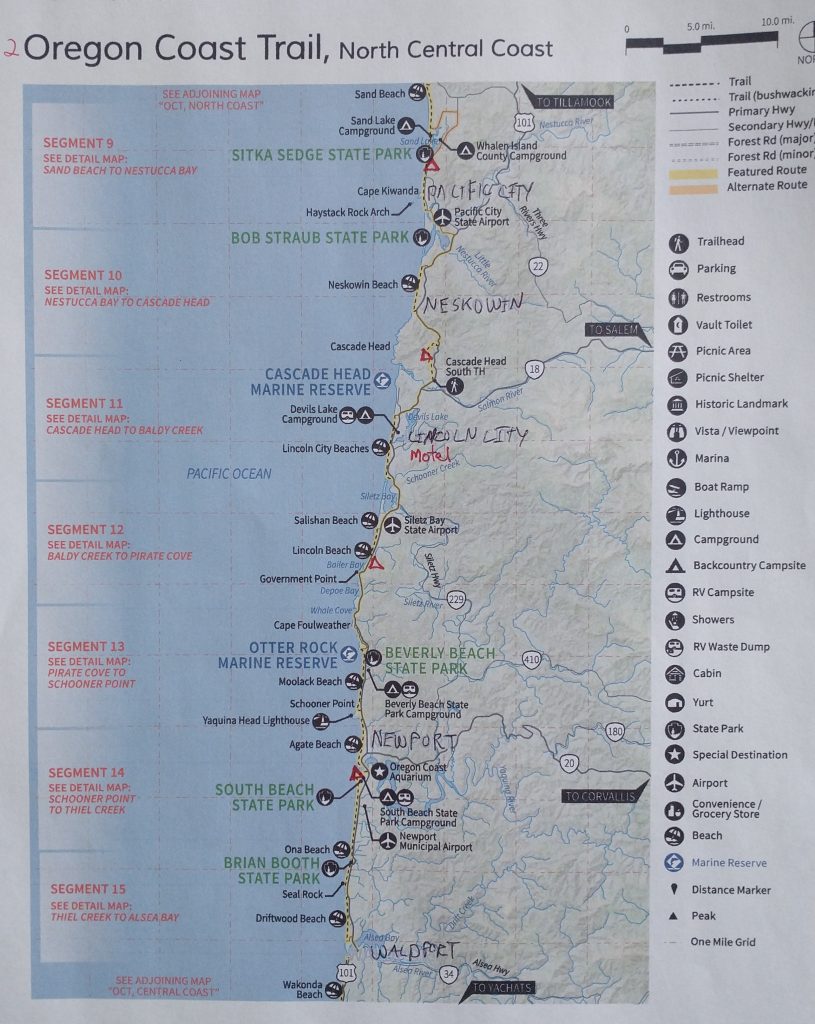
Coming up short on catching a bun, at least I caught the early morning bus at 0540 am so that I could skip about 6 miles of road walking. The detour was necessary to get around Nestucca Bay (missing a beach spit through Bob Straub State Park). I had exactly 4 quarters left over from the shower and the bus was only $1, so it was an excuse to get rid of weight. More importantly, I didn’t have to walk miles on HWY 101. This was the first place I broke my footsteps on this trail, but I was ok with doing so. Technically, I broke them when I got 2 boats rides across inlets on Day 4. The OCT is not a trail that need be taken too seriously and purists will probably feel frustrated by the myriad of logistics, costs and planning needed to connect footsteps, plus a little traumatized by a few highway stretches (Heceta Head tunnel). But HYOH.
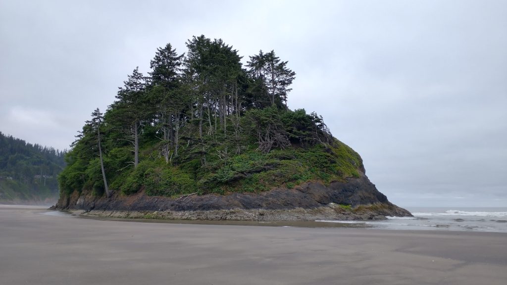
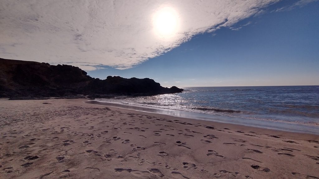
In all honesty, the road walk probably would have been fine, but the bus was just so convenient. The driver kindly dropped me off at an unplanned stop (intersection with Winema Rd) at my request. This way, I was able to maximize my beach walking. After about half a mile on the quiet side road, I was back on the deserted beach for another 3 miles, leading south to Neskowin. It was remarkably quiet and peaceful. I watched harbor seals swimming along the shoreline, playing in the waves. One seemed to be following me for over half a mile. I felt like I was walking my dog…here boy! I came to the end of the beach at Proposal rock, another giant seastack just offshore but accessible during low tide. A man walking his dog was very friendly and curious about my hike. Some locals were familiar with the OCT, but it still surprised me when they mentioned it out of the blue. So far, I hadn’t garnered any averted eyes or been treated as though I was off the street. I tried hard to stay clean and present well-enough. The few times strangers tried to hand me cash in the past made me feel really uncomfortable and awkward… I never accepted such handouts. Yogi-ing was one thing, panhandling was another. I hadn’t even felt the need to yogi this hike because food was so plentiful along the way.
The man kindly pointed to the way off the beach. It can be hard to tell which dune trails are private access and which are public. Usually there’s a neon sign with a sequential number for the public trails but not always. I wondered, in the case of a tsunami threat, do private ways automatically become public? No one’s probably going to be sitting around, ready to shoot trespassers in such an event, I hope. Trespassing and private property are an interesting and ever-present dilemma to me.
I took a break in the tiny town, having my coffee and breakfast. I continued on down highway 101 (with a nice wide shoulder) for 2 miles before coming to the Rainforest Trailhead. I’d heard horror stories about this overgrown and unmaintained trail, almost to the point that I was considering avoiding it by staying on the highway. That would have been a huge mistake. I started up the trail and was immediately loving it. It was a beautiful, enchanted forest that felt uplifting rather than oppressive. This had a lot to do with the sun shining through all the gaps, plus heaps of giant salmon berries enticing me to pick them. I didn’t mind overgrown trails when I got a little food reward as a result…if you can’t beat em, eat em!

I also climbed over about 20 or so blowdowns, which honestly felt like nothing after some of the horrors I’d dealt with on other trails. It helped that with my small pack, I was able to slide past the obstacles pretty easily. My crawling and climbing prowess was up to task, enough that I could look past the sometimes tedious spots and enjoy the forest for the whole. I loved the Rainforest trail over Cascade Head!


At the top, I considered taking the closed-to-traffic dirt road out to the end of the peninsula, but noted a sign saying that it was also closed to foot traffic until July 15th. I was only days away from the opening, plus the signs were dated to 2022. Still, I didn’t want to piss anyone off or negatively affect some nesting bird or something, so I stuck with the main route. The south side of the trail really needed a haircut but still wasn’t as bad as I expected. My legs didn’t even get scratched…but my belly did get full on berries! In the last half a mile, I encountered about 7 day hikers, but they were the only ones I saw all day. In fact, I’d rarely seen anyone on these headland trails, feeling like I had them all to myself most of the time. What a joy! It could be because they had a reputation for being muddy, overgrown and rooty…one of the day hikers had already complained to me about this. Clearly none of the haters had ever hiked the AT or PNT before…haha.
Some of the other day hikers told me about a thru-hiker that was resting at the south trailhead. Sure enough, I found Shawn there, an OCT hiker from Denver. We started walking together, glad to have company for another highway stretch. We were immersed in conversation when a truck stopped, offering us a ride out of the blue. I was content with walking the highway into Lincoln City but figured it would be foolish to pass up a freely-offered ride when I also had a male companion (for safety sake), so we jumped in the back. The driver was a laid-back older surfer dude, who we kindly asked to drop us off at the first beach access north of Lincoln City. He replied, “don’t worry, I know just the spot!” To my dismay, he proceeded to drive us many miles through the spread-out town, all the way to the bottom near Taft Beach. I never want to argue with drivers of free rides, plus it would have been hard yelling through the window, so we just went with it. He was so pleased with his choice of beaches and to his credit, it was very lovely, with a beautiful surf break. We smiled widely and thanked him for his generosity.
I parked myself on a nearby bench and went over my options. Because of the unexpected hitch, I missed about 2 miles of highway 101 and 4 miles of beach walking. I felt guilty about the skipped beach miles, but of all the beaches, this seemed like a good one to miss. It looked to be one of the most crowded and commercialized. Shawn decided to hike north 2 miles, as he planned to stay at the Devil’s Lake hiker biker campground. I’d had my fill of noisy campgrounds for a bit and instead had my sights on a Buck30/Steady stealth spot down by Depoe Bay. So I decided to just keep going south from where I was.
By now, it was time for lunch in town! I passed a ton of Thai restaurants during the truck ride, so my taste-buds were suffering from memory recall. I walked the beach for another mile or so until I came to Siletz bay, where I had to turn inland towards town again. Across the inlet, there were hundreds of seals laying on the beach like sausages. They were so cute. Sadly there were no small boats in the vicinity which I could have begged a ride from, so my only choice was to walk HWY 101 for a little over 3 miles around the bay. But because of this, I found the most awesome food truck complex, which had everything a hiker could want food and drink wise, but unfortunately no outlets or wifi. Oh well, you can’t have it all! I got an order of pad Thai and a coke, which really hit the spot. I did some phone stuff and lingered too long, as always. Back on the road, I dealt with another few miles of 101 around the bay, but at least it was very scenic looking out over the estuary. There was also a pretty wide shoulder, so I found it to be low stress.
Shortly I cut to the beach on a semi-private gravel trail past a golf course. The guidebook said this was only an option if you were a guest of the resort but I’d just met a NOBO woman who had used the trail and reported it to be great and no problem. Perhaps we both took advantage of our white female privilege but it was worth it, as it got me onto the beach about a mile before the first public side road. Of course, no one even glanced at me as I strode by, confident in my purpose. Thanks for the great tip Pancake! She was the NOBO hiker and we chatted for a bit about trail stuff. Wish I could have got to know her better, as she seemed really awesome. She was going NOBO because she’s from Washington and it’s nice to walk towards home…though she did acknowledge that heading into the typically daily NW wind was a pain. That’s why the guidebook strongly recommends a SOBO hike…I of course concur…SOBO for life!
The longer beach walk was perhaps not as great of an option as I thought it would be. For the first time, the tide was rather high and the shoreline very slanty. I kept alternating between the harder-packed slant and the soft top sand. The tide came up high enough that I had to outrun the creeping waves pretty frequently. All part of beach walking I guess…I’d almost had it too good, thus far. Though it caused my hip to start hurting, after so much off-kilter walking.
I reached the end of the beach at Fishing Rock just as another apparent NOBO hit the sand. I don’t think she saw me since I was headed in a trajectory for the rocks, to sit and make my dinner. That made 3 OCT hikers I’d seen or met this day. Same as the day before and a total of 11 altogether. Dinner was good, watching the waves roll in. I headed off the beach and into a state park that was designated for day use only. I cleaned up for the night in the bathrooms, then quietly strolled up a dirt road into the National Forest boundary. I went almost half a mile in, up to the top of a hill where there was a water tower. I’d gotten a hot tip from Buck30’s blog about this spot. Sure enough, it was a great location, far enough away from the traffic noise of 101, virtually assured no one would bother me since the road was gated below. I didn’t see any ‘no trespassing’ signs, so that was good also. Most National Forest lands are open to dispersed camping. Of course, I made no fire, left no trash, and even roughed up the grass where I’d been the next morning…no trace! It was a nice, peaceful night….but sadly without camels.
I also just wanted to highlight what a diversity in methods of travel and surfaces/environments I passed in one day. I calculated that my total distance covered on the OCT came to around 35 miles, but I only actually walked about 21 miles. I took a bus for 6 miles and also an unplanned hitch for about 7 miles. I walked around 6 miles on HWY 101, but only in 3, 2, and 1 mile increments. In between, I walked about 8 miles on 3 different beaches and 6 miles of quiet rainforest trails over Cascade Head. Plus don’t forget the half mile or so through a golf course.
I also passed through 3 or 4 little towns…hard to say since the area around Lincoln City was so spread out. I stopped at a general store/cafe and food truck complex to get snacks/meals. I finished the day with a backpacker meal watching the sun sink into the ocean and a stealth site outside a State Park. The guidebook was such a huge help in figuring all this out! There was so much variety to the day, it makes my head spin reflecting back on it. But this was what many days on the OCT were like. With so many twists and turns, the one thing I could guarantee is that everyone’s experience will be quite different from mine. What a whirlwind of a trail!
I live a sheltered life in Silver City! What is yogi-ing?
Begging for food, as in Yogi the bear
Thanks, Ms. Twig. I’m thoroughly enjoying your postings. How far south will this trek take you?