Friday, July 28th, 2023, 0630-1850
South Crescent Beach to Flint Ridge
24 miles, Gain 3000′, Loss 3000′, elevation 480′
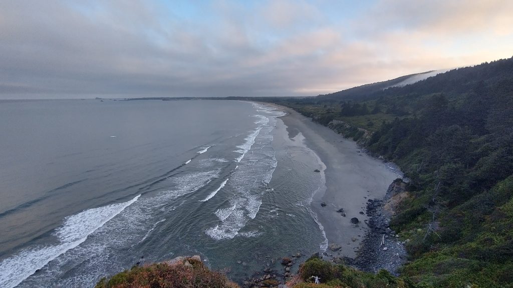
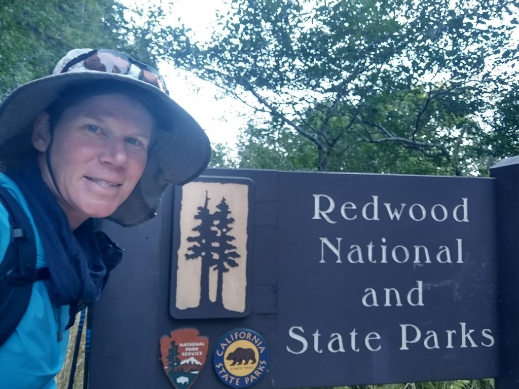
Amazingly my tent dried over night, even though I could hear the surf just below, I was that close to the ocean. I walked the trail to an overlook of Crescent Beach, so beautiful in the early morning. I entered the park and began a climb into the hills and through the amazing redwoods. The trail leveled off on an old road that was barely recognizable, except where there was a remnant painted line on the pavement below the duff. It was a very pleasant stroll, flat and open so that I could stare up at the trees rather than down at my feet. I had the trail all to myself except a few spots where the highway allowed easy access.
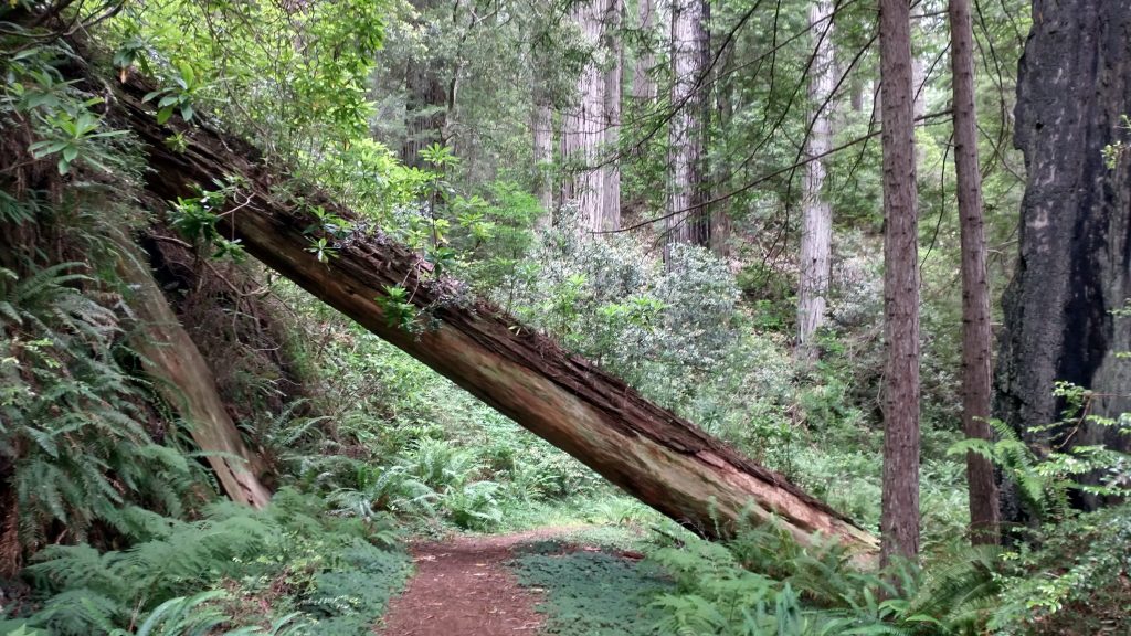
I crossed the highway and had to consult the gps to find where the trail resumed. Compared to the last, this section was in pretty bad shape, with some blowdowns and overgrowth. When a redwood fell on the trail, it created a pretty significant obstacle! The trail wound in and out and up over a ridge, very sinuously. The forest was very peaceful and again, I was all alone. I came to the first backcountry campsite in time for lunch. I should have read the description better, indicating that there was no nearby water source. I’d neglected to collect water at a tiny spring early in the morning and I didn’t see any more the rest of the day. Despite not having much water, I cooked one of my extra dinners. The campsite was empty and not that great. I expected it to be in the Redwoods but it was surrounded by deciduous trees, instead. Still, I can’t complain about having a picnic table to sit for lunch.
I didn’t have much of a plan for the day, going with the theme of winging it. I took a long break but eventually the cold got me moving again. It was still foggy and quite chilly. I shivered as I started down the hill, taking a shortcut to the highway and a viewpoint. The trail ended just ahead of Wilson Creek Beach, where I briefly walked the beach to pick up where the trail resumed on the south end. I had trouble finding it, overshooting and walking the beach too far. I missed having a detailed guide book about this section. Bonnie’s guide to the OCT was extremely helpful. All the little pointers about how and where to find trail segments, low tide restrictions, etc made the trail so much easier. Also, of particular importance, was where to find water. I needed some and had no idea where the next source might be. I should have just asked for some from the beach goers but stubbornly pressed on. Surely there would be some small coastal streams through the headlands ahead.
The next section followed the high bluffs, up and down relentlessly. It felt a little like the Boardman Scenic Corridor but not quite as bad. There were great views of the coast along the way and the trail was in pretty good shape. It was like I was back on the Oregon Coast Trail… my extension of it, at least. The sun reappeared and now I was hot and thirsty. None of the little watersheds had water until the very last, but it was too far down and bushy to easily get to. I’d been paranoid about poison oak for the past week, so was reluctant to bushwhack. Just then a man with a cute border collie came along. I’d passed him earlier, startling his dog, who had barked at me. But she was friendly, just as surprised as I was to bump into someone was all. Greg offered me some of his water from his car, which was just ahead at the trailhead. I hadn’t realized that there was a pretty long road walk from Requa point to where the trail resumed on the other side of the Klamath river. So Greg also offered to give me a ride, which suited me just fine (note my miles listed for the day only include the miles I actually hiked, as always). He drove me all the way to the other side of the river and stopped at a RV park so that I could top off my water for the night. The manager was very nice to let me fill up and buy a coke for my pit stop. I thanked both him and Greg for their kindness.
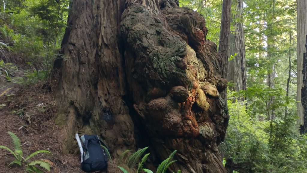
The ride gave me quite a jump-start past where I thought I’d get for the day, so I decided to take the coast trail over Flint Ridge to the backcountry campsite on the other side. Since I was loaded down with water, I left my plans open to stop early before the campsite, if a good stealth spot should present. I passed a lake and started climbing. The underbrush was so dense and the terrain so steep, I shortly realized there would be no good stealth sites. These last few miles really wore me down, as it was probably the most overgrown trail in awhile. But I did pass by some more grand redwoods, one in particular that had a massive burl. I gained a fair bit of elevation and then dropped it.
I came to the official campsite and took the first site that was open. There were perhaps 4 other groups for the 8 site area, plenty of room. I admit that I hadn’t made a reservation online but didn’t feel too bad, since permits were free and it was late in the day. I was fairly confident that there were extra sites this night. Like the Demartin campsites, I found the Flint Ridge sites pretty lacking. The picnic table was broken and leaning and the mosquitoes were annoying. Mostly, I just didn’t like that this was considered a backcountry campsite when it was less than a quarter mile from a road. I was definitely the only one staying there that had actually hiked in. Everyone else had driven their cars, parked, and dragged their items a little ways up the hill. I could hear someone’s car alarm going off for awhile…not very backcountry in my book. Still, I guess I shouldn’t complain that I had a safe and free place to stay in the park.