Monday, Oct 9th to Wednesday Oct 11th, 2023
Total distance: 45 miles
You can watch Worm’s accompanying video here.
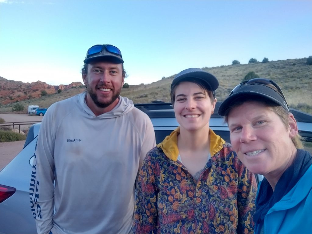
To celebrate finishing the Hayduke, we walked down some MORE canyons! This was all thanks to Worm, who scored us some last minute permits and also provided his wheels to get us to the hike. While I’m at it, note that most of the pictures posted here are also his…basically if I’m in the photo, he took it! I also must thank our Hayduke cohort, Sky, who shuttled us from Lees Ferry to Wire Pass trailhead so that Worm’s van would be waiting for us at the end of the hike. Sky’s impeccable timing meant that they just so happened to be on the way back from the North Rim to meet up with Leah, after they went down Saddle Canyon. Sky hiked the rest of the route from the Colorado River, up Kanab Creek and out Hack Canyon in the spring, so this time they just did a loop hike from the North Rim. Leah continued on the full route and Sky was on their way to meet her at the Hack Canyon trailhead. But first, Sky did us a huge logistical favor, plus added to our fun little Hayduke reunion. Sky and I had also met up near Lake Tahoe over the summer, while I was hiking the Tahoe Rim Trail.
Sky delivered us to the Wire Pass trailhead just in time for dinner and to find a nearby campsite next to the wash. This shuttle really set us up for success. We were able to get an early start the next day, beating the crowds at the beginning, and we avoided a costly shuttle/difficult hitch at the end. It was funny to be back to the area I had just been to in the spring and almost exactly 4 years beforehand, when I started the AZT. Even though it’s quite literally in the middle of nowhere, Wire Pass is a pretty popular and busy trailhead. People utilize it for both Buckskin Gulch and the Wave, including the occasional AZT or HDT thru-hiker. It’s part of both routes, though technically the AZT’s northern terminus is a few miles south. On a Sunday night, it was pretty quiet. A few people had set up their tents right in the parking lot, but there were only about 3 vehicles parked overnight.
Let me provide a little more background information about this hike (also see the the map below). It sits on the Arizona/Utah border in the Paria Canyon-Vermilion Cliffs Wilderness. Buckskin Gulch is one of the longest slot canyons in the world. As such, it’s definitely one of those ‘bucklist-hikes’ and pretty renowned…some famous people have even hiked it (read this bizarre and over-the-top trip report about Glen Van Peski and Matthew McConaughey). I realize some people must spend weeks, if not months, planning for it. It’s not a round trip and in such a remote location that there are a lot of travel considerations. Plus, when hiking such a long slot canyon, it’s important to only go in good weather. Several people were killed by flash floods in 2023. This was the main reason I didn’t hike it in the spring, plus I also didn’t have a permit.
That all being said, for us experienced Hayduke hikers, planning and completing this route were like an after-thought, done spur of the moment. I was actually quite surprised that were were able to get permits so easily. I suspect this is not normally the case and that we probably got lucky because of a last-minute cancellation. Permits are limited to 20 people a day and can be applied for here. We picked up our permits the day before at the BLM Paria Contact station located on HWY 89 (along our way), about halfway between Kanab and Page. The package included a WAG bag for each night that we had a reservation (2 per person). Hikers are required to carry out ALL solid waste…so this means pooping in a bag rather than digging a cat-hole. This is becoming a pretty common practice in these sensitive canyon environments of the SW and I support such strategies. Though I’d like to add, there is still almost no regard for the copious amounts of cow shit and carcasses that flow down from upper watersheds. Any canyon that is free of human poop will still be quite contaminated by cows. Boo the Moos.
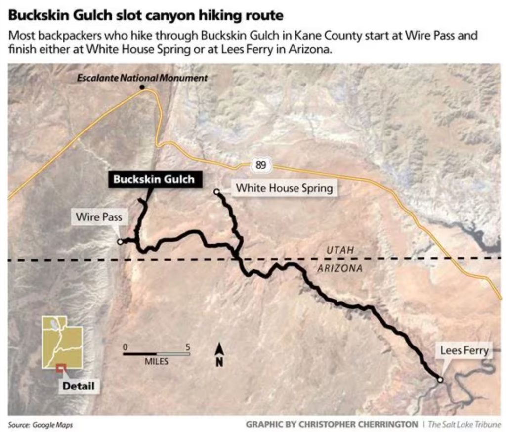
Our hike was 2.5 days over 45 miles…no records were broken but it was nice to be able to take it easy, relatively. I suppose a really fast hiker could do the whole route in 2 days/1 night, but this is the kind of hike that shouldn’t be rushed. There are lots of short side trips and panel hunts. Commercial trips usually go for 4 nights/5 days, to put things in perspective. It’s also possible for Hayduke hikers to do a modified loop hike and to ‘ditch out’ of the special use area in a few spots to avoid needing overnight permits…see Wired’s blog and Jamal’s Across Utah. I walked the first part of Buckskin wash/gulch back in May, all the way from the highway to Wire Pass as part of the official Hayduke route. This time I repeated the 1.7 miles from Wire Pass and resumed the rest of Buckskin Gulch to the Paria river confluence…about 12 miles. From there it was another 32 miles down the Paria river to the Lees Ferry parking lot…which incidentally was where I’d be starting a rafting trip of the Grand Canyon in February 2024. It was fun connecting the dots to all these places…by foot.
Day 1: Wire Pass Trailhead to Big Spring, 18 miles
We woke very early Monday morning to the sound of car doors slamming and people stumbling around in the dark. This is always the problem with camping near a trailhead. A few hikers took a wrong turn and started heading straight for my tent. I listened to their entire conversation and footsteps getting closer…right up to the point where one remarked: “there appears to be a (long pause/confusion) tent? over here.” At least they saw me in time to avoid stumbling over me, my perpetual fear in a camo tent. I was next to a juniper and definitely NOT on the main trail, but there was a confusing network of social trails in the area. The guy asked his buddy: “which way is the trail, left or right?” I replied for him: “LEFT!” It was 4 am and I really wanted them to go away. They bumbled off and not long after, I started packing.
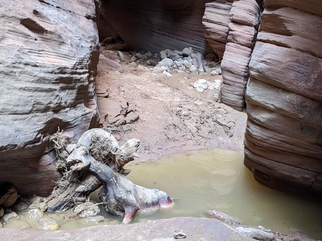
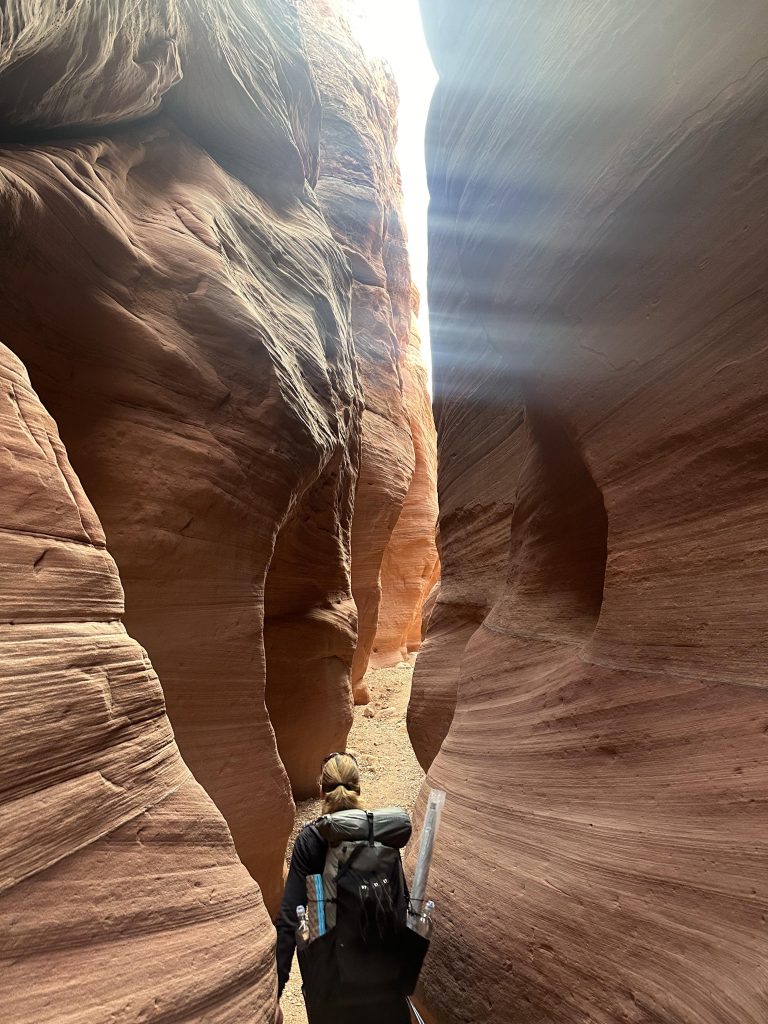
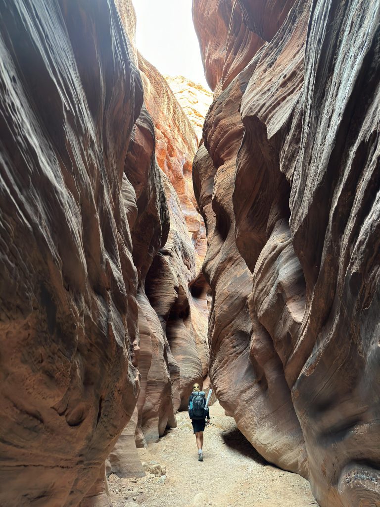
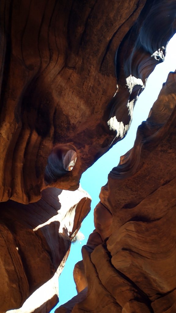
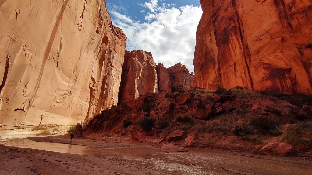
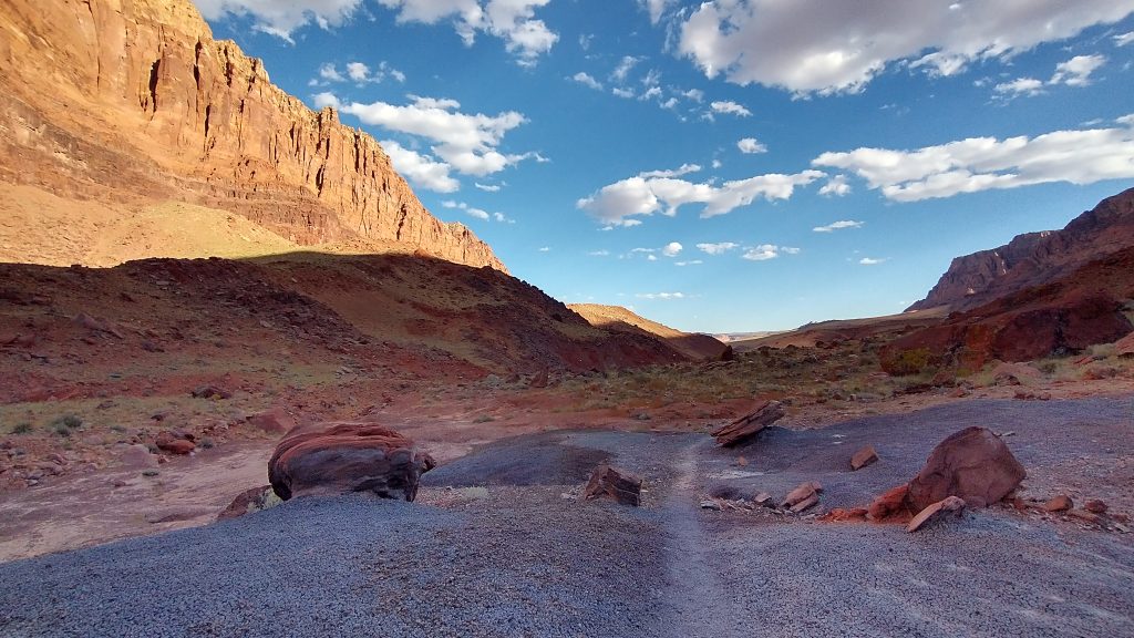
It was fairly warm when we woke, which was good since it was much cooler and shaded for most of the day in the canyons. They were of course spectacular. There’s no good way to describe all the colors, layers and lines. The pictures don’t capture the full essence either. Day hikers can easily access this area from Wire Pass, so go see them for yourself! We saw a few people at the beginning and then only a handful of backpackers further down Buckskin Gulch. We saw only 1 ultra-runner once we were in Paria canyon, so mostly we had the place to ourselves. The going was quite easy in Buckskin, as the canyon was mostly dry. Our friends Leah and Sky had quite the opposite experience back in May: they had to step over the rotting carcass of a bighorn sheep, being careful to avoid the putrid pool of water it was disintegrating into. Head’s up for a very disturbing picture below! Well, at least they didn’t find human remains, as was the case for one unlucky hiker this year (see the newspaper story link above).
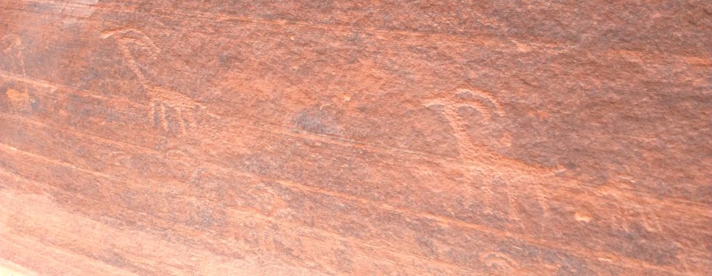
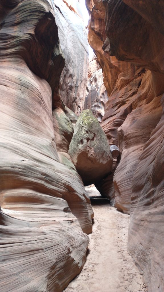
We barely even encountered any mud, and no carcasses, just a few bones here and there. There were also some cool animal petroglyphs…obviously bighorn sheep have been a feature of this area for a long time.
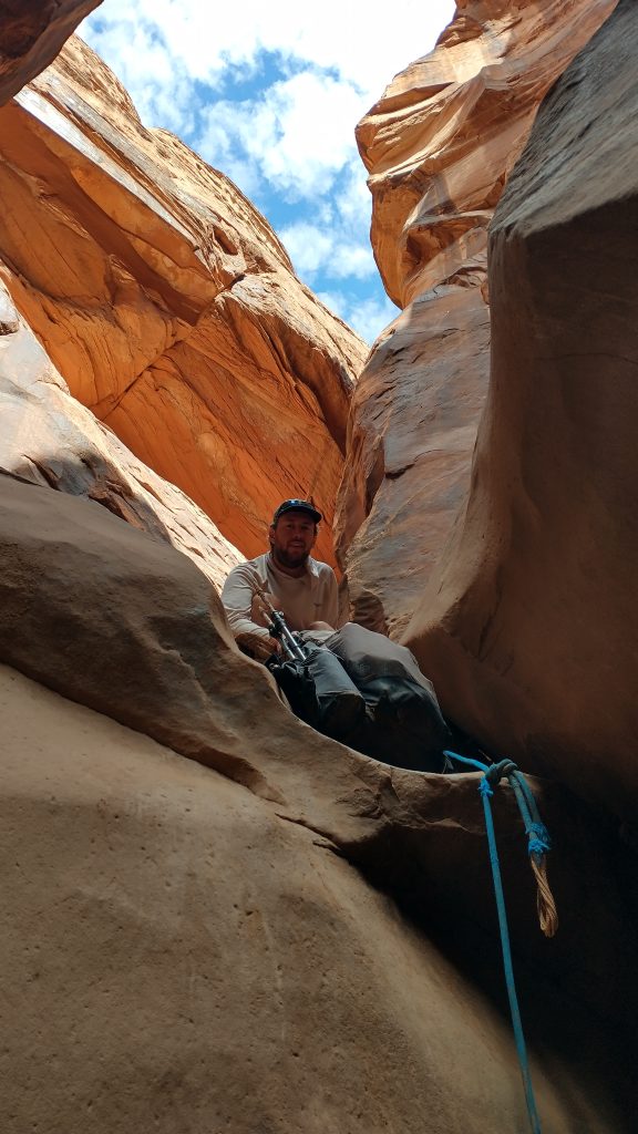
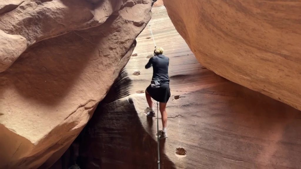
We took a break at the one and only emergency exit point about 8 miles in. I couldn’t quite make out the route…it looked pretty steep. There was a long side trip (about 4 miles RT) to an arch in this area, but we decided against it. I was glad I had a permit for camping in the canyon and didn’t have to do a hairy climb. We had a fun time with the only obstacle requiring a downclimb, a series of rockfalls about 11 miles in. There were 2 fixed ropes that made the downclimb pretty easy. We passed packs and just for kicks, went up and down both ropes. One had a nice series of moki steps.
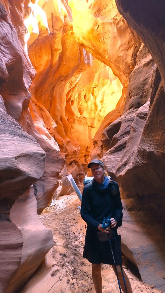
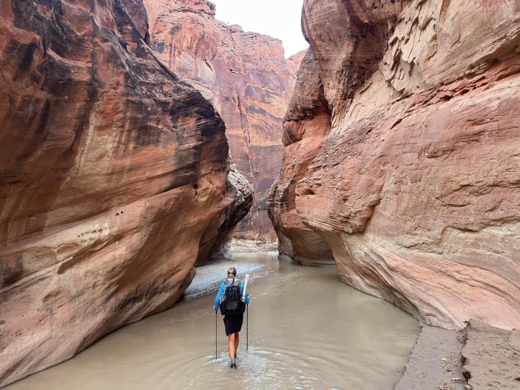
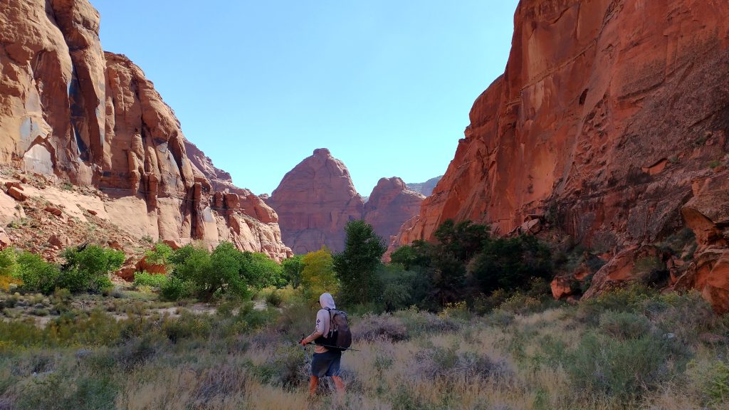
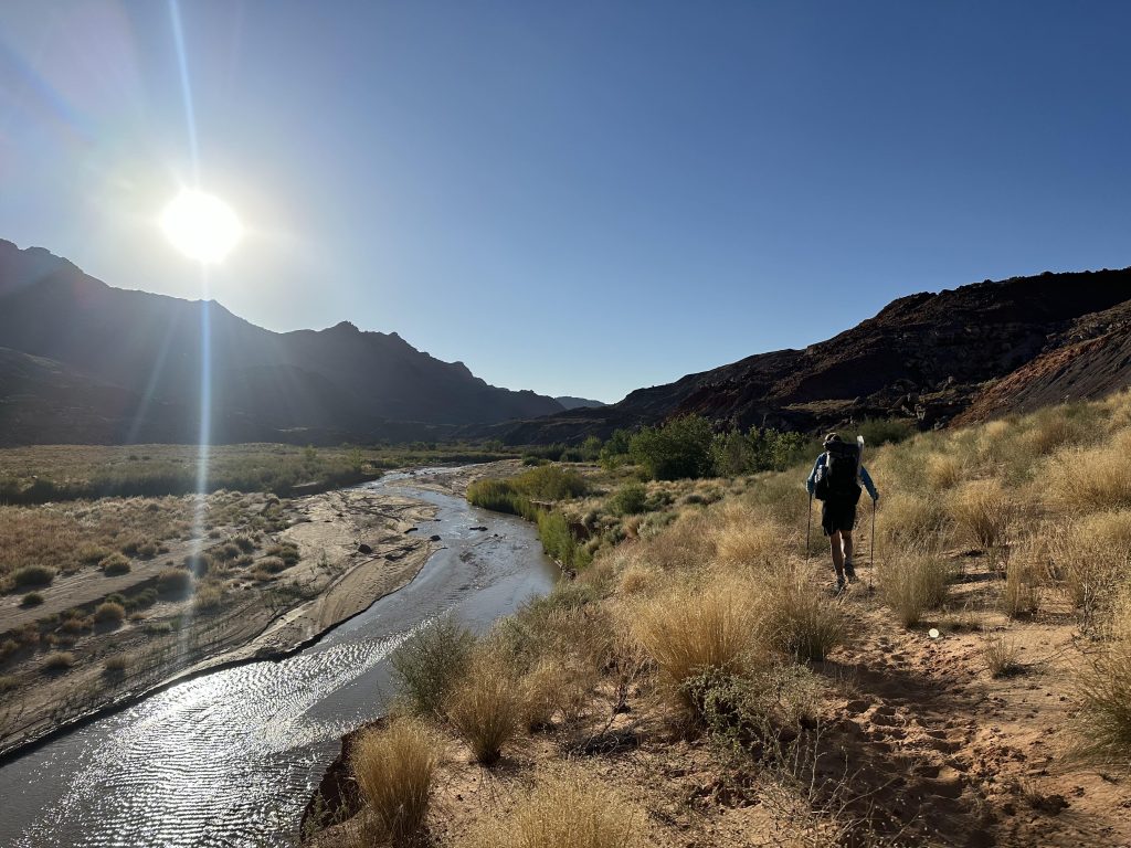
It was nice to travel the full length of both canyons, noting the transitions from one layer to the next. Water started flowing right before the confluence with the Paria River. At that junction, wet feet became mandatory once more. I was kind of surprised at how well the Paria was still running this late in the year, but the depth was very easy, all below the knees. As usual, we had to watch out for quicksand. The canyon really opened wide and the walls were very tall once in the Paria. But there were still some pretty narrow parts, just not as narrow as Buckskin had been. There were also a lot of big alcoves, similar to Muley Twist canyon.
We went down the river a ways, collected some clear water from a side-spring, and took a long and late lunch break near a giant alcove where Sky and Leah had camped. We continued on a few more miles and took another detour to hike the length of a dry oxbow in the river. We dropped our packs at one entrance and circled back. It was a change in pace and had some fun scrambling, but wasn’t totally necessary to the experience. It was simply a feature we saw on the map and thought would be fun to check out. Spontaneous exploration is good now and again.
We arrived at Big Spring just in time for dinner and a nice campsite. Since this was a popular feature, we were worried that there might be other backpackers, but we were the only ones. I guess the permit system works! We collected beautiful clear water that was bubbling out of the ground and rocks, which was a blessing since I sure didn’t want to filter Paria river water…yuck! The campsite on a sandy high bank was absolutely lovely. It was a perfect day. I slept really well, knowing we had another full but chill day just walking down the canyon.
Day 2: Big Spring to just east of petroglyph panel, 20 miles
We took it easy out of camp, not really trying to make miles for once. After a few minutes, I came across a woman and her dog as they were just finishing packing. I caught them by surprise and her huge Leonberger mutt let out a big warning bark. He was just doing what he was supposed to do in protecting her and shortly I discovered he was just a big, sweet baby. I’d seen his paw prints the day before and thought they looked like wolf prints, they were so big. The lady was a river guide and so we discussed the Grand Canyon for a bit (I’d just began talks to join a private rafting group in February 2024). She also mentioned the difficulty she had filling her water containers at a tiny nearby seep, contrary to our experience. I knew what had happened. She’d stopped just short of the main spring, settling for one of the lesser seeps in the area. Often there are several flows within 100 yards of each other. The trick is to find the main spring and not waste time at the small ones. But as water is such a precious resource in the desert, it’s hard to pass up the first you find, especially when you have a dog. You never know if that’s the last you will see.
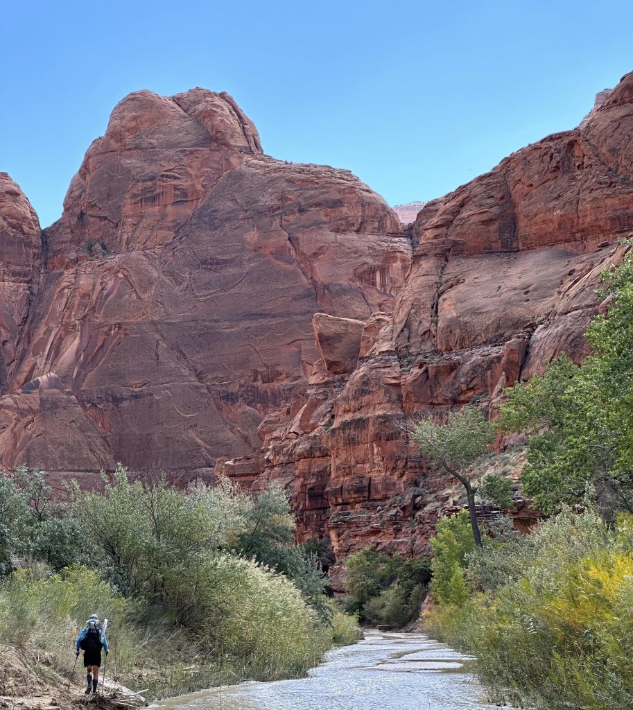
We hopscotched each other through the morning and I enjoyed petting the pup each time. He instantly recognized Worm and me after our first meeting…we quickly became part of his pack, or at the very least, not a threat. Eventually we pulled ahead and the canyon grew ever wider. We transitioned from the smooth redrock walls into a lower, more crumbly layer. The vegetation started to grow thick in places and it became a game of finding the quickest, easiest way. Stay in the river, periodically sinking into the quicksand, or take the short-cuts across the banks, risking a battle with tangled bush. It was kind of slow going in some spots, since a few small water falls and boulders made it difficult to stay in the river bed. It also got pretty hot, but this was easily remedied by splashing in the river.
We came to the Last Reliable Spring (that was indeed its name) mid afternoon, where we had to stop for a long time to refill. Up to that point, the other springs had been very profuse, but this was merely a series of drips. After the other backpacker’s story, I was leery to believe that this was the only source. I dropped my pack and went down the river a ways to look for a better flow. I found none, so finally settled on the first. Worm had already devised a series of catchment devices, so it was actually pretty easy to fill. I just felt bad for the lady with the dog, since she’d have to struggle to collect water again. It was over 13 miles from here to the end, so we needed to carry enough water for overnight and the next morning. I gathered my standard 4 liters, but I wondered how much our friend would need to collect for her and the dog, as dogs usually need quite a bit more water. Of course, they could always just drink the river water if they got desperate. It was possible the remaining distance could take them a full day.
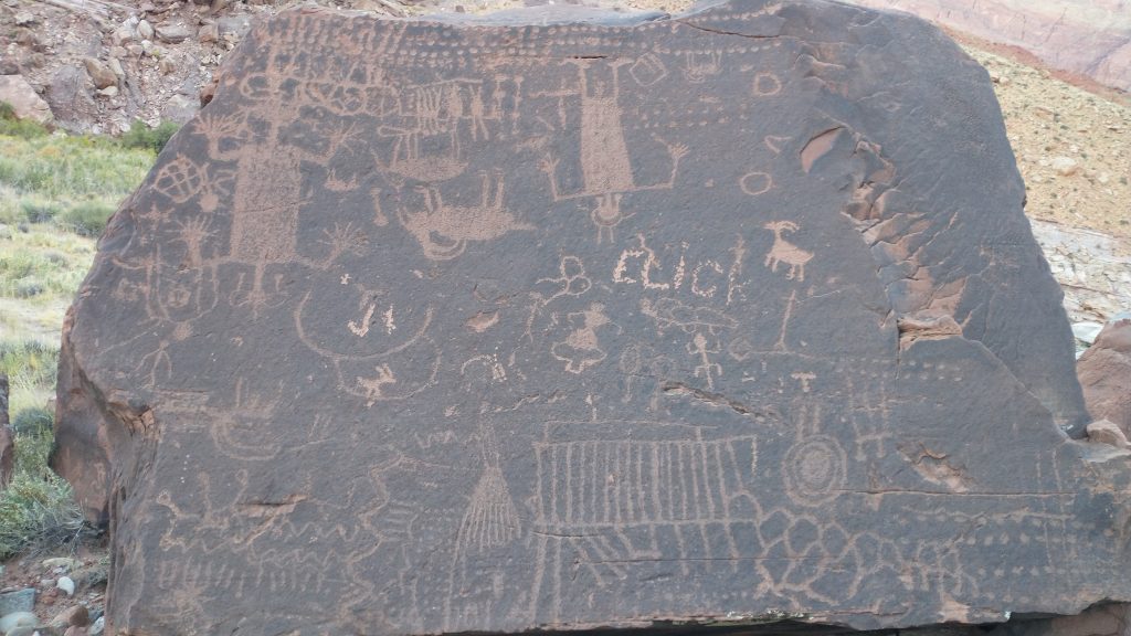
In the late afternoon, we found a petroglyph panel that was listed on our maps. It looked like the boulder had dislodged and rolled down the hill, landing upside down. Subsequent etchings had been made in an upright orientation, some in an apparent attempt to look like the ancient art and others clearly just stupid graffiti…what kind of name is ELiCK anyway? It was an interesting study in real and fake.
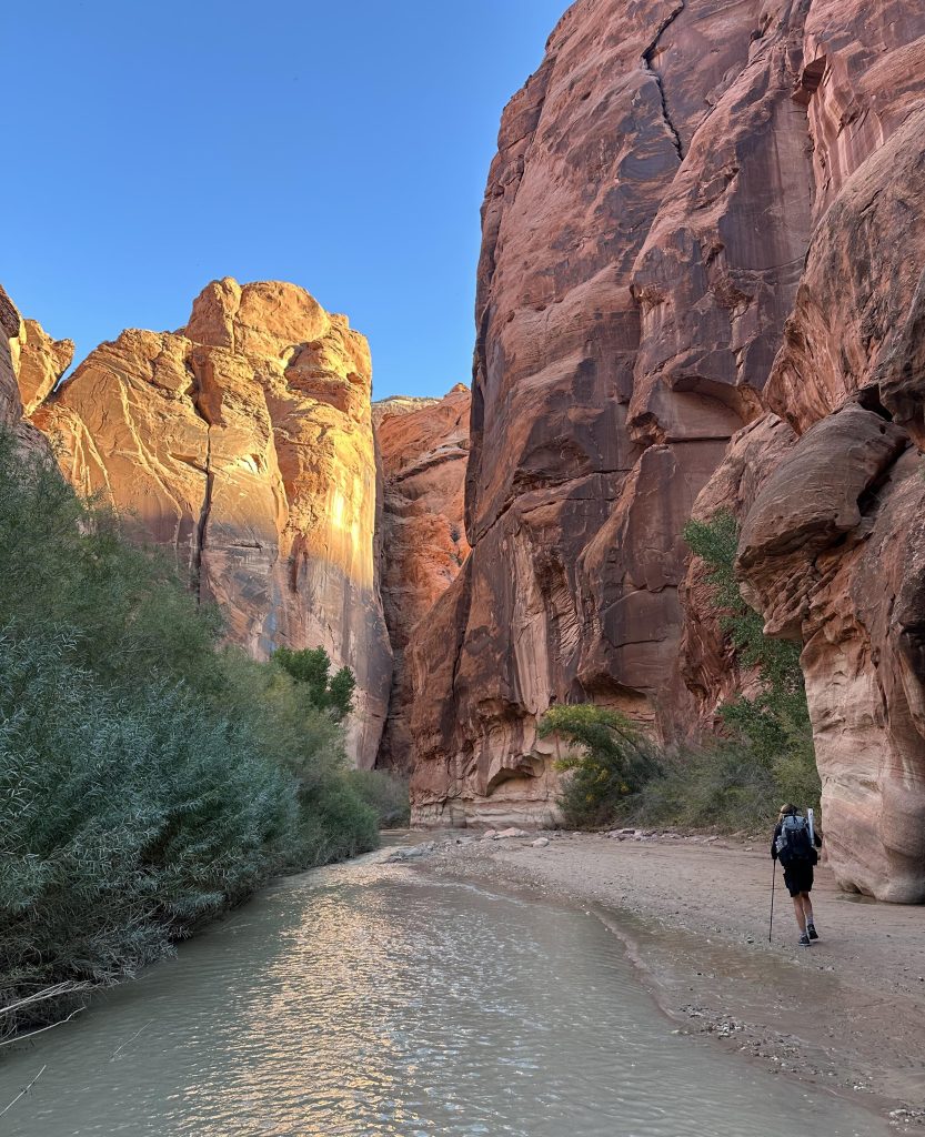
We decided to go a few miles further, by which time a real trail had taken shape. It led high onto a barren bluff and past some interesting geologic features. We descended back to the river bed, finding some nice campsites next to some gnarled cottonwoods. It was so peaceful this night. There was no wind and the temperatures were really mild, kind of like our last night on the official Hayduke in the Barracks. This was officially our last night of the thru-hike overall and it was a great one! It seemed fitting that we were ending on an alternate route but in the setting of yet another beautiful, desolate canyon. Hayduke Perfection.
Day 3: Out to Lees Ferry, 7 miles
This day was just an easy transition back to reality (unfortunately). We followed a real trail for the most part, so the miles went by quickly. The valley became wide and sandy, sometimes choked with tamarisk and grasses.
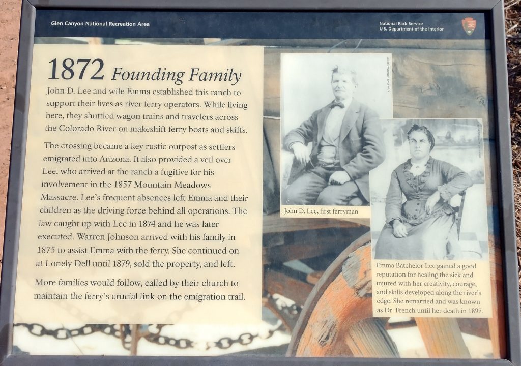
In the last mile, we passed heaps of day hikers as part of some tour group. There were many relics of the historic Mormon settlement, so we paused to check them out. Lees Ferry was the site for crossing the mighty Colorado River back in the days, before all the dams and bridges. It’s the reason the Mormons were able to settle in northern AZ and southern Utah. Lee was a questionable character, whose involvement in the Mountain Meadows Massacre led to his execution. What I found most interesting was this picture of his wife. That was one tough woman to make a living out here, and she certainly looked the part!
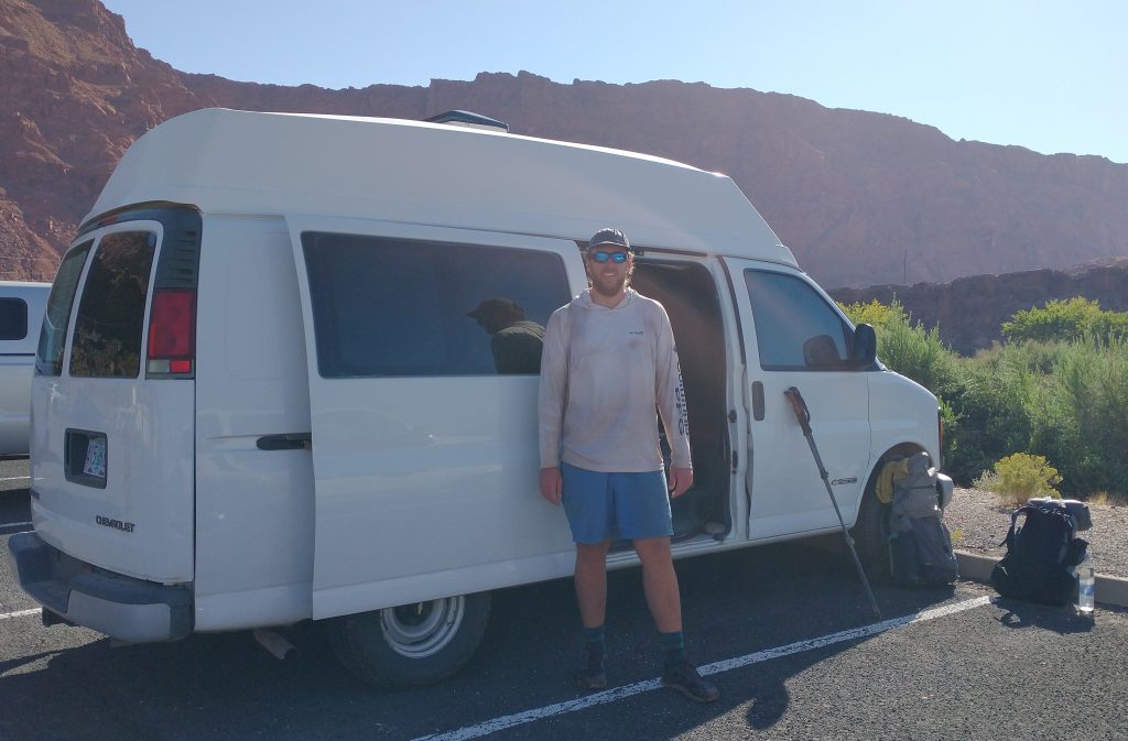
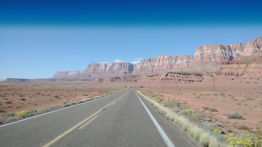
We made it back to Worm’s van, so thankful to have our adventure escape vehicle waiting for us. We got settled and hit the road, driving all the way back up the Kaibab Plateau, past Jacobs Lake and down into Kanab. It think it was my 5th visit to the town in the past year. We went straight to the pizza buffet, where for something like $6 we got AYCE pizza, soup and salad. What a deal. Then we jumped in the van for a return to Zion, eager to visit the Weeping Wall and take our Hayduke Finisher photos. I added them to my previous Hayduke post, but I’ll include a description of our Zion adventures in my next Hayduke Bonus post. This one is already wayyyy too long.