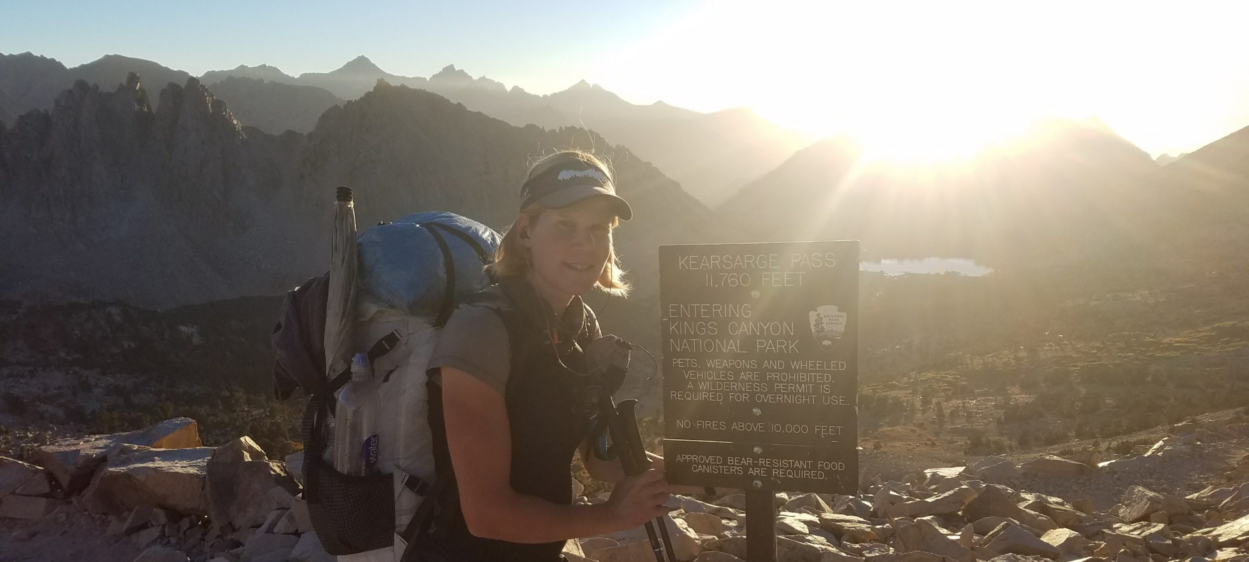
Saturday September 11th, 2021, 0600-1900
2 miles west of Wind Gap to half a mile south of PA Route 309, SOBO AT mm 947
32.5 miles
4764 gain, 4905 loss
Man, what a day, by far my longest on the AT and not something I’d want to do again anytime soon. I didn’t plan my food situation between my next expected town stop very well. After starting out, I realized that I was short one dinner and some snacks. Rather than just hitching to one of the myriad of small towns along the way, I got the idea of having either lunch or dinner at a restaurant that was right on trail. I would either need to slow way down or speed up to align with their 12-9 pm hours. Like the movie Speed, for some unexplained reason I can only speed up. I would need to walk 32 miles in a day, no problem.
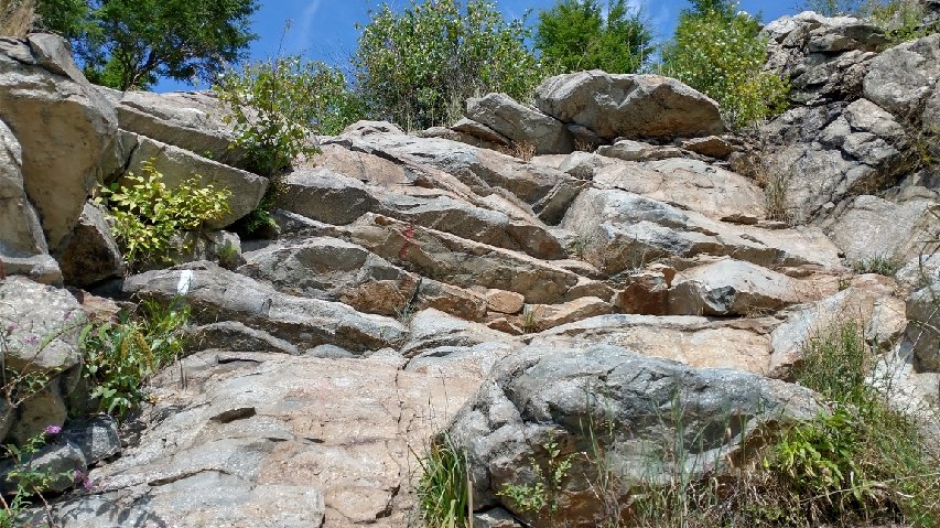
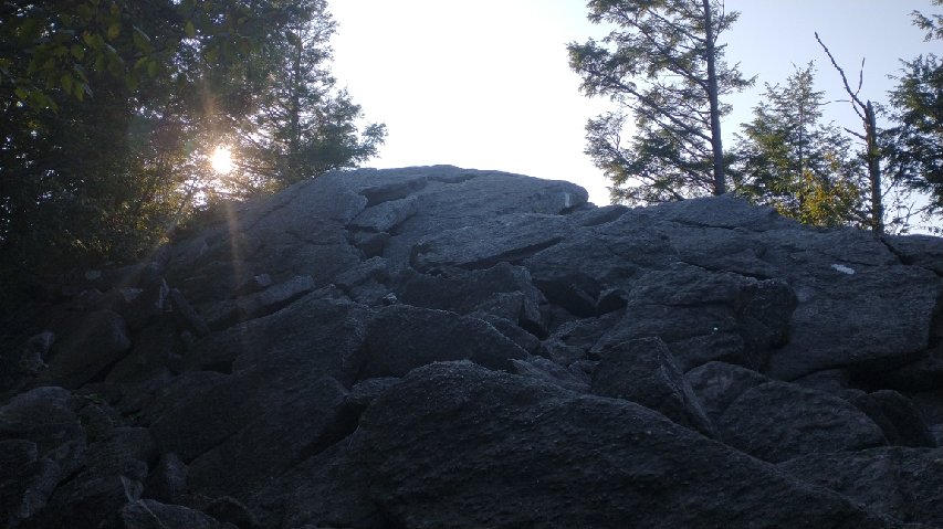
I wasn’t totally committed to this idea at the beginning. Like every day on this trail, I figured I’d just see how it went. I never knew quite what to expect as far as terrain and stops along the roads. I knew the trail would be rocky and was certainly not disappointed in this. Rocky is an understatement where PA is concerned. It seems almost every square inch is dominated by a rock. And so it went with the trail much of the day…which was really not conducive for doing 30s. But I was strongly motivated by food & beer. Luckily it was miles and miles of walking a very straight and flat ridgeline.
According to Wikipedia, the Kittatinny is the first major ridge in the far northeastern extension of the Ridge and Valley province of the Appalachian Mountains. For anyone that’s ever driven through PA, these many SW to NE running ridges stand out as very impressive and a natural impediment to travel. Roads follow gaps and even tunnels to get through them. Naturally, the AT utilizes this most extensive ridge, which stretches for over 150 miles in PA. It’s actually the same ridge I was walking for much of New Jersey, too. The high point is, you guessed it, High Point, NJ.
The day started off at the perfect temperature. I even wore my wind jacket for a spell. I stopped at the first shelter to use the privy, noting a number of tents nearby. I continued to pass tents and hammocks well after 9 am…weekenders with the luxury of just lounging about. At one opening, a guy was cowboy camping next to a fire blazing under a power line. Later, I would see campfires starting by 3 pm. In the heat of the afternoon, I wondered why anyone would want a fire, but I guess that’s how ingrained and integral they are to people’s idea of camping. I hadn’t made a fire yet on this hike and had only partook of a few at shelters and hostels.
Fire rings and stealth camps were everywhere along the ridge this day… definitely an obvious difference from the previous 5 states, where stealth camps are expressly prohibited. Even though I stealth camp a lot myself, I can see why this policy exists. It’s really to limit and confine the number of fire rings and noticeable rock and log alterations (making of camp furniture) along the trail. Fire rings also invite a lot of trash…people burning things they shouldn’t, like cans, bottles, and plastic. With no policy on stealth camping, what you get is kind of an unsightly and excessive mess, a big deviation from leave no trace principles. When I stealth camp, I never make fires and go so far as to throw vegetation over the area where my tent was…no one could ever guess where I’ve been except for the occasional dry spots I leave after it’s rained.
I also noticed a lot of graffiti on all the rock outcrops…what is up with this PA? It’s sad to abuse these beautiful ridges in this way. I hope they can find a way to better manage and educate the public on leave no trace principles because it’s sorely needed in this area.
Mid-day, I walked for miles through a Superfund site. An abandoned zinc mine had left the ridge and surrounding valley a sad mess. Slag heaps were everywhere and the vegetation was only starting to grow back in some areas. The view to the valley showed a large rusted factory surrounded by what looked like piles of coal tailings. It was an eyesore to say the least and a reminder of the trauma these mountains had seen and would continue to experience for decades to come.
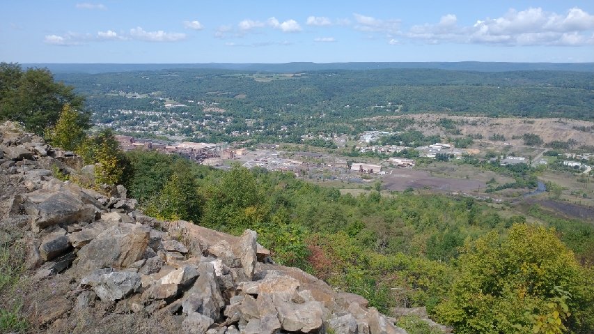
The trail came down through some pretty treacherous rock slag into Lehigh gap. It was noted to be one of the most dangerous rock scrambles on the AT but was no worse than the many in ME and NH. I didn’t like it just because of all the graffiti and general unsightliness of the area. The gap was largely devoid of trees, with a major highway running through. An informational display depicted a beautiful riparian area that looked nothing like the river I was actually seeing. The poor Lehigh river…I can only imagine what kind of heavy metals are streaming through it. I’d been short on water all morning but I wasn’t desperate enough to touch that water.
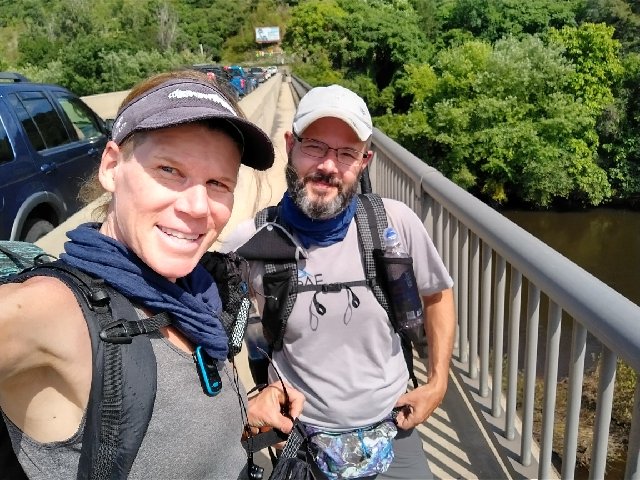
I crossed the river on a busy road bridge, where I met a hiker named Soma. He told me he worked for LiteAF (based in NJ) and had made my fanny pack. He makes all of them for this small cottage company. Ironically, I’d met the company’s founders while section hiking the CT in 2019. It’s a great vote of confidence in outdoor equipment when you see the designers out hiking the trails.
I had lunch at a shelter with a nice spring. The cold water was a relief after the hot and exposed travel through the gap. I noted my mileage was on schedule to make it to the lodge by 6 pm or so. But then the rocks really started kicking in. I went over several big outcrops, including Bake Oven Knob, Bear Rocks, and Knifes Edge. The rocks were very large around these areas, boulders really, with large crevasses in between. These types of rocks were leg and full body eaters if you’re not careful. And sometimes they unexpectedly moved under my feet… surprising for how big some were.
I navigated all these unscathed, only to stub my toe on a section of flat and easy trail…it always happens when you let your guard down. This was the 3rd time I’d tripped on my right foot this day and it was a charm. I had to let out a long shout to deal with the pain. I figured it would shortly go away but it didn’t. I wondered if I had actually done some damage, like broken my toe. I had 3 miles left to go and I limped the whole way, fearful I would stub my foot again. The rocks never let up the rest of the way, which was very frustrating.
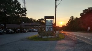
I made it to the restaurant a full hour and half after I thought I would. But I made it. The sun was just setting and I wondered where I would be able to camp. I tried to call to order ahead of time but they didn’t take orders over the phone. A very nice hostess seated me at the end of the bar next to an outlet for charging. This is where they always seat the hikers, it turns out. I asked her about camping behind the establishment under the nice pines, which made a look of concern come over her face. She went to get the manager, who promptly asked me to go put my pack outside, even though there were a number of day packs piled on a bench in the corner where my pack had been siting for almost an hour. I of course pointed this out and he had no answer. He also made it very clear that no camping was allowed in sight of the restaurant. Let’s just say that their usual customers are quite a bit cleaner and nicely dressed, so there’s a lot of concern about negatively affecting their experience.
It was a far cry from the warm reception I always received from the pubs in New Zealand. There they actively invited hikers to camp in the backyards, recognizing that hikers also spent money on drinks and food. But I get that here it’s all about the numbers. There are just too many AT hikers. If you allow one tent and word gets around, it’s all over. In the peak of the season, the restaurant could end up overwhelmed with 30-50 tents. Even still, I was one person with a clean appearance, no odor and a credit card. Perhaps they could make considerations more case by case.
My dinner was pretty good but expensive. I ordered a stout beer…which at least was delicious. I’m not sure I would do it all over again but it fit the bill this day. I stumbled out into the darkness, hobbling down the trail for half a mile until I settled on a passably flat spot in the rocky woods. I had to dig out a rock or 2 to make it work but at least it was quiet and I wasn’t bothering anyone with my unsightly camo tent in the dark. Life of a privileged vagabond.