Twig Adventures

Completing the CO CDT Red Line through RMNP
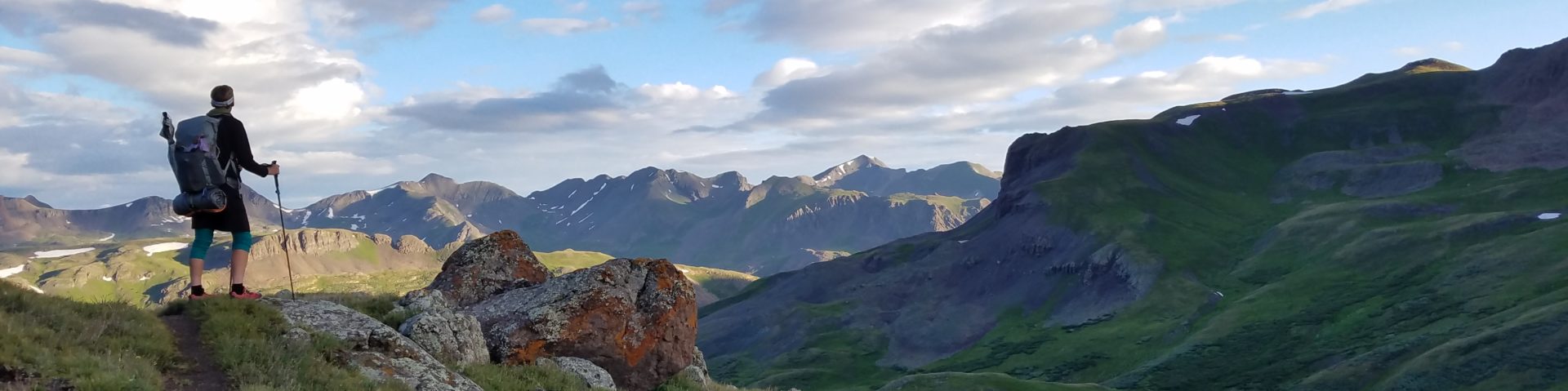
Wednesday, 7-22-20 Distance RT: 26 miles Location: Grand Lake, CO Route: Rocky Mountain National Park loop, counterclockwise from Grand Lake A little bit of background: Most thru-hikers use an app called Far Out for navigation and trail intel. For National Scenic Trails, the official trail is notated by a red line. Alternates are depicted with different colors (orange, blue, etc). If you’re a purist, you’re always “on the red line.” I took plenty of alternates while hiking the CDT, especially through New Mexico and Montana. But I tried to be a purist through my home state, dedicated to the red line with the one exception of Rocky Mountain National Park (RMNP) loop. Many CDT hikers bypass this loop (following the[…]

Read more

2020 Colorado Trail Segments 4-7 & Tramily Reunions

Before I get back to the 14er’s, I wanted to provide some highlights from a section hike of the Colorado Trail and reunions with Tramily members. Here’s a quick summary of the hike: July 18-21, 2020 CT Sections 4-7 (Bailey to Copper Mountain) Miles: 66 To start this hike, I got a ride from my cousin’s house in Denver to the beginning of CT segment 4 at Rolling Creek Trailhead, outside of Bailey, CO. I was meeting up with my friend YoYo on the Trail, who had come to Colorado to finish the CT. I’d first met him back in 2017, the very first day on the CT. We’d hiked together off and on all the way to Twin Lakes.[…]

Read more

Taking a break from 14ers to hike 13ers

Saturday 7-11-20 to Monday 7-13-20 Distance RT: 14 miles Elevation gain/loss: 5,500′ Starting Elevation: 9,280′ Summits: 13,423′ & 13,524′ Rank: 252 & 186 of 584 Location: Sangre de Cristos, Southern Colorado Route: Gibson Creek Trailhead (road 172) to Rainbow Trail to Swift Creek Trailhead, return on Lake of the Clouds Trail to Rainbow Trail/carpark. Companions: JR, Maggie & Niki I really needed to spend a weekend in the outdoors and it was JR to the rescue again. He invited me along for a mellow trip with his friends Maggie and Niki from Ft. Collins. The plan was to hike up to the Lake of the Clouds valley in the Sangres and spend 2 nights enjoying the area. I did some[…]

Read more

#5 of 20: Mt. Antero 14,269′

Friday 6-26-20 to Saturday 6-27-20 CO 14ers: 10 of 53 Distance RT: 20.5 miles Elevation gain/loss: 5,200′ Starting Elevation: 8,900′ Summit: 14,269′ Rank: 10 of 53 Location: Sawatch Range, Collegiate Peaks, north of Salida Route: Brown’s Creek Trail to FR #277 up to peak, back down Little Browns Creek Trail I’ll start by explaining that this was my first trip combining an overnight backpacking loop with a summit hike the following morning. I didn’t follow the standard route to the top, which is a boring 16 mile RT jeep road walk. I did some research to find that I could hike up one valley, summit, then come back down another valley, making for a much more interesting and scenic loop[…]

Read more

#3 & #4 of 20: Mt. Shavano 14,229′ & Tabeguache Peak 14,155′

06:00-13:00, Sunday, 6-14-20 CO 14ers: 8 & 9 of 53 Distance RT: 11 miles Elevation gain/loss: 5,600′ Starting Elevation: 9,750′ Summits: 14,229′ & 14,155′ Rank: 17 & 25 of 53 Location: Sawatch Range, Collegiate Peaks, north of Salida Route: Shavano East Slopes then 1 mile ridge hike to Tabeguache, Class 2 Companion: Wind Photos from 14ers.com Suddenly peak-bagging had become a thing I was doing this summer (for various complicated and sad reasons I explained in an earlier blog). Achieving these feats was the positive measure I needed in my life at this time. A short-term goal and focus. A big reward. 14ers.com had become my new shopping list. It’s a webpage outlining all the routes and details of climbing[…]

Read more

#2 of 20: Humboldt Peak 14,064′

07:00-17:30, Sunday, 5-31-20 My CO 14er count: 7 of 53 Distance RT: 17.5 miles Elevation gain/loss: 5,350′ Starting Elevation: 8,800′ Summit: 14,064′ Rank: 37 of 53 Location: Sangre de Cristos, Southern Colorado Route: South Colony Lakes 2WD Lower Parking Lot to Humboldt West Ridge, Class 2 Companion: Jolly Rancher (Kevin Parsons) Photo from 14ers.com After I’d recovered from my climb up Pikes Peak, I felt really inspired to do more. What next? I’d been in touch with my friend Jolly Rancher (JR), who lives less than 1 hr from my base camp in Canon City. I met JR while hiking the Colorado Trail in 2017. His amazing Earthship home is nestled in the Wet Mountains, facing the awe-inspiring Sangre de[…]

Read more

#1 of 20: Pikes Peak 14,110′

05:45-18:30, Thursday, 5-21-20 CO 14ers: 6th (& 1st) of 53 Distance RT: 27 miles Elevation gain/loss: 7600′ Start Elevation: 6,650′ Summit: 14,110′ Rank: 30 of 53 Location: Front Range, Central Colorado Route: Barr Trail, Class 1 Pikes Peak was the first peak above 14,000 feet (here on referred to as 14er’s) I ever hiked…but only halfway. Back in 2003, I went up with a friend and we got a ride down with my parents. Pikes Peak is one of two 14er’s in CO with a road all the way to the top (the other being Mt Evans and a 3rd, Mt Antero, has a road within a few miles of the top). At the time, it was the hardest thing[…]

Read more