Wednesday, 7-22-20
Distance RT: 26 miles
Location: Grand Lake, CO
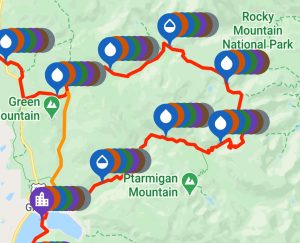
Route: Rocky Mountain National Park loop, counterclockwise from Grand Lake
A little bit of background: Most thru-hikers use an app called Far Out for navigation and trail intel. For National Scenic Trails, the official trail is notated by a red line. Alternates are depicted with different colors (orange, blue, etc). If you’re a purist, you’re always “on the red line.” I took plenty of alternates while hiking the CDT, especially through New Mexico and Montana. But I tried to be a purist through my home state, dedicated to the red line with the one exception of Rocky Mountain National Park (RMNP) loop.
Many CDT hikers bypass this loop (following the orange line to/from Grand Lake), mainly because of the logistics of needing a backcountry camping permit and a bear canister. Very few thru-hikers carry a bear canister if they don’t have to. And when you’re on the trail for months, you don’t have easy access to pick one up just for a few miles. So spending a night along this stretch of trail is a no-go…unless you want to chance breaking the rules (bad idea in a National Park).
At 26 miles RT, the loop can be hiked in a day…a long day. I could have done it in 2019 but it would have meant another expensive night staying in Grand Lake. I was also hoping to summit 14ers Grays and Torreys for my birthday, so I skipped the loop, expecting to be able to come back to it someday. By the end of Colorado, I felt a huge sense of accomplishment in having stuck to the red line. It was hands down some of the hardest hiking I’ve done in all my life, yet so rewarding. But the RMNP loop was that one little piece of unfinished business still nagging me.
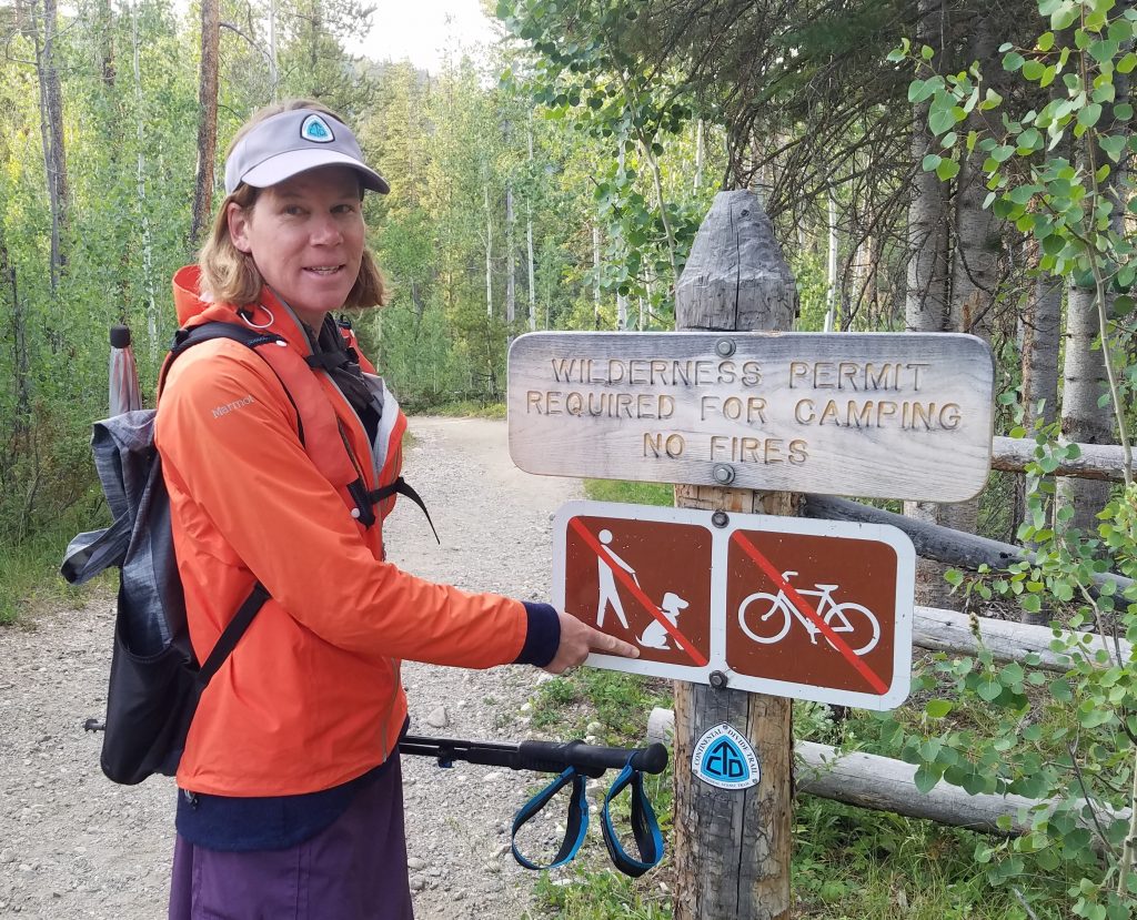
True to my word, I was back to get er done. I started from the trailhead at 5:30 am, after I spent the night tenting at a nearby campground. The new park service rules re: COVID were a little ambiguous about the need for a timed entry permit. From my understanding, as long as I entered the park before 6 am, I didn’t need one. Given my planned distance, an early start was crucial anyway.
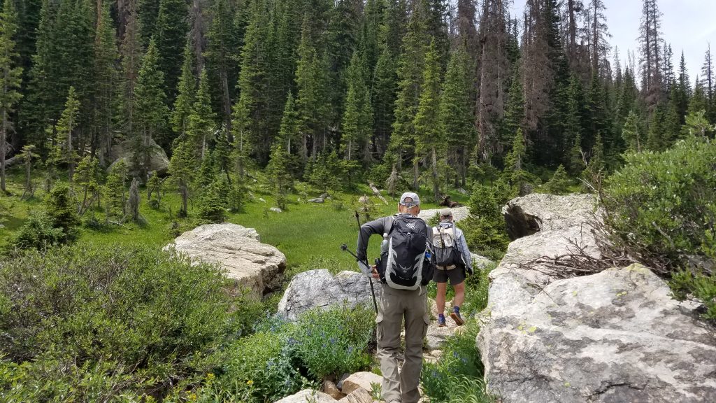
The trail followed a nice creek up a valley for the morning. I found huckleberries and strawberries growing alongside—yummy. I stopped to check out Cascade Falls (real original name) and shortly afterward caught up to CDT thru-hiker, Gaoshan, which means ‘mountain climber’ in Mandarin. He was slack-packing for the day and I was eager to hear about his adventurers. Former thru-hikers are often desperate for news of the trail and I was no exception. I started keeping pace with Gaogshan and ended up hiking with him all day.
Next we passed a few hikers going the opposite direction, including a lady that recognized me. I had met her in Chama just after she finished the CDT the year before. Now I can’t remember her name but I did vaguely recognize her after she refreshed my memory of where we’d met before. She’d come back to finish this skipped section, just like me. We laughed about our dogged determination to hike every inch. It was nice to see I’m not the only crazy one.
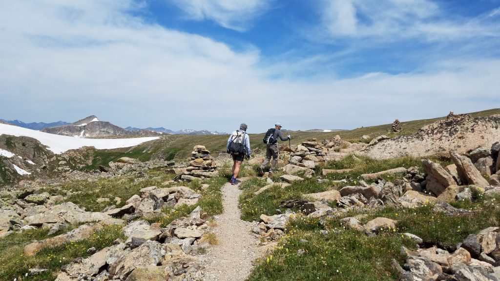
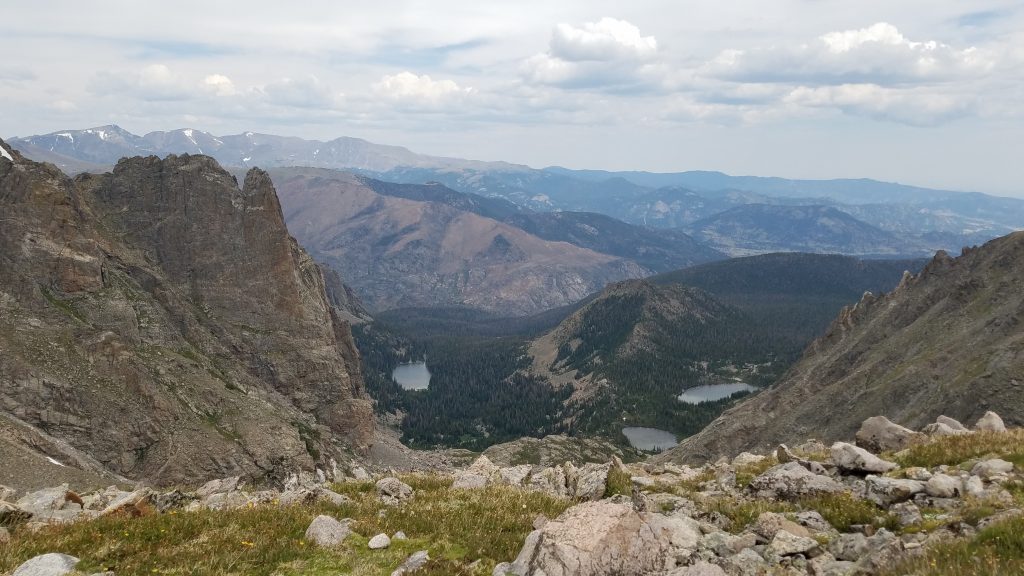
We gained elevation above treeline and enjoyed 4 miles or so hiking through beautiful tundra. It was pretty flat on top the mesa and the trail was well-marked with giant double cairns. We could see lots of mountains around, including Longs Peak and Park View Peak (both tops I’ve summited). We stopped to have lunch at an overlook where we could just make out a few tiny figures rope-climbing a pinnacle almost half a mile away. This was our entertainment for lunch.
We continued on, heading down another valley alongside Tonahutu Creek. There were some really nice waterfalls and then, in following with the standard RMNP experience, we encountered MOOSE! I saw them first, 2 big bulls laying down in a meadow in front of us. I had to yell out “Moose ahead!” The closest bull was one of the largest I’ve ever seen. In true RMNP moose fashion, neither paid us any mind. In fact, the other one was standing when I first saw him and proceeded to lay down as we got near…that’s how unconcerned he was. The RMNP moose seem to be really chill…but I still wouldn’t want to get any closer than we did.
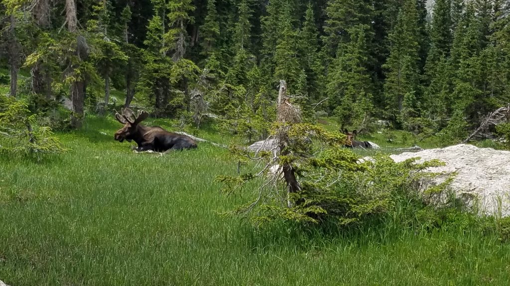
As big as they were, it’s incredible how easily they blended in. Having fulfilled my moose sightings for the day, I plodded on for the final stretch. I was feeling pretty tired by this point and Gaogshan offered a nice alternative. His wife had been following him along in a van the whole time and was supposed to be waiting at the HWY 34 trailhead. Hiking west to the HWY would shave about 2-3 miles and we could get a ride back to Grand Lake from there. Only problem was, Gaogshan and his wife hadn’t known about the timed-entry permit before they’d made their plans and now we weren’t sure if she’d be able to get into the park for the pick-up. We tried calling her but no one had cell service. So we kept hiking south towards Grand Lake. I’d already hiked these miles the previous year, so I would’ve been just as happy taking the shorter route. Oh well.
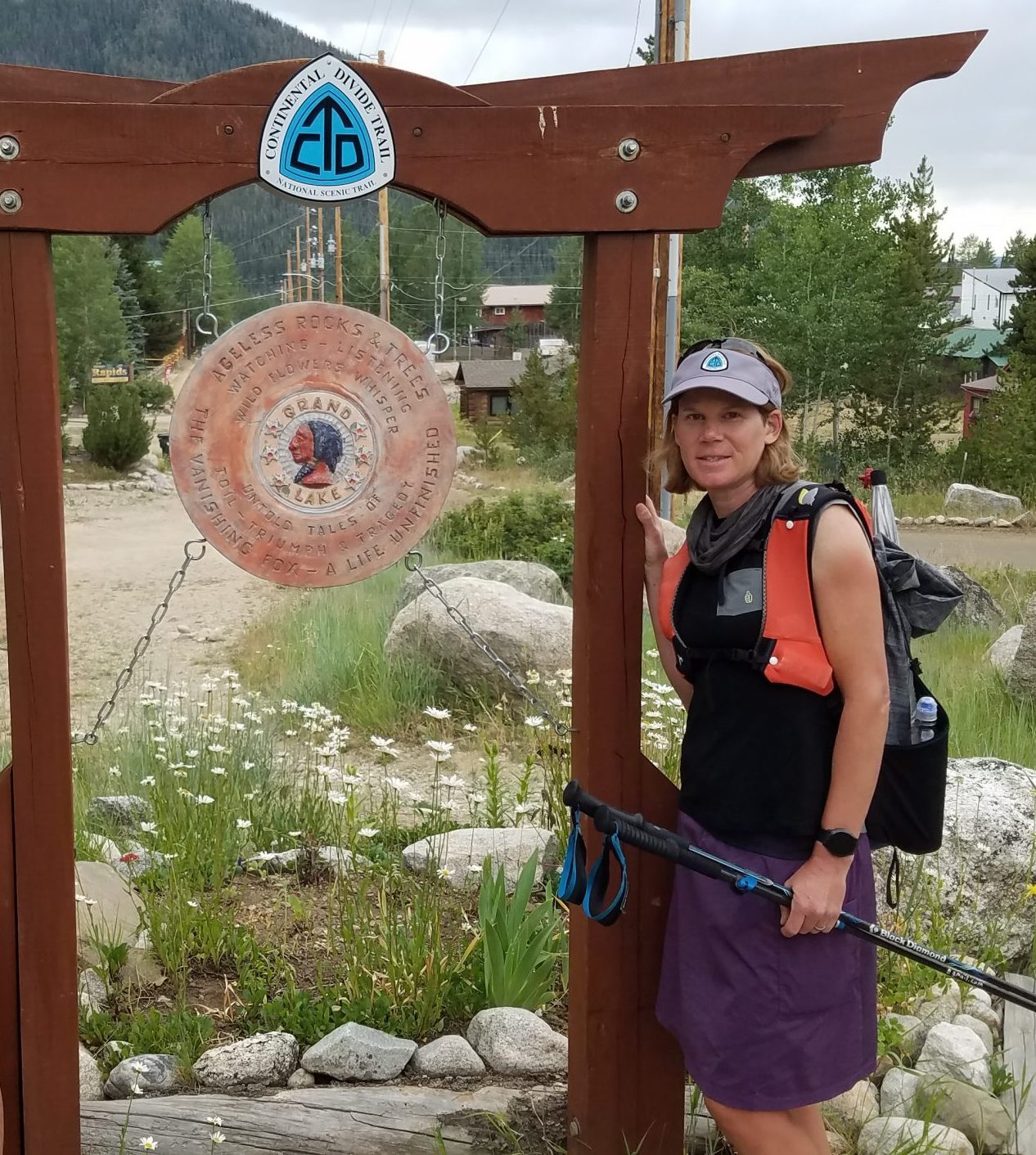
I rolled into Grand Lake just before 5 pm, having hiked for almost 11 hours. It was a long day. Now with the red line done, I could finally get back to hiking 14ers! Get ready for a whirlwind of peak-bagging.