Friday 6-26-20 to Saturday 6-27-20
CO 14ers: 10 of 53
Distance RT: 20.5 miles
Elevation gain/loss: 5,200′
Starting Elevation: 8,900′
Summit: 14,269′
Rank: 10 of 53
Location: Sawatch Range, Collegiate Peaks, north of Salida
Route: Brown’s Creek Trail to FR #277 up to peak, back down Little Browns Creek Trail
I’ll start by explaining that this was my first trip combining an overnight backpacking loop with a summit hike the following morning. I didn’t follow the standard route to the top, which is a boring 16 mile RT jeep road walk. I did some research to find that I could hike up one valley, summit, then come back down another valley, making for a much more interesting and scenic loop hike. Given the distance, I opted to split the hike into an overnight, which turned out great! I highly recommend this loop when climbing Antero, as I think it’s one of the nicest loops I’ve done in all of Colorado. There’s a little bit of everything: waterfalls, creeks, lakes, meadows, route-finding, and peak-bagging.
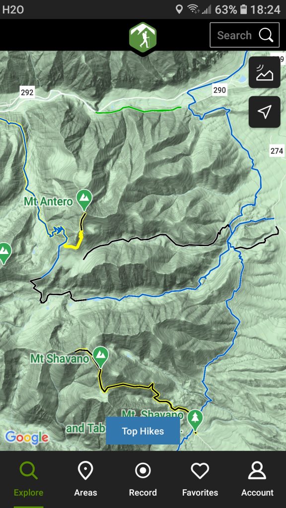
Here’s the route depicted on the app Hiking Project. This is a free app and I highly recommend it!
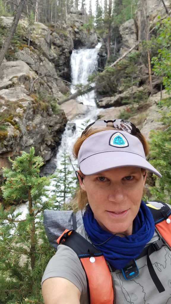
I began day 1 around 5 pm in the afternoon. The trailhead was easy to find and parking plentiful. After a short connector trail and even shorter segment on the Colorado Trail, I was hiking along perfect, beautiful tread on Brown’s Creek Trail. A nice waterfall was the first treat.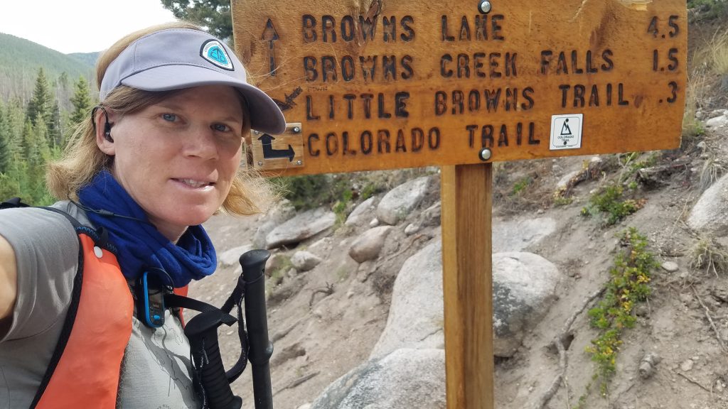
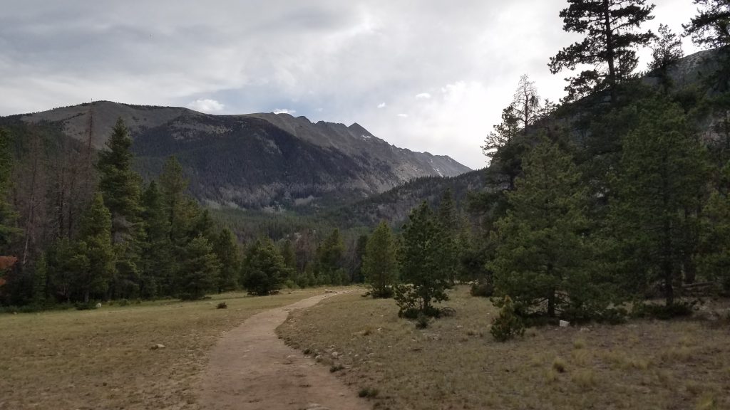
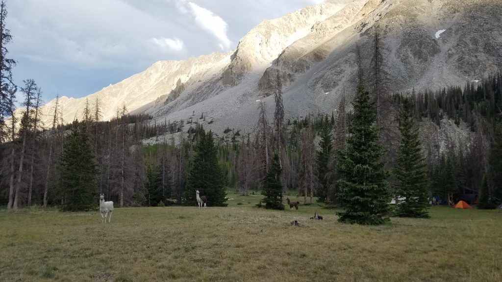
I continued ascending, coming to a lake and several meadows. There were some llamas from a nearby camp posted in one of the meadows. I wanted to pet them but I’m never quite sure about llamas…they always look like they’re on the verge of spitting on me, or worse. So I left them alone and continued on. I came to a nice campsite among sparse trees right at treeline and decided to call it a night. This was only the second night I’d had my new Zpacks Plexamid tent in the backcountry. I settled in for a peaceful night with lovely mountain views and Alpenglow.
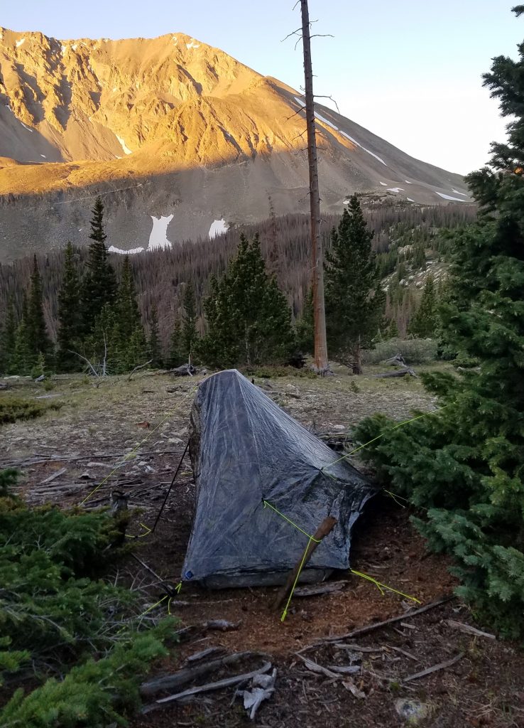
The new camo Plexamid…a bit shiny (will wear off with use) but blends in pretty well. Still learning the tricks to getting a good pitch.
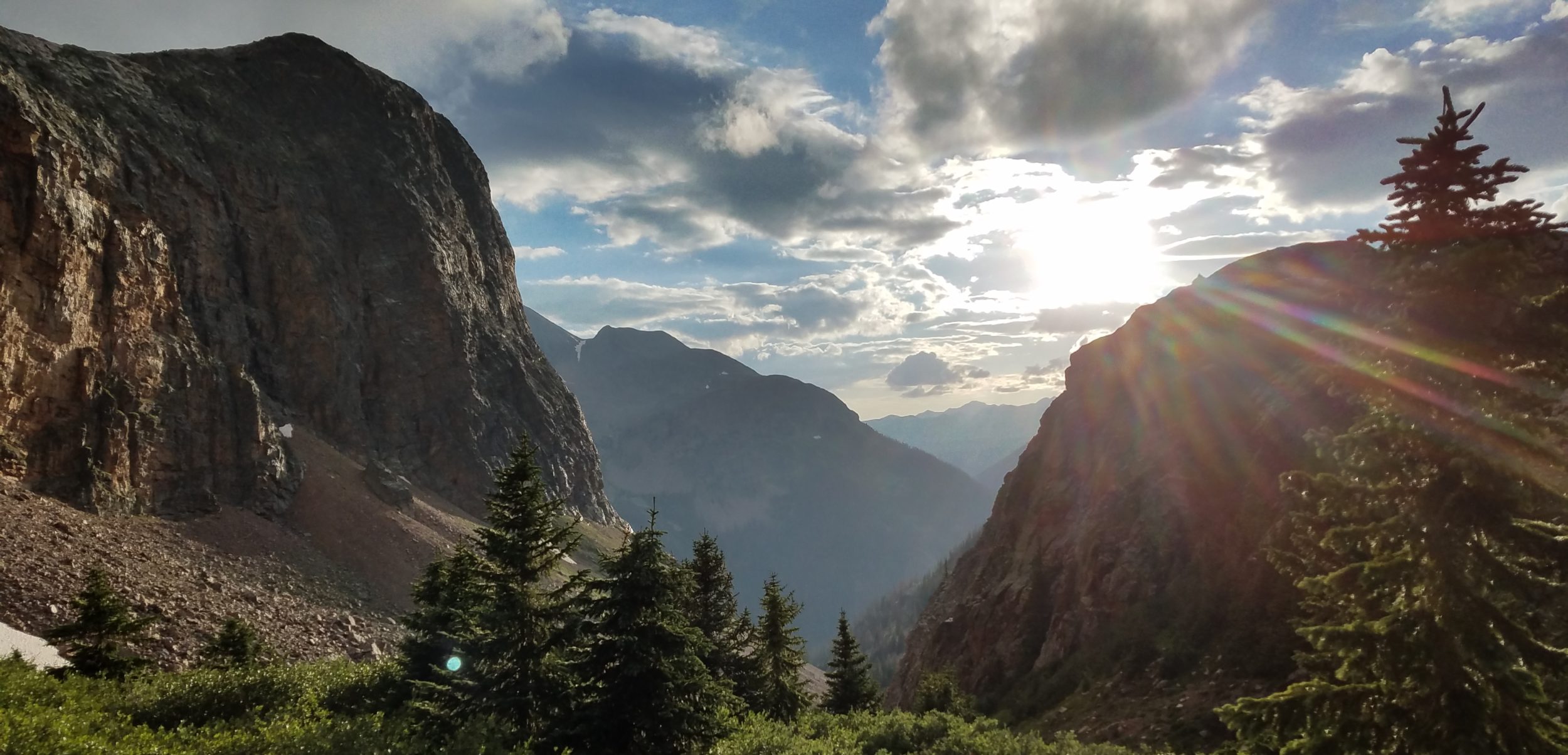
I was up and on the trail (road, actually) by 0630 am the next morning. I got a little cold overnight since I was using my 40 degree quilt at 11,000′, but not too bad. It was good to hit the sunlight early, exposed as I was above treeline.
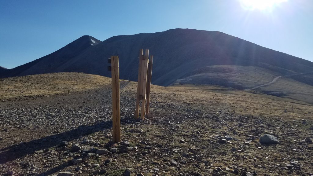
I navigated along a series of mining roads up to a saddle. There were several roads going off in different directions, so I was glad I had my GPS and hiking app to keep things straight. No one else was around to ask for directions. In fact, save for the llamas, I hadn’t seen anyone the day before, either. I continued for a few miles until the jeep road connected to the final turn-off to the peak. Then I started to encounter plenty of other peak-baggers. There were even a few 4x4s taking the easy way to the top but not as many as there could be, given that it was still early in the morning. Those that choose to drive to the tops of mountains don’t need as early of a start (thank goodness).
The road leads to 13,800′ and less than 1 mile from the summit. So even the 4wd people have to walk a little to get to the very top. The final bit of trail involved a little route finding and rock scrambling but was pretty easy none-the-less. I gained the summit by 8:30 am, backpack and all. For this trip I was using an ultralight frameless pack and my total weight was well under 10 lbs.
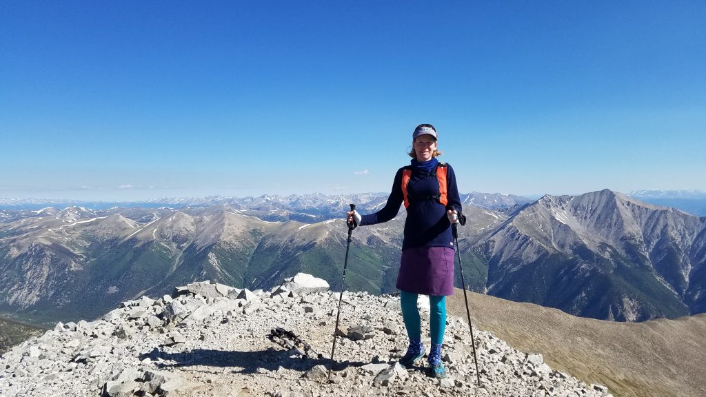
Showing off my ridiculous color combinations once again.
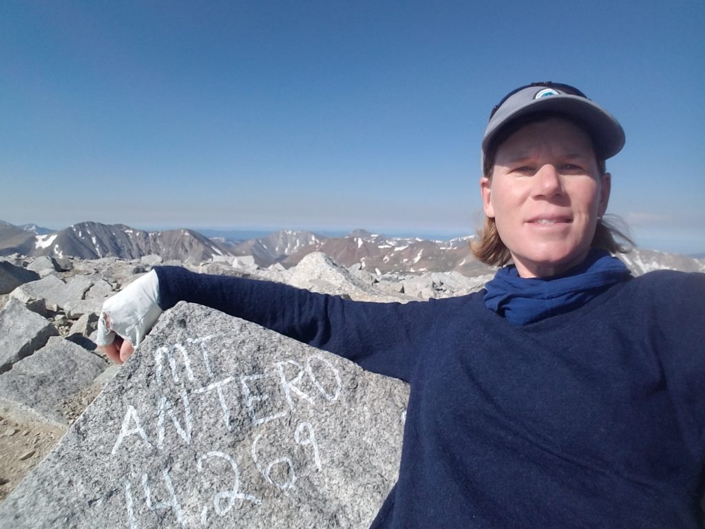
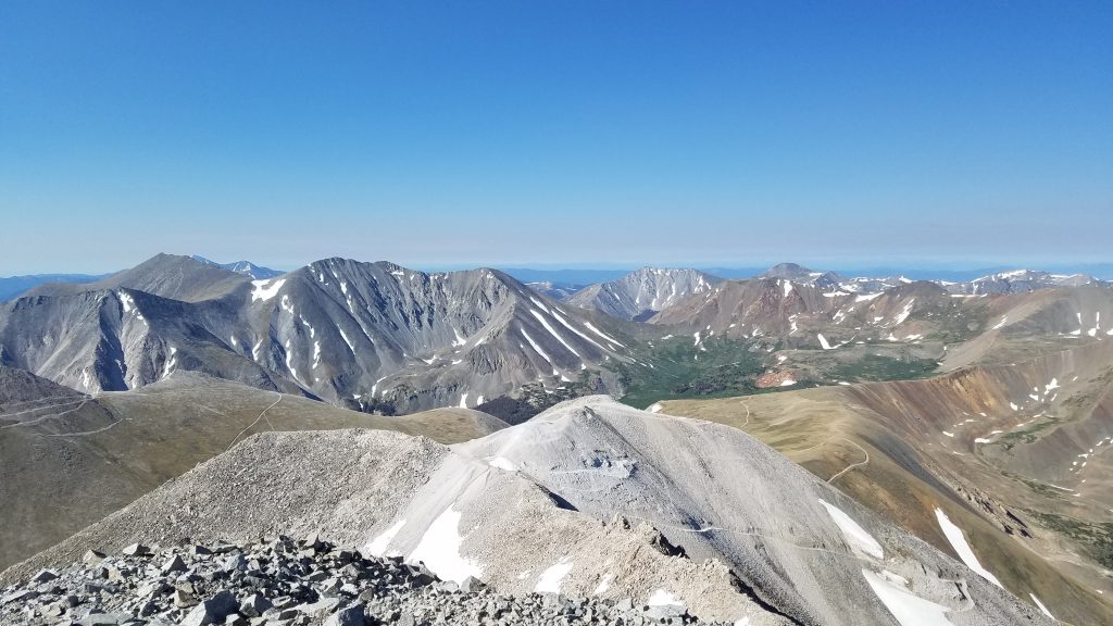
As usual, I wasn’t one of those organized hikers that makes a nice summit sign, so I settled for a little graffiti on the rocks. It was another gorgeous day at the top, without a cloud in sight. I took in the views, especially of Shavano and Tabeguache that I hiked a few weeks before, which can be seen to the left in the photo below. Also note all the mining roads in the area.
Antero contains one of largest deposits of aquamarine crystals in the world. People are still actively mining the gems to this day, with many youtube videos detailing the process. On my way down, I saw a few miners working the slopes. Not a bad place to go to work on a day like this.
At the point where several roads met at a saddle, I diverged down a new valley for Little Brown’s Creek Trail. My app didn’t show the trail meeting with the others but it was easy to figure out the route…just head down the valley. Shortly a well-trodden trail emerged along the stream, which I followed for several miles to the end. Along this trail, I only saw one other hiker…on a Saturday. It was a great way to finish my loop hike and I barely felt like I had just hiked to the top of another 14er.
Again, I highly recommend this route as opposed to the standard jeep road up the west slopes. I ended up having to walk the jeep road for only about a mile, saving countless encounters with machines. My route was blissfully quiet and solitary. Just what I was looking for on this trip. Cheers!
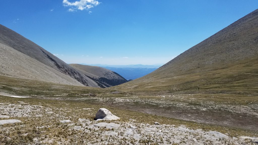
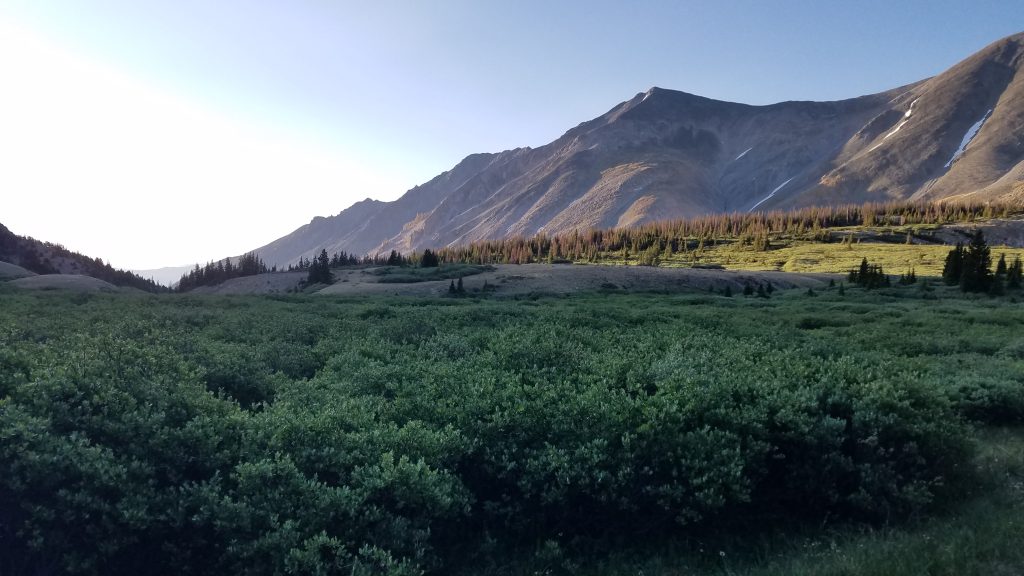
Following the tundra down the gap.