Saturday July 16th, 2022, 0700-1800
Lower Ball Lake #2 to US Hwy 1, WEBO mm 251.2, Segment 3 Selkirk Mountains
26 miles, Gain 3640′, Loss 8160′, elevation 2100
We had a big day ahead if we wanted to get to town. I was almost out of food, so I didn’t have a choice. This coming on the heels of one of my most exhausting days ever…I didn’t get my normal early start, to say the least. On the way out, I checked the upper Ball Lake, only to find all the campsites still covered in snow. Good thing we’d come to the lower lake first. Later I met 2 local hikers\fishermen that said that even lower Pyramid lake had been frozen over just 2 weeks before. Hiking into this area felt like we’d stepped back in time…back to spring.
There were nice views overlooking Pyramid lake. I spotted a bald eagle flying to a perch. It’s not every day that I can look down on eagles. Some of the switchbacks to the lake were eclipsed by snow, making for a few tricky spots but nothing I couldn’t walk around. Where I met the guys was where they’d had to turn back 2 weeks prior. I knew at least one PNT hiker had been through around that time, Captain Jack, and I couldn’t imagine how he’d managed. Since rejoining the red line the day before, we’d seen pretty fresh footprints going westbound. We figured we’d passed some WEBO thru-hikers, just missing each other while we were on different routes. They would have been the first since Captain Jack, who I passed unknowingly (maybe he was still sleeping?) during the roadwalk just west of Northport. It’s actually quite easy to miss hikers going the opposite direction because of all the alternate routes and also the roads…a lot of people just hitch past those sections.
Regarding the road hitching versus walking topic, I could care less what strategy people employ for themselves but for me, I’d decided well before I began this hike to at least try all the road walks. So far, I hadn’t encountered anything I felt was dangerous or uncomfortable. I’d thoroughly enjoyed some of the dirt roads and the rest were really no bother. Easy miles. Besides, it would have been next to impossible to get a ride on many of the roads, as there were simply no cars going my way. Perhaps I’d skip a few of the more busy highway walks once I came to the Puget Sound, but for now at least, I was fine with all the road walking. Sometimes it’s easiest just to keep walking, rather than trying to coordinate or get lucky with a ride.
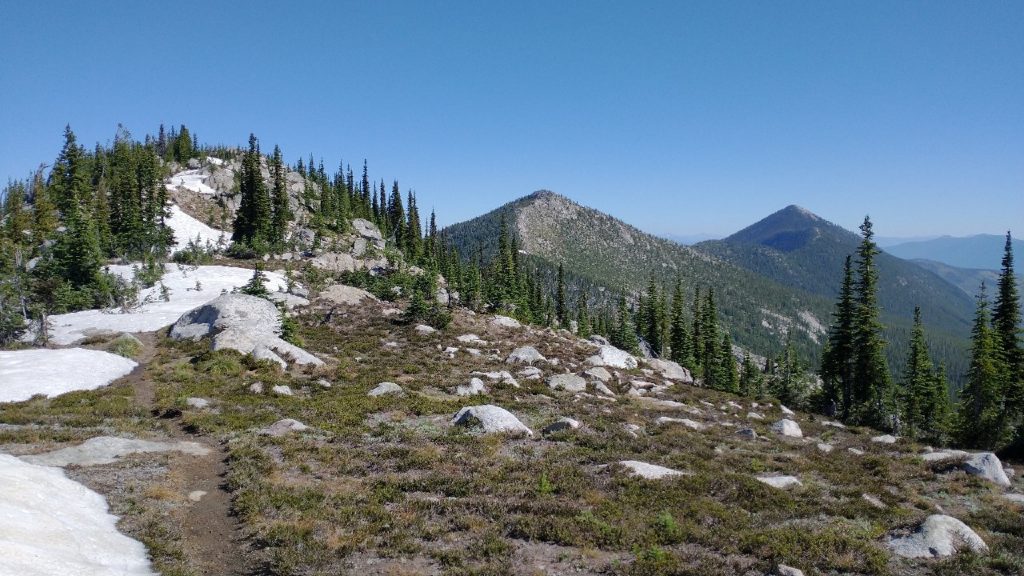
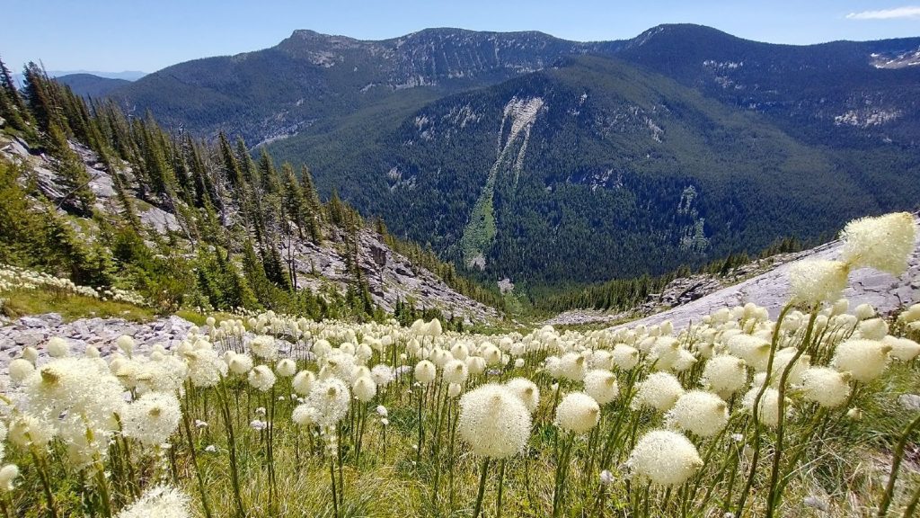
Past the lake, the trail went up again, gaining the ridge we’d be on all day. Aside from a few little bumps, we’d be descending for 15 miles…over 8k’ of loss total for the day! I was glad I wasn’t going the other direction! The ridge was grand, with just the right amount of firm snow to make it beautiful and fun, but not a chore. We’d later talk about how much we enjoyed this little bit of snow travel and our WEBO counterparts would either roll their eyes or curse us under their breath. For those sticking the course and starting from Glacier NP, the snow had been drudgery for the past 2 weeks. For us flippers, we were catching the tail end when it was just a novelty. ‘Work smarter not harder’ is the mantra I try to live by…though I’m not sure if walking double digit thousands of miles puts me in that category…
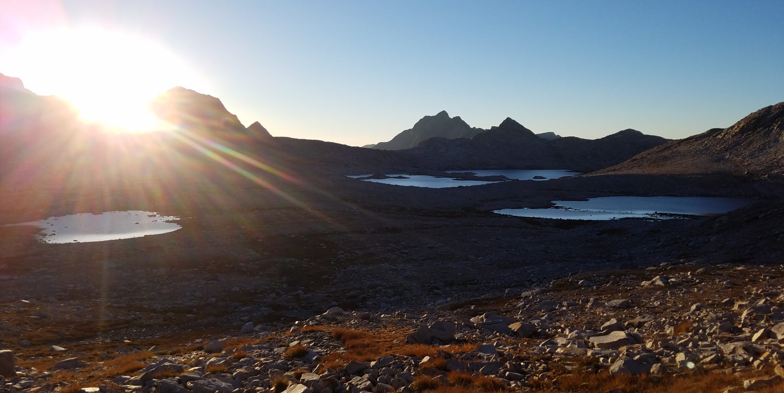
The ridge undulated for awhile and I was loving the roller coaster of unending views. Combined with the day before, it had been the best part of the trail thus far. I couldn’t stop gawking at Lions Head and its supporting cast of craggy peaks that we’d somehow managed to pick our way through. Like so many attendants to the crown of a magical kingdom. I could just make out the tiny glint of the white cabin on Lookout Mountain, a shiny beacon in the distance, beckoning me to retrace my steps. Not a chance…at least not this year. But I hoped I’d be back again soon.
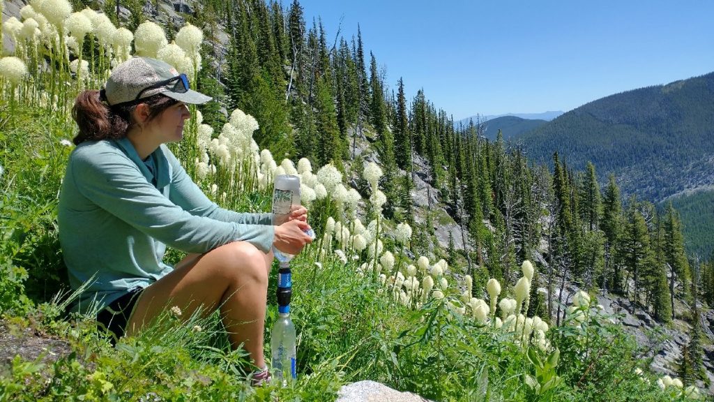
We stopped to collect water from a miraculous spring, just gushing forth in the shadow of Parker Peak. It ran down a steep field of bear grass blooms, waving in the wind like a dance of popcorn. What an enchanting setting! The rest of the descent was less scenic. We entered a burn area that was rather monotonous. It contained switchbacks upon endless switchbacks. I could clearly see the valley below and that it was slowly getting closer but my goodness did it take a long time. This felt like the biggest descent I’d ever done. So much down. I was so grateful not to have to go up!
I finally reached the trailhead and was rewarded with a cold stream with a dipping pool. It was the first water in 10 miles. Again, thank goodness we had been traveling down on this hot afternoon. I took a long dunk, mentally and physically preparing for a 7 mile road walk. In this rare instance, we could have easily gotten a ride all the way from the trailhead. There was a local man waiting for his buddy to return with their vehicle, after completing a backpacking loop. He even offered us a ride and of course we were very tempted. As eager as we were for town after the hardest section yet, plus very tired and hot, there wasn’t really a good excuse to skip the road. It was exceedingly quiet, shaded for the first few miles, and easy. Plus, it might have been difficult to get a ride back to this remote trailhead. We’d connected footsteps all this way and we still had plenty of time in the day.
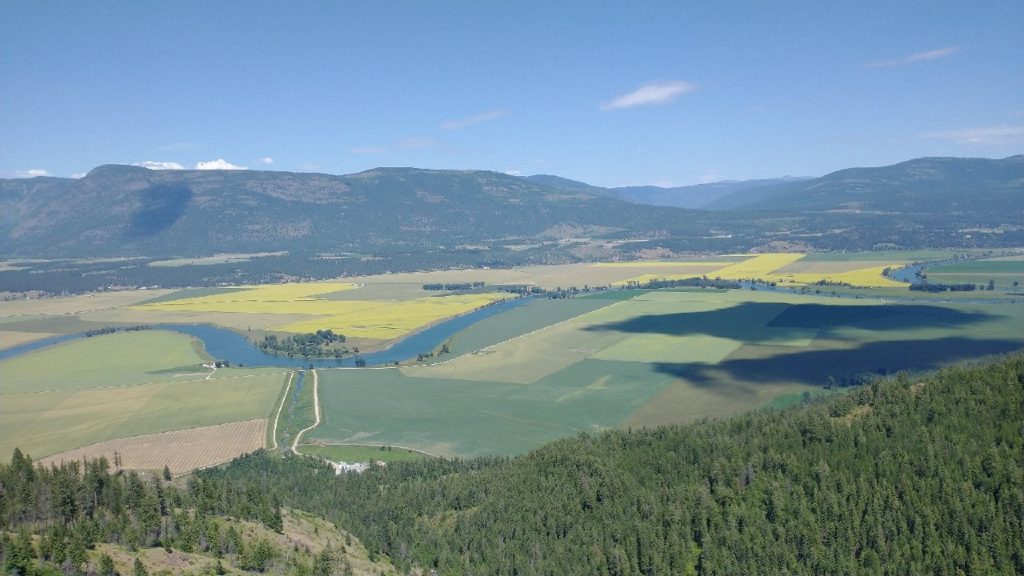
I missed the first left turn off the road but fortunately there was another that connected to the route without adding distance. So I actually got to walk the shaded portion hugging the mountains for a few miles longer. Once in the valley, I was fully exposed to the sun. It had gotten later in the day, cooling down just enough. I busied myself with watching cows and farms pass by. This valley was huge, with a wide swath of agriculture taking place along the Kootenai river flood plain. The river had been channeled and levied, winding like a serpent through this verdant expanse. It’s one of the most productive valleys in the US and the location for a ginormous hops farm, owned by a large beer company. Canola (with yellow flowers) and alfalfa were also grown in abundance.
I walked across the bridge over the river…the only one for many miles in either direction, hence our particular route. I caught up to Wolverine just as we came to our first road to hitch from. We needed to walk this road for a mile or so but with our prowess for getting rides, we scored one from the very first vehicle. It was a family with 2 kids fast asleep in the backseat, so we squeezed into the trunk. I still chuckle that people with such precious cargo would take such a risk, but I guess that’s just how safe we look. Turns out, they had given a German backpacking couple a ride just days before. We didn’t know of these hikers but would hear about them for over a week, as they remained just ahead of us. They’d started in Republic on July 2nd.
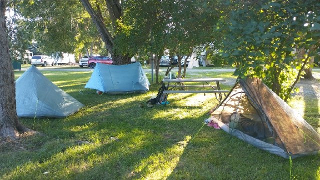
The family dropped us off in the Safeway parking lot, where casual observers must have thought it funny that a well dressed man opened the hatch for 2 scruffy girls to clamber out. We hemmed and hawed about whether to get food first or a hotel room. In the end we decided to tent for $10 a night (plus hot showers and towels) at the RV park across the street. This was such a good deal and location that we figured a zero (day of rest\no miles) was in order. We got set up and semi clean then went for dinner at a nearby greasy spoon, Chic-n-chop. We were so relieved not to have to hike the next day. It had been a tough last section, to say the least.
Sunday July 17th, 2022: Zero in Bonners Ferry
I took a day off to rest and try to catch up with things. I won’t write too much about this day, other that to give some details about the town. The RV park was great. There were two bathrooms with showers and places to charge our electronics. Wolverine took our clothes to wash at a laundromat that was nearly a mile away, so that wasn’t great. But everything else (2 grocery stores, organic food store, coffee, & restaurants) was within a half mile radius. We didn’t make it to the downtown part (PO & brewery) this day but visited the next on our way out of town.
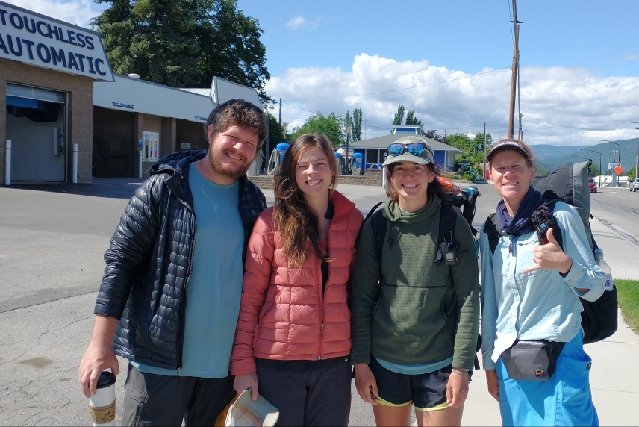
Skunkbear and Sashay joined us mid day, after getting off trail near Pyramid lake. Sadly Sashay had strained his knee, probably due to all the clambering over blowdowns and brush during the Lions Head creek bushwhack. It’s a wonder the rest of us made it through unscathed. Their plans were uncertain depending on the severity of his injury. They hoped to find a doctor but as it was Sunday, nothing could be done this day. They were now at least a day behind us mileage-wise and would definitely need to stay in town longer.
Wolverine’s plans had changed as well. She’d accepted a new teaching position, so now she had a hard deadline for finishing the trail. She needed to hike close to my planned pace, thus it made sense for us to stick together through grizzly bear country, most likely all the way through Glacier NP. We’d been a good team through the bushwhack section. She’d handled it with grace and confidence and I admired her tenacity and dedication to the trail. I was sad about our inevitable separation from Sashay and Skunkbear. They were Wolverine’s original tramily and my adopted one. But this is how it so often goes on trails. People have different paces, objectives, and priorities. Goodbys are sometimes final and sometimes not…you just never know. At least we all had a great dinner together at a wonderful restaurant, Two Tone Cafe. I had the signature Thai nachos, which were again one of the best things I’ve eaten on trail. I was grateful for the wonderful company, food, and town services. Another trail town that ranks high on the list!