Friday July 15th, 2022, 0610-1930
Trail 37 to Lower Ball Lake #2, WEBO mm 277.3, Segment 3 Selkirk Mountains
12 miles, Gain 4600′, Loss 3300′, elevation 6620
The big day had finally arrived, what’s commonly thought of as the PNT’s ‘right of passage.’ There’s no trail on the western side of the Selkirks to connect to trails on the eastern side. So a PNT thru hiker has to bushwhack through this section. As I’d found out on a 3.5 bushwhack south of Republic, going even a short distance can be just awful. These northwestern forests are incredibly dense, cluttered with an understory of fallen trees, tangled willows and brambles. Sometimes just traveling 10 feet is an undertaking of epic proportions.
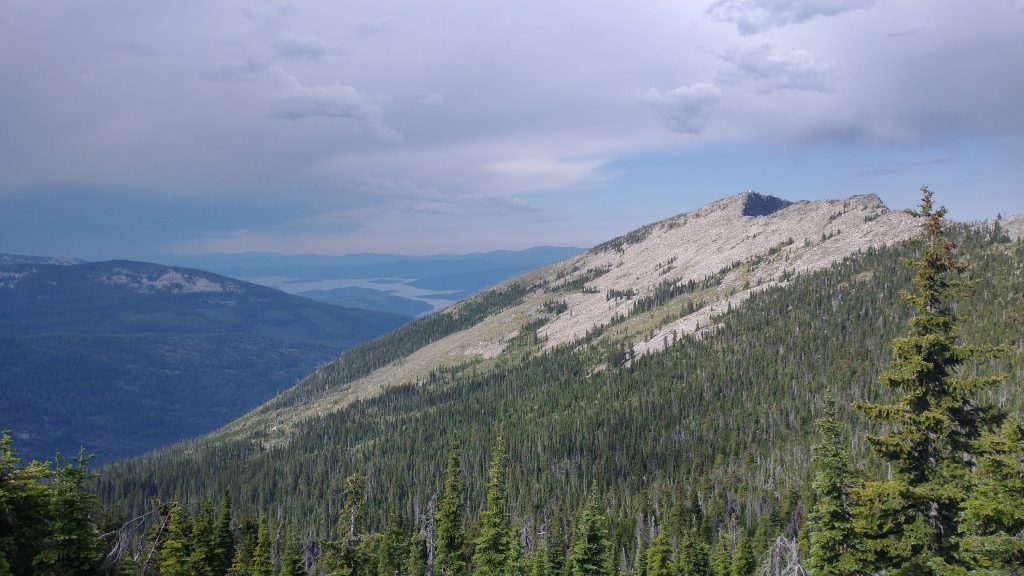
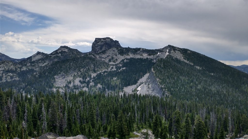
Lions Head is a prominent and dominating massif of granite jutting from the range. The official route travels from the southern reaches of Upper Priest Lake along a creek, passing by the mountain. The creek route gains a saddle after about 4 miles of bushwhacking, then proceeds another 2 miles up to a ridge and north to Ball Lake, so it’s about 6 miles where there is no trail or faint game trails. But we didn’t do this route.
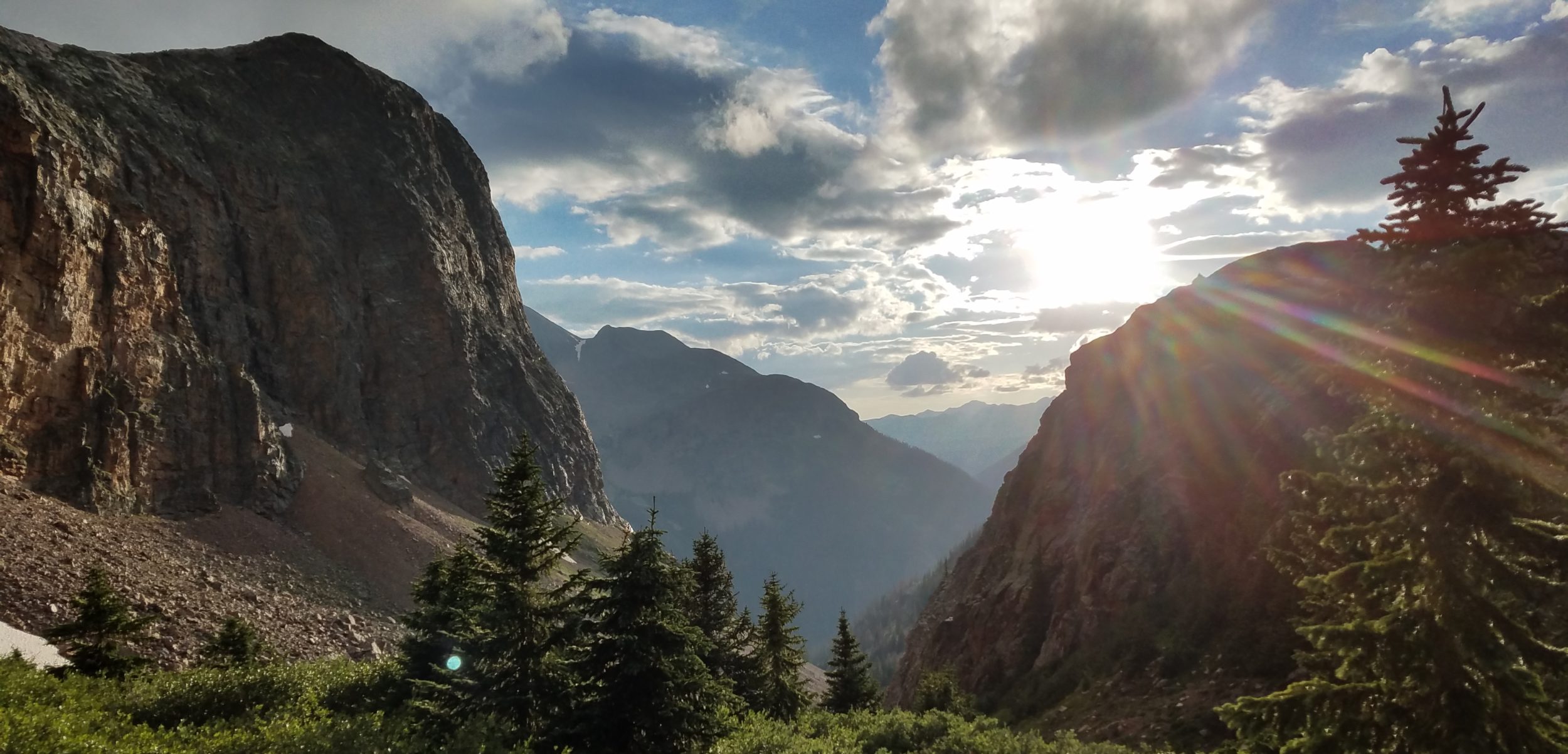
At some point, a brave pioneer devised a ridge route that stays high, skirting the flanks of Lions Head and several other craggy peaks. It goes right over the top of several lesser crags, involving lots of rock hopping, boulder scrambling, and travel across slick slabrock. There’s also a fair share of bushwhacking along steep slopes and through congested saddles. The ridge route is about 8 miles, in addition to the 2 miles of bushwhacking from where it joins the red route at the saddle. So it’s longer, with more elevation gain and loss, plus greater exposure to storms and to falling\breaking things. But the views were said to be grand.
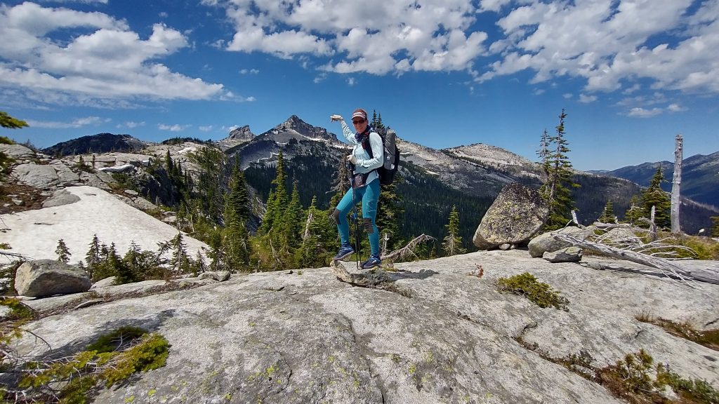
I’d set my sights on the high route after reading about it and watching a video. I really wanted to see if my skills were up to the challenge, but I was afraid to go it alone. Thankfully Wolverine also wanted to attempt the ridge, so now here we were. First we had to finish the climb to the top of Lookout Mountain. We grabbed water from the pond again, filling all our bottles and then some. We weren’t sure about water sources along the route, since there were no notes from this year. As far as we knew, we were the first to attempt it. So we each carried 3 liters, which weighed heavily as we grappled our way up the steep slopes.
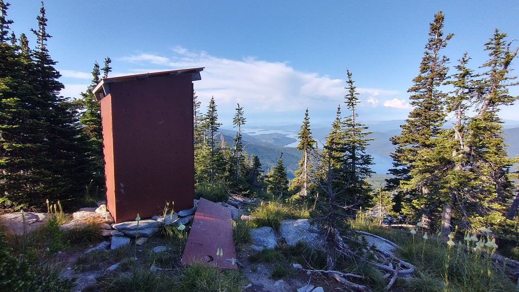
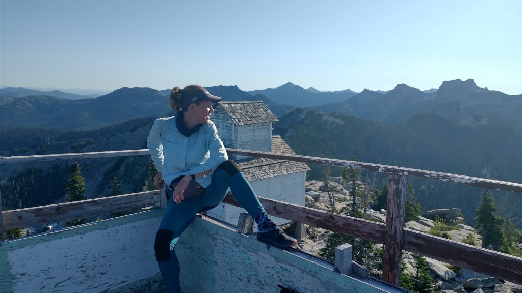
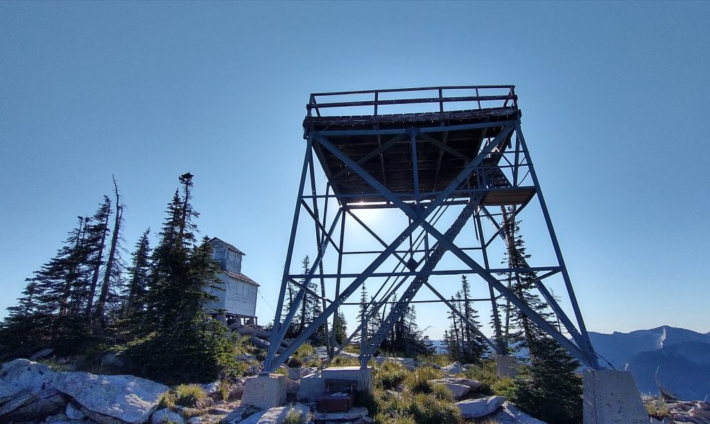
Lookout Mountain of course had a spectacular lookout platform, cabin and privy. I just had to do my business in the privy, with one of the best views ever. The door was ripped off, which was even better. The platform had a million signs warning that it was unstable and should not be climbed. Seeing what was in store for us, it seemed to be the least dangerous thing we’d do all day, so we of course clambered up. I say this was necessary in order to scope out our route, but really I just can’t resist climbing things for a view. It takes a dedicated gate and lock to keep me out.
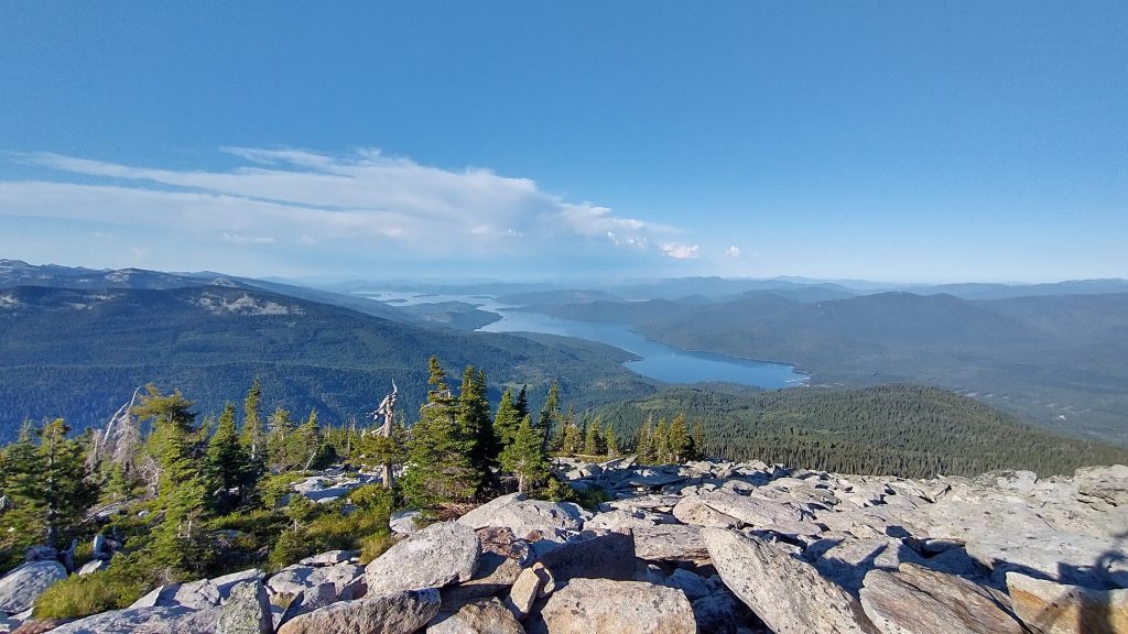
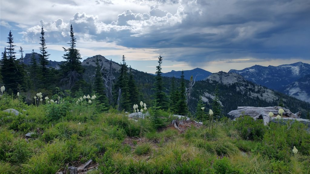
We remained for a long time on the lookout. I had to do a lot of peakfinding, which in this case really was valuable as I could identify the peaks we’d be passing. From a distance, the route looked pretty daunting…technical and long. But it was not supposed to involve anything more than class 3 scrambling, which I’d done plenty of on 14er peak routes like Longs. Then we had to take lots of pictures, because the views were so great. This mountain top, like many others, is bypassed by the red line of the official PNT. It comes to within 0.2 miles then goes straight back down, which I think is criminal to gain 3k’ and then not even get a view (welcome to the AT). I suspect many Westbound hikers following the creek bushwhack probably don’t even go with the red line up, electing to just follow the creek straight out to Priest Lake. Our route started from the top of the mountain, so we weren’t tempted to bypass it. I’m so glad, because I loved it!
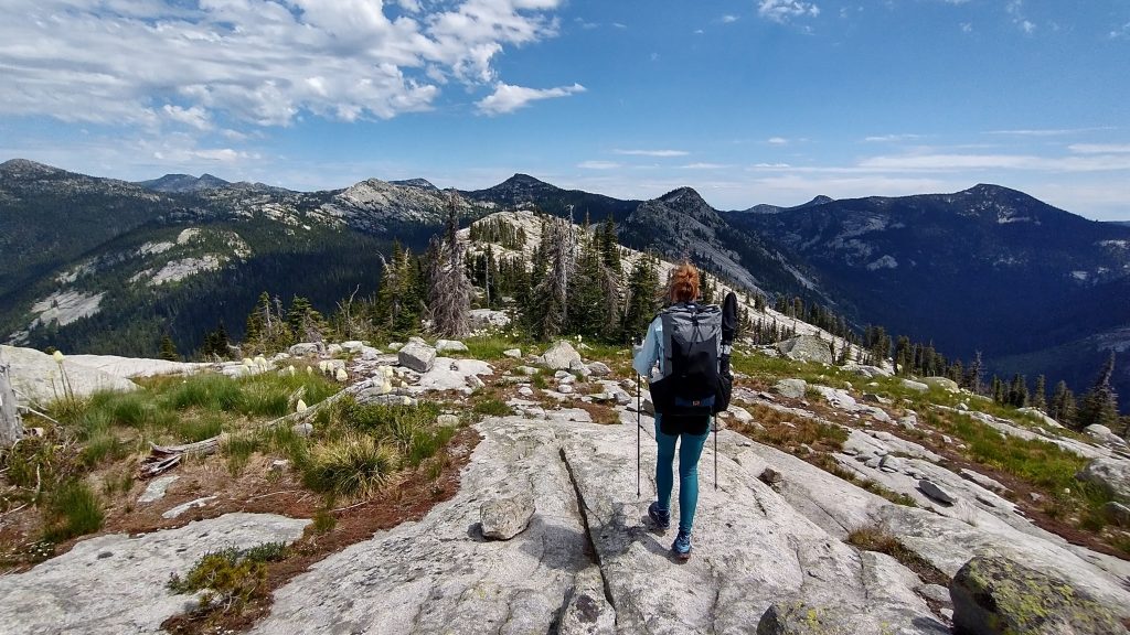
Just past 8 am, we began the route. It was perhaps one of the more difficult parts, with a sheer cliff on the north side, a small cliff on the east top, and house sized boulders in a sharp decline on the south side…the clear winner in terms of the route. We hopped from one to another, rapidly loosing elevation. I was glad to start by going down but felt jittery…nervous, excited and off balance from all the water weight. I had to put my trekking poles away so that I could use my hands to steady myself. Early on, a small item was jettisoned from my side pocket and my heart sank when I realized it was my bug spray tumbling into a crevasse, never to be seen again. I felt bad about littering and also to be loosing my spray when the bugs have been so bad. But there are worse things to lose. By the time the ridge flattened a bit, I felt much more confident and balanced.
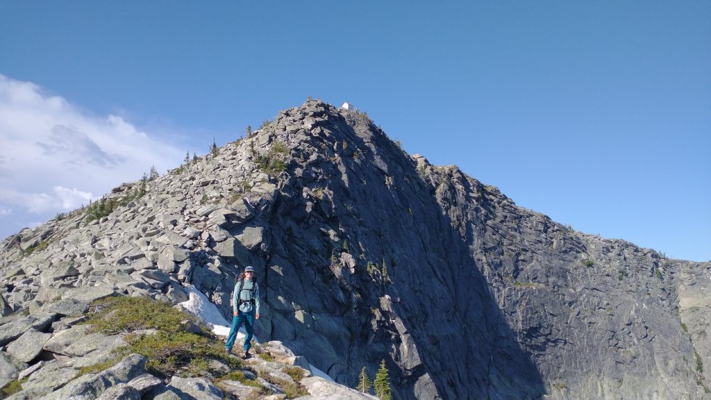
The next couple miles flew by as we did our best to stick to the ridge. It was pretty straightforward and easy travel, as the vegetation was sparse amongst the rocks at the top and we could see where we were going. Notes from the Far Out app described the west end as the most difficult (as in dangerous, I guess), so we thought we were in the clear after this. Meanwhile, a distant set of clouds had moved closer, and the day suddenly went from clear and sunny to threatening from a thunderstorm.
I was a bit surprised by how quickly it came up on us. There were no clouds anywhere else and nothing in the forecast to suggest a threat. When I started to hear distant rumbles, I really began to worry. We couldn’t have been in a much worse place to be dealing with lightning. But the storm appeared to be passing to the south and soon did nothing more than provide overcast skies for a bit. I gave my thanks to the weather gods, who merely wished to remind us how small and frail we are, trespassing through their high realms. I am humble and cower in your presence, ye gods.
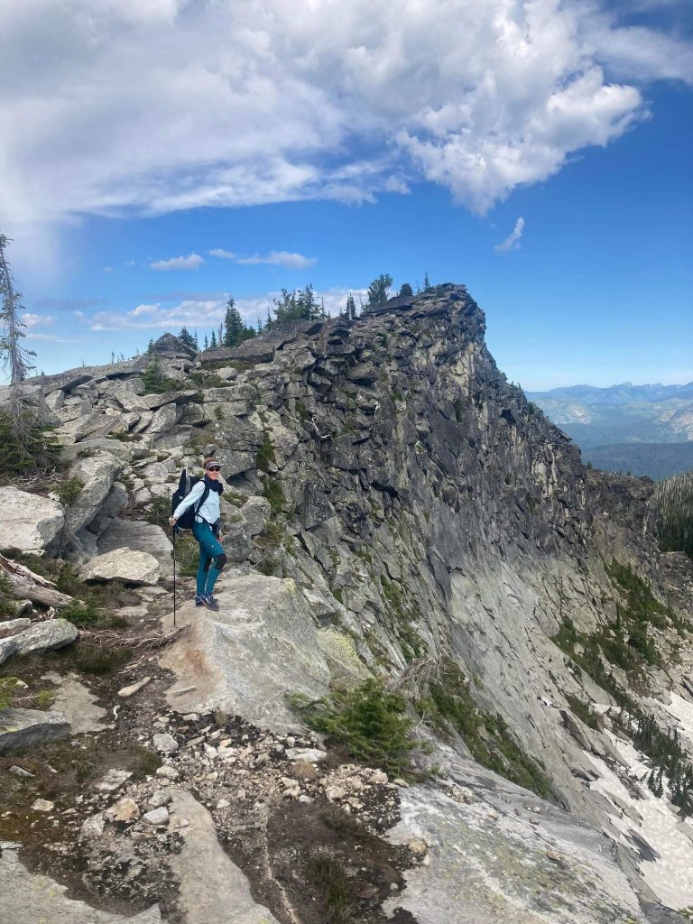
We then had to skirt around the south side of the Lions Head massif, which was still pretty easy. By lunch we’d come to a large slabrock area where a creek roared down from a circ above. This feature showed clearly as a blue dot and line on our maps, so we should have realized that it would be flowing in this high-snow year. We didn’t need to carry as much water as we did.
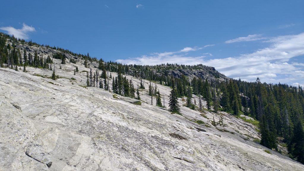
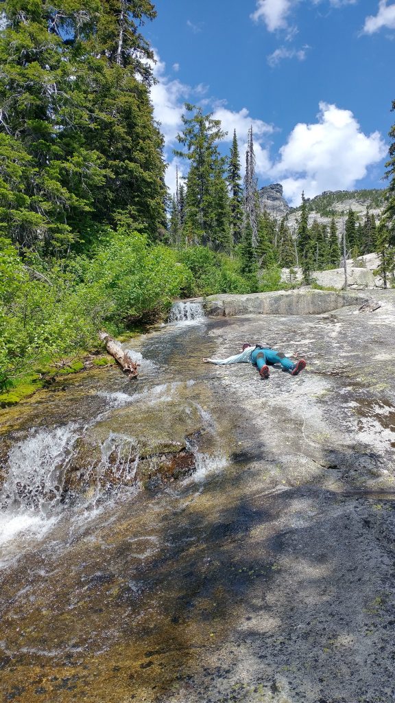
We stopped for a nice lunch break, absorbing the fantastic views. Everywhere was gnarly rock, yet where we sat the slope was gentle and inviting. Water flowed like velvet down the slab…effectively a waterfall but at a more gradual tilt. The scene reminded me of the Desolation Wilderness along the PCT in California. Yet I imagined that we could be the only people around for miles in such a fantasy alpine realm. It was really special. I started lamenting that the experience was going by too quickly. This was often labeled as a hiker’s worst day on the PNT, but I was having so much fun and loving it.
Well, we’d saved our type 2 fun for the afternoon. After the easiest travel along the gentle slabrock area, we got into some confusing stuff. Suddenly the ridge presented as a ravine, with a small bluff, or what I’d call a gendarme standing in our way. We couldn’t tell from our GPS trackline if we were supposed to skirt it or go up and over. We could have followed a crack that might have gotten into some class 4 moves, but instead we tried to go around and then went up anyway on the south side, following a line of trees and grass. The slope was stupid steep but at least I could grab onto the vegetation. We were definitely off the suggested line and I still have no idea which way we were supposed to go. Only thing that matters is that we were able to keep going.
Following this little hick-up, we got into a spot where we were too far down from the line and had to climb steeply up to avoid steep and slick slab. Then we were going through a meadow with thick bushwhacking conditions. The afternoon wore on and there was nothing to be done about our slow pace but to keep pushing. We saw some footprints in a snow patch that we thought were human. We had some more confusing sections, and we did a horrible bushwhack to get down and through the saddle to join up to the red route. The final insult was yet another steep climb to a ridge, swimming through willows that were all pointed downward against us. I could barely move through these at times. At last I found a game trail that became a real trail and it was like a miracle. We came across a nice spring and also ate some snow to cool down. I even stuffed some into my bra.
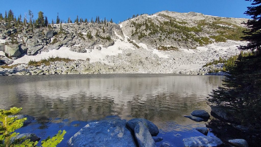
Once we got on the last ridge leading to Ball Lake, I thought we were finally in the clear. But the ridge turned into one more steep traverse through boulders and cliffs. I was so exhausted and sore. My legs and arms ached from the exertion. We’d found some snow patches to walk over, making the ridge easier, but now we had to be very careful again. I just wanted to get to the lake, eat dinner and go to bed. At last the beautiful alpine lake came into view and we glided on snow down to it. Luckily all the campsites were free of snow and the lake a real gem to relax next to after one of the hardest days of my life. It took us 13 hours to go 12 miles, with a 1 hour break. But we made it exactly according to our plans and I was really proud about this day. What an amazing mountain range…I’m truly blessed to have been able to experience it in this way.
Great description, can’t wait to do this myself. Great to meet you and Wolverine, happy trails.
Hi Twig, hope that you are doing well .
Wow Twig, how beautiful and impressive. Great writing!