06:30-13:00, Sunday, 8-02-20
CO 14ers: 16 of 53
Distance RT: 10 miles
Elevation gain/loss: 5,000′
Starting Elevation: 9,400′
Summit: 14,196′
Rank: 21 of 53
Location: Sawatch Range, Collegiate Peaks, west of Buena Vista
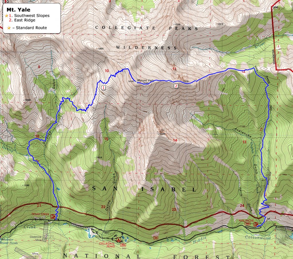
Route: Avalanche Trailhead, north on CT, up East Ridge, down Southwest Slopes to Denny Creek Trailhead/HWY 306, Class 2.
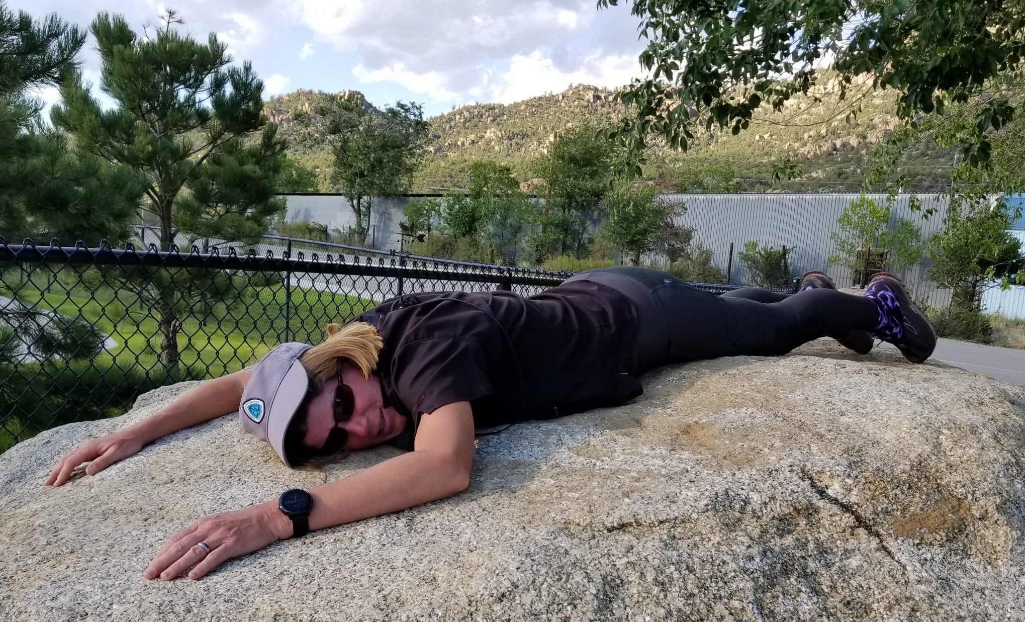
I was feeling pretty good after my marathon of 5 14ers in 2 days, that is until the 3rd day. Then I felt like this:
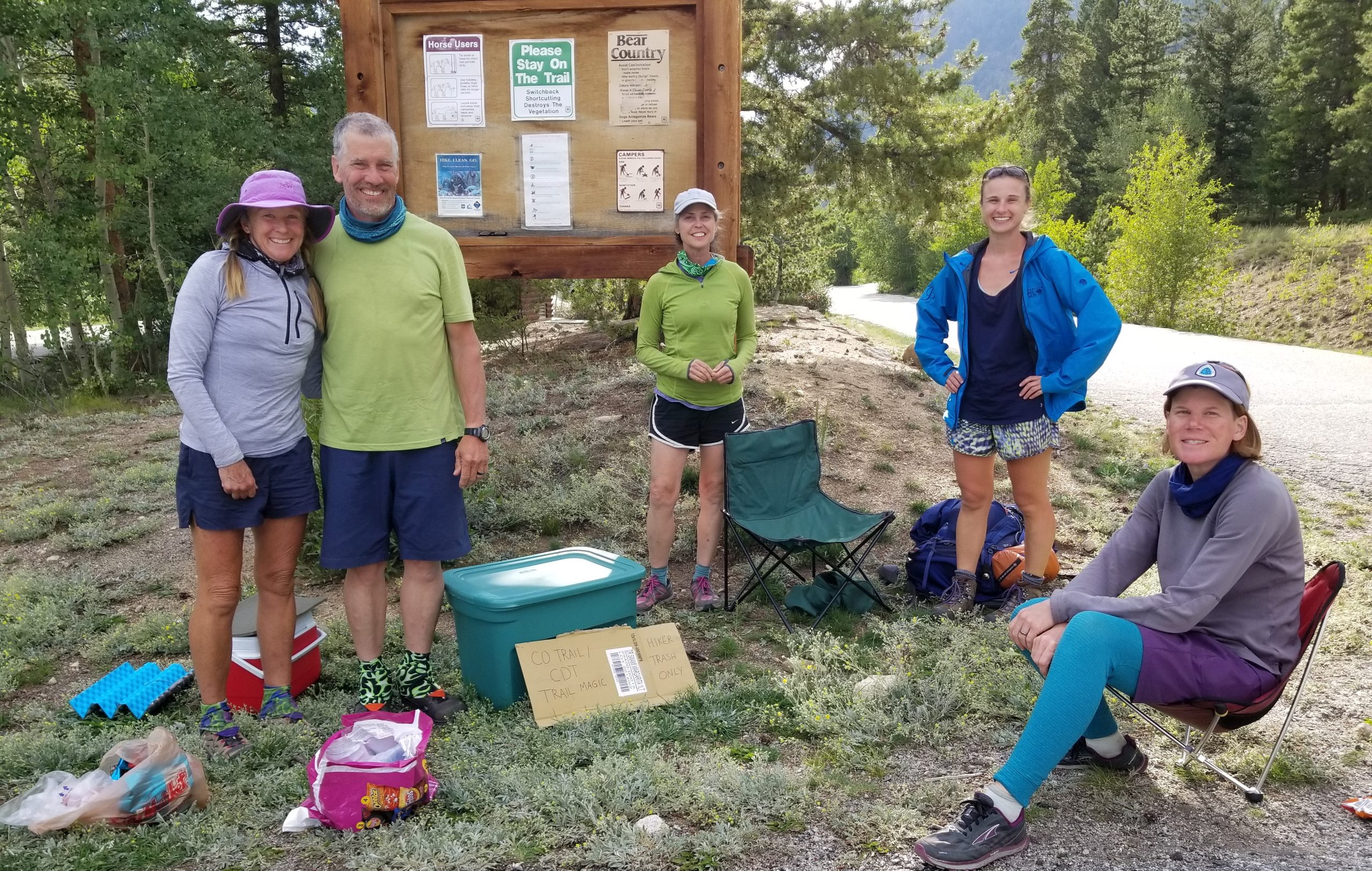
After Bierstadt and Evans, I decided to head for Buena Vista for the night. The plan was to hike one of the Collegiate Peaks the next day. After dinner and a night tenting at a KOA, I was none too excited about waking up early to hike another mountain. So I came up with another plan. It was a Saturday and I was in the vicinity of several access points to the Colorado Trail and CDT. For a long time, I’d been wanting to return some of the years of kindness I’d received from Trail Angels by becoming one myself. So I hit the grocery store in the morning, stocking up on fresh fruit, candy, chips, soda, and beer. In all, I bought over $100 in food and drink, then hauled it up to Cottonwood Pass to dole out to hikers and bikers.
This is the same pass where I longed for trail magic several times as a thru-hiker myself. It sits along the Collegiate West section of the CT/CDT. It’s not the best spot to offer trail magic, since many hikers are either getting on or off the trail via Buena Vista and therefore aren’t in need of TM as much. But it’s easily accessible and would put me in a proximate position to hike Mt. Yale the next morning. I arrived around 11 am and quickly had my first customers. Ham, Scooter and F-word were 3 CT thru-hikers I met when section hiking the CT 2 weeks before and also appeared in Griz’s CT videos. Unfortunately I’d just missed Griz (otherwise I might have made it into one of his videos).
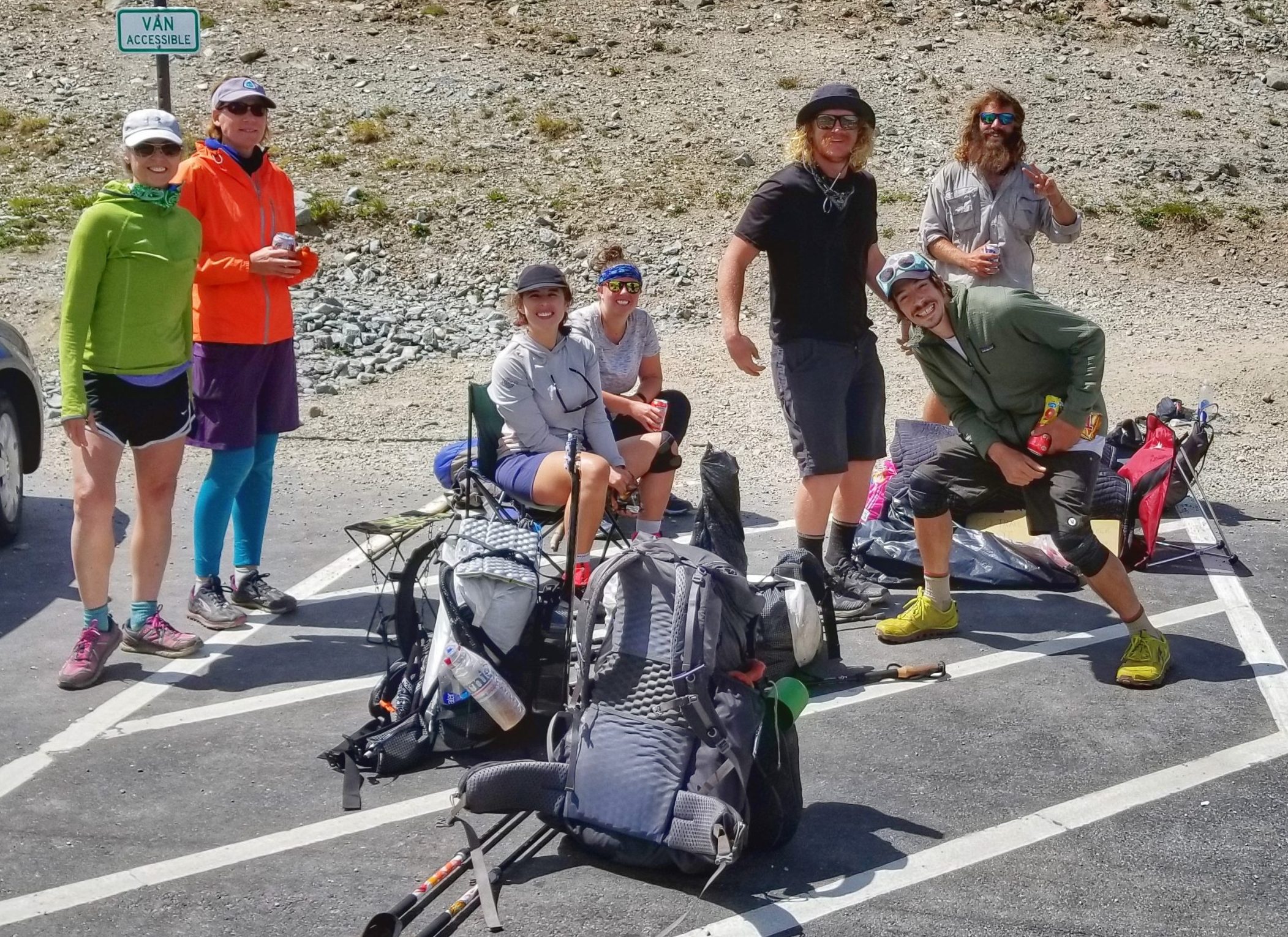
In all, I provided trail magic for about 20-30 hikers and bikers. I also acted as a ‘ride bride’ for a few guys trying to get a hitch into town (vehicles are more likely to stop if they see a woman). There are many ways in which one can provide trail magic.
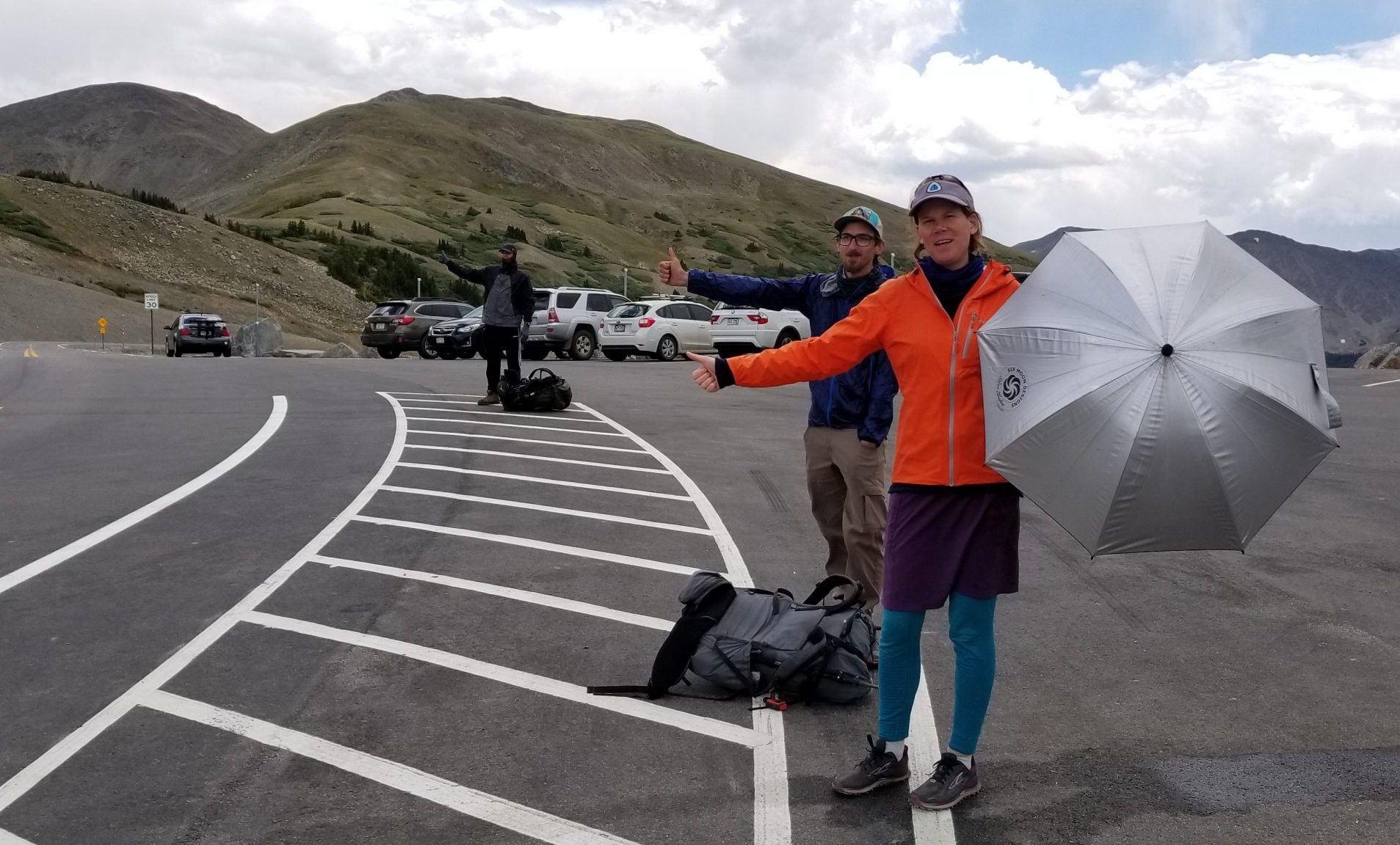
It started to storm at the pass around 3 pm, so I packed it in and headed for Avalanche Trailhead. This is where the eastern corridor of the CT passes through, so I set out the remaining food and drink to give away to more CT hikers. This couple and solo woman were the sweetest hikers I met all day. They were so surprised and appreciative of the gifts. We hung out together for awhile, sharing stories of the trail. This was my launch point for the next morning, so I had all evening to enjoy the fresh mountain air. I set up my tent in the forest a little ways outside the parking lot so that I could feel like I was “on the trail.” What a great day it was, giving back a little.
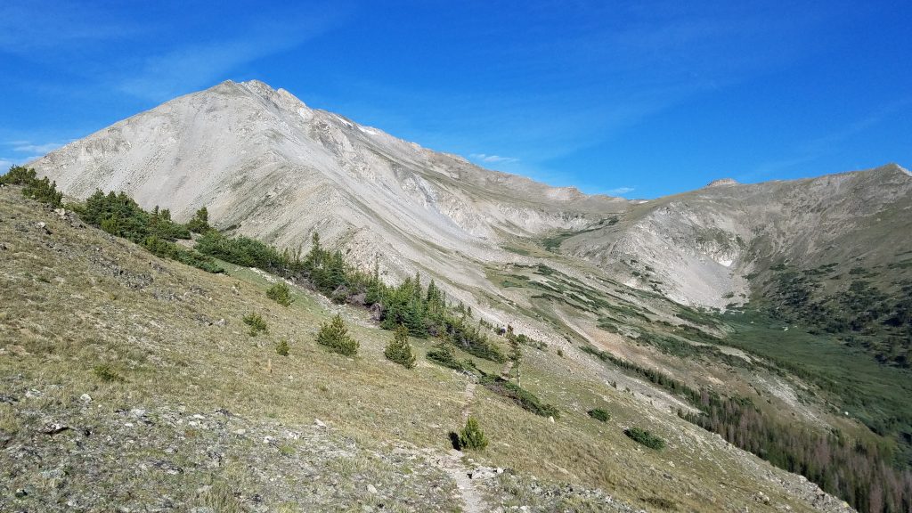
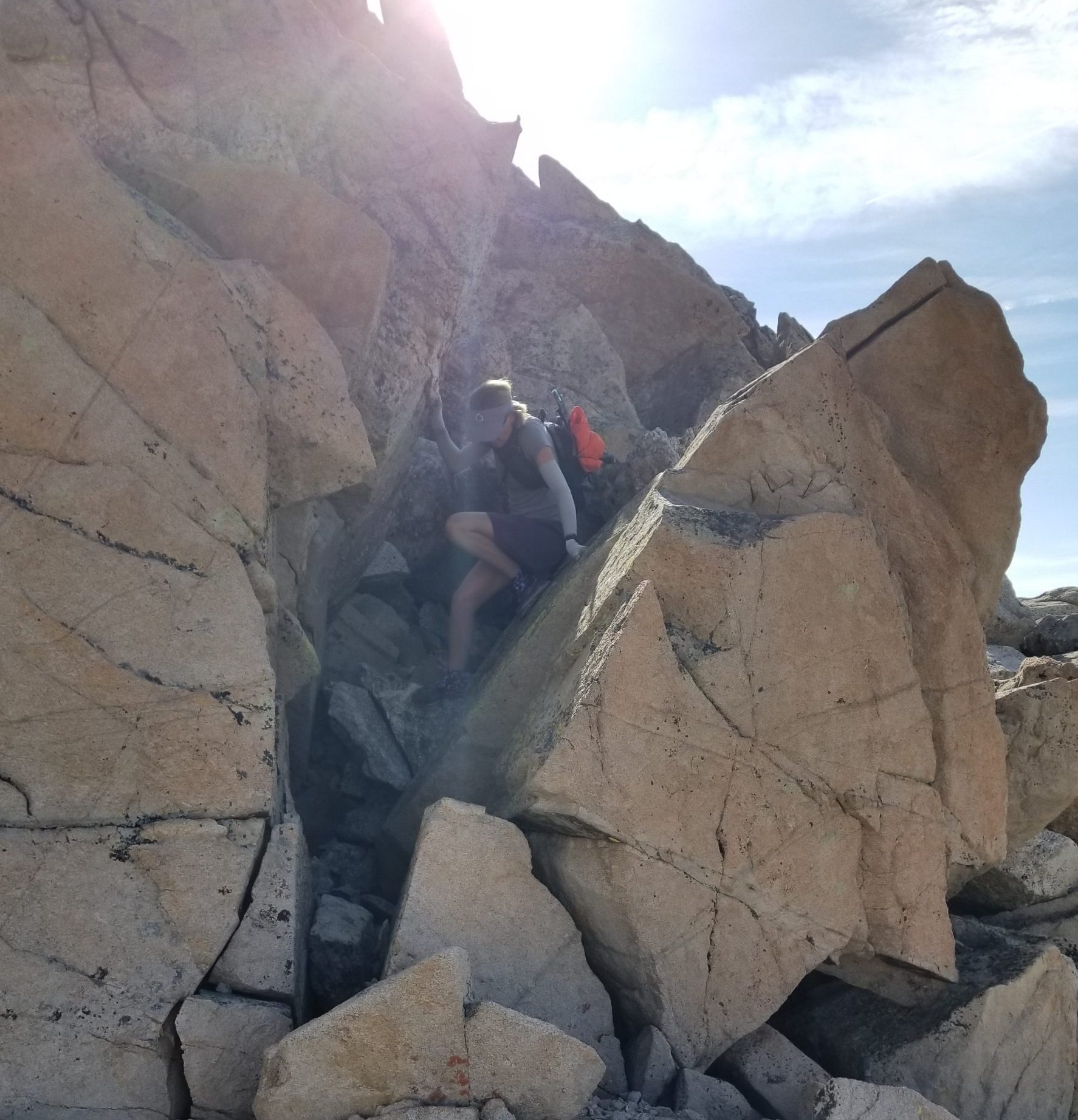
Ok, back to the topic of this post: Mt. Yale. I hiked past this mountain on the CT in 2017, now it was time to go all the way to the top! Sandy, another hiker I’d met, offered to drive her vehicle to the Denny Creek Trailhead, about 5 miles up the highway. She would hike to the top from there while I did a loop hike, starting at Avalanche Trailhead and finishing at Denny Creek. In retrospect, I could have made it ‘700’ less in elevation gain’ easier by doing the loop in reverse, but this was just the way it worked out. I hiked north on the CT for 3.25 miles, all uphill, until I came to a faint trail leading up the east ridge. After I made a big deal about how I always study a route in detail in the last post, I have to admit that I didn’t really review this one at all. I knew that I just had to stick to the ridge and that it would be fairly obvious, all class 2.
For the most part, it was. But there were a few tricky spots in the form of some cliffs and really steep and slippery scree slopes. I managed to find good routes around most of these hazards, but went too high on the ridge at one point and had to do a little downclimbing, which was kind of fun. I was feeling pretty confident in my mountain scrambling skills by now, this being the 13th mountain over 13,000′ I’d done this year. The many encounters with rocks, cliffs, and scree slopes add up, to the point where it all starts to feel second nature.
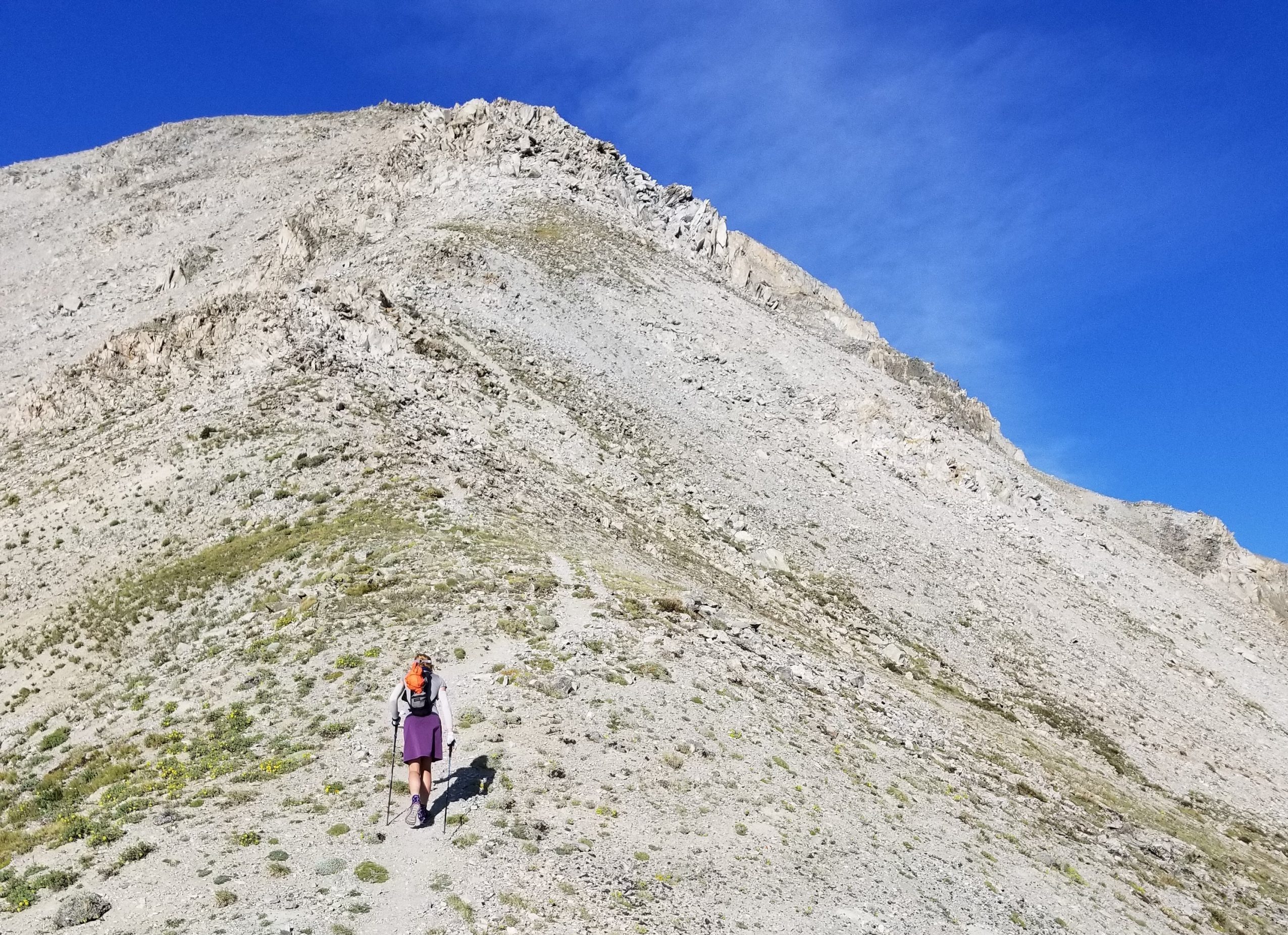
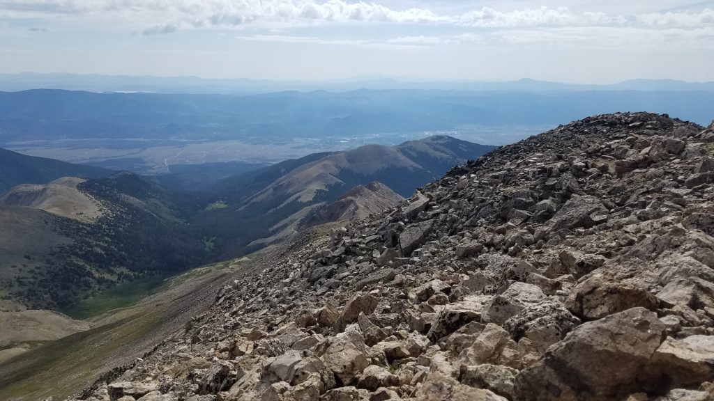
Looking back down the East Ridge towards the saddle with the CT and further towards the Arkansas River valley and Buena Vista.
It was a pretty long and exposed ridge (2 miles) but I made it to the top by 10 am, just in time to rendezvous with Sandy. With another perfect weather day, we were able to hang out for awhile. I was lucky to get so many good days for hiking 14ers this year. The monsoons (afternoon rainstorms) were almost non-existent…which wasn’t so good for the horrible fires later in the season.
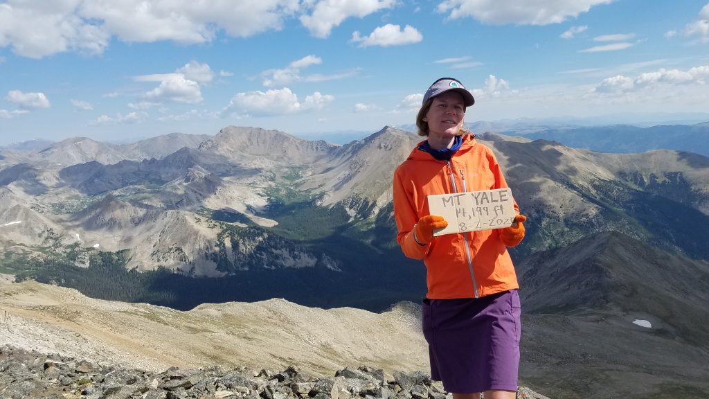
I like this photo because Mt Columbia and Mt Harvard are visible just to the left of my head…2 more 14ers I’d strike off the list later this summer. Plus, the sign is proof-positive that I hiked the mountain on this date!
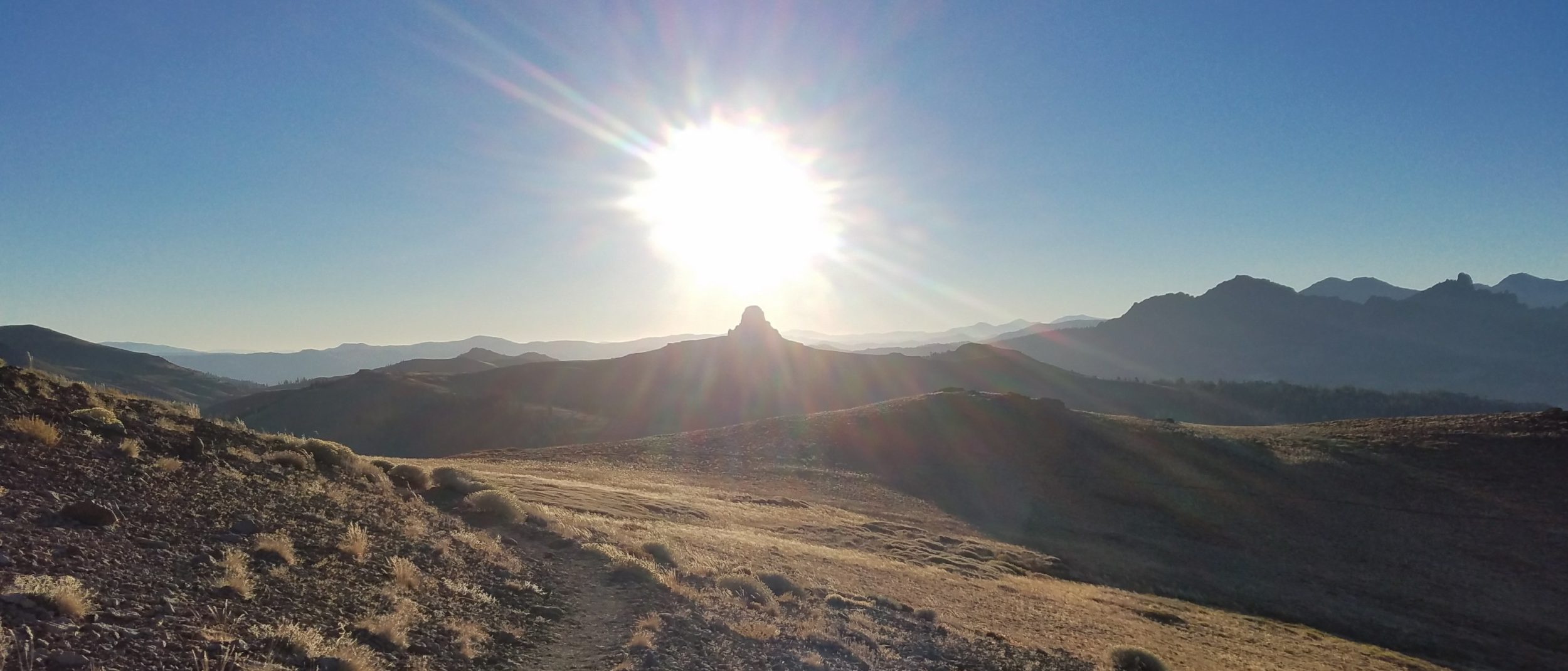
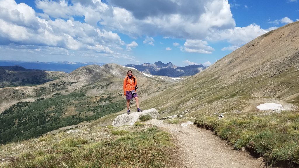
There was a decent sized crowd at the summit but far fewer than I would have expected for a Sunday. I only saw a handful of people on the East Ridge. We started down around 11 am, just as some clouds were starting to gather. The western slopes were much easier and we enjoyed a very pleasant stroll through the tundra. All the surrounding valleys were so beautiful, almost free of snow and alive with green grass and wildflowers. I posed for a picture in front of the 3 Apostles, just to the right in the distance.
The rest of the trail was just as nice. I highly recommend it for doing an out and back to the top of Yale since it’s well graded and has many pleasing features. But I was glad I was able to do the loop hike just the same, since I had looked longingly on the East Ridge trail when I passed it by in 2017. I always enjoy when I can hike a trail and not have to repeat any portion of it on the return. Perhaps next time I’ll take the easier direction by hiking it in reverse, west to east.