06:00-14:00, Friday, 7-31-20
CO 14ers: 14 & 15 of 53
Distance RT: 10.25 miles
Elevation gain/loss: 3,900′
Starting Elevation: 11,699′
Summits: 14,060′ & 14,264′
Rank: 38 & 14 of 53
Location: Front Range, Guanella Pass Scenic Byway between Bailey and Georgetown
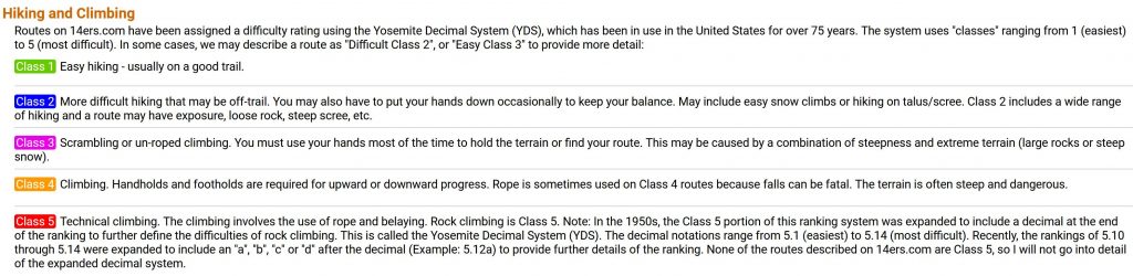
Route: Mt Bierstadt West slope to Sawtooth ridge to Mt Blue Sky, back down through Scott Gomer creek gully, mostly class 2, Sawtooth section is briefly Class 3.
After a sweet ‘3 for’, it was time for another ‘2 for’. To put things into perspective, it took me years to work up to my first five 14ers, then months to do the next 5. With this series (the DeCaLiBron the day before), I knocked out 5 in 2 days! This combo route involved a pretty easy hike up Mt Bierstadt, followed by a high intensity scramble across a ridge called the Sawtooth, then another easy hike to connect Mt. Blue Sky.
I had been wanting to do this combo for weeks, having researched 14ers in proximity to Denver while visiting my cousins. But the weather had not been cooperative and I was also reluctant to go for it alone. This was because I’d never done a designated Class 3 section while hiking a 14er. Level of difficulty is based on a 1-5 rating, described in the snip below:
In retrospect, I’ve probably done plenty of Class 3 scrambling on past hikes without even realizing it, especially in New Zealand. And now that I’ve calibrated my knowledge of these classes, I’m pretty comfortable with hiking future Class 3 routes. I’m of the mindset and experience level of being as prepared (and sweaty) as possible. As such, I study all the pictures of the routes on 14ers.com and sometimes even watch videos. At a minimum, I want to know the crux (most difficult part) of the route and the major landmarks to look for along the route. Something as simple as going up / down the wrong gully definitely can mean the difference between life or death. Most routes are somewhat marked, but the website does a good job of calling out the places where it’s common to make (fatal) mistakes…learned from the experience of countless others.
I had done my homework regarding this hike, so I felt pretty good about tackling my first Class 3 route. I staged for this hike by car camping at the trailhead, where I enjoyed a nice sunset, celebratory drinks and fresh mountain air (this was still the same day I had done the DeCaLiBron). Technically, camping is not allowed but there’s nothing saying you can’t grab a bit of wink-eye for a few hours inside your car…as long as you’re discreet about it. Be quiet, respectful, and leave no trace, etc. The trailhead actually has 2 parking lots and I mistakenly set up in the lower (closer) one to start. When some younger hikers showed up at sunset, blaring their speakers and making a comment about how sleep is overrated, I wisely moved to the upper lot.
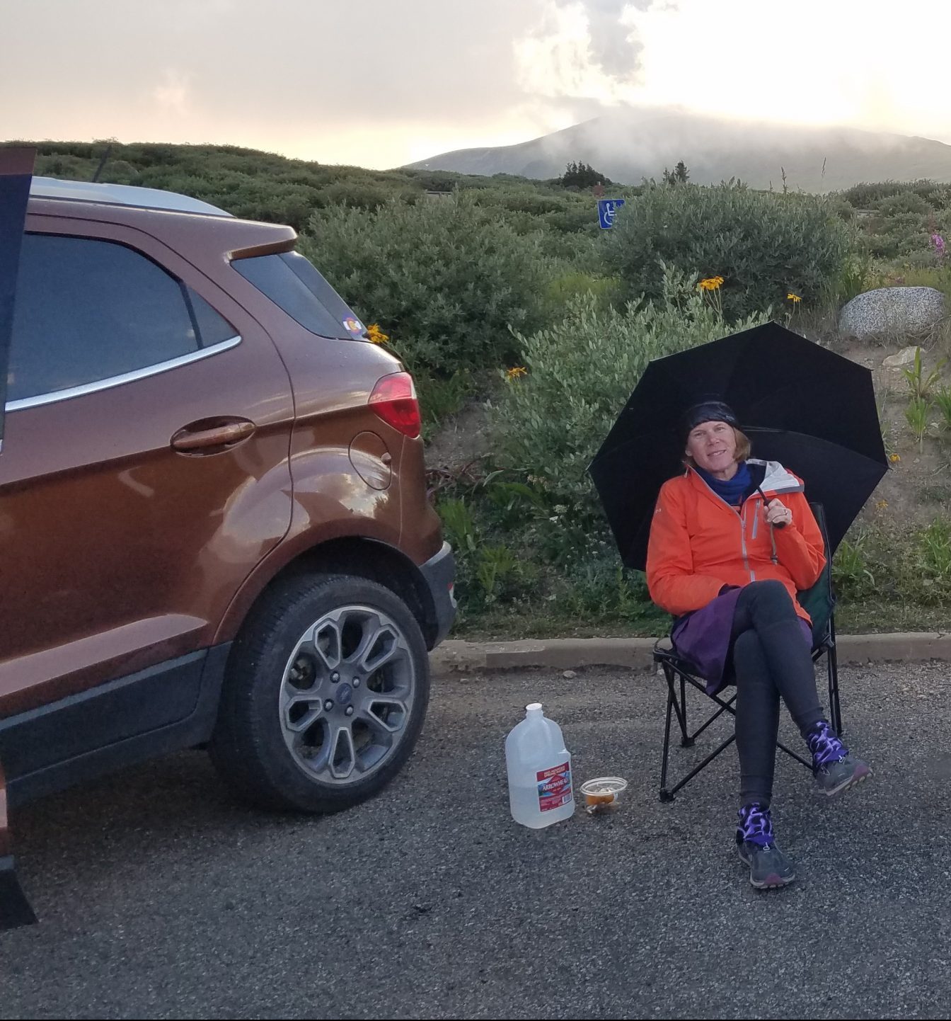
There, I was treated to some entertainment via a few astronomy buffs, their telescopes set-up to view a meteor shower. It was too cloudy for the shower but we did get to share in some nice images of the moon. Plus, the upper lot was MUCH quieter. Lots of folks arrive at 3 am (or earlier) for sunrise summiting and I correctly assumed these early risers would park at the lower lot first. I went outside to pee around 4 am and could see plenty of little lights heading up the mountain. My location was dead quiet until about 5 am, by which time the lower lot had already filled up…time to get up and go!
I set out relatively late and was shocked to see what a zoo the lower parking lot was at 6 am. 30 some vehicles were lined up on the roadside, in addition to the jam-packed lot…this amused me since the upper lot still had plenty of spaces. Already I could see a line of hikers that stretched for 3 miles…the length to the top. Due to it’s close proximity to major front-range cities, as well as the relatively short distance from the trailhead to the top, Bierstadt is thought to be the most-hiked 14er. The forest service estimated the total numbers for 2018 between 35,000-40,000 people, with a single day record of nearly 1,400. This was not the best hike for social distancing. But I did it anyway.
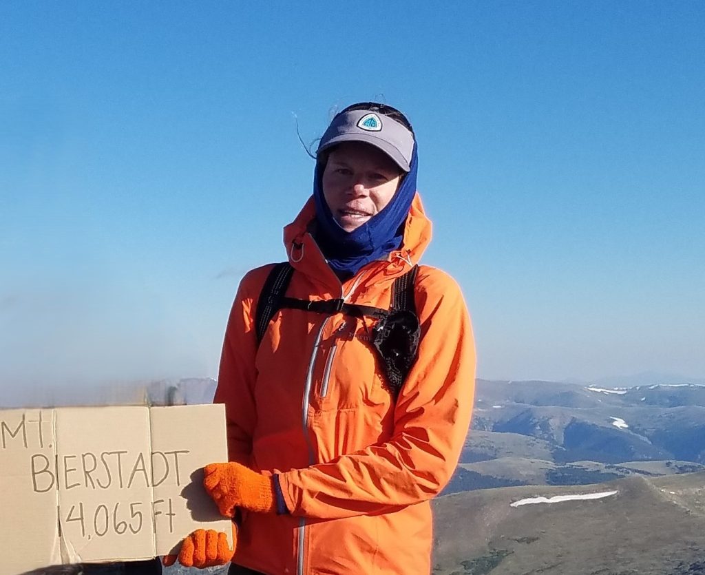
The first part of the trail involved a lot of boardwalk through marshy habitat, so I had to go a pretty slow pace in single file, trying to keep 6 feet of distance. Once I got to the rockier slopes where the switchbacks began, I was able to pass dozens of hikers. Given my usual fast pace, I passed so many that there were only about 20 people at the summit when I arrived.
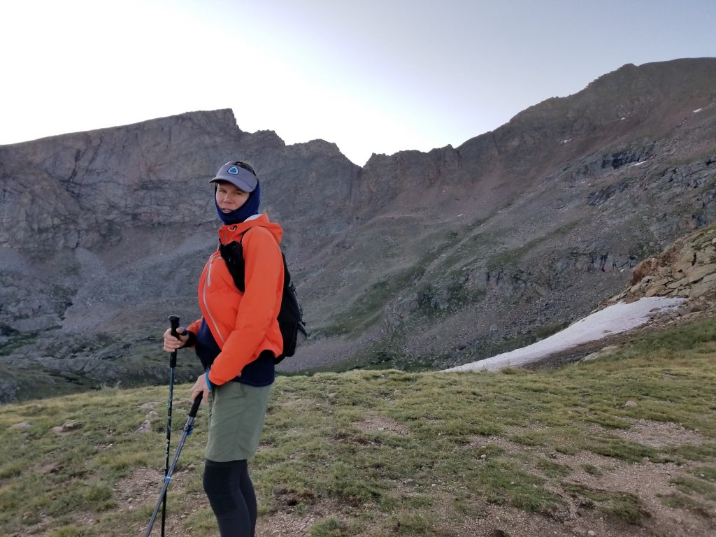
I took the obligatory photos (organized hiker sign and all) but didn’t linger. It was only 8 am, but I was nervous about the Sawtooth and wanted to get cracking at it.
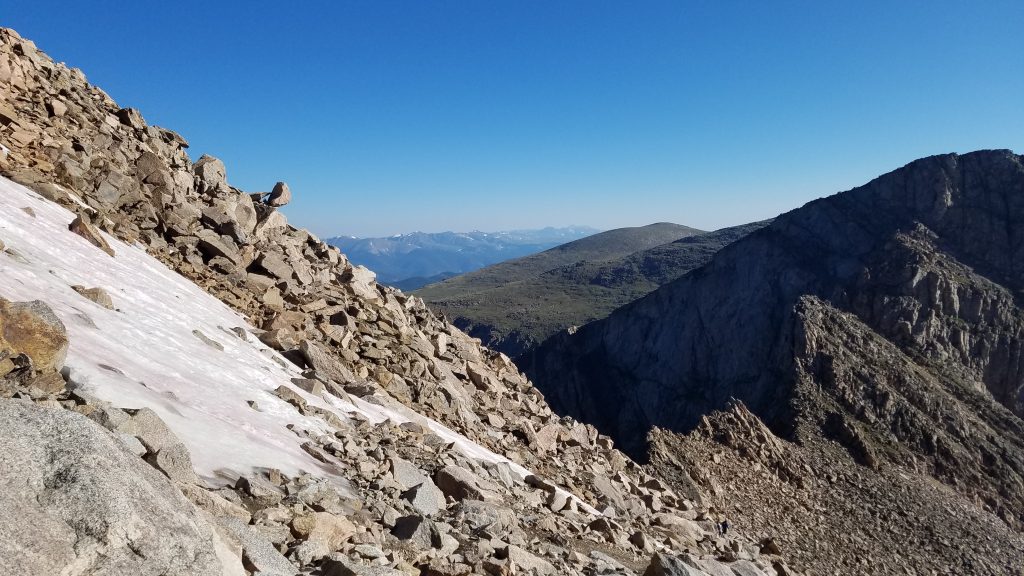
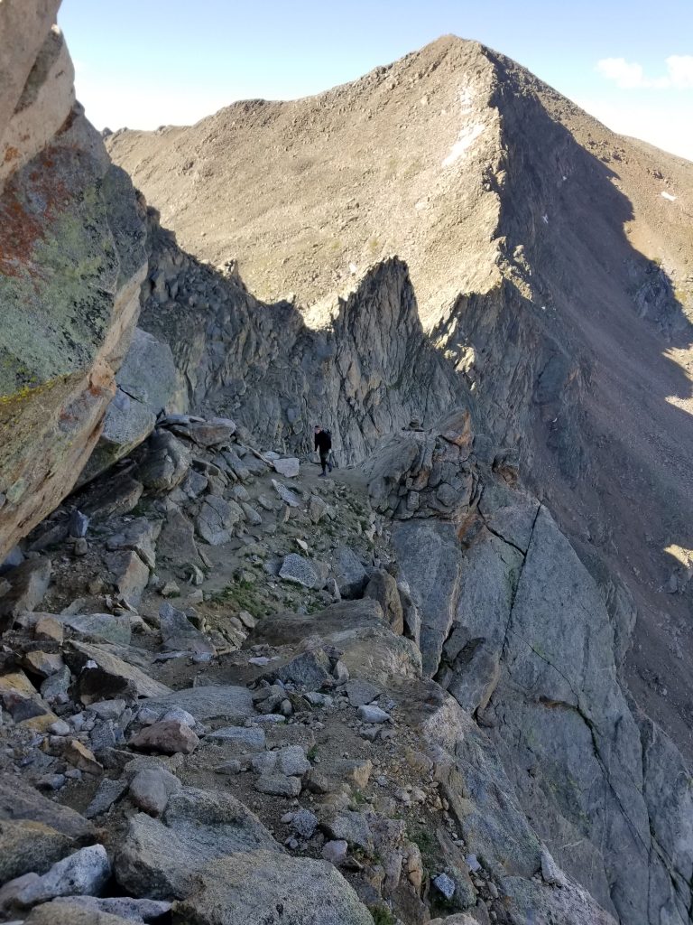
On the way down from Bierstadt, with the Sawtooth looming. Notice the balanced rock on the ridge to the left, above the snow patch. About the size of a car, it looked like it was ready to leap off and land on my head!
The crowds immediately disappeared as I started down the ridge. I could see only a few people ahead, all wearing climbing helmets. This is a piece of gear I really should have been wearing. Later, I thought about wearing a bike helmet but didn’t want to look silly…better than nothing though. I’m going to get one for future mountaineering hikes. BTW, helmets aren’t really for rockslides, severe falls, or the occasional loose boulder…those are probably going to kill you regardless. A helmet is good for the small rocks that other people kick loose when they’re climbing above you. It’s a smart practice to be prepared for such an instance, but luckily there were so few people on the route that I didn’t have to worry.
As I downclimbed the steep ridge, I started to gain some confidence. The rocks were big and numerous but not enough to scare me. It was all stuff I’d done before. I quickly caught up to a couple in front and just as quickly was passed by a solo guy. I marveled at the different skill levels and paces. The couple indicated that they were already pretty sketched out by the terrain, even though we hadn’t yet come to the toughest parts. As we got to the saddle, I looked to see what route the solo guy was taking to get past a gendarme (crux of the route), but he was already out of sight. Another fast guy passed us and we watched as he made short work of the gendarme, going up a chimney feature. He made it look so easy that we decided to follow his route. This is when I learned that just because someone else makes it looks easy, it doesn’t mean it’s so (this principle works the opposite way, as well). Of course, the chimney was NOT easy and we came to a spot where a fall would have been very bad. I didn’t look down and just kept going up.
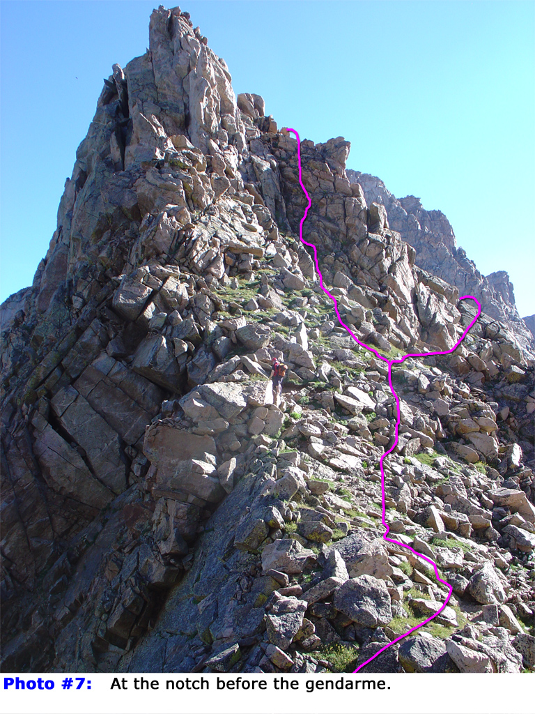
A photo from 14ers.com showing some optional routes past the gendarme. I went left, even though I had originally planned to go right because it looked way easier. I did not like the chimney near the top…probably more of a Class 4 route than Class 3. To note, I went up slightly left of the left-drawn route. There’s a guy in the center of the photo that gives an idea of scale.
I breathed a big sigh of relief once safely past the gendarme. It was the worst, according to the beta. At this point, it’s critical to know that the route proceeds over the ridge to the west-facing slope of the Sawtooth and across a ledge. Missing this turn would result is some further hairy climbing, probably death for me. This is a great example of why it’s so important to study these routes beforehand.
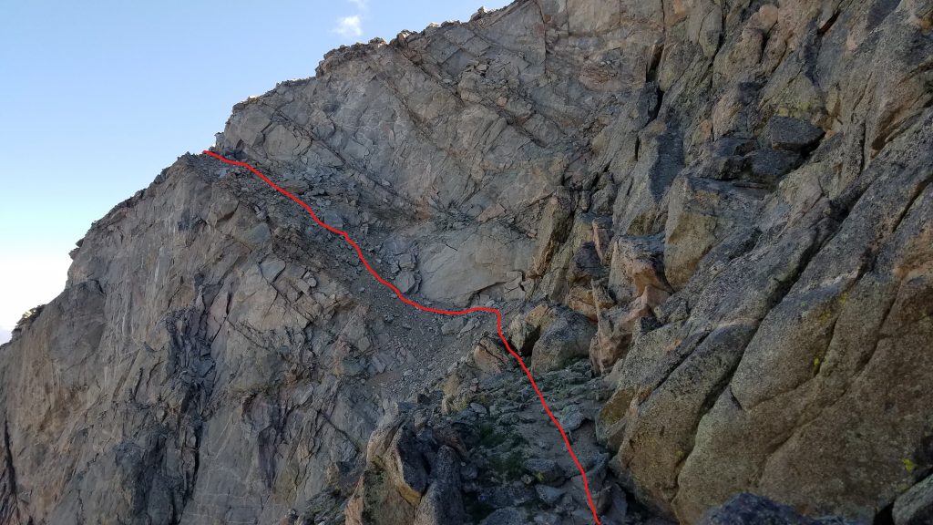
The ledge was not difficult at all. I was able to walk at a normal clip and didn’t even have any visions of slipping off the side. There was some loose gravel in some places and a bit of a steep climb at the end, but nowhere near as bad as some of the scarier stuff I’d done with a full backpack on.
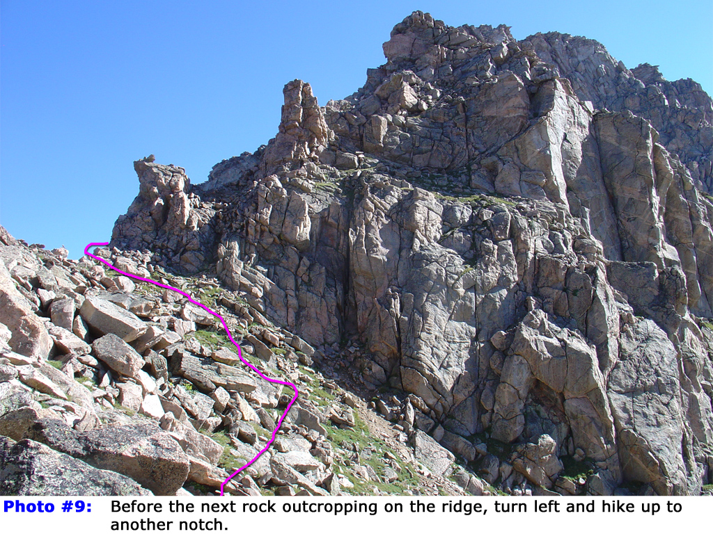
The sun was shining bright on the other side and the hike held a whole new meaning. I’ve felt this feeling many times before when accomplishing difficult things and/or living on the edge, but mostly from climbing mountains. Relief, satisfaction, elation…kind of a whole bunch of things wrapped up into one. All I had to do was climb another 14er and head back down a different, easier route. It seemed like child’s play. The route east to Mt. Blue Sky followed a relatively broad ridge, involving just a bit of route-finding and boulder hopping. Here and there were a few cairns but it took a lot longer than I expected. The 2 guys that had passed me on the Sawtooth were already returning as I approached, along with some others that I hadn’t seen yet. I didn’t know who was coming or going since there are several other routes in the area.
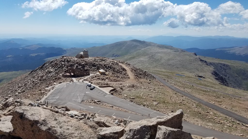
After awhile, I spied my final target. Mt Blue Sky is one of only 2 Colorado 14er’s with a paved road to the top (the other being Pikes Peak). It’s accessible by the general public but not this day…or year. Thanks to COVID, I enjoyed one of the rarest events of all: an empty summit atop one of the most accessible, and therefore visited, mountains in the world. At the time, the road was closed to all but bicyclists (or any other pedestrian, looking for a really long walk, skate, etc). I saw about 20 cyclists but since most were wearing cleats, they were stopping at the observatory. The actual summit is up some rocky switchbacks, 100′ more in elevation. Riding the road is enough for most but of course hikers always have to go to the very top. There were also 2 forest service rangers in vehicles. They were surveying and planning new strategies for how to open the road in the midst of COVID. They asked me about the crowds on Bierstadt and I relayed that it was not an ideal situation. We mused at how the pandemic had made conditions ideal on one mountain top, yet seemed to be contributing to the overuse of another.
This was 1 of only 4 14ers so far that I was able to enjoy to myself for a reasonable length of time (arrival at the summit to departure). The others were San Luis Peak, Mt. Humboldt and Mt. Harvard. San Luis is still the only one where I was by myself and didn’t see anyone all the way up or down (RT 3 miles). This is all to say that during such perfect weather conditions, it’s pretty rare to be alone on a 14er and almost unheard of for this particular one. Thus, I took my time hanging out and striking silly summit poses. The downside is that I didn’t benefit from an organized hiker’s sign.
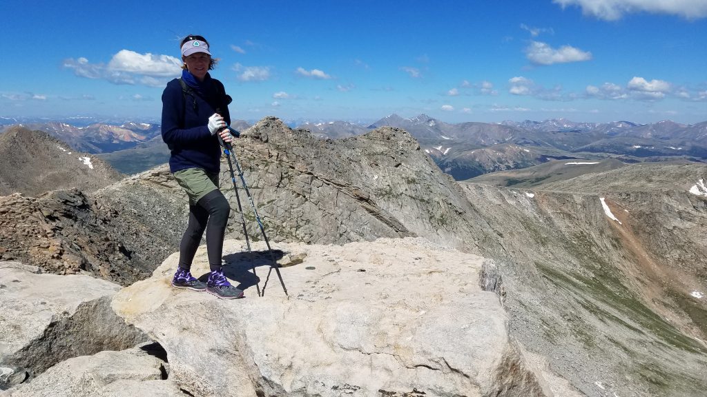
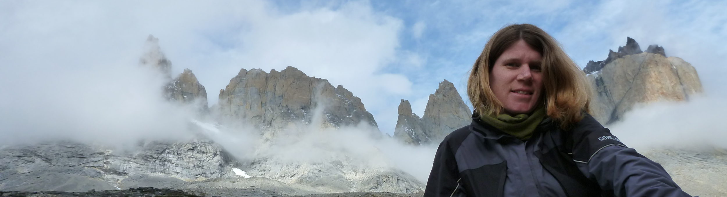
You’ll have to take my word that this is Mt Blue Sky, since I had no sign. See Grays and Torreys in the background? That should be proof enough.
By the time I headed back, it felt very late in the day, yet it wasn’t even noon. I stopped to watch some bighorn sheep cross the road while an unsuspecting cyclist nearly plowed into them as he raced downhill. Yikes! Not an obstacle you expect when riding a bike…at least not most places. I retraced my steps west along the ridge, meeting up with the couple I passed on the Sawtooth. They had a much harder time with the ledge, reporting that it was the most harrowing experience of their life. Like I said about an experience being easy for one person but not the next. But good for them, they persevered and were some of about a dozen to finish the combo route this day.
Just before the Sawtooth ridge, I made a turn towards a gully that would lead me down to the valley. This way I didn’t have to hike the Sawtooth or summit Bierstadt again. All I had to do was keep going down. The wide open tundra eventually funneled into the steep gully. The slippery slope was actually pretty fun.
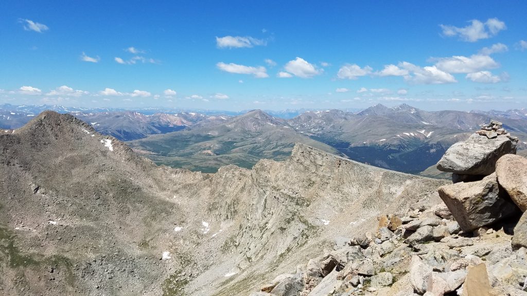
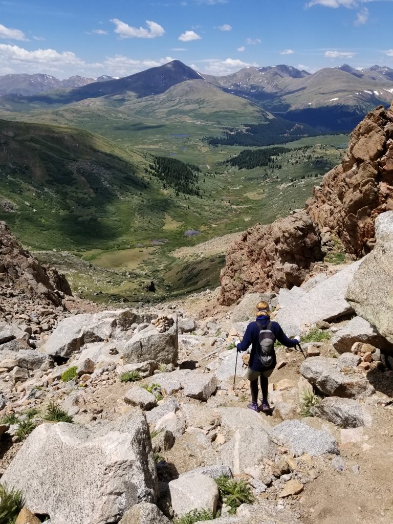
A look back along the Sawtooth and summit of Bierstadt.
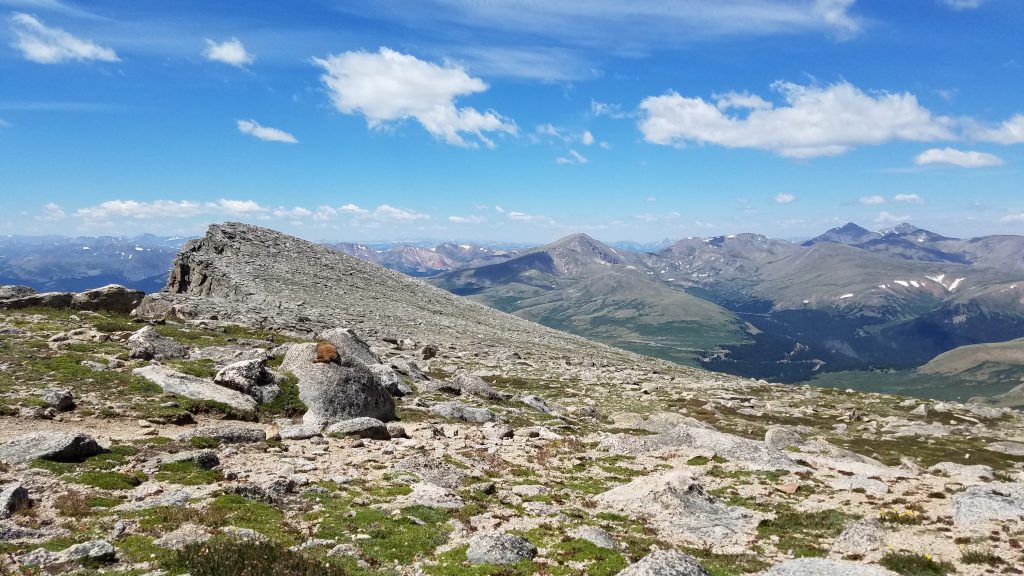
See the phat marmot lounging on the rock? What a day to enjoy a rock pillow. Exquisite.
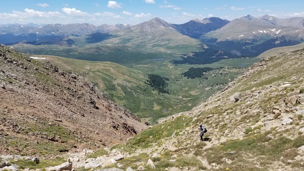
Down the gully and into the willow-chocked valley.
I was more worried about bush-whacking through the willows than slipping down the gully.
I’d read some trip reports that said the worst part of the whole route was navigating the willows and marshes at the end. Luckily I found some well-worn trails and didn’t have to bush-whack much. There were also some muddy parts but even these were negotiable without having to get too wet of feet. I saw only a handful of other hikers exploring these parts. The route eventually joined the last half-mile of the standard trail, where I also rejoined the herd. I knew exactly the remaining distance to the main trail by the sound of people’s voices getting louder and louder, like approaching a super highway. As I quietly inserted myself into the line of traffic, I smiled at how special and unique my day had been. It was worth every bit…I daresay one of the best days of hiking I’ve ever done.
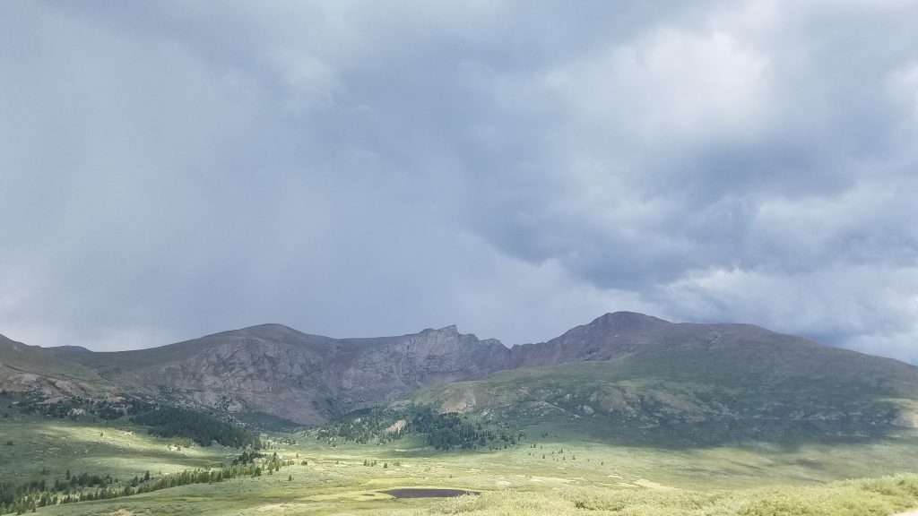
At the car park, I took a look back on the valley, noting the gathering clouds. I’d just passed people that were heading up, not heeding the well-proclaimed advice of getting an early start. Thunder boomed just as I rolled out. Off to the next adventure but no more 14ers for today.