Tuesday May 3rd, 2022, 0640-1920
Iron Creek to West Fork Gila, GET Seg 21 mm 11.5
27.5 miles.
I wasn’t looking forward to the challenge of the first half of the day. We were walking unfamiliar territory for about 14 miles, a lot of which was in burn areas. This alternate now had its own alternates to avoid miles of washed out creek travel. The first few miles were fine, on maintained trail. Then we turned up a drainage towards Turkeyfeather Pass, which was chaos from the get-go. I thought there might be some remnant parts of the trail left to follow but I was wrong. Massive erosion and flooding from the surrounding burned areas had turned the drainage into a jumble of rocks and deadwood. It’s hard to describe such disorder or even the process of trying to move through it. It’s one of those things that can only be experienced.
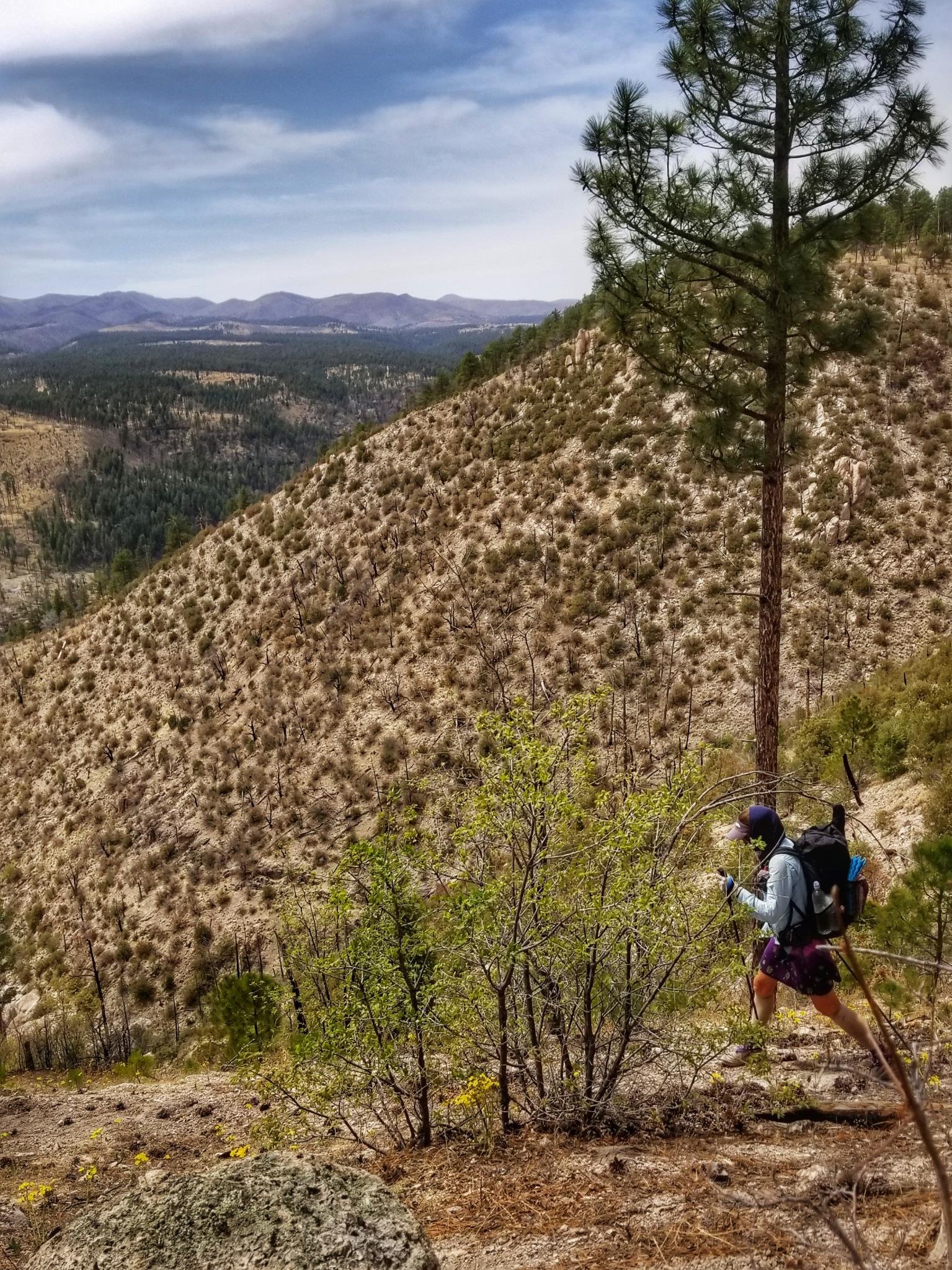
There was an alternate around this drainage but I stupidly decided to see just how bad it was. About 20 minutes into it, I was thinking it wasn’t so bad. But an hour later, having gone only 1.5 miles, I wished I had tried the ridge alternate instead. I got really tired of boulder hopping and climbing over dead trees in that short amount of time. We came to the beginning of the next alternate and I didn’t even think twice about heading up the ridge to avoid more chocked drainage travel. Well, the first part of this alternate wasn’t great either. There was no trail that we could find for the first mile, so we just bushwhacked up a hill. The vegetation wasn’t too thick in most of these areas, so bushwhacking wasn’t the same as bushwhacking in say, the Pacific Northwest. But it can still be slow.
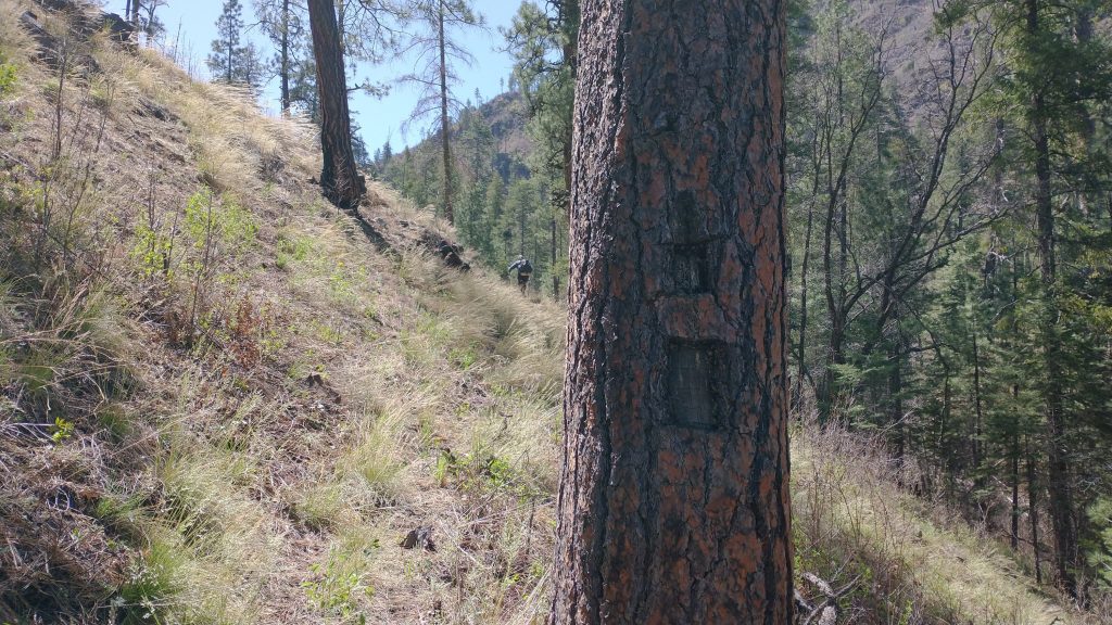
Eventually a passable trail emerged, marked sporadically by old cairns and notched blazes on the trees. You can really get a sense for just how old some of these trails are by the size of the blazes. The antiquated practice of gouging the tree bark leaves a permanent scar, one that grows with the tree. They can be quite large. It’s kind of fun searching for such clues, like reading a mystery novel. We walked along several ridges that were open, with nice views towards the west into the middle fork and beyond to the Black Range. We also had a good views of the Mogollon mountains. It would have been shorter going through them, but I knew that trail was way worse than anything we’d encounter today.
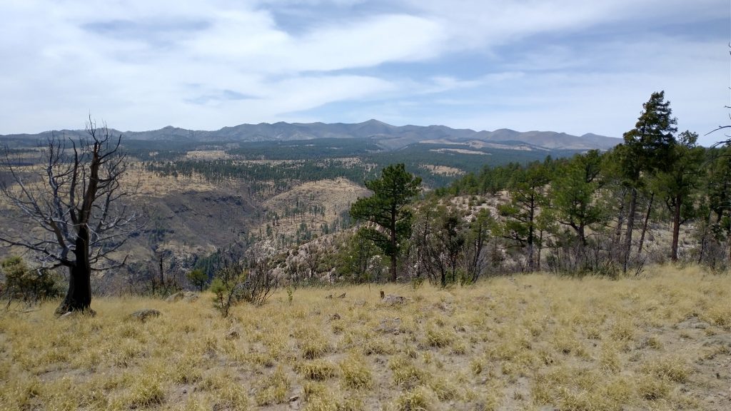
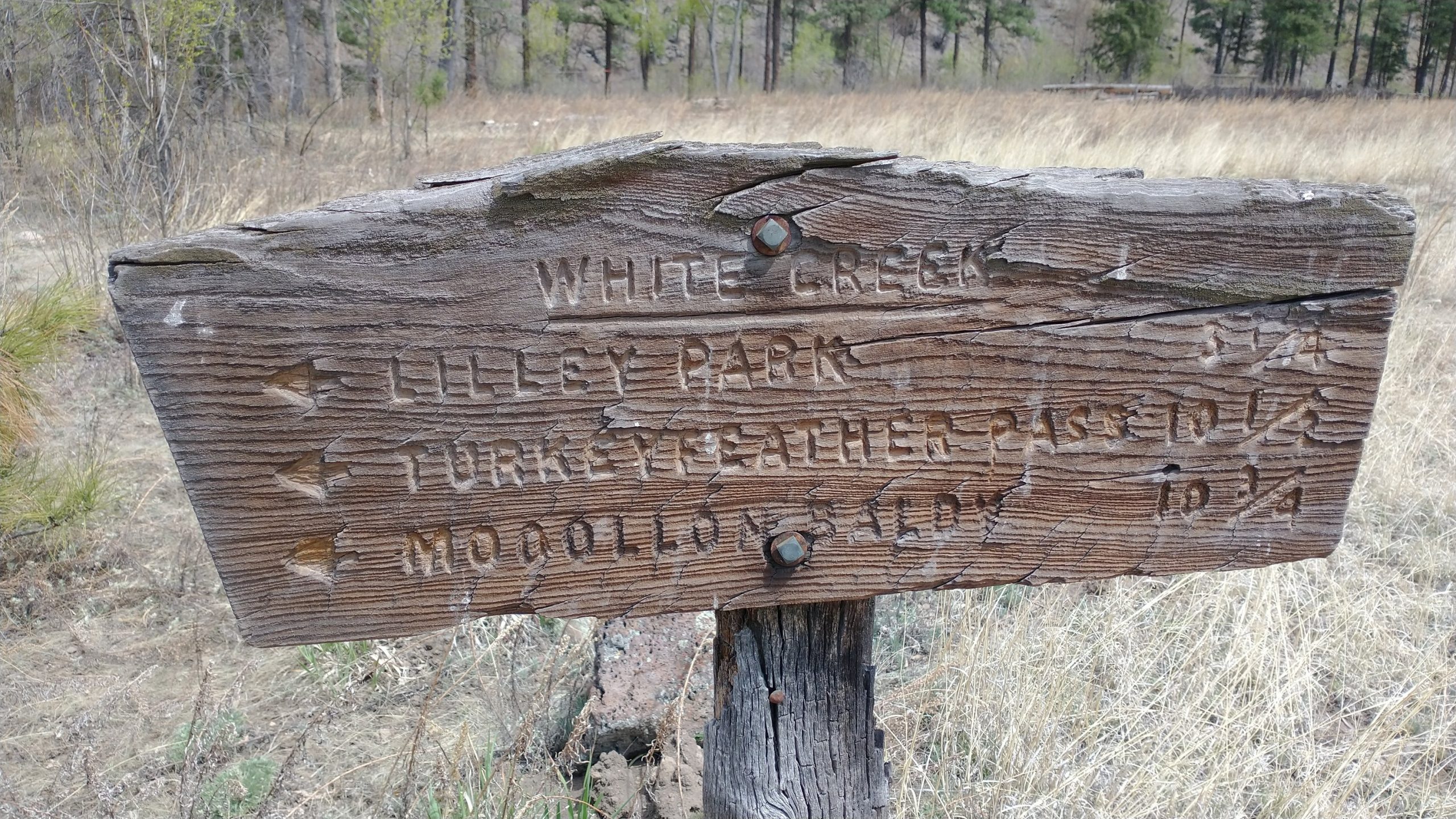
The closer we got to a place called Lilley Park, the better the trail became. There were many points along this route where we could have taken trails to the middle fork, but for whatever reason, we decided to keep the west fork as our destination. I’d walked both before, so it didn’t really matter to me. The Gila has quite a network of higher elevation trails, but most lead back to either the middle or west forks of the rivers. As such, it’s popular to do multi-day loop hikes connecting both, with a wide variety of options in length and duration.
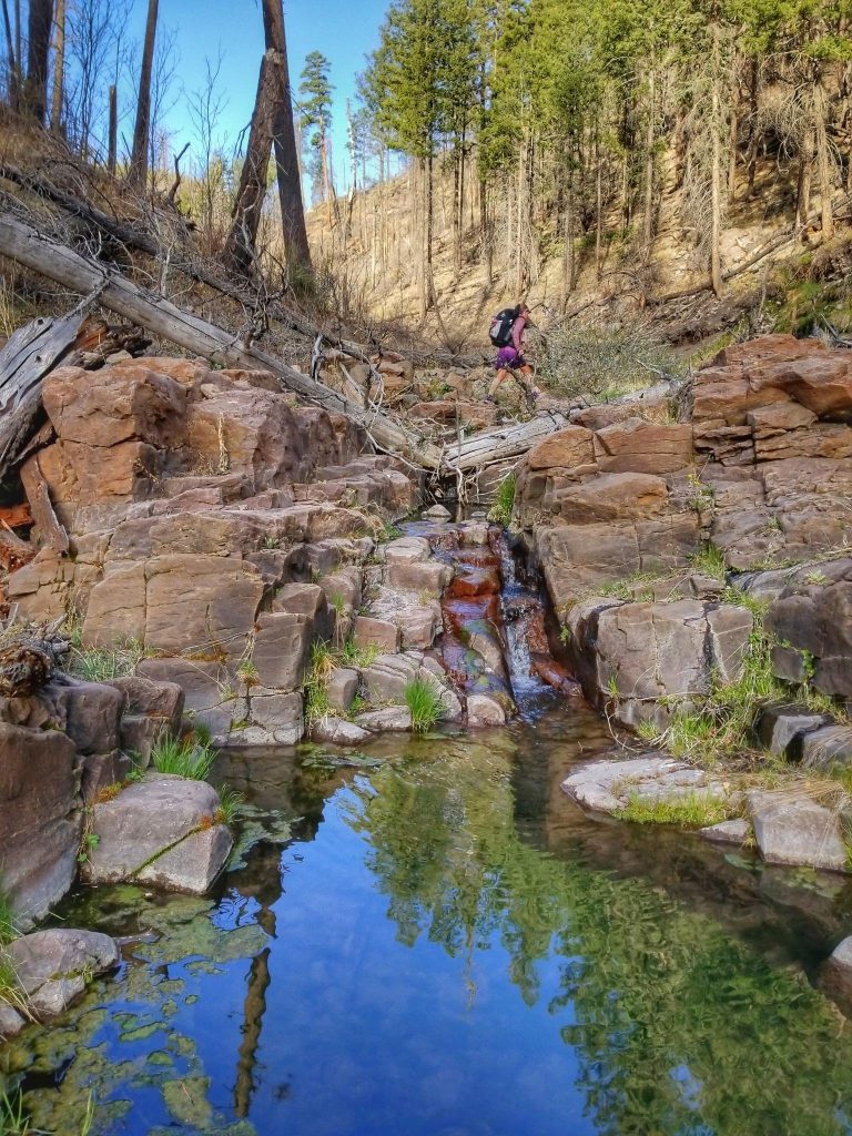
Arriving Lilley Park, I could tell we were back in the regular realm of backpackers. For starters, I found a piece of trash…a tuna packet. And there were suddenly many footprints. This seemed to be a nexus point in the compilation of popular Gila trails. We followed the final leg of our alternate down a series of switchbacks into the west fork. Earlier we’d spied a “shortcut” in a side drainage that seemed to lead more efficiently into the west fork. But we were concerned about some tight topo lines indicating possible cliffs. We matched these lines to the canyon wall we were descending on the switchbacks and were grateful for our intuition. Shortcuts can lead to delays…and sketchy cliffs.
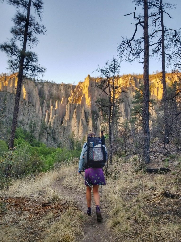
Upon reaching the bottom of the canyon and an old ranger station, we promptly ran into the first group of backpackers. We hadn’t really seen such a thing since the Highline Trail back near Pine and the AZT. In talking with the 5 of them, we neglected to read a junction sign and took the wrong turn along the river. We walked about half a mile on an abandoned trail, as it slowly disintegrated under our feet. I guess we were just so used to bad trail, we didn’t notice that this wasn’t the right trail. Coming to a washed out dead end, we realized our mistake and that the real trail was a couple hundred feet above us. No wonder I didn’t recognize the big pools and waterfalls that were in this tight canyon. We hiked this section just a year before but these landmarks were unfamiliar. We could try to continue forward by boulder hoping along the river, bushwhack up the cliffs towards the trail, or just go back to the junction. Clogged canyons, cliffs and bushwhacking were out of my system for the day, so I smartly went back. Sometimes the experience of doing hard things doesn’t prompt you to do more hard things, it gives you the wisdom to back down from those things.
The other backpackers saw us turn around and decided we knew best. Glad I could be a good role model. We got back on track and the rest of the day was just nice hiking along good river trail. Except that there were a few new washouts to pick through, some quite steep and sketchy. A fire had burned on the south rim in 2021, followed by some severe monsoons. Once again, I was amazed by the destructive forces. There were many side drainages where flows of boulders and sand has been deposited chaotically and profusely, resembling the pyroclastic flows of volcanic areas. Only in New Zealand had I seen such dynamic and devastating flows. Though I’d been lucky to never be a part of them in real time, just walking over them after the fact gave me an appreciation for the extreme sides of nature.
Where just the year before this trail had been passable by pack horses, this was no longer the case. On foot, we just barely managed to slide by. We walked until late in the day, trying to cut some of the distance to the hot springs the following day. After settling in and having my dinner, I was surprised to see someone walk by in the dark. Most casual backpackers wouldn’t attempt the many water crossings and sketchy slips at night, especially when the point is to enjoy the beautiful scenery of the canyon. So I wondered if it was some sort of thru hiker or FKT (fastest known time), but not so likely since this wasn’t too standard of a route. Who knows. I was just happy to be relaxing in my tent after a long, hard day.