The Long Pathway of New Zealand
(Scroll to the bottom for a links listing of all my daily blogs)
The Te Araroa (TA) is a 3000km/1900 mile route covering the entire length of New Zealand (and then some!). It stretches from Cape Reinga in the North Island to Bluff in the South Island. It’s a relatively new route, officially opened December 3rd, 2011. In the first few years, only around 50 people walked the whole trail. Now there are hundreds doing it. Please see the Te Araroa Trust’s website for detailed information, including maps, trail notes, and trail status updates/closures.
Key Features along the route include:
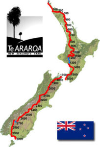
- 90 Mile Beach (really less than 90km)
- Tongariro Alpine Crossing (Great Walk)
- 100km kayak of the Whanganui River
- Tararua Range
- Queen Charlotte Track
- Richmond Range
- Travers Saddle and Waipu Pass, Nelson Lakes
- Hurunui River & Deception Valleys
- Greenstone Track
- Longwood Forest
The TA is not like the long trails of the USA (PCT, AT, CDT), as it is not continuous. The route is a mix of beach walking, farmland tracks, connector trails, gravel and paved roads, urban pathways, river and estuary crossings, stream tracks (where you walk directly down the streambed), a 100km kayak/canoe section, and some really heinous backcountry routes.
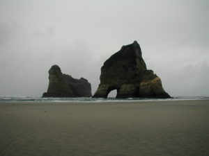
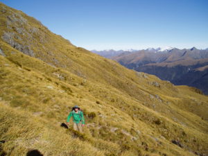
Hiking/backpacking in New Zealand is known as “tramping” and the Kiwi’s (being the unique, independent, industrious, and hardy folks they are) have very different standards. Switchbacks are almost non-existent (a straight bee-line up a mountain) and tramping tracks are often muddy, full of roots, thick with brush or tussock, and not-benched or formed at all.
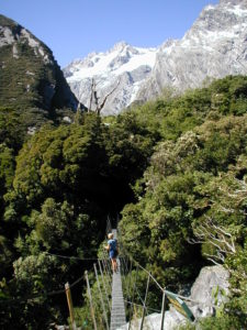
Water crossings are by far the most dangerous aspect of travel in the NZ bush. It rains frequently and the ubiquitous rivers easily become swollen and impassible. There are some bridges, from elaborate swingbridges to the very basic 3-wire bridge (2 cables for handholds and 1 to tight-rope-walk across). There are even cableways (trams). Many of these can be as scary as fording a river. Sometimes it’s easier just to get wet feet, as they are pretty much wet all the time.
The upside is that New Zealand has the best hut system in the world. For a country roughly the same size as Colorado, there are more than 900 backcountry huts! These also range from extremely elaborate with heating to simple A-frame, 2 person structures. And please, anyone reading this blog, I BEG you, do not write graffiti on these huts! It is common in the US but this is New Zealand—here they are considered a national treasure and deserve the utmost respect. Many have historical significance. Because the weather is so often bad, a nice, clean hut is a blessing.
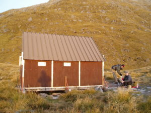
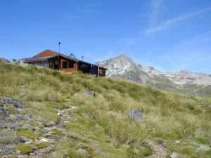
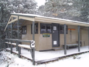
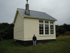
So Yes, the TA does have some epic scenery and ‘sweet as’ accommodation but also long road walks, logistical challenges, major river crossings, and probable weather bombs. It’s NOT ideal for a first thru-hike or for those with little experience. If visiting the country for the first time, I recommend doing some of the more well-known 4-5 day hikes and traveling around by bus or caravan to see the more common tourist sites.
Here’s a list of all my posts related to the the Te Araroa
- Why I am hiking the Te Araroa
- Final preps…frontloading
- Travel Day!
- In-flight Updates
- Day 0: Auckland bonus
- Day 1: The perfect start
- Day 2: Bring on the beach
- Day 3: Make it burn
- Day 4: In and out
- Day 5: Climbing to start and end
- Day 6: American Ninja Warrior in the Jungle
- Day 7: There are others!
- Day 8: It’s time for town
- Day 9: More luxury from a tent
- Day 10: A little bit of everything
- Day 11: Lessons from the road and a raptor rescue
- Day 12: Walking bliss
- Day 13: From one haven to the next
- Day 14: Stairmaster to Heaven
- Day 15: One foot in front of the other
- Day 16: Everyday’s a Feast for the Senses
- Day 17: More beach and bush
- Day 18: Pushing to Puhoi
- Day 19: Riding the tides
- Day 20: Auckland is waiting
- Day 21: A day for R&R
- Day 22: The eve
- Day 23: Christmas hiking, drive-by-shootings, and trail magic
- Day 24: Back into the bush
- Day 25: The detour
- Day 26: Follow the River
- Day 27: Good paths and views fueled by soda
- Day 28: In and out of Hamilton
- Day 29: First for the New Year and on top of the world
- Day 30: A classic TA day
- Day 31: Trials on the trail
- Day 32: Slacking along the river
- Day 33: A zero for weather
- Day 34: Batten down the hatches
- Day 35: Back on track
- Day 36: On Easy Street to 1000 kms
- Day 37: Cheers for the TT
- Day 38: Taumarunui zero
- Day 39: Full of surprises
- Day 40: To the Volcanoes
- Day 41: Tongariro Alpine Crossing
- Day 42: Downhill
- Day 43: To the River
- Day 44: On the river
- Day 45: Bridge to Nowhere
- Day 46: Riding the rapids
- Day 47: Kayaks rule!
- Day 48: I love Wanganui and Bouncy Pillows
- Day 49: Riding the roads to Palmy
- Day 50: Halfway
- Day 51: In the bubble at Makahika
- Day 52: In the Tararuas
- Day 53: One big day
- Day 54: A day of recovery, sort of
- Day 55: A grand day for new pettings and just walking
- Day 56: The big penultimate step to the finish
- Day 57: North Island Complete!
- Day 58: The Wellington zero that was anything but relaxing
- Day 59: Part 2, The South Island
- Day 60: Cruising on Marlborough Sound, TA-style
- Day 61: Stormy weather
- Day 62: Like a nero in Havelock
- Day 63: A great start to the Richmonds
- Day 64: Rain and Clouds
- Day 65: If you don’t like the weather, just wait 5 minutes, it will change
- Day 66: Exceptionally Beautiful
- Day 67: A big finale for the Richmonds
- Day 68: Welcome to Nelson Lakes
- Day 69: Earning some R&R
- Day 70: Walking Fever
- Day 71: A great day to stay in a hut, but…
- Day 72: How a Zero should be done
- Day 73: An easy day after town
- Day 74: Peaceful Walking and a Reunion
- Day 75: Harper Pass
- Day 76: Pushing to beat the weather, again.
- Day 77: Arthur’s Pass rain zero
- Day 78: The most elusive petting finally in the bag
- Day 79: Walking to escape Cyclone Gita
- Day 80 & 81: Methven Cyclone Zeros
- Day 82: After the Storm
- Day 83: highs and lows
- Day 84: The Rangitata Detour
- Day 85: To the limits
- Day 86: The Best Ridgeline Walking on the TA
- Day 87: A much needed town stop
- Day 88: The Lake Tekapo to Lake Ohau Express
- Day 89: Trail Magic
- Day 90: A kick-butt finish to a long day
- Day 91: A Refreshing Day
- Day 92: Into Wanaka
- Day 93: Wanaka Zero
- Day 94: Back into the hills
- Day 95: Slowing it down
- Day 96: From solitude to city bustle
- Day 97: Avoiding the Adventure Capitol of the World
- Day 98: Greenstone
- Day 99: Mavora Lakes
- Day 100: A close call, just when I thought I was safe
- Day 101: Takahe pics, a dog rescue, and route finding
- Day 102: Inching along
- Day 103: Meandering through the hills
- Day 104: A hut that’s got it all
- Day 105: How it finishes is how it starts
- Day 106: The day the TA finally broke me
- Day 107: The day the TA buried me
- Day 108: The nail in the coffin for the Walking Dead
- Postscript 1: Back on track on the Kepler Great Walk
- Postscript 2: Routeburn Great Walk
- Postscript 3: Caples and Greenstone Tracks
- Postscript 4: Ball Pass, Aoraki/Mt. Cook…the Grandest of Finales
- Te Araroa Summary
