January 13th
Whakapapa Village (km1173)-Upper Retaruke rd. (km1212)
Mileage: 24.2mi/39km
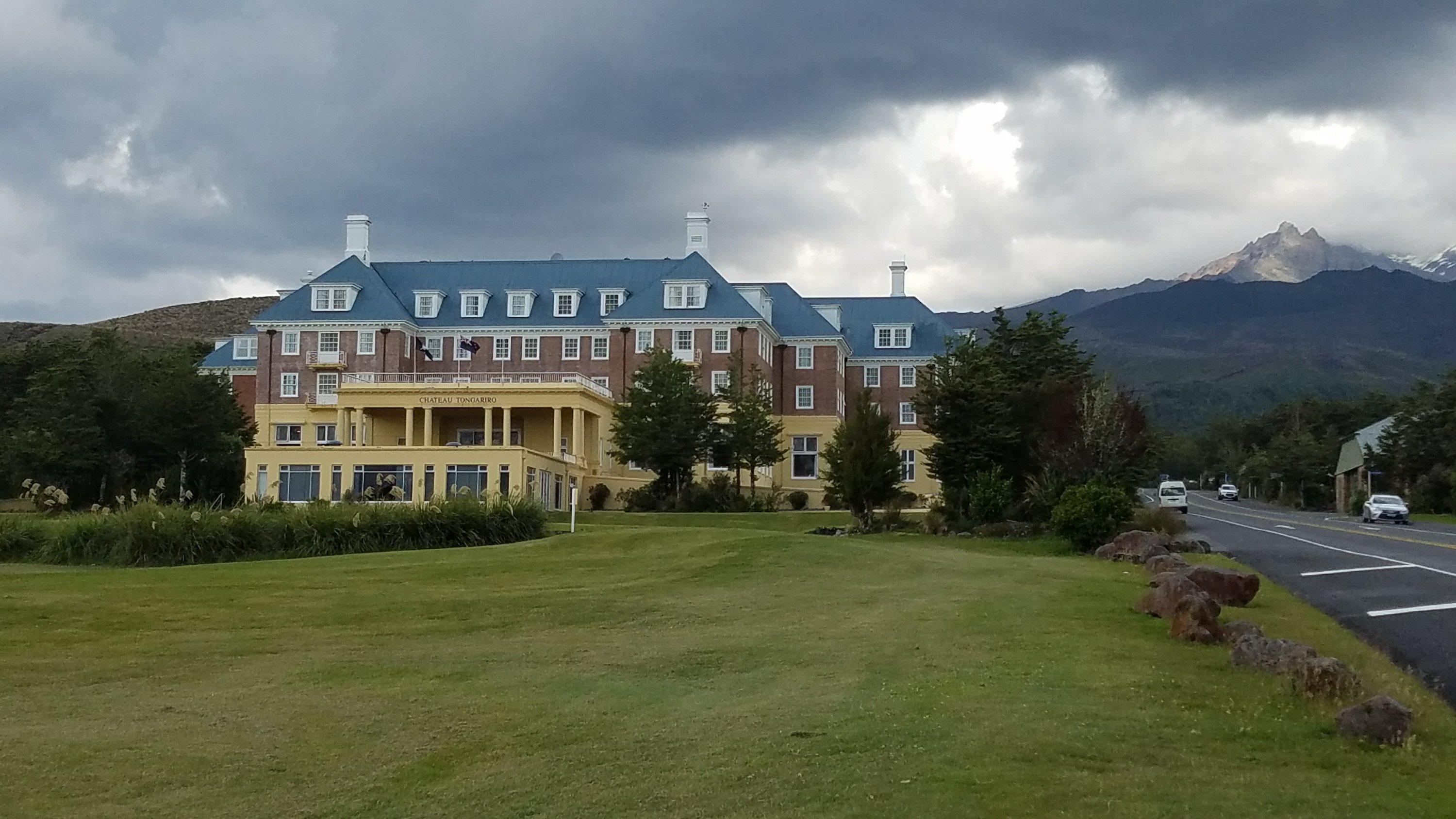
We had a wonderful night, with only one interruption from a fierce thunderstorm rolling through. I saw lots of flashes and heard some thunder, but it was pretty tame otherwise. The thunder burger was just a precursor! In the morning, we went to use the very nice public restrooms and took a last look at the cute little town. This lodge made me think of The Shining.
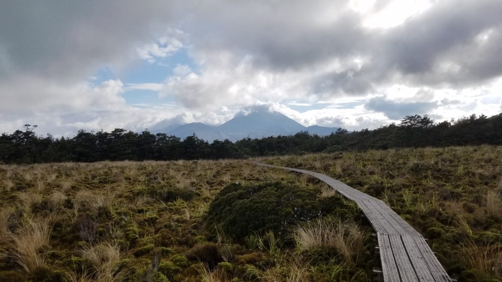
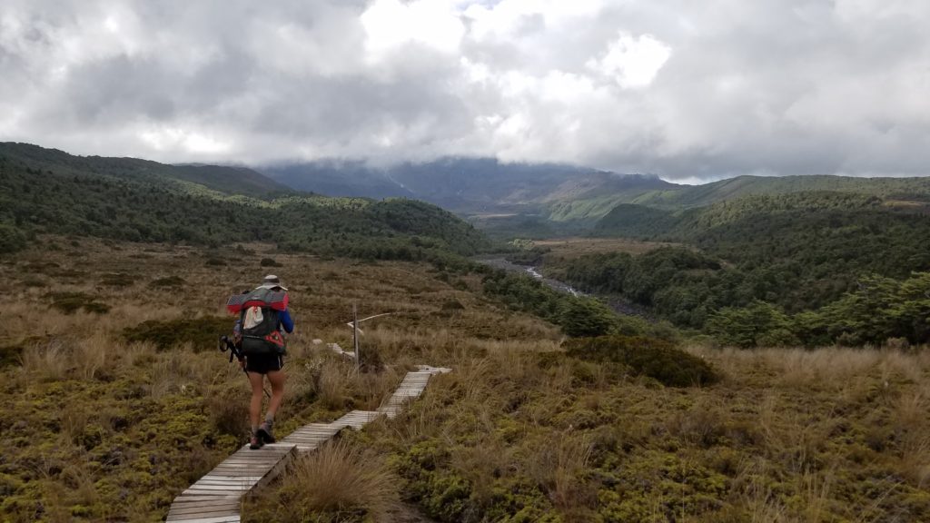
The track from the village followed some more awesome boardwalk, with views back towards the volcanoes. The first couple miles were on the ’round the mountain’ route, circumnavigating Ruapehu. Later we would split off from the well-maintained track and just have to walk through the marsh, sans boardwalk, getting very wet feet. But I still really liked the trail since the ground was soft and views so nice.
We took a short break before walking 6 kms on the highway into the town of National Park. This is a tourist town catering to all the people coming to hike the crossing, among other things. It had a weird vibe and I was ready to move on after getting some resupplies at the 4-square (small grocery) and failing at finding any free wifi. My carrier, Spark, is supposed to have a free hotspot here but it appeared to be broken. I walked all the way to the other end of town just to see if there was another hotspot, as shown on the map. There was not. Another few kms walked off trail, for nothing.
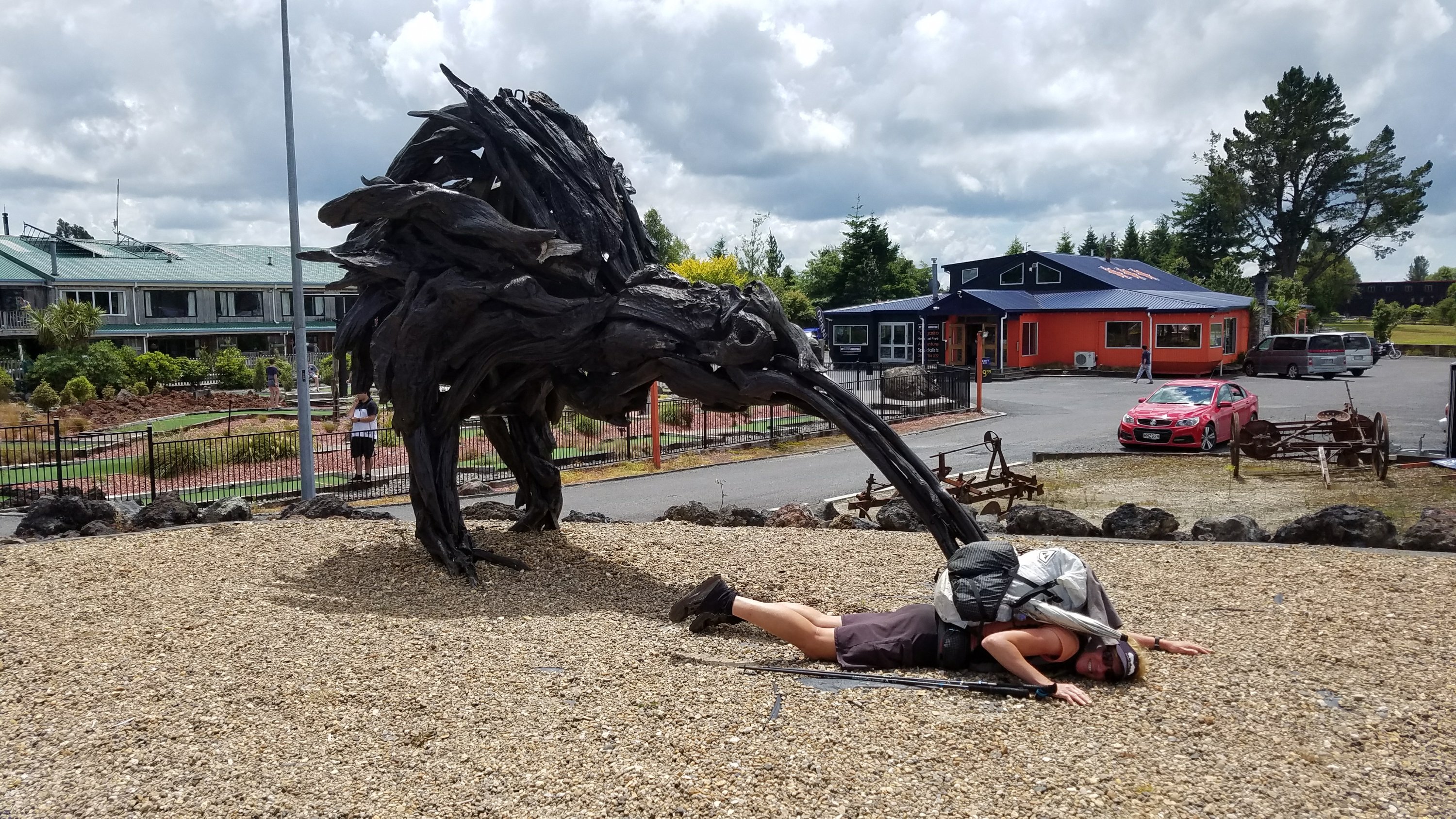
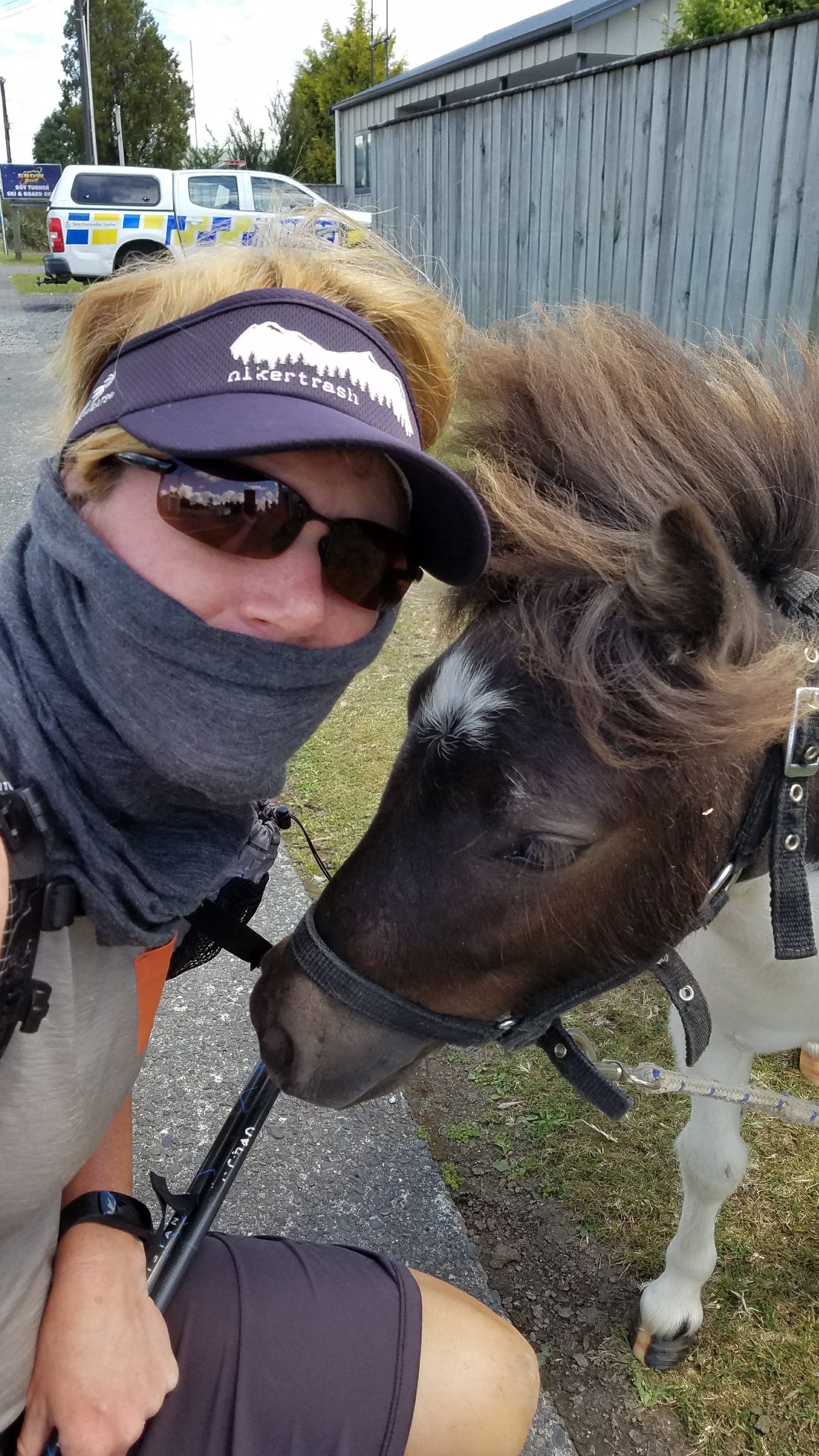
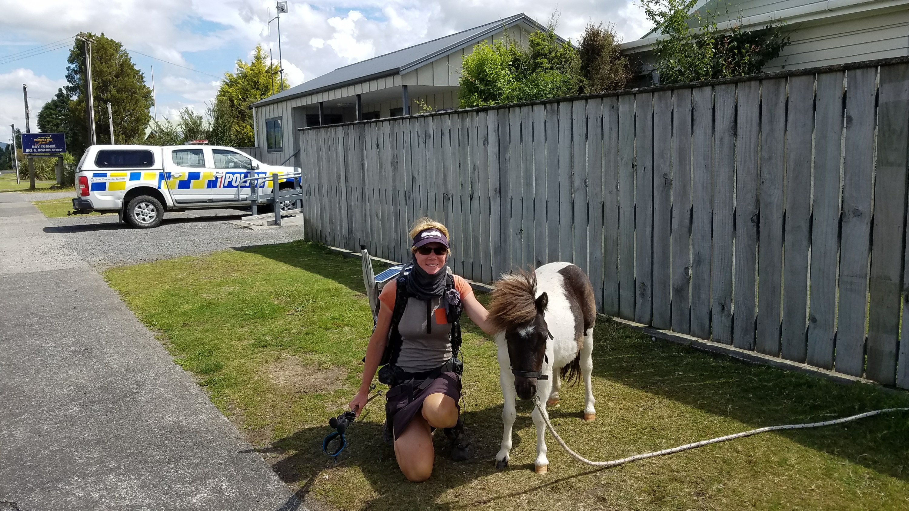
At least on the way back I came across a funny site. Just next to the police station was a miniature horse on a rope leash. I’m not sure if he is connected to law enforcement but he made for a lousy sentry. We became good friends but he kept trying to eat my shoe, still caked in mud. I was also also attacked by a giant kiwi. I told you this town was a bit weird!
On the way out of town, Connor and I stopped to play on the very interesting and elaborate playground…the town did have a few redeeming qualities.
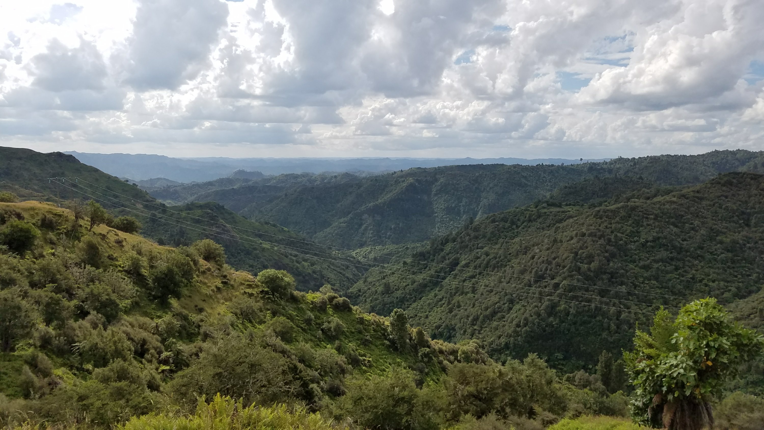
The route for the next day and a half would be mostly road, as we wound our way down from the central volcanic plateau and into the lower river valleys. The Fisher track started as a gravel road but then switched to a narrow ATV trail on mostly grass turf. It was a great trail, sidling the valley and dropping from 800m to 400m. We saw a lot of wild goats (later the cafe near the river would be serving curry goat). Eventually the track rejoined a country road and we walked past a lot of farms.
We wanted to do about 35 km for the day, not sure what we find for camping along the road. Around 6 pm we heard thunder and the sky just opened up. Out came the umbrella and I later had to put on the rest of my rain gear, it was raining so heavy. It was really beautiful walking in the rain. The low sun was shining through to the west, blue skies to the east, surrounded by green hills, and thunder rumbling all over. We desperately needed a place to take shelter by 7 pm and had to get a bit creative. We found a mostly dry spot under some big trees and settled in. It was another great night, with the sound of light rain on our walls, perfect for sleeping.