This long and picture-dense post details the 4-day zenith of my hiking adventures in New Zealand. My final route was a 26.8 km circuit over 2121 meter Ball Pass (actually, I climbed all the way up to 2222m/7290′ atop Kaitiaki Peak, my highpoint in NZ:). The weather was stunningly perfect for 3 full days and I got to soak up a lifetime of views of 3724m/12,218′ Mt. Cook, hereafter referred to as Aoraki, its more appropriate Maori name meaning ‘Cloud Piercer’ (because let’s face it, Cook was really just a pompous passerby). What a way to go out with a bang, leaving me to muse: Te Araroa what? Only kidding, this was just the icing on the cake. A grand finale after 4 months of Wonderlust. I have been blessed.
Summary: 26.8 kms, 3 nights: 2 tenting, Ball Shelter. Total elevation gained: roughly 6700′
March 28th, Hitch from Queenstown to Mt Cook Village, hike to Kea Pt
March 29th, Mt Cook Village to Playing Fields
March 30th, Playing Fields to Ball Shelter
March 31st, Ball shelter to Blue Lakes carpark, hitch back to Queenstown
Backstory: I had been to NZ twice already but had never gotten a chance to see Aoraki, the tallest mountain in the country. I was finally able to catch a glimpse of it when coming down from Stag Saddle on the TA. I wanted to take a side trip to Mt. Cook Village back then, but the weather was looking rainy for a week or more. So I kept going, hoping I could make it back after the TA.
Finally, things were lining up for this epic trip. I met up with Ruslan in Queenstown again, where we debated how best to use the 3 day rockin’ weather forecast. Remember, I had just served my time with several days of rain on the Routeburn, Caples, and Greenstone, so I was ready to take advantage of this rare weather window. We contemplated hiking the Rees and Cascade Saddles but decided to go for this much grander opportunity. I probably wouldn’t have undertaken it myself, since the majority of the terrain in Aoraki National Park is more suitable for those with mountaineering skills (of which, I have virtually none). But Ruslan had already done a fair bit of hiking and climbing in the area, and I trusted his judgement and skills.
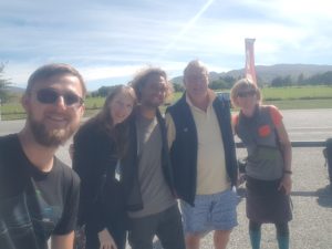
So the first challenge was how to get 264 kms/3 hours to Mt Cook Village without a car? Well, being pros at hitchhiking, we decided to take our chances. It took us 5 rides and most of the day but we did it and had some good stories to tell afterwards. Twice along the way we had some competition. We gave-way to a couple trying to get from the outskirts of Queenstown, then caught up to them, convincing our ride to pick them up, too. Murray, long-time owner of the New World grocery store in Dunedin and now a Wanaka resident, gave us all a ride from Queenstown to well-past Wanaka. He was so nice and friendly, going out of his way, we just had to get a picture together. Thanks Murray!
Then at the intersection of the road that leads to Mt. Cook Village, I saw the same 2 girls that I had met at the start of the Routeburn. It’s such a small country! They too were hitching up to the Village, so of course, we sat down on the side of the road to let them go first. It didn’t take long before we all had rides…ours was a nice couple from Seattle that work for Microsoft.
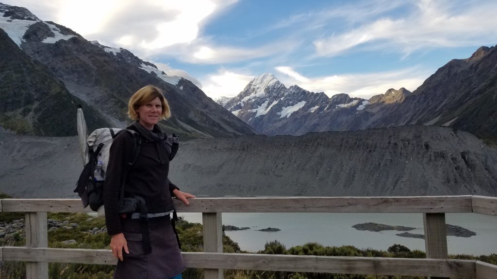
Having finally made it to the Village (just a collection of really expensive hotels, villas, restaurants, and the fanciest DOC visitor’s center in all of NZ), we had a look around. The Seattle couple had told us they were paying over $200 a night for their villa. We joked about pitching our tents on the manicured front lawn of the Hermitage, the biggest and most prestigious hotel, and even went so far as asking the receptionist how much it would cost if we did. The poor lady was so confused, she didn’t know how to answer. That’s hikertrash for you. But of course, we did have somewhat of a plan in mind and that was to camp in the nearby wilderness, by far the best option by my standards. Camping on DOC land is legal, of which there was plenty only a few kms outside of town and on a well-traveled path leading to a lookout over the Mueller Glacier.
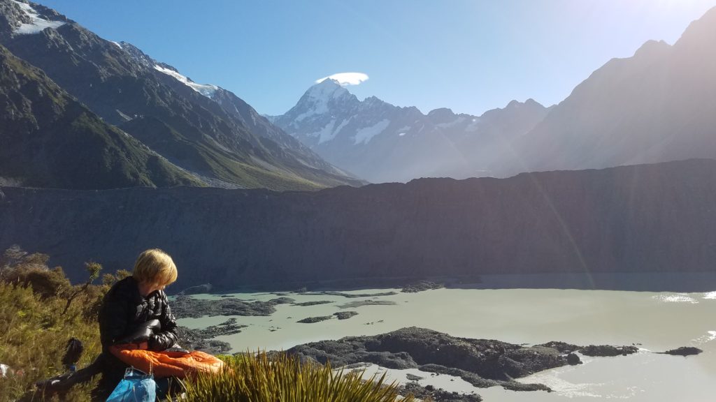
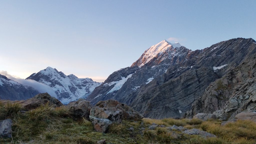
We strolled slowly among all the tourists wondering the path in the late afternoon, taking in the views of Aoraki along the way. These were my first close-up sights of the mountain, so I was pretty enchanted. From this angle, only the lower summit is visible. There are 2 higher summits obscured by the first.
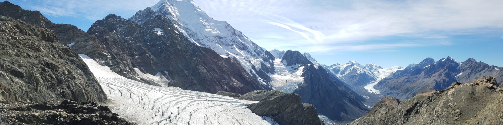
For most hikers, the path we were on diverges up a ridge to the infamous Mueller Hut. It is one of the most popular huts in all of NZ, and for good reason given its spectacular views overlooking the Hooker Valley and Aoraki. But it must also be booked well in advance and costs $36 /night/pp. Instead, we boulder-hopped out of view of the path and found a few tent-sized indentations among the rocks and vegetation. This whole area is incredibly rugged, so it was a challenge but I am a pro stealth camper. We ended up with some of the best views of Mt. Sefton and Aoraki that money can’t buy. I went to sleep looking up at the stars and listening to calving seracs tumbling to their doom…in the house of the Gods.
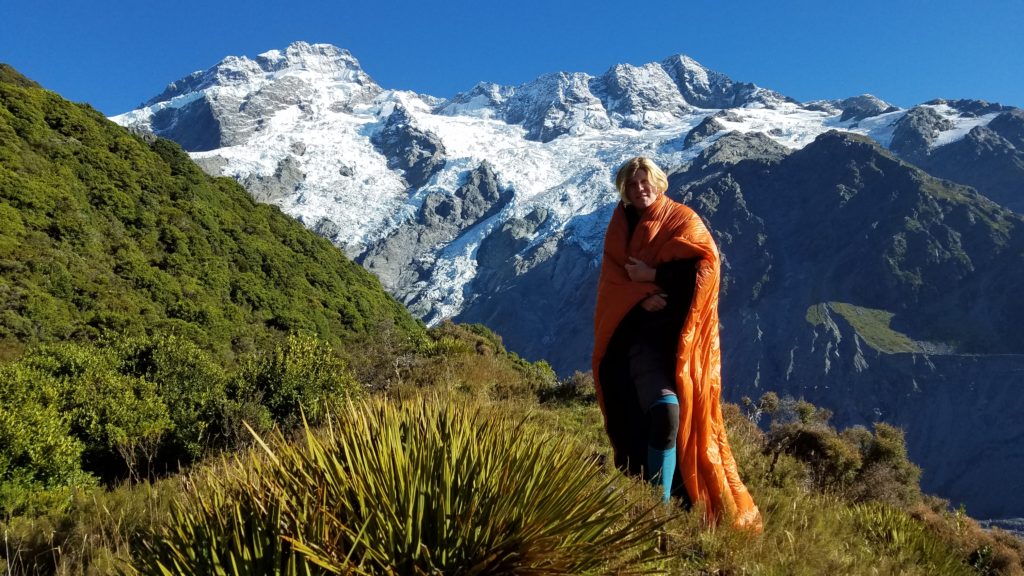
The next morning, we took our time enjoying our surroundings. We still had to talk to the DOC office in order to solidify our plans for Ball Pass. It had been closed by the time we arrived the day before. It was such a glorious morning, I could have stayed put all day.
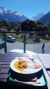
Finally we packed up and headed the short way back to town. We spent some time viewing the great displays at the visitor’s center. If you ever make it to this area and the weather doesn’t cooperate (which is a lot of the time), it’s still worth going to the visitor’s center. There is enough information to keep one entertained for nearly a full day. We also firmed up our plans with the DOC personnel. They like to keep a close eye on hikers, given how things can get real ugly, real fast in this exposed land of ice and rock. Then we went to the Hermitage to check out what was on the menu. Since we had saved so much money in travel and accommodation, we felt like splurging a little on food. The place has an upscale restaurant but also a cafeteria-style eatery, which was right up our alley. We each got a huge plate of curry and rice, which hit the spot and was complemented with more great views.
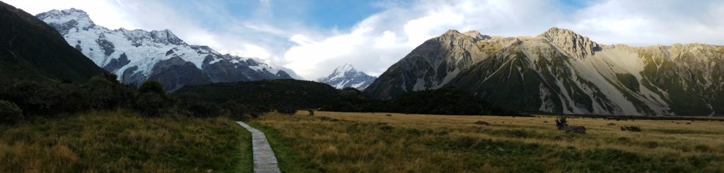
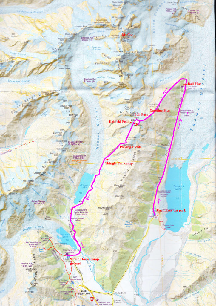
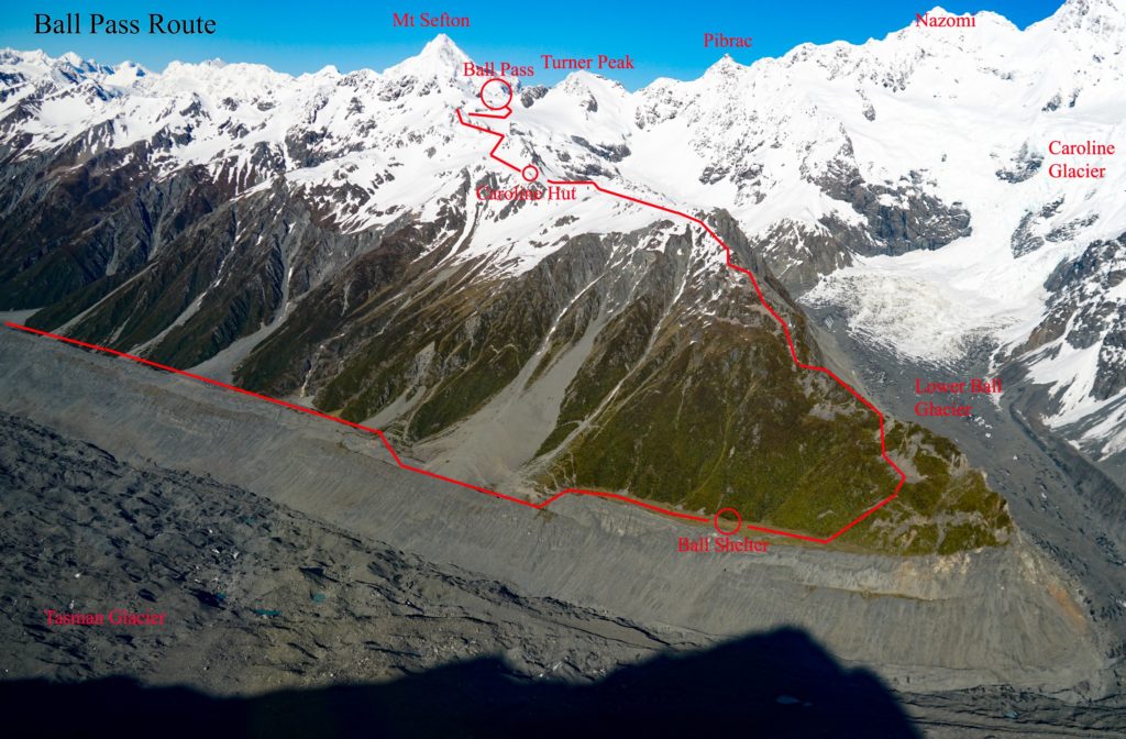
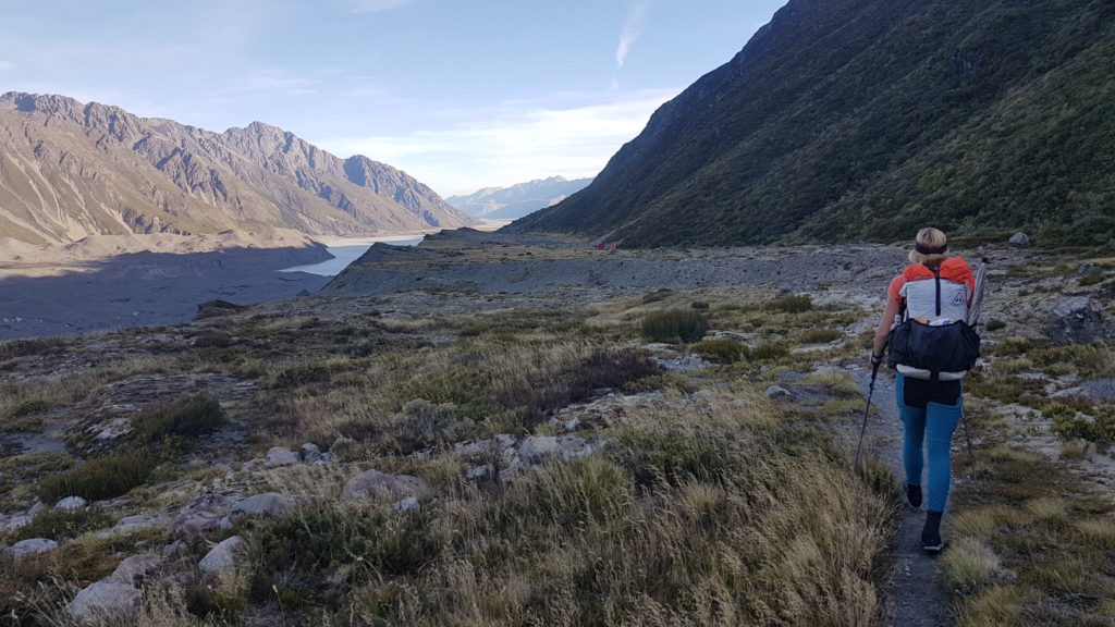
It’s sometimes hard to break away from town but on this day, the mountains were beckoning loudly. We walked from the village to the Whitehorse car park and on along the tourist path to Hooker Lake. It was chockablock with day hikers, as this is the extent of most visitors’ tramping forays into the park. Once we got off the beaten path and onto the route, we were essentially on our own. Here is a map of the route. Just look at all the glaciers!
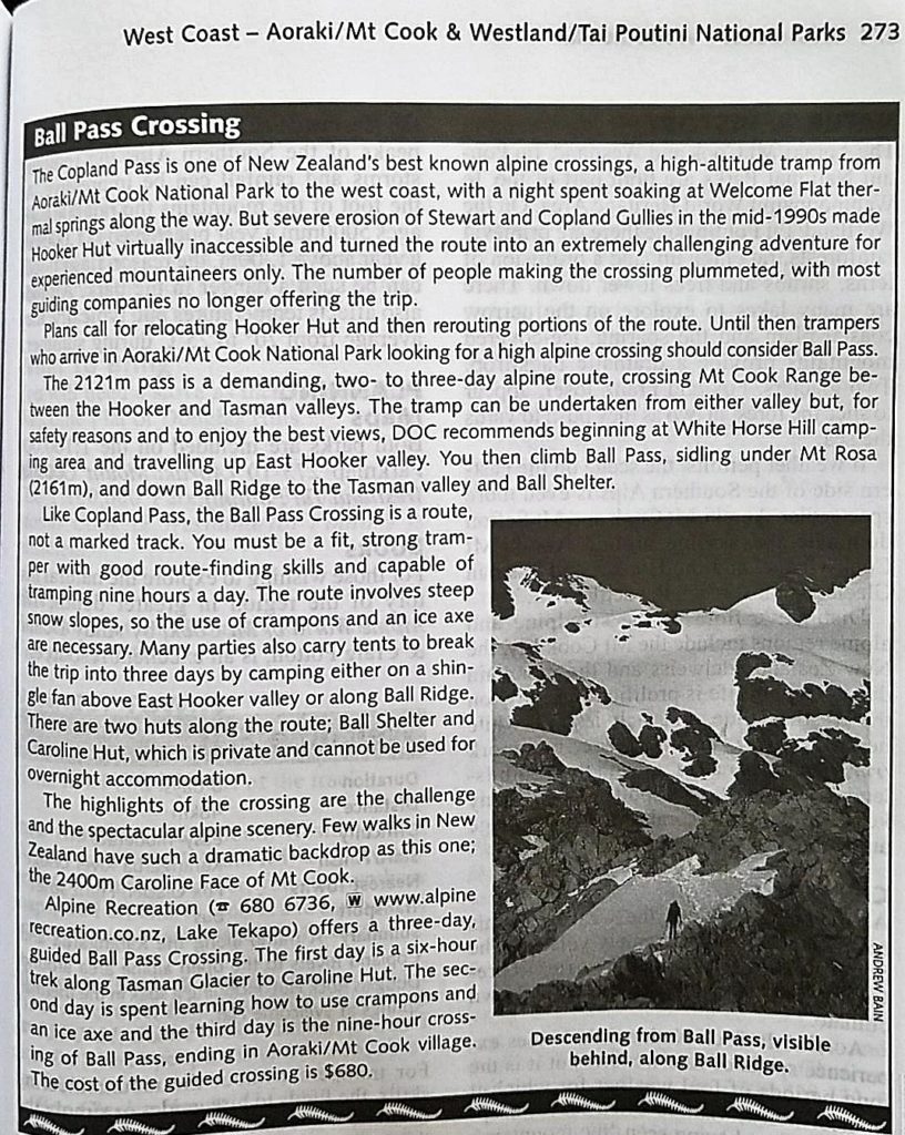
Here is also a description of the route from my 2002 edition of the Lonely Planet’s guide to Tramping in New Zealand (note the cost of the guided tour being $680…it’s more like $1500 NZD now!):
 About a km into the route, we encountered the first obstacles. In three places between the end of the Hooker Lake Track and the start of the climb to Ball Pass, streams have cut deep gullies into the side of the moraine wall. This is even worse on the west side of the lake, along the route that leads over Copland Pass. We had to climb high and then down again to avoid these dangerous spots. At one point, I was going across a boulder field when a boulder rolled under my feet and pitched me forward into another boulder. The rolling boulder bit my ankle, leaving a decent gash, and I hit my right chest pretty hard. At the time, it felt like only my pectoral muscle was bruised but for weeks afterwards, I would experience a sharp pain when breathing deep or pressing on my ribs. I either broke or bruised my ribs it seems, but there was nothing I could do about it then and it didn’t affect my ability to hike.
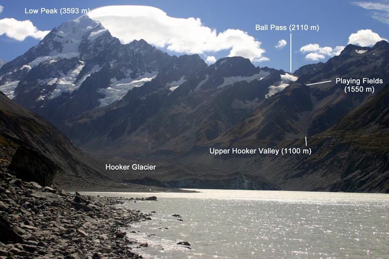
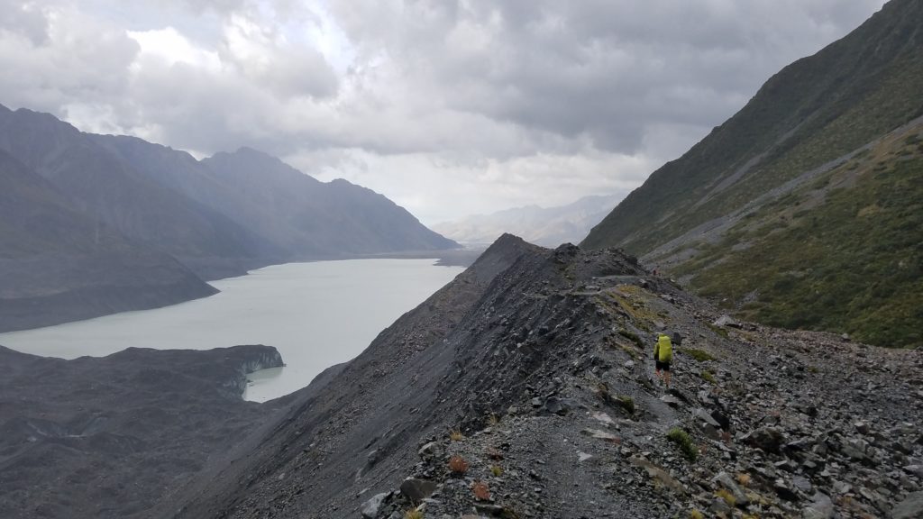
Keeping to the route was also tricky. There are spotty cairns marking the way and it was difficult to see these piles of rocks amongst a background of more rock. Luckily, the eyes of 2 TA veterans were sufficiently up for this challenge. When one of us failed to spot the next cairn, the other one would find it. Ruslan had been up to Ball Pass before but it was during winter and looked completely different when covered by snow. But he still had a good sense of the general layout of the route. Here are some pictures with navigational points and the route drawn in.
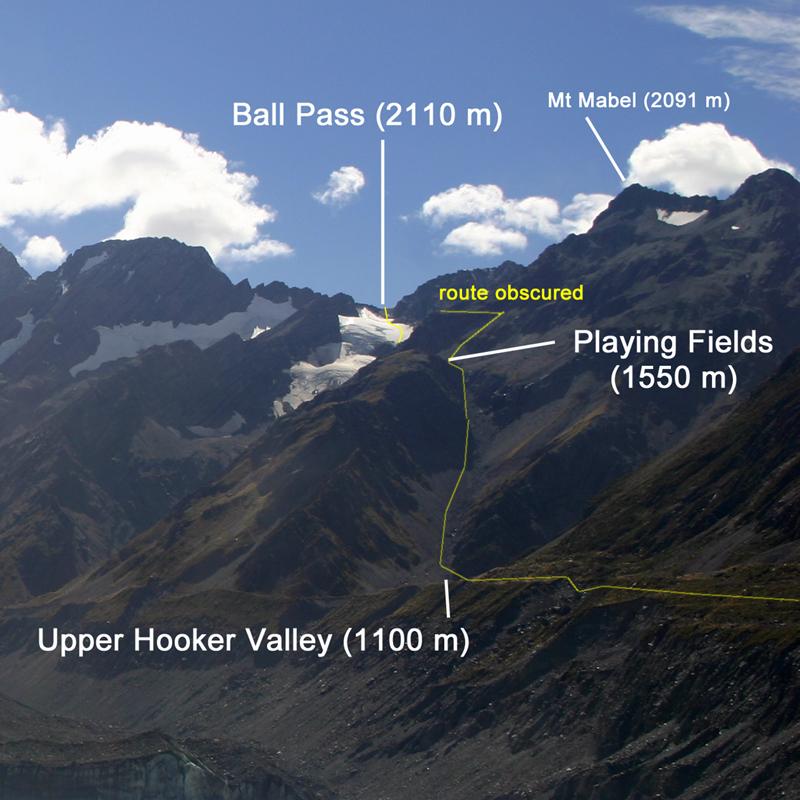
Looks pretty rugged, eh? We met 2 women and a man coming down from the pass. The guy commented on my pack and then introduced himself as the women’s guide. We met another guided group the next day, this one led by a woman, yeah! It made me feel pretty good about myself, being able to do this route independently with just a friend, albeit a very competent one. But I have to concede, the route was free of snow at this time of year and so it didn’t require crampons or an ice axe. I have yet to practice these skills but I do intend to take some courses to become better acquainted with ice and snow travel in the near future.
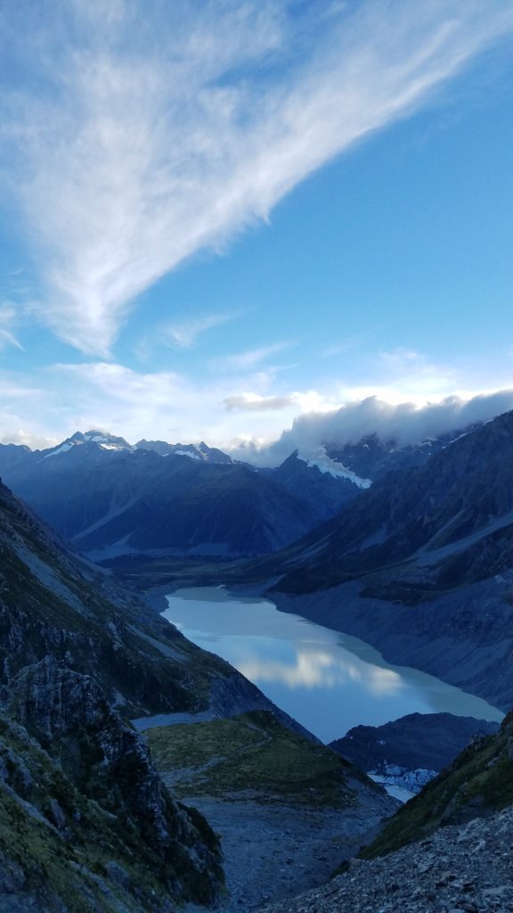
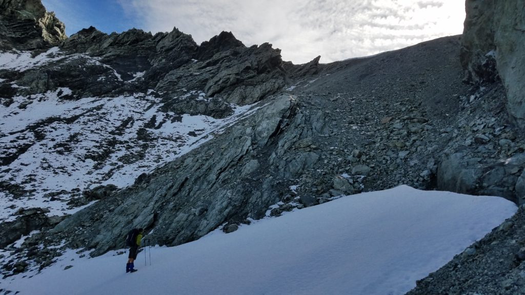
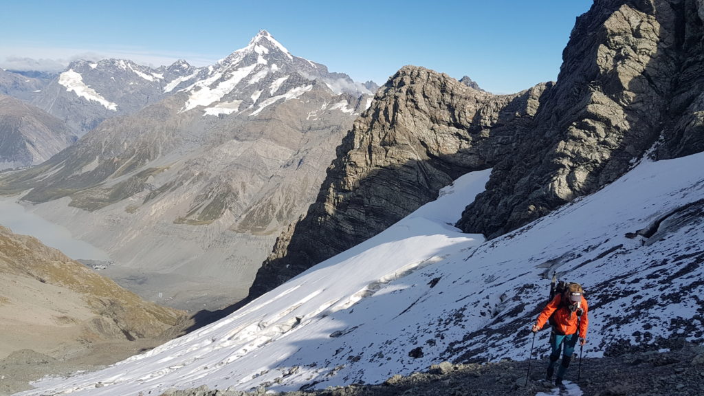
From this point, we had a 450m ascent up a 40 degree slope. Seeing this scree gully from afar and knowing we had to go up it made me nervous but it wasn’t as bad as it looked. We stopped a lot to enjoy the views and it was over before we knew it.
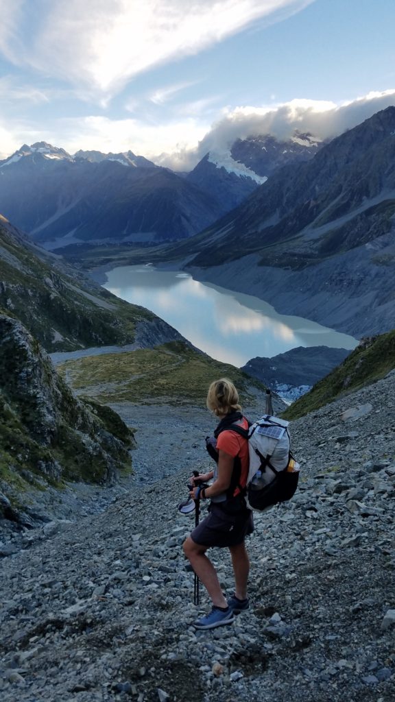
Across the valley and on top the ridges, we could just make out the red/orange figures of Mueller Hut and Sefton Bivy. We could also see where we had camped just above the moraine wall the night before.
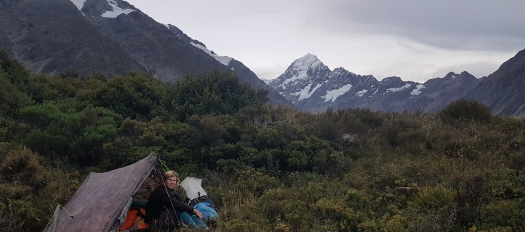
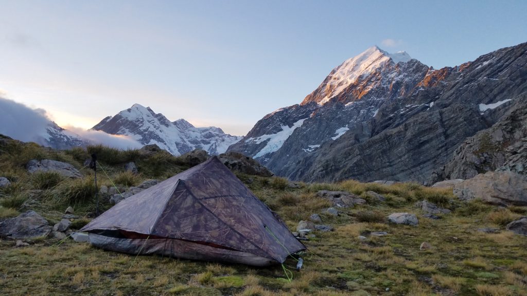
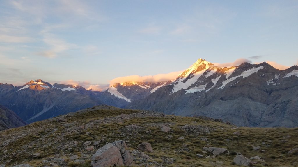
We reached our destination, an area called the Playing Fields, just in time to make camp and enjoy the alpenglow over Aoraki. We had only gone about 10 kms along our route, maybe 13 total for the day. But this trip wasn’t about covering the distances. It was about being present in the power of this wild and ancient landscape. On this tranquil night, the area made for the most incredible campsite. But I can only imagine what it’s like in the frequent gale conditions that blast through. In fact, had we been just a day later, my tent would have gotten flattened or blown over the cliffs. Aoraki was kind to us on this day.
Once it got dark, we were able to make out the faintest light coming from across the west side of Hooker Lake, nearly the same elevation as us. We reasoned that it must be someone’s headlamp or a candle from tiny Copland Shelter. We could also see a glow coming from Mueller and Sefton huts. It was so cool to see these little specks of human existence in such remote places. At that moment, I wondered if anybody was looking back at us and pondering our existence? To cap off an amazing day, I had strategically placed the open side of my tent so that I could enjoy looking out at the stars over Aoraki all night long. Another night in the house of the Gods.
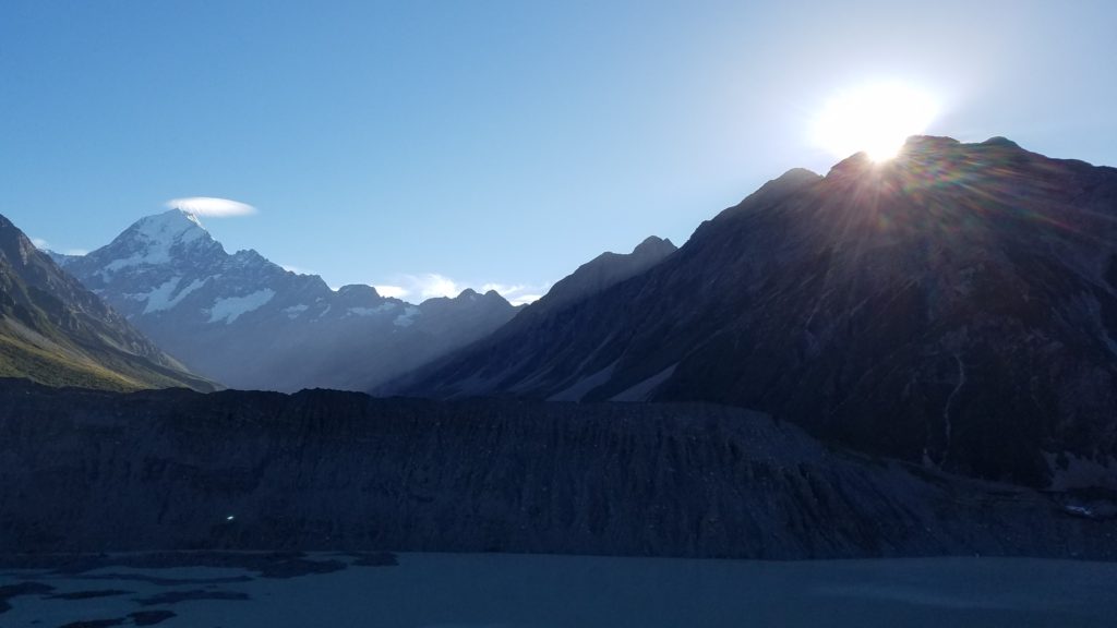
The next morning dawned with more alpenglow on Mt. Sefton.
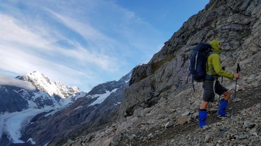
Today was our big day over the pass and I was pretty apprehensive. Looking up, it seemed steep as! I was also worried about having to cross ice, even though the guide had said it was all avoidable. Just in case, Ruslan donned his high gaiters, looking the part of the mountaineer…ok, minus the shorts.
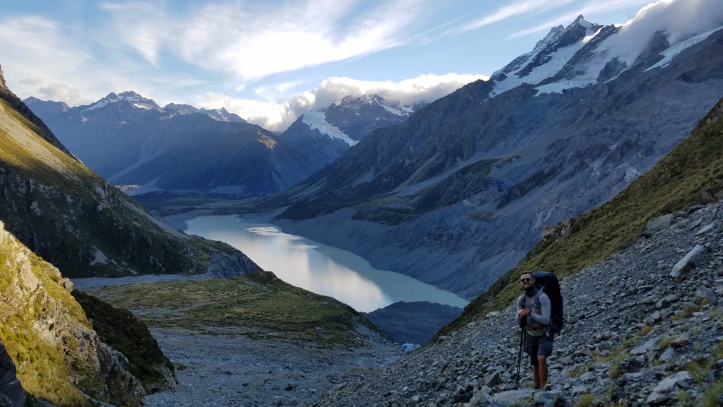
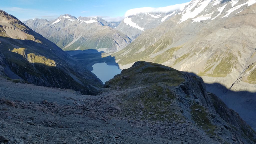 A view back down towards the Playing Fields, our campsite.
The climbing went pretty smoothly and at no time did I feel in peril. There were plenty of spots where I wouldn’t want to slip but I’m pretty steady on my feet after all my hiking.
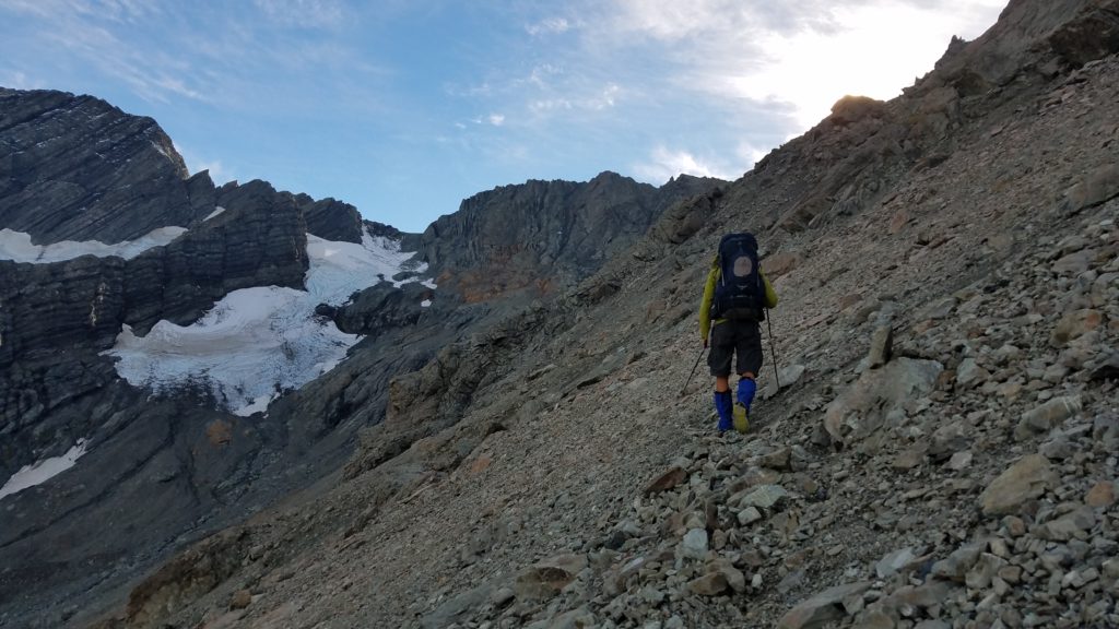
There was only one remnant snow field/glacier near the top.
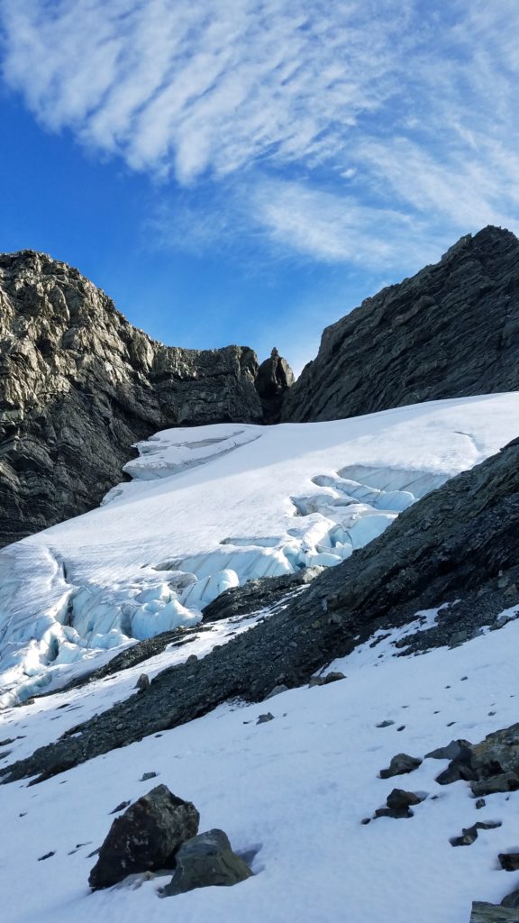
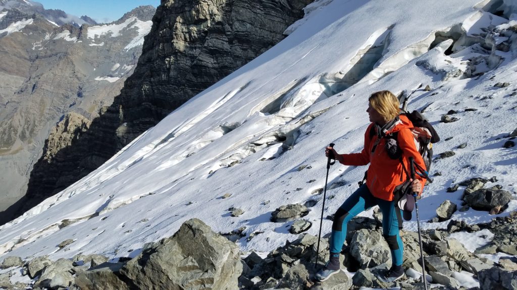
Ruslan felt confident enough to wonder onto the ice but I avoided it to the far right. I think he actually had an easier route up the last little scramble to the top. Ice and snow travel is often much easier than rock scrambling, if you have the equipment and experience.
At the pass, we ditched our packs for the final climb up to Kaitiaki Peak. I was worried about pilfering Keas but we hadn’t heard or seen any in the area. Just in case, we stashed them behind some rocks and put a rain cover over them. So much for taking my own advice not to leave gear behind during summit bids. There was some minor rock scrambling to get up but it was pretty easy. The views down into both the Tasman and Hooker Valleys are definitely worth the small side trip. Plus, 2222m is an easily remembered height.
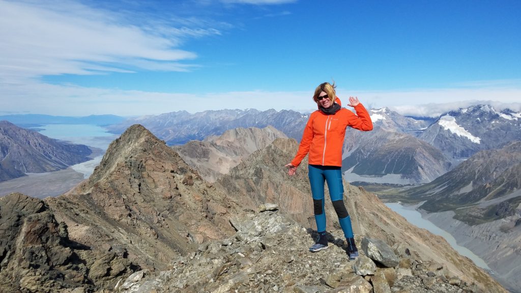
Tasman to the left, Hooker (the valley, not me!) to the right. Both feed into Lake Pukaki in the background, far left.
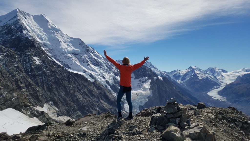
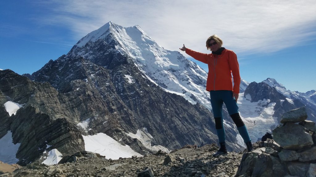 And of course, the best reason to climb to Kaitiaki Peak is for the unobstructed view of Aoraki, now with the higher middle summit clearly in view to the right. Can you believe it’s another 5000′ or so to get to the top from where I’m standing? Aoraki really towers over all the rest.
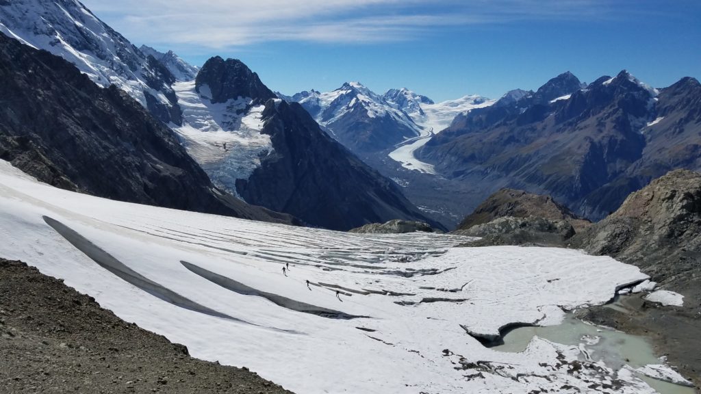
To our surprise, a couple of Americans joined us at the top. They were attending college in Dunedin and out for a weekend escape. We also met a 4-person guided tour near the pass, who were practicing repelling and glacier travel skills. Suddenly it was a bit crowded at the top…by New Zealand standards. It was dead quiet compared to being on top of Pikes Peak or Mt. Elbert in Colorado, where there may be 100’s at a time. In the picture below, you can see the guided and roped-together group traversing the Ball glacier.
After a prolonged lunch break, we reluctantly started down Ball Ridge. It would have been great to spend another night up here but the forecast called for increasing winds and rain by the morning. Hard to imagine given the pristine conditions we had at the moment.
Here is a view of our route down the other side:
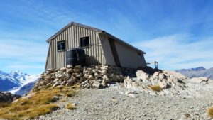
We descended pretty rapidly and were soon at Caroline hut, a Private Guided Tour hut but with an emergency shelter on one end for desperate trampers to seek refuge when the sh*t hits the fan. Most importantly, there is a water tank that can be used by all. The hut sits in a great setting, with views of the Caroline Face of Aoraki. We sat for awhile, entertained by the avalanches and seracs jumping off the hanging glaciers. From a distance, such events are really fun and make great ‘booms’ throughout the valleys. I just love this stuff!
Nearing the hut, we were passed by a guy trail running the whole route in a day (there went my ego) and we also met up with a group of 4 non-guided hikers moving towards the pass. This group gave me pause because 1, it was kind of late in the day to be heading for the pass, 2 the weather was forecasted to deteriorate overnight, and 3, they were asking us about possible shelters along the way because they didn’t have a tent. Yikes! Two of them were also wearing jeans. You get the picture. No matter where I hike, I always meet a wide assortment of people spanning the preparedness-spectrum. These folks were definitely towards one of the far sides of the spectrum.
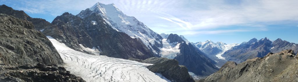
We descended another 850m to the Tasman Valley, taking in views of the 29 km long Tasman Glacier stretching out to the north of us. 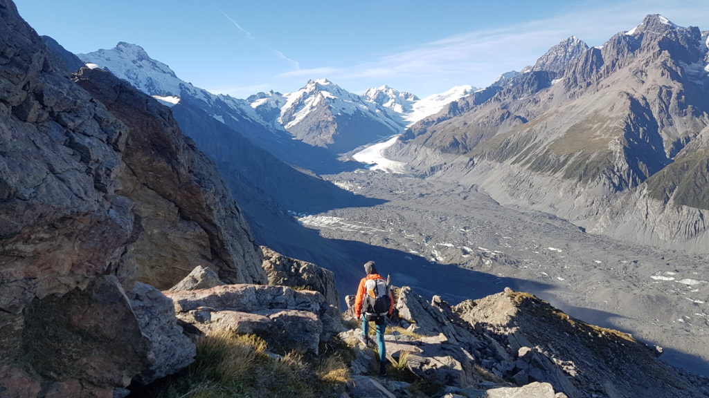
Our final views of Aoraki disappeared behind the ridge, along with the sun. But it was still beautiful.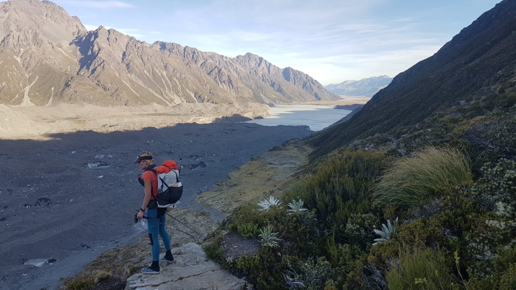
The route leveled out and we began the final part towards Ball Shelter. We had planned to camp near the shelter, because the DOC office had said it would be full. But when we arrived, we were amazed to find it completely empty! It was already 6 pm and we couldn’t believe our luck that this tiny 3-bunk, easily-accessible shelter was empty on a Friday night. We quickly grabbed 2 bunks and settled in. Shortly after, 2 kiwi guys arrived. They had intended on tenting but even still, we offered to make room for them. There was an extra mattress that could have easily gone on the floor. But they stuck to their plan. I offered to at least make them tea, a NZ hut ritual. This was well received and we had a great conversation about their ex-guiding experiences in the area. They hoped to head up the Tasman Glacier the next morning but were concerned about the weather. We all listened into the hut radio at 7 pm for the weather forecast…another hut ritual. It wasn’t great…gale force winds overnight and rain in the morning. More and more, we were feeling lucky that we had the shelter. Around 8 pm, a Danish guy arrived to grab the last bunk. He was by himself and didn’t have a tent. Wow, did he get lucky!
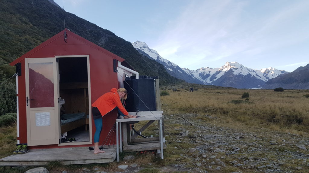
In the picture above, notice the guy-wires strapping the shelter to the ground. In the middle of the night, I discovered why these are necessary. The winds started cranking, just as predicted, and the shelter began shaking. I huddled in my bunk, pretty confident in the shelter’s ability to withstand the gusts, and again thanking my lucky stars that I wasn’t in my tent! Around 5 am, the rain started. It’s hard to describe the good feeling you get when it’s raining and you have a roof over you. Try living outside for 4 months and you will understand and appreciate this luxury that we all take for granted.
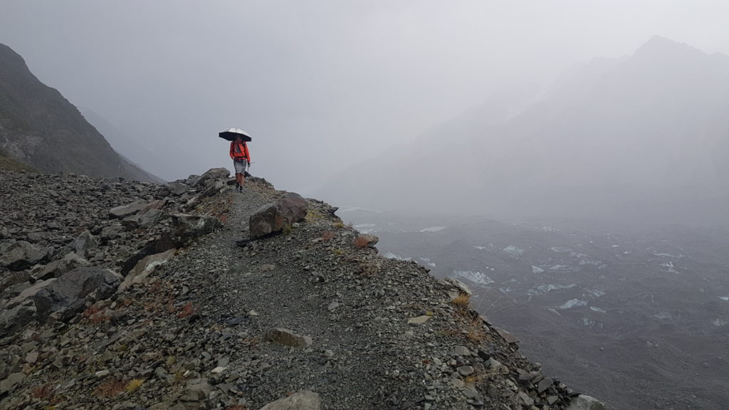
For obvious reasons, we were in no hurry to leave the shelter in the morning. When we finally did, the rain had subsided some. The 2 kiwi guys in the tent had apparently packed up early (like middle of the night) and spit, as they were nowhere to be seen. We only had to go another 8 kms or so on mostly flat terrain, though there were a number of small climbs to avoid slips in the moraine wall. A 4WD road used to run all the way to the shelter and we had the luxury of walking on the parts that still remain. Apparently, over 100 years ago, there was a ski resort here that had runs down the glacier. In the next pictures, you can see how far below the moraine wall the glacier sits presently. Back then, the glacier was supposedly above the level of the wall.
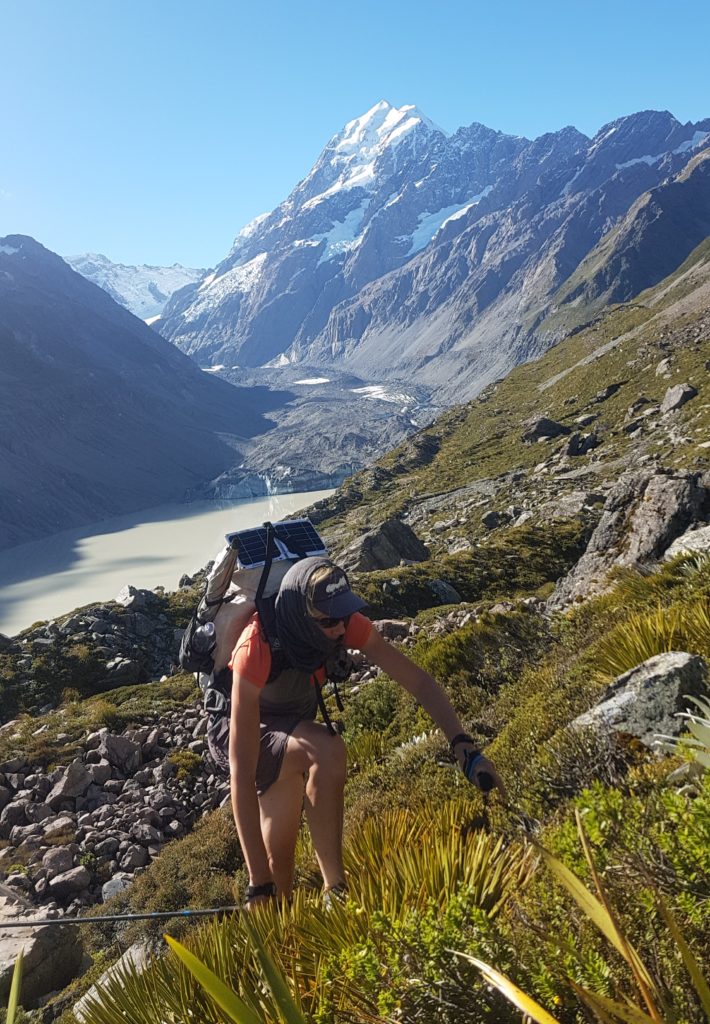
I love this picture of me walking in the rain with my umbrella. It looks like I’m on another planet with my solar ray deflecting shield (SRDS).
At last, our journey came to an end at the carpack. Well, not including the journey of hitching back to Queenstown, where I had to fly out of the next morning. We were fortunate to make it back in only 3 rides and by the next day, I was in Auckland. A day after that, I flew back to the States. So I really did pack in as much adventure as I possibly could, right up to the end.
I hope you enjoyed this post and stay tuned for more…adventures on the PCT are coming up soon, I hope!
Enjoyed your trip reports! What a great adventure! Enjoy the PCT if you are able to.