(Scroll to the bottom for a listing of links for all my DWTH posts, see this link for the rest of my 2025 PCT hike)
Like my 2023 PCBCRT hike, my Desert Winter Thru Hike ended up being the sum of multiple parts, a conglomeration of 3 different long-distance trails/routes. It’s difficult to summarize such a segmented journey, so I’ve attempted to break some of the data into distinct parts to cover each trail, but also lumped some of the information together. At the core, I’m proud to say that I hiked from the outskirts of Tucson, connecting footsteps from the Arizona Trail to the Pacific Crest Trail, plus also my footsteps along the PCT to the San Diego Trans County Trail, and all the way to the Pacific Ocean. Note that I didn’t hike continuously from east to west, which allowed for a complete thru-hike of the SDTCT, starting at the Salton Sea. The PCT was thus integral in linking the 2 routes later on.
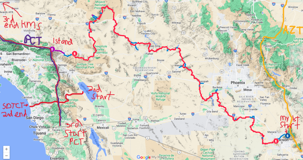
Given the consistent desert theme, I took to calling the entire hike my Desert Winter Thru Hike, incorporating the SDTCT and PCT with Brett’s official DWTH from Saguaro National Park to Joshua Tree National Park. The beauty of a route such as this is that it’s just a suggestion. There’s no congressional designation of where the start and end points are, or a right or wrong way. The point is just to have fun, be safe and respectful. From the beginning of my hike, I was intrigued with a journey from the depths of the desert all the way to the ocean, so that is what I did. And then I did some more, because I just also love the PCT and wanted to re-hike the desert section while I was already in the area. Looking back, I wouldn’t change a thing about this hike. It covered a breadth of new experiences, landscapes, conditions, and challenges. I came away from it yearning for even more desert treks, hoping to delve into routes through Nevada and Oregon in the upcoming years.
My objectives met during this hike:
- Complete the Hike Invention Desert Winter Thru Hike
- Connect my footsteps from the AZT to the PCT, thereby completing all sections of the Great Western Loop (see my preamble on this)
- Complete the San Diego Trans County Trail
- Complete the PCT desert section from the Mexico Border to Kennedy Meadows South, thereby also meeting these objectives:
- connect the SDTCT/PCT intersection to my DWTH finish at Whitewater Preserve, thereby completing a continuous footpath from the depths of the desert to the ocean (similar to the Pacific Northwest Trail)
- finally complete all parts of the PCT, since I missed about 13 miles along the ridge south of San Jacinto in 2018, due to a fire closure
- complete another large section of the PCT for a second time. My remaining sections are WA/OR and the Sierra, which I’m planning to tackle summer 2025.
- Not get lost, run out of water or die in the desert. I didn’t even come close!
- Get charged by both a burro and a cow, but not get eaten by a mountain lion, Check, Check & Check!
Dates Total: January 29th through May 3rd, 2025
Dates of the DWTH: January 29th – March 15th, 2025
Dates of the SDTCT: March 16th – March 24th, 2025
Dates of the PCT: March 26th – May 3rd, 2025
Duration Total: 84 days of hiking (not counting zeros/days in between trails)
Days on the DWTH: 41 (not counting 3 intermediary days for setting caches in CA, then 2 unintended wx days in Desert Hot Springs)
Days on the SDTCT: 9 (including 1 zero)
Days on the PCT: 39 (including 4 zeros)
Total Distance Hiked: 1,690 miles (about 1k miles Tucson to San Diego)
DWTH Distance Hiked: 850 miles (750 miles SNP to JTNP, 100 miles additional to connect the AZT and PCT)
SDTCT Distance Hiked: 155.5 miles
PCT Distance Hiked: 684 miles (bridge miles from the SDTC to DWTH: 155)
Zeros: 1 on the SDTCT, 4 on the PCT. I didn’t view my ‘days off’ the DWTH as zeros, since 3 were necessary for caching==work (plus 1 of those days included a 9 mile side hike in JTNP). The other 2 were for weather days at the very end of the route, with only 10 miles left to reach the PCT. Desert Hot Springs basically served as my planning and transition period from the DWTH to the SDTCT.
Average Daily Distance (w/o zeros): 20 miles
Longest day: 30.5 miles (1st day of the SDTCT, my only day over 30 miles)
Shortest day: 1 mile (nero into Salome)
Days hiking 15 miles or less: 19
Days hiking 16-20 miles: 15
Days hiking 21-25 miles: 33
Days hiking 26-30+ miles: 18
Favorite Days: DWTH Day 17: Harquahala, Be My Valentine, DWTH Day 27: The Turtle Mountains…Wow!, DWTH Day 33: Monzogranite, Budweiser & Rain, nearly every day on the SDTCT, PCT Day 12 climb to San Jacinto.
Least-Favorite Days: DWTH Day 6: Hot and Dry, DWTH Day 13: Buckeye Hills
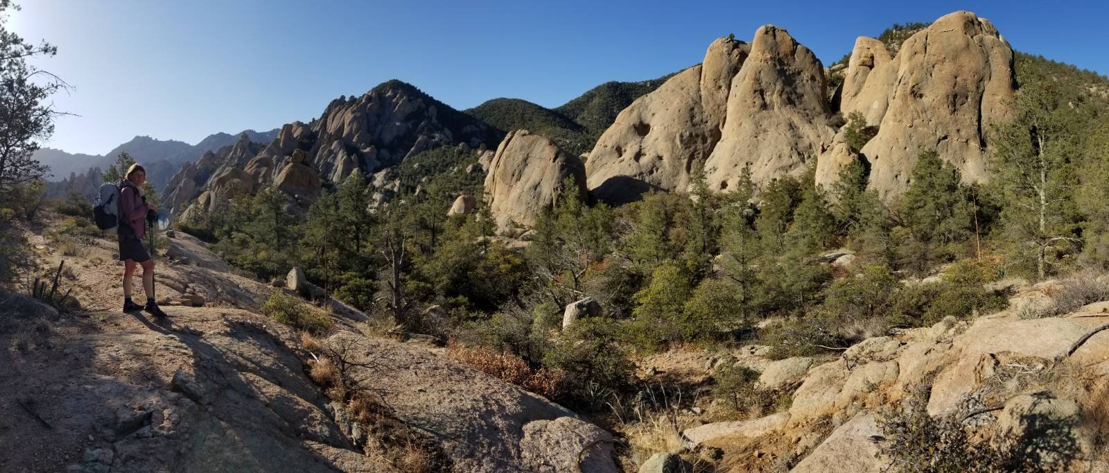
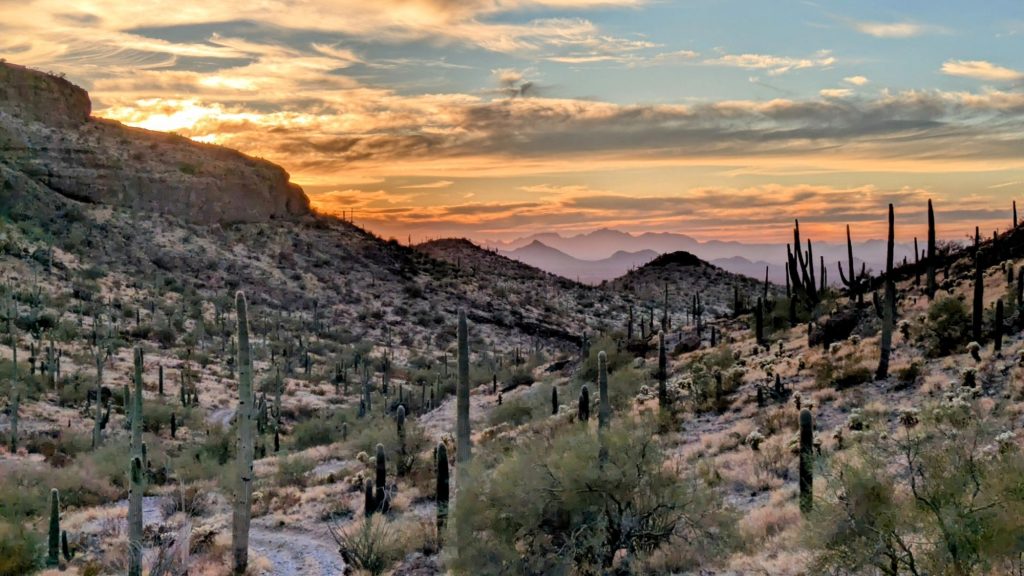
Favorite Sections: Sabino and Romero canyons, Saguaro National Park, Ragged Peaks, North Maricopa Mountains, Signal Mountains, trail down Harquahala, Whipple Wash, Turtle Mountains, Granite Mountains, Queen Valley and Wonderland of Rocks Joshua Tree NP, Whitewater Preserve, Anza-Borrego Badlands and Borrego Springs, meadows around Lake Cuyamaca, the San Diego River basin, El Cajon, San Jacinto, final walk into KMS.
National Parks: Saguaro and Joshua Tree
Wilderness Areas/National Monuments/Preserves: Ironwood National Monument, Table Top, South Maricopa Mountains, North Maricopa Mountains, Woolsey Peak, Signal Mountain, Big Horn Mountains, Harquahala, Harcuvar, Rawhide, Swansea, Whipple, Turtle, Old Woman Mountains, Piute Mountains, Mojave National Preserve/Hole-In-The-Wall, Bristol Mountains, Sheep Hole Mountains, Pinto Mountains, Whitewater Preserve, Anza-Borrego Desert State Park, Torrey Pines State Preserve, San Jacinto, San Gorgonio.


Highpoint DWTH: Romero pass 6000′ (AZT connector) / Harquahala 5681′ (DWTH Official highpoint)
Highpoint SDTCT: Near Lake Cuyamaca 4900′
Highpoint PCT (and whole trip): San Jacinto 10,834′ (side-trip) / Mount Baden Powell 9,407′ (basically on trail)
Peak Bagging: (11 total, 6 DWTH, 1 SDTCT, 4 PCT) SNP Wasson Peak 4688′ (short side trip), Waterman Peak 3830′ (short side trip), Harquahala Mtn 5681′ (on trail), JTNP Eureka Peak 5,521′ (longer side trip), Whipple Peak 4,131′ (on trail), Amboy Crater 944′ (short side trip), El Cajon Mountain 3,677′ (on trail), Mount San Jacinto 10,834′ (longer side trip), Mount Baden Powell 9,407′ (on trail), Mount Gleason 6530′ (short side trip), Skinner Peak 7131′ (short side trip).


Nights tenting on or near trail: 73
Nights camping alone or with only 1 other: 59 (100% for the DWTH/SDTCT, 16 nights on the PCT)
Nights camping with a group of hikers or around other people at a campground: 16 nights on the PCT
Nights Spent at a Friend’s/Trail Angel’s place: 14 (including days before and after trip)
Nights in town at a motel/AirBnB: 9 (only 1 night in Big Bear split with others)
Days seeing no other people: 9 (all DWTH), longest streak: 4.5 days in Section 6
Towns/resupply points visited, in order: Tucson, Arizona City, Buckeye, Salome, Lake Alamo visitor center, Parker, Fenner Gas Station, Amboy Roy’s Gas Station, Desert Hot Springs/greater Palm Springs area, Borrego Springs, Stagecoach R/V park/Alpine, Poway, Pacific Beach. PCT: Campo, Lake Morena, Mt Laguna, Julian, Idylwild, Whitewater, Big Bear, Hesperia, Cajon Pass, Wrightwood, Acton, Agua Dulce, Green Valley, Hikertown, Tehachapi, Lake Isabella, KMS.
Resupply parcels mailed: 5 (1 box of food to Buckeye, 2 boxes of food to Parker, 1 package with new shoes to Desert Hot Springs, 1 package odds and ends to Tehachapi)
Longest food carry: 5 days, twice: DWTH Section 3-4 and Section 7
Longest I went without a hot shower or laundry: 18 days, Parker to Desert Hot Springs, 354 miles. During that time, I did manage one partial sink shower and a couple smartwater bottle rinsings. There were no water bodies large enough or suitable for taking a dip, just some cow troughs and tiny potholes. But I learned that a bottle rinse and some ziploc bag laundry will do wonders, in a pinch!
Precipitation/Weather on the DWTH/SDTCT: it was an extremely dry and hot year. I got rained on only 4 times (Days 1,16, 34 & 40). Unfortunately, none of these rain events were enough to make much of a difference to the guzzlers. The main weather events were at both ends: my first day in Tucson it rained in the valley and snowed in the high country. I adjusted my starting plans because of this, but it wasn’t that much precipitation. Then at the very end, I took 2 wx days in DHS because of a major winter storm. It rained pretty significantly for one day, with snow in JTNP and the Mojave Preserve…I was so lucky to make it through before this big storm hit!
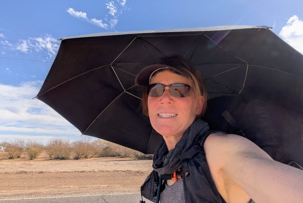
As for the weather in-between, like I said, mostly hot and dry. It was especially hot all the way through Arizona! Many of the days were in the mid to upper 80’s. One day hit 89 degrees UNDER my umbrella. I used my umbrella for shade for over half the days and can honestly say I wouldn’t have made it through if not for this single piece of gear! I am NOT exaggerating about this! It prevented me from sweating as much, thereby I needed less water. It also protected my brain from baking in the sun…there is no shade otherwise and I can’t emphasize what a relief it was to have some sort of reprieve from the direct sun, at least for a few hours each day. Even if it was only used for a lunch break! There were only a few days that it was too windy for the umbrella and on those days, the breeze was enough to keep me cool instead.
Thankfully, once the route climbed a bit higher into the Mojave, it started getting a lot cooler. In fact, a few days were pretty chilly, especially since the Mojave was quite a bit windier, too. March brought the most unsettled weather, which has been my experience in the desert SW for several years now.
Precipitation/Weather on the PCT: the weather was so much more temperate and unsettled in late March through April. There were a lot of windy days and many cold mornings. I got rained on a few times and even snowed on once (Idylwild). The proximity of the Pacific Ocean to the vast inland deserts makes for a dynamic and wild situation along the Crest! There were many places where the marine layer infiltrated the mountains, leading to some very foggy, windy, and cold conditions. But whenever the PCT meandered closer to the eastern side of the crest, poof, then it was clear and hot again. It’s really neat to behold, but an early spring hiker better be ready for a wide array of conditions in the ‘desert’!
Campfires enjoyed: none on the DWTH/SDTCT, 3 on the PCT (made by others): Little Jimmy & Landers Campground, KMS
Injuries: I dislocated my shoulder once during the DWTH, but it popped back in easily and was just sore for a few days afterwards. I also suffered many minor cuts, bruises and stabs, but in general, the bushwhacking on the DWTH was pretty tame. On the SDTCT, I gouged my shin pretty badly on the bushwhack up El Cajon. It bled profusely and I still have a “memory scar”. Not too bad, considering! On the PCT…did I suffer at all? Maybe from being too full from all the trail magic, I can’t recall.
Times I wished I carried a gun or bear spray: A couple times I wished I had pepper spray to ward off loose dogs. Luckily my trekking poles always did the trick.
Animals seen and/or heard: Curved bill thrasher, hummingbirds, gila woodpeckers, acorn woodpeckers, Gamble’s quail, California quail, great egret, Phainopeplas, Black-Throated Sparrows, road runner, blue heron, western screech owl, barn owl, great horned owl, burrowing owl, meadowlarks, redtail hawks, harrier hawk, swainson’s hawks, kangaroo rat, common rat, deer mice, javelina, deer, desert bighorn sheep, feral horses, feral burros, cows, fox, mountain lion (only fresh prints), bobcat, skunk, frogs, garter snake, 3 rattlesnakes (PCT), alligator lizards, whiptail lizards, horned lizards, western fence lizards.
Pettings: cats, dogs, horses, goats, a duck, alligator lizard, horned lizards (I’m sorry, I just can’t resist those little guys). A cow tried to pet me (well, run over me).
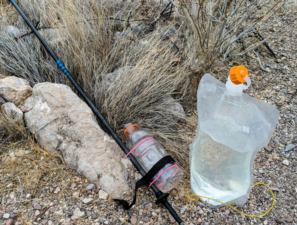
Gear: My gear was nearly identical to what I carried on the Hayduke Trail 2 years before, see gear list here. I used my Plexamid tent instead of my Solplex. It held up just fine, but of course I needed to replace the zipper at the end. The MVP of the trip was my Hyperlite Mountain Gear umbrella, which was downright essential and also proved to be very durable. The vented design held up really well in the windy desert. I prefer this particular silver trekking umbrella over all the others I’ve used in its class.
Shoes: 3 pair. I became a new believer in Topo Athletic shoes on this journey (my first thru-hike not starting in Altra’s). The Ultraventure Pros were absolutely great shoes for desert hiking. I met several other people wearing them on the Hayduke and for this reason, decided to give them a try. I couldn’t have been more pleased. The uppers were very durable (not one hole or rip!) and the vibram soles held up to some incredible abuse. I didn’t get a single cactus spine in my foot, which is pretty miraculous. The entirety of the DWTH is so rocky, I was grateful that these shoes shielded my feet better than any Altra’s ever did. For off-trail travel, these are my new go-tos. (the Ultraventure has since been replaced by the Traverse).
Also, I would suggest that most DWTH hikers replace their shoes in Parker. This seems to be the standard, but I have always managed to squeeze much more out of my shoes. The Topo’s started to concern me by Salome, where I had to beef-up the toe caps with superglue because they were starting to peel. But they held up just fine the rest of the way. Yes, the soles were quite flattened and the tread completely gone by the end, but they did see me through almost the entirety of the hike. And Yes, I was VERY happy to get new shoes in DHS.
1 pr Topo Ultraventure Pro from start to DHS, 830 miles.
1 pr Altra Superior 5.0 from DHW to PVC, 326 miles (I sent these shoes home from Idylwild, after I unexpectedly found another pair of Topos on sale at the gear store there).
1 pr Topo Ultraventure Pro from PVC to KMS, 530 miles.
Least used items: rain gear…mostly used for wind, cold, and sun protection
Gear lost/failures: I lost my serial killer face mask (blew out of my pocket on a windy day) and also my thermodrop thermometer when the lanyard broke. Amazingly, I didn’t have any cactus spine punctures in my Neoair!
Trail Angels and Trail Magic DWTH/SDTCT: Josh (home-stay for 2 nights and rides all around Tucson), 2L water and fruit from guys in sidebysides, 2 very crucial 2 gallon water caches–thanks to Gary Householder, 1 L water from a boondocker near I-8, 2 gallon water cache near Gila River–thanks to Doug, Alan (transportation all over SoCal to set food and water caches, side quests in JTNP, ride into Tehachapi, then ride/road trip side quests from Bishop to Reno), magical gallon of water next to Kelso Rd (unknown origin), guy in prius that took my trash at Kelso Rd, a couple of prearranged caches left for me by previous DWTH hikers, I gave Trail Magic (food/water/battery life) to people stranded in car outside Amboy, only to be returned the very next day by Ohio couple in van at the Amboy Crater (Gatorade and crackers…karma!), CA state trooper that took my trash at HWY 62, Jeep John who shared a beer with me in the Pintos, visit and food from TideWalker in DHS, PCT Trail Angels Otzi and Barbara (2 night home stay…tipi, plus lots of their food), Professor (ride), random citrus fruit along route into San Diego, Sheri and Glen (2 night home-stay, rides, food)
Trail Angels and Trail Magic PCT: PCT Trail Angel Cynthia (offer of home-stay, ride to REI SD and then ride to Campo, plus amazing cake!), free pie in Julian, PCT TA’s Bee and Legend (dinner and breakfast at Scissors Crossing), goodies and hospitality at the Warner Springs Community Center (run by kind and amazing volunteers), PCT TA Tracy (Airbnb-style home-stay and dinner), various water caches before and after Warner Springs, Sky (shared their AirBnb in Whitewater, ride to grocery store, delicious burrito dinner, rides), I-10 underpass soda, candy and fruit trail magic, PCT TA Kristin (offers Airbnb-style home-stay in Whitewater and holds packages for free), free Ben&Jerry’s ice cream Big Bear, Warren Summit Chef (tacos and margaritas at Deep Creek), Trail Magic from Shawn at Deep Creek trailhead, more water caches, PCT TA’s Carol and Dale (rides and 2 night homestay, lovely shared dinner at the Mexican restaurant in Wrightwood, cat walks), Hiker LAF who gave us a ride around the fire closure, mini-pie from snowplow driver along HWY 2, sweet lady who gave me a free roadside pizza in Green Valley, many water caches on the way to Tehachapi (almost of all of these now have venmo codes, so I usually gave $5 to each), PCT TA Barbara and the Tehachapi Hiker Hut (2 night stay and awesome hiker box, loaner bikes, hot showers), Clint who gave me a ride around Tehachapi and then back to the trail, several caches Tehachapi to Walkers Pass, including Mike and Terry who came by at Bird Springs rd to replenish and provide donuts, fried chicken, and cold drinks!, Leigh (2 nights home stay near Lake Isabella and meals), Peg who gave us a ride back up to Walker Pass, Jim (trail magic at Chimney Peak campground, pancakes and coffee), OutsideJay (amazing TA who does it ALL for hikers, including bear can loans, moderator and contributor of multiple PCT TA FB pages, resupplies and rides–he gave me one all the way from KMS to Bishop and wouldn’t even take any money for gas!).
Hitches/Ride-offers: ride-offer from PO to Airbnb Arizona City, hitch into Buckeye, hitches in and out of Salome, hitch from Whitewater Preserve into Palm Springs, then well over 30 more hitches/rides on the PCT.
Hiker Reunions on Trail: Alan CDT 24 (met up with 3 different times: Parker, Tehachapi, Bishop), Tide Walker Hayduke23, Tracy CDT19, Akuna CDT19, Sky Hayduke23, TwentyThree BMT/AT 24


Here are some more specifics about the DWTH and SDTCT (no need to go into much detail about the PCT, as there is already so much information and support, both online and on the trail):
The summary that Nate Ventura wrote is very good and thorough, so I won’t overlap what he already covered too much. You can read it here: Comparisons and Advice for Prospective Hikers of the DWTH
Caches: 2025 was an extremely dry season. My average carry between water sources (including caches) was ~20-25 miles. My longest carry was 50 miles over 2 days (HWY 95 to a surprise spring and cow trough, section 6), but I skipped a few guzzlers along this stretch because they were either too far off course (when I didn’t need water at the time==saved miles) or didn’t have the best looking water. I was often carrying 4-5 liters of water from each source. When the daytime temps finally cooled off in the Mojave, I carried as little as 2-3 liters. I almost always had a liter still in reserve when arriving at the next source, just in case it was no good. When arriving at a cache, I’d generally depleted my water beforehand. This is not to say that caches can’t get compromised, but in general, self-caches are pretty dependable. Worst-case-scenario, most cache locations are in proximity to HWY traffic, so in a pinch, a hiker can wave down a passing vehicle to beg for water or hitch somewhere.
Also note, I consider myself to be a pro camel when it comes to this game, having really dialed in my water needs during thousands of miles hiked in the desert. Most will have greater water needs, so please don’t go by my minimums. Practice practice practice desert hiking, caching, and doing long caries before taking on this route…Brett pretty much requires this. The AZT, GET, MRT, and Hayduke are good hikes to start with.
Even during this extremely dry year, I did not cache any water for Sections 1, 4, 5, & 7, and I did not feel I needed to afterwards. Sure, there were still many 20-30 mile carries in those sections, but this was just a factor of this hike. In the other sections, only a few of my caches were absolutely essential, while others were for peace of mind, a reduction in weight, and avoidance of some of the worst sources. In general, a hiker can usually get by without caching at all in Arizona. But given the extreme circumstances in 2025, I was able to sequester the help of some friends to set a few caches spur-of-the-moment, which greatly helped me avoid some really bad sources (Table Top guzzler that was reported alkaline, canal and Gila river water…no thanks!). Hopefully the large guzzlers in AZ get replensished by summer monsoons.
I highly recommend a wait-and-see approach in setting food and water caches in California. There are 2 parts to the California strategy, since the food resupply options are also very strained. The gas station at Fenner does NOT accept packages and it would be an extremely expensive resupply buying there. A hitch to Needles is possible, but would be difficult along the interstate. So this factor plays into whether it’s worth it to cache water in CA.
My initial plan was to rent a car in Lake Havasu, but my friend Alan came through instead. If hiking from west to east, it would also be easy to rent a car from Palm Springs for a day or 2. Both Parker and Palm Springs have ample grocery stores/Walmarts for buying supplies. I also suggest marking all your cache locations as saved points on Google Maps ahead of time. This allowed me to visualize and set directions for an efficient route connecting all the points, saving time in having to research and map the locations in situ. As such, I was able to set all the water and food caches in a span of about 2 days.
I was so happy I did! The Whipple wash and HWY 95 caches were crucial in being able to get through Section 6. I also avoided an expensive resupply at Fenner by burying a bag of food there. And the remainder of drops for Section 8 made my last days of hiking very enjoyable, rather than heavy and stressful. Even if I did this hike again during a water-bountiful year, I might be inclined to repeat all these caches, just for ease.
As for the SDTCT, most hikers choose to cache water along the route. The FB page has good information on this. I did not do a single cache, since I was feeling very desert-hardened by the time I took on this route. My longest carry was 35 miles, which was relatively easy after the DWTH. I think resupply and water sources are also relatively easy on the SDTCT.
List of my cache locations:
2 gallons of water left at Stanfield rd intersection, off I-8, Section 2
2 gallons of water left at Maricopa AZ238 rd. intersection, Section 2
2 gallons of water left in vicinity of the Gila River, Section 3
2 gallons of water buried in Whipple Wash, Section 6
3 gallons of water plus food resupply buried at HWY 95 intersection, Section 6
Food resupply buried near Fenner (gas station unable to hold a package), Section 7
Food resupply dropped off at Roy’s Gas Station for hold, plus 1 gallon of water buried nearby (store does not have running water, but does sell bottled water), Section 8
1 gallon of water buried at route intersection with Amboy rd, about 13.5 miles into the route, Section 8
1 gallon of water buried next to Amboy rd, about 28 miles into the route…note deviation, Section 8
1 gallon of water buried at HWY 62 intersection, Section 8
2 gallons of water plus food resupply buried near Park blvd, Joshua Tree NP east side, Section 8
One last thing about caches, in addition to an excellent summary post about the DWTW, Buck30 has a good discussion on how to bury a cache of water and food in the desert. I followed his advice and had no problems. Because of my mid-way caching strategy, I also ensured that my caches weren’t out in the elements for more than about 2 weeks tops. Less can go wrong in that short amount of time, and I’ll be the first to admit that I took some short-cuts with my caches because of this. I also happen to know that a cache can be buried for many months, probably up to half a year, and still be fine…even re-usable.
Navigation: I used the CalTopo app exclusively for both the DWTH and SDTCT. Nate Ventura has a much more in depth discussion about his use of Avenza, so if you’re inclined to go with that app instead, read his notes. I never once used it, since I found the CalTopo app sufficient. I also didn’t print maps, but I did print the data book to carry for each segment. It was helpful, serving as an overview for the day and turn-by-turn info without having to click on waypoints to read in the app. Since I was only carrying a 10k mAh spare battery, I was trying to limit my phone use. In the event of my phone dying (which has never once happened to me in 20K miles of hiking), I simply carried a second phone, fully charged and loaded with duplicate apps/maps. This served as my emergency backup navigation system, as well as a spare battery, but thankfully I never needed it.
I found navigation in the desert to be pretty easy and straightforward. The landscapes are generally so open, I could see where I was going or where I needed to be. I also had a good grasp on which direction to bail if I ever needed to bisect a distant highway (in the event of electronics failure/running out of food/water). One can head in a straight line for a long time in most parts of the desert. But GPS was very handy in figuring out instances like which divergence of an old road to take…something I would have struggled with having only a map and compass. There are so many turns and transitions on the DWTH, trust me, you’ll want the electronic aids for a lot of the route. But there were many other times that I could just turn off my phone and brain while following a wash for miles and miles…bliss. I also used line-of-sight and compass bearings (Garmin watch) rather frequently when crossing the wide playas.
As always, I recommend an app like Peakfinder for brushing up on your geography/topography skills…it’s also a good navigational practice to know what mountain you’re looking at. I loved being able to see so far to distant mountains, especially San Jacinto. I never grew tired of looking back and ahead to see what peaks I could identify. Nearly the whole route can be connected by vistas from or of just a few peaks (Mt Lemmon, Table Top, Harquahala, Whipple Peak, San Jacinto).
Navigation on the SDTCT: the only resource I had was a shared CalTopo route line with a few notes. I read a few blogs and watched a few videos beforehand, going into this hike trail-ready but lacking what I consider to be the right amount of detailed information. I got by just fine following the route line, though the private property issues and bushwhack up El Cajon were a challenge. I won’t summarize here, as my blog posts cover the details well and there’s only 9 of them to have to pick through. If anyone has specific questions on this route, I’m happy to go into more detail. It’s a really fun route, but not to be taken too lightly.
Daytime Temps: ranged from low 50’F’s to upper 80’s.
Nightime Temps: ranged from the low 30’F’s to the upper 50’s.
My DWTH Resupply Strategy: Sabino Canyon-Romero Pass-Tucson-Saguaro NP (Start) > Arizona City (walk through/buy from Dollar General) > Buckeye (Hitch/uber in/pick up box (not necessary)/buy from Dollar General) > Salome (Hitch, buy from Dollar General, (I skipped the midway resupply option in Tonopah)) > Parker (walk through/send box of specific mid-way items/shop at Walmart for supplies to cache through to DHS) > Fenner (walk through/dig up cache of food nearby) > Amboy (walk through/pick up box that I left in the store) > END in DHS.
Lastly, my sincere and heartfelt thanks to Brett (Blisterfree) and Melissa (Treehugger) for developing this route and sharing it with others like myself. I can tell that a lot of blood, sweat and tears went into testing it. Such suffering and dedication to the cause directly made my experience so much easier and enjoyable. I got to visit the wildest of places that I never even knew existed. I discovered whole new realms of desert beauty and solitude. I found an inner peace out there, such that I hadn’t experienced on many of my other hikes. Though it was sometimes a lonely journey, I relished the freedom and self-reliance of going solo. Where in the past I would have felt it necessary to hike with a partner, I discovered so much more about myself and the desert because I was alone. In retrospect, I wouldn’t have done it any other way.
It’s ironic to thank the creators for providing the keys to unlocking such places, when unfortunately the keys must remain a part of it. Please note that due to the sensitive nature of the environment and water sources, there are some requirements that must be met before Brett can share his data. Please see his website for more information, but I will attest to the fact that the wells, troughs and guzzlers along the route can only withstand a certain amount of pressure from the occasional hiker. They were never meant to service the needs of many hikers, only wildlife and livestock. Due to the drought, there were many that I didn’t utilize at all, either because they were too fouled or I thought the responsible thing to do was to leave the little remaining water for the desert creatures. Consequently, there may come a point at which self-caching is the only viable option in completing this route. That is a big ask of the average hiker.
Also, please do not try to use my images/maps for navigational purposes. I posted them solely for the purpose of providing an overview of the route, but they don’t show enough detail to guide a person through such a demanding and hostile landscape. While this route is not overly difficult in terms of navigation or terrain, the stakes are high in the desert. Having little to no knowledge of where the water sources are or a firm grasp on one’s water needs over distance and time could lead to serious consequences. Likewise, I cannot share the dataset or navigational maps for this route, so please don’t ask. Besides the obvious reason of it being against Brett’s terms, I suspect he added unique identifiers that would single out anyone who did make the information public. There are many more BTR’s I wish to hike and I’m not getting blacklisted…LOL!
So in conclusion, enjoy the sunsets and sunrises…they are the best part of the desert!


Here’s a list of all my posts relating to the DWTH:
Introducing the Desert Winter Thru Hike
DWTH Pre-Game show
DWTH Day 1: Rainmaker
DWTH Day 2: The Highpoint of the Trail
DWTH Day 3: Saguaro National Park
DWTH Day 4: Cow Troughs and Javelina
DWTH Day 5: Waterman Peak
DWTH Day 6: Hot and Dry
DWTH Day 7: Arizona City
DWTH Day 8: Water Water Everywhere..
DWTH Day 9: A Big Carry
DWTH Day 10: Keep Calm and Carrot On
DWTH Day 11: North Maricopa Mountains Wilderness
DWTH Day 12: Buckeye
DWTH Day 13: Buckeye Hills
DWTH Day 14: Woolsey and Signal Peak
DWTH Day 15: Saddle Mountain
DWTH Day 16: Big Horn Mountains
DWTH Day 17: Harquahala, Be My Valentine
DWTH Day 18: Salome
DWTH Day 19: Harcuvar Mountains
DWTH Day 20: Lake Alamo
DWTH Day 21: Bill Williams River
DWTH Day 22: Burros will make America Great Again
DWTH Day 23: Tiabombs For Those That Make It Across the Desert
DWTH Day 24: Parker
DWTH: 3 Day Midway Caching Hiatus
DWTH Day 25: Whipple Wash
DWTH Day 26: Whipple Mountains
DWTH Day 27: The Turtle Mountains…Wow!
DWTH Day 28: Old Woman Mountains
DWTH Day 29: Fenner
DWTH Day 30: Into the Great Wide Open
DWTH Day 31: Hole-in-the-Wall
DWTH Day 32: Hill Top House
DWTH Day 33: Monzogranite, Budweiser & Rain
DWTH Day 34: Rescue on the Way to Amboy
DWTH Day 35: Zombies, Roy’s, & Lava
DWTH Day 36: Sheep Hole Mountains
DWTH Day 37: Pinto Mountains
DWTH Day 38: Joshua Tree National Park!!!
DWTH Day 39: The Homestretch
DWTH Day 40: Desert Hot Springs Layover
DWTH Day 41: Whitewater Preserve & the PCT
DWTH SDTCT Day 1: The Salton Sea
DWTH SDTCT Day 2: Borrego Springs
DWTH SDTCT Day 3 & 4: Stagecoach & Unexpected Zero with Friends
DWTH SDTCT Day 5: Crossing the PCT
DWTH SDTCT Day 6: Cresting the Crest, Then Big Descent
DWTH SDTCT Day 7: El Cajon & Trans-passing Like A Champ..it’s not what you’re thinking
DWTH SDTCT Day 8: Urban Thru-hiking
DWTH SDTCT Day 9: The Finish Line at Torrey Pines
DWTH PCT Days 1-13: Mexico Border/Campo to Whitewater Preserve
DWTH PCT Days 14-25: Whitewater Preserve to Acton
DWTH PCT Days 26-39: Acton to Kennedy Meadows South
Wonderful, rich content summary. Impressive number of activities. Thanks for sharing your adventure.
Thank you for reading!