February 16th
Kiwi Hut (km2170) – Arthur’s Pass road (km2208)
Mileage: 23.6mi/38km
Here I am again, recounting a day of big miles over the most difficult of terrain, a solid 12 hour effort. All to beat some more rain. It’s not that I can’t hike in the rain. We proved that 28 kms in the rain is no problem just the other day. It’s these river crossings that determine everything. We must have crossed streams or rivers at least 50 times this day, probably even more. This included crossing the Taramakau, Otira, Deception, Mingha, and Bealey Rivers. These were all easy crossings, no more than knee deep.
I am lucky that it has been a relatively ‘dry’ year because both WhyNot and Wired were unable to do the route we did this day. Many TA walkers have to skip Goat Pass because the Deception river must be forded not once, but 8 times. The route basically goes up the river course, and that requires perfect conditions. The minute there is heavy rain, these watersheds swell to impassable levels. That is why the notes say to carry at least 3 days of extra food, should one get trapped by a water course. Or, you do like I do and walk long days to be clear of the threat.
We began at 6:30 am, an early start all agreed on the night before. Our plan was to go as far as Goat Pass hut, 28 kms. Connor would either bail out at 10 kms, where the route first meets SH73, or go all the way up and over Goat Pass. That, at the time, seemed like an impossibly long day.
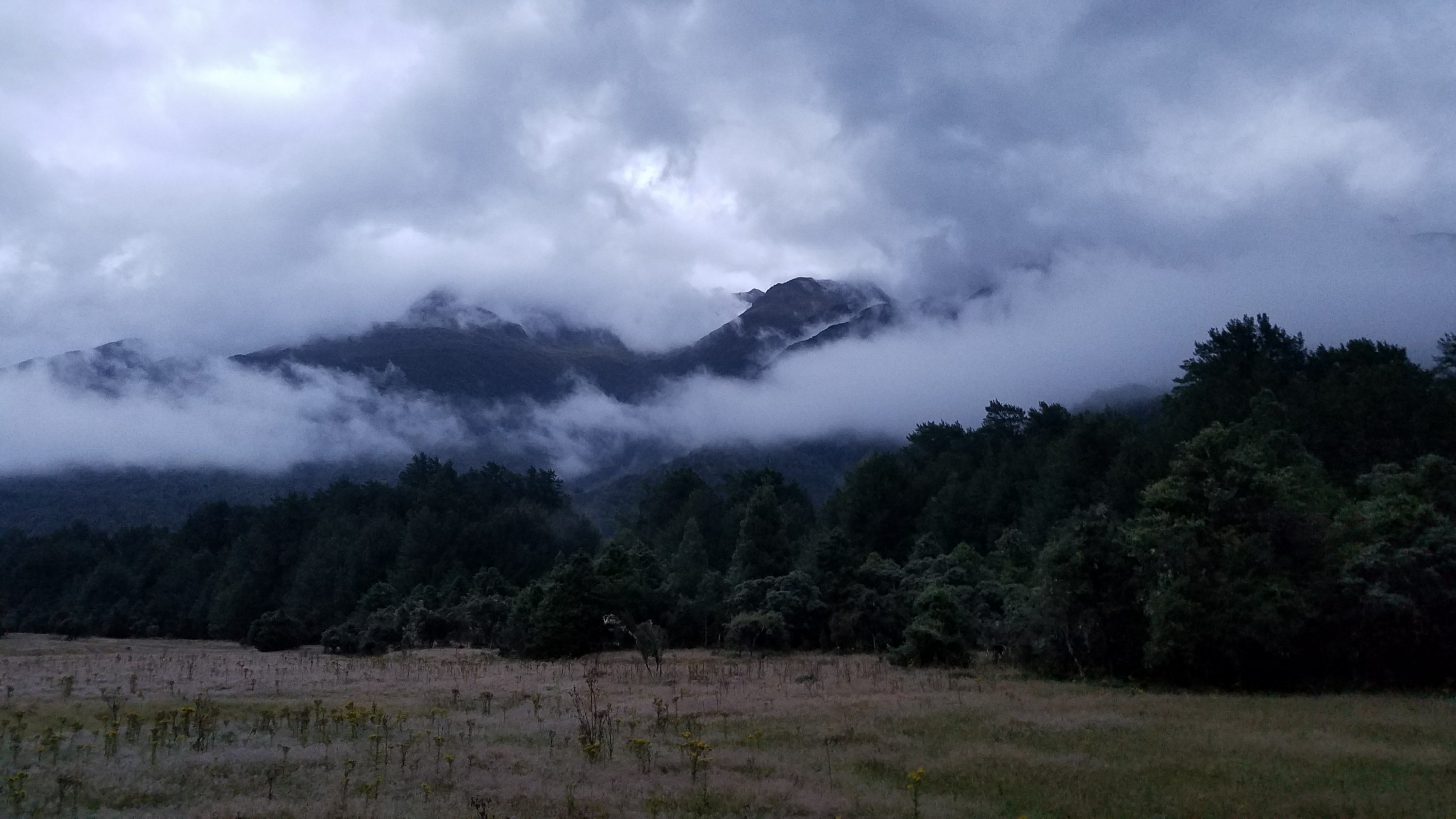
The morning clouds were really cool. It was very wet from the rain the night before and the valleys had that smokey look.
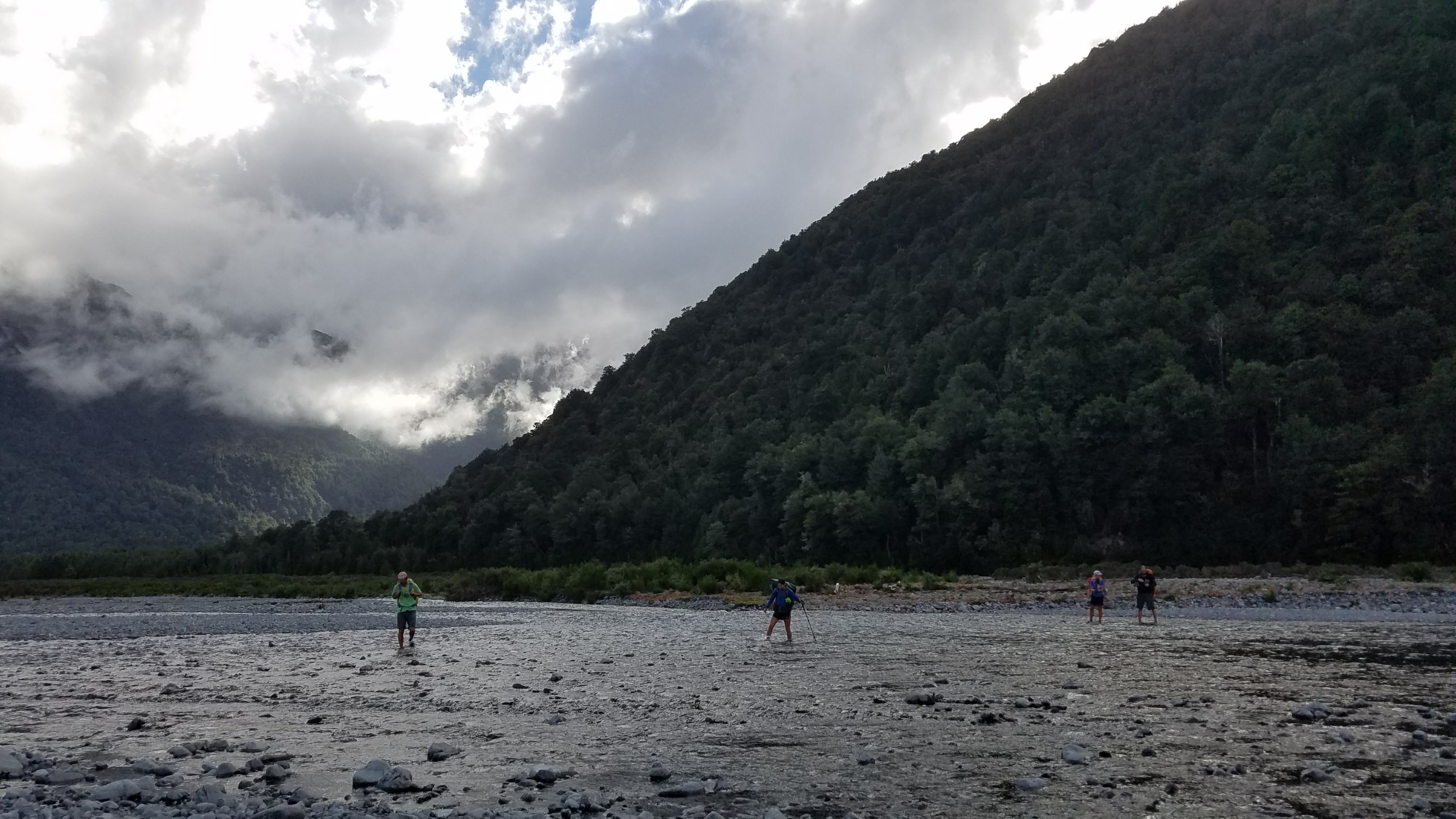
We started off with crossing the Taramakau River. Thank goodness for GPS, as there were no markers indicating the crossing. We were working hard all morning to find route markers, this being the most poorly defined section I have seen yet on the TA. We were following a nice jeep trail through lots of gorse until it abruptly ended into the river. You could see where it had been just completely washed away, since the GPS line still indicated solid ground where now there was only water. Of course, no one has bothered to rebuild/reroute the trail so we had to bushwhack about 700 meters through gorse and forest jungle. I had moss and ferns hanging off my pack by the end, looking a bit like Rambo.
After that, we made pretty good time to an intersection just before the highway. We could either cross the Otira river towards a small settlement called Aickens or continue along a ‘flood track’ on more of a straightline course to the Morrison Footbridge. This provides safe passage over the Otira, for those wishing to escape to the highway. Well, we tried the flood track for awhile but found it to be yet another poorly made and maintained connector trail. There was a ton of deadfall and it appeared that the trail did a lot of steep ups and downs to avoids slips. Tired from all the bushwhacking earlier, we opted to abandon the flood track, cross the many strands of the Otira river, and walk out to the highway via a farm driveway. I’ve never been so happy to walk a highway for 3 kms.
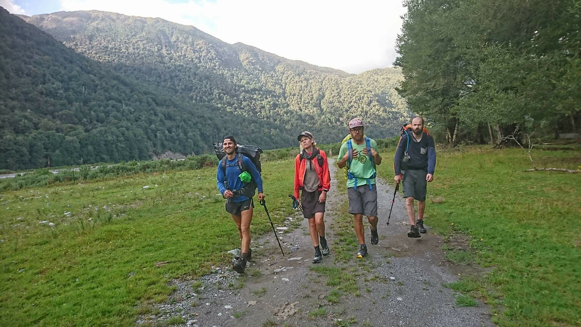
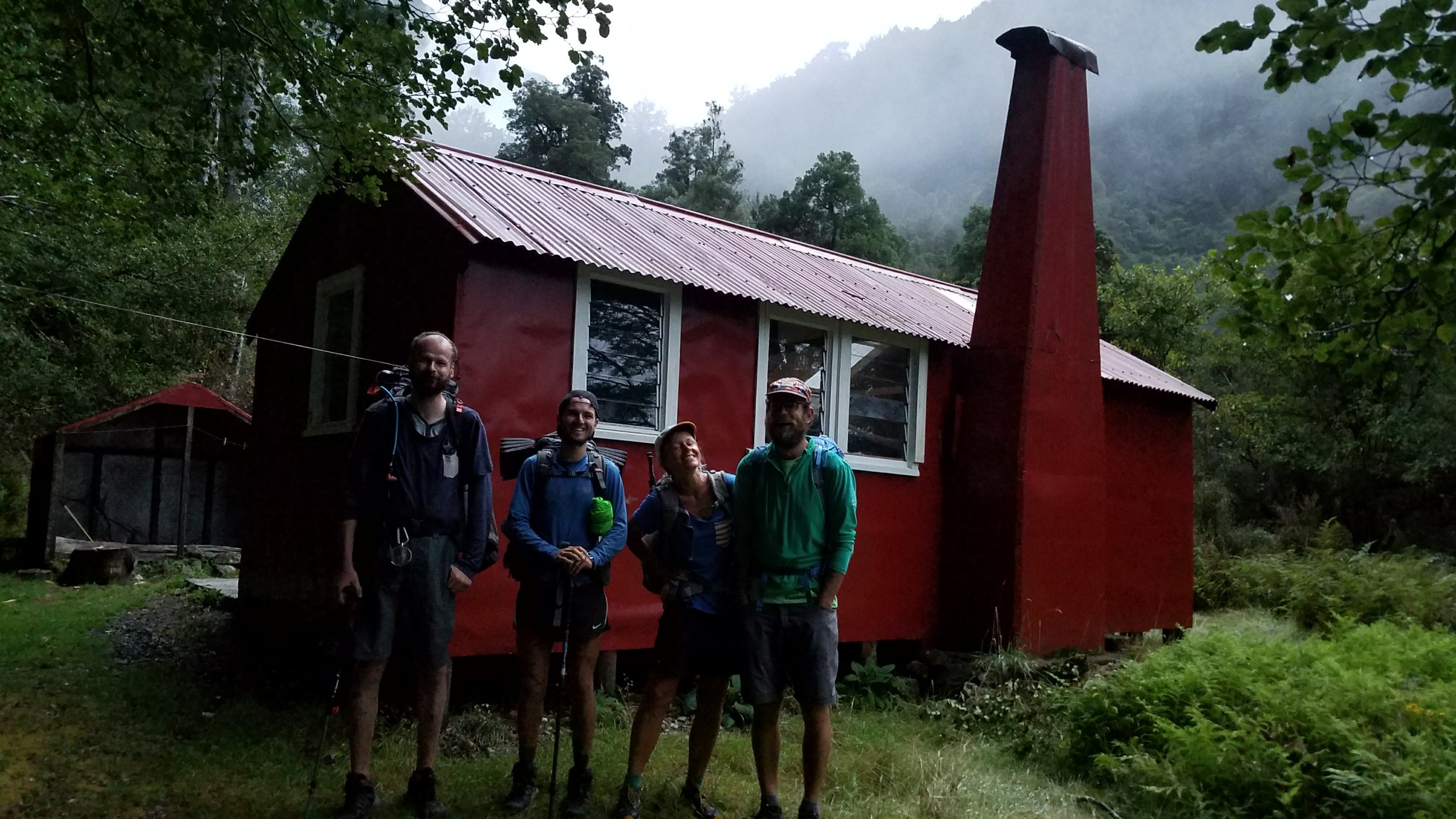
At the footbridge, we said goodby to Connor and Bertram. Connor had classes starting on Monday and needed a few days to shift from hiker mode to student. He plans to resume the TA when he has a month break in March. It was sad to say goodby once again but I was glad I got to hike with him the last 2 days to this temporary end. Hearing him singing all morning reminded me of the weeks from Tongariro to Palmerston North. We shared a lot of great moments on the trail. He was even nice enough to take our trash so we didn’t have to carry it over Goat pass…what a team player. I will miss him.
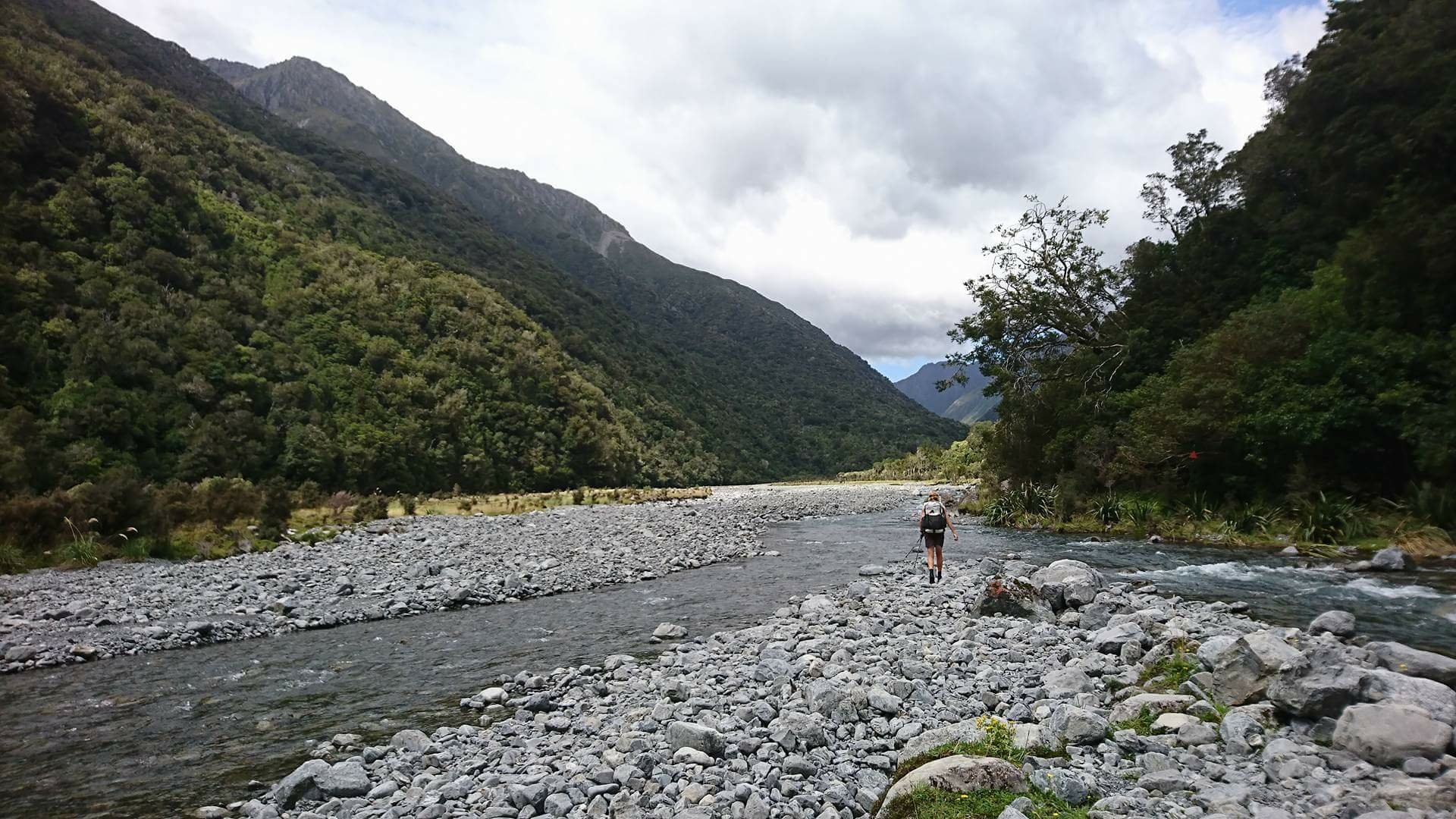
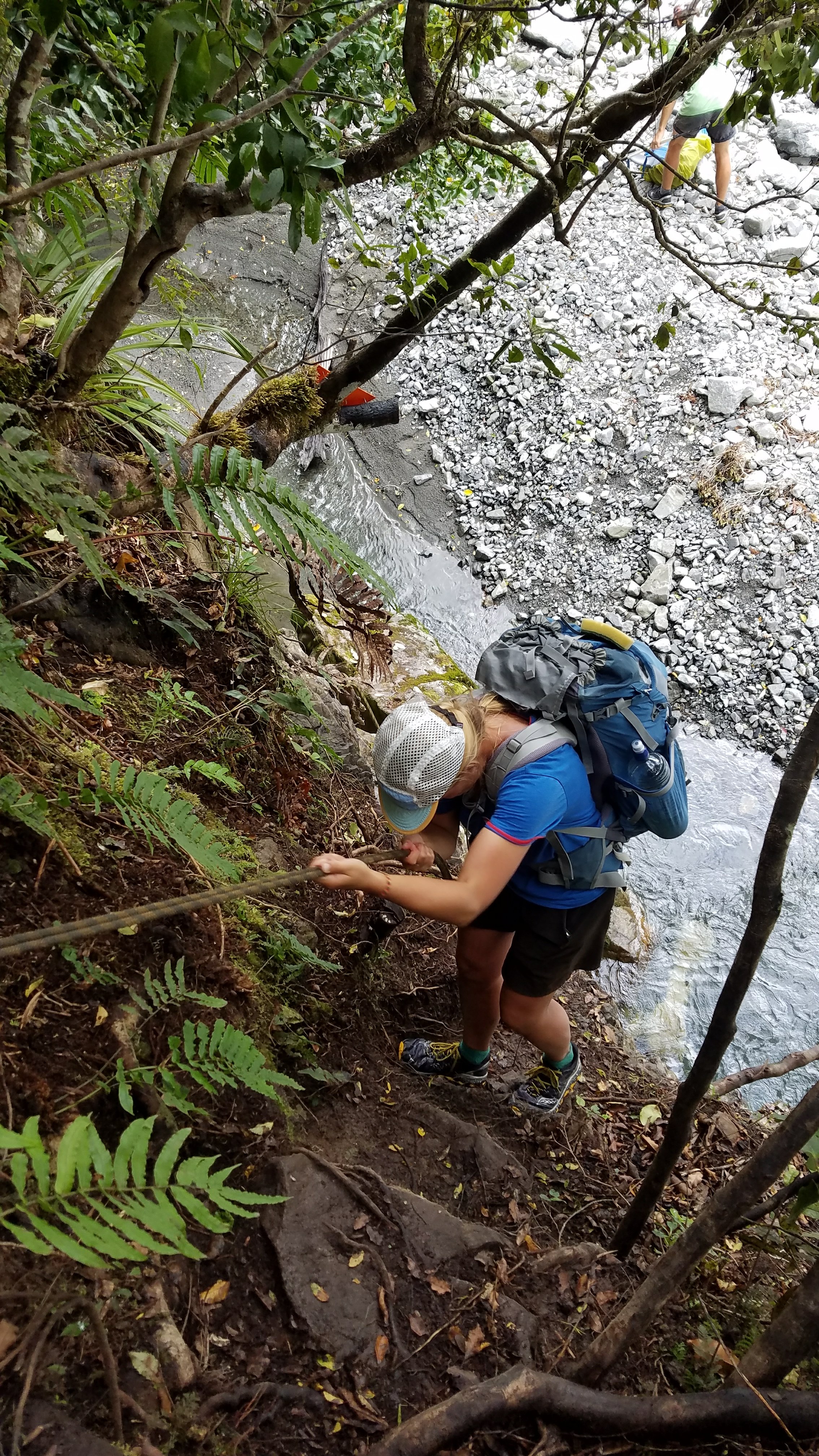
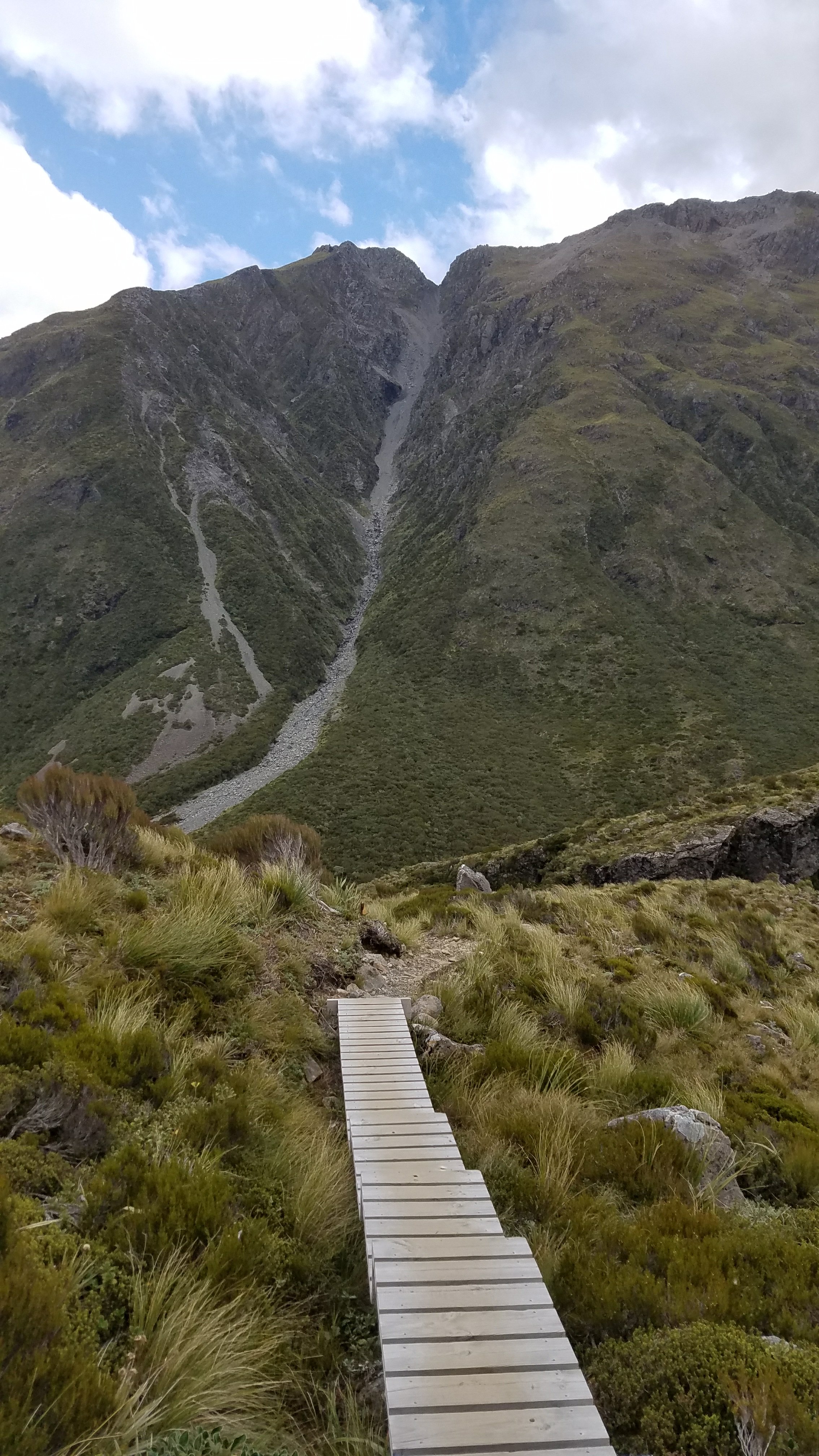
So the Fins and I set out across the footbridge and to our first crossing of the Deception River, about 1.5 km in. There was a large sign at the beginning of the track warning of the many dangers on this route, namely the river crossings but also rock slides, avalanches, and difficult terrain. It said to allow 9 hrs to Goat Pass hut (we did it in 5) and that the first crossing would be the indicator if it was passable, yet there are a few crossings upstream that can be even more difficult. We found the first to be quite easy. The second was the most difficult of the whole day, and that’s only because I chose a bad spot. The water went up to my crotch and for 2 steps I definitely felt the power of the river.
I am a bit more bold and aggressive than most when it comes to river crossings. Perhaps because I grew up practically on the Arkansas River and am into many watersports (kayaking, boating, surfing, rafting, scuba diving, etc), I don’t fear water as much. But I do have a healthy respect for its power, especially after surfing in Hawaii.
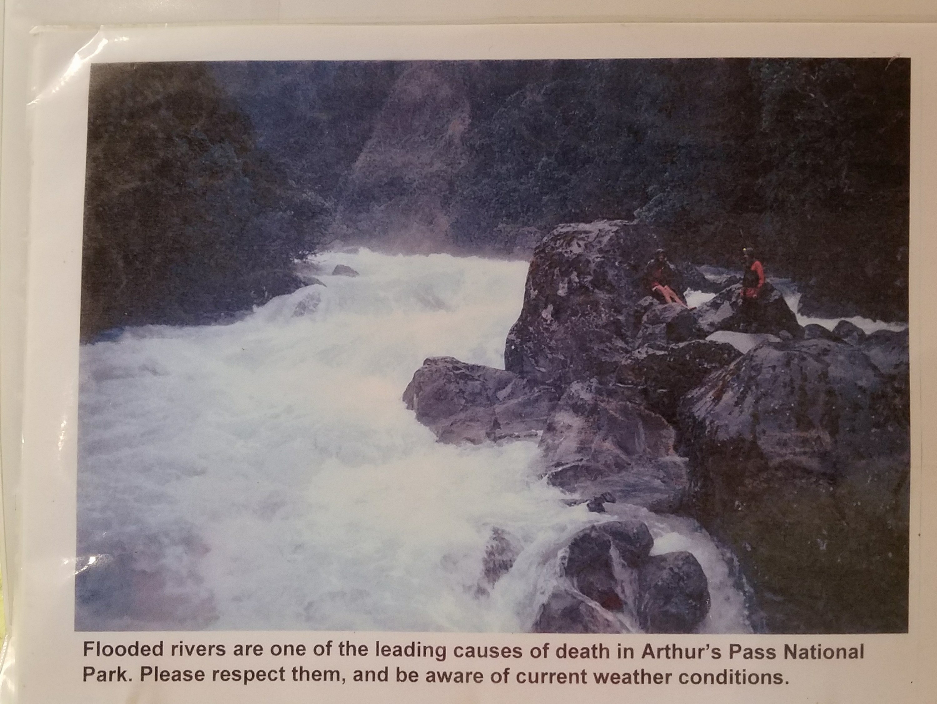
I later took this picture of the Deception River in flood from a scrap book in the DOC office. There are 2 people stuck on an island waiting to be rescued.
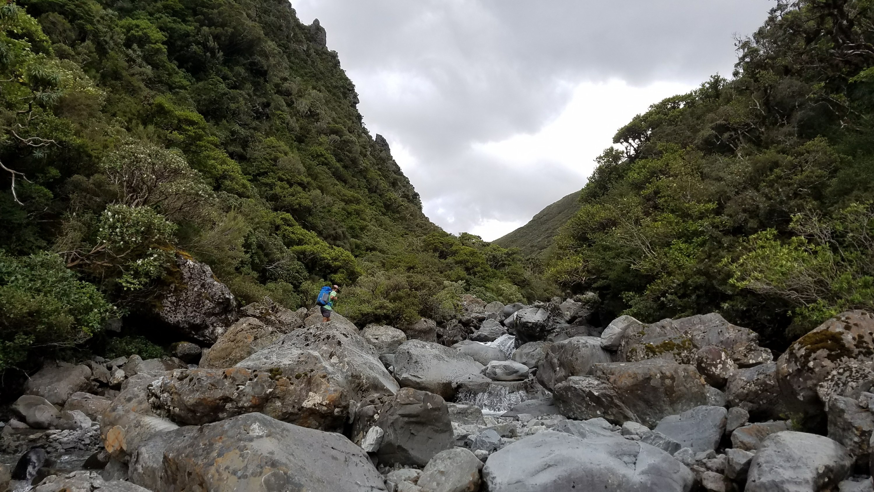
The easy conditions we had.
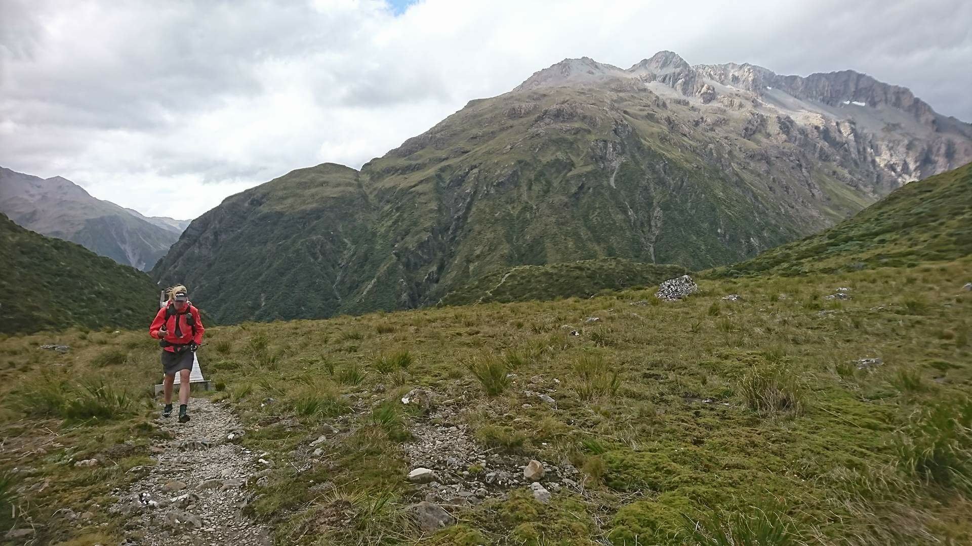
After reading the many warnings and a few blog descriptions, I found the route to be not as bad as I expected. There were many markers and cairns to guide the way. This route is used by the Coast to Coast, a popular adventure race which just took place last week. So I think the route looked somewhat trodden because of that. There was still a lot of boulder scrambling and hopping. There was even a wall where we had to use a fixed rope to repel down.
Further up, we were just about to go past a slide area when I heard something that sounded like thunder. Tuomas actually saw it. It was a rock slide, right where we were about to walk. We avoided the area by just walking in the river.
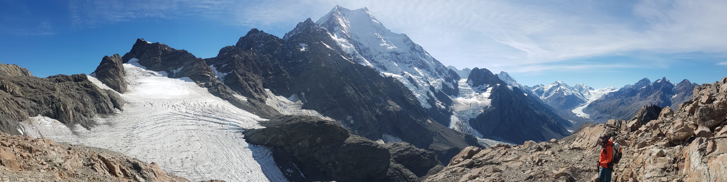
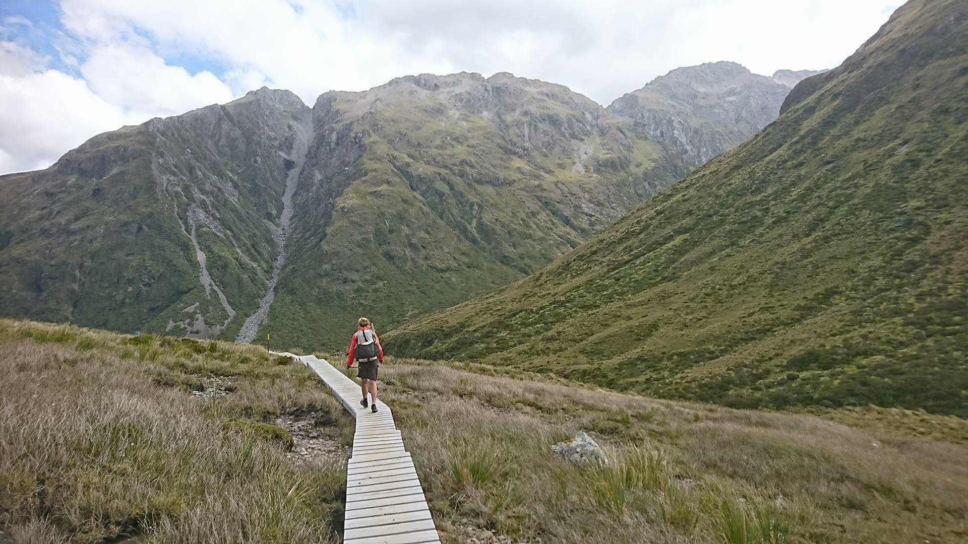
Near the top, the route climbed steeply up a small stream. The radio antenna of the hut could be seen just above.
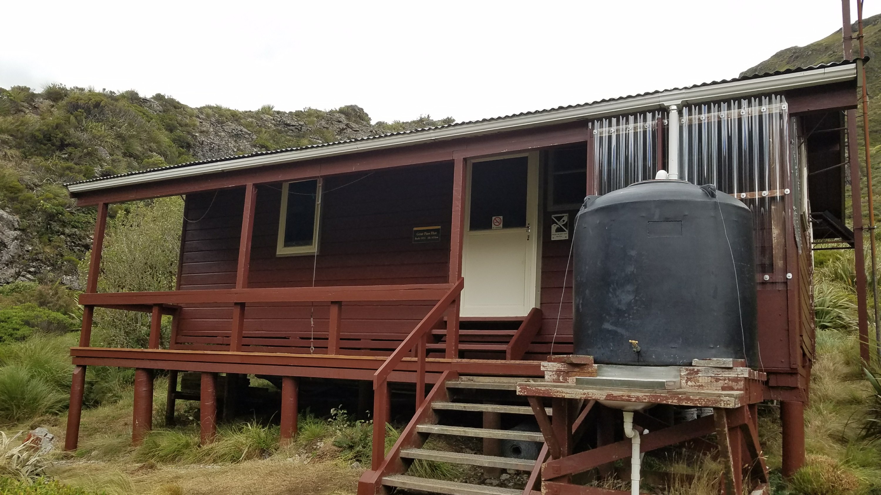
I was so happy to get to the hut and begin unpacking. It was only 4 pm. There were still patches of blue sky but the wind was really strong and gusty. I decided to use my radio skills to call the DOC office for a weather report. They came back straight away and read the report: heavy rain beginning that night or early next morning. Not good for us. We still had the Bealey River to cross at the very end, which the DOC person warned would likely be flooded.
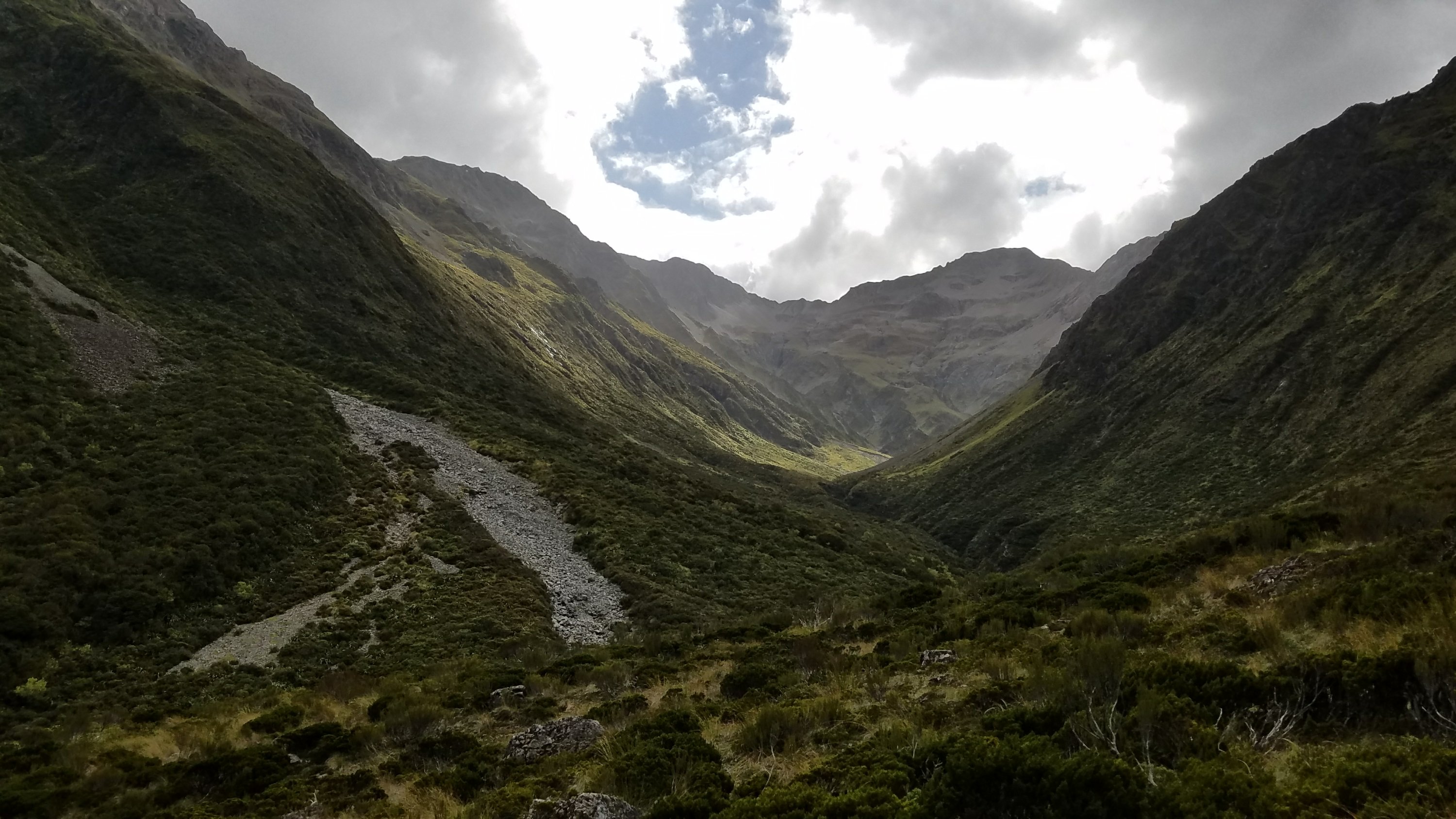
We came to a decision pretty fast. We would not stay overnight at the hut but instead walk the 9.5 kms to the road on this evening. I had to pack my stuff again. We ate some food hurriedly and began hiking at 4:40 pm. Fortunately it took us just 2.5 hrs, half the DOC estimated time. It was a beautiful section, especially the part over the pass. The surrounding mountains were quite spectacular and a boardwalk stretched for a long ways, allowing a hiker to be able to walk and enjoy the views. The late sun made the light on the mountains really nice. Even though we were tired, we all agreed that the last 10 kms was best enjoyed on this day rather then the no-view conditions we would likely have had the following morning.
We easily crossed the last river, the Bealey, then caught a ride for the short trip to Arthur’s Pass Village. Ransom, an American on holiday, actually passed us, then turned around to come back to pick us up. What a nice guy. Later, he was able to get the last bed at the backpacker. This was because I had just previously turned it down in favor of pitching my tent. Karma.
I had sent my resupply box to The Sanctuary, which is a budget accommodation run by Bill. He charges $10 to hold a box, but that includes a free night of camping. Even though I knew the weather was going to be bad, I decided to give it a try. My poor tent hasn’t seen daylight since the Queen Charlotte track. I was amused to find a dead cicada inside. A hitchhiker for the past two weeks.
I pitched up against a screen of trees and hoped that would be enough of a wind block. Then I ran to get dinner at the only cafe/bar open in town. The curry chicken plate was $26 and not that inspiring or generous. The Wobbly Kea thinks highly of its limited options, judging by the high prices, but the food is so-so. They thrive off being the only restaurant open past 5pm. Arthur’s Pass is no more than a collection of a few buildings and a train station, so don’t have high expectations. The curry was too spicy to eat the whole thing so I took the rest for a snack the following day.
Anna and Tuomas had struck out on all accommodation options in town (everything booked) so they went back to Bill and struck up a deal to stay in one of his containers outside. He has a sink and laundry in it but there was just enough room for a few mattresses. I found Bill to be the most laid-back hostel owner and his willingness to accommodate us so late in the day was sure appreciated. The facilities are somewhat rustic but have character and are the right price. I recommend the place for sure.
Whew, it was a long day and I went to bed without even taking a shower. I was in for a long night of disturbed weather but happy to at least not be fretting about river crossings… for maybe a day.
Hi Twig,
there is a litte backround story to your Goat Pass Journey .
After I left you on the highway, I hitchhiked to Arthur’s Pass. and went to the tourist information to find out how the weather will be for the coming days. When I heard of a cyclone sweeping across the island, I asked the person at the information desk if there was any way that they could contact the (Radio) Goat Pass Hut because I told them that you were going there and you would be stuck there for days. She then tried this too but received no answer.
Toumas later told me later you
Guys Radioed DOC and they told him that a gigant guy worried about you and asks them to call.