For links to each daily post, see here.
What a strange, long trip it’s been. The CDT will go into the record books as the thru-hike that never stopped testing, frustrating, enchanting, and forever changing me. It was the best of times and worst of times, all wrapped into a long and incongruous season of hiking. To further prolong the magic, I went straight onto the Arizona Trail only a week after finishing the CDT in Grants, NM. I wanted to get the full experience of hiking from Canada to Mexico for the second summer/fall in a row but somehow fell a bit short in replicating that magical feeling I got at the end of the PCT. That trail was just such a smooth and perfect ride while the CDT is all about staying flexible, patient and calm while adjusting to the many curve-balls.
But what do I have to complain about? I got to hike for months on end and see so many incredible sights. I persevered through some tough times and came out a lot stronger in the end. And I had good friends to share the experience with. Between the CDT and AZT, I hiked about 3500 miles. I also completed several hundred miles of day and section hiking in Colorado.
I did not count the month and a half that I took off to spend time with my dad in my stats. He was diagnosed with stage 4 melanoma cancer in May and I went home to be with him, thinking that my hiking season was over. He began a treatment shortly after which put his cancer in remission for about 6 months. thus I was able to begin the hike anew, starting at the northern terminus and hiking southbound.
“Flipping”, the term for starting at one end of a trail and skipping to the other end or another part, usually to avoid snow, is something I had planned to do all along. I just ended up doing it a little earlier into my NM hike than anticipated. The snow in Colorado was so bad this year that flipping made sense for many, thus I had lots of company. I was also much happier going southbound, since that had been the direction of all my past thru-hikes. I even called myself a southbounder (as opposed to flipper) since I planned to either re-hike the section in NM or jump over to the Arizona Trail to make it to Mexico, which I did. But I didn’t regret hiking a section northbound since I finally got to experience what all that’s about. I was able to attend Trail Days in Silver City, there was lots of early trail magic, a few parties and I met a lot of great people…many of which I ran into as I went southbound, which made for fun reunions.
Northbound: Southbound:
Start: April 22nd, 2019 Start: June 25th, 2019
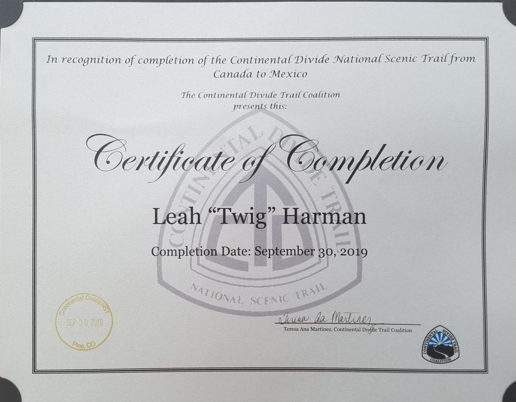
End: May 9th, 2019 End: September 30th, 2019
Miles: 376.5 Miles: 2304
Days: 18 Days: 98
Totals:
Miles: 2681
Days: 116
Zero days: 8 (5 in CO, 3 of which were at my parents’ house in Florence and another at my aunt’s house in Steamboat)
Average daily mileage (including zeros): 23.1 mi/day
Average daily mileage (excluding zeros): 24.8 mi/day
Most miles hiked in one day: 45 (on the heels of my first 40 mile day)
Fewest miles hiked in one day: 6
Days hiked over 35mi: 4
Days hiked 30-35mi: 24
Days hiked 25-30mi: 32
Days hiked 20-25mi: 22
Days hiked 15-20mi: 16
Days hiked less than 15mi: 10
CDT High Point: 14,261ft (Grays Peak, CO)….3 other 14ers I hiked as side-trails: Torreys Peak 14,267′, Mt. Massive 14,429′, and San Luis Peak 14,022′
Stats By State:
Montanaho
Miles: 824
Days: 34 days
Zero Days: 0
Average daily mileage: 24.2 mi/day
Days with rain: 10
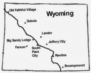
Wyoming
Miles: 489.5
Days: 19
Zero Days: 3 (Pinedale, Wedding & Rawlins)
Average daily mileage (including zeros): 25.8
Average daily mileage (excluding zeros): 30.6
Days with rain: 3
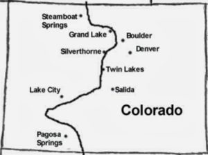
Colorado
Miles: 716
Days: 36
Zero Days: 5
Average daily mileage(including zeros): 19.9
Average daily mileage(excluding zeros): 23.1
Days with rain: 7
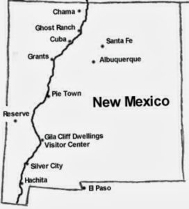
New Mexico
Miles: 651.5
Days: 28
Zero Days: 0
Average daily mileage: 23.3 mi/day
Days with rain: 5
One thing really stands out about the state by state breakdown in that I set a blistering pace through Montanaho and Wyoming. Bear in mind, I was able to push hard since I already had trail legs, with much of New Mexico under my belt. I walked over 1000 miles before finally taking my first zero in Pinedale, WY. I wasn’t even planning to zero there but because of the timing of the trail wedding and the fact that I saved a whole day in not having to hike the 15 mile side-trail to Pinedale (instead I got a ride from Green River Lake Campground and back), a zero was totally justified. The following day was the trail wedding at Green River Lake, which was technically my first and only on-trail zero. This little break was a nice diversion but then I went back to crushing miles. I only took a zero in Rawlins because I had hiked 45 miles the day before, so it was more like a nero had I hiked a regular 30 and then 15 miles to get into town. I walked the whole Great Divide Basin in 5 days (180 miles: 30, 40, 45, 35, 30). I was on a mission!
My goal all along was to make it to Colorado as quick as I could so that I could enjoy my homestate without the threat of snow, and that I did. My pace slowed significantly once in Colorado. The elevation and difficulty of the trail will do that to anyone. But I also enjoyed many town stops and stays with relatives and friends. I got to Colorado mid-August and felt like I had all the time in the world. But the days crept by quickly and by the time I finished the San Juans, I felt like I had barely squeaked through before winter set in. Other hikers were just getting to Colorado as I finished and I think many of them struggled with the cold and early snow. I was so happy for my timing and I highly encourage anyone reading this to do what you can to get through Colorado between August and September. The weather is so good during this time period and there’s not so much pressure to deal with snow.
Trail Town & Resupply Point Stats:
Trail Towns/Resupply Stops: 30
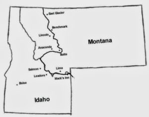
…East Glacier(2x), Benchmark, Lincoln, Helena, Anaconda, Darby, Leadore, Lima, Island Park, Old Faithful, Dubois, Pinedale, South Pass/Atlantic City, Rawlins, Steamboat Springs, Grand Lake, Breckenridge/Frisco, Leadville, Twin Lakes, Florence (Salida/Monarch Pass), Lake City, South Fork, Chama, Ghost Ranch/Santa Fe, Cuba, Grants, Pie Town, Doc Campbells, Silver City, Lordsburg (2x).
Nights spent in a hotel, hostel or cabin: 13 (all but 2 nights split with other hikers)
Nights spent camping for free or low cost at an RV park/hot springs/city park/ranch: 8
Nights hosted by a trail angel/church/friend/family: 16
Most interesting town accommodations: a delux RV in East Glacier, a city park in Anaconda, a community center in Dubois, a church basement in Pinedale, an 1800’s vintage cabin that housed mill workers in South Fork, the Davilla Ranch Pavilion, the TLC Ranch and of course, the notorious Toaster House in Pietown.
Rides from Trail Angels: 21
Hitches (not from trail angels): 21
Resupply boxes sent/delivered to myself: 6 (3 shipped at cost)
- East Glacier–had to ship my trekking poles and such stuff anyway
- Benchmark–sent along w/ Relentless’s stuff so we split the cost
- Leadore–all Amazon Pantry stuff…free delivery…which carried me through limited pickings in Lima as well
- South Pass City–sent from Island Park/Macs Inn with leftovers that my Florida hiking buddies gave me
- Battle Pass–Relentless brought my resupply from Rawlins when he met up with me here (since he had already hiked the basin earlier)
- Pie Town–was able to drop off a box on my way down through NM with Lisa, so I didn’t have to ship this one. Definitely need a box sent here!
Nights I slept in my tent: 73
Nights I slept in a cabin/hut on-trail: 1
Campfires made: 4
Times I Wished I Carried a Gun (or Knife or Bear Spray): 0
Most days between showering/laundry: 7
Longest gap between resupplies: 5.5 days
Most miles/days between zeros: 996 mi/40 days, Canadian Border–Pinedale, WY
Days hiked solo or mostly solo / nights camped solo: 19 / 11
Pairs of shoes: 4
Hikers I hiked at least a few miles with along the way (in order of appearance): Capt’n, Salty, P’Diddy, Relentless, Bearman, Luckyman, Open, Jetpack, Nikoli, Animal & Towny, Samson, Freebird, Sugar Rush & Sunshine, 2Forks, Etch-A-Sketch & DinoDNA.
Bear sightings: 4 (3 black bears on the first day going SOBO in GNP, 1 black bear on the last day of the Winds)
Other animals sighted: SO MANY COWS…CDT=Cow Dung Trail, wild horses, antelope, elk, bighorn sheep, mountain goats, moose, mule deer, marmots, pika, coyote, fox, pine martin, lizards, horned lizards, 3 rattlesnakes, wild turkeys, owls, bald eagles, golden eagles, grouse, including 1 very irate one. I saw one mountain lion on a day hike in Colorado. I had ZERO encounters with animals getting into or messing up my stuff.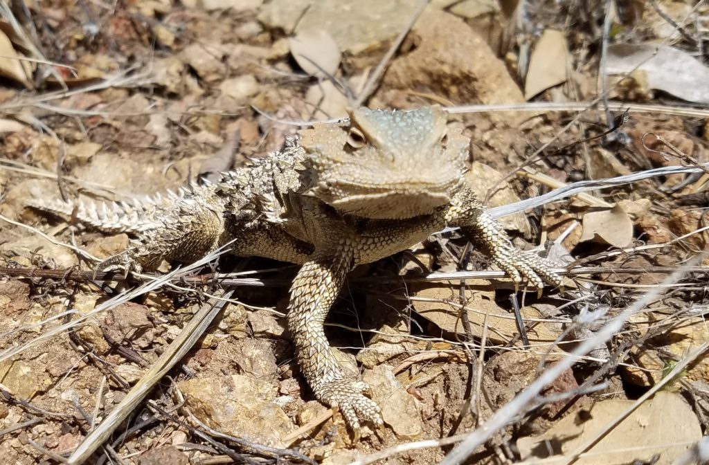
Alternates: The CDT is said to be a 3100 mile trail but in reality, it ends up being much shorter than that for most hikers because of all the alternates. I took what I consider to be the average alternates and hiked 99% of the road walks. I tried to be as accurate and honest in my blog’s daily mileage totals, which is where I get my figures. I only hitched one highway (about 10 miles into Silver City) and skipped about 3 miles of the road walk along HWY 40 going into Steamboat Springs. And I still came up shorter in mileage than I did on the PCT, but not by much. I think of the 2 trails as being about the same length.
Alternates taken and reason(s) why:
- Chief Joseph, GNP, Canadian Border to Many Glacier: due to lingering snow on main route. This alt was phenomenally beautiful and I don’t regret doing it! Any route in GNP is great.
- Spotted Bear, Bob Marshall Wilderness: this alt was said to be more scenic plus saved about 15 miles…and it was a very nice, scenic route, I’ll agree.
- Anaconda Cut-Off: I think the majority of hikers take this and for me, I just wanted to get to Colorado all the faster. It saves about 100 miles/3 days of forest and road walking. The official route around Butte is reportedly not much to write home about. And at least I walked ALL of the roads in and out of Anaconda…many hitch the roads and I’ll admit that one of the highways is pretty sketchy. This is the only place I wish I had hitched.
- Mack’s Inn, Idaho: I took this alt to make my resupply easier. I was also able to meet up with my hiking friends from Florida who were visiting Idaho at the time. Island Park has some fun attractions (a Subway, RV park full of friendly and helpful Mormons, ice cream and great Mexican restaurant both next to the Snake River) and is a great place to relax. I think it’s a good alt and saves something like 50 miles.
- Cirque of the Towers, Wind River Range, WY: this alt is a no-brainer and most hikers do it for the stunning views and challenge. There’s also the Knapsack Coll alt, which I didn’t do since I was a bit hung-over from the trail wedding at Green River. Definitely do at least one alt if not both, mileage savings is negligible.
- Road walks in and out of Rawlins: going off numerous tips from friends and blogs, I walked highways getting in and out of Rawlins. The trip in was about 15 miles, didn’t save miles but did save a whole lot of time picking my way through the sagebrush. The trail off to the side barely exists. But the highway is very busy and was no fun…at least there’s a wide shoulder. Going south from Rawlins, I decided to stay on the highway, saving about 20 miles where the trail dove off to the west to follow a series of jeep trails through the sagebrush. Road walking is road walking, so I went for the straighter path. The highway was actually quite pleasant because there was hardly any traffic and yet numerous vehicles stopped to give me water and treats along the way. I crushed 35 miles in a day on this single highway and would do it again but man did I have some heat rash on my poor feet at the end!
- Bypass of Rocky Mountain National Park Loop to Grand Lake: Given the hassle of permits and need for a bear canister, I skipped this 25 mile loop. It can be done as a day hike but then I would have needed to spend a second night in Grand Lake and it was a bit too pricey for my taste. (I hiked this loop the next summer while visiting family in CO).
- Twin Lakes, CO Bypass: this is a short alternate that goes west out of Twin Lakes and crosses the river that flows into the lakes. The official trail goes east all the way around the lakes and then back west to meet up on the way to Hope Pass. I had already walked much of this when I did the Colorado Trail, so I took the shortcut bypassing the lakes and saved about 10 miles. This alt is not recommended in the spring or early summer because the river runs high. For me it was an easy shin-high stroll across.
- Ghost Ranch, NM: Many take this alt to resupply in Ghost Ranch/Santa Fe. Relentless got off the trail at this juncture so I went into Ghost Ranch and then Santa Fe to see him off. I’ve actually never known anyone that bypassed Ghost Ranch and don’t know if the official route is shorter or longer. There an option to take the main route and hitch into Chama as well.
- Mt Taylor, NM: this alternate side trip goes up to one of the highest peaks in NM and is well-worth it. Since this is basically where I was finishing my southbound CDT hike, I thought of this summit like AT hikers think of Mt Katahdin. In this case, the alternate is harder than the official trail, going up to over 11,000′ in elevation. The views are fantastic!
- Cebolla Canyon, NM: This is an alternate to hiking the official route through the Chain of Craters, which is said to be hot, rough volcanic terrain with hardly any water sources. Chain of Craters is also about 20 miles longer…I don’t know of anyone that has hiked it. The Cebolla alt goes in and out of 2 really nice canyons and was a pleasant route. Another option, the most direct, is to just stay on the dirt road to where it meets up with the highway. But I needed a break from all the road walking in and out of Pie Town.
- Pie Town: There’s new trail listed as the official route and then there’s the old official route that follows a series of forest service roads directly into Pie Town. Everyone I know of walked the Pie Town alt because the Davilla Ranch is located along the way, and who would pass on a free place to stay that has showers, laundry, wifi, and beer?
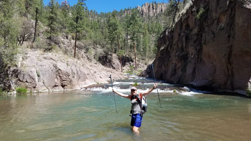
- Gila River: This ought to be listed as the official route because it’s the one everyone takes. Unless the Gila River is overflowing its banks and cannot be crossed, take this beautiful, unique diversion in lieu of the dry hills. This alt also shaves nearly 100 miles. (I’ve since hiked a portion of the Black Range as part of the Grand Enchantment Trail and I must admit, it’s a pretty cool section as well. If you like solitude, follow the official CDT through the Blacks…you won’t see a soul for 3 or 4 days probably).