For links to each of my daily posts, see here.
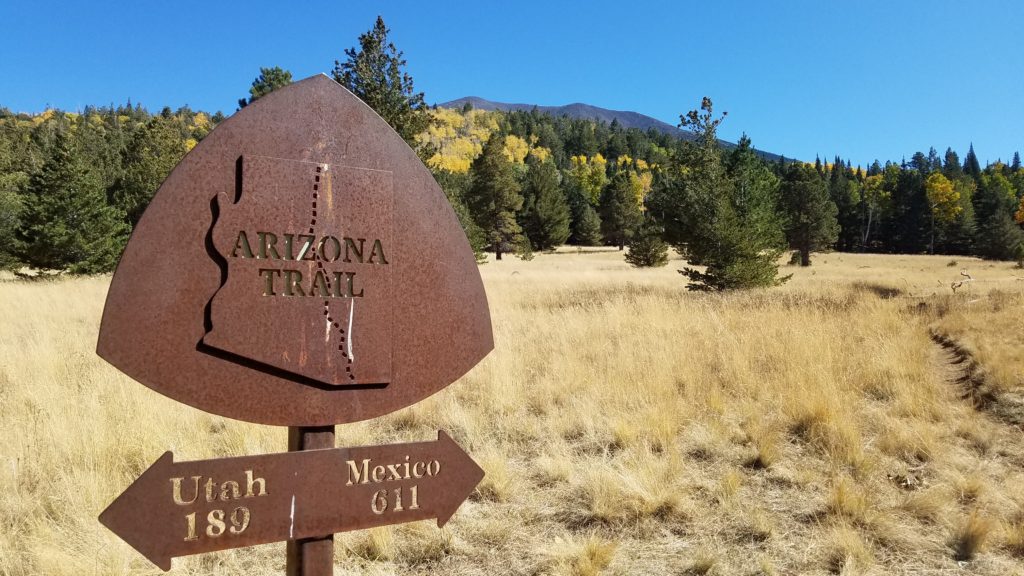
I thru-hiked the Arizona Trail for several reasons. One, I said I would when I first learned about it while visiting my friend Jon near Phoenix at the end of 2018. And secondly, I wanted to hike from Canada to Mexico again in one season. I finished my thru-hike of the CDT going southbound through Montana/Idaho, Wyoming, Colorado, and half of New Mexico…long story, see my CDT summary. I finished this journey by hiking all the way south through Arizona.
The official CDT is a 3100 mile trail but in reality/practicality, it’s about the same length as the PCT (on account of all the popular alternates). By adding the AZT, the CDT became a 3500 mile trail for me. Now I can claim to be in that prestigious 3000 miler club, woo-hoo. And besides, the ruggedness of the AZT is more in following with the majority of the CDT. Sorry New Mexico, you’re just too easy to really fit in with the other CDT states.
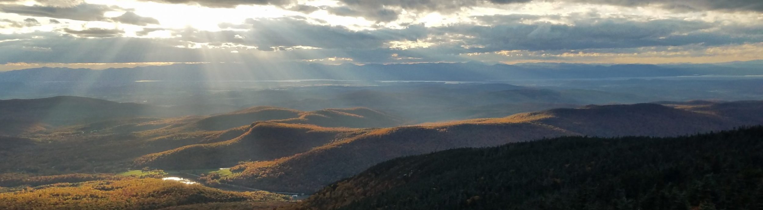
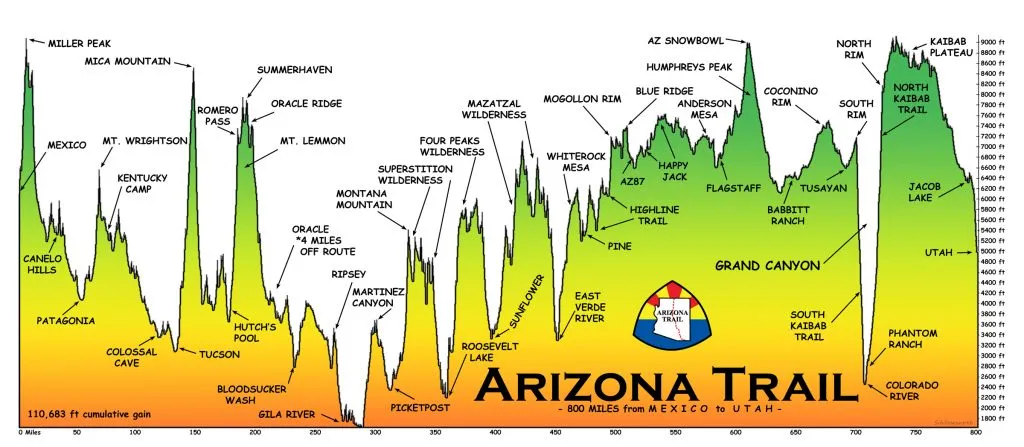
The AZT is actually pretty chill in the northern 300 miles on the Colorado Plateau. But it’s quite rocky and rough south of the Mogollon Rim, especially the sections through the Mazatzals, Four Peaks, and Superstition mountains. Then there are the big climbs over the sky islands to the south, some as much as 4000′ of gain. Yes, the AZT definitely has some teeth. I was happy to have my CDT fitness to get me through so smoothly.
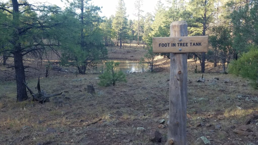
A southbound hike is ideal in terms of building fitness, starting off with the easier part of the trail. But due to the lack of water sources in the fall, I think a northbound hike might be a better choice for most. I started out being able to do 30+ miles days, so the frequent 20 mile waterless carries were not as big of an issue for me. I’m also a camel, so that made it even easier. There were a couple of times I went over 30 miles between my collection points (with 3 liters or less)…but that doesn’t mean there weren’t one or two yucky water sources in between. I could mostly go from one cache to the next, so I was never forced to filter water from one of those disgusting earthen tanks with brown cow poop water. As one can never predict the persistence or reliability of water caches, these tanks will unfortunately be a predominant resource for most hikers. Water is definitely the most limiting factor on the AZT.
The other limiting factor for me was daylight…I would’ve traveled longer most days but I didn’t want to hike in the dark. One of the few times I did hike in the dark, I encountered 2 rattlesnakes laying across the trail. Best to stick to the daylight outside of full moon conditions. In October and November, daylight lasts for less than 12 hours…6 am to 6 pm. This is perhaps another reason that a spring northbound hike might be a better option, but only marginally.
A note about navigation and planning…I basically did no planning for this trail and relied almost completely on Atlas Guides Guthooks AZT app for navigation. I had no problems with this strategy. I think the app is a great deal…purchase price for me was only $12…I’m sure it’s much more expensive now. Even without the app, the trail was pretty well marked. Jeep trail intersections and splits could be tricky, similar to how they were on the CDT. I think this was also a pretty affordable trail, especially since I was able to benefit from the kindness of so many trail angels. Resupply along the trail was pretty easy and prices were good except for the Grand Canyon Village and Tusayan… the only places I would send a box if I had it to do over again.
Lastly, I’ll say that Trail Angel support is phenomenal on this trail. Not only are there countless people that leave water along the roads, many towns seem to have a couple people willing to host hikers. The AZTA maintains a list of trail angels, which is mostly where I got my information. The Facebook page also had some good leads. I would encourage future hikers to try to make at least one or two connections along the way since this was one of the highlights of my trip. See my special post on Trail Angels and Trail Magic for more.
Totals:
Miles: 785
Days: 34
Zero days: 3 (Flagstaff, Phoenix, Patagonia)
Average daily mileage (including zeros): 23 mi/day
Average daily mileage (excluding zeros): 25.3 mi/day
Most miles hiked in one day: 36.3
Fewest miles hiked in one day: 9
Days hiked over 35mi: 1
Days hiked 30-35mi: 12
Days hiked 25-30mi: 3
Days hiked 20-25mi: 6
Days hiked 15-20mi: 7
Days hiked < 15mi: 2
High Point: Mt Miller 9466′
Low Point: Gila River 1700′
Trail Town & Resupply Stats:
Trail Towns/Resupply Stops: 11…Kanab UT, Grand Canyon North/South Rim & Tusayan, Flagstaff, Pine, Jon’s house outside Phoenix, Roosevelt Marina store and restaurant, Superior, Oracle, Summerhaven on Mt Lemon, Vail, and Patagonia.
Nights spent in a hotel, cabin, or Air B&B: 3 (Flagstaff, Oracle, Patagonia)
Nights spent camping for free/low cost at a campground/park: 3 (Grand Canyon & Patagonia)
Nights hosted by a trail angel/friend: 10 (Kanab, Flagstaff, Pine, Phoenix, Superior)
Rides from Trail Angels / hitches: 7 / 3
Resupply boxes sent: 1 care package sent to my last stop, Patagonia
 Nights I slept in my tent: 25
Campfires made: 0
Days of Rain: 0
Times I Wished I Carried a Gun (or Knife or Bear Spray): 0
Most days between showering/laundry: 6
Longest gap between resupplies: 4 days
Longest water carry: a couple over 30 miles to avoid earthen water tanks (cow pools), many around 20 miles
Pairs of shoes: 1
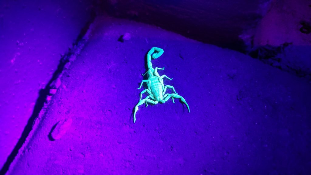
Animals sighted/heard: 1 black bear, porcupine, bobcat, striped skunk, javalina, elk, mule deer, white-tailed deer, cows, horses, coyote, owls, ravens, roadrunners, lizards, praying mantis, scorpions, tarantulas, 2 rattlesnakes, and a few other non-venomous snakes. I heard and saw many unidentified songbirds but my favorite is the curved bill thrasher because of the cool sound it makes.