Saturday, August 13th, 2022, 0730-2030
Baker Lake Road to FR 313, WEBO mm 881, Section 7 North Cascades
31.5 miles, Gain 6273′, Loss 4540′, elevation 2630′
Dan gave all of us a ride back to the trailhead early in the morning. We picked up Karaoke at the motel, where she stayed for a second night. At least we were efficient in consolidating the ride so he didn’t have to make several trips. It was incredibly nice of him to take us so far…probably about 30 minutes one way. We offered gas money but he wouldn’t take it. Again, I offered my free Te Araroa consultation services… it’s something.
The route started off on a very nice closed forest path but all too soon rejoined an open-to-traffic dirt road. Boy was there traffic. It’s the road that goes to the trailhead for Mt Baker. I realized with dread that it was early Saturday morning, so there would be a ton of cars driving up. It wasn’t too bad for the first few miles but the later it got, the more steady the stream became. The vast majority of drivers were considerate enough to slow down the 10 extra seconds it takes to reduce the dust. But there were enough jerks speeding by to make me really grumpy… and struggling to just breathe. I guess they were in too much of a hurry to fight for a non-existent parking spot at the top.
After about 5 miles of this, I finally got to the trailhead. It was a zoo. I counted 83 vehicles at the parking lot, well overflowing the capacity. Probably about half of those had passed me, the rest already there from days or hours earlier. Now it was my turn to pass everyone…at least around 30 people. I caught up to one of the guide services, which was a good opportunity to ask some questions. I was considering climbing Mt Baker as part of the culmination of this trail. Another factor I hadn’t considered, in addition to the cost of the guide (between $800-1000), I would need to rent a bunch of gear. It’s ironic that I’m equipped with nothing but backpacking gear, yet none of it’s really suitable for a mountaineering adventure. Go figure.
Reaching the top of pass on Mt Baker’s shoulder, I was disappointed not to catch a glimpse of the peak. It was very shy this day, hidden behind thick clouds. It was even spitting rain off and on, but not enough to do anything about. Funny, because the forecast had been for clear conditions. Mountains don’t care about forecasts. A side trail led to an observation tower but it wasn’t worth the extra effort on a day like this. I continued straight down and was shortly back in a valley surrounded by dense forest.
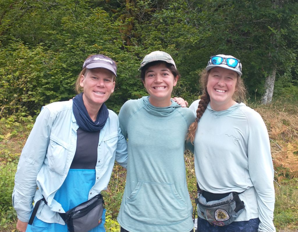
I took a very short lunch break, hurrying because it was cool and I got chilled. Wolverine caught up, with another hiker in tow. It was a guy named Easy, who had just finished the PCT and was taking the PNT west to his friend’s place in Bellingham. He was really positive about the PNT thus far, but I wondered if that changed as another classic bushwhack section reared its ugly head. The route followed along a river valley for the afternoon, with notes describing difficult-to-find trail, blowdowns, and washouts. One comment simply stated that the section was “stupid”, whatever that means.
Shortly I found out. The trail was a mess for 2.3 miles. I did pretty good in following it but had to do a wide variety of acrobatics to stay upright and keep moving. Just about every classic bushwhack obstacle presented: blowdowns, tangled roots and branches, lose footing, washouts, scrambles, holes, mud, creek crossings WHILE climbing blowdowns, steeply undulating tread, barbed wire bramble thickets, being whipped in the face with alder branches, stinging nettles, and debris raining down on my head. Sound like fun? I’m very capable of handling all this by now but I think I’m just tired of it as well. This day came with few rewards, so it was mostly for the sake of doing the miles. The next hundred miles were kind of a big connector piece, linking the Cascades to the Olympics range. So maybe I was a bit too gloomy worrying about that as well (it would turn out to be really fun, actually). It’s just the nature of the geography along this route.
After more than an hour spent getting through the 2 miles, the route joined a very old road. Ironically, this was the stretch described as a bushwhack. It was still a solid push through alders and occasional brambles, but at least it was mostly straight and level, easy to follow. There were frequent cuts and streams crossing the road, requiring some scrambling to cross the steep banks each time. This wore me down. In the last crossing, my foot slipped on one of the rocks and took a dunk. That being my worst casualty for the difficult afternoon, I considered myself pretty lucky. Still, I needed to vent some frustration about the whole situation.
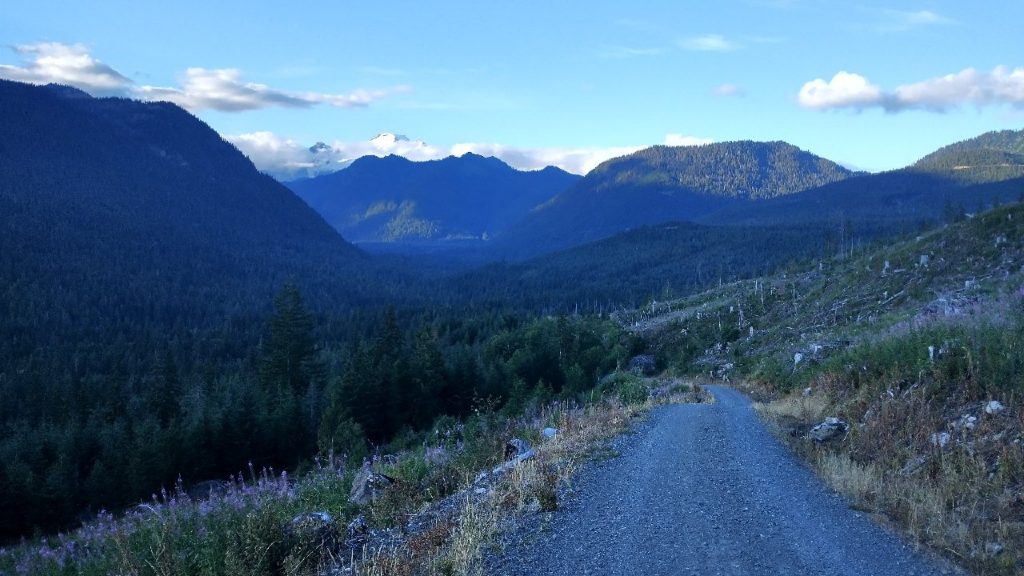
It’s funny how quickly the misery fades when the route opens to a dirt road and travel becomes so easy once again. Suddenly everything was fine and I was enjoying the late day. Not having given this section enough consideration beforehand, I now found myself in a long stretch of logging operations. Notes about private property and no camping persisted for the next 15 miles. It was too far for me to walk in the evening and I sure wasn’t going back through the mess to find a campsite. I stopped to make dinner at a stream, figuring I’d just walk late into the evening and find a stealth spot off the road. Given that it was the weekend, I didn’t figure much work was taking place, so I shouldn’t bother anyone.
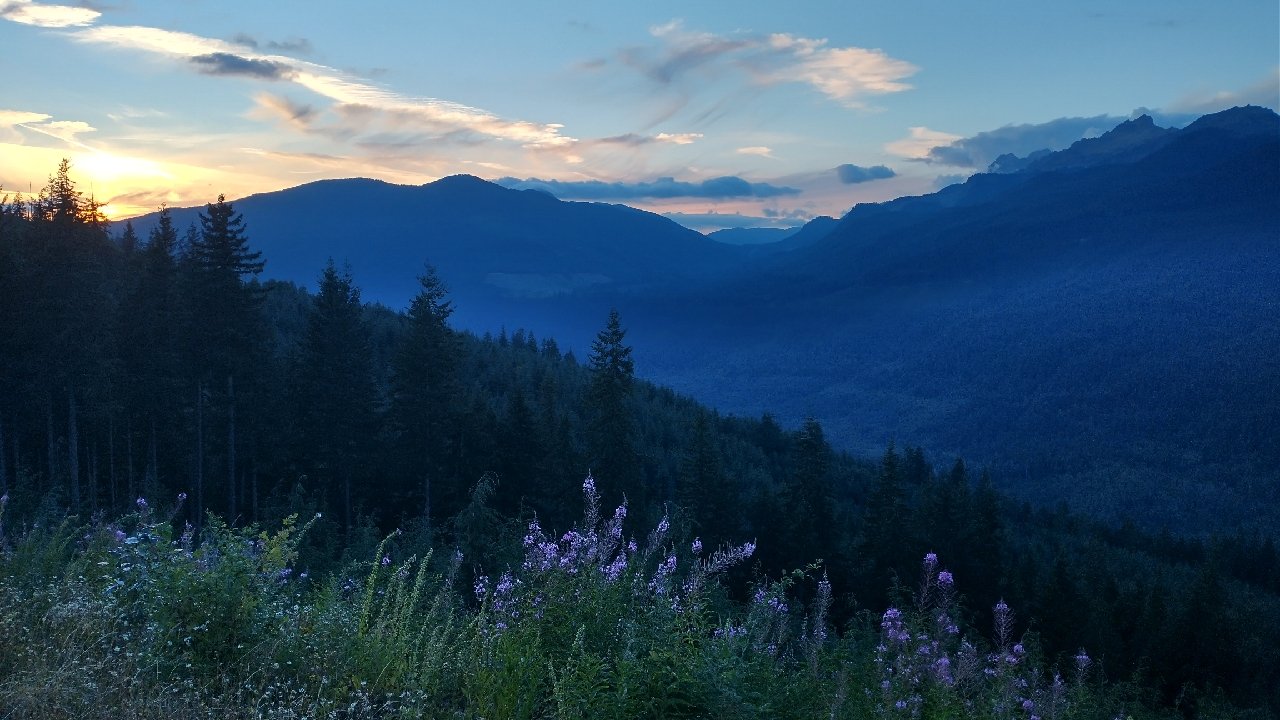
I walked for another few hours right up until dusk. I saw one promising spot and then a bear butt disappearing into the bush. Nope, not that spot. I came to a crossroads in a clear cut area with some dead space in the middle. It was really not ideal but would have to do. At least there were nice sunset views of Mt Baker, which had finally made an appearance this day.