Friday July 29th, 2022, 0800-1720
Waterton River Camp to Gable Creek Camp, WEBO mm 6, Section 1 Rocky Mountains
20.8 miles, Gain 3680′, Loss 3232′, elevation 4650′
The last piece of my PNT eastbound section was ready to be hiked this day. Stoney Indian Pass had been the crux giving so many hikers fits in the early weeks. It’s a very difficult pass with snow, but now all that snow was gone. In its place were wildflowers and waterfalls. I think my visit to Glacier was the perfect timing, as I got to experience it in its full summer glory.
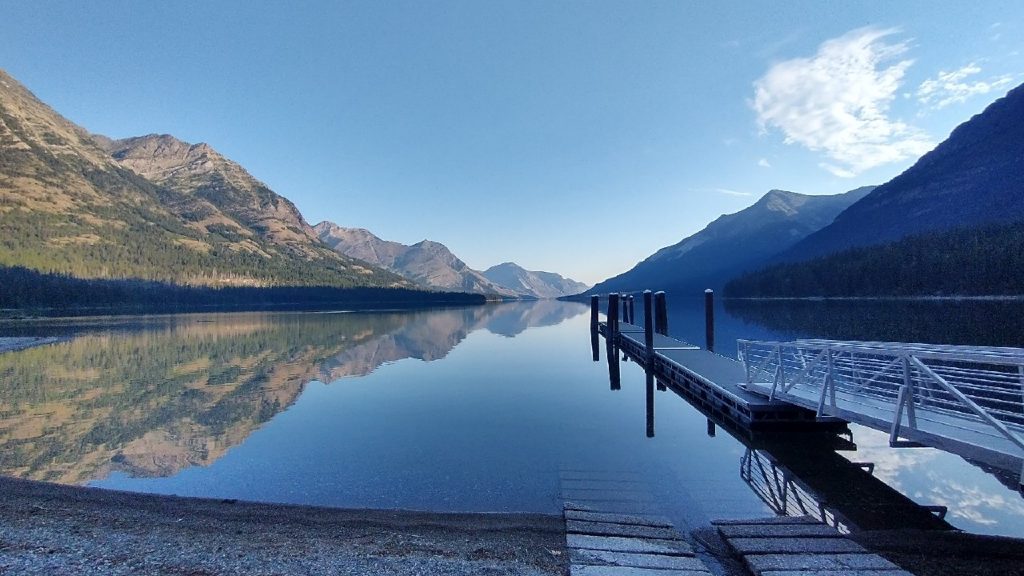
The morning got off to a slow start. I brought all my stuff over to the lakeside ranger station and gazebo to escape the bugs, as did Skunkbear, Sashay and Wolverine. All of us enjoyed a casual breakfast next to the picturesque lake, as well as use of the flush-toilets! I forgot to mention that there was a couple just starting the PNT at our campsite overnight. Unfortunately, I didn’t get to interact with them for long, given the bug situation. I’d been surprised to see a stream of 1-2 PNT hikers a day while traveling through GNP. I didn’t expect anyone to be starting so late. Perhaps some were only doing half or maybe just seeing how far they could get. My understanding is that the Olympics can get pretty cold and rainy in late September, so I wanted to be there by late August. Plus, there’s the always present concern over wildfires in mid to late summer. Wolverine and I were still on an early schedule and hopeful our luck would remain, even with our GNP extensions and travel days built in.
Leaving Waterton valley required some heavy pushing through underbrush. If ever I got tired of the overgrown trail, I merely had to look left or right into the actual forest floor to be reminded of what it could really be like. I wondered how big animals didn’t just get stuck in the bushes. Could a grizzly bear attack me if it could barely move? How would we even see each other? Crews had cut all the blowdowns and that was all the more anyone could ask for or do for the trails. The Tunnel (or wall) of Thimbleberry was just as much a fixture of the landscape as waterfalls and trees.
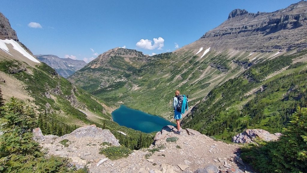
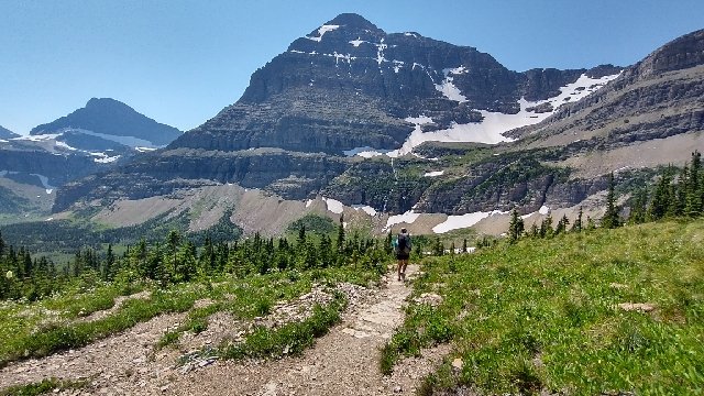
After 4 mellow miles along the valley, I made the turn for Stoney Indian Pass, switchbacking steeply up the hillside. It was so much more tiring with the thimbleberry holding onto every footstep. Swimming uphill, against the tide. But I knew with every step, I got closer to the top where the trail would be open. I made it to Stoney Indian Lake and found relief. There was a lovely campsite nearby and remarkably no snow…just green hillsides. I’d seen pictures from a month and a half prior when the lake was completely frozen over. Captain Jack and Eric had walked across the lake on June 16th. Now there was a tiny snow bank left at the edge, which actually fractured into pieces while I was taking a break. I sat in the shade of a cliff, watching the ripples from the snow collapse lap the bank.
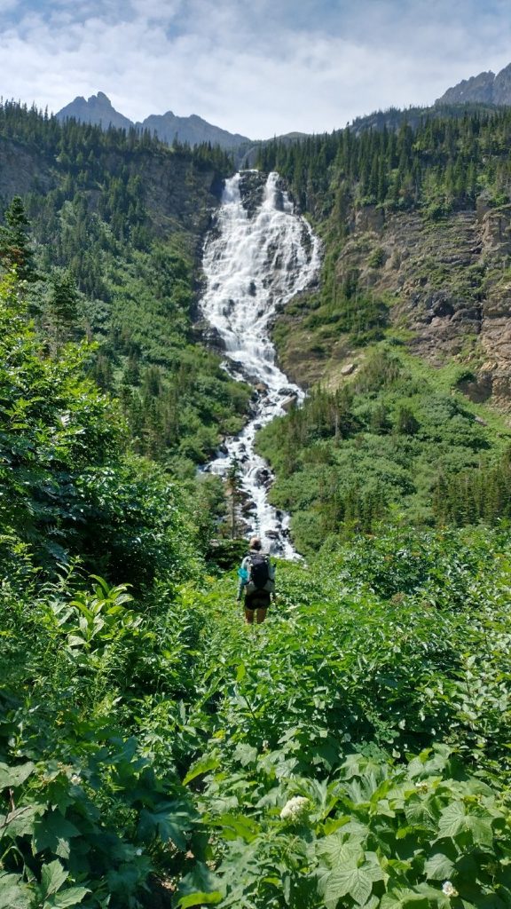
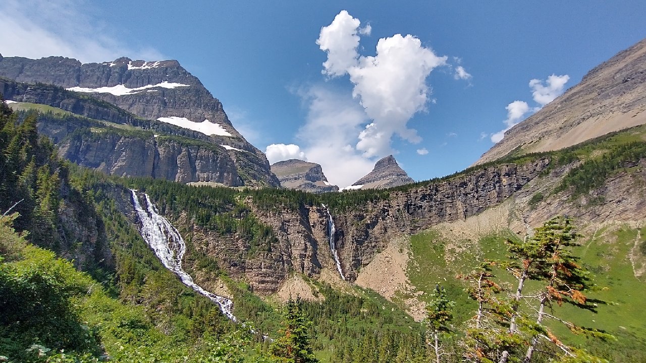
The trail skirted the far east shore at the edge of a bluff, practically in the water. This was another spot that I knew was tricky in the snow. I rock-hoped a few steps and was past it in seconds. Next was another 500′ of gain to the pass, easily done on some switchbacks. I had a hard time envisioning this pass as difficult, only because in such good summer conditions, it was a well-graded, non technical passage. Had any of the switchbacks been covered in snow on either side, then it would be very steep and treacherous. Going down was even better. The descent followed a series of 3 tiers, each revolving around these giant and dramatic waterfalls. The tiers of a wedding cake came to mind, with icing pouring down the sides. So much gushing water. The wildflowers seemed to be exploding from the ground as well. It was another fairy tale scene.
We came to one wet-foot stream crossing and opted to take our shoes off. This is always easy for me, since I have bungee laces. I waded across barefoot as it was so small. A group of 8 day hikers arrived just as I was resuming. I didn’t wait around to see what they would do. They were all wearing heavy boots that they wouldn’t want to get wet and it was going to be a lengthy process for all of them to un-shoe, cross, dry, then re-shoe. I was surprised that the park service hadn’t put up a simple bridge board, as all the other crossings had them. Probably it had been washed away early season.
Despite the plethora of water still emanating from snow on the high peaks, these crossings were easy. That had been another thing to fear earlier in the season, when the creeks and rivers were raging. I’d even forded the large Waterton river earlier in the morning, simply because I didn’t want to go all the way around to the bridge. I was glad for a stress-free experience with all the easy conditions this day. It was just a beautiful and peaceful hike in GNP, no worries.
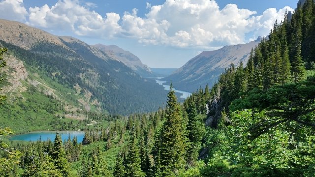
We had lunch near a lake, catching up with our German friends, Simba and Nala. They had taken the Bowman lake and Brown pass red line route, and so had gotten ahead of us. I walked with them a bit in the afternoon and also took another break to go for a dip in a lake. It had gotten very hot as we’d descended. A heat wave was hitting the area. As a result of all the exertion going over the pass and the heat, I was really dragging in the afternoon. I got to the campsite fairly early, just in time to see Wolverine take off. She’d arrived long before me, set-up, and gone into beast mode again. She planned to walk an additional 12 miles round trip in the evening to tag the Chief Mountain border monument. This was the official eastern terminus of the PNT, after all, and it meant a great deal to her to arrive at it, after connecting footsteps all this way. I admired her commitment and the energy it must have taken…she ended up pulling a 33 mile day.
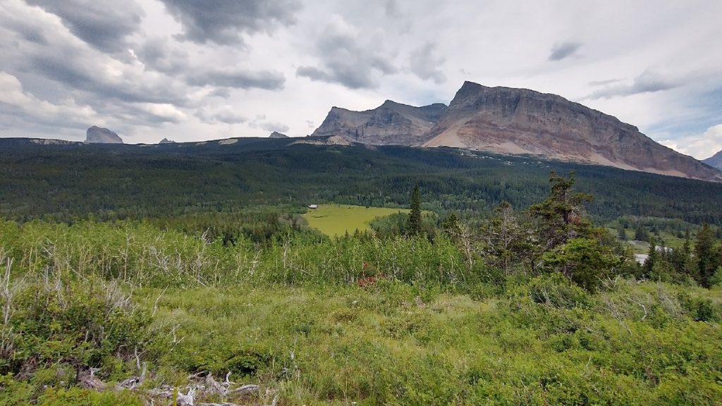
As I’d come down into the Belly River valley near the ranger station, I’d gotten great views of Chief Mountain…the actual peak for which the border crossing is named. It’s a prominent butte that rises high in the front range. For me, it was significant enough to sleep in the shadow cast by this mountain. The more trails I do, the less important the starting and end points become (as evidenced by my flip-flopping). A number of factors led to my decision to hike south the next morning, away from the eastern terminus and without touching it. For one, I figured I had a much better chance of getting a ride if I hiked out to the tourist “town” of Many Glacier. The CM border crossing was still closed, which meant less traffic. Two, I’d been to CM before and had pictures…it was my CDT starting point after I’d flipped from NM. I’d found it rather boring, to be honest. Another border swath in the woods, without a view of any of the grand mountains in GNP.
In hiking south, I planned to travel a new (for me) route through the Ptarmigan tunnel. This is a highlight for many visiting GNP, which I’ll describe in detail in the next post. I always like to see new things when I have a choice. I’d done just this by visiting the border at the Waterton monument…which is what I deemed as my PNT terminus…but still effectively completed the majority of the route in hiking over Stoney Indian Pass. Lastly, I’d already hiked extra miles on the PNT by taking some of the longer\harder alternates like the Lions Head high route and Boulder Pass. I would do even more extra miles hiking out via the Ptarmigan tunnel trail. The RT hike to Waterton monument had been exactly 6 miles, same distance to CM from where I was, so that alone felt aptly satisfying. I was plenty ahead on the score board, screw Chief Mountain. Even still, I sincerely respect Wolverine for staying the course. In doing it as a RT day hike, she’d won herself a similar option of hiking south to Many Glacier, taking the Red Gap Pass route, which would be new to her as well. I would’ve done what she’d done this night if I could’ve…I just simply didn’t have the energy or willpower.
Miss getting reports of your perambulations!