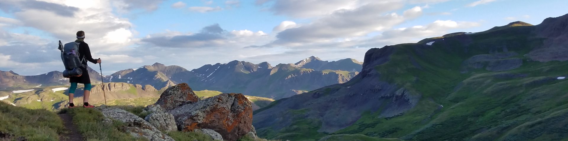
Thursday July 28th, 2022, 0640-1900
Upper Kintla Lake to Waterton River Camp, WEBO mm 26.8, Section 1 Rocky Mountains
18.4 miles plus 6 RT bonus miles to Waterton Border Monument, Gain 3700′, Loss 3860′, elevation 4220′
It was another grandiose day that was too good to put into words. On the one hand, I love experiencing such days, and on the other, I hate writing about them. There’s just too much to say and none of what I write can do the experience justice. Even the pictures aren’t enough.
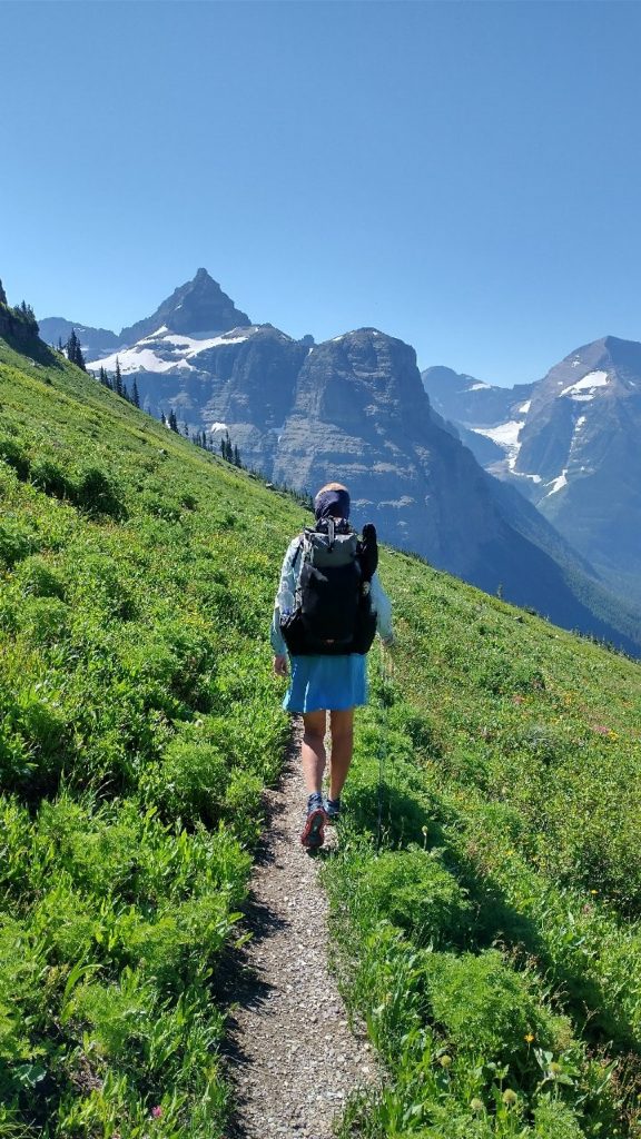
We tried to get a pretty early start but having to make coffee and breakfast at the cooking area instead of from the front porch of my tent messed with my routine a little. I also didn’t want to leave the beautiful serenity of the lake. We still departed camp well before anyone else…a classic thru-hiker thing. We climbed for 5 miles, much of which was through incredibly thick thimbleberry. There had been an explosion of growth the closer we got to Glacier and we were in some of the wettest and lushest valleys yet. The snow and rain had turned into mountains of vegetation. It was like swimming through a sea of green. Trekking poles were useless. Far better to wave my arms as if doing the breast stroke. I heard a lot of grumbling from other hikers about the overgrown trails in GNP but there’s no way that trail crews can keep up with such explosions in herbaceous growth…it comes and goes each year, just like the snow. Trail crews mainly get rid of blowdowns and fortify trails to prevent erosion…they just can’t spend their time and resources ‘mowing the lawn’ every week.
At least there was an underlying trail to follow, which is far easier than none. I can’t imagine how the animals move through the mountains when there’s such dense underbrush. I’m sure they also follow trails as best they can. Rocks and dips caught us by surprise a few times but amazingly we managed to push through without falling. My legs didn’t even get torn up because fortunately thimbleberry branches and leaves are relatively soft, with no thorns. It’s an entirely different story with blackberries…those would come weeks later in the trip.
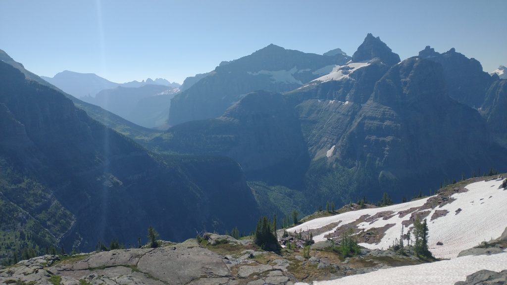
We climbed above the tree line and finally the underbrush, entering the high alpine and easy travel. Except now there was some of the snow we’d been promised…only it was so much fun! At first, we easily skirted a few steeper patches and places where snow bridges were on the brink of collapse. Where there wasn’t snow, there was lots of water. The ebb and flow of the seasons were in full swing. The gravity-defying storms that brought all this precipitation up were long past and now it had all begun its journey downward. The great melt was still very much in progress, resulting in almost a sheet-like flow across the mountain tops. Everywhere water was trickling, streaming, roaring. I guess I somewhat knew that GNP was known for its many waterfalls but even so, the abundance and grandeur of them surprised me.
The concept for the PNT was to be like a raindrop, following a path from the Continental Divide to the Pacific Ocean. Except that no rain drop would ever go up and down every mountain range like we had. Given that we’d now done half the trail flowing towards the Continental Divide, this concept was out the window anyway. But still, it was cool to think of all this water just beginning its journey so far west. We’d cross the Continental Divide at Brown Pass this day, after which the water would then be flowing east into the Missouri River and later the Mississippi. Some also goes north into Canada and eventually Hudson Bay.
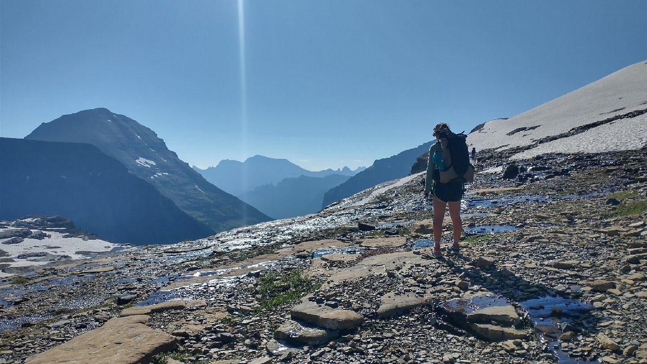
As we came over the top of Boulder Pass, we got a good look at a huge snowfield still covering most of the bowl of the upper basin. It wasn’t steep, so I was able to easily walk down it. Wolverine tried to slide down on her butt but it wasn’t steep enough to maintain momentum. We passed a small pond that was still partially frozen….no dipping in that one! Then we came to the edge of the basin, where there were a series of tricky ledges to descend. We made up our own route for awhile, until I spied a day hiker way below us, realizing that we were pretty far off trail. We scrambled down rocks where could, then slid down a small snow bank. It was very steep but fortunately the run out was into some grass and mud, not rocks. Still, I tried very hard to control my slide. I can see why snow travel can be so dangerous.
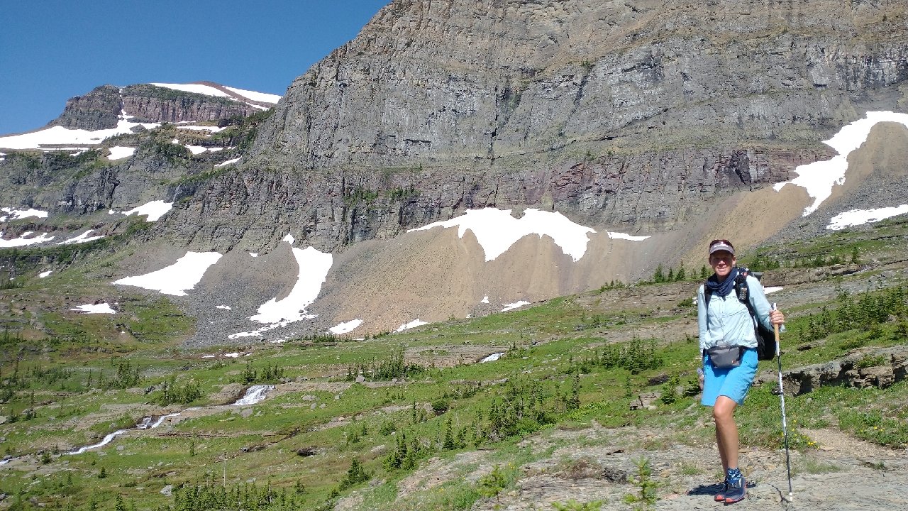
Just after this hard part, I slipped on some wet grass, stuck a pole out to steady myself, and it folded like butter. I went down in the mud and grass but it was a soft landing, so no injuries. The pole, however, was F’ed. The carbon had splintered at the locking joint…a catastrophic failure that unlike previous failure points on my Black Diamond poles (after thousands of miles), couldn’t be easily fixed with a shim. I was very surprised and disappointed by this occurrence, to say the least. Being down to one pole for a few days was a big inconvenience but replacing the pole before upcoming sections was going to be a huge problem, as I’ll explain later.
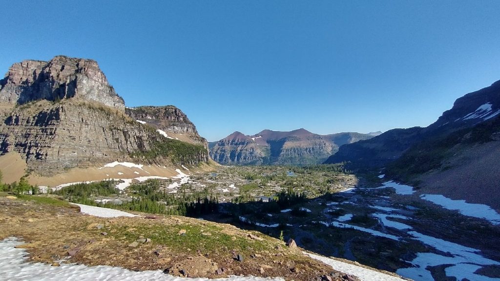
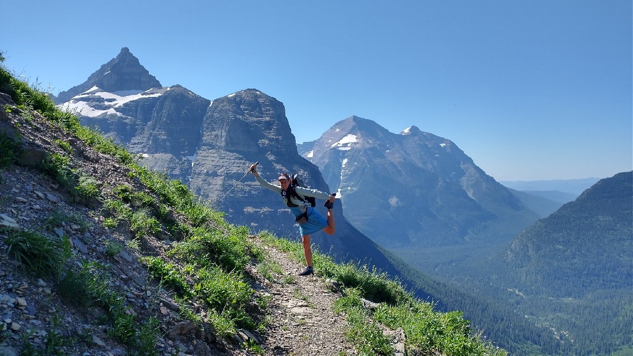
We followed the trail across a ledge and down to a series of sweeping switchbacks that could be seen from very far away. Views across the valley to the surrounding peaks were just breathtaking. This quickly became my favorite pass in the park, even more striking than the other 4 or 5 I’d done on the CDT. There was a nearby campsite in the basin called Hole-in-the-Wall, one of the most prized in the park. Unfortunately it was still closed due to “winter conditions.” I guess there was snow still covering the tent sites. The Boulder Pass campsite, which we’d passed on the western side, apparently had the #1 best privy with a view, as scored by Backpacker Magazine. It was also closed, so I didn’t get to see the privy view. Darn.
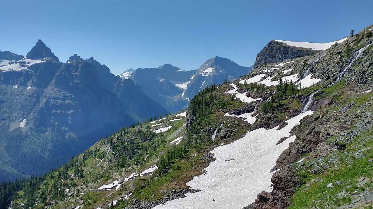
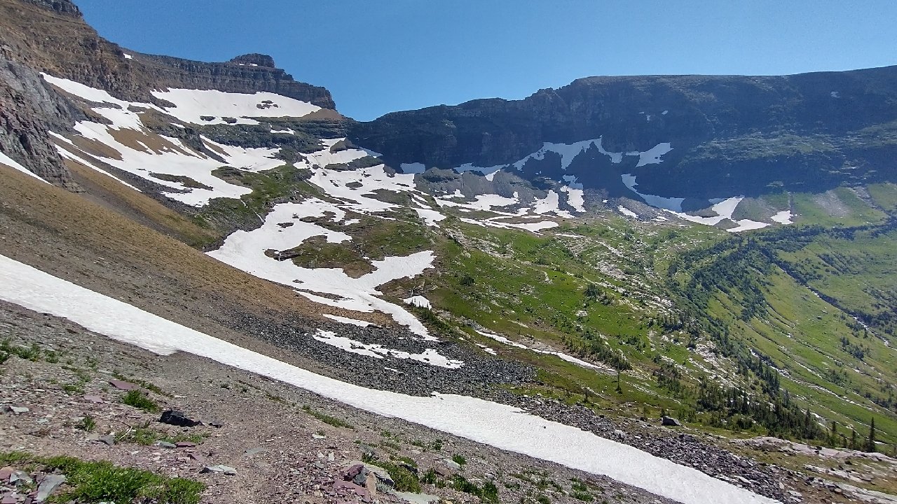
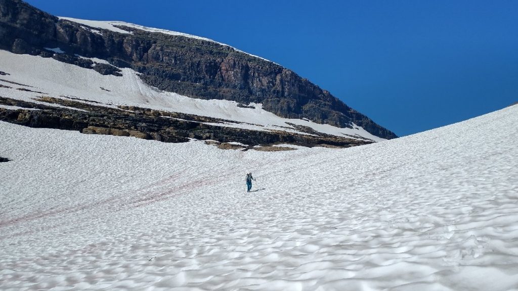
One last set of high angle snow fields blocked the sweep of our long traverse, so we went down and around them easily. They were probably the most sketchy snow I’d seen this whole trip, with stupid steep and long run-outs into scree. Thank goodness they were so easy to avoid. I guess part of good snow travel is recognizing the bits (snow bridges and high angle traverses) to avoid altogether, if possible. If we’d had to cross them, we would have needed traction and ice axes to be safer but even still…
Once past all the snow, we could breathe a sigh of relief. Rather than 12 hours, the high parts of the pass had taken us less than 2 hours. We’d taken it slow because we were having so much fun and because it was so beautiful up there. The next few miles were very easy as we wound our way down towards Brown Pass. Reaching the junction, it was striking just how much lower (1,200′) and relatively mundane Brown pass was compared to Boulder pass. I was so glad we took the alternate! It was definitely worth the extra 15 mile road walk and I’d even venture to say, worth a flip-flop. That’s right, being able to do this one alternate is reason enough to re-work the direction of the whole hike, regardless of the many other benefits that might be gained from a flip-flop.
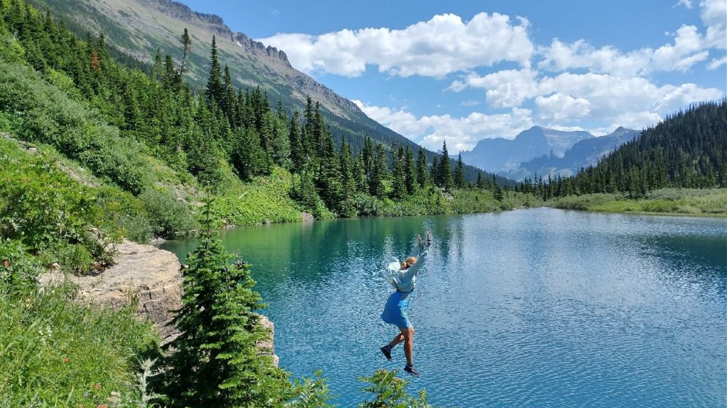
We stopped for lunch just past Brown Pass and then another short break to jump in a high alpine lake. The color was such a deep blue…I just knew it was going to be freezing! A perfect jumping rock beckoned us. Best to take the plunge outright in such cold water. As I surfaced, I let out a shriek. It was ice cold for sure. Wolverine didn’t often jump in water sources but she’s also the kind to be enticed by the more hard-core a thing is…and I loved that about her. She went straight in after me, coming up with eyes wide open, a look of shock. It was great.
We walked fast for a long time after this, both because we were cold and we still had an agenda once reaching our campsite at the Waterton river. We planned to walk to the border monument along Waterton Lake, the official northern terminus of the CDT. I’d decided that I’d rather make this my eastern terminus for the PNT instead of the official one at Chief Mountain border crossing. In 2019, I’d started the CDT at CM (an early-season alternate), so why not flip things around and see a place I hadn’t been before? The PNT is more of a ‘choose-your-own-adventure’ hike than even the CDT.
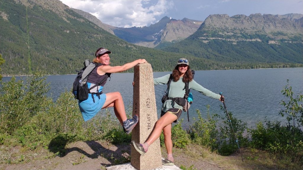
We arrived at the campground plenty early to set up and have a snack. We hung our food and loaded our packs with some minimal stuff. We were excited to find Skunkbear and Sashay’s tent set up there as well, but they were off somewhere… probably tagging the monument as well. Since departing Brown pass, we’d re-entered the thick tunnels of vegetation. At least going downhill wasn’t so bad, since we had gravity working with us. But the 3 miles one way to the monument were quite the drag. I considered turning back several times, only because I was grumpy about the extra miles in the woods, after we’d had such an incredibly scenic day. Getting to the border monument was worth it though. I’d seen it in so many CDT finisher photos, it was great to finally see it in person.
We had a moment of contemplation on the beach, drinking what was left of our box wine, waiting just long enough for a 3rd person to join in. He was a Great Divide Trail (GDT) hiker coming down to touch the border from the Canadian side. This border crossing had been closed since the pandemic started. CDT Nobos and GDT hikers used to be able to cross from the US into Canada here, traveling on to the town of Waterton. While it was legal for all of us to hike to the border from our respective sides, we had to go back the same way we’d come. At least we could mingle here in the gap and Dracula turned out to be the perfect addition for taking our pictures. Yay, PNT\CDT\GDT Terminus! We made it halfway…sort of.
We didn’t want to trek the 3 miles back through the dense underbrush, but our gear and food were waiting at the other end, so we had no choice. I really wished there had been a boat but no such luck. On the way, we came upon a black bear with at least one cub. The kid was running up a tree right next to the trail while mom huffed. We backed away and made a bunch of noise for a bit, but I knew the kid wasn’t coming down until we left. It wasn’t really feasible to go around due to the dense brush, plus we didn’t know if more cubs might be off to the other side. So we just pushed on past, ready to spray the bear if we had to but we didn’t even see her again. This was less than a quarter mile from our camp but would be my only bear encounter in Glacier this time around. I still hadn’t seen a grizzly in my lifetime. We rejoined our friends at camp but it was kind of late and the mosquitoes were pretty bad. We’d all meet up again in a few days in East Glacier, so I went to bed early, looking to recoup after a long and eventful day. GNP is always a feast for the senses!
You will still get another chance at a “hole in the wall” on our coast! Hopefully you can go through instead of over.