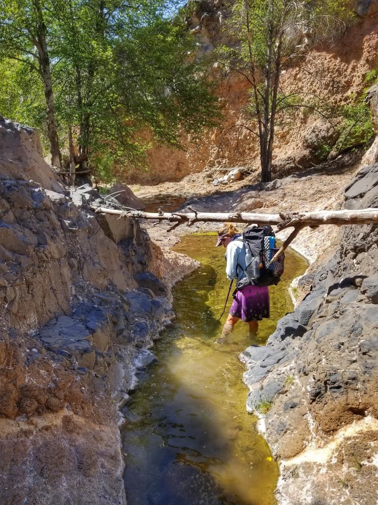
I thought this would be quick and easy, given how short this hike was. But actually, there was quite a bit to it. I’ll let my daily blogs do most of the talking, as I was pretty detailed in capturing the spirit of each moment. My main takeaways from this route were greater confidence in my abilities and appreciation for remote and ‘difficult’ hiking. Going for days or even weeks without seeing other hikers, let alone other people, really appealed to me. I felt like I saw a lot more wildlife and was more in the zone of just being in nature. Without an audience, I find a stoicism in my responses to the conditions and hardships of the trail. I’m getting better at taking things as they come…the mindfulness of acknowledging, accepting, and not wrongfully judging the circumstances. There weren’t many times when I let the difficulty of this route get to me. I knew what to expect and actually found great joy in some of the harder parts. Most days I was left with the sense that things should have actually felt harder than they did. I’m not trying to brag but rather convey the gratefulness I felt for traversing remote areas and seeing all the amazing wonders Arizona has to offer. We were also blessed with pretty mild weather…one morning of rain/hail and also a few very windy days but all in all, very placid.
To be sure, there were some challenges in terms of colder temperatures. Largely thanks to carrying a small digital thermometer, I know better now that I can deal with colder temperatures. Having this data really helped me mentally. I’m sure I’d experienced cold times before…I just couldn’t put numbers to them. The days were warm but the nights chilly…at least 6 in the 20’s…one almost in the single digits. I wasn’t always comfortable in my old and compressed 22 degree quilt but I didn’t exactly suffer either. I actually found the more cold it got, the more immune I seemingly became. Nights in the 30’s suddenly felt very nice. Of course, when you can warm up to temperatures of 70-80 degrees during the day, this goes a long ways in dealing with the 20’s at night.
I hope to do more of these obscure SW routes like the Hayduke, Hot Springs Trail, Desert Trail, Deseret Trail, and Great Basin Trail in the future. I’ve pretty thoroughly explored Arizona and New Mexico by this point but haven’t even scratched the surface in Utah or Nevada.
The most thanks goes to Blisterfree and Tree for developing and sharing this route. It was a joy and privilege to follow in their footsteps. Any complaints or criticisms that might have been gleaned from my posts should not be a reflection on their efforts, but rather on my own limitations or the constantly changing conditions of the trail. In just the short time span that I’ve been hiking, the desert SW has gone through monumental climate changes. Decades-long droughts, massive fires, and cataclysmic floods have and are going to continue to impact these routes. In only one year since I hiked the GET, fires had already washed over about 6 sections. One of my favorite stretches along South Diamond Creek in the Gila National Forest was on fire as wrote this…I saw it from the air as I was flying home from this hike…in May! It was heartbreaking. In fact, about half the National Forests in NM were closed in May 2022, due to fire threat, effectively blocking huge parts of the GET and CDT. Going forward, it will be important to bear in mind that these creators are not responsible for the conditions of these routes, only the concept of them. It will take a large collective of people, resources, and policies to keep these public lands open and preserved…something I fear may not be too feasible in the growing climate crisis. Get out there now while you still can….this is a driving philosophy in my own hiking and in life in general.
Total Distance: Just the MRT: 500 miles. With the addition to Silver City: 620 miles
Dates: April 9, 2022 to May 4th, 2022
Time: 23 days to complete the MRT, 29 days with the additional segment to Mogollon & Silver City
Average Daily Distance: 22 miles
Longest day: 33 miles
Shortest day: 5 miles into Silver City
Zeros: 1 Show Low, AZ
Days hiking 15 miles or less: 6
Days hiking 15-20 miles: 3
Days hiking 20-25 miles: 7
Days hiking 25-30 miles: 8
Days hiking more than 30 miles: 4
Nights tenting/cowboy camping on trail: 23/2
Nights camping with 1 or 2 others on trail: 22
Nights camping with a group of other hikers at a campground: 1…Gila Hot Springs
Nights next to a water source: 9
Nights in a hotel/motel: 3 (2 in Show Low, 1 night in Hannagan Meadow)
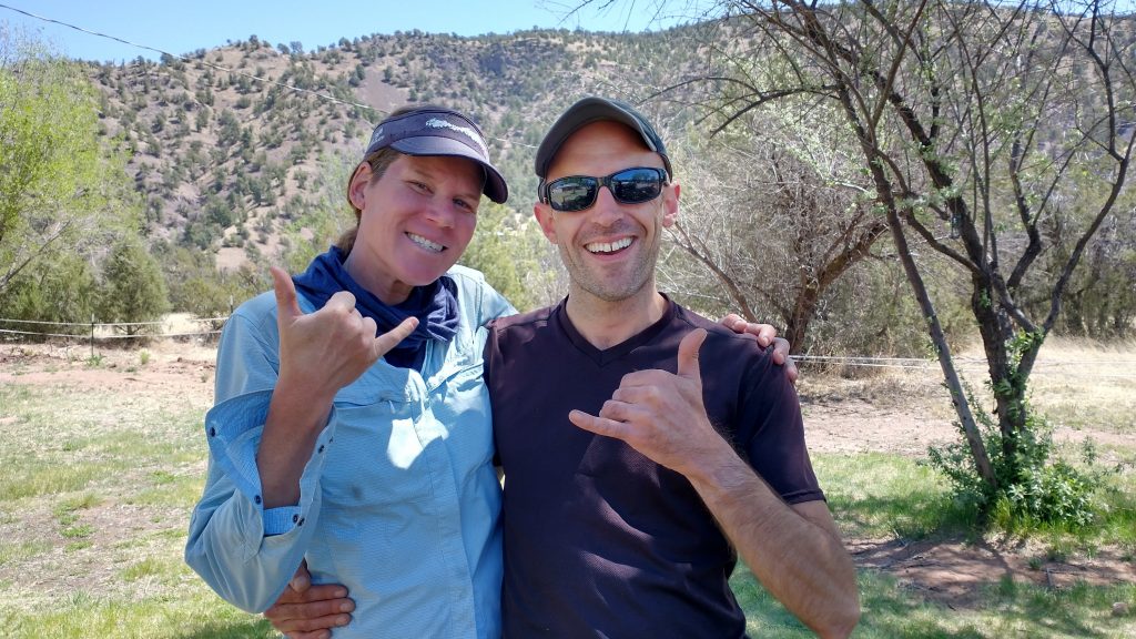
Hiker reunions: Flowers and Pinestick.
Towns/resupply points visited, in order: Sedona (in & out), Red Rock Visitor Center (water/bathroom/electronics), Pine (in & out, pick up box at brewery), Forest Lakes (in & out, pick up box at general store), Show Low (2 nights/zero), Greer (in & out, pick up box at general store), Hannagan Meadow (1 night in the lodge/pick up box), Alma (in & out/pick up box), Doc Campbells/Gila Hot Springs (1 night/small resupply purchased), Silver City (finish, 1 night at the RV park, 1 night in a motel, direct flight to Phoenix)
Resupply Boxes dropped off/mailed: 3/2 (Pine, Forest Lakes, Greer / Hannagan Meadow Lodge…UPS, Alma)
Longest food carry: 3.5 days from Sedona to Pine. Most of the time I carried 2-3 days worth of food.
Longest I went without a shower: 12 days…from the start to Show Low (but I took many dunkings in streams and ponds to help cool off and wash away the dust)
Precipitation on the trail: 1 morning on the 4th day as we left Sedona. It rained and hailed for about 1 hour. There were hardly even clouds the rest of the time.
Campfires made: 0!!!…In case you haven’t already caught my drift on this, I think it’s absurd to mess with campfires in the southwest, given the decades-long droughts these regions are experiencing. There were red-flag warnings for days on end, then later wildfires and closures very close to our route…just say no to campfires! Enjoy the stars! I’m too tired for anything else when thru-hiking anyway!
Injuries: my lower back plagued me a lot on this trip…I was very bad about stretching so it’s my own fault.
Animals sighted/signs/noises: bear tracks, the howl of a Mexican Gray Wolf, coyotes, 1 javalina, mule deer, whitetail deer, elk, desert bighorn sheep, vermilion flycatcher, turkeys, grouse, bald eagles, hawks, owls, toads, frogs, lizards, 1 black tailed rattle snake and 2 unidentified rattlers, bull snakes, garter snakes, 1 or 2 mosquitoes, cows, wild horses
Times I Wished I Carried a Gun (or big knife or bear spray): 0, even when some rednecks in a truck tried to run me over in the dark at my campsite Day 18. I’m not sure how any weapon would have helped this situation. I just should’ve remembered to turn off my headlamp and they never would have seen me.
Hitches: 2 quick rides in & out of Show Low for only 2-3 miles each. Otherwise we walked right through most towns or walked a side route. The few times I would’ve liked to skip a road walk, there was generally zero traffic to get a ride from, so we just walked. I can truly say I connected ALL my footsteps on this thru-hike, though we took a few short-cuts, as well. I accounted for any short cuts in my daily mileage counts and still came up with 500 miles for the whole MRT route.
Gear: My gear was a mix of mostly old but with a few major new pieces. These were my Zpacks Plexamid tent and Hyperlite Mountain Gear 2400 Windrider pack. I’d used the tent on a dozen overnight hikes and the pack was basically the same as my first HMG Southwest. I found it used for $220 on Ebay with the old-style pockets (the small ones), but it was basically brand new. I had one brand new trekking pole and one older adjustable one. Otherwise, I carried basically the same kit that I used on my CDT and GET hikes.
Shoes: 1 pair of Altra Superior 4
Least used items: my umbrella (after it slightly broke, plus it was windy a lot) and my PLB (Personal Locator Beacon)…carried the whole way, never used…but that’s a good thing.
Gear lost/failures: I left my tent stakes at my first campsite. I put a call out on the FB page and wouldn’t you know it, another hiker picked them up and mailed them back to me! So glad to get them back before my next hike. In the meantime, I found some good quality MSR shepherd hooks at an outfitter in Sedona. I liked these but they were heavy and bulky…they will do well in the sand for when I go kayak camping.
Arriving Greer, I discovered that two of my umbrella stays had separated right at the top joints. I taped them, which seemed to do the trick in holding things together, but I didn’t have a need to use the umbrella much after this. SMD agreed that it seems to be a defect and are sending a new one.
The gear I was most happy with: I really enjoyed the protection and little bit of extra warmth provided by my tent. I was still getting used to pitching this tent…it’s a bit different and more fiddly than my old Solplex…but I also liked the little bit of extra room it affords by not having a second pole. It’s actually a huge amount of extra space for me. I was also very pleased with my quilt. Despite its age and no doubt compromised ability over the years (I’ve also had it on the CT, 1/2PCT, CDT, AZT, LT, & GET), it still lived up to its temperature rating. I also really loved having a few extra hand warmer packages…I used them for 4 nights. One package stays warm for over 8 hours, so I’d break one out just before bedtime and still have a warm bundle in the morning for my hands.
Trail Magic and Trail Angels: This route is so new, remote and unknown that there aren’t too many dedicated trail angels along the way. Some might be encountered in Pine AZ, where the MRT intersects the AZT briefly. Otherwise the only kind of trail magic is of the very spontaneous nature…rides, shared beverages from motorists, etc. I tried to list all my experiences below, sorry if I overlooked anyone/anything, it was not intentional. Many thanks to all the individuals and businesses listed:
- Brett Tucker (Blisterfree) and Melissa Spencer (Treehugger)…many months/years of effort in groundtruthing (hiking the route themselves) and creating maps and information that made this route complete
- Buck30, Carrot & Muffy, Longdistancehiker.com, and Sagebrush, whose blogs greatly helped in planning. I’d guess that only around 20 people have hiked this route but there’s quite a bit of good information on the internet. Most hiked spring of 2019 and the route has changed quite a bit in the last section -Blue Range, since that time. Sagebrush hiked spring 2021, so I found his journal and timeline most congruous with my experience. Incidentally, it seems that I passed him just north of Goat Rocks while we were both hiking the PCT in 2018, but I didn’t make his acquaintance at the time.
- Coyote and Nasty Noodle are 2 that we learned of while all of us were hiking the GET spring 2021. Both hiked the MRT fall 2020 and provided some great info in the way of videos and also offers of support to hikers passing through Sedona. I regret that our timing didn’t line up with their schedules, so we still have yet to meet them in person.
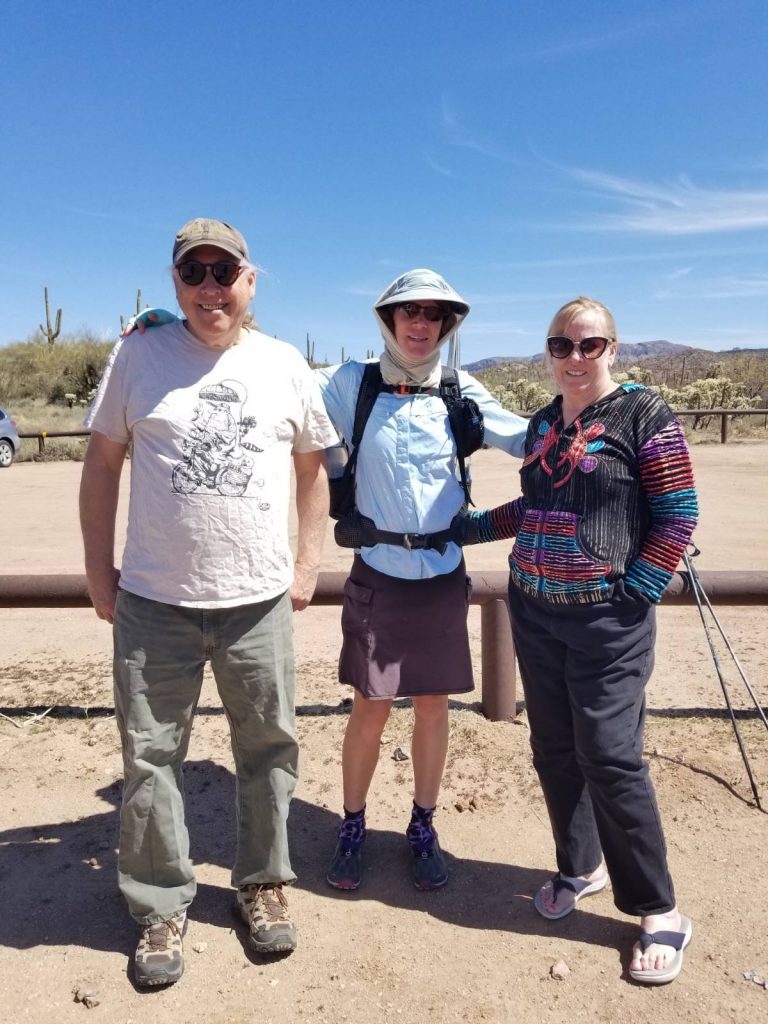
- Jon and Laurel, my # 1 trail angels, who shared their beautiful home outside of Phoenix…essentially our homebase in AZ going on for 4 years. They also drove us to the trailhead outside of Cottonwood…this was a HUGE part of our logistics.
- Dogwalkers that gave us a gallon of water outside Sedona on Day 2
- That Brewery in Pine and the Rim Resort near Forest Lakes, which both graciously held resupply boxes for us
- Local Trail Angel that stocked seltzers in the trailhead bear box outside of Pine.
- 2 nice drivers that gave us short rides in and out of Show Low
- 925, who shared his hotel room with us in Show Low (he drives trucks for work, so he’d acquired a lot of hotel points to use). This was a very appreciated treat!
- The Lazy Trout General Store, which held our resupply boxes near Greer.
- The Hannagan Meadow Lodge, for providing nice accommodations and holding our boxes.
- The Alma Grill and general store for holding our boxes
- Flowers, my friend from the PCT, who we ran into unexpectedly at Doc Campbells. He provided our celebratory beers for finishing the MRT. It was awesome to share his company once again, especially in such an awesome place as the Gila hot Springs.
- Tie, a long-distance hiker staying in Silver City, who graciously gave us a ride to the airport
- Shan Holyoak, another MRT hiker, that graciously recovered and returned my favorite tent stakes. THANK YOU!
On a very bittersweet final note, I dedicate this hike to Laurel. Heartbreakingly, she passed away only weeks after our visit. She’d been bravely facing an aggressive form of cancer for about 6 months, but none of us knew she’d become so sick and that our time with her was so fleeting. Her doctors didn’t even have a clue. In hindsight, I somewhat regret our intrusion into their lives during such a difficult period but I’m also grateful for getting to spend time with her in the end. Laurel loved Arizona and exploring its natural wonders as much as I do. She rode horses on many of the same trails throughout her life. She lived and breathed the desert, taking in the cacophony of birds on her porch every morning. The cries of the Gambel’s quail, curved billed thrasher, cardinals, cactus wren…she knew them all. I can still hear her trying to teach me the name ‘Phainopeplas’, a type of bird that spreads mistletoe to the Palo Verde trees. I always had to ask her to repeat it because I could never remember. I’ll never forget it now. She was a kind, caring, and beautiful person. I will miss her so very much.