Wednesday Apr 27th, 2022, 0600-1700
CR 25 to Hannagan Meadow, EABO mm 415.6, End Segment 6 mm 70
21.5 miles.
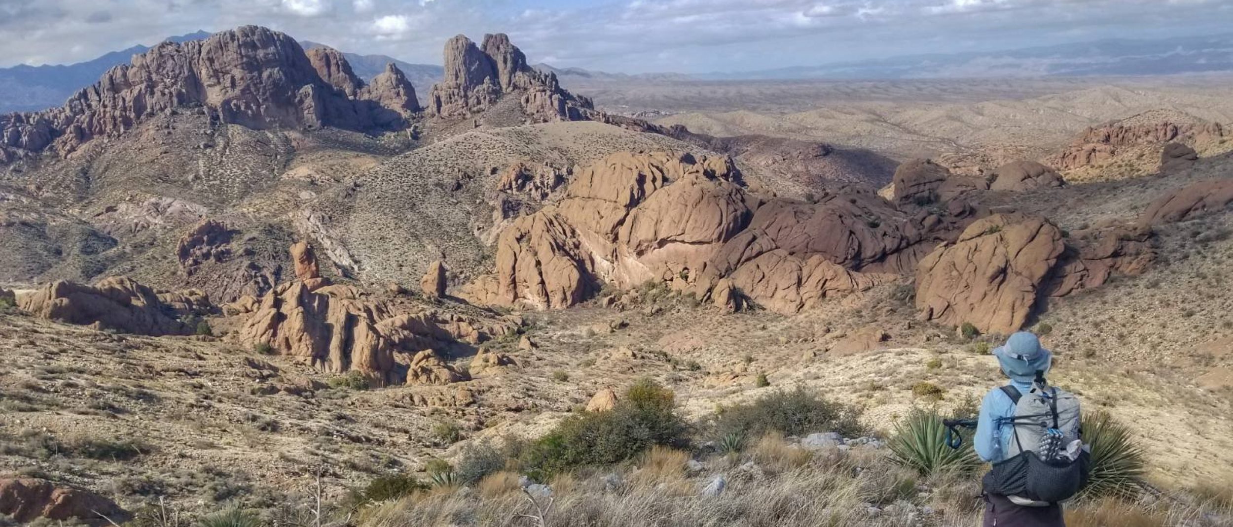
I managed to get some sleep after the nighttime raid but was glad to wake early and get away from the road. I paused to inspect how far the tire tracks came into the forest…pretty far actually. They stopped about 50 yards from my tent, which was still a decent buffer. I noticed a crushed log that they’d driven over in their wrecklessness. Good, maybe it did some damage to their vehicle. We resumed our remote hiking, going cross-country down a steep hill and then up a ridge that had mostly been burned. We followed a series of old logging roads, most that were impassable to vehicles (or so I would think but you never truly know). We had to climb over a ton of downed trees and wade through a gauntlet of thorny plants. I managed to slide by most of them unscathed.
The route entered Bear Wallow Wilderness and descended Gobbler Point Trail several miles to Bear Wallow Creek. The route proceeded up this creek for about 6 miles on another old trail. Both were very overgrown and showing little sign of being traveled by humans recently. Contrary to their names, I did not see any gobblers or bears (I want my money back!). I did enjoy seeing large conifer trees along the creek that had been spared from the massive Wallow fire. It reminded me somewhat of South Diamond Creek NM, on the Grand Enchantment Trail, which I’d loved so much the year prior. Though the roughness of this trail wore me down a bit. I was growing tired of the myriad of twigs and thorns constantly reaching out to grab at my clothes and limbs. I started walking faster, under the theory that they wouldn’t grab as much if I could just go past without their notice. Kind of like how going faster on a washboarded gravel road achieves a certain resonance that makes the bumps less bad.
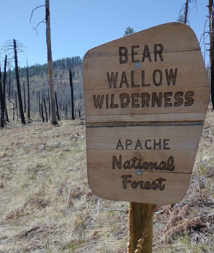
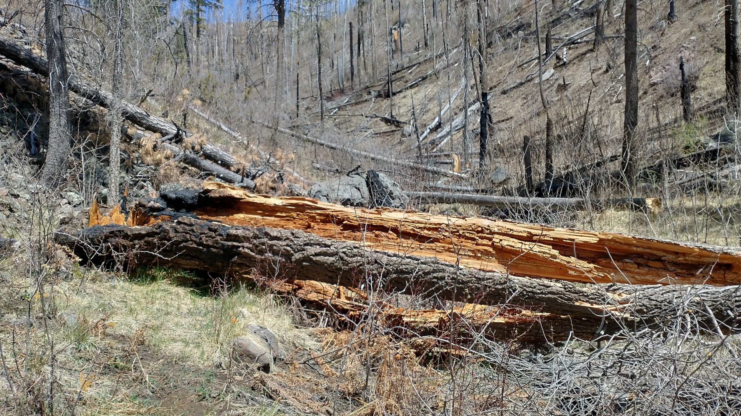
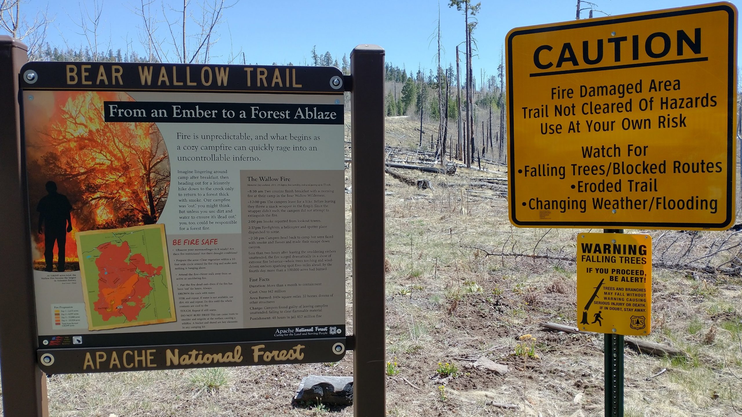
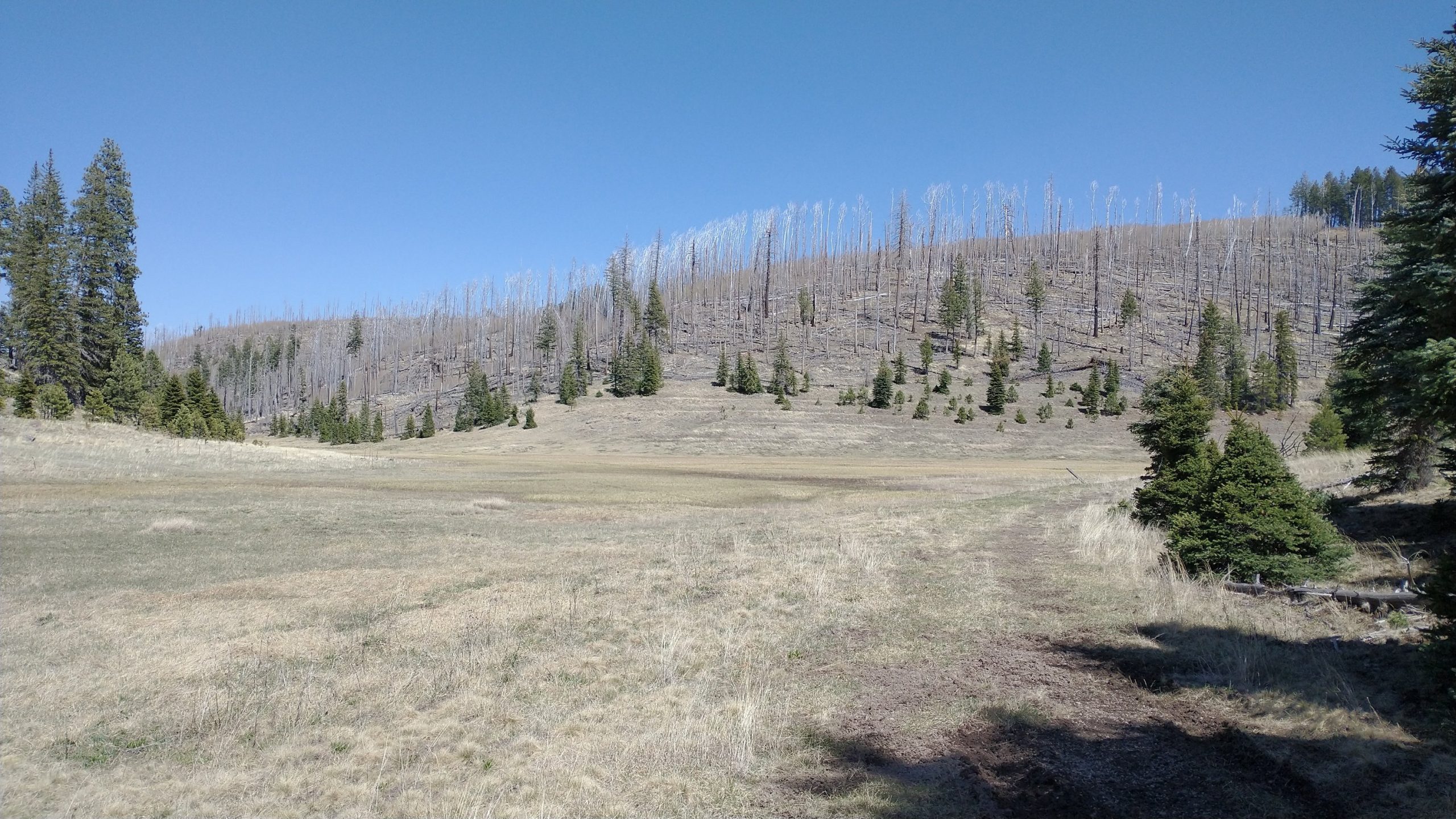
Speed bumps, in the form of giant downed trees, just couldn’t be avoided, slowing my pace to a crawl at times. Oddly, a few had been cut, giving me high hopes of recent trail maintenance. But it was not so. Maybe 2 out of a couple hundred had been sawed. It seemed strange that someone had even bothered with those. We took a long lunch break, then climbed out of the valley on a side trail. The landscape turned back into a charred nature for the rest of the day. A sign at the trailhead described how the Wallow fire had been started by 2 campers leaving a fire unattended while they went on a day hike. The fire grew to over 100,000 acres in just 4 days, lasting over a month and eventually burning 840 square miles, 32 homes and many more structures. It cost $42 million in damages and the campers were charged 3.7 million in fines (which I’m guessing they never actually paid). I will probably never have a campfire in the west again. I prefer just cuddling in my quilt and watching the stars. Campfires are just too much work for a thru hiker, anyway.
We enjoyed the respite of a brief road walk then it was back to more cross country work for the rest of the day. We walked for miles down an open drainage (Double Cienega) that started off as a wide meadow, gradually narrowing and forcing relentless hops across a small creek. Most of the area was entirely devoid of unburned trees and there were the usual downed ones to negotiate. But I found this area a lot less claustrophobic due to more grass and less thorny underbrush, and therefore enjoyable and unique.
Here’s a quote from Carrot Quinn’s MRT blog that I really liked (and could really relate to this day): “It’s not always straightforward, moving across the surface of the earth. Sometimes there are a lot of objects in the way. The incredible thing is that we’re able to move forward at all. The amazing all terrain capabilities of legs- it’s really quite something.”
The last challenge was moving up Fish Creek all the way to Hannagan Meadows. This drainage was more cluttered but still not too bad. And I finally saw some fish in the creek…living up to its name! We clawed our way up one final steep hill clogged with downed trees and were at last at a side road leading to HWY 191, the Coronado Hwy. We’d earned our keep at a resort lodge after all the rough travel and cold temps over the past few days. What a sight for sore eyes it was to come to this oasis of forest and log cabins, particularly after such a long and arduous day. The Hannagan Meadow Resort had been spared from the 2011 fire, thanks to the hard efforts of many firefighters. It was all documented in a picture album in the lounge. The flames had appeared like a 50 foot wall all around. Having walked for miles through the burn (all the way since Greer), I can attest to what an island this place was. How scary it must have been to be there at the time.
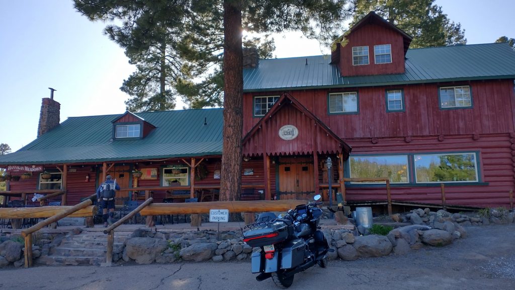
We were checked in by seemingly the one and only employee at the lodge. We chatted briefly with a nice couple from Minnesota who were touring on a Harley. They were the only other guests in the lodge. I headed up to the room for a long hot shower and didn’t leave the room all night, not even for dinner. I was too exhausted and had too much leftover food, so I just snacked in bed. What a day but with a very nice reward at the end. The lodge sits at around 9,200′ and is the highest in all of Arizona (reportedly).