Monday Apr 25th, 2022, 0715-1800
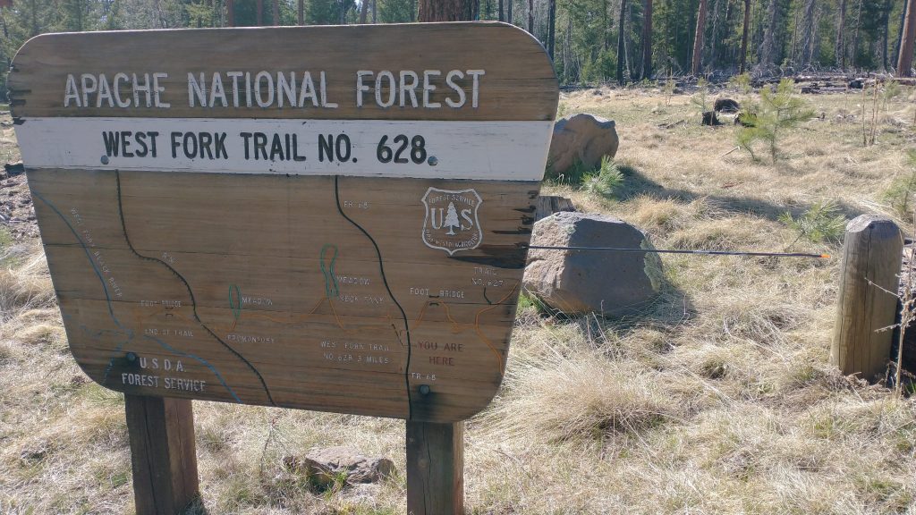
Coldest place in AZ to Fork Tank Drainage, EABO mm 373.3, Segment 6 mm 27.7
26 miles.
It was a rough night…not my worst ever but definitely my coldest. I didn’t understand it. The temperature was not too bad as I was setting up camp but by the time I’d finished dinner, the steam on my pot lid had frozen. Uh oh. Somehow the cold had crept in and it was insidious. It would invade nearly every space overnight, including my sleeping bag. I cracked a hand warmer but it seemed to take forever to get sufficiently warm. On top of this, the air felt very damp. The moisture settled on everything, combined with my breaths. I kept waking to find ice crusted all around my quilt collar. I tossed and turned all night, wondering how I was such a wimp to be suffering from the cold so much worse than previous nights. The forecasted low for Greer, 2 miles away, was only supposed to be 27 degrees. I’d handled much colder.
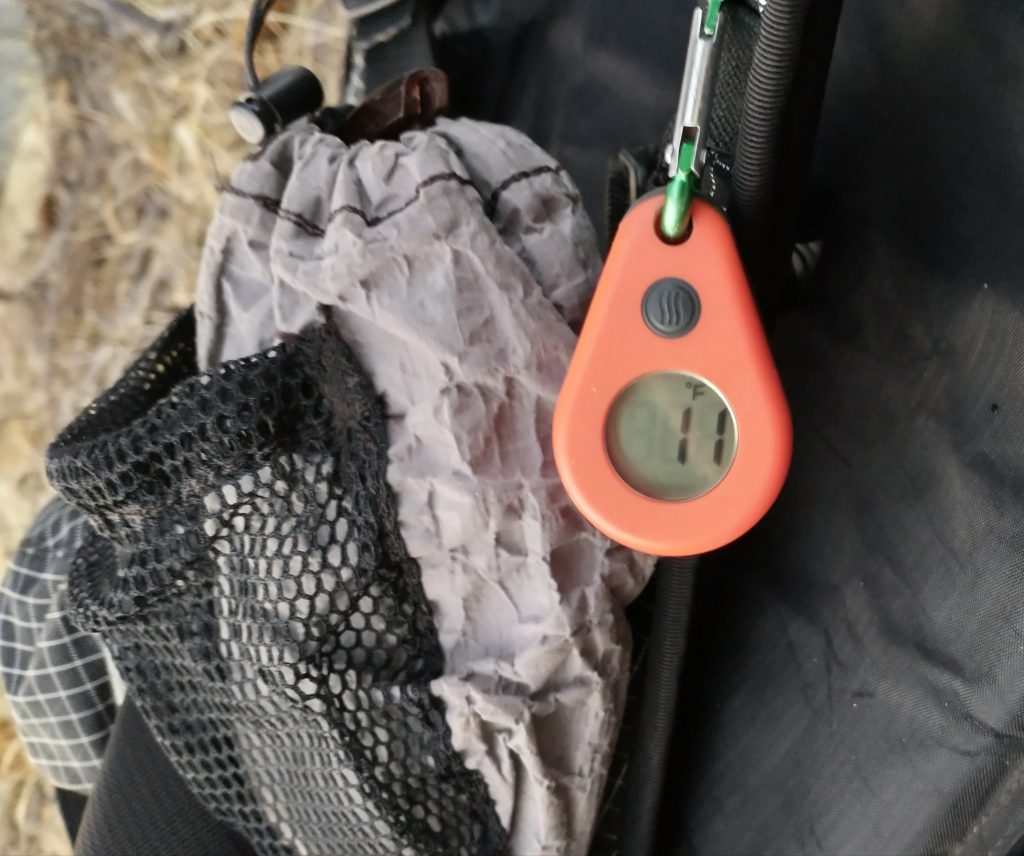
I was shocked to read 15 degrees from my thermometer at 5 am. I set it outside and it dropped to 11! WTF? How could there be such a difference from the predicted low? Had we picked the worst cold sink in the area? We were on a ridge above the canyon where Greer sits, about 700′ higher. It didn’t make sense. I really wanted to know what the current temperature in town was but I didn’t have service. Had I known it would be so cold, I would have stayed in a cabin in town. Oh well, I survived at least.
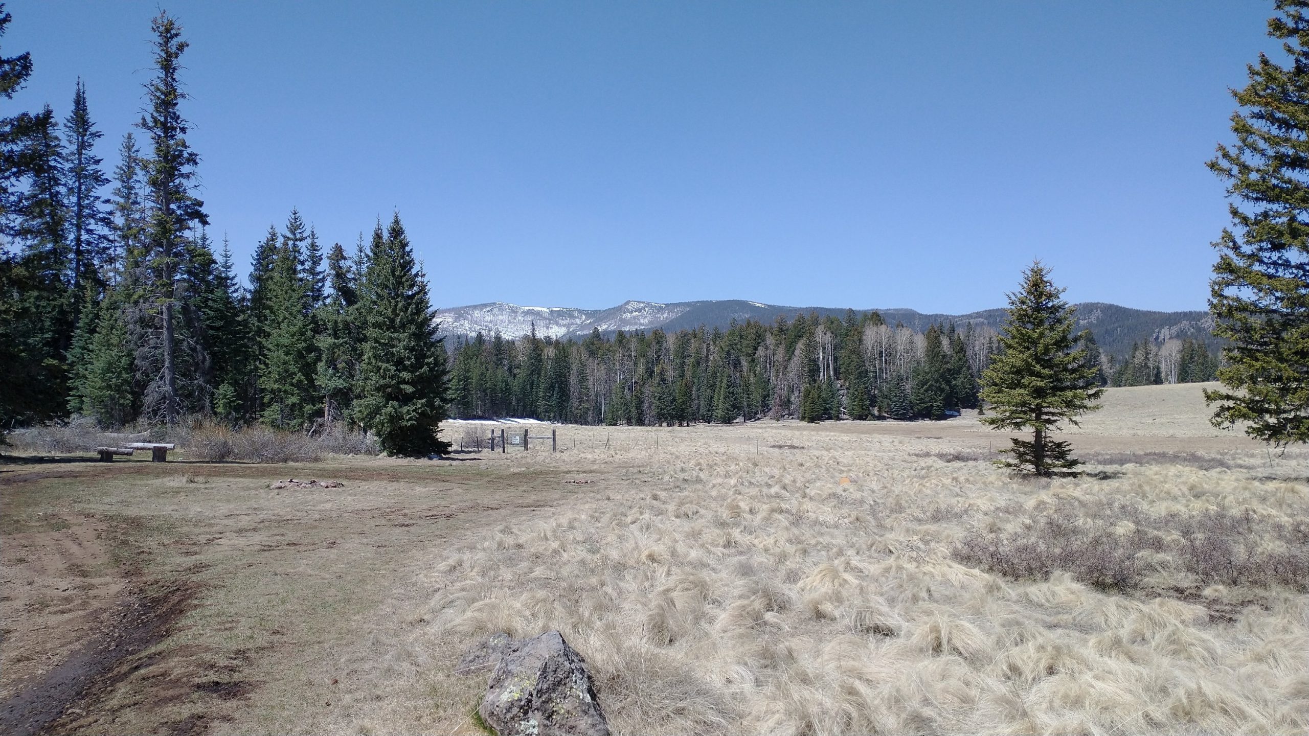
Looking ahead and in consideration of the cold, we delayed our start. If we walked our usual mileage, we’d end up at the beginning of many crossings of the Black River for the following morning. Breaking ice to cross a river 30 times didn’t sound like fun. Better to save that stretch for mid day. So we lounged in bed, eagerly awaiting the sun to strike our tents. I really love getting an early start but I can honestly say, I relished the delay this day. When the sun finally hit my tent, it washed away all the worry and dread about the cold. The temperature had already risen to 35 by the time we started walking. I still had to scrape the frost from my tent walls, much like one would do to scrape their windshield. But just like that, it was dry and all was fine.
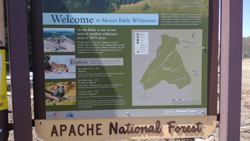
A herd or elk crossed our path within half an hour of setting out…a good omen. Later I saw a coyote trotting along in a meadow. We came to a trailhead within a few miles that had a long-drop…again, perfect timing. Here we rejoined the Apache Railroad trail…the one we’d followed the day before. We were supposed to break from it after only a few tenths of a mile but we liked it so much, we decided to follow it for the rest of its course. The main MRT route went up along the banks of the Little Colorado on the West Baldy Trail, with the option of ascending close to the summit of Baldy Peak, at 11,358′, or taking the ‘crossover’ trail to the East Baldy Trail. We’d really wanted to climb Baldy, but once we got within sight of it a few days before, we realized that there was still too much snow. Since we didn’t have any snow gear like ice axes or microspikes, we figured we shouldn’t tackle such a feat so early in the year. We were already encountering remnant patches of snow at our elevation…several thousand feet lower.
The Crossover trail sounded like it was mostly in the trees and might have snow too, so we opted for alternate 3, in a choose-your-own adventure style. The railway ended up being 1 mile longer but was very scenic, with more wide open prairie travel. I got to see a tom turkey strutting his stuff for the ladies next to the Little Colorado…and also next to the trailhead parking lot just off the highway. Not a smart move for Mr. Turkey, since there were so many hunters out looking for him. Perhaps this was his plan: be in an easy-to-get-to spot when the hunters were going to the most remote spots. We connected to the East Baldy trail easily, passing by some van campers. They lamented about how cold it had been overnight… yeah, inside their van. I felt little sympathy for them.
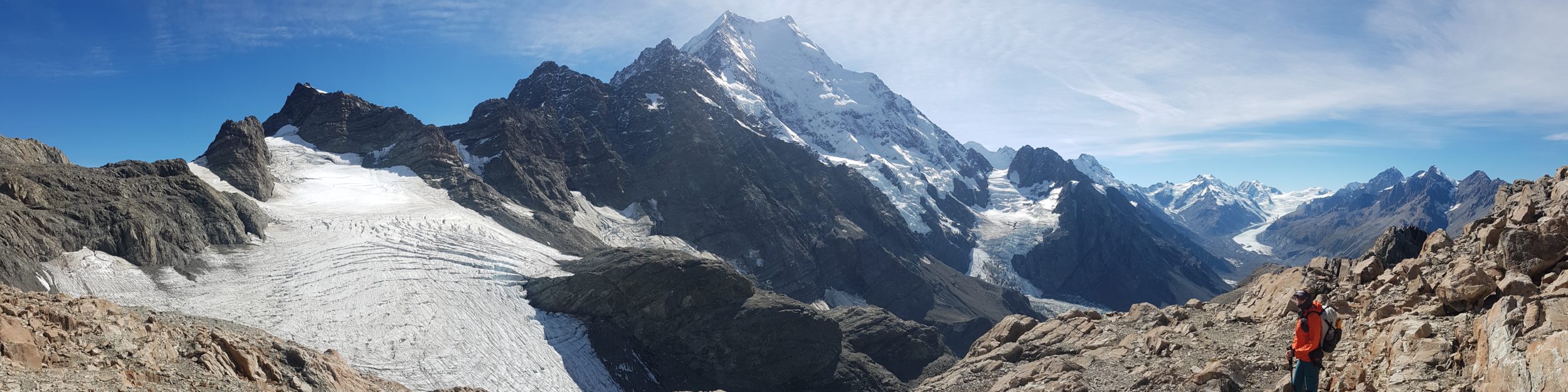
More fun cross country meadow travel ensued…I was loving it. Then some climbing up steep jeep trails. We topped out at around 9850′ in elevation near Burro Mountain, our highest point on the whole trail. It wasn’t as great a view as would have been had on top Baldy, I’m sure, but it was pretty good. It got my peakfinder loaded to score finds of Mogollon Baldy and Mt. Graham…our good buddies from the GET. The latter was 87 miles away…I could just make it out through the haze. Smoke from (I’m guessing) the Flagstaff fire seemed to have blown back south and was filling the valley. The winds were to shift out of the south again this week, so we hoped the sky would clear.
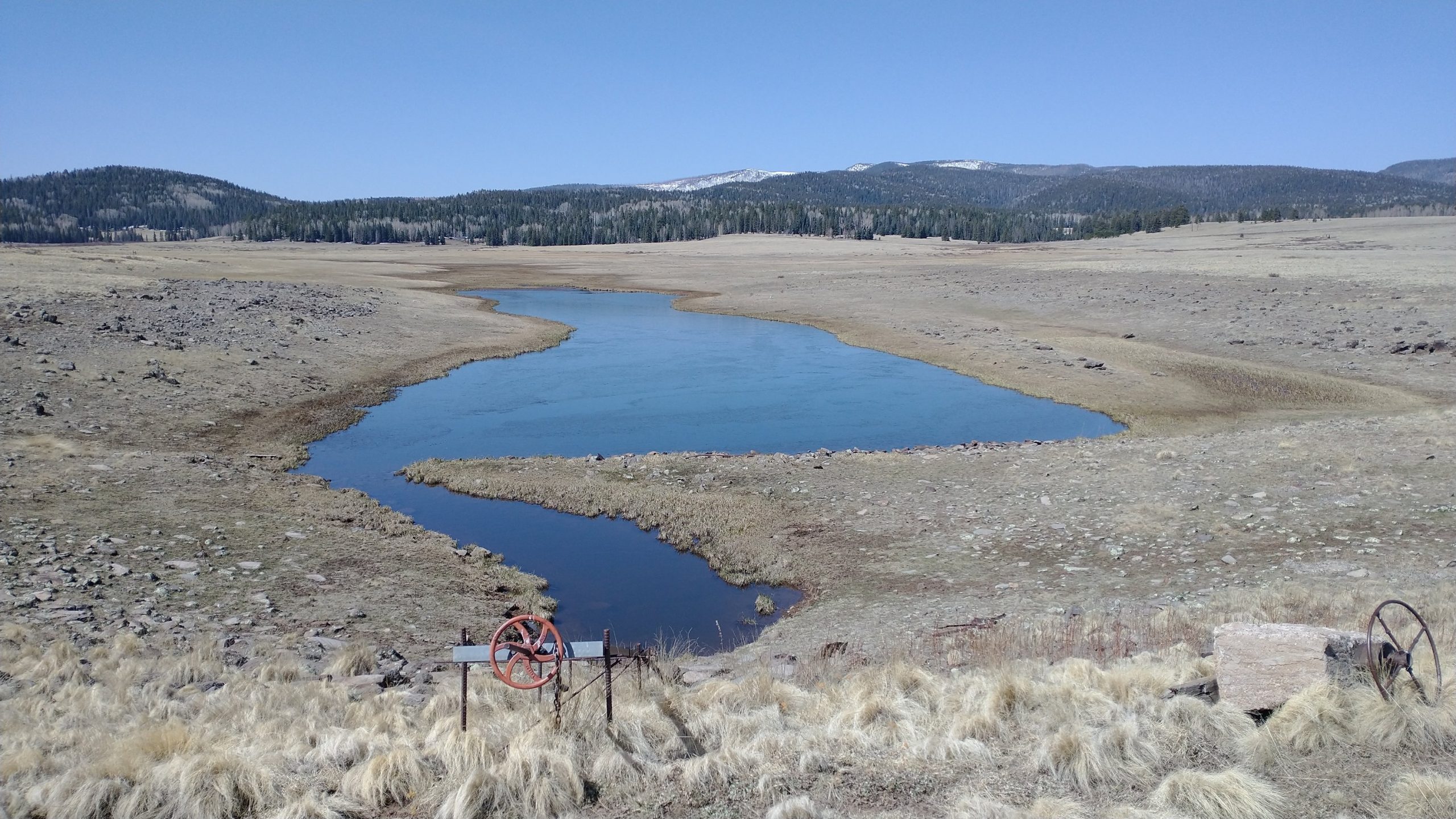
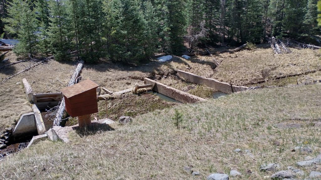
We stopped for lunch at a sparkling creek, sitting in the grass and enjoying the sun. I brought my quilt out to dry. It puffed up luxuriously. I dreamed of a warm campsite, much lower in elevation. We stopped just ahead of a fish barrier, a dam with overflow, constructed to protect the Apache Trout, the state’s official native fish. The dams are meant to block non-native trout that might hybridize with or prey on this fish. It was one of many we’d pass in the area.
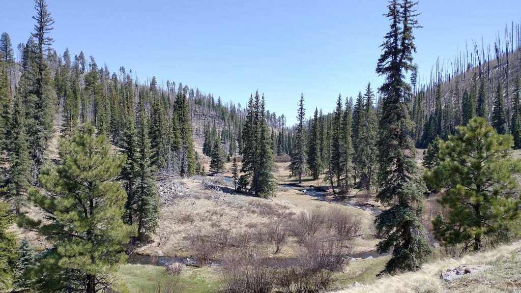
Further down the valley, we came to a trail along the Black River. This was a short section in the upper reaches of the West Fork, with only one small crossing required. This had to be one of the most pleasant riverside trails I’ve ever walked…and I’ve walked along a lot of rivers and creeks. The big trees were stunning, spared from the ravages of the 2011 Wallow fire. The canyon was shallow and wide, making for good and easy tread. There were a few boggy areas but overall it was a walk in the park along a placid stream. If I were to design a theme park of various walking trails, this would be the inspiration for my river trek. I was very sad when it ended after only a few miles, but we’d get more the next day.
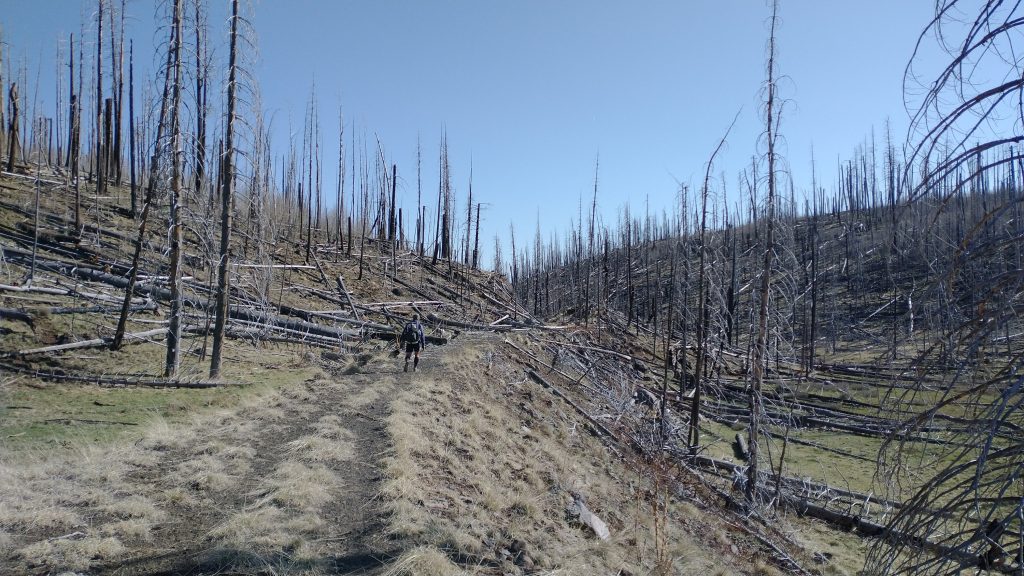
To leave the canyon, we walked through a bad burn area…one of many we’d travel through over the next 2 days. After over 10 years, very little had grown back. The aspens had been the first to settle the area but without their leaves out yet, everything still looked very dead. Once out of the valley, we decided to do yet another choose-your-own -adventure. We saw on our maps that we could take the southern semi circle of the Indian Springs loop trail, bypassing the Big Lake campground and shaving a few miles off the route. We had no reason to go to the lake or campground, so we opted for the shorter trail. This was another rail-trail and pretty easy passage. We entered another complete-devastation burn area but it was interesting in a way, being able to see so far.
As choose-your-own adventures sometimes go, I stopped to pee right as TS went a different way than expected. I turned a corner, thinking he was just ahead but out of sight. Miles later without seeing any footsteps, I realized that he’d taken another route. I figured we’d both end up on the main route again… eventually. The dusty trails and roads give away footprints in seconds, so he’d either see mine or I would see his. I went for miles down a jeep trail on the main route, wondering if I should stop to wait. But if he came back to the red line further down, I might miss him. It was time to camp soon, so I decided I’d stop at the next water source. Just as I was checking out the pond, TS came along behind. He was certain he’d taken a shortcut to our shortcut, but obviously not. There were lovely campsites under the ponderosas, near the spring. Best yet, it seemed like it would be much warmer. I was excited for a comfortable night.
Wow, what an awesome adventure you are having, most of the time❣️?
Beautiful photos, Twig. Your narrative shapes the minds eye, and brings us in with you.
Unreal the fire damage there ?
What a life you lead, gal❣️? Big hugs❣️?