Sun Sept 27th, 2020, 0600-1800
Taft Lodge to Gleason Brook, SOBO LT mile 89.4
23.5 miles, 6350 gain, 9300 loss (highest & lowest points on the trail, in the same day!)
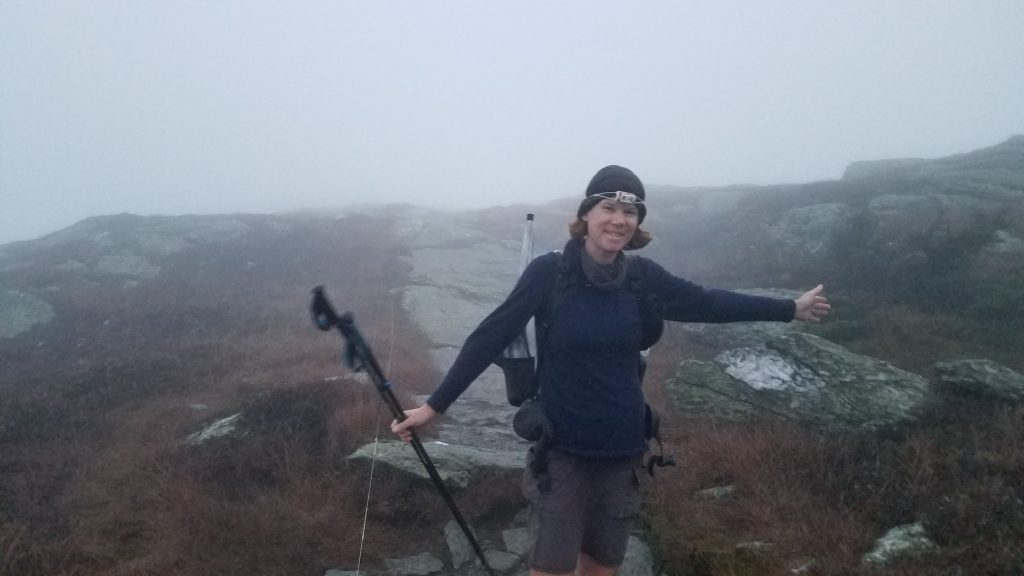
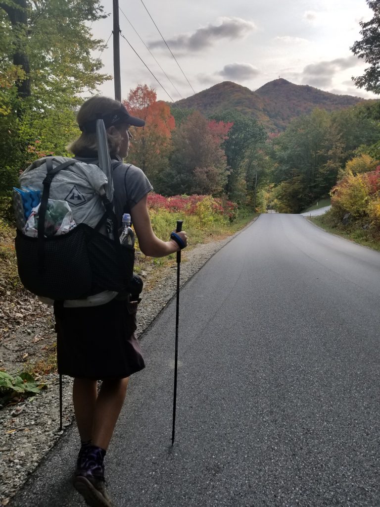
I sleep surprisingly well in the lodge, despite the comings and goings of my fellow occupants throughout the night. The ancient door latch gave everyone a fit, making a lot of unnecessary noise. We should have set an alarm for everyone to go pee at once. Several got up at 5 am, including myself, all hopeful to see a sunrise from the highest point in Vermont. I set off in the dark up the steep, rocky flanks of Mt. Mansfield. My headlamp beam was distorted by fog and I struggled to find my grip on the slippery rock ledges. I felt like a mountaineer, hauling myself and pack up the side of a Himalayan peak. Except that I was stripped down to my shirt and skirt, it’s was so unseasonably warm, even at 4,000′.
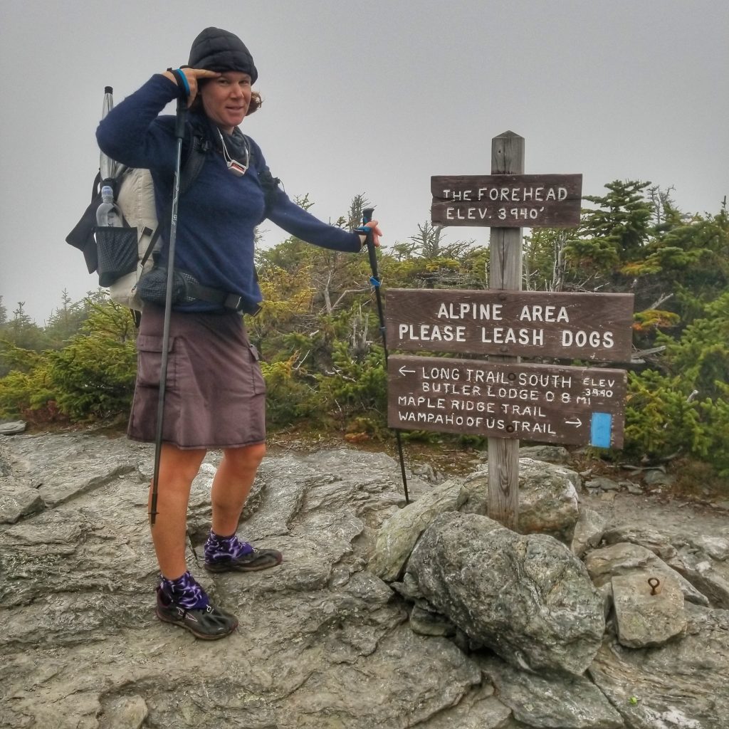
A gray dawn was just breaking when I reached the ‘chin’ highpoint at 4,324′. This feature was so named because the profile of the mountain was thought to resemble a face…apparently with a severe under-bite. I was surprised to find about 15 people huddled at the top, expectantly peering towards the east. The wind and mist made for an uncomfortable waiting room, so I was inclined to keep moving. The views from the top were spectacular…but not this day. I could tell this was the kind of fog that was going to stick around for awhile. I put on my alpaca fleece to cut the chill and continued on.
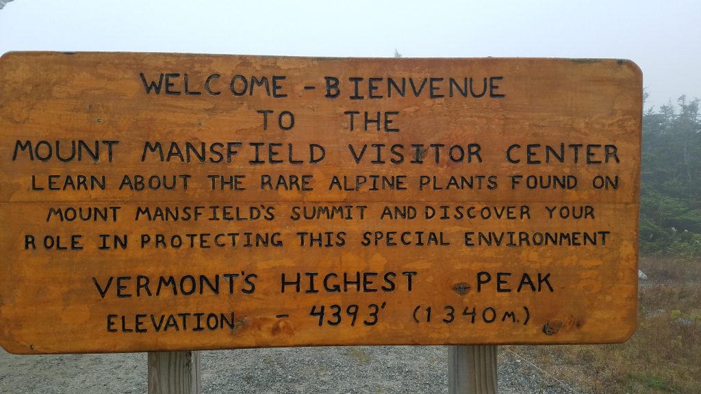
The trail traversed the ridge, mostly over rock and past stunted spruce and tundra. Numerous signs warn of disturbing the fragile sub-arctic alpine ecosystem. It was a really neat area, too bad the weather wasn’t more conducive to enjoying it. I passed the toll road and visitors center. No one was around…either I was too early or it was closed due to COVID.
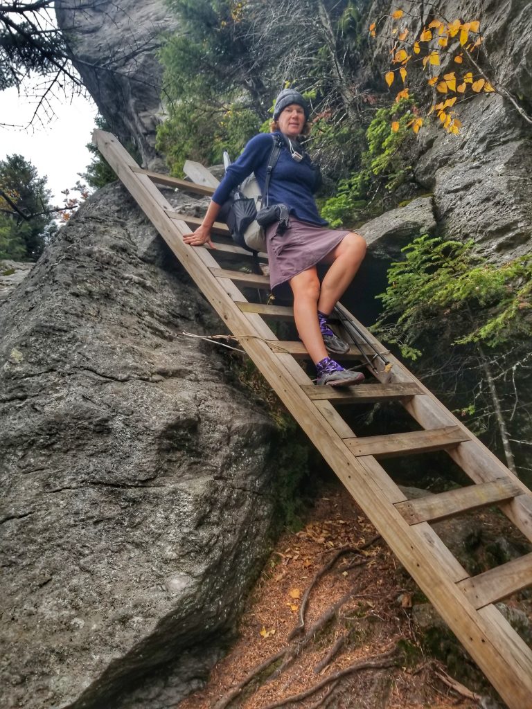
With my Mansfield tour nearly concluded, the mountain threw a series of ladders and boulder scrambles my way, for one last hurrah! This was one of the most technical sections of the LT, which would make it difficult to bring along a companion dog. Get ready to carry Fido if you go this route.
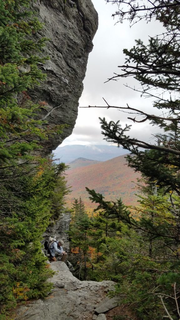
As we dropped in elevation, the fog cleared and we could see across the valleys below. The sun even peaked through at times. We traversed another ridge, which led us to more smaller peaks and ridges. Hours later, I looked back at Mansfield from Puffer Shelter. The forehead and nose were finally below the clouds but the chin was still encased. Good thing I didn’t wait for the fog to burn off.
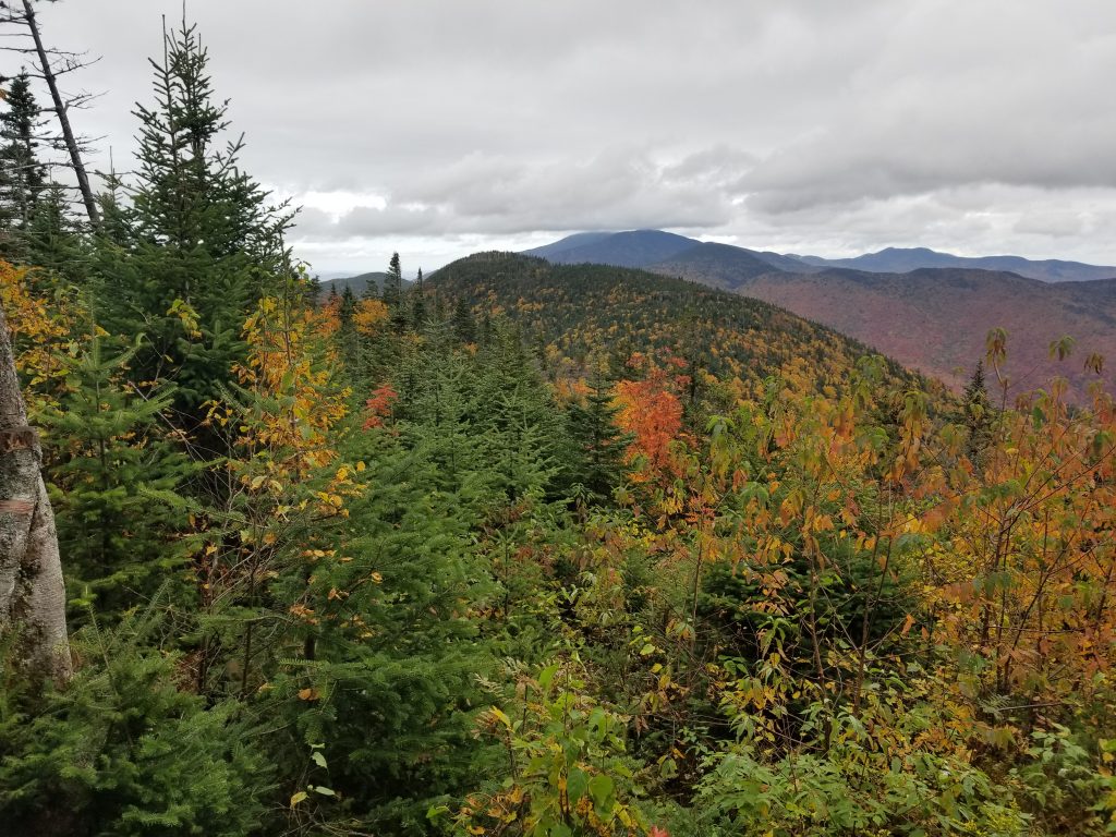
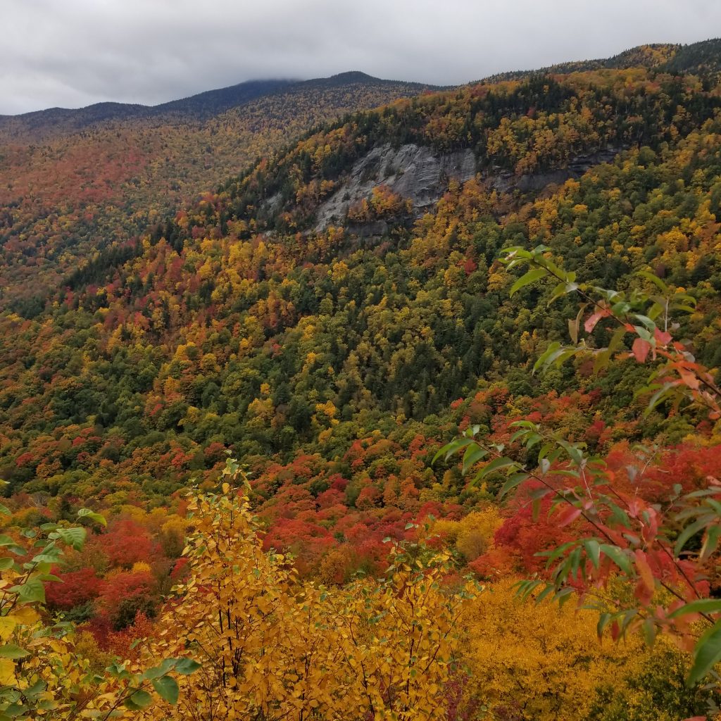
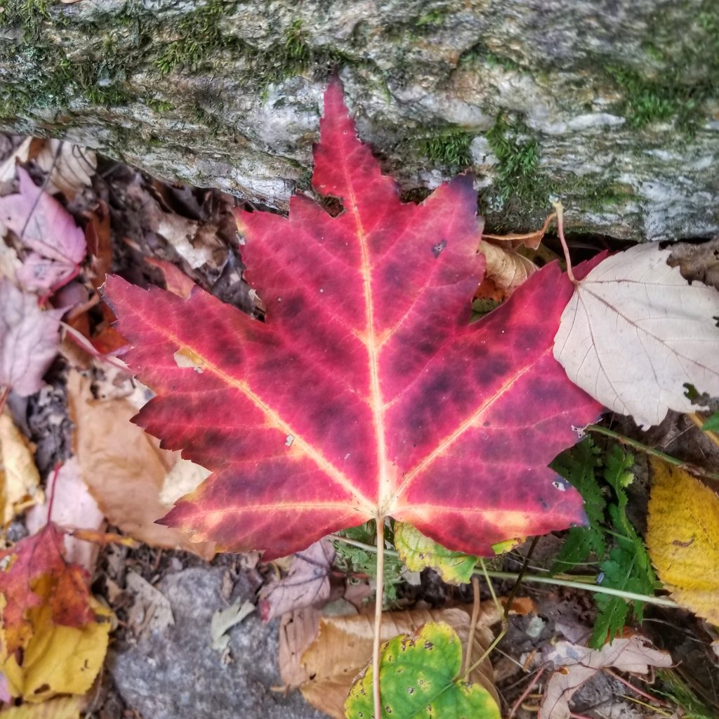
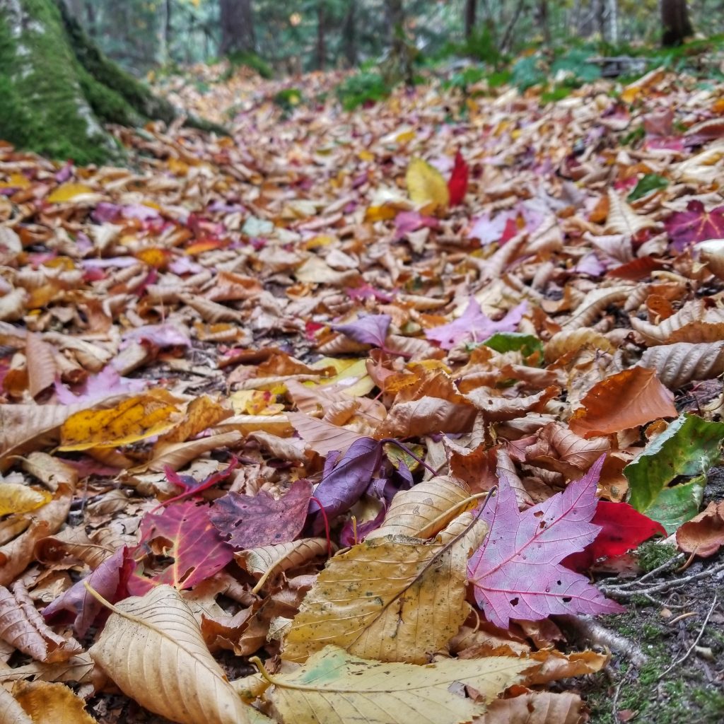
Though I didn’t have perfect conditions for Mt Mansfield summit, the fall colors more than made up for it. I made it over a second climb, Bolton Mountain, before noon and descended for the rest of the day. Unfortunately I neglected to pick up water miles beforehand, only to realize that there was no more for another 5 miles. It was hot and I was down to just a few sips. But I knew I’d be ok. The walking was pretty easy, incredibly pleasant, in fact. The trail was on a ridge covered in deciduous trees. I glide over a bed of soft leaves, surrounded by a rich mix of colors. I thought of various analogies: confetti, sugar sprinkles, cornflakes, fruity pebbles.
I finally came to the creek, which was down to just a dribble but it would do just fine. The water took awhile to collect and I guzzled it as it passed through my filter. It was 3 pm and I was nearing 20 miles. I’d come to a big gap (lowest point on the trail) and road walk. I’ve been looking forward to this easy finish all day, especially since much of the morning was so rugged.
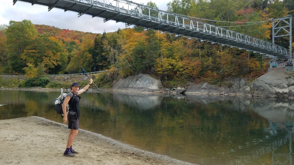
At the Winooski River pedestrian bridge, there was a perfect beach and swimming hole. The sun was out so it was time for a dunk! Once again, I marveled at the late season conditions and also how the day had started. From the highest to lowest points on the trail and chilly fog to blazing sun. The water was cold but pleasant. I went in fully dressed, since my hiking clothes need a rinse too. All the sweat washed away and man did I feel refreshed. It was 3 more miles to our planned campsite, just the right amount to let my clothes dry as I walked. It was almost like I planned it!
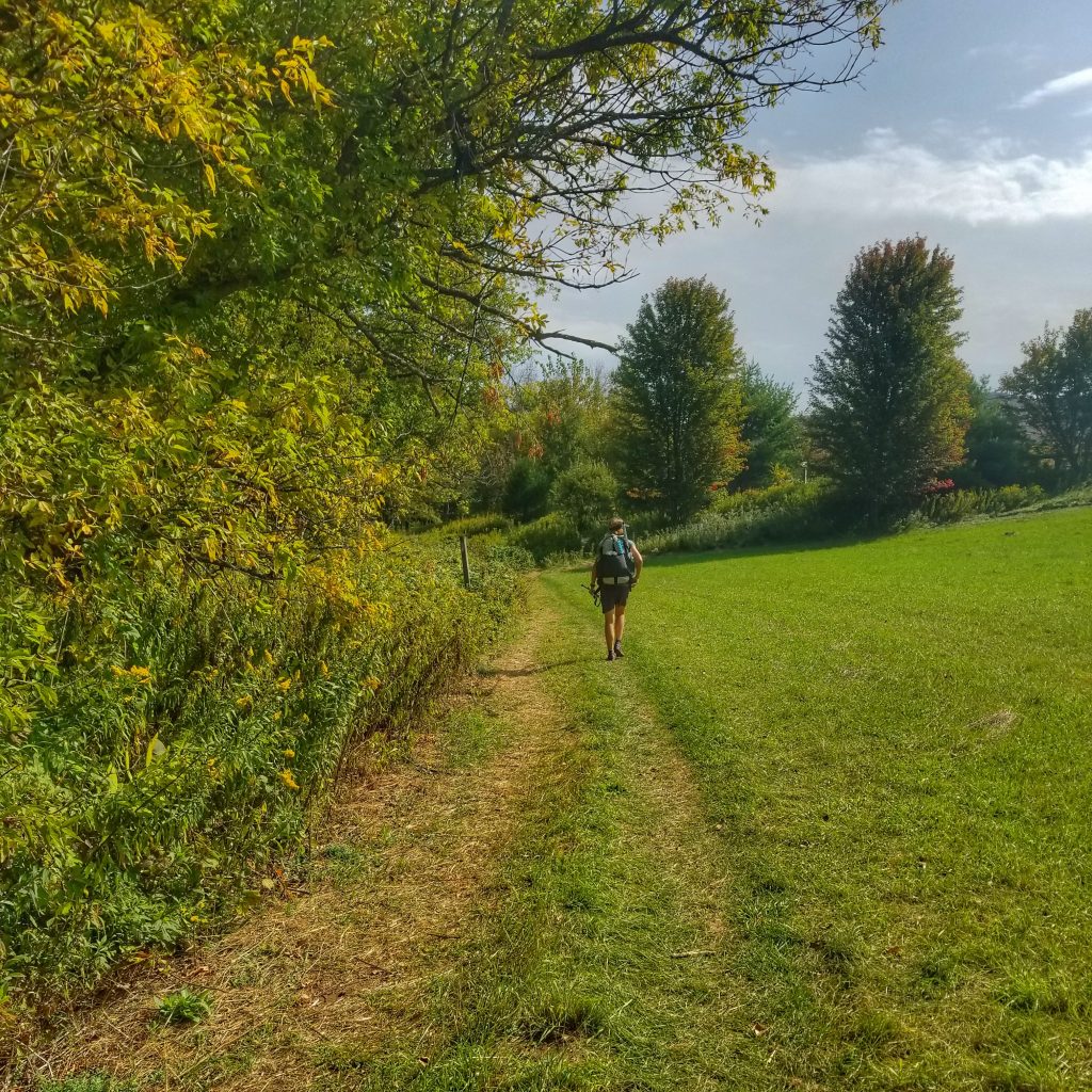
Unfortunately my feet started hurting after just a couple hundred feet on the pavement of Rt 2. Luckily the trail was re-routed through privately owned fields along the river. Notes said to skip this longer, less direct route and just walk the road. But I said, let’s do this, Te Araroa style! It had been awhile since all the farm walking in New Zealand. Passing through the fields and over the styles brought back so many good memories. I even passed some mobile chicken and turkey coops. Seeing the birds range about made me so happy. I was tempted to give chase but the pens were closely guarded by big white Pyrenees dogs. They watched me particularly close, as if they knew what a threat I am to domestic fowl…smart dogs!
We left the fields and river, heading up to a trailhead at Camels Hump State Park…the largest park in Vermont, the sign stated. After some brief but painful uphill, we came to a creek and the perfect tent sites. I settled in quickly for a much-deserved dinner and sleep. What a long and diverse day!