(Scroll to the bottom for a links listing of all my daily & weekly blogs)

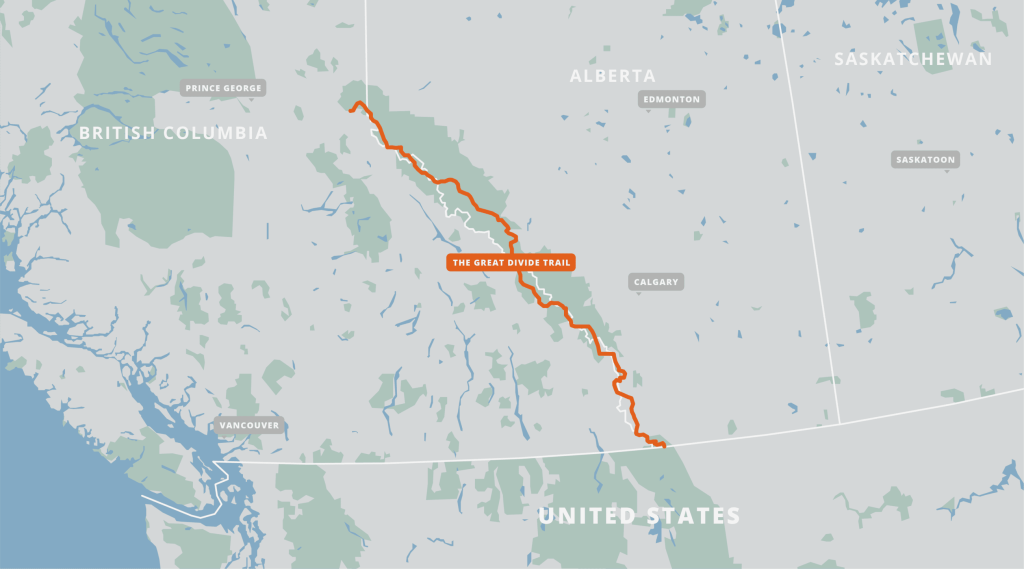
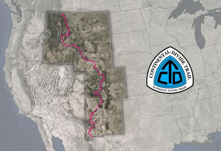
The Great Divide Trail, GDT, is a long distance hiking route that runs approximately 700 miles / 1100 kms through the Canadian Rockies, between Alberta and British Columbia (not to be confused with a bike route of a similar name). It’s also commonly thought of as the continuation of the Continental Divide Trail, or CDT, in the USA. In fact, the southern terminus lies at the US/Canada border, 4 miles south of Waterton where the CDT officially ends. The Northern Terminus is in Kakwa Lake Provincial Park, pretty much in the middle of nowhere. It’s anywhere from a 20 to 60 mile ATV road walk/hitch just get from the northern terminus to a highway that leads to Prince George and Jasper. More detailed information can be found at the Great Divide Trail Association GDTA website.

Some GDT highlights:
- High point: 2,590m or 8,500 ft at a pass in Section E
- Low point: 1,055m or 3,500 ft outside of Jasper
- Peak hiking season: July to September
- Duration: 30 to 60 days
- There are 7 sections outlined by the GDTA: A B C D E F and G
- 5 National Parks, 9 Provincial Parks, 4 Wilderness Areas, 4 Forest Districts
Here’s a list of some of the most popular and relevant pages I found for information about the GDT (and much thanks and praise to the authors who put in so much time and effort to share these details!):
Jupiter Hikes: How to Thru Hike the 1,200km Great Divide Trail
Permits on the Great Divide Trail – Part 1
Permits on the Great Divide Trail – Part 2
Great Divide Trail Hikers Facebook Group
Plus this page on the GDTA website lists almost every other blog and journal dating to the early 2000’s. I found Erin Saver (Wired’s) detailed blog to still be quite useful, though trail maintenance, reroutes and mapping apps (FarOut) have made leaps and bounds since she hiked the trail in 2015. Her descriptions of the alternates in particular are really good, for which it’s hard to find a lot of info.

What makes the GDT unique, different and/or challenging compared to other long distance hikes:
If I had to liken the GDT to any of my other 15+ thru-hikes, I’d say that it was most similar to the Pacific Northwest Trail, but obviously a lot like the CDT and certain aspects of Te Araroa (glacial/braided river crossings), as well. Here’s a bullet list of some of the most pertinent challenges of the GDT:
- Individual backcountry campsite permits are required for all the National Parks and many of the Provincial Parks. There is no one-permit-covers-it-all, like there is for the PCT. Online reservations begin opening in January and can be fully booked within just minutes of the opening time. More than 1/3 of the route requires these permits, which means it’s still a necessity to stick to an exact schedule for the other 2/3rds.
- A lot of the trail traverses very remote areas and is often not well-marked. There are some parts with no trail at all…like the PNT. Some advanced navigation skills and experience with cross country hiking may be required, aka bushwhacking. It could also take a long time to get rescued.
- There are many alternate routes to choose from (like the PNT / CDT), which can cause some anxiety in decision-making, as well as uncertainty regarding pace.
- Many stretches between towns / resupply points are over 120 miles or 200 km (most of my food carries are 6-7 days).
- Some resupply involves having a cache delivered for a hefty price…as opposed to 10-12 day food carries.
- The weather can be just like the CDT…cold, rainy, and snowy with lightning and hail in exposed areas. There can be hazardous snow travel across high passes.
- There is almost no cell service available on trail, or even in some towns.
- There are numerous creek and river crossings. Many rivers are glacially-fed and braided, experiencing level fluctuations throughout each day, depending on rain and melt water.
- The entire route is also shared by potentially defensive or territorial North American mega-fauna: Grizzly bears, black bears, cougars, wolves, moose, and other large ungulates and ROUS’s that may appear cute but have large deadly horns, hooves, and/or teeth (still, nothing is as dangerous as a cow or Escalante Beaver:).
- For most, this is an international hike, which brings about a whole suite of additional complications….
As of this update, I was only able to hike about half the GDT before wildfires closed down Sections D, E and F. I’m undecided whether I will go back to complete the trail, but was happy with what I did get to hike. For a more complete discussion and to see all my posts about the GDT, plus related hikes following it in 2024, see the links below:
Introducing the Great Divide Trail
GDT Days 0: Travel Woes
GDT Day 1: Tagging the Border
GDT Day 2: Into Waterton National Park
GDT Day 3: Lone Lake…the Ursine Tinder Meetup
GDT Day 4: Scarpe Pass
GDT Day 5: The Barnaby Ridge Alternate
GDT Day 6: Easier Cruising
GDT Days 7 & 8: Coleman
GDT Day 9: Section B
GDT Day 10: Into the Deep
GDT Day 11: Tornado and Beehive
GDT Day 12: A Bear on My Back
GDT Day 13: Fording River Pass
GDT Day 14: Valley of the Horses and Heat
GDT Day 15: Boulton Creek
GDT Day 16: Section C & Northover Ridge
GDT Day 17: Marvel
GDT Day 18: Heat
GDT Day 19: Sunshine
GDT Day 20: Floe Lake
GDT Day 21: The Rockwall
GDT Day 22: The End of the GDT, For Now
After the GDT: Back to the US, Past Glacier, Yellowstone, and onto the Teton Crest Trail
Jackson Hole & the Gros Ventre Wilderness
Wind River High Route, Part 1
Wind River High Route, Part 2
Sawtooth Mountains, Idaho
Uinta Highline Trail
