Monday, April 17th, 2023, 0645-1900
Halls creek end to beginning of Coyote Gulch
18 miles, elevation 3750′
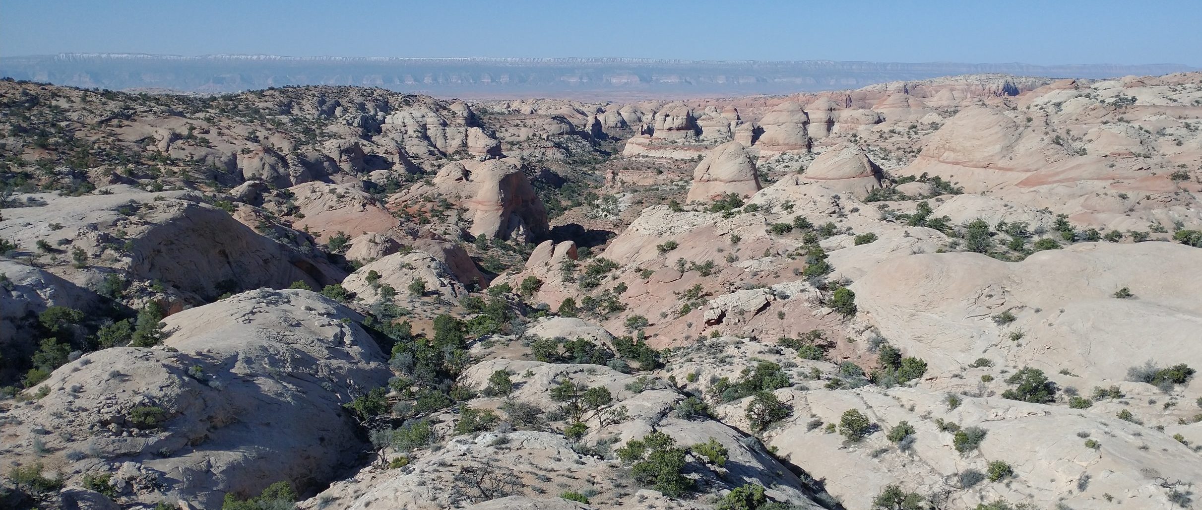
There was a 2000′ climb to start the day, glad we saved it for the morning while it was still cool. Instead of waking up to the 30s, temps were in the 50’s! We got a great start before sunrise and were flying up the Waterpocket Fold. From afar, the feature looked like a giant homogeneous slab of white sandstone. But there were many peaks and valleys, ripples and rumples. It was incredible to see how varied the formation was up close. As the name suggests, there were many pools of water but also tiny micro-cosms of habitat, including juniper and pinon pine. I spotted a harrier hawk and later a huge jackrabbit, that went bounding from a pocket of brush over a rise. I wished I could so easily travel the diverse topography.
Near the top, we got cell phone reception. We could see Lake Powell and the town of Bullfrog sparkling in the distant morning light. We stopped for awhile to play with our phones. I found it amusing that we could so easily be distracted from the sublime beauty we were surrounded by. But I’m a product of the modern world, not quite ready to give up on social connections. I was surprised to see some of the news from the trail. A few we met in Moab had to be helicopter-rescued from Dark Canyon but several others had made it through and were in Hanksville. Plus there were more woes ahead with snow and flooding in Bryce and the Grand Canyon.
We had our own challenges to focus on, namely getting down from the high mounds of sandstone we’d climbed. Getting up had not been too bad. The route basically went straight up the sandstone faces, defying gravity with a complex coefficient of friction dependent on what’s left of the tread of one’s trail runners. It was difficult to calculate when exactly the angle of the rock became too steep…sliding was the dead giveaway. But all of the slabs were at a reasonable angle and there were intermittent cairns to guide the way.
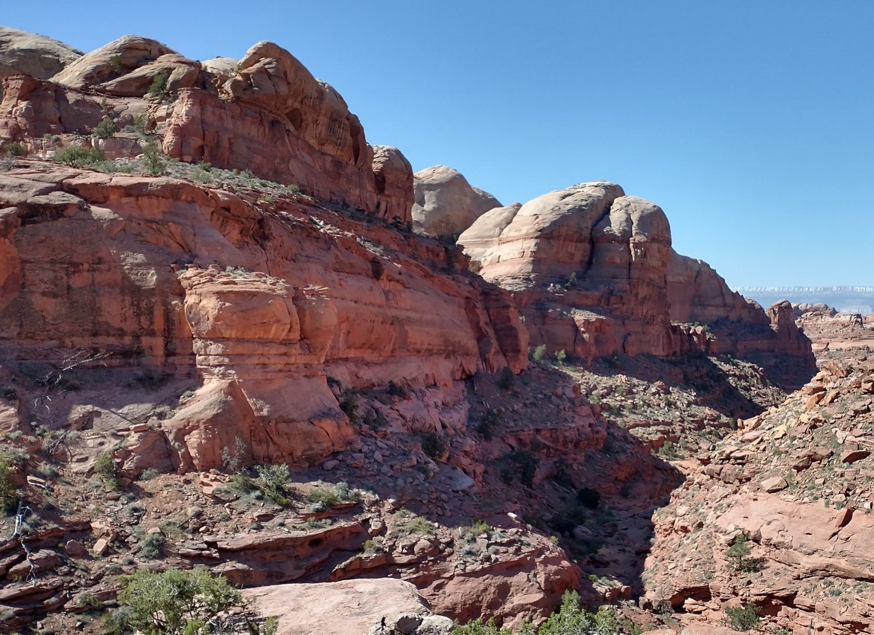
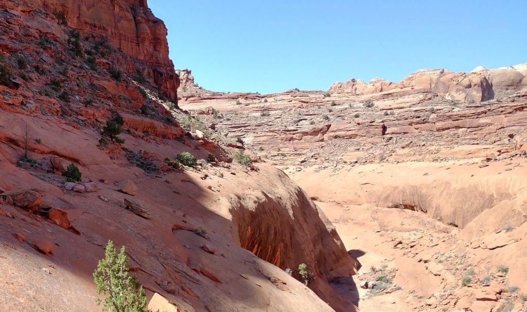
Getting down involved navigating the very complex and fantastical Stevens Canyon. Jamal Green’s route description sounded pretty intimidating, but the rewards were many. For the past 2 days, I’d been saying that each new canyons was my new favorite of all time. Now seeing Stevens from above and inside, I couldn’t imagine how any other canyon could surpass it. Lower Muley Twist and Halls Canyon had also both been rather straightforward and nontechnical, but Stevens kept me on my toes!
The route went in and out of the main channel multiple times, due to giant pour offs. One of the descents involved some ledge switchbacks and scrambling. Thankfully we didn’t need to take our packs off all day but there was some passing of poles.
We stopped for lunch at a series of cascading tinajas, the gurgle of the water reverberating magically off the curved and overhanging canyon sidewalls so that it sounded like there was a waterfall above my head. The acoustical tricks of these natural amphitheaters were incredible. I thought about how much money it would take to recreate such a scene…and still not get it right. Human architecture could never surpass the bounty and complexity of what’s found in the Utah wilderness.
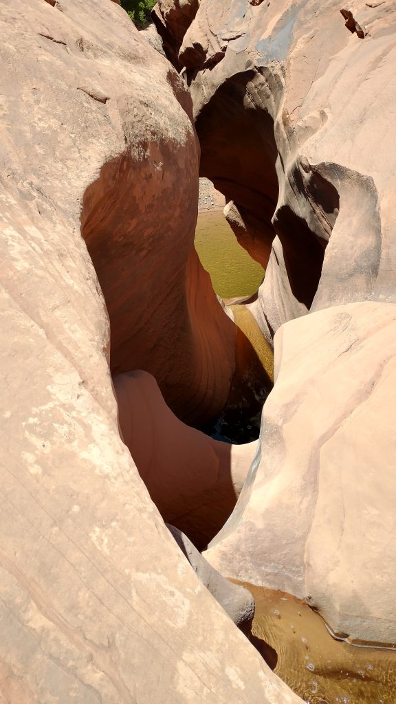
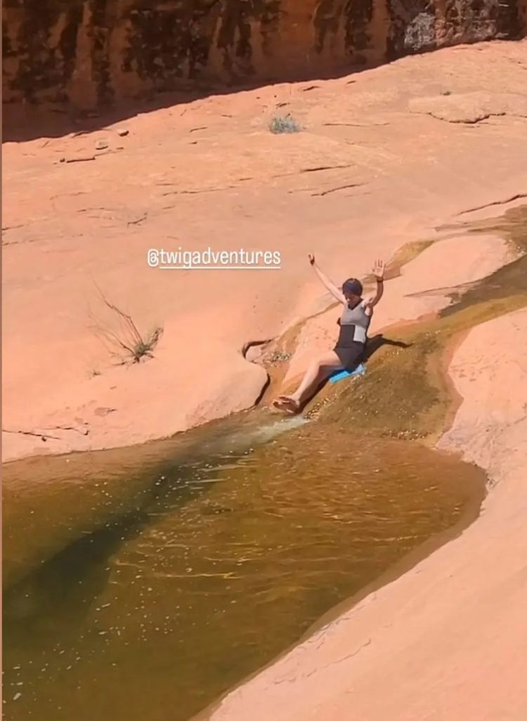
Of course, I had to turn this masterpiece into my playland. I tried to go down a small water slide on my sit pad, but the slickrock was far to coarse for that, even with a layer of algae greasing the slide. It was a dismal failure but I did succeed in butt-scooting into the pothole for a dunking. The water was pretty warm, being heated by the sun and rocks, but still a tad bit too refreshing. I had to immediately start walking to warm up.
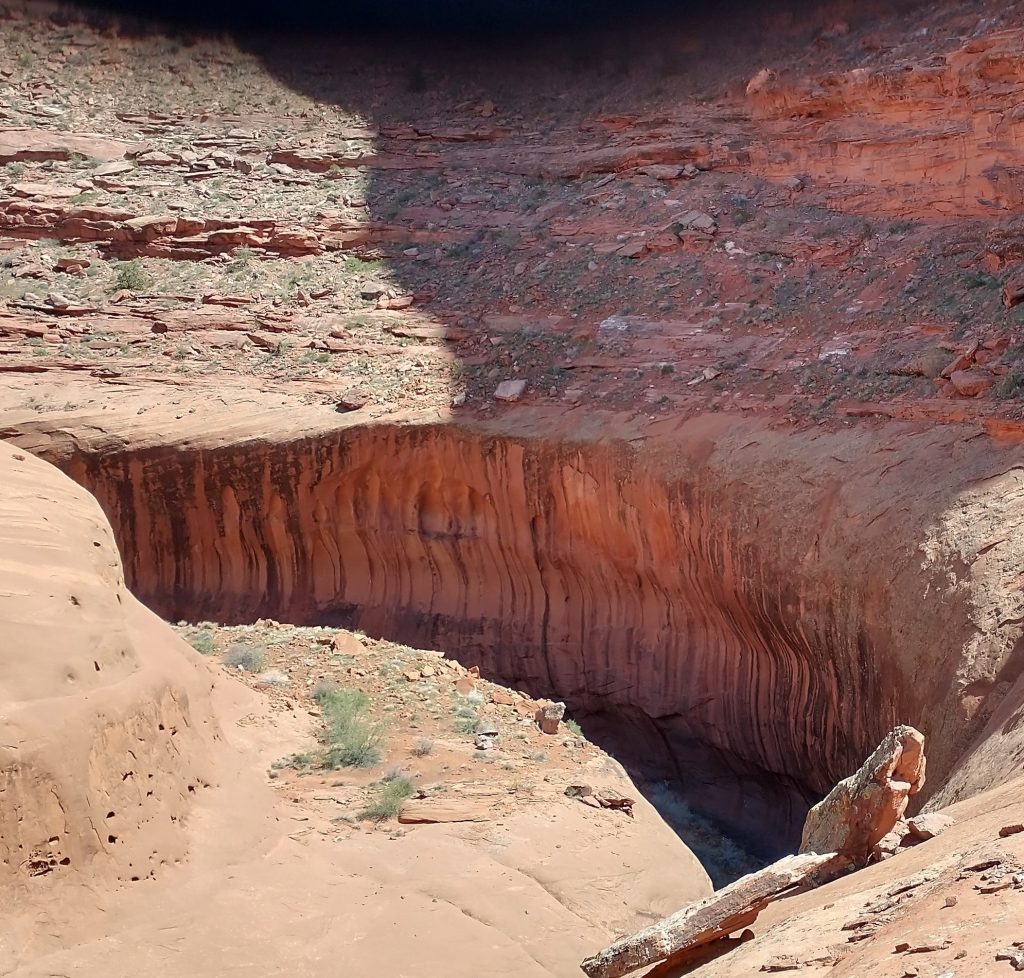
Stevens canyon also had long sections where we needed to walk along the upper inner rim of the canyon, avoiding numerous waterfalls, slots and pour offs. Usually the rim was quite wide, but many times we were walking the thin line between the higher canyon walls and the sloping chasm of sandstone to the bottom stream bed. It could be a fall of 100 feet or more if one were to take a misstep. From afar, some of the narrow bends seemed pretty daunting. One looked downright impossible but there was always a way in the form of a chossy and sandy trail or slickrock. I’d fretted over this section but close up, it wasn’t bad at all. Obviously having a fear of heights wouldn’t work well for the Hayduke…
For me, the toughest part of Stevens canyon was the last 4 miles, once we were back in the stream bed for good. The channel was very tight, clogged with vegetation, poison ivy, debris, and rock falls. We came to a huge rockfall with less than half a mile to go, having to climb a large hill of debris, then finding a steep route down through more chossy hell. The bottom of the hill became clogged with vegetation and a seep that served to grease the slides for about about 10 feet. I managing to stay upright, but only by clinging to tufts of grass with my hands…tufts which also included poison ivy and something with thorns. At least we were rewarded with some nice overhangs.
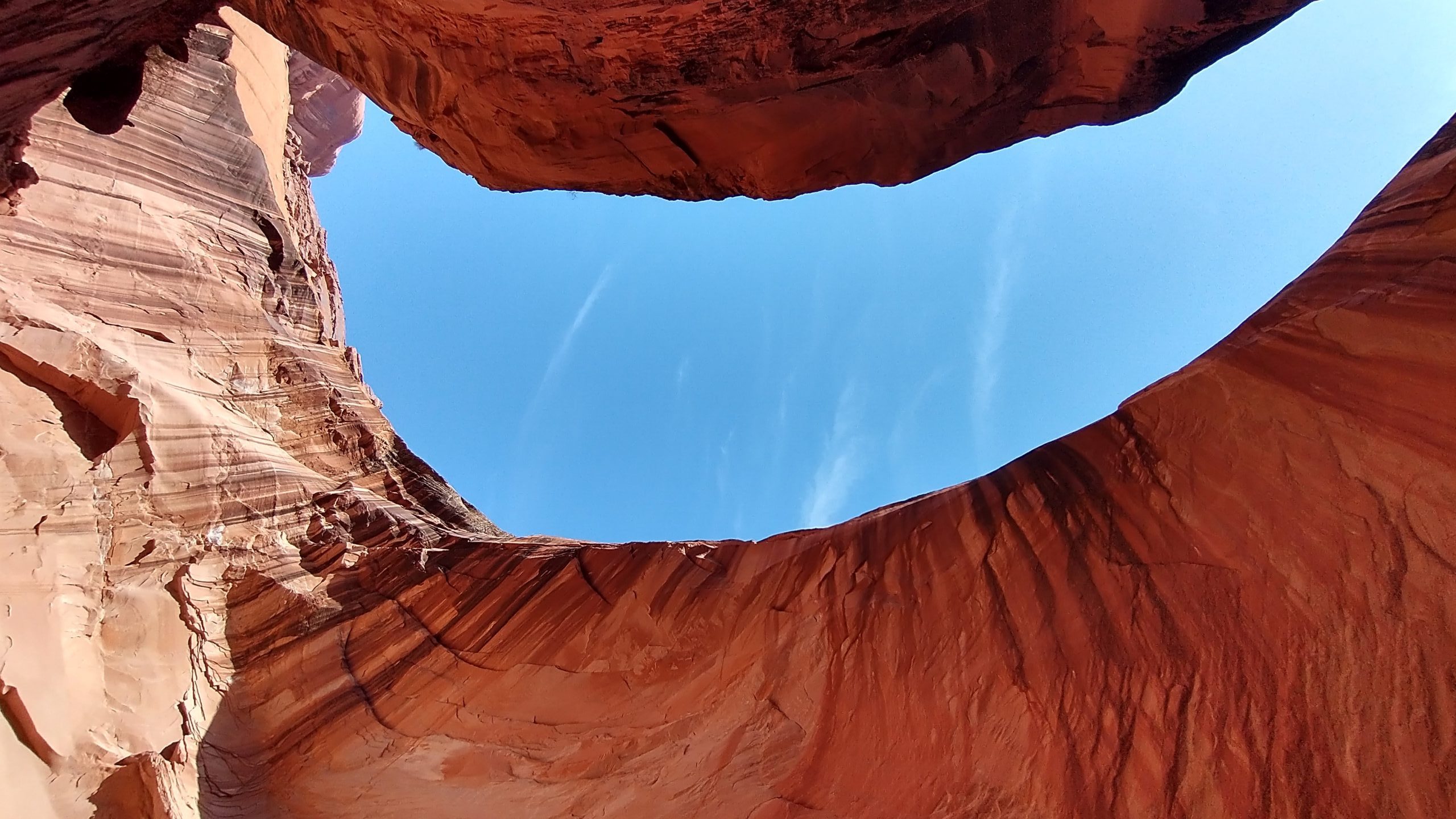
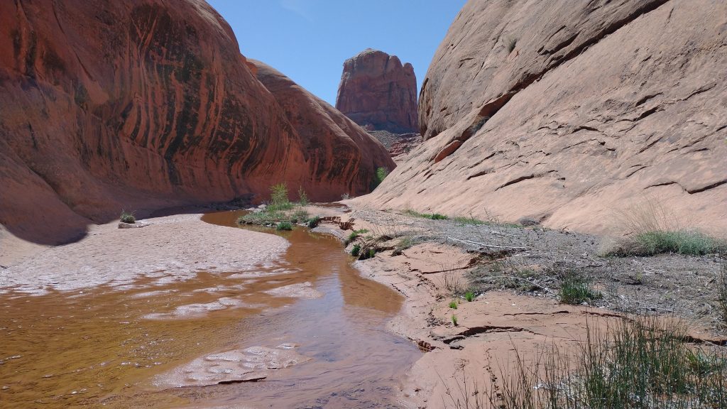
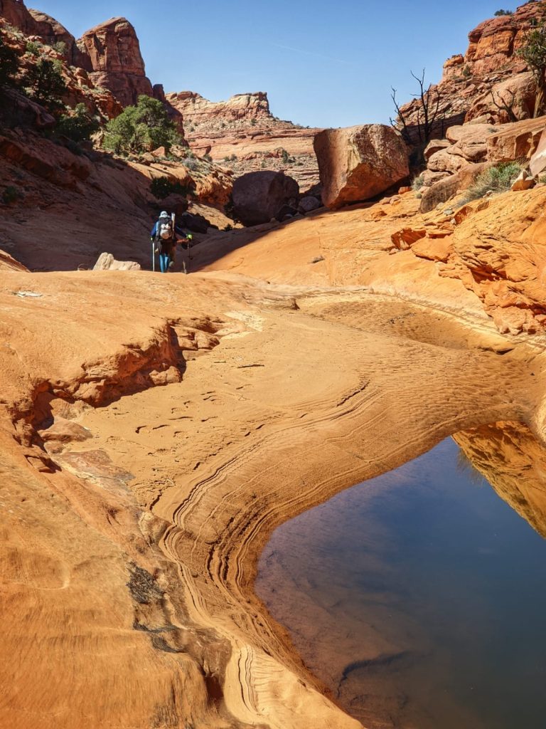
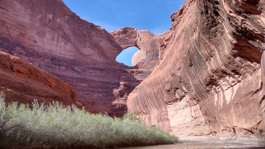
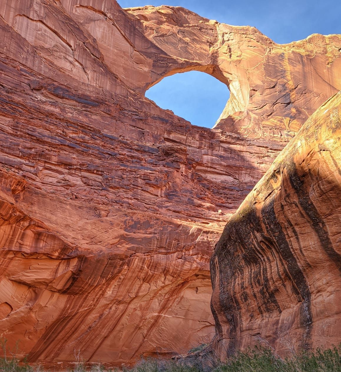
After what seemed like the longest half mile, we finally reached the Escalante River. We’d been concerned that it might be flooded but the river was a tame little kitten. We easily walked right down its center, never experiencing water much above our knees. I’d heard such horror stories about bushwhacking alongside the river but we found a few use trails through the tamarisk. Even so, it was almost just as easy to walk in the river. Plus, around a bend, the river afforded the best views of the magnificent Stevens Arch. Supposedly it’s big enough to fly a plane through!
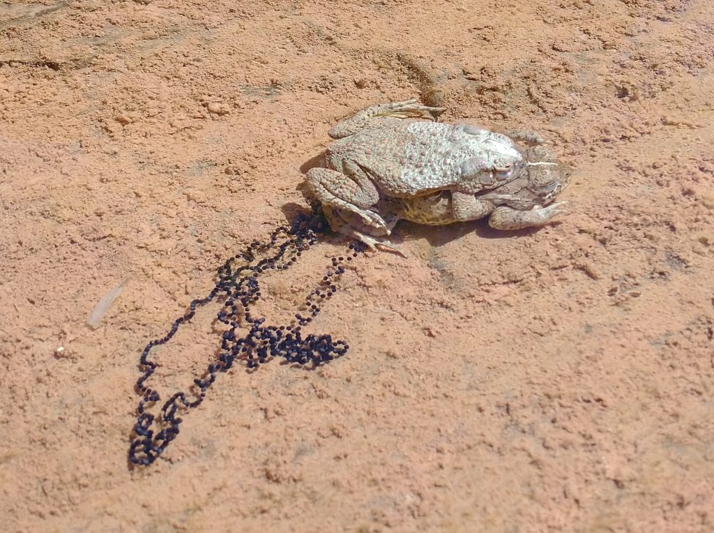
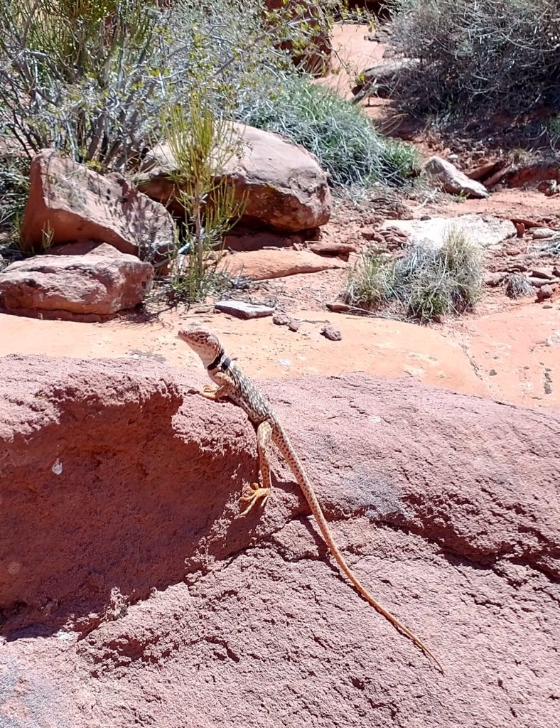
As tremendous as this day was on scenery, it wasn’t big on wildlife. I did find a pair of frogs making more frogs and a cute lizard. We let our imaginations take over, joking about the infamous Escalante beaver. They were a special kind, vicious in nature, waiting to seize hikers and pull them under the water. Thankfully we didn’t encounter any. But once we got into Coyote Gulch, we had a new worry…Gulch otters! They were mortal enemies with the beavers and had turf wars at the confluence. We could have found ourselves right in the middle of one of these epic battles if not careful. And don’t even get me started about the dangers of the Waterpocket Fold mongoose. ROUS’s abounded in this area!
Entering Coyote Gulch, we had one final scramble across a slippery, sandy, slanted ledge, made all the worse by the hundreds that had gone before us. The canyon was one of the most popular in the area, with pretty easy access to a road, where we were headed. And yet we still hadn’t seen another person all day…our 3rd such on the Hayduke. I didn’t like the slippery ledge, definitely the worst thing I did all day, but was too tired and anxious to get to camp to overthink it, just get it done.
We stopped at the first campsite we came to, still within view of Stevens Arch. It was a beautiful spot, with water rushing by in the stream and a huge cottonwood overhead. It was prolific with bats, eating any annoying insects. There was also the creaking of a frog…or perhaps it was the menacing shriek of a Gulch otter, I couldn’t be sure. Despite the lurking threat, I passed out completely, absolutely exhausted from such a long and exciting day. Almost every mile had been cross-country but oh what a treat. This alternate was perhaps the best on the whole Hayduke.
I love me a good Princess Bride reference! Amazing pictures — almost makes me want to do it, but not quite 😉