Sunday, April 16th, 2023, 0650-1845
Muley Tanks to Halls creek, just before the Baker route
23 miles, elevation 3830′
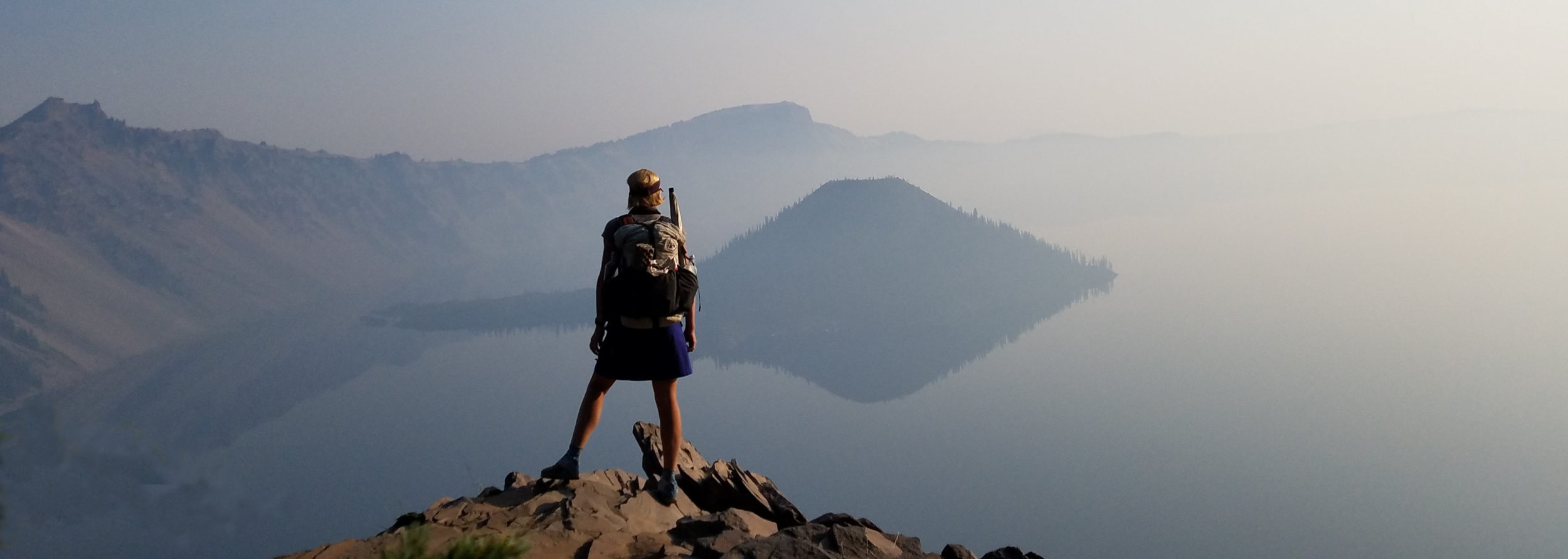
I woke with a bit of a headache, probably because of staying up too late. The party people didn’t go on all night but I wasn’t sure when they stopped, since I took measures to be dead to the world…earplugs and herbal remedies. I think they carried on pretty late. I was glad to get away from them in the early morning. We waved goodby to Mac, since he was heading over the Waterpocket fold on the main Hayduke route to the Escalante River. He planned to packraft down the river for about 25 miles. We were doing the Halls Creek \ Baker \ Stevens canyon alternate, remaining on the eastern side of the Waterpocket Fold for another 20 miles. This had become the more popular route with Hayduke hikers, for good reason. It was some of the coolest hiking I did the whole route.
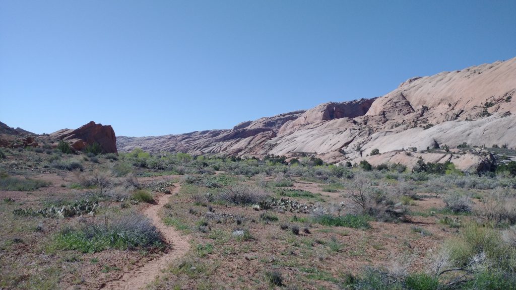
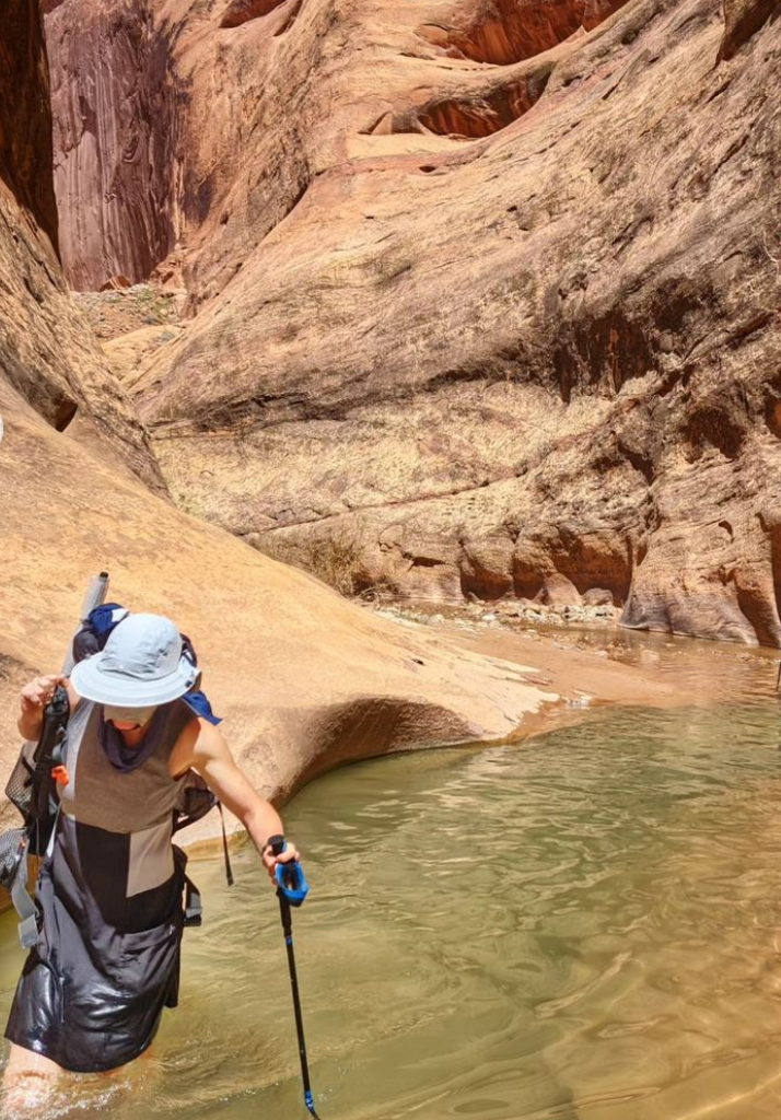
We explored a side canyon for a little ways, trying to make it to a double arch. The canyon proved to be too much of a scramble, so we turned around short. We had an exciting day in Halls Creek planned anyway, so no loss. It was another amazing canyon similar to Lower Muley Twist, but with less extensive overhangs and more water. There were a few slot \ narrows sections that held deeper pools of water, our main challenge for the day. Reports from other hikers indicated we’d be wading in chest deep water. We waterproofed our stuff as best we could.
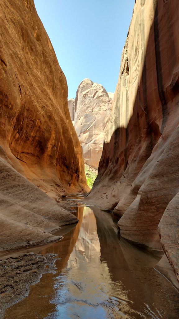
We passed lots of tents but only a few people, and basically no one once we got into the 4 mile section of narrows. We were once again awed by the enormous walls, patterned varnish, and clear water pools. There were about 3 pools that came up to our hips and one that was chest deep. I managed to lift my pack high on my shoulder so it didn’t get dunked. The largest section of pools was only 30 feet long and not all of it deep. It was the coolest narrows section, almost looking like a man-made waterpark. I just wanted to swim through rather than walking, if not for my pack. Thank goodness it was nearly 80 degrees, so the water felt great, so refreshing. As far as wildlife in the canyon, sighting were pretty sparse but we did see a few frogs.
All too soon it was over and we were back to walking over dry benches and along the open creek the rest of the afternoon. We left the park and immediately noticed how inundated the area was with cows. We didn’t see any live ones but their poop and hoof prints were everywhere. It was also incredibly green, more so as we went down the creek. All the cottonwoods were leafed out and green grass was growing everywhere. I didn’t feel like I was hiking in Utah anymore. It looked like a savanna after the monsoons had come.
I’d say the hardest part of the day was the last 5 miles. The creek became impossible to follow because of all the vegetation, mainly the invasive tamarisk. So we followed cattle trails as best we could, which wove in and out of all the little side drainages coming from the Waterpocket Fold. It was tiring going up and down so many crevasses. We often lost the trails in the thick brush and did some heavy bushwhacking, the worst yet of the trip. But we knew this alternate was greatly preferred to hiking down the Escalante river, which involved even worse bushwhacking.
We also struggled to find a campsite for a bit at the end. We tried the main floodplain, which had nice cottonwoods but was dusty and cow-muddled. The animal sighting of the day was 3 turkeys. We eventually found a nice grassy plain away from the stream, next to some oak trees. I was amazed to find a few mosquitoes. They buzzed around ineffectively for the most part. I laughed at them and told them they were pathetic. Still I was glad to zip them away, outside my tent