Sunday Mar 21st, 2021, 0700-1800
Picketpost trailhead to Gila River, mm 72
24 miles
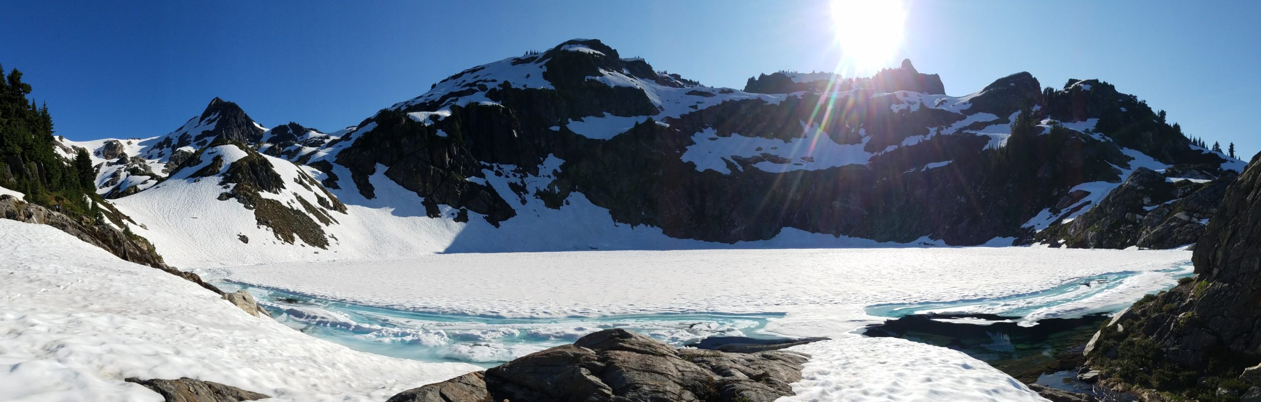
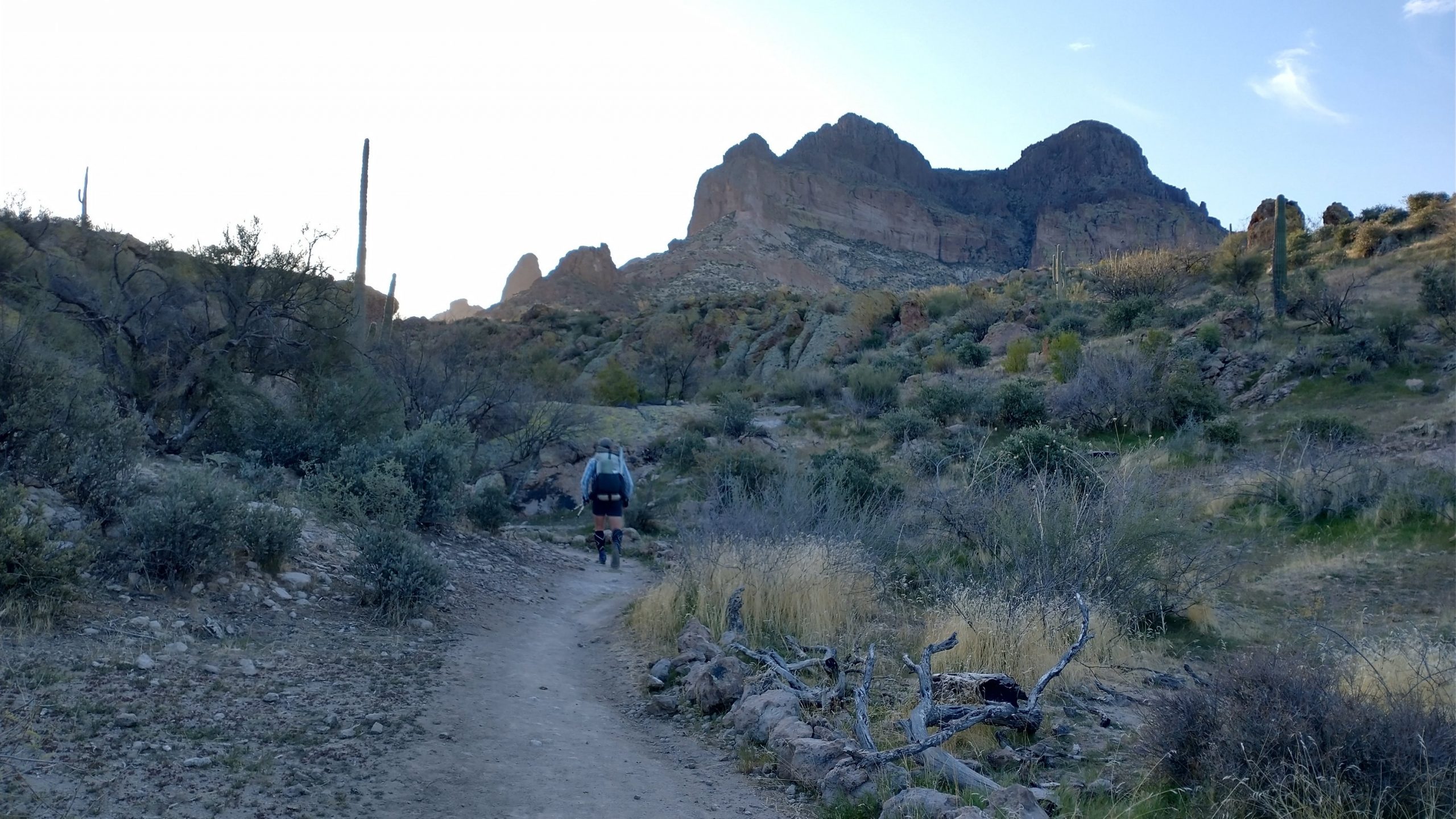
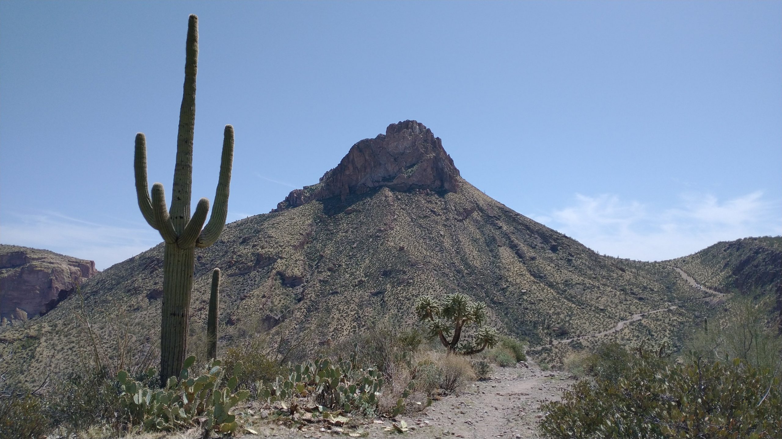
MJ was up at 5 am getting coffee and omelets made for several of us hikers. Then she had us to the trailhead by 7 am. She really is amazing. After more reluctant goodbyes, we began the winding trail in the cool of the morning…a far cry from my afternoon start in 2019. The tall mass of Picketpost provided shade well into the morning, making for an easy climb into the canyon. This stretch headed into the White Canyon Wilderness area, which gave the Superstitions a run for their money in terms of scenery. This was one of my favorite stretches on the AZT.
We had a slightly different route in store for us this day. Many years ago, the new AZT was moved farther west to avoid the wilderness area, allowing for uninterrupted mountain bike travel through the section. The old AZT was left in tact and is still officially the route of the GET. I’d already enjoyed the new trail, so I was happy to travel the old trail. It was 5 miles shorter after all, and routed through a canyon where a natural water source is usually flowing. The new AZT trail now has a rain collector but it sits 1 mile past the intersection, so we didn’t get to utilize it. We came to the turn off about 10 miles from the Picketpost Trailhead. The old trail was essentially indiscernible at this point…we knew it would be from the GET notes and blogs. We followed some scant cairns for a mile, where the outline of the old trail eventually became more apparent. It was actually pretty fun route-finding. I was also nice to be in a setting which we assumed we would have to ourselves most of the day.
After a few miles with minor bushwhacking, we came to a saddle that led into White Canyon. This is where the “wows” really started flowing. We made our way down this wide canyon, stumbling from one cairn to the other as we tried to lift our eyes off our feet to take in the surroundings. It was a wild ride trying to avoid the many cactus and rocks. Eventually the trail turned into an old jeep trail, making for easier travel and better view-gawking. I felt quite pleased with our prowess at route finding through this first test of scant trail GET routing. We were rewarded with some truly spectacular and wild country.
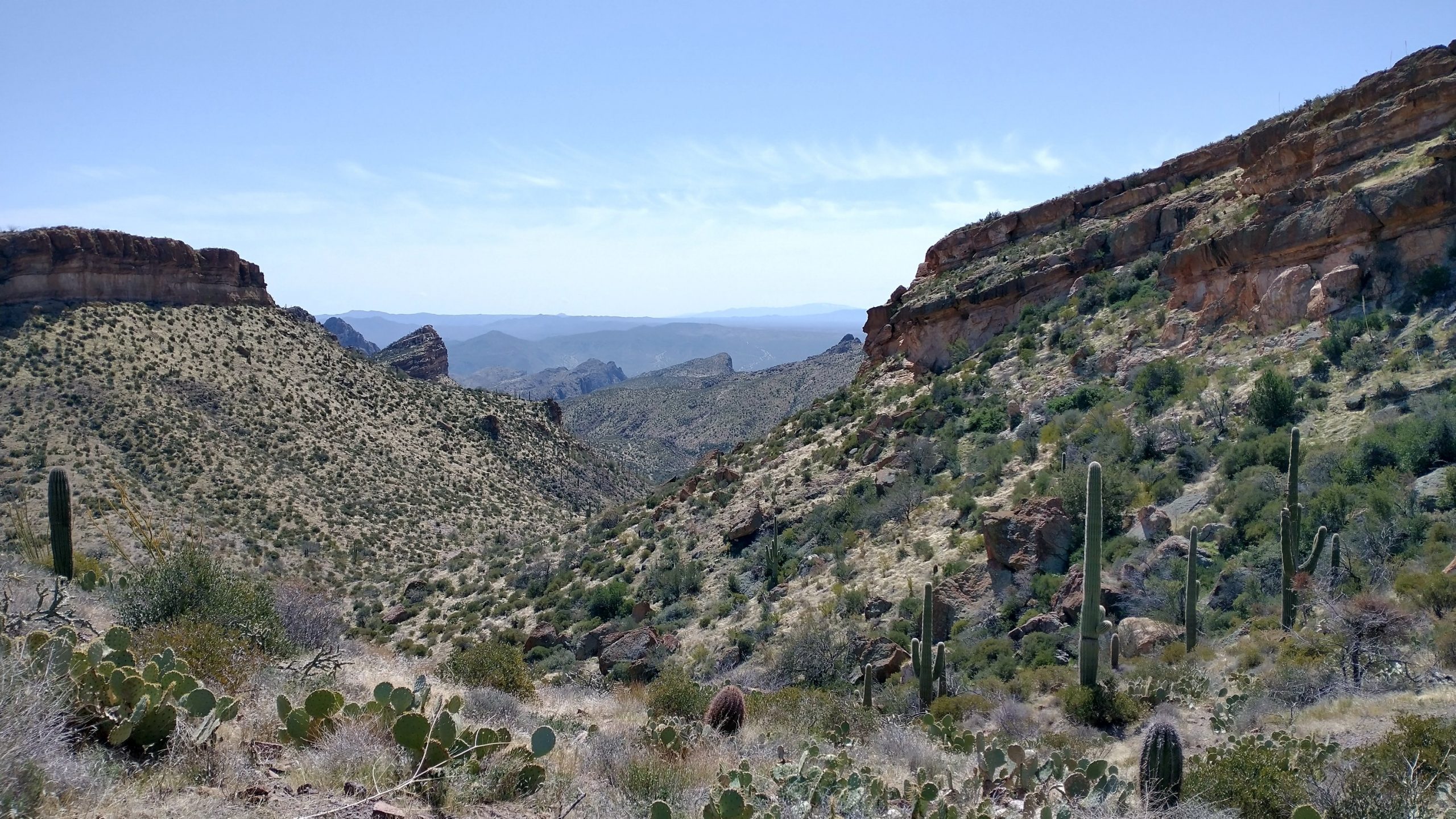
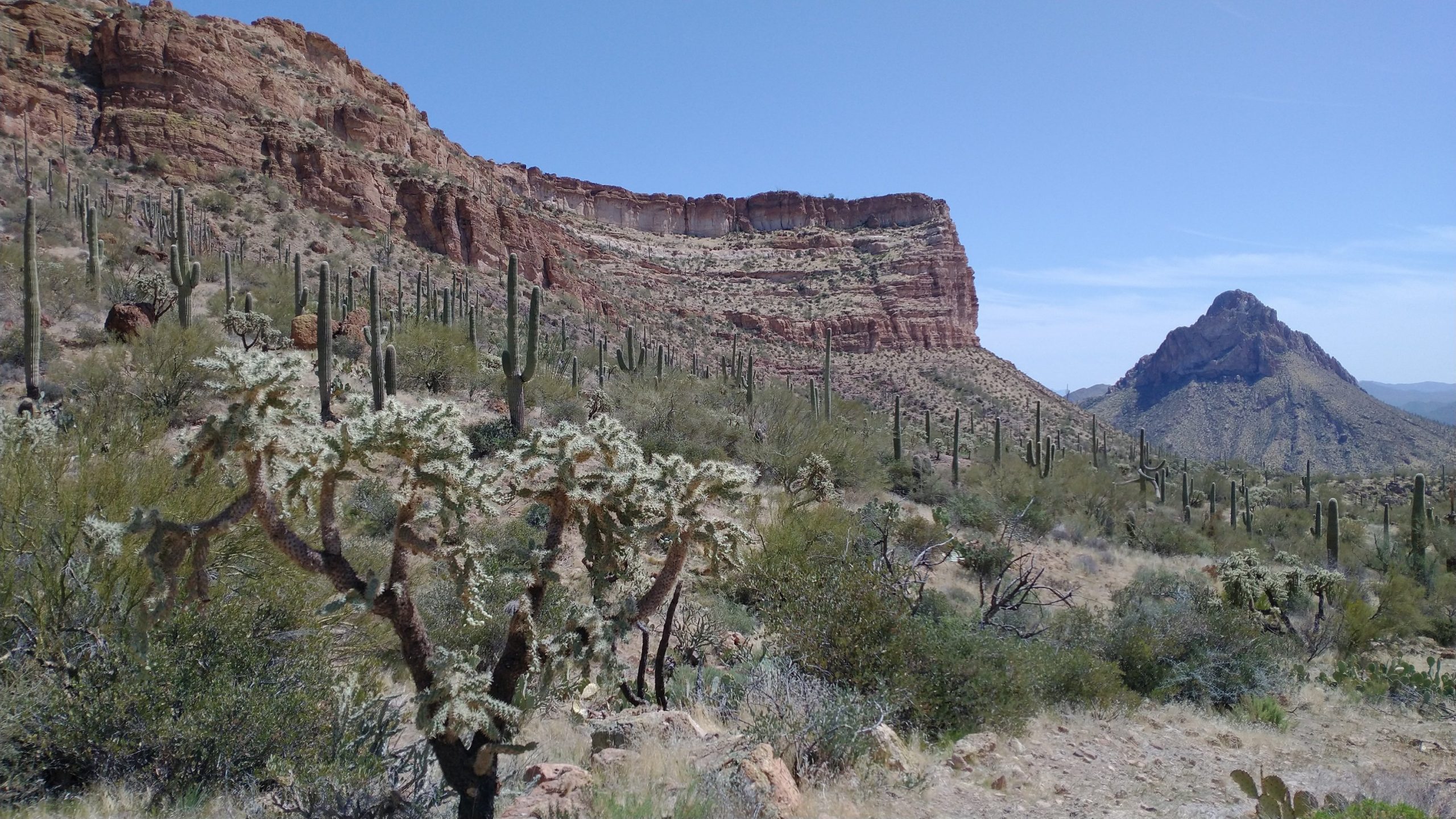
Finally we left the wilderness area and reached a well-traveled jeep road, just in time to see some side-by-sides go by. To avoid some private property due to a mining claim, we left the old AZT and proceeded over a saddle around Battle Axe Butte, a prominent shark-tooth of a mountain. It was a long hot slog up and down this saddle but I enjoyed the ever-changing face of the Butte as I went along. What dramatic features this landscape bears!
We arrived at Walnut Canyon just in time to see a woman hike by, seemingly oblivious to our presence. I was confused by her appearance from the wash, finally putting together that she was a NOBO AZT hiker. Someone had put a note in Guthooks about this alternate trail and so now quite a few were attempting it. But word about the private property issue apparently had not spread, so she was heading all the way up the canyon to where it reconnected to Battle Axe Road. We followed her about 100 yards up the wash, which our notes indicated had good pools of water. Indeed, there was a flowing spring…the only water we had come across since Picketpost. I tried to mention something about the lack of water ahead and the private property issues, but she seemed completely uninterested in talking. I think she assumed we were just more AZT hikers coming from behind her. She hiked on without a word…ignorance is bliss.
As we collected water, 6 more AZT hikers appeared from the wash. They were more engaging and sat down with us to inquire about the route. A few had at least downloaded the track onto Gaia, but none had the detailed notes that we were carrying…which helped a lot in terms of locating water sources and pointing out other notable features. I gave them the heads up about the lack of water ahead. They were in for a rough 6 miles heading up through the dry and exposed canyon in the afternoon, followed by another 10 dry miles to the trailhead. I didn’t envy their position. But they enthusiastically carried on. Sometimes I wonder if GPS emboldens people a little too much. The AZT is so well trodden now, it’s like a highway. But this alternate was certainly quite a departure from that standard.
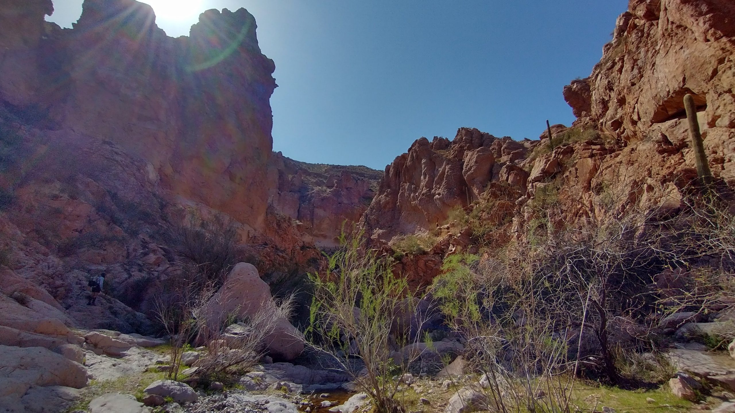
We collected enough water so as to avoid needing to collect from the Gila river…it’s pretty polluted from agriculture and mining activities. We proceeded down the canyon through a glorious box area, which was sadly all too short. Cries of the canyon wren echoed as we marveled at the walls. The wash opened wide for the last mile, where numerous ATV and cow trails made for a maze of pathways. We both took different routes, enjoying the freedom of travel the wash afforded. Here I encountered my first rattlesnake, it’s buzzing easily heard over the noise of my music and already in position to strike while I was still yards away. Easy buddy, I was happy to go around. Shortly after this I ran into 2 more AZT hikers taking the alt, giving them pointers on the route.
We popped back onto the main trail and started heading east along the Gila valley. At another wash, I noticed 3 hikers taking a break. I asked if they were doing the AZT. Nope, these 3 were GET hikers! Suddenly we were in a GET bubble. I knew I had seen very fresh footprints heading down the wash….the same that I had seen back in the Superstitions. I couldn’t believe we had caught up to them since they had left 3 days ahead of us, according to the trail registers. They had taken a zero in Superior and I gathered that they were a little newer to the route finding aspects of this long distance adventure. In fact, this was one of the guy’s first thru-hike! I couldn’t even imagine doing this route without having at least first experienced a desert hike like the PCT, AZT, or CDT. I had all 3 under my belt and even still I wondered if I was ready for this. Today gave me some confidence at least.
We chatted for a bit but it was getting late. We were all heading for the next river access area to make camp, so we assumed we’d be able to chat with them more. As it turned out, we were all really tired from the challenging day and stayed confined to our tents. The Gila river lulled us to sleep, as we lay tucked under the mesquite. It was a very lovely campsite and a great finish to a fantastic day.
In prep for my GET thru hike this coming spring I’ve been reading some previous hikers’ trip reports. When you referenced AZT hikers going up Walnut Cyn I checked my trail journal for my AZT thru hike in 2021. I went up Walnut Cyn (solo) the same day you dropped down to the Gila. I remember briefly talking with a woman in a skirt. She told me that she had just taken a rattle snake alt. She even mentioned that there was another hiking with her (I never saw the hiking partner). We didn’t introduce ourselves. I thought your photo looked vaguely familiar. But, I believe we ran into each other that day. Small LD hiking community.
Sounds like it! I remember bypassing a tree with a rattlesnake under it and then running into a guy just after. Must have been you. It is a small world. It’s pretty much impossible to hike a trail now without running into someone I met before. Good luck on the GET!
And, I was the hiker that picked up your tent stakes that you lost on the MRT in 2022. Talk about a small world.
I thought your name sounded familiar! Thank you again, so so much. I’m still using those stakes! Happy to report I don’t think I left anything behind on the GET.