Monday Apr 19th, 2021, 0830-1900
Magdalena to South Canyon end, alt to Socorro via Magdalena mountains.
25 miles
The skies cleared and the weather was forecasted to be great the rest of the week. Time to hike! But first we had to finish the big plate of leftovers that Osiris and Michael had given us the night before. They were going to be closed for several days and hated wasting food, so they often gave leftovers away to customers. The plate was a sampling of mostly fresh and perishable stuff like salad and slaw…. all stuff I was in bad need of. So Pro tip for starving hikers: check their hours and time your visit appropriately!
Having gotten only a 2 day resupply from the Family Dollar and Steer Stop (only ‘grocery-like’ places in town), we set off on our adjusted course for the Magdalena mountains. We were backtracking on the main route about 8 miles and would then take an alternate to Socorro. We chose this in lieu of the main route because we missed the Magdalena Mountains when we bypassed Potato canyon in the San Mateos. We felt it was important to the spirit of the GET to hike as many of the mountain ranges as possible. We’d be missing a section through San Lorenzo canyon, but there were several canyons along the alternate route as well.
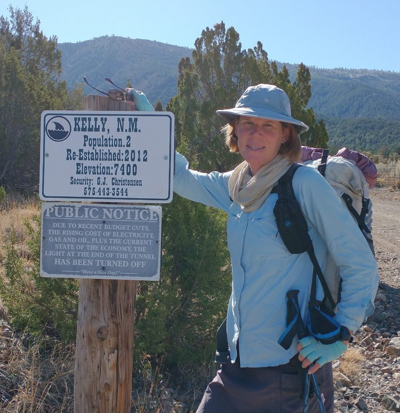
As we left the motel, we immediately ran into Donnie Chavez, who was working a construction project at the corner. He waved hi and we waved back…he was harder to recognize since he wasn’t wearing his Pro-bull-riding jersey. It sure didn’t take long to make friends in this small town. We walked down a long street, barely gaining the interest of the local dogs. Given the many rural places we’d walked through, I was surprised we didn’t have any problems with dogs. They were pretty friendly everywhere, or not even caring about us. The street turned into the road to Kelley, an old mining town. There wasn’t much there but an old church, which was for sale. If one were to buy it, would they become the owner of the whole town?
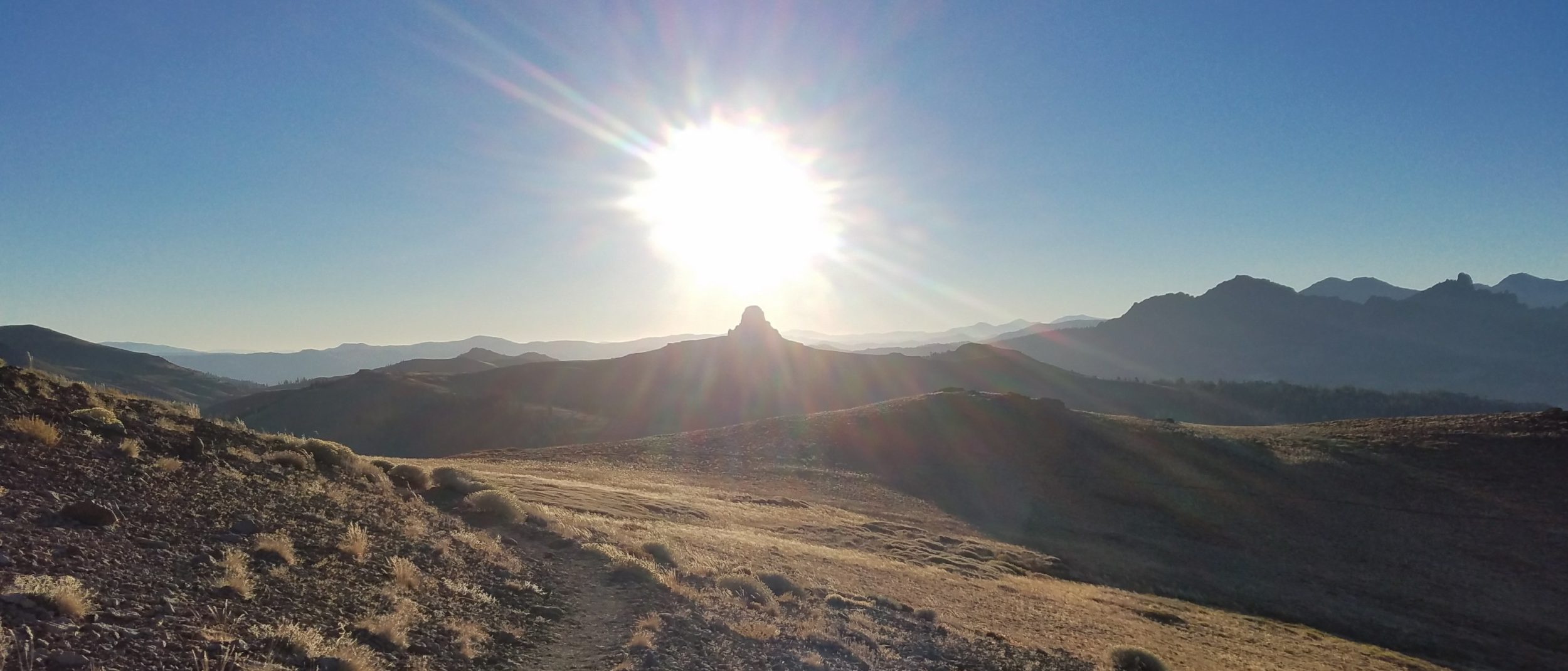
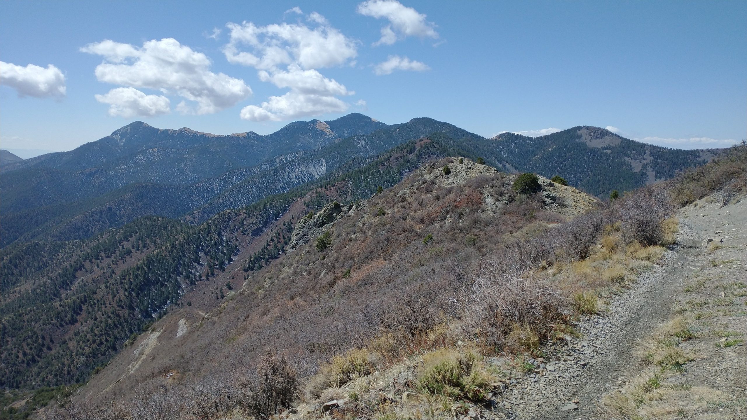
From there, we started a rough, rocky jeep trail that had one purpose: going up. This elevator road had me scrambling just to keep my balance. Like an ATV, I felt as though I might start sliding backwards if I didn’t keep my momentum going. The good news is that we were very quickly on the ridge with fantastic views of the desert and plains below. And snow! There was a beautiful fresh dusting on the ground and ice crystals lining the ponderosa pine needles. It felt like we were in a fairy-tale land, so opposed to the arid plains below.
Another striking contrast was the green trees. We walked for miles through live forest this day. In fact, not one area that we went through in this range was burned! The beauty of the live forest made this my favorite mountain range in New Mexico, thus far. And to think that most of it wasn’t even a part of the official route, it’s kind of ironic. I was so glad that we didn’t miss these mountains!
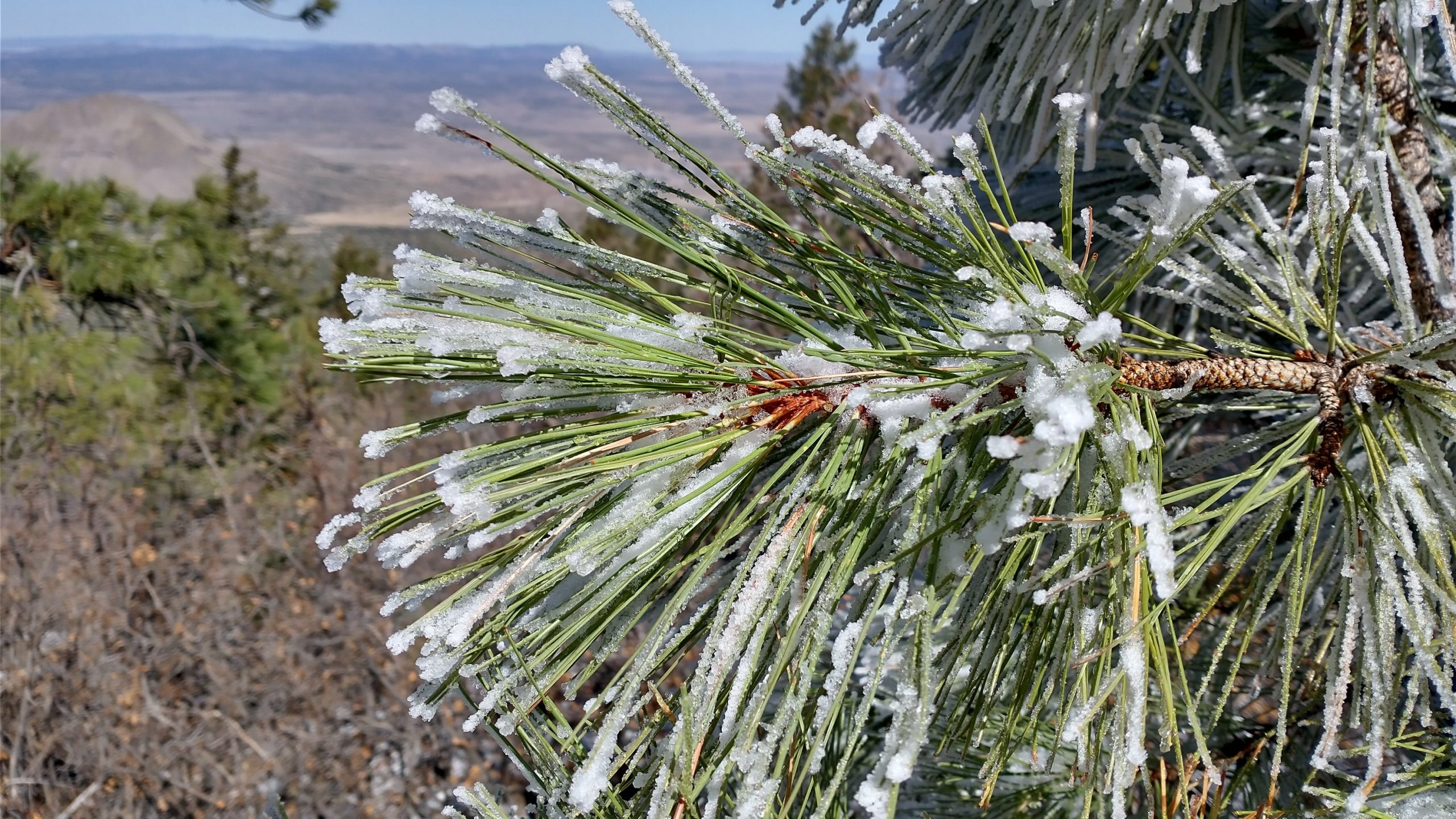
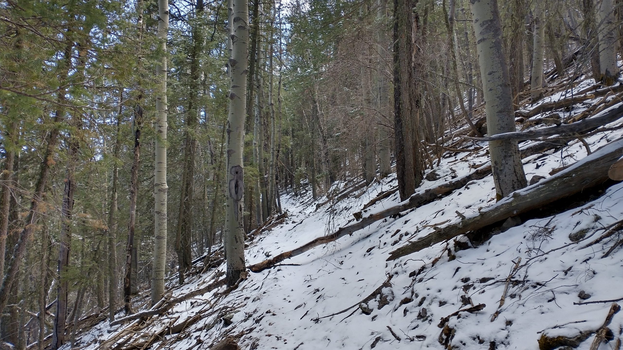
Also, the trails were some of the best we’d experienced since the Gila… definitely maintained recently. Some parts were even better than the CDT through the Black Range. I took a picture of just one of about 10 blow downs that we crossed, but mostly I was just capturing a memory of the nice trail and pretty snow cover. I actually loved walking through this snow, hearing the crunch, smelling the scent, seeing all the little animal prints, feeling the drips of it melting from the trees, and experiencing the silence it seemed to evoke. It was all so refreshing. The new snow was just enough to be pleasant and not difficult. I slipped in a few places, mostly where there was old snow underneath, no big deal. What an overall treat this day was.
The first part of the trail involved a little clambering over rocks and along a narrow ridge. This was a highlight, though I was glad not to be doing it in bad weather (like we would have if we hadn’t altered course). The later parts had us going through pretty meadows and traversing the steep hills. I highly recommend the whole North Baldy Trail to anyone living in the area…it was so much fun.
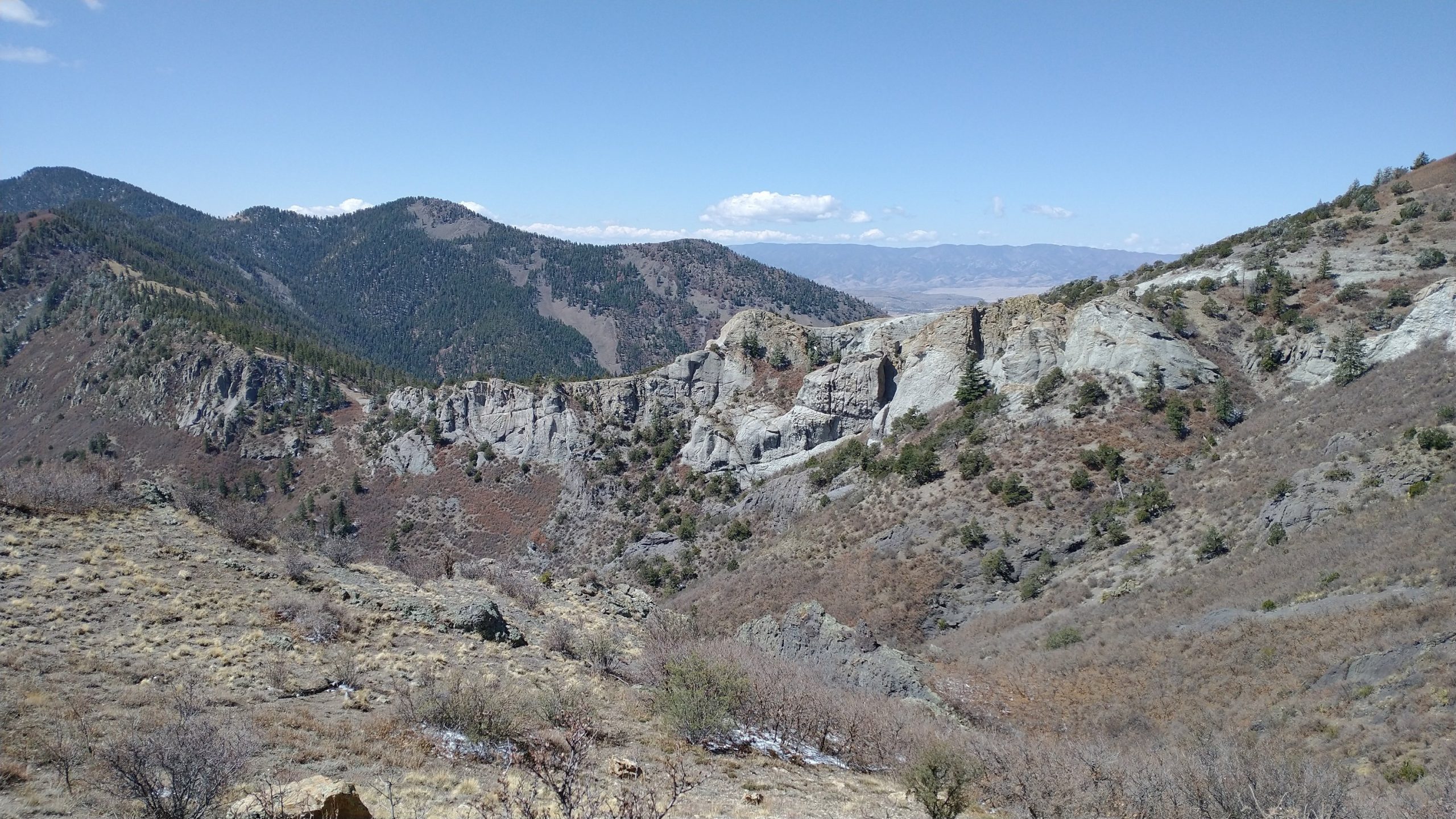
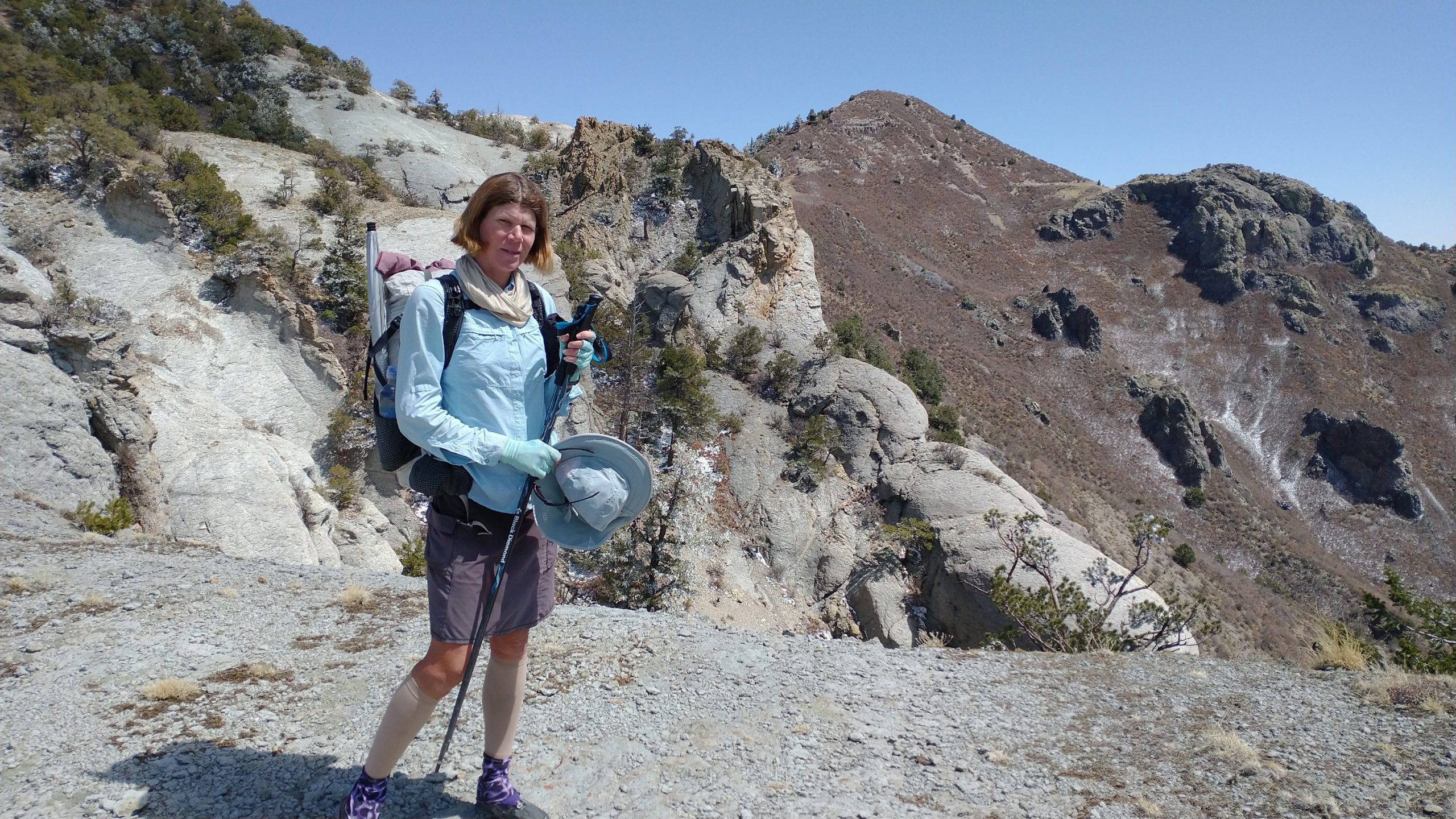
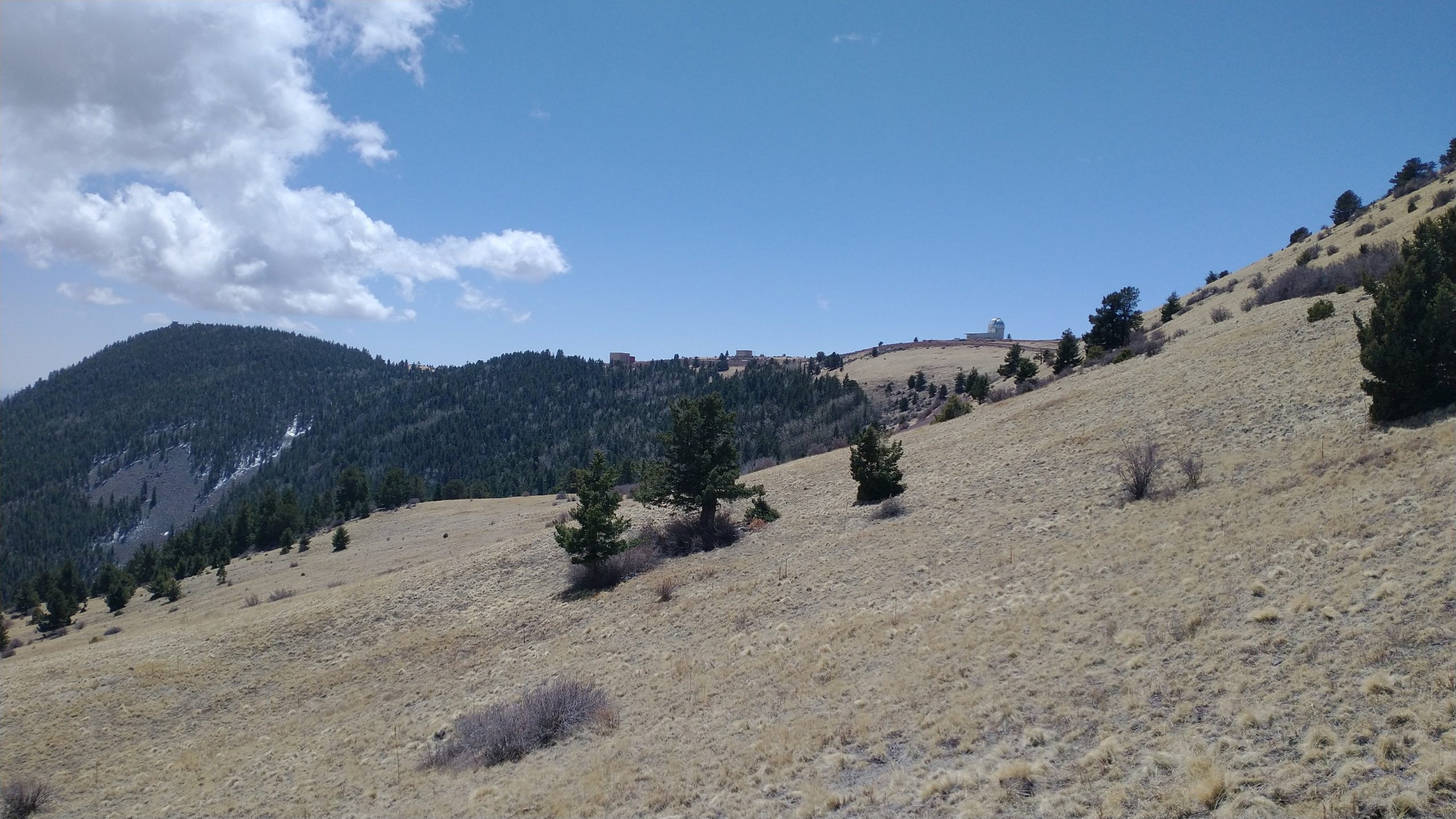
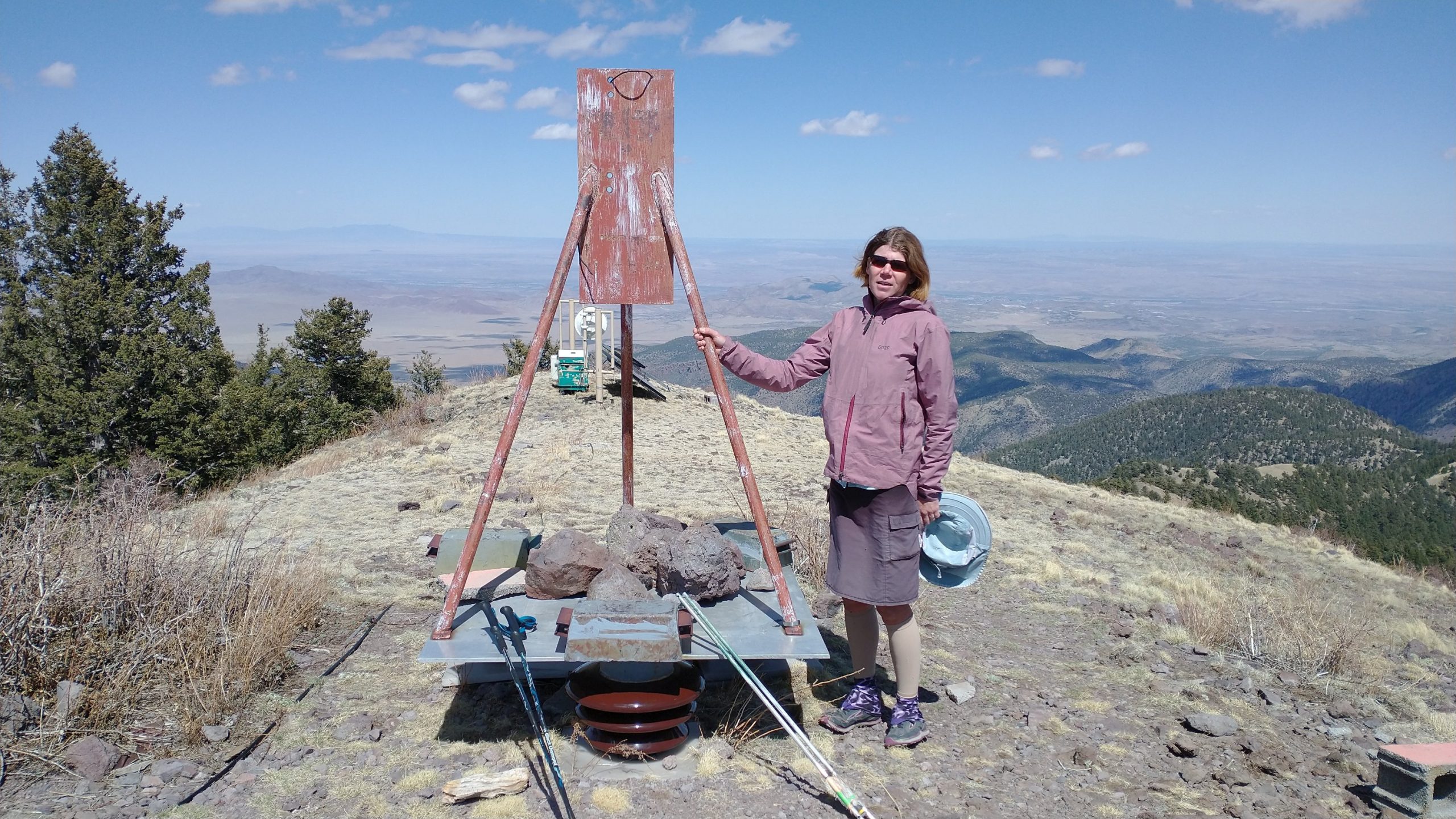
The trail ended right at the base of South Baldy and the road to the observatory. There were actually a collection of about 5 buildings up there, most seemingly associated with the nearby university. The gate was closed but being on foot, we walked right on by… it’s quite liberating to be free of a vehicle. There was a stile to walk through, so it seemed legit that foot traffic was allowed. We were in search of a reported water spigot (which we found and got nice water from) but also some peak-bagging. At 10,783′, South Baldy was the highest we’d been on the GET, but only by 13′ over Mogollon Baldy. But this peak wasn’t on the official route, or even the alternate…still well worth the short side trip for the fantastic views.
From South Baldy, I could see ahead to the final ranges we had left to cover on our route: the Manzanos/Manzanitas and the Sandia Crest near Albuquerque. I could also see 2 weeks back to the Mogollons… Whiteface Baldy and Mogollon Baldy were just barely peaking above a saddle between Grassy Lookout and Mount Withington in the San Mateos (thanks Peakfinder). Recall that from Mogollon Baldy, I could see the Pinaleños in Arizona. From the Pinaleños, I could see all the way back towards the start of the GET in the Superstitions. So from these 3 vantage points (Magdalenas, Mogollons, & Pinaleños), a hiker could connect the dots of the whole route, some 800 miles! Isn’t that incredible? I sure thought it was neat.
We also had a fantastic view of snow-capped Mt Taylor to the north, which was my self-imposed finish point of the CDT. At 11,305′, she was a fine mountain to celebrate the conclusion of a grand thru-hike. Someday I may be able to connect the dots in every western state… I’m getting close. Peak-bagging is so much fun.
It was time to go down, which we did on another fun trail…the South Baldy no 11. Weeee I exclaimed all the way down. The trail rolled along with good banking and some switchbacks. We saw fresh footprints in the snow, which meant someone had just hiked the trail this day or the day before. It was nice to see these trails getting used. With road access and a nearby sizeable town, I guess it makes sense. We walked the road for a brief spell before the route wizard had us on another trail going up and over into a different canyon. The route wizard did his best to keep us off major dirt roads and highways and we generally, dutifully, followed his advice. We were on this trail all the way to the mouth of a canyon, where it dumped us out onto the desert plains.
We should have stopped short to take advantage of the inner protections of the canyon and nice ponderosa but we hiked until late to see if we could make it to a water tank. I didn’t really need water, since I carried a lot from the observatory, but it was nice to have a little extra to wash up with…just a few splashes on the face goes a long ways. Unfortunately the tank was dry, no big surprise. We had to make due with some scraggly pinions and junipers for camping. Cows were once again our unwilling companions for the night. I don’t care for such neighbors anymore, what with them always pooping on top prime tent real estate. But what you gonna do? They didn’t appreciate us taking their tree refuges probably either. It’s another interpretation of the saying “fences make good neighbors.”