Thursday Apr 15th, 2021, 0700-1930
San Mateo Canyon to Indian Springs, segment 29, mm 535
26 miles
Coyotes howled all night but their antics didn’t bother me in the least…I kind of like the sound. I also heard a western screech owl. It stayed pretty warm overnight and we woke to high cloud cover. I was glad that it would stay cool for the climb into the San Mateos but worried that the bad weather was moving in early. We began walking up the Burma road towards the southern end of the Apache Kid Trailhead. The road seems to have several offshoots and I was uncertain where it went or came from.
We bothered some more cows, unintentionally as always, then came over a rise to see 2 javalina trotting along the next hill. I’d never seen them in New Mexico before. I found cell service, so I made a brief call to my mom as I walked the road. It was all uphill but not too bad. At a point where it flattened out, I checked my GPS and sure enough, I’d missed a turn…but only just.
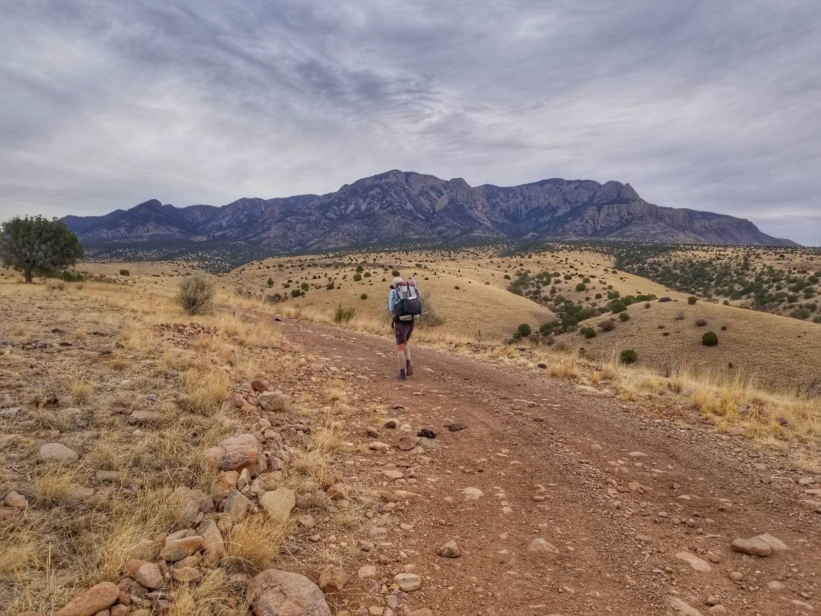
The trailhead was pretty indicative of what was to come. The gate was hard to open and there was no kiosk or information display…it had been long abandoned by any authority. Nor were there signs of any use. We thought the other 3 GET hikers had been through here within a week, but we couldn’t see footprints. I guess they got erased by the wind pretty quickly. We started up the Apache Kid trail, into the Apache Kid wilderness (though I’m not sure of the boundaries of said wilderness since we never saw a sign). The Apache Kid was killed in these mountains and his gravesite was noted on the map, a ways down a gully where the trail didn’t go.
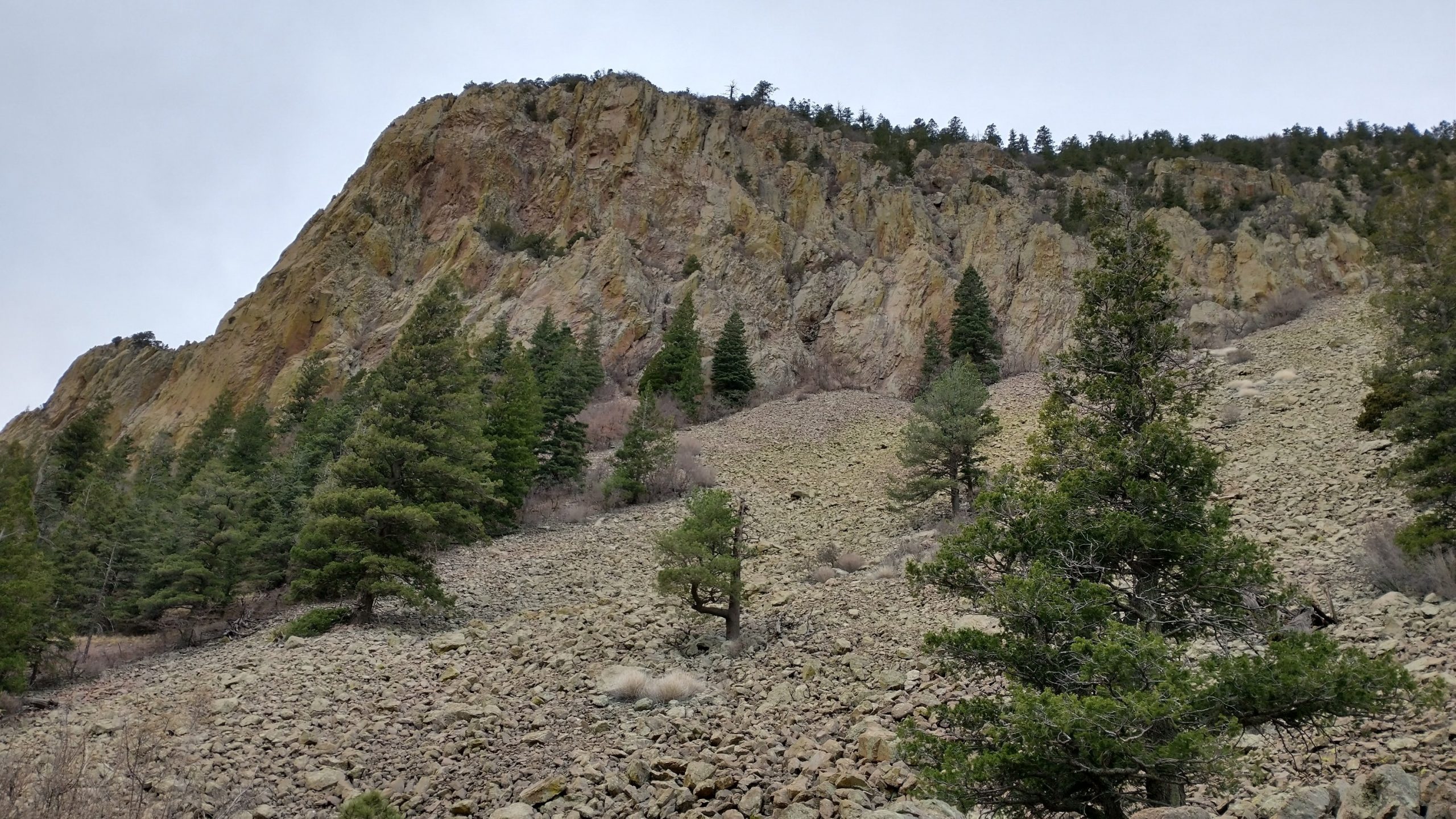
We headed up a gully, which was steep, but I knew to expect lots of these kinds of ups and downs all day, so it didn’t bother me. I also knew we’d be walking through predominantly burned areas, which we encountered as soon as we got near the first saddle. Some of the burns were from as recent as the year before, so there were a few really charred areas. The trail was obliterated in these parts and we had to be careful not to fall into the collapsed holes of burned tree roots. We found the foundation of an old cabin that had burned. Only some random metal objects remained.
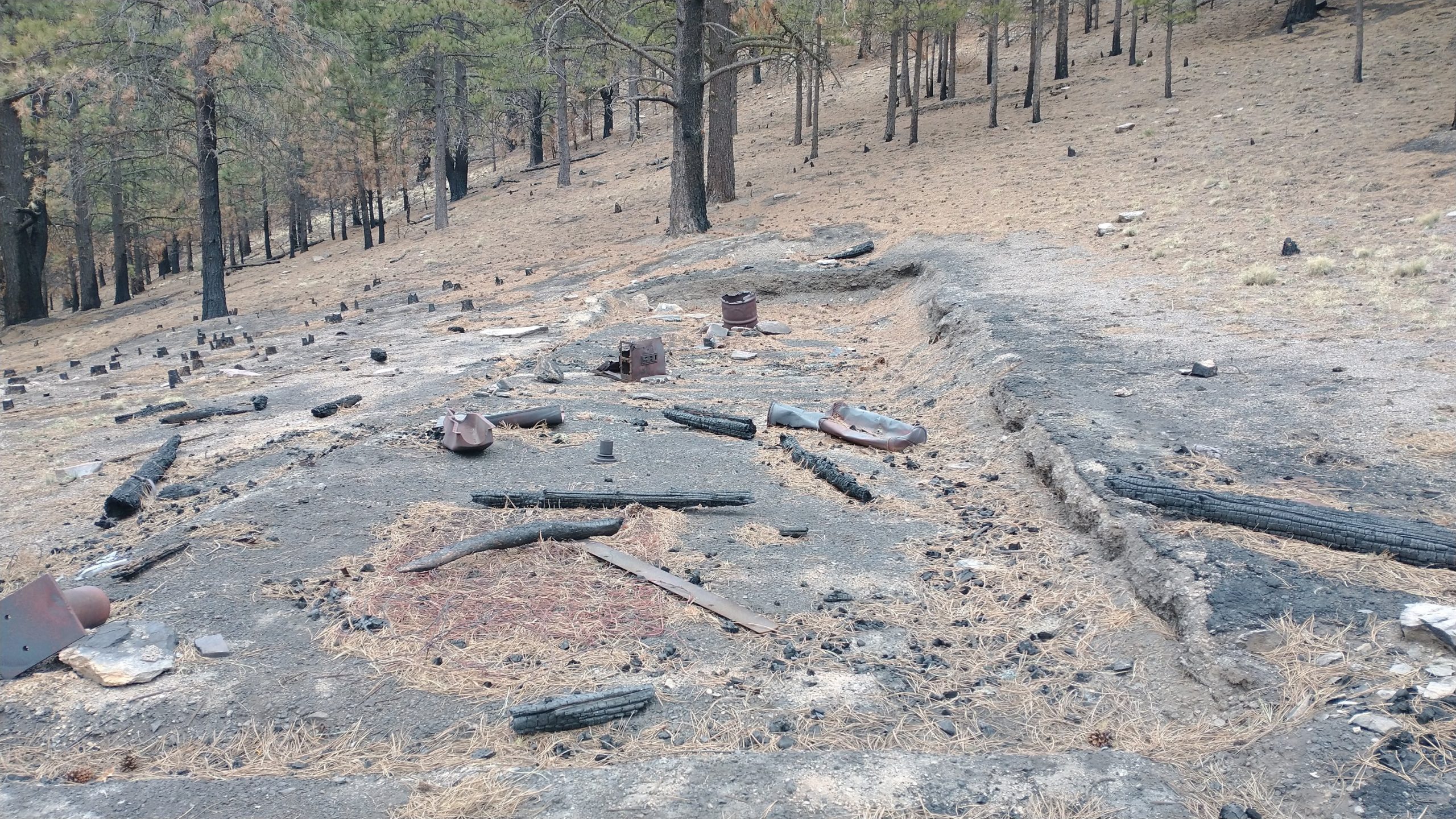
It was interesting to experience such devastation. One really gets a sense for just how ruined an area can become during these overly hot burns. In addition to all the vegetation being destroyed, the soil is decimated for many feet down, zapped of its organic nutrients and biota. It turns into a powdery grey and black dust. This leads to severe erosion problems. We saw whole hillsides sliding into the drainages, choking them with dead trees and black mud. Where once there might have been healthy little springs and creeks running, most of the drainages were dry and scoured.
We did find several springs that were still running well or at least had a few puddles (Myers, Nave, & Yard). We stopped for lunch at Yard Springs, which still had live trees surrounding it. I don’t know if the spring was spared because the trees didn’t burn or that the spring kept the area moist enough, sparing the trees (probably the latter). There were positive feedback loops like this in forest ecology and likewise negative loops, keeping forests from regenerating for a long time after a burn.
It all had to do with how hot and long a burn lasted. Healthy burns were those that went through quickly and frequently, clearing the underbrush and deadfall, creating space for new trees to grow. Fire resistant trees, like ponderosa, were protected by their thick bark and able to survive. European settlers suppressed these kinds of fires for over 100 years, so presently the fires were very hot and massive, with 100 years of clutter in the understories to burn. Plus drought conditions had turned even the live trees into matchsticks. These kinds of fires caused total devastation to the forest, soil and watersheds, leaving behind a landscape that could take decades to recover, if ever.
We made the best of the day, but it had been discouraging to walk through so many mountain ranges in the southwest where huge regions were destroyed by fire. This also meant that the trails in these ranges had all but been abandoned. We did encounter quite a bit of deadfall on this trail (probably close to the order of hundreds if not thousands), but most of it was small low trees, so it was easy to just step over. It made the trail a bit more tiring and challenging, but the roughly 6000′ of elevation gain was the clear winner on that front.
Again, I knew to expect a hard day so I just put some music on and attacked the climbs. The trail had been built properly back in the day, with good switchbacks and ramps, so it was actually pretty fun. We made it to the top of Blue Mountain, 10,301′, in the afternoon. We took awhile to do some peakfinding and cell phone play. The view to the north and west was obstructed by live trees, go figure, but we could see our next mountain range to the NE pretty well. We’d need to go up and over them as soon as we finished this range, before we got to the next town, Magdalena. This sure was a tough stretch!
We headed down down for the rest of the day, which was a nice break. We had a good run and were perhaps feeling a bit overconfident when we made a huge tactical error. From blogs, FB posts, and the water report, we were expecting to find our last water source at potholes springs. Not wanting to schlep any more weight than we had to, neither of us had carried more than a liter up the mountain, confident we would find more on the other side. We passed by a hole with a good sized pool early on, but didn’t give it much thought since the springs was still 2 miles down. Well, as you might have guessed, the water reliability 3 (highest rating in our system) spring wasn’t running. There was a muddy puddle surrounded by cow dung, not collectable. How could this be, I wondered? I’d just read a FB post that a hiker had found water at this spring just a week before and also a 2019 report said there had been scoop-able pools. That report had been spot on with all the other sources we’d come to this day, so again, we had just assumed.
The clear choice was to drop our packs, make camp, and walk 4 miles RT back to where we had seen the pool earlier. But of course we didn’t do that. I hate backtracking and that clouded my judgement. So we forged on, hoping that one of 2 springs in another 4 miles might be flowing. Ironically, we were hiking down a drainage named Water Canyon…for its weakness and not its strength, I guess. We wasted 40 minutes and almost a mile going off trail to look for one spring. All we found was a small stock pond with the foulest muddy cow shit water imaginable at tool box spring. The next, Indian springs, was a bust too, with just a muddy puddle. I was able to scoop a few ounces before it got too disturbed. The water smelled bad. I used it to rinse off my feet, which were completely black from walking through all the burns.
I had about half a liter of clean water left at this point and TS had none. It looked like there weren’t any more water sources for the next 15 miles, so we were in a bit of a pickle. I was also really tired and cold. The wind had blown like crazy all day, chilling me to the bone. Plus we’d done a herculean day, mileage and elevation wise. And it was getting dark. I just wanted to crawl into my sleeping bag to deal with the problem the next day, and that’s what I did. But first I made a hot meal with my remaining water (because I was also starving), saving just a few ounces to be able to wet my mouth and swallow my vitamins in the morning. What a lousy end to an otherwise good day.
I knew I could manage without water until the next source but TS couldn’t. He set up camp, then marched off into the darkness to walk 7 miles (14 RT) back to the pool, like we should have done when we were only 2 miles away. He took one of my containers to fill, as well. I felt bad, but reasoned that it didn’t make much sense for both of us to go back. Lesson learned… study the water situation better and don’t pass up good water. Then again, all the information led us to believe the spring was good. So I don’t know what the lesson is…maybe don’t hike in the desert and burned mountains during a 20 year drought?
Hello Twig,
I saw the link to your blog on the GET facebook post. If you were to walk down West Red Canyon from Tool Box spring, you would come to our house at the forest boundary which is why I love reading about this section of the trail. It’s my home range.
If you do this section again, might I suggest that when you come out of Water canyon, you turn west in West Red Canyon going downhill past Coffee Pot Canyon to just before Red John Box where you will find a livestock water that is solar powered. There is always water here and it is clean. You can keep going downhill through the short but spectacular Red John Box to Ed’s place where there is another solar well and then turn up Hudson canyon. This bypasses Indian Creek. It is a road instead of a trail that goes up Hudson, but outside of hunting season, there’s almost never anyone driving on it and I personally think it is prettier than Indian Creek. It’s a favorite canyon to go birding for me.
Mary Katherine
That is great advice Mary! Thank you. I hope you don’t mind but I’d like to post this info on the GET FB page to help other hikers. Or maybe you have already mentioned it before? I remember reading something about how this might be an option and seeing it on the maps. You live in a beautiful area!