Monday Apr 12th, 2021, 0700-1830
CDT mile 250 to Duck Canyon near solar water tank, start segment 27, mm 484
30 miles
It was my longest day yet on this trail, partly because the cruisey trail allowed it but predominantly because we were motivated to get through a 26 mile dry stretch without having to carry too much water. Our notes told of a fairly reliable solar trough at the beginning of segment 27, so we decided to make that the aim of our day. I was lucky to be able to do such big miles, because it made these dry stretches much more manageable. I realize that’s not the case for a lot of people. It’s either carry the weight or walk a lot of miles….sometimes it’s both.
We started the day 1.5 miles into segment 25, finished the remaining 10 miles, hiked all 19 miles of segment 26 (which incidentally is what day we were on), and made it half a mile into segment 27… how’s that for progress? Like many long trails (CT and AZT), the GET is divided into segments, with their own corresponding mile markers and start / end points…usually road access locations. This makes long trails more accessible for section hikes. We’d been following a group of 3 hikers who were both thru-hiking and section hiking. They started more than 2 weeks ahead of us and had been doing car shuttles to tackle some sections. So for instance, 2 of them set out from Magdalena (our town stop after Winston) going westbound, while the 3rd set out from HWY 59 (which today we crossed mid-day) going eastbound. When they met up in the middle, they exchanged keys. This was a great way for groups to hike trails like the Florida Trail, sometimes allowing them to cut out long road walks.
There were a total of 39 GET segments, with some being around 10 miles in length and others more than 30. In looking more closely at things, I realized that we were keeping pretty good pace with the segments in our days on trail (I also counted our one zero as a day, as I’ve done for my other long trails). This was never an objective of ours but it’s interesting that this far into our thru-hike, the days and segments matched perfectly. It would be interesting to see where we were when (or if) day 39 came around.
Day and segment 26 were pretty groovy, but not all that remarkable. We came to our first and last water source for the day’s walk after 4.5 miles (mm 6 of segment 25). The spring was 0.3 miles off trail, so I was inclined to dismiss it, since both my water bottles were still full from the night before. TS needed water and offered to pick me up a liter while down there. I did some tasks while waiting and then downed the liter right there, leaving 2 liters for the rest of the day (25.5 miles to go). I stupidly hiked 45 miles on that amount once, so I figured this would be a cinch.
The day started out overcast, which made the miles even easier. This stretch of the CDT went through lower rolling hills, similar to the Cochetopa hills in Colorado. We passed HWY 59 around 11 am, which was a paved highway that went to Winston and beyond. It was reported to be a very hard hitch and sure enough, not one vehicle came by while we used the trailhead toilet. There were also no vehicles in the parking lot. CDT hikers used this point to go into Winston for resupply, but we would be walking an additional 29 miles to HWY 52 for our hitch to Winston.
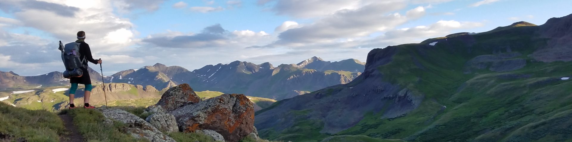
To say the Black range felt remote would be an understatement. It’s sometimes thought to be the most quiet stretch on the entire CDT. We went all 40 miles without seeing anyone. There were also hardly any signs of civilization visible, save for the few roads that cross, one powerline, and a few structures such as a fire tower on top Lookout mtn and a ranch along HWY 59. There were no towns visible on either side of the range…just grassland and more mountains. New Mexico is one of the most desolate places I’ve ever been (Antarctica easily takes the win here).
After the highway, I bumbled along for several hours, trying to make it to 20 miles before breaking for lunch. I found cell service at 18 miles, so I stopped there. How I could get service in the middle of nowhere, I had no clue. It was nice to finally be with a Verizon carrier. After that, the trail started doing some bigger climbs, finishing off with a kicker near Wahoo peak. It also became quite nondescript and poorly marked, as if it was aiding our transition back to more typical GET conditions. It had been rather novel to look up and see trail markers for the past few days. No mater, I still had plenty of water and was feeling good.
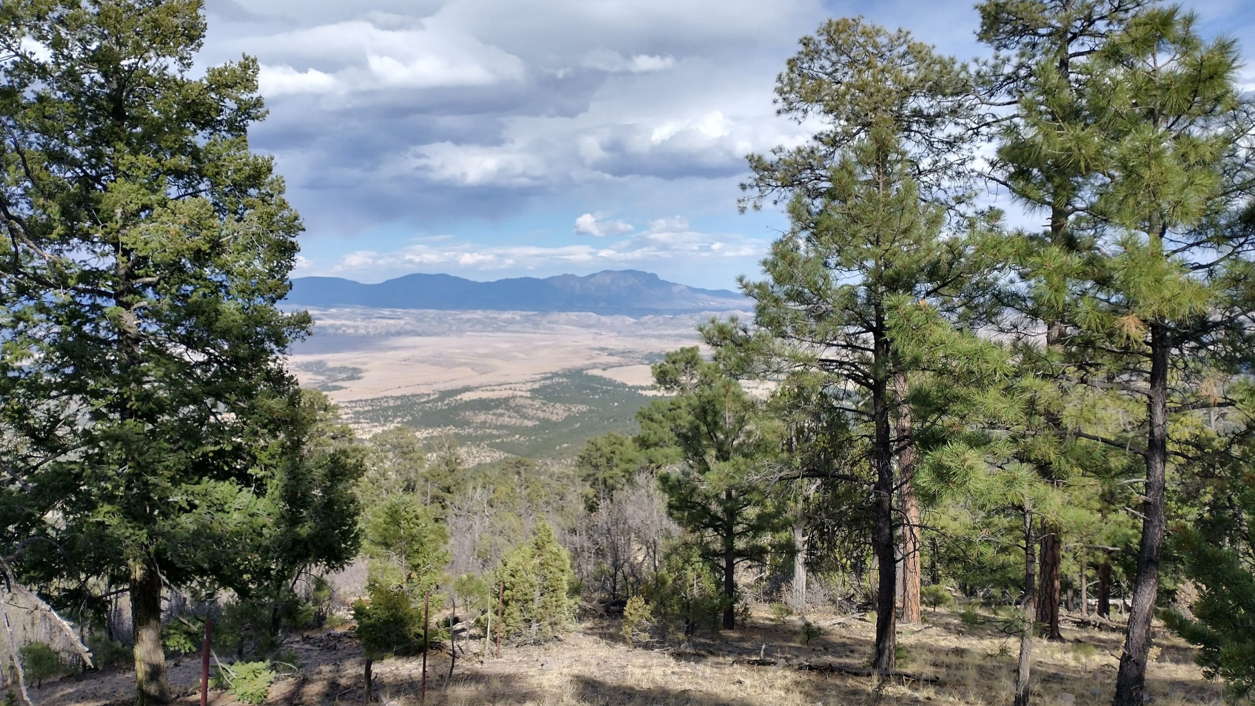
I said goodbye to the CDT once again, heading east along a fence line that was to be our trail for the next 3 miles. There was sort of a cow path, so I was happy. My standards for what constitutes a trail were pretty low at this point… I’d take just about anything. In fact, nothing at all wasn’t even that bad when I was just going through juniper grasslands. There were nice views across the valley to the San Mateos, the next mountain range. They looked like some big mountains…a lot of climbing and sweating was in store for us.
I got to the end of segment 26 and immediately started following a series of ranch roads to the water trough. The trough was huge…head high and brimming with cold, clear water. It was like a swimming pool and I was tempted to jump in. But I felt the need to respect the structure, so we only collected some water and used a little to scrub dirt off our bodies. We retreated a ways away, back into the junipers to set up camp. I was glad we did, because an ATV came by several times to check on something. I hope we didn’t disturb anything or anyone. Signs on the corral warned of video surveillance, but I seriously doubted anyone was watching us.
It ended up being a very nice night, not too hot or cold. We did very good on this stretch, making it possible get into town a day early. It took us only 3.5 days but we brought enough food for 4.5 days. What to do with the extra food?