Wednesday Oct 6th 2021, 0610-1910
Four Pines Hostel to War Spur Shelter, SOBO AT mm 1523.7
33.5 miles
7000 gain, 6440 loss
I was out the door of the hostel early and walking up to the Dragon’s Tooth in the dark. The fog was very thick and so my headlamp was nearly useless. As anyone that’s driven in fog knows, light beams reflect and scatter. There were some slippery rock slab cliffs to negotiate along the trail. There were decent holds and ledges but long drops into the dark abyss awaited a misstep. I felt like one of those early morning mountaineers making a summit bid, except that it was 70 degrees and I was already drenched in sweat. I caught up to another crazy person climbing the rocks by headlamp. He was a very fit young man but I still outpaced him to the top.
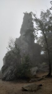
I took a short side trail to the Dragon’s Tooth just in time for sunrise. Well, had there been one to view this day. My timing was great, it was just the wrong day. Rain and fog had been forecasted for the entire week, so this viewpoint simply had to be a miss. At least I got 1 out of the 3, the most important one, too. The tooth was just a big pointy rock. I took a dreary picture and kept hiking. I followed along the ridge for miles after, weaving through some rock fields and outcrops and trying to avoid all the drenched vegetation overhanging the trail. This was the story for much of the day except…
I came to a gap around 9 am just as it started to rain. Ahead, there was another viewless mountain to climb OR there was a quiet dirt road leading to a quiet country road that bisected the trail further down. The valley looked to be less rainy and might even have some views. So I opted for another road walk. This again turned out be a great decision. Both roads were extremely pleasant, with only about 10 cars going by over a 5 mile stretch. I got to look at farms, fields of cows, birds flying about, and lots of fall colors. The atmosphere was a postcard of a county road in fall. The views stretched through the valley but all the mountains were obscured. It rained lightly on and off for half the time, then stopped for the rest of the day.
I reached the trail about an hour and a half later. The trail distance was 7.5 miles, which would have taken me at least 2.5 hours. I guestimated that I shaved about 2.5 miles walking the road…not that I was trying to save miles, I just didn’t see the point of walking over a mountain in the rain and fog. The name especially… Brush mountain … didn’t sound appealing in the wet.
I stopped at the first shelter I came to for an early lunch. There I met 4 guys: Brian, Bojangles, All There and Oracle. They were all full SOBOs and Brian was finishing his Triple Crown. Like me, he’s done them all southbound…the only other Triple Crowner I’ve met or know of with such a distinction. He did the CDT back in 2009, hiking with Samurai Joe, founder of Zpacks. He’s taken 11 or 12 years off in-between each thru, so his final finish at Springer has been in the making for decades.
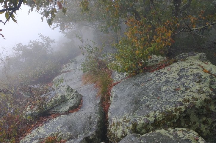
The trail went back up to a ridge and stayed there most of the afternoon. This whole stretch from Daleville to Pearisburg (and beyond) follows a pattern of ridge and valley traversing. The ridges run SW by NE. Going southbound, the AT does a lot of travel N to NW to cross the valleys from one ridge to the next. As such, very little progress is made in a southerly direction. I was pretty zoned out for the afternoon, deep in some music and podcasts. The ridge had some slippery slab rock to deal with but it was kind of fun. The time passed quickly and soon I was back in another valley.
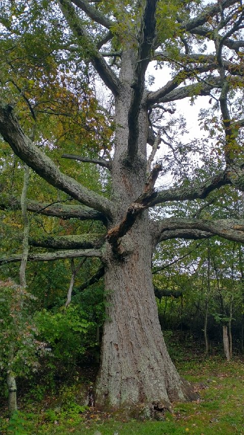
The trail went by a giant oak, said to be the largest and oldest (300 yrs) tree on trail. It was impressive. I took some time to lean against it, closing my eyes and breathing in the essence. It felt very nurturing. Imagine the refuge it’s provided to so many fleeting lives over the years. How many things have come and gone in its presence? It’s mind-blowing to think about.
I made it to my planned destination by 4 pm. The sun started to peak though the clouds and I took it as a sign that I should keep hiking. It was another 6 miles to a shelter…a distance I definitely wanted to make to hide from the expected rain overnight. I went up again, over a feature called Kelley Knob where there even a few views. Down into another valley and finally, just as it was getting dark, shelter for the night. It was a nice one too, with a creek and good chair. Brian, Oracle, and All There arrived after dark.
All There tried to hike on a few more miles but was turned back when he saw a pack of coyotes just up the trail from the shelter. I’d heard them howling when I came in but didn’t realize they were so close. He ended up tenting, while the other 2 guys shared the shelter with me. It was a nice dry night, very cozy.